October 15, 2020
With the snow flying in October, I was on the hunt for a close and lower elevation hike. My hiking partner Annette found exactly what I was looking for – Missing Link Mountain.
Located in Sheep River Provincial Park, Missing Link is a very close and accessible mountain that does not see much action, mainly because it is located off Gorge Creek Trail. This road was closed for several years after the 2013 flood, but is now open.
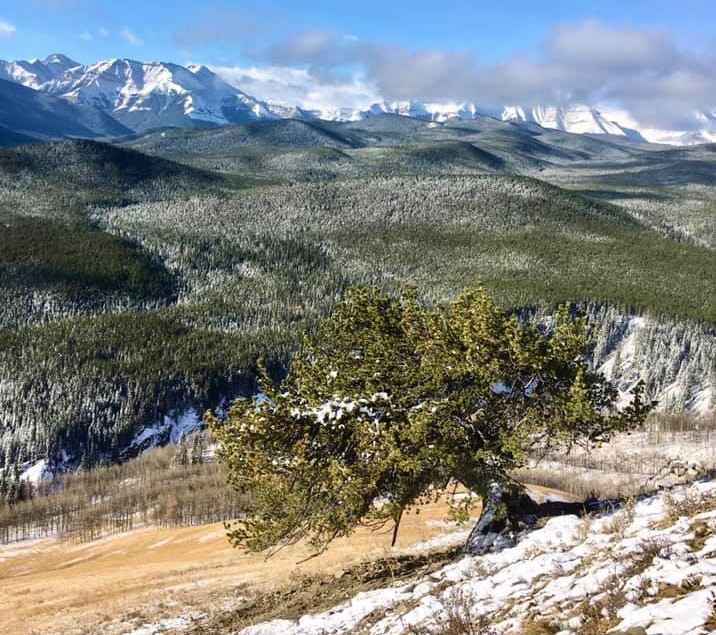
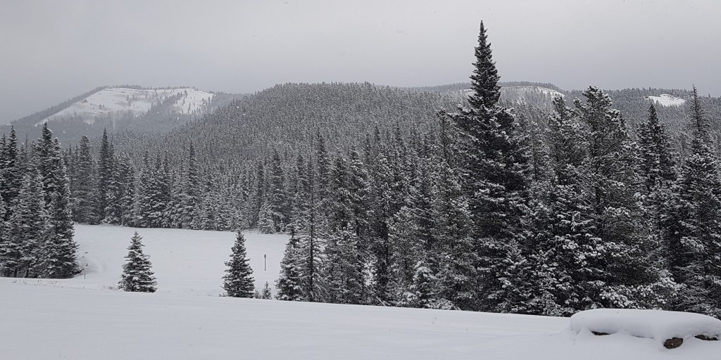
While there was more snow than I expected (10 cm), we managed to find our way and were rewarded with some spectacular views of the big mountains to the west. While a lot of this short hike is in the trees, there are enough interesting views of the jagged cliffs to keep us well entertained, and made this an enjoyable hike.
Note: Highway 546 into Sheep River Provincial Park has an annual road closure from December 1 to May 14th.

Gear
Hiking boots, poles and your regular day pack kit. If going when snowy, also bring gators and spikes. Black bears and cougars are plentiful.
Overview
Park at the base of the trail at one of the two ascent routes. Head straight up to the wall of rock, find the chimney and climb up. Go left and follow the ridge until it runs out. Then head into the forest to pick up the crest of the wide ridge. After going down and then back up, you are at an open meadow. Continue straight to pick up the trail to the summit. After curving around to nab the summit, continue in that same direction until you close the loop at the same open meadow. From here, return the way you came.
Parking and Trail Head
Gorge Creek Trail is accessed from Highway 546. This used to continue all the way to Highway 549 by Millarville, but it is now decommissioned at the Gorge Creek Day Use area and is mostly grass.
Turn right onto Gorge Creek Trail from Highway 546. The first Missing Link trail head is about 1 km from the turn off. There is a small pull out on the west side, just past the creek crossing.

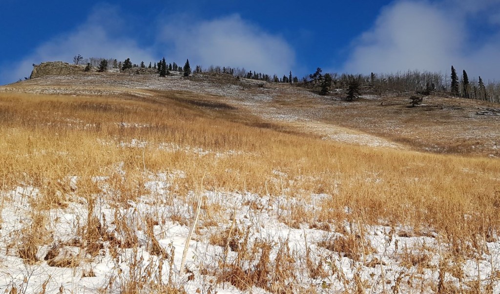
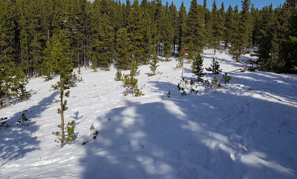
After parking, I looked up towards our objective and could not see any discernable trail.
The route on my map was basically straight up to the rock outcrop, which you can definitely do. Instead, I chose to switchback my way up on the right side of this hill, finding lots of animal trails that felt the same way I did.
Main Trail
Once at the base of the rock outcrop, we had a look at our options.
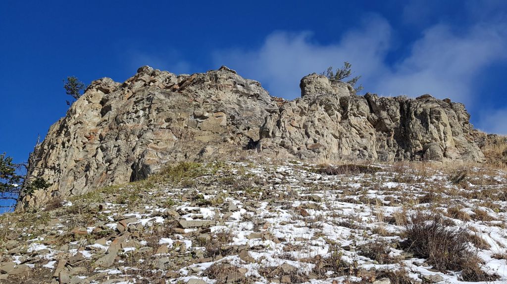
We decided to have some fun, and scrambled up the short chimney to the top. If this doesn’t thrill you, then go around to the right and hike up the side.

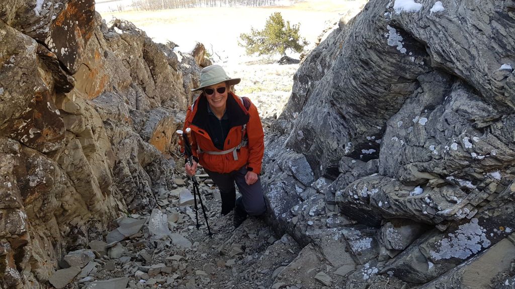
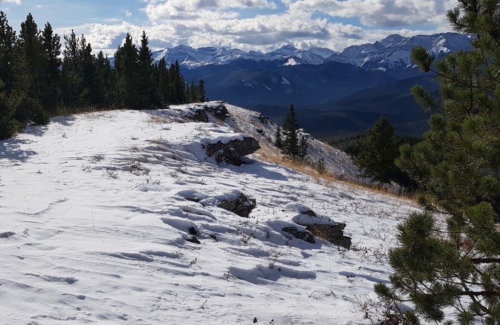
At the top, make sure to look around and enjoy the views.

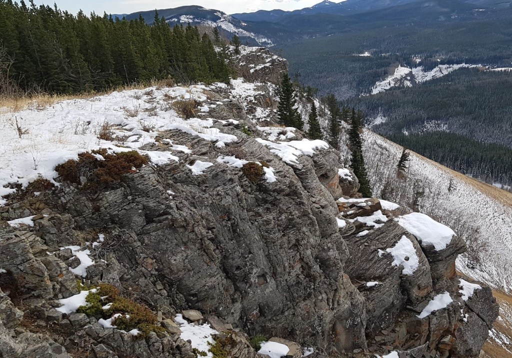
From the top of the chimney, head north (climber’s left) and follow the ridgeline as it snakes along the top of the rock outcrop. Photographers would love this area as there is no shortage of interesting formations.
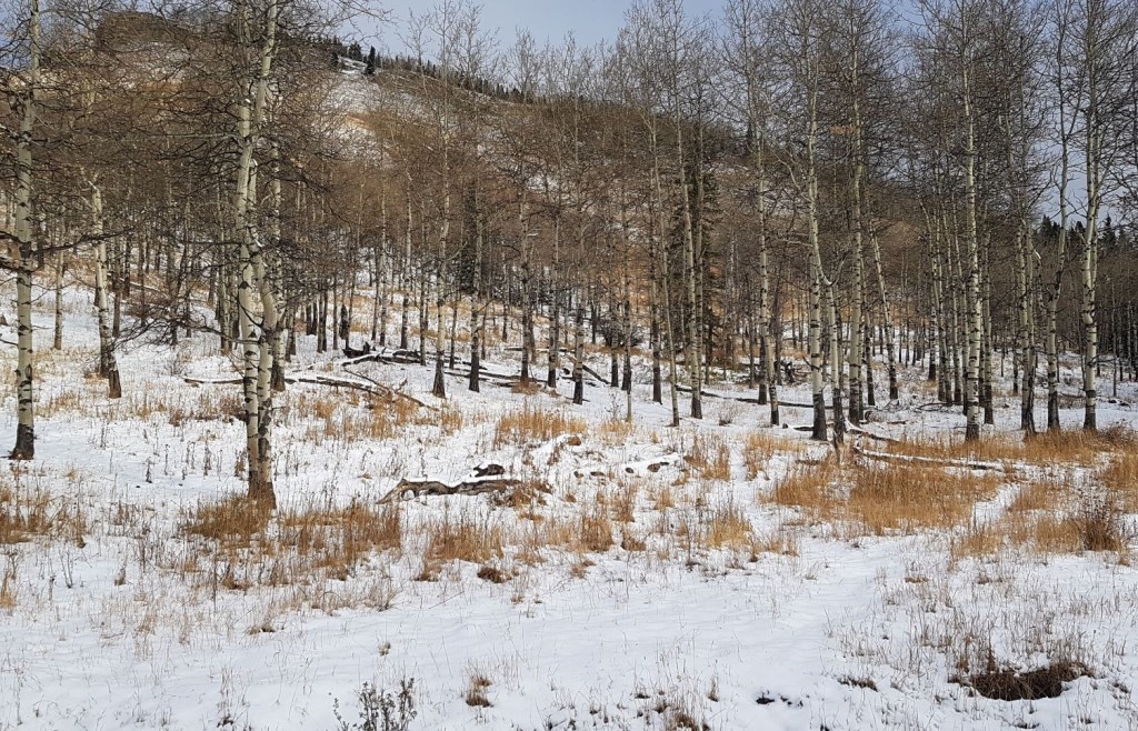
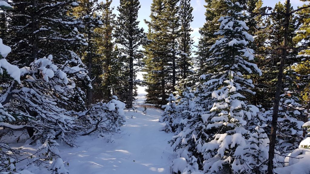
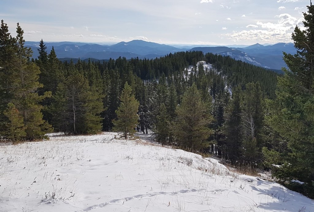
Soon, the trail enters the forest as it follows the top of the wide ridgeline, generally heading NNE.

The snow on average was about 10 cm, but deeper in some spots. The trail was visible for the most part, but I did manage to lose it completely in other areas.
It is a ridge hike though, so when in doubt just stay on the top of the ridge. On the way down, we did see a buried cairn in one of the trickier spots, so I’m sure it’s more than obvious in the summer.
Around 2 km, we started to lose elevation as we trudged through the forest. After the low point, the trail then gradually regained the lost elevation.

All through the forest there was not so much as a blaze or a bit of flagging to help us out. However, once we found this wide cut on the crest of the very obvious ridge, someone decided to put in a bit of flagging. I am hoping they were being ironic?


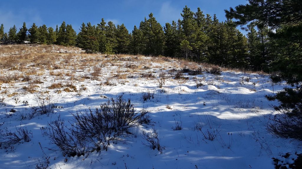
After the wide swath in the trees, we came to an open meadow. This is the start and end point of the loop around the summit of Missing Link Mountain. Continue more or less straight ahead in order to go counter-clockwise.
Here we found some flagging and other obvious signs that we were headed in the correct direction. The forest is more wide open here, with lots of options. By heading in generally the correct direction, we picked up the ridge trail that led us directly to the summit cairn.
Distance to summit is about 3.2 km. Elevation gain is 398 m. Time to summit was 2 hours, 20 minutes at a very leisurely pace.
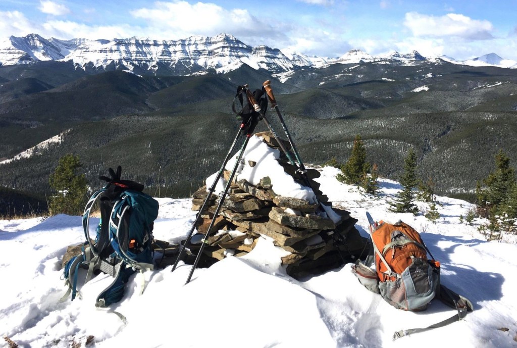
From the summit cairn, we walked down a bit to the ridge top directly west to enjoy our lunch. This gave us wonderful views in which to ponder life, and to dream about our next hiking adventure.

Missing Link Mountain Return
To head back, we continued in the same direction to complete our loop.
We stayed on the ridge for a bit, then headed into the forest. Here it was fairly obvious as there were blazes on trees and some flagging. We were kindly shepherded straight back to the main trail at the open meadow.
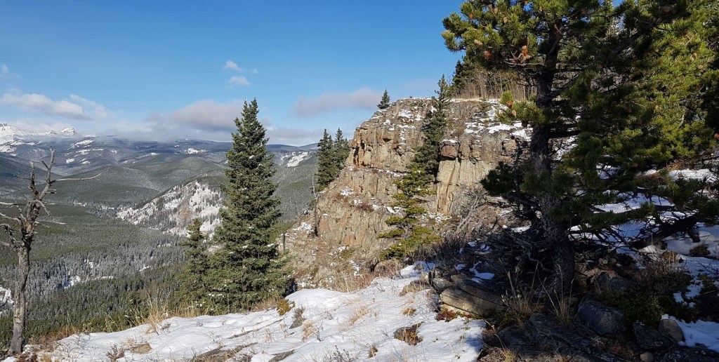
Heading back, we actually got better views of the ridgeline with the steep rock walls below.
Once again we decided to take the chimney down the rock wall.
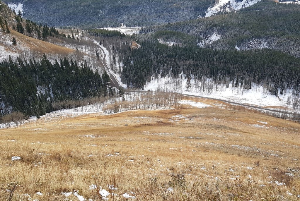
We could see my car on the road, and decided to make a hasty beeline back towards it.
Missing Link Mountain is a fun, short and close hike that is an ideal shoulder season objective when the snow starts flying at higher elevations. It is also great for beginners and kids in the summer, when the trail will no doubt be quite obvious.
If you found this post useful, please do me a huge favour and click the Star button to “Like” it. You can also follow my blog, follow me on Instagram, or join my FaceBook page Al’s Adventurers.
Alisen
Totals – Tracked on Strava
Date: October 15, 2020
Group: Two (Alisen and Annette)
Distance: 6.2 km
Elevation: 395 m (1,303′)
Time: 4 hours (includes lunch & breaks)


Beautiful pics 😍😍
Thank you. Both the scenery and Annette do most of the heavy lifting 🙂 I am lucky that I seem to attract “official photographers” on my trips. I lead, they take photos.
I’ve never hiked Missing Link. Thanks for the great info, maybe we’ll try it in the spring.
Almost no one goes over there. It would be a lovley early season hike too.
Very nice post about Missing Link and great to see you already have snow there.
Beautiful photos too.
Thank you very much. This is very early for snow – we are setting all kinds of records this year. However, it probably won’t last. It’s already melting out in town, but am hoping it will stick around in the mountains and higher elevations. Fingers crossed!
Snow!? Already!? I guess I should stop complaining about the weather here in Toronto. Glad you were able to get a good hike in and see some nice views along the way! I’m thinking of buying some microspikes this year so I can extend the hiking season. I use snowshoes when there is a lot of snow, but spikes would be nice when its icy or when there isn’t a thick layer of snow.
Microspikes have really changed the shoulder season. They are also great on winter snowshoe trails when the trail is pretty packed down already.
I know – snow! I should first off say that we had the most amazing autumn. Sunny, warm, nice fall colours – this is very rare! We’ve had about 2 weeks of snow, but it’s already starting to melt out, at least in town and lower elevations. However, we did set several records for the earliest track setting on cross-country ski trails at several locations. I’m a skier so … let it snow! 🙂
Thanks for your like of my post, “View The Video. Read The Text. Acts 2:42. Which Teaching? Which Gospel?; you are very kind.
Wonderful 👍
Simplemente hermoso lugar!!!
Muchas gracias. es hermoso.
Thanks for the Spanish lessons!!! Much appreciated.
Wow! Amazing scenic trails and lovely pics. Glad you had a good hike 👍🏻
Thank you! It’s always fun to explore your own backyard. This area of our mountains often gets overlooked for the big stuff further west.
Very nice Alisen! Take care and thank you for following.
Alisen, my hiking days are behind me, but I enjoyed the lovely photos! 🙂
I am so glad I brought back some memories for you. I would like to think that I can hike forever but alas, I know that this too must eventually come to an end.