November 3, 2023
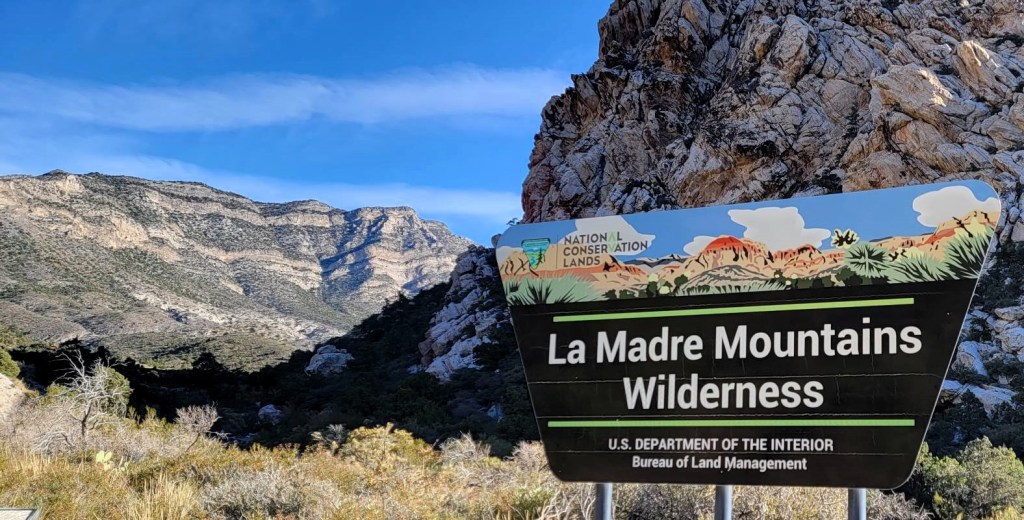
For our second day at Red Rock Canyon, we wanted to get in another big hike. We decided to do the other Visitor Centre recommendation – White Rock Mountain Loop. They also recommended hiking the extension to the Keystone Thrust lookout.
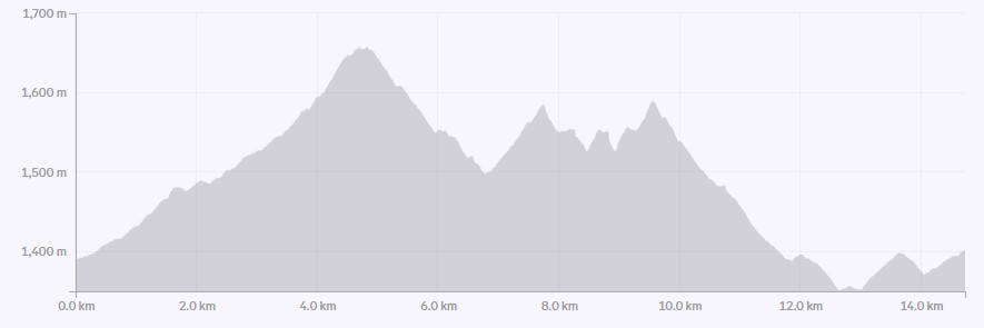
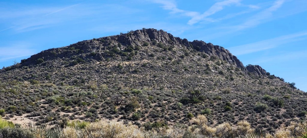
The White Rock Mountain loop was a definite highlight, and it seemed to be more popular than Turtle Mountain, probably because it has less elevation gain. However, at 10 km (13.4 with the Keystone Thrust extension), it’s still a long time to be out in the hot sun. There is elevation gain, as the trail is undulating.
The Visitor’s Centre recommended that we start at Willow Springs, and go clock-wise. This ensured we did the big elevation gain earlier in the morning. Thank you for that! There were still lots of people coming towards us, so both directions definitely work.
Considering what the Keystone Thrust turned out to be (read on to find out), if I had to do it again, I would skip this and instead do a smaller hike in a different area. If you have more time to explore this area, then its worth hiking.

Gear
Hiking boots, poles and regular day pack kit. Lots of water.
Overview
From the Willow Springs parking lot, we headed northwest to do the loop clockwise. The trail was very straight-forward as there are not a lot of other trails through this area. At the junction for the Keystone Thrust Lookout, we turned left (north) and did the short there and back. After the side quest, we continued on to the front side of White Rock Mountain, back to the parking lot. After a short break, we did the short walk to the Petroglyph Wall.
Totals – Downloadable Tracks on Gaia, and on Strava
Date: November 3, 2023
Group: Two (Alisen & Mike)
Distance: 13.4 km
Elevation: 433 m (1,428′)
Time: 4 hours (includes lunch and breaks)

Parking and Trail Head
There are two parking lots to access this hike, but the Visitor’s Centre recommended the second, further lot at Willow Springs. This allowed us to tackle the high point earlier in the day, and we could then walk to the Petroglyph Wall without moving the vehicle. We always got into the park at the earliest time slot, but by noon the park was very full and getting a parking spot was not easy.
Anyhoo, from the Willow Springs parking lot, we headed northwest to hike the loop clockwise.

Main Trail
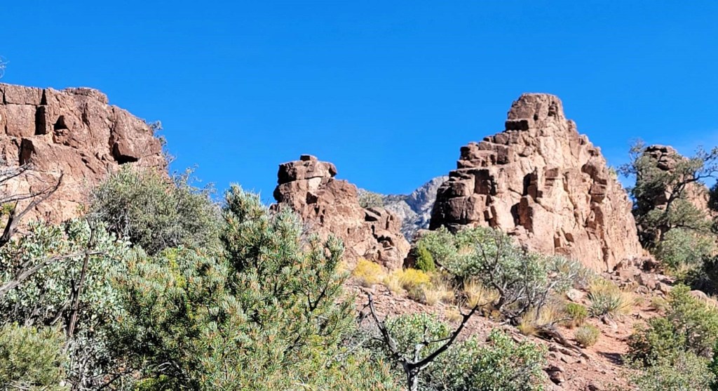
Once on the main trail, it was simple enough to follow it around the mountain. We found one side quest – a narrow upthrust of rock that we just had to explore. It was a steady uphill to the highest point, but as we were mainly in the shade, it wasn’t too strenuous.


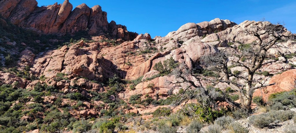
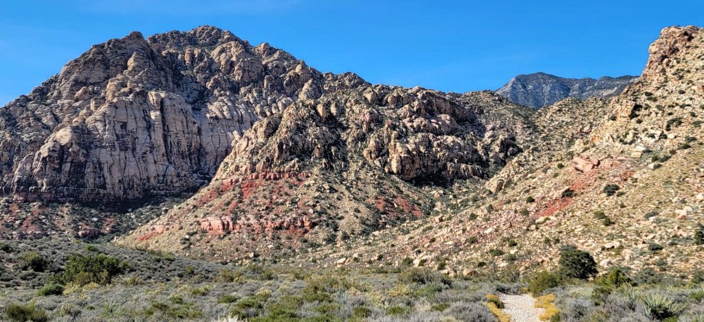
The highest point of the trail is directly opposite our starting point, so we were approximately half way. We could now see around the corner of the White Rock Mountain, and into the wider Red Rock Canyon basin. We also needed to decide if we were going to add on the extra Keystone Thrust hike. We decided to go for it.
I should note, that if one started from the White Rock Spring trail head, and went counter-clockwise, this side junction is pretty close and could be done on its own. Most people we met were indeed doing it this way.


I have to say, we completely missed this. We stomped around the area, looking for the big reveal. There were no signs to point out what we should have been looking for. I’m a HUGE geology geek, and would have loved to figure out where the plates were. Oh well.
After that side detour, it was a long, slow slog back to the car in the baking hot sun, and no shade to save us. Sounds delightful? Seriously, as the days went on, and I got acclimatized to the heat, I was fine. Had I done the Red Rock Canyon second (we went to Valley of Fire after this), I’m sure these hikes would have been no problem. So take what I say with a grain of salt.


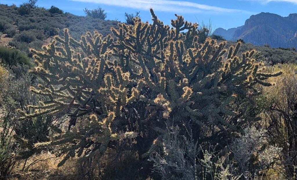
We found many interesting desert plants to keep us interested as we hiked back to the vehicle. These plants will never get old.

Petroglyph Wall
Once we finished this trail, we again cooled off in the campervan for a minute. While the van does not have A/C, it does have an exhaust fan that pulls out the hot air. That’s enough to cool it down inside.
We then went for the five minute walk to the Petroglyph Wall. While there are way more petroglyphs in the neighbouring Valley of Fire park, it was pretty cool to see these markings. We were kept well back by a fence, which is a great way of preserving these drawings.


After this short walk to the Petroglyph Wall, it was time to end our time at Red Rock Canyon. We needed to find some dinner, drive over to Good Springs, and find a BLM spot for the night. Mike was wanting to go paragliding the next day, and we needed to be in position to meet up with the pilots first thing in the morning.
As we were driving out, there was SO much more that I would love to explore in this area. I’ll have to come back, perhaps with some climbing gear to try some of the easier routes.
Thanks for reading! You can follow my blog, join my FaceBook page Al’s Adventurers, or follow me on Instagram.
Alisen
I love all things mountains! I live next door to the Canadian Rocky Mountains, however I travel the world to enjoy the many different mountain environments and cultures that I can. I hope you enjoy these trip reports, and that it inspires you to accomplish your own adventure goals.

Good call on going with the earliest time slot available in an effort to beat the heat and the crowds. The scenery and rock formations are beautiful. It’s too bad you didn’t know what to look for at the Keystone Thrust Lookout until afterwards. The Petroglyph Wall looks pretty cool.
I felt like a bit of an idiot. We wandered in circles for a bit, trying to figure out what we were looking for 🙂 It wasn’t until I was back in cell range that I could find some answers, but it was still pretty limited.