November 5-7, 2023
The Valley of Fire park has some great trails, many of which are quite short. I’ve grouped together four trails that are all less than 2 km, or under 1.5 miles. These trails are one after another on the White Domes Road, starting from the Visitor’s Centre.
For each hike, I will give a brief description, the Map and Elevation Profile, and some key photos.
Gear
Walking shoes and a water bottle.
Balancing Rock Trail
This was the very first trail we did in the Valley of Fire. When we entered the park, we headed straight for the Visitor’s Centre for some local knowledge. While we were parked, we took advantage of the location to do a short walk to see the Balancing Rock.
The trail is very straight forward, and less than 1 km in total return.
Totals – Downloadable Tracks on Strava
Date: November 6, 2023
Group: Two (Alisen & Mike)
Distance: 0.75 km
Elevation: 12 m
Time: 15 minutes


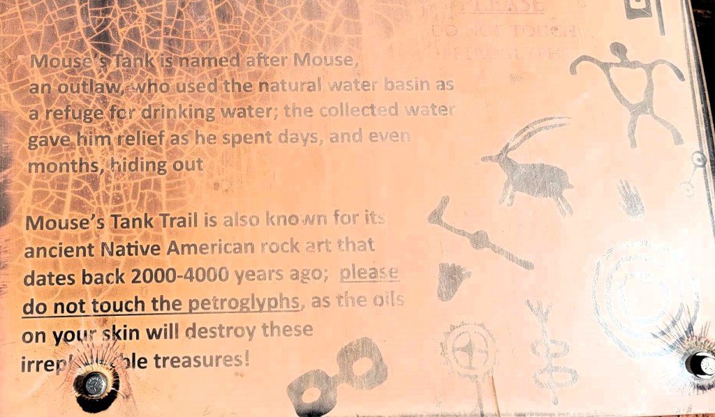
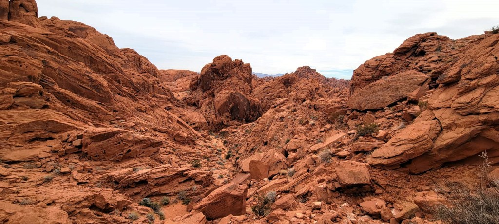
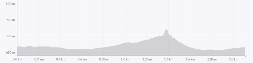
Petroglyph Canyon to Mouse’s Tank Trail
This was my favourite short hike to do in the Valley of Fire. Like the Calico Tanks in Red Rock Canyon, it’s always a thrill to find some water. “Find” being the word as it is not obvious where the tank is hidden. No wonder that outlaw could evade capture here.
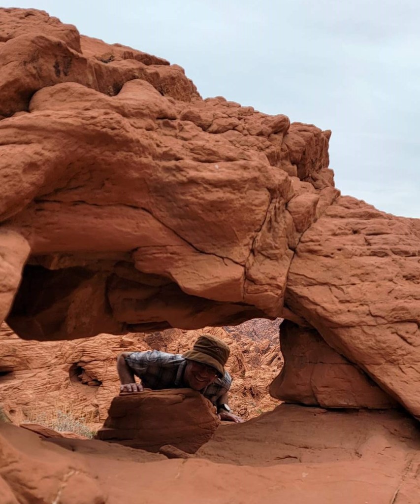
While the tank was fun, the petroglyphs were some of the best I’ve seen in the area, and the side exploring options were endless. Considering we spent nearly an hour to explore less than 2 km? It must have been great.
Totals – Downloadable Tracks on Strava
Date: November 7th, 2023
Group: Two (Alisen & Mike)
Distance: 1.82 km
Elevation: 12 m
Time: 50 minutes
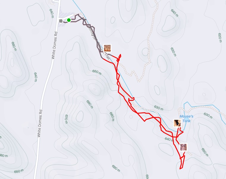

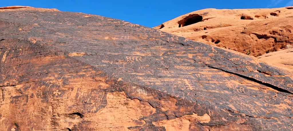
The start of the trail is Petroglyph Canyon. These ancient wall drawings were endless, and extensive. Unlike at Red Rock, it was possible to walk right up to them. This was perhaps not a great idea, as it looked like swaths of the petroglyphs had been removed in prior years. Also, not everyone is respectful of national and state parks… Anyhoo, we sure appreciated getting to see these.


The trail to Mouse’s Tank was gorgeous. We bee-lined it to the tank, and then spent quite some time exploring around there.


Rainbow Vista Trail
This was probably one of my least favourite trails. When the name says Rainbow, I expected some colour variations like we had at Fire Wave. Nope. All red rock, which don’t get me wrong – is stunning. It’s just not rainbow. Also, I came here after the Fire Wave trail, so you know…my expectations were high.
This is a very simple there and back trail. We found some petroglyphs as well.
Totals – Downloadable Tracks on Strava
Date: November 5th, 2023
Group: Two (Alisen & Mike)
Distance: 2 km
Elevation: 28 m
Time: 38 minutes


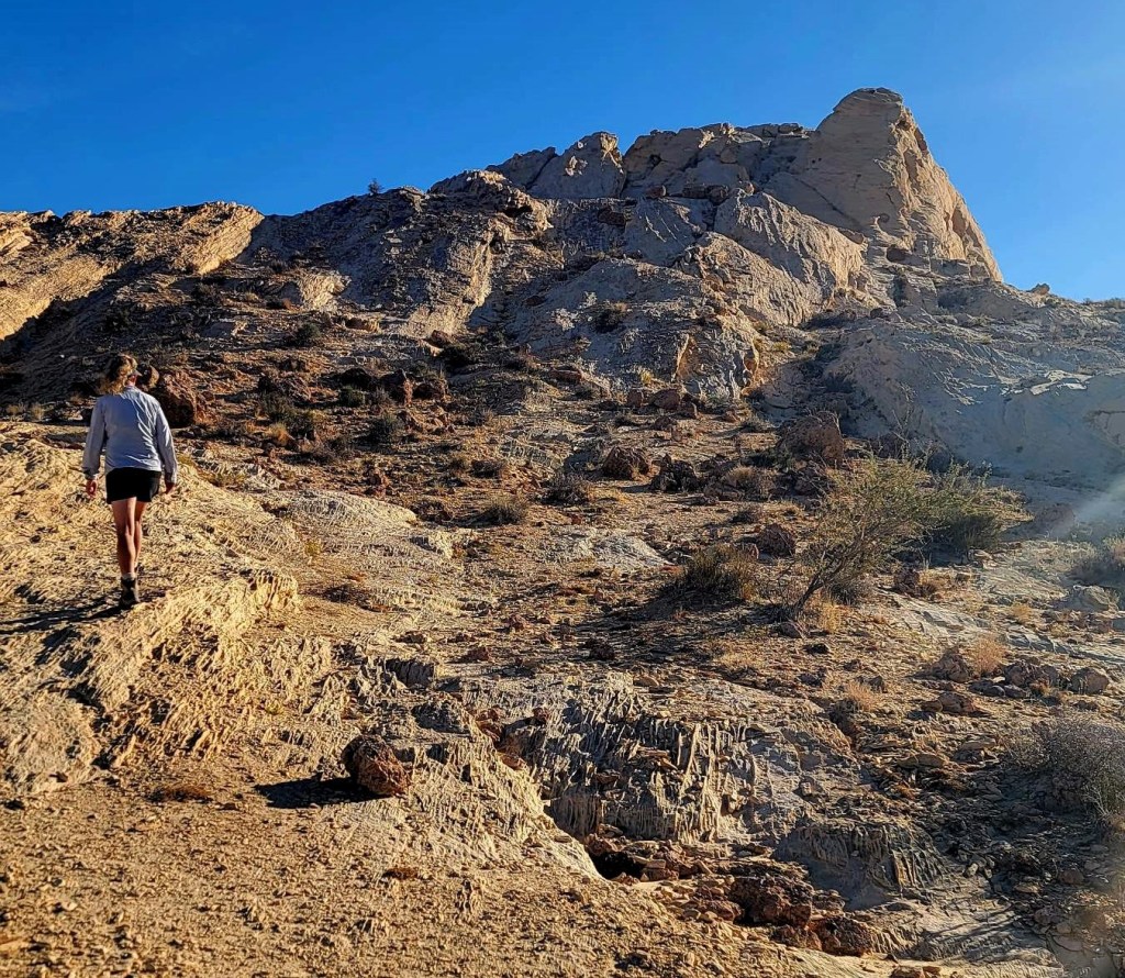
Silica Dome / Fire Canyon Trail
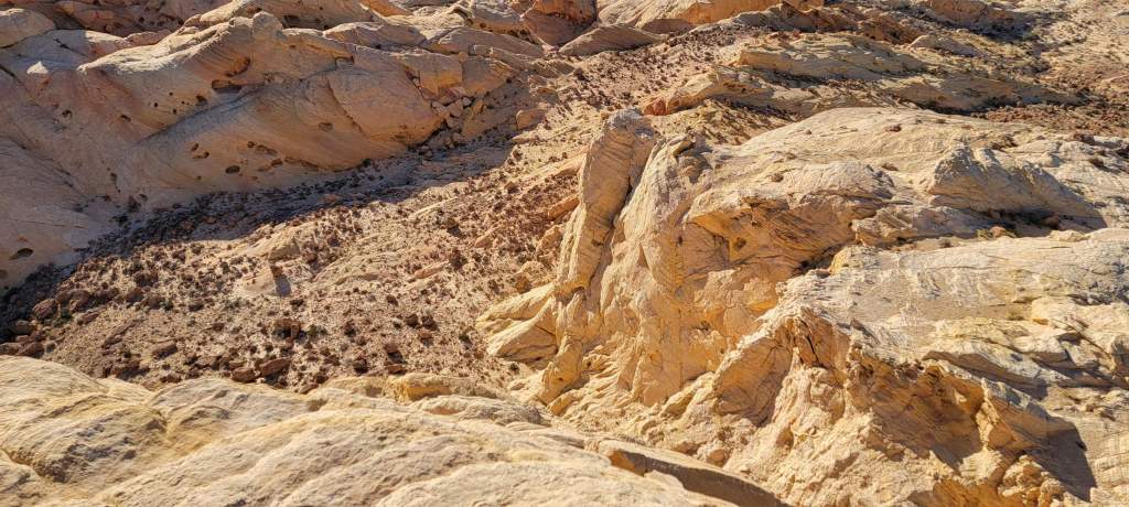
Silican Dome is on the Fire Canyon Road, just off the main White Domes Road to the east. This was a quiet little area, that doesn’t get too much attention. Indeed, most of the people parked here were just trying to avoid the crowds 🙂 While a few people were venturing out, we didn’t see anyone on the trail there or back.
This had a whopping 175m of elevation gain, which is the highest we got in this area of the park. I have to say, this was a nice, quiet little jaunt away from the busy-ness in the rest of the park.
Totals – Downloadable Tracks on Strava
Date: November 7th, 2023
Group: Two (Alisen & Mike)
Distance: 2.1 km
Elevation: 75 m
Time: 37 minutes

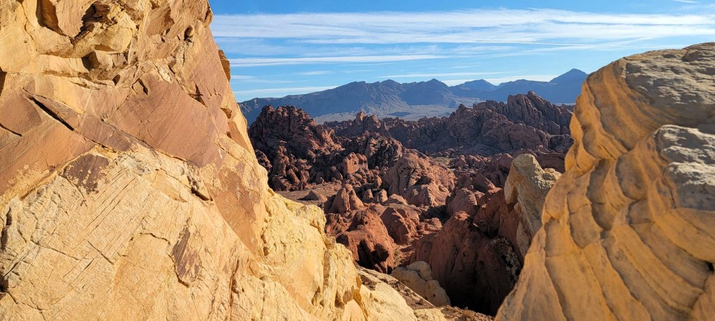
From the parking lot, we hiked due east on an old road. We turned off the road, and followed a faint trail to the top of the highest Silica Dome. After enjoying the view – which was really one of the best overall views of the park – we headed back down the way we came.


WRAP UP
The first three hikes on the White Dome road are all short and sweet, and very worthy with their own unique rock formations and features. The last hike – Silica Dome – is just off the main road, to the east. They are quick to do, and are great to save for the end of the day when the park is less busy. It’s possible to do all four in under three hours.
Thanks for reading! You can follow my blog, join my FaceBook page Al’s Adventurers, or follow me on Instagram
Alisen
I love all things mountains! I live next door to the Canadian Rocky Mountains, however I travel the world to enjoy the many different mountain environments and cultures that I can. I hope you enjoy these trip reports, and that it inspires you to accomplish your own adventure goals.

That’s a pretty amazing collection of petroglyphs! Valley of Fire is on my list of places to visit, so this is a nice virtual tour 🙂
You’ll love it Diana. It’s possible to tick off just about every single trail in this park.
The only trails we didn’t do were the long-distance ones that paralleled the parkway roads. I just didn’t have enough time. If I had three or four days there, I’d consider doing them. Also, I saw some cyclists doing the long-distance trails, and really, that looked like the way to go. Next time…
I had no idea there were so many petroglyphs in Valley of Fire. It’s sad to hear that some of them have been vandalized, but so many of them look like they’re in really great shape. I was surprised that the Rainbow Vista Trail wasn’t more colourful either, especially with a name like that.
The petroglyphs were amazing. We spent so much time gazing at them. For such a short hike, it really packed a punch. I’m glad I saw the Red Rock ones first, so that I wasn’t too underwhelmed after seeing these.