November 7, 2023
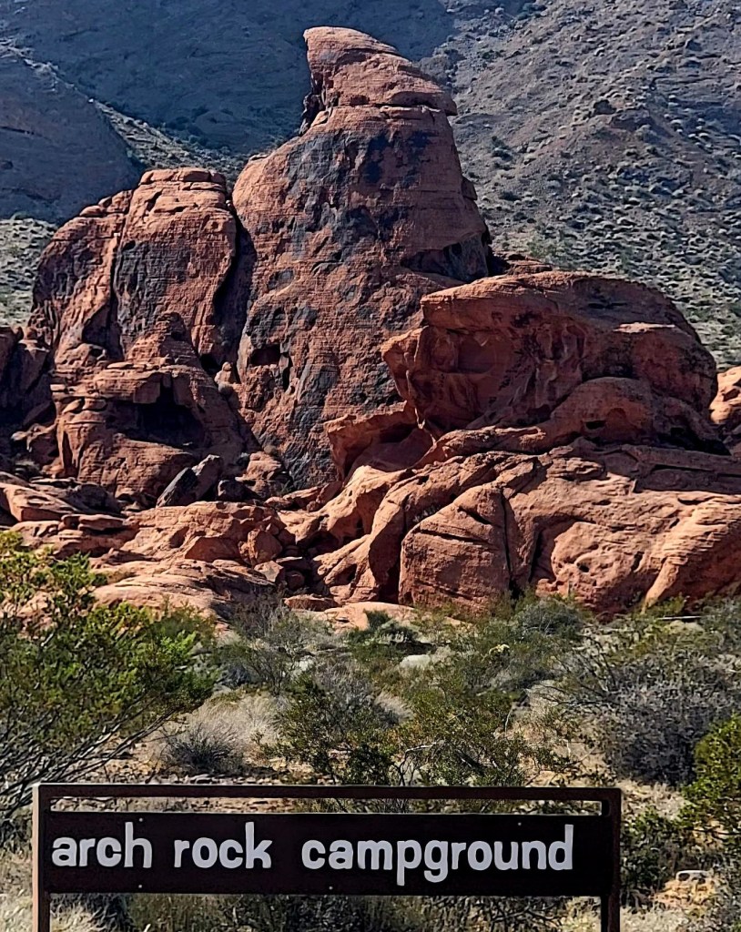
We spent the night in the Valley of Fire Arch Rock campground, which was so nice. There is something about being surrounded by these amazing red rocks that inspires a great sleep. The campground is also down in the valley, so no wind. Since we had a great spot, we decided to start hiking right from the campground.
There’s a faint trail behind the campground that parallels the Scenic Loop Road. We headed out, with no real destination, and extended the loop as we found something interesting to explore. This turned out to be the second longest hike we did in the area.
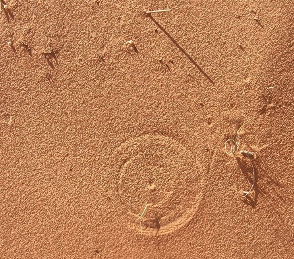
Without knowing exactly what the formations looked like, it was hard to know when we found the feature we were looking for. If I did it again, I would download some photos of the features so I would ‘know’ when I saw it. However, the searching was the best part. Plus, by using our imagination, we found many shapes in the rocks that we might have missed if we were not in full on hunting mode.
Gear
Running shoes, and regular day pack kit. Extra water.
Overview
This loop can be started anywhere, as there are parking lots all through here. We started at our Arch Rock Campground, and went counter-clockwise. The trail is fairly obvious, as we stayed in the valley below the red rock wall on our left. We crossed the Valley of Fire highway to look at the Beehive, and explored the group campsite (Whoops! It was closed). We crossed back over the road to explore Atlatl Rock. We finished the loop at Arch Rock, and walked back to the campsite.
Totals – Downloadable Tracks on Strava
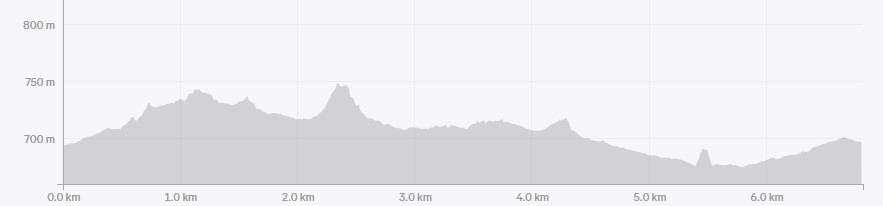
Date: November 7, 2024
Group: Two (Alisen & Mike)
Distance: 6.8 km
Elevation: 135 m
Time: 2 hours 15 minutes

Parking and Trail Head
We started at the Arch Rock campground, and found a small trail that lead through the rocks to the trail next to the Scenic Loop Road. All photos are in order of when we saw them.
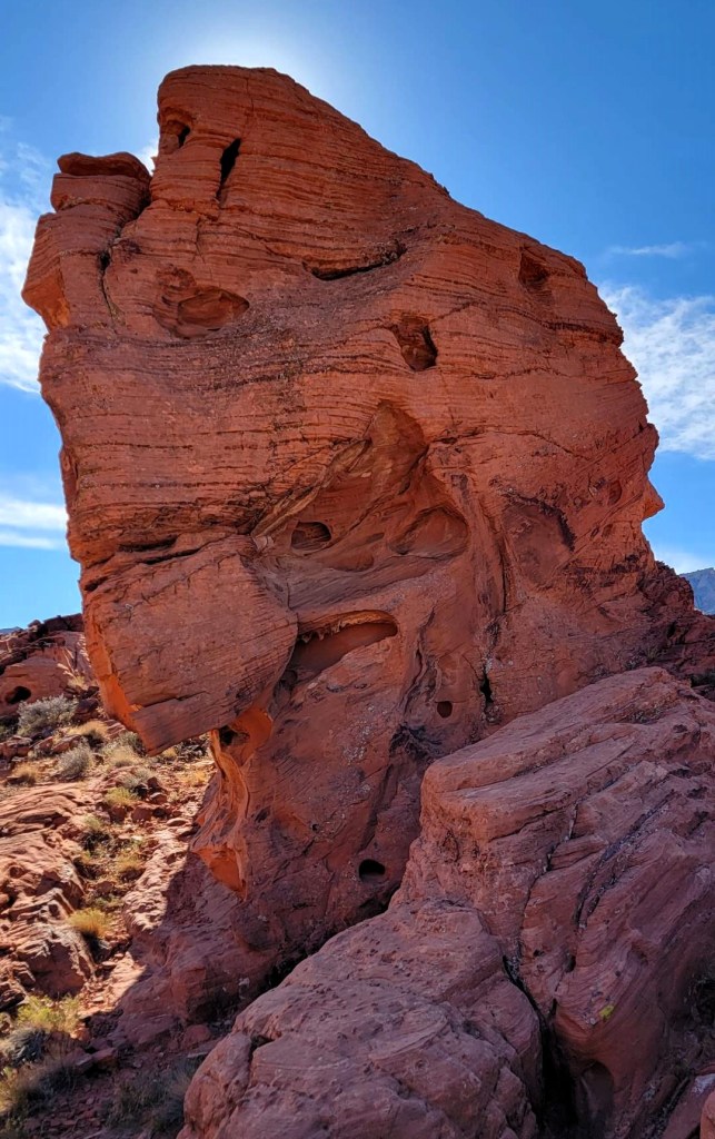
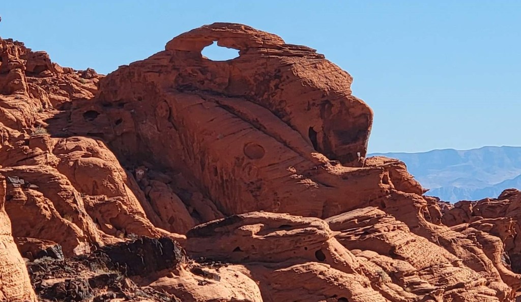
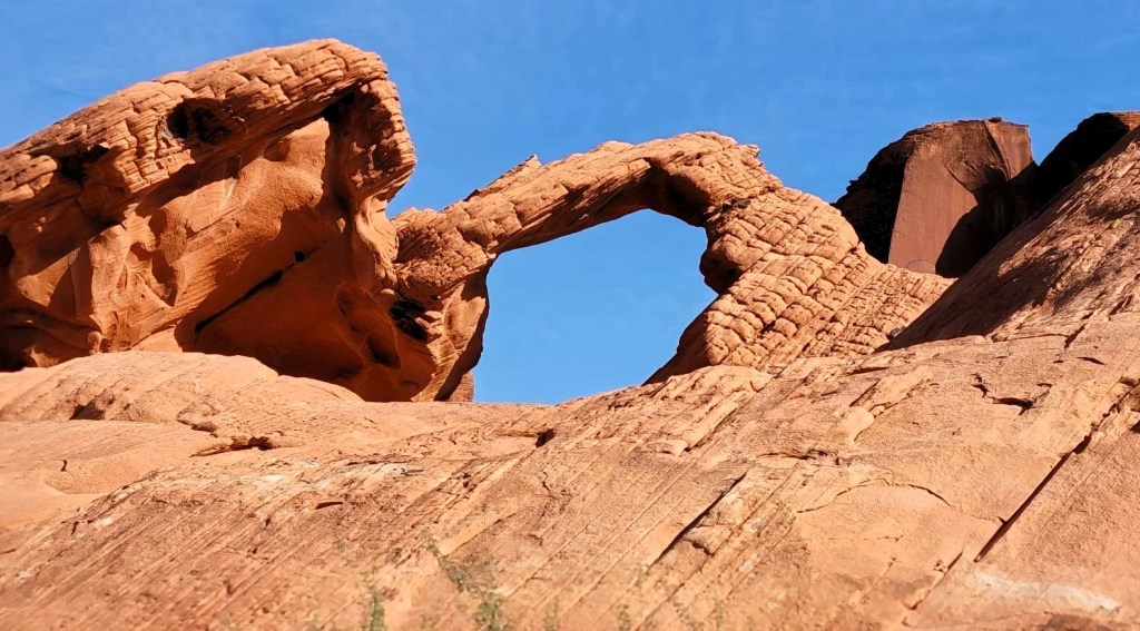
Pagoda Arch & Elephant Rock
Once on the main trail, the fun of hunting down the features began. These were all found prior to crossing the Valley of Fire Highway.


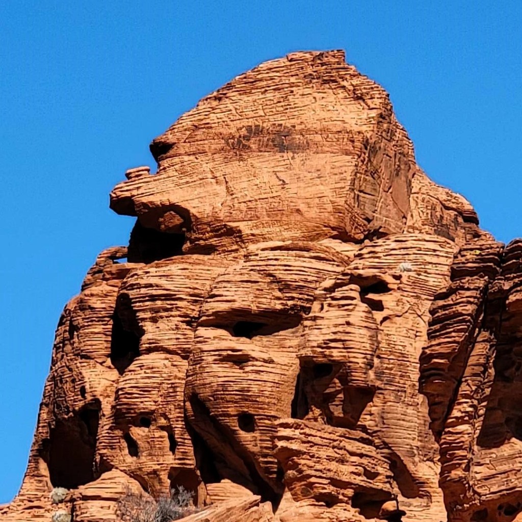

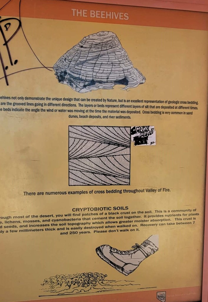
Beehive Rock
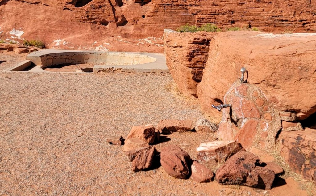
We then crossed the Valley of Fire highway to view the Beehive formation. A tour bus had just disgorged a large group of people, so we looked around and saw a trail leading behind it. This turned out to be the Group Campsite. This place was so cool – the vibe was “The Jetsons meet The Flintstones”. Unfortunately, this campground was closed, but we didn’t know that until we exited through the entrance. We came in the back, and there were no signs. Our bad.


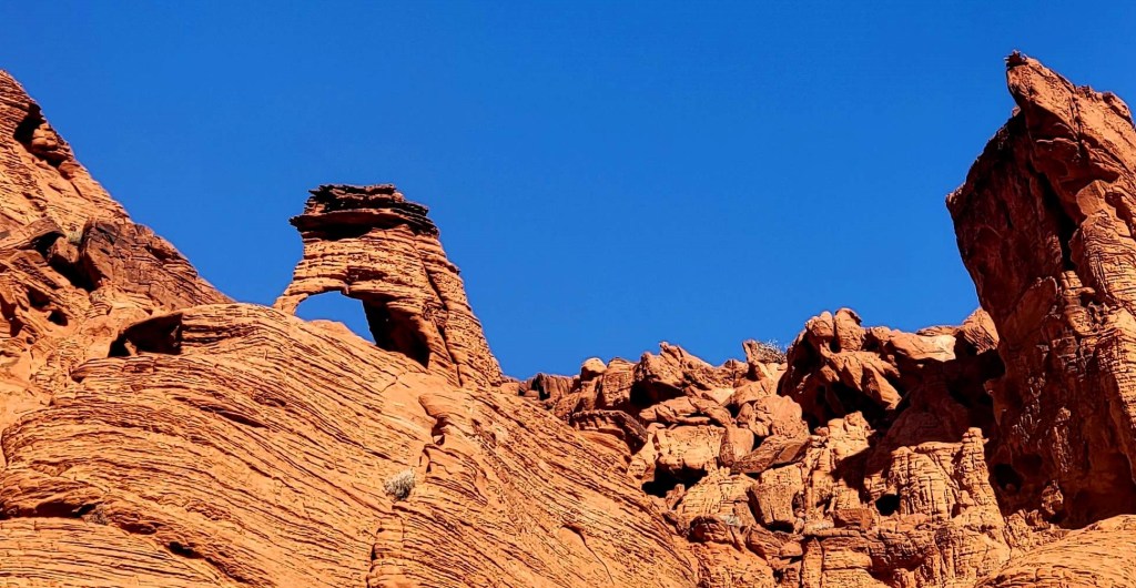
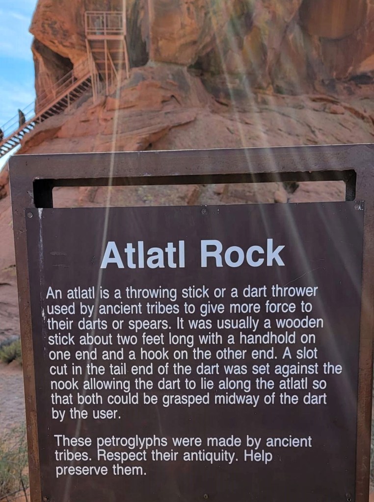
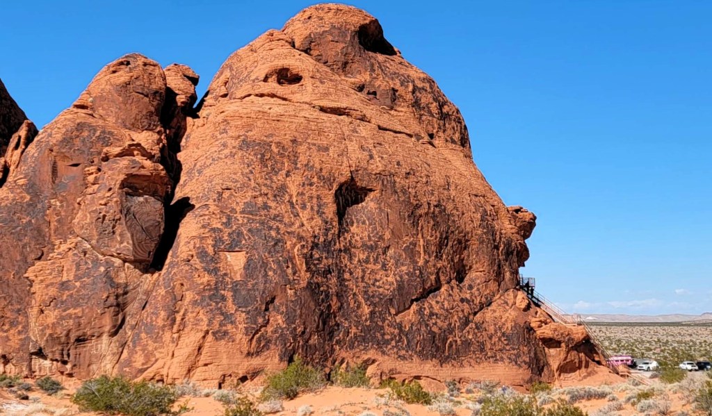
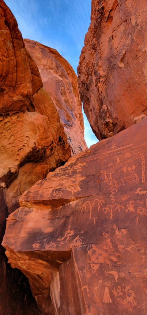
Atlatl Rock & Arch Rock
Atlatl is the BIG draw in this area. Funnily enough, we drove past this rock several times, and totally missed the ladder going up, It was only when hiking past that we saw it.


We walked past Atlatl Rock, and considered heading out into the desert on one of the side roads to the right. However, we met a group of cyclists, and decided that was the better mode of transportation. Trudging for hours through the scrub – not fun. Instead, we continued the loop to see the Natural Arch.


Wrap Up
This was such a fun hike. It was nice to just head out, and see what we could find. Turns out, we found a lot more than just the ‘featured’ rocks and arches. I hope you could see what I saw, or used your imagination to find something I missed.
Thanks for reading! You can follow my blog, join my FaceBook page Al’s Adventurers, or follow me on Instagram
Alisen
I love all things mountains! I live next door to the Canadian Rocky Mountains, however I travel the world to enjoy the many different mountain environments and cultures that I can. I hope you enjoy these trip reports, and that it inspires you to accomplish your own adventure goals.

💛
Fantastic captures of all the beautiful red rock formations and arches. This sounds like a bit of a choose your own adventure and use your imagination type of trail. I can totally picture Gimli in that one rock! The old staircase up Atlatl Rock looks a bit sketchy. I get why they replaced it with something more safe and sturdy. And how fun to find more petroglyphs.
So glad you saw Gimli. My kids were a hard NO on that one.