July 5, 2023
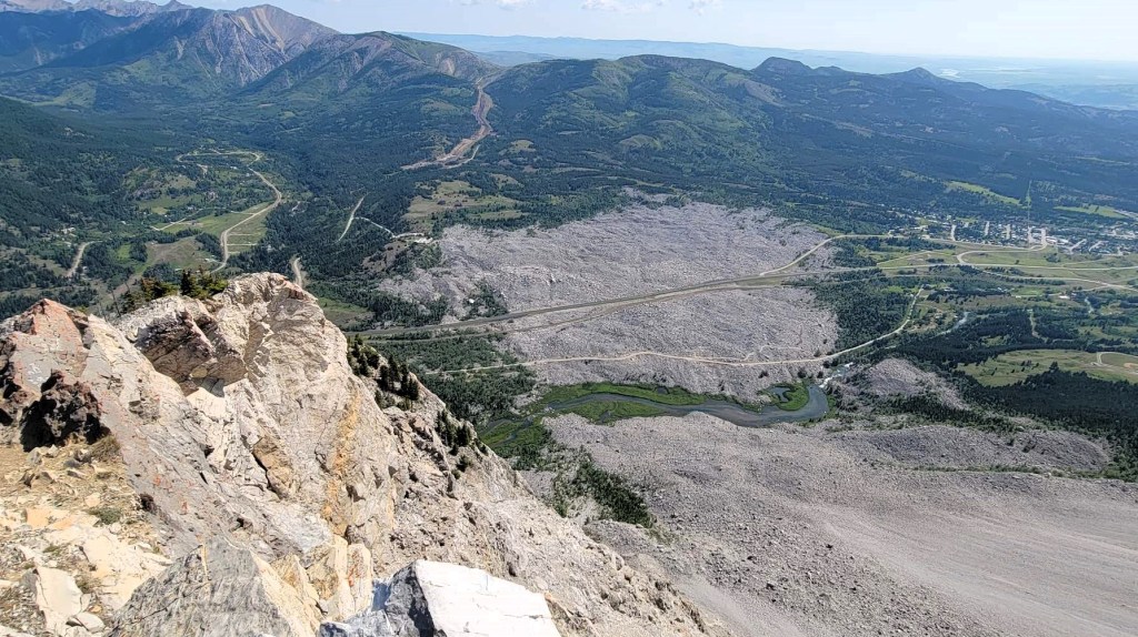
Turtle Mountain is an iconic Albertan mountain because of the Frank Slide rockfall tragedy in 1903. Most of the town of Frank was buried when 44 million cubic meters of limestone broke away from Turtle Mountain, slid down the valley, crossed the train tracks, and continued up the opposite hills. While there are several theories as to why this happened, including the mountain being inherently unstable, there was also a coal mine at the base.
While I’ve driven past Frank Slide numerous times, I did not realize that Turtle Mountain is still unstable, and that geologists study it. We found the historical monitoring equipment and several information boards near the summit.
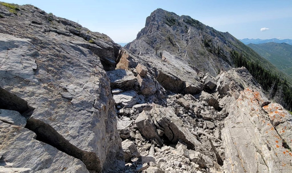
We saw lots of gaping fissures when we ventured past the first south summit. If hiking this in the winter, I’d not travel past the south summit unless you know where those fissures are. The crevasses are deep, and I was a bit freaked out just thinking about falling into one of those.
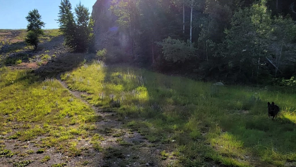
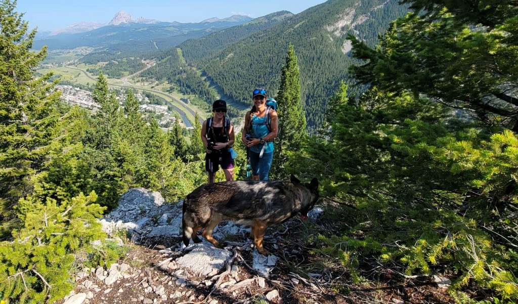
This was my first hike with my buddy Taylor, who is also my Athletic Therapist/Chiropractor. She brought her friend’s dog Luna (such a cutie!) and a snacklebox of treats. We’d have many more adventures after this. She’s a good 20 years younger than me, so I feel the need to move a little faster when she’s around 🙂
Gear
Hiking boots, poles and regular day pack kit.
Overview
From the preferred parking area (not street parking please), start hiking straight up. Keep going up until you reach the first south summit. Return here, or down-climb to the col. Cross several convoluted features, and then ascend the ridge to the higher north summit. Return the way you came.
Check out the video:
Totals – Downloadable Tracks on Gaia, and on Strava
Date: July 5, 2023
Group: Three (Alisen, Taylor and Carlie)
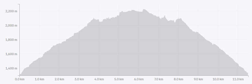
Distance: 7.6 km return
Elevation: 945 m (3,119′)
Time: 6 hours (includes lunch and breaks)

Parking and Trail Head
Turtle Mountain is located above the town of Blairmore, Alberta. There is a grassy area at the base of the hike for parking. Google maps has the spot pinned, so it’s easy to find. This mountain gets very busy, so please be courteous and park somewhat close and in a row,

Walk to the far east side of the parking lot, and look for the marker to start the trail.

Main Trail
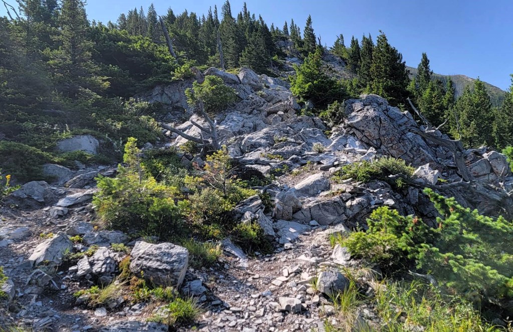
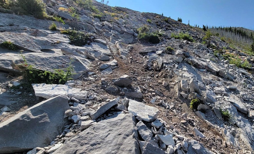
We started hiking up, and I mean up. Almost immediately we were huffing and puffing. I thought it was just me, being the ‘elder’ of the group, but nope! Even the youngin’s were breathing hard. The trail did back off a bit after the initial incline, but it held steady all the way to the summit.
The trail is very well marked with yellow and orange paint. The local trail minders have done an excellent job of mitigating trail braiding.
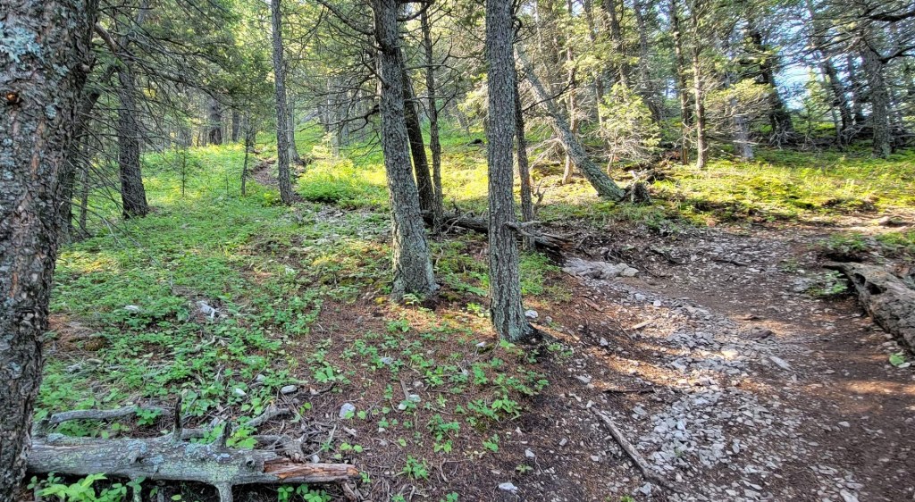
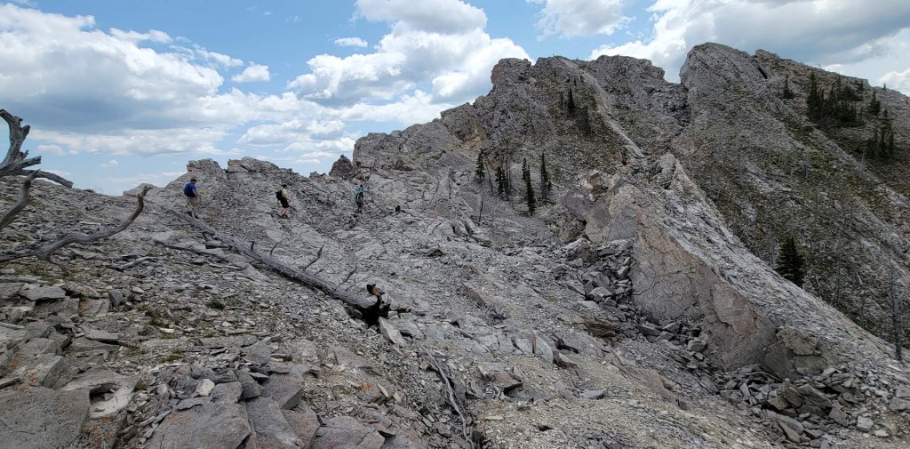
Other than one short interlude in a lovely shady forest, we were on the ridgeline the whole time. And what a ridge it is! I took about 20 photos of the gorgeous white limestone that paved our way, but I’ve only included a few, because well, you get the idea.


Turtle Mountain South Summit
We arrived at the South Summit of Turtle Mountain in 1 hour and 45 minutes. Distance was about 2.7 km with an elevation gain of about 770 m. This is where most people turn around. The views are incredible, and there’s no route finding to get here. It’s also very sobering to look down at the Frank Slide and the loss of life still buried beneath the boulders.
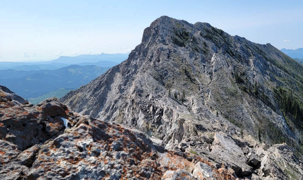

Turtle Mountain North Summit
We decided to keep going for the higher north summit. Immediately, it was a ‘choose your own adventure’. To start, there is a pretty good down climb off the south summit, which turns back most hikers.
While it looks like another straight shot to the north peak, it’s surprisingly convoluted once we got down to the col. There were multiple options, and while none of them looked right, they also weren’t wrong. We ended up taking two different routes through here on the way up and down.
It was here that we found the fissures and rock crevasses. As the east face of the mountain was being pulled away and torn off, it created big cracks on the remaining west side. I can see why geologists think this area might collapse one day.


There were a few steep sections before we got to the historical testing area and information boards. From there, it was a straight shot to the north summit, with one little dip prior to the peak. At the summit we found a helipad, and ate our lunch sitting on the warm wooden boards.


Time to North Summit of Turtle Mountain was 3 hours and 10 minutes. Distance was about 3.8 km, and elevation gain was about 900 m.


Turtle Mountain Return
We hiked back down the way we came. I took a photo looking down to the col so I could visualize my way through it. Unfortunately, once I was back down there, it was as convoluted as before. A few other people were now coming up, and they were all on different trails too. No worries – we found our way back to the south summit and then had a quick descent back to the vehicles.

Wrap Up
Turtle Mountain is a worthy objective for many reasons. It has significant cultural history, it’s a gorgeous mountain with beautiful white limestone, and it provides some good route finding and easy scrambling options if you choose seek them out.
Thanks for reading! You can follow my blog, join my FaceBook page Al’s Adventurers, or follow me on Instagram
Alisen
I love all things mountains! I live next door to the Canadian Rocky Mountains, however I travel the world to enjoy the many different mountain environments and cultures that I can. I hope you enjoy these trip reports, and that it inspires you to accomplish your own adventure goals.

splendidly organised box of food!
-✧✦☆❖◈❋✤☆✦-∞-♡-∞-✦☆✤❋◈❖☆✦✧-
This is on our to-do list … although I prefer not having to do “route finding”:)
I have never thought of hiking Turtle Mountain, but you’re making me reconsider. Maggie
I’m not the greatest with navigation so I appreciate a well marked trail. Beautiful shots of and from the ridge. That is one delicious snacklebox (and I love the term snacklebox – I’ve never heard it before)! What a great idea!
This looks tricky but fun! I think I’d be nervous hiking on a mountain that had a giant rockslide and is still unstable. But with those views from the top, it looks worth the risk anyway!