August 23, 2025
This is Day Four of Five. Click HERE for the full overview, including distances and elevations for each day.
After yesterday’s fantastic hike up to Poboktan Pass, I was thrilled with the way this backpack was shaping up. Glorious rivers and an amazing lake. Epic mountain views. What more could I ask for? Our Brazeau Buddies (people who were also doing the Brazeau route and staying at the same campgrounds) told us that today was the really big day with the best views. I found that hard to believe. What do I know???
Last night was again pretty chilly. Clear skies means the heat dissipates quickly, but I was not going to complain about the severe clear and the brilliant blue skies during the day. I moved my tent away from the creek, and I slept with my head under the sleeping bag. All in, not a bad sleep. Erin and I were up again at 6:00 am, and were on the trail by 7:55 am.
Gear
Full backpacking kit. See Overview page for detail.
Overview
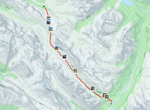
From the campsite, between the tables and the tent area, look for the yellow diamond. Follow this trail to connect with the Jonas Shoulder trail heading SSE. Steadily gain elevation up to Jonas Shoulder. Freak out about the views and take a million photos. Descend the other side of Jonas Shoulder into the wide valley. Gain minimal elevation until Jonas Pass. Keep hiking, slowly losing elevation until about the 16 km mark. Hike steep descent into the forest. At the T intersection, turn right. The Four Points Campground is about 50 m on the right.

Totals – Downloadable Tracks on Gaia, Displayed on Strava
Date: August 22, 2025
Group: Two (Alisen & Erin)
Distance: 18.8 km
Elevation: 553 m (1,842′)
Time: 7 hours 20 minutes (includes lunch and breaks)
Jonas Cutoff Campground to Main Trail
Another chilly morning. I tried to dry out my fly and ground sheet while making breakfast, but it was a lost cause. Erin and I were now in the flow of getting up, eating up, packing up, and giddying up. We were again the first on the trail and THANKFUL for the early start. It was going to be so hot, and were happy to be off the steep stuff so early.
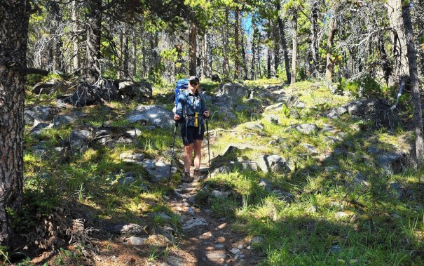
The trail starts right from the campground, just past the highest picnic table. Look for the yellow diamond. This trail is fairly steep. At the top, turn right. There’s fantastic wood signs here to guide you along.

The hike up was beautiful, and Erin and I fully enjoyed the amazing scenery. We were again in the wide Poboktan Pass plateau we hiked through yesterday, but the other side. The ground was wet and marshy. This might be from a really wet year, but other backpackers said it’s always wet and mucky through there.

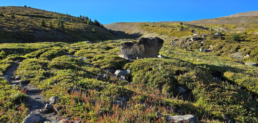
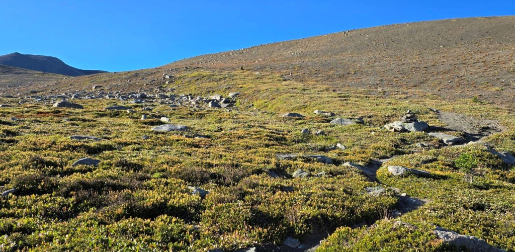
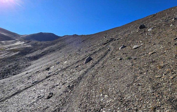
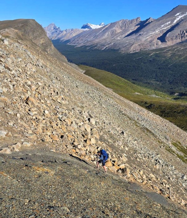
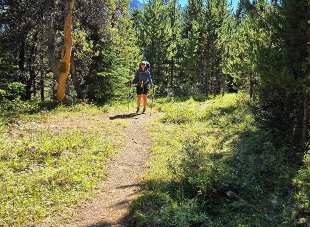
We loved the scenery, and saw the gorgeous hills and mountains from yesterday. The steep ascent starts at the moraine. We both agreed that one more switchback was needed to maintain that perfect Parks Canada elevation grade.
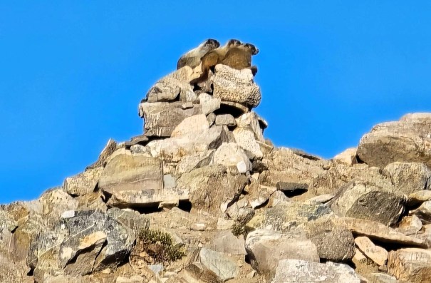
As we neared Jonas Shoulder, we found “Marmot Mount.” There was a family of young Marmots playing on the highest point. There was four on the summit at once. They were looking at something way more interesting on the other side as we sneaked up on them. LOVE marmots!
Jonas Shoulder
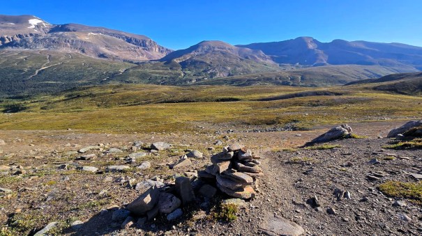
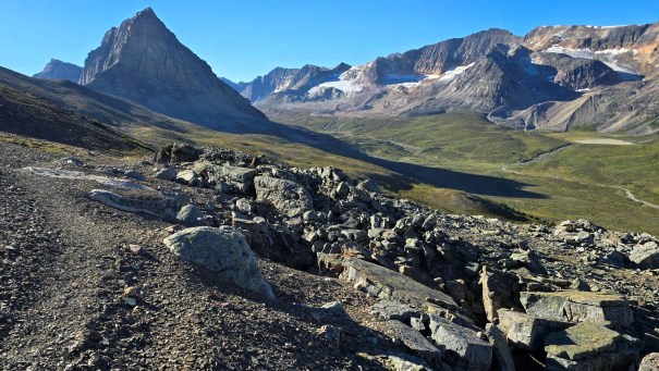
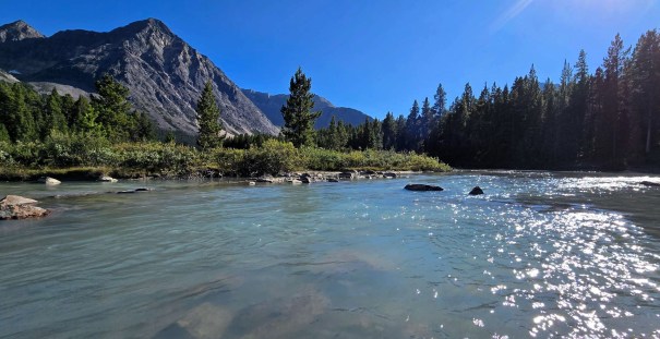
We continued on, and gained Jonas Shoulder. I was absolutely BLOWN away by the view on the other side. Wowzers. Magnificent. The main peak is Sunwapta, and is accessed from the other side on Highway 93 (Icefields Parkway). The big purple beauty is a Sunwapta subpeak named “SE3.” Boring. Erin and I renamed it Purple-lishious. This gorgeous mountain with several alluvial fans held our attention for hours. Each kilometer gave a slightly different view. Out whipped the cameras!
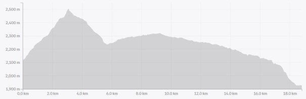
Distance to Jonas Shoulder was 3.1 km. Hiking time was 1 hour, with most of the elevation gain for the day, so around 550 m.
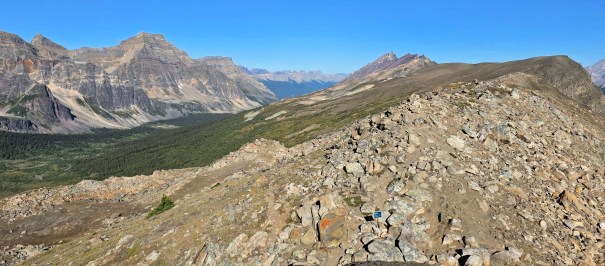
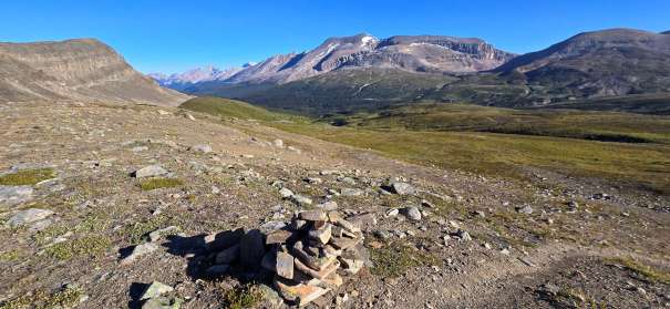
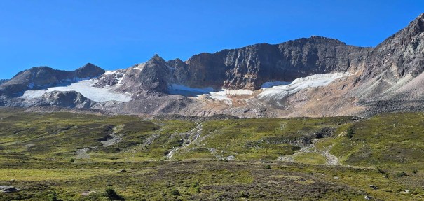
Jonas Shoulder is a pass, and is named after Chief Jonas, hereditary chief of the Nakoda people. The shoulder is at the end of a long, skinny mountain, with no named peaks except for Waterfall Peaks to the north.
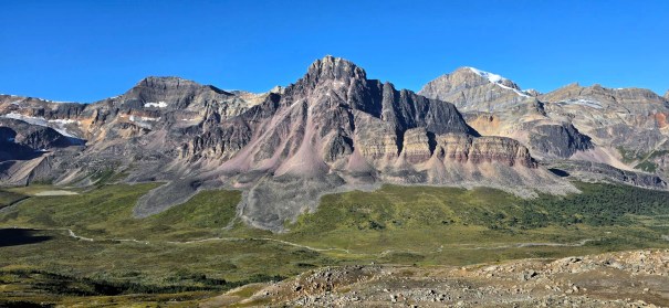
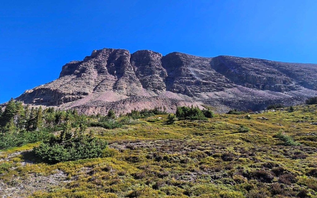
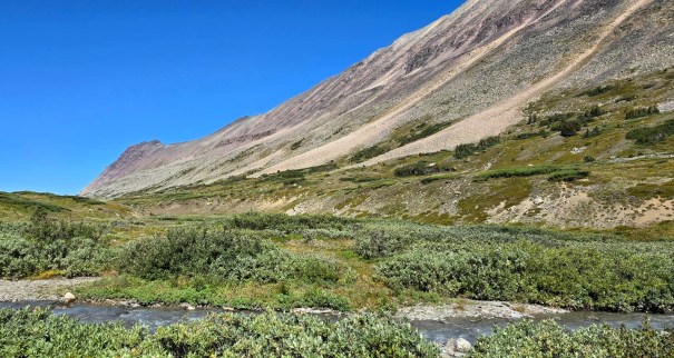
All too soon, we had to hike down the steep trail to enter the wide Jonas Pass valley. The Sunwapta ‘range’ was on our right, with several small glaciers and interesting rock formations to keep us well entertained. On our left we had “Le Grand Chateau” – the mountain we named the day before. Who knew we’d be seeing this beauty from all sides. The scrambler in me was looking for routes up all these peaks.

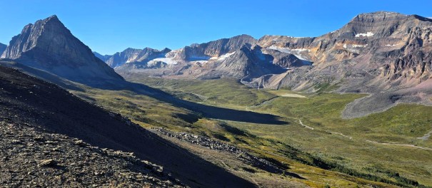
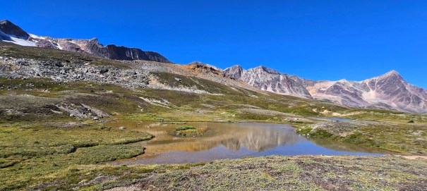
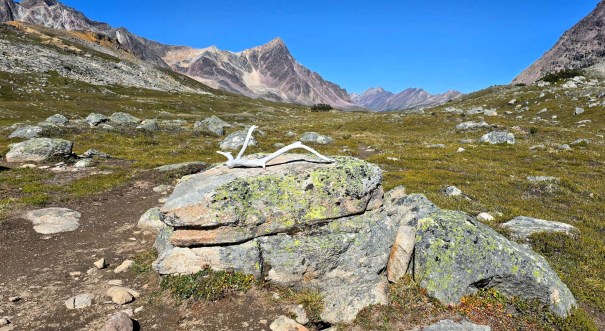
Jonas Pass
Once we got off the steepest part of the descent, the trail leveled out. We hiked to Jonas Pass, which was not marked other than a big rock with some antlers. It was 11:30 am, and a little early for lunch, but we took the opportunity to dry out the tents, and air out the sleeping bags. Four Points campground is not bright and sunny, and we wanted everything as dry as possible.
Distance to Jonas Pass is 9.2 km. Hiking time was 2 hours, 40 minutes.

After repacking, we continued down the trail. It was getting hotter and hotter. At the next major creek crossing, Erin and I decided it was time to cool down. Erin filtered some cold water, and we drank about a litre each. We both splashed off in the water, and soaked our hair. The best part? I took off my hiking shirt and soaked it in the water. It’s hard to get it back on, but it kept me cool for hours to come.

Four Points Campground
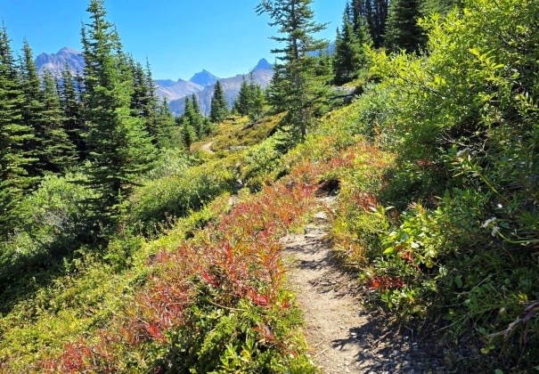
I knew we were getting close to the end when we descended into the forest, at about the 15 km mark. Unlike the tight forest of the day before, this featured nicely spaced trees with mossy undergrowth. It was delightful. We were shaded from the sun, but without the oppressive heat.
There’s one steep descent, but it featured these amazing natural stone stairs. Everything about today’s hike was fantastic.
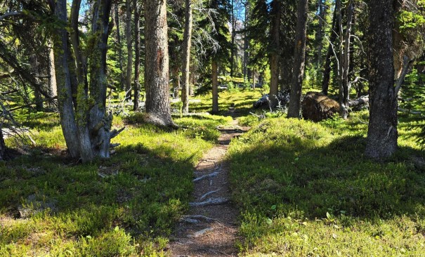
At the end of the trail we hit the T intersection we saw on Day 2. I turned right, and was at the Four Points campground in under 50 meters. As there was a new group of backpackers coming in, we quickly snagged our campsites and set up the tents.
Distance to Four Points was 18.8 km. Hiking time was 7 hour and 20 minutes, and total elevation was 553 m.
Unlike our first day in Four Points when we were rushing to avoid the rain, this was a completely different experience. The sun was shinning, and it was time to hit the river. The best spots are slightly down stream from the campground, heading towards Brazeau Lake. There are several large rocks, and lots of places to wade in without fully committing to the fast water.
As this was our last night on the Brazeau Loop, our “Brazeau Crew” decided we would have our Last Supper together. Along with Erin and I, we had Shelia and Alan, and Rea and Kim. We shared one big table, made our dinners, swapped recipes, and swapped tales of derring-do. It was the perfect ending to an absolutely amazing backpack. It was so nice to see the same faces in camp every evening. It was fun to swap tales of the terrain and to discuss the route ahead.
Wrap Up
While I really enjoyed the mountains on Day 3 as we entered Poboktan Pass, I have to agree with everyone that today held the most spectacular mountain ranges. I’ve seen a lot of mountains, and been blown away by a few, so to get me this excited about a view? Yup, it’s that good. I hope the pics do it justice. If not, then you’ll have to come see for yourself.
I was a little worried that tomorrow would be pure drudgery, hiking out the same route we came in. Not! Heading out gave a different set of amazing views.
Click HERE for Day Five on the Brazeau Loop (coming soon).
Thanks for reading! You can follow my blog, join my FaceBook page Al’s Adventurers, or follow me on Instagram
Alisen
I love all things mountains! I live next door to the Canadian Rocky Mountains, however I travel the world to enjoy the many different mountain environments and cultures that I can. I hope you enjoy these trip reports, and that it inspires you to accomplish your own adventure goals.

Your Brazeau Buddies weren’t kidding about the beautiful views. And how fun to have spotted some marmots. I love seeing them on the trail too!
I am glad I didn’t ask for more info on the view. Being surprised by it was a big part of the fun.
Whoa! I’d say those hikers were right about this being the best day. The view into Jonas Valley is so quintessentially Canadian Rockies. I love it!
Yes! I agree. Wouldn’t have this view anywhere else. So nice to share this with you – you completely get it 💖❤️💓