August 17, 2020
Updated July 1, 2025
Healy Pass is a classic Banff National Park hike. It’s a good long walk with gradual elevation gain. The scenery is always stunning, and if you time it right, the wildflowers are gorgeous.
This is the fourth time I’ve hiked Healy Pass. Two were backpacks into Egypt Lake and beyond. I have to say I felt a small pang of jealousy watching all the backpackers make their way in.
Although, I was NOT jealous of the people who got to the trail head late. With Covid, the Sunshine parking lot is closed. This means there are only a few dozen spots available at the small parking lot. Once that is filled, the gate is closed! We met two backpack parties around 2:00 pm who were JUST starting out. This is because they had to park at the start of the Sunshine Road, and walk the extra 7 KM to the trail head!
UPDATE: Covid is now over. The gates are open, and we parked right next to the Sunshine Gondola. There are washrooms at the base, but only when the building is open. If you are here early, stop at the outhouses at the base of the road.
Gear
Hiking boots, poles, and your usual day pack kit.
Overview
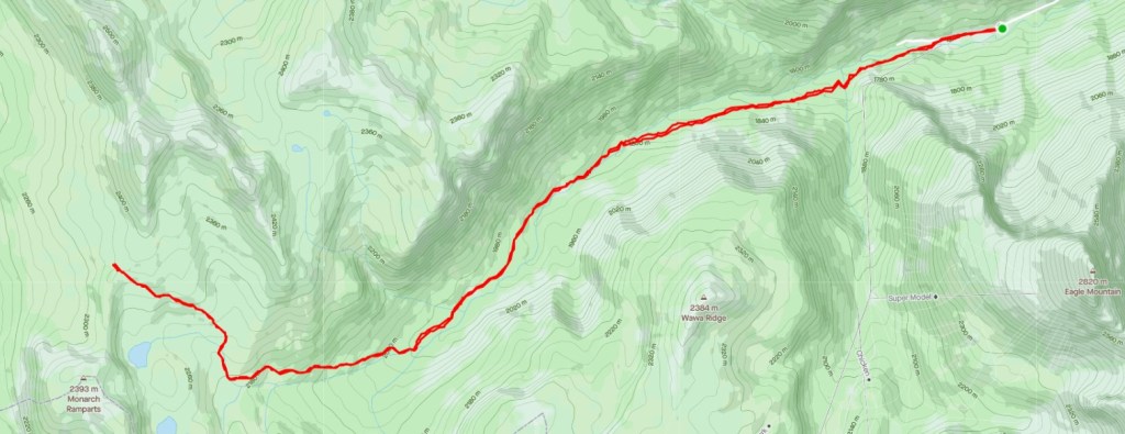
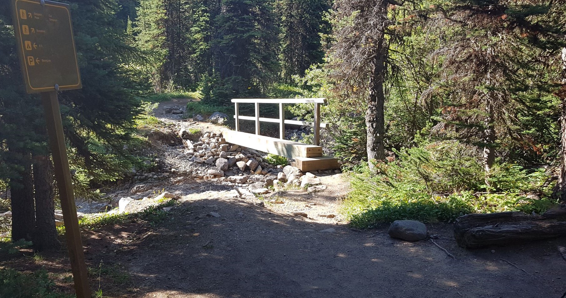
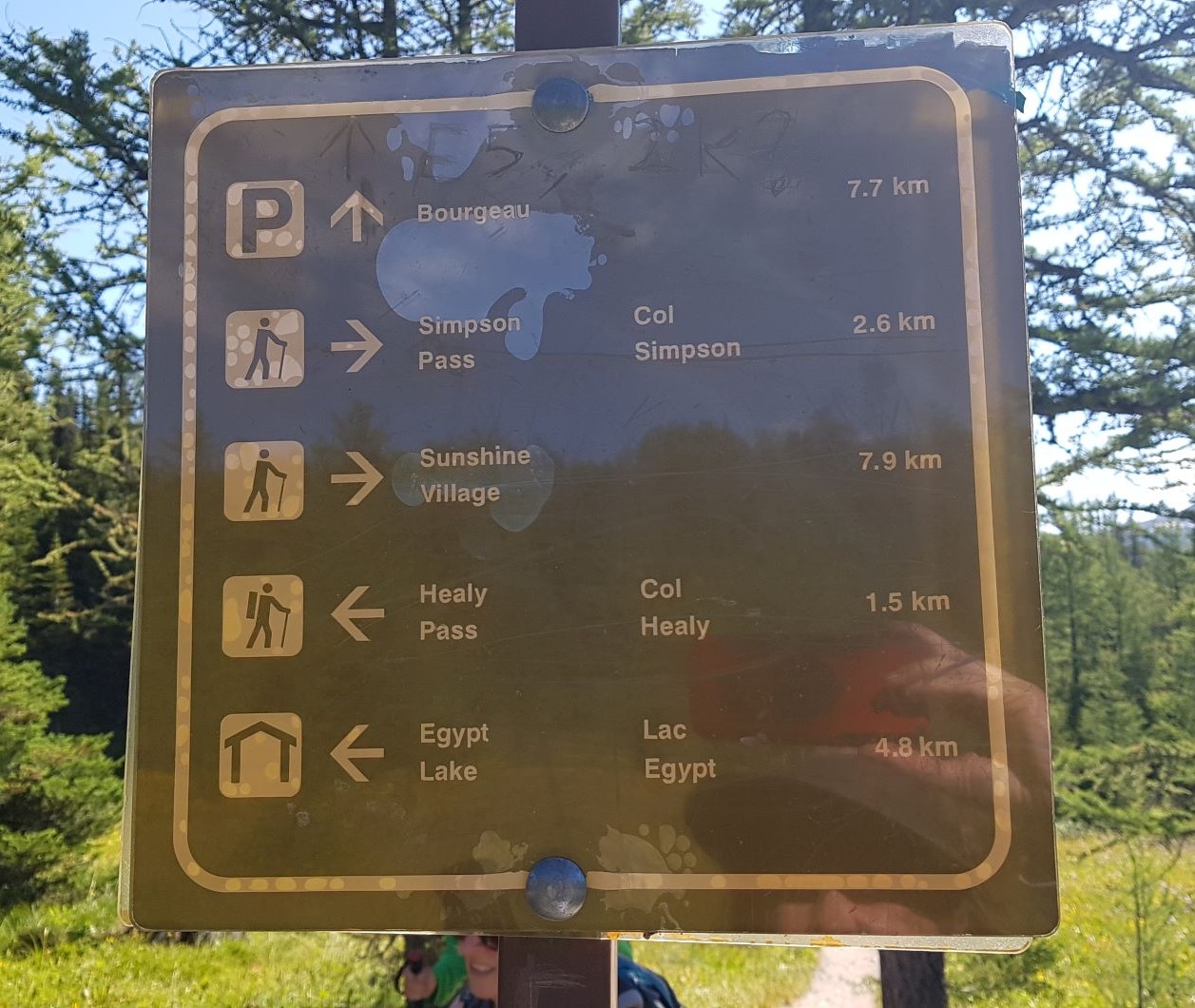
Park at the base of Sunshine Village. Walk around the lodge on the right side. On the left is the trail head. At the first junction, turn right to Healy Pass. Continue past the campground. At the Junction to Simpson Pass, veer right. Go straight up to Healy Pass. Return the way you came.
Totals – Downloadable Tracks on Gaia. Displayed on Strava
Date: August 17, 2020 (Updated July 1, 2025)
Group: Five, and Two (Alisen & Erin)
Distance: 19.89 km
Elevation: 736 m (2,429′)

Trail Head
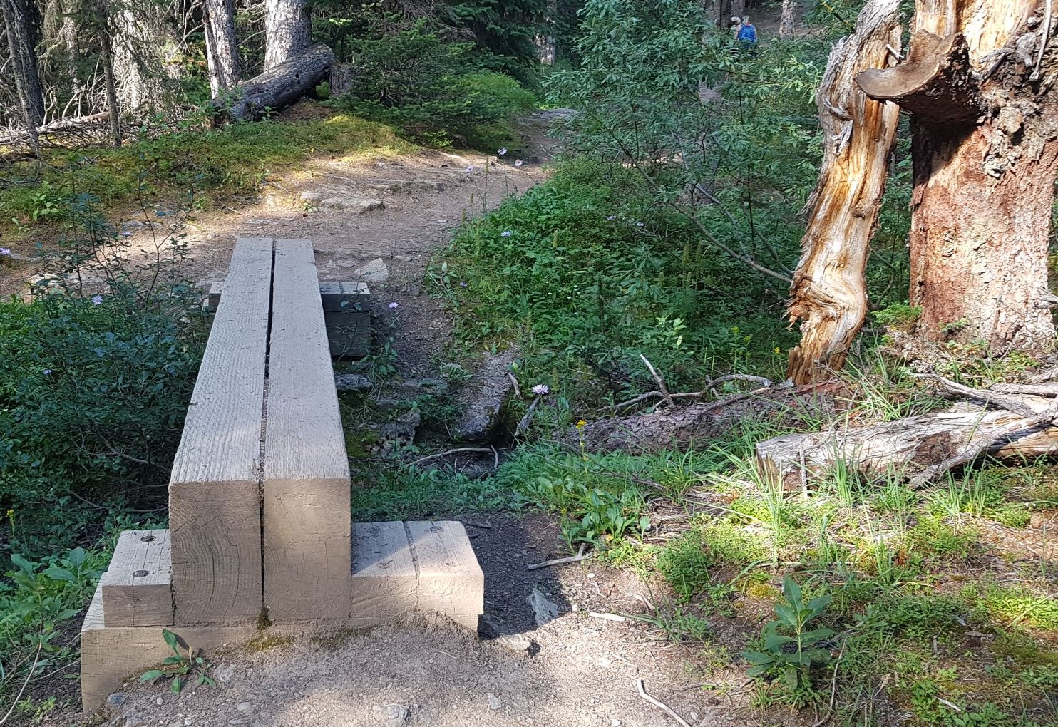
For us oldies, the trail head to Healy Pass has changed. It used to be behind the Sunshine base lodge on the right side of the parking lot. It is now on the left. Walk behind the lodge, and the trail head is immediately on the left and well marked. UPDATE: This is now changed but I didn’t take a photo. The start of the Trail Head is now a lovely wooden bridge across the river. Very obvious.
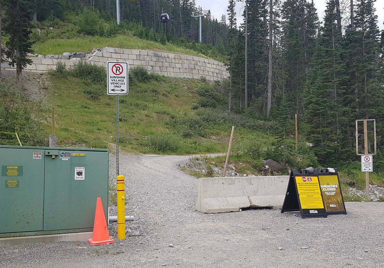
Please do not be tempted to go up the Ski Out, which is in front of the lodge. We saw a party on the upper road. This is where the vehicles drive, and is a dusty mess.

Main Trail
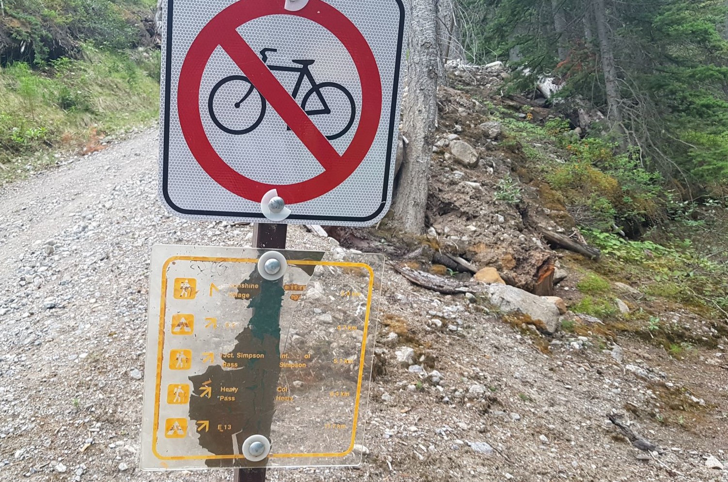
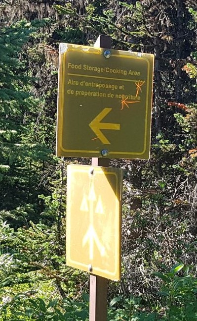
Once on the main trail, hike for about 1.3 km. At the first junction, turn right at the sign.
Follow this trail to cross Sunshine Creek, where we found a sketchy bridge.

At about 3 km, cross the bridge over Healy Creek. This is a gorgeous creek. Take your time here to explore up and down stream of the bridge.

After the bridge, you are again in the trees for some time. Bring bug spray and a light, long sleeve shirt. We were harassed by black flies and horse flies the whole way.
We passed several small bridges. In July, most of these seasonal creeks were dry, but I imagine they are flowing quite good in the spring and after a solid rain.
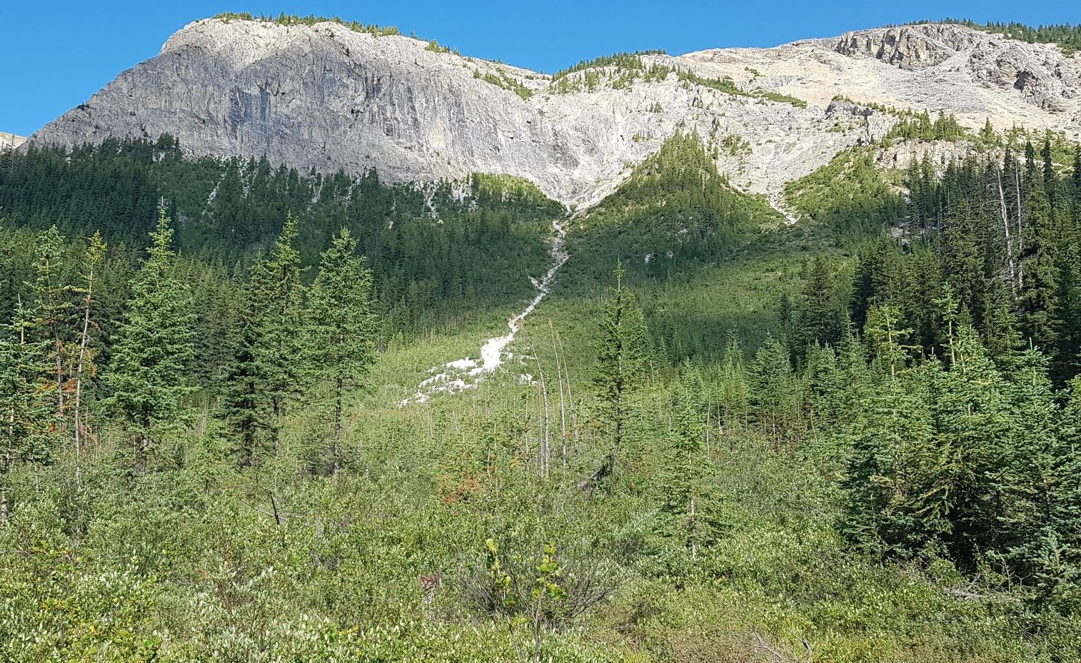
For winter ski travel, be aware of the three avalanche slope paths. The run-out will completely cover the trail, so cross one at a time.
Around 5 km, we passed the Healy Creek backcountry campground. This is an ideal spot for those new to backpacking or young kids. Lots to explore from here.
At about 6 km, we passed the turnoff to Simpson Pass. This is a loop that connects back into the main Healy Trail. My friend Erin did this recently, and the trail is really bushy and filled in with vegetation.
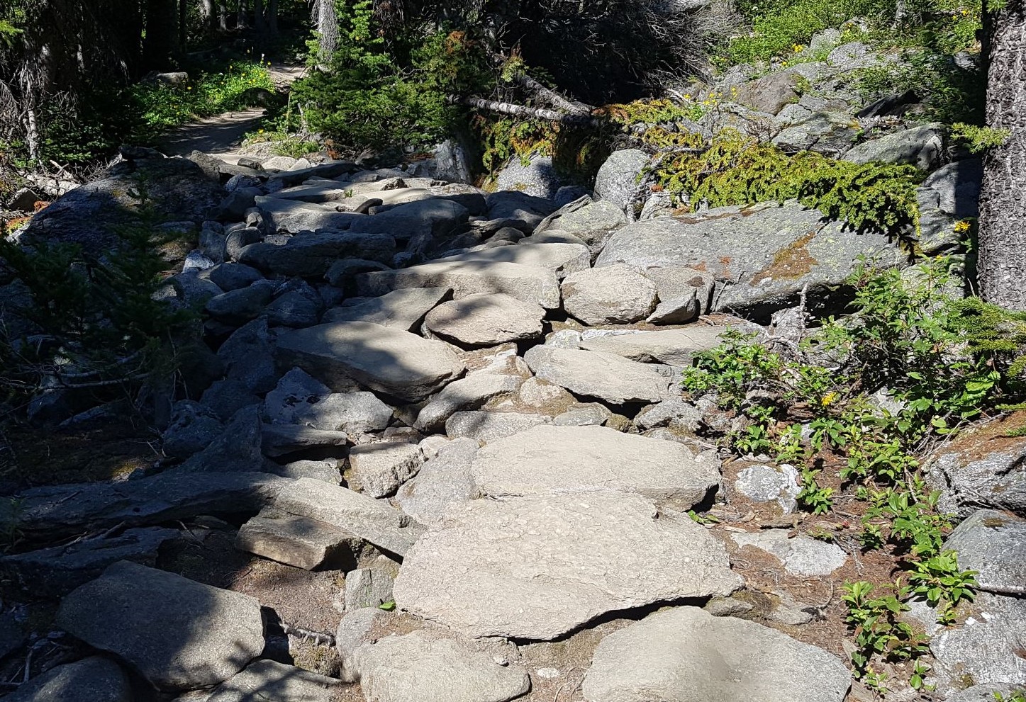
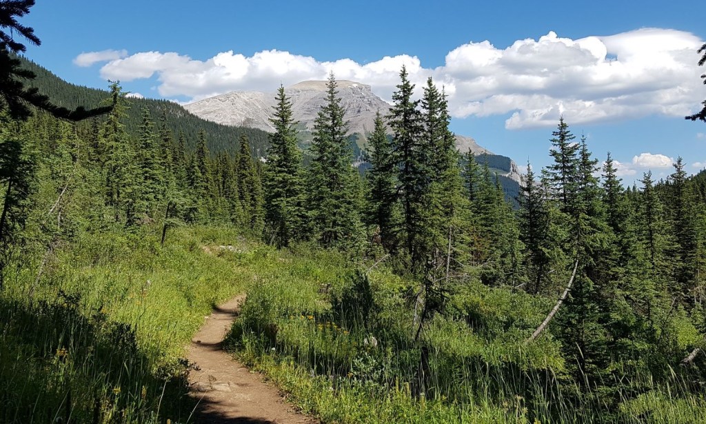
After the Simpson Pass junction, the trail gains elevation in earnest. The trail changes to rocky steps for a while, and then back to soft ground.
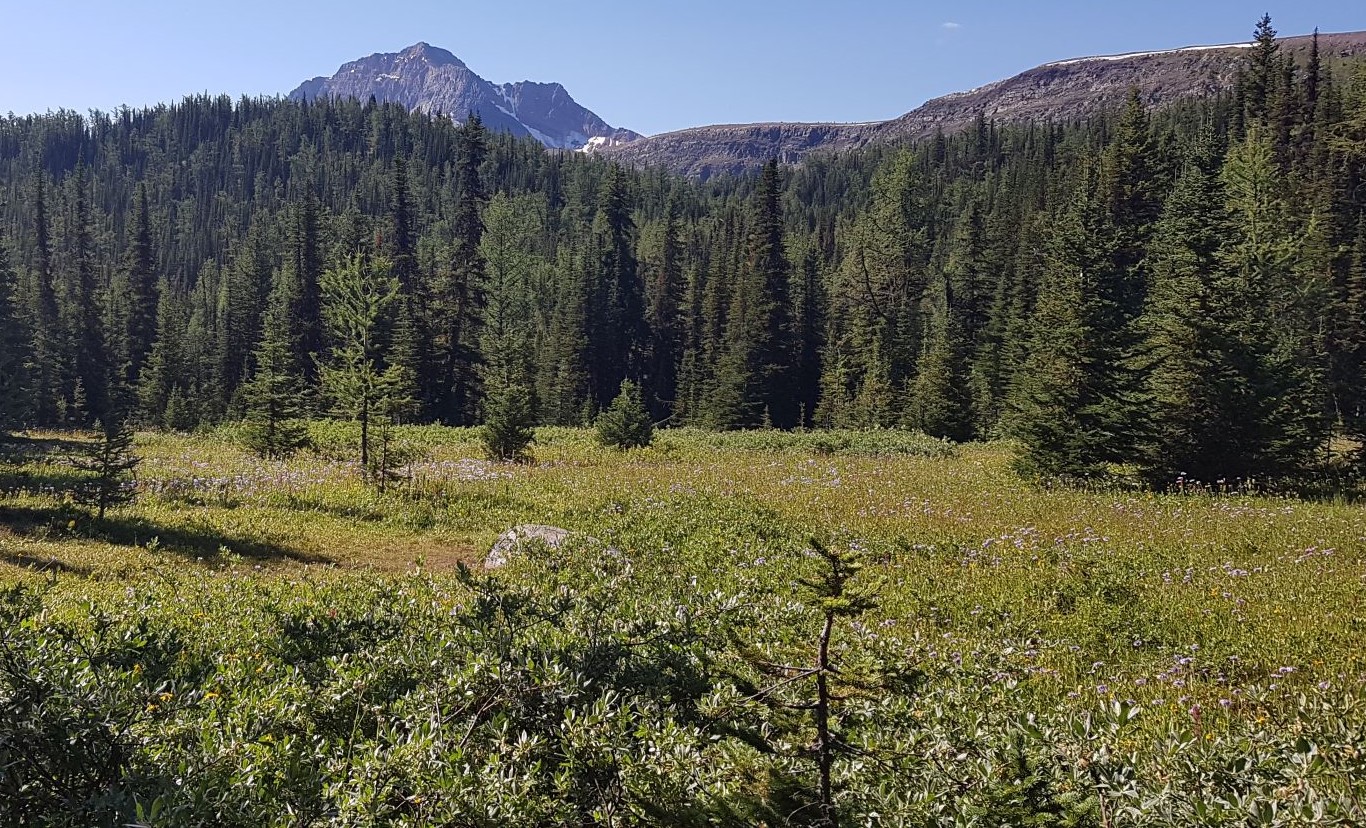
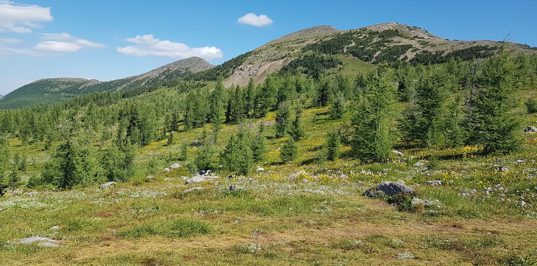
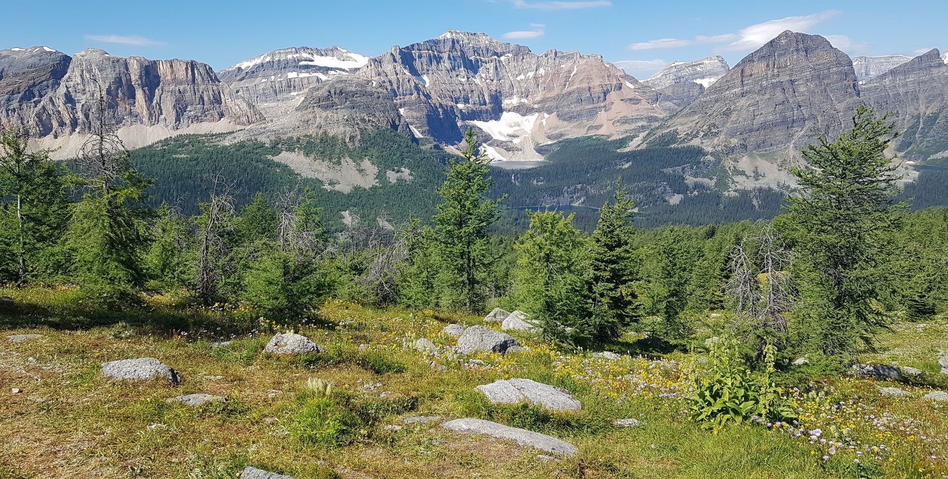
This was our first glimpse at the Monarch Ramparts on our left. Most people see the other side of this while skiing at Sunshine Village. This area is now closed.
At 8 km, we came to the second Simpson Pass sign. This is the other end of the Simpson Pass loop. Turn Right here to continue the final 1.5 km to Healy Pass.
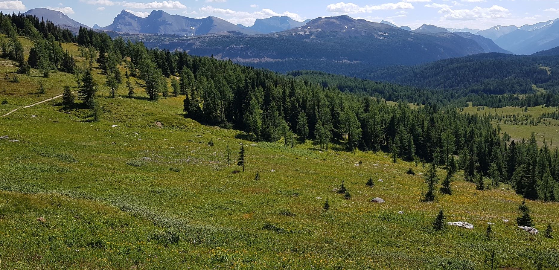
After the Simpson Pass junction, we were finally at a high enough elevation to break out of the tight spruce trees, and enter the realm of larch trees. Larch only grow at higher elevations, and don’t like to be crowded. This means more open spaces for the wildflower meadows we came to see.
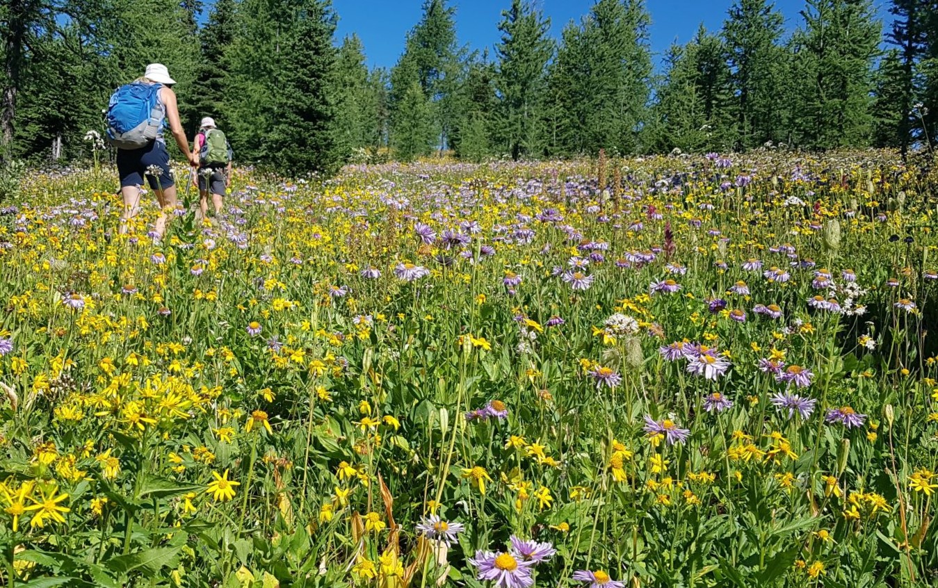
This last kilometre to Healy Pass is by far the nicest section of the trail. Healy Pass sits in a low saddle between Monarch Ramparts and Healy Ridge, and is marked by a giant bolder.

Healy Pass Peak is above. It looks to be an easily accessible summit, but it is closed all summer. This is a winter only objective.
The distance to Healy Pass is 9.4 KM. The elevation at the pass is 2,508 m. According to Gaia, the elevation gain was 760 m. It took us 2 hrs 24 min.
While the view from Healy Pass is gorgeous, it is also worthwhile to walk a few metres down the trail towards Egypt Lake. From here, there are amazing views of Egypt Lake (below), Scarab Lake, and Haiduk Peak towering above. The pyramid shaped mountain to the right is Pharaoh Peak. Egypt Lake campground is directly below Pharaoh Peak. If you want to backpack there, and climb Pharaoh Peak, then click HERE to see the route.
It was such a warm and beautiful day, so we had a good long summit lounge. We watched a pair of marmots keep a close eye on the hikers and their domain, avoiding the time when we had to descend again into the woods and flies.
Healy Pass Return
The return route is the same, unless you want to take the Simpson Pass detour. We chose to stay on the main trail to get our fill of the spectacular views while they lasted.
Before we entered the forest, we were treated to a view of Mt Bourgeau’s summit ridge.
Healy Pass is one of the classic Banff day hikes. At almost 20 km, it is a long day, but not difficult or technical. This hike is great all summer long and into the fall to view the larches changing colour.
If you found this post useful, please do me a huge favour and click the Star button to “Like” it. You can also follow my blog, follow me on Instagram, or join my FaceBook page Al’s Adventurers.
Alisen
I love all things mountains! I live next door to the Canadian Rocky Mountains, however I travel the world to enjoy the many different mountain environments and cultures that I can. I hope you enjoy these trip reports, and that it inspires you to accomplish your own adventure goals.

Great 👍
Thank you! Happy trails.
We are planning on doing Healy Pass when the larches change colour 🙂 Thanks for sharing your insights here.
Excellent choice! Another really good larch hike is the other end of this backpack. If you go in via Vista Lake to Arnica and Twin Lakes, there are lots of larches there. Might be a little less busy. Let me know how it goes for you.
We went just beyond Twin Lakes and turned back as the weather wasn’t great that day. We’re thinking Smutwood might be a good one for the larches too.
Yes, it would. I am considering Smutswood this summer, but I’m not thrilled about the 6 km approach. I skied that a few years ago, which is way faster than walking. I think the views of the lakes would be prettier in the summer or fall though. Decisions, decisions 🙂
I’ve never done back country skiing. I’m way too chicken (and lazy) for that! Hopefully you’ll do the hike before me and I can learn from your experiences there 😊
I will give it my best shot! 🙂
If you are interested in skiing, the most fun and least risky is Light Touring. It’s like cross-country skiing but with metal edges and bigger boots. There are all kinds of winter trails with low to no avalanche danger, and you get a free ride down.
Alisen, we’re planning to hike Sunshine to Assiniboine this week. What time did you get to the parking lot to still get a spot? Bad enough we have to hike up to Standish chair but I don’t want to also do that road! Thanks, Maggie
Hi Maggie. We were at the trail head by 8:30 am, and there were still plenty of spots. It’s not as busy as the Lake Louise parking lots, but I’m glad we opted for the earlier start.
Thanks Alisen, 8:30 isn’t too bad, I was worried we’d have to be there by 7. Thanks for the info.
No problem. Enjoy your trip.
Great destinations for travellers with beautiful photographs.Thank you very much.🌹👍🙏
Thank you, and welcome to the Canadian Rocky Mountains. The scenery does the hard work with the photos 🙂 I hope you get to visit them one day.
Most welcome.🌹👍🙏
Engaging writing and beautiful imagery🌷 Thank you for sharing.
Thank you very much for your kind words. I am glad you enjoyed the post. The scenery does all the heavy lifting in this case 🙂
🙂🌷
Beautifully described ❤
Thank you very much. I do hope to make it easy for people to do these hikes. Enjoy!
Wonderful. Happy Weekend ☀️🙏
What a perfect destination for travelers like me.. This sounds like fun and interesting adventure!
This is indeed a great adventure for a traveler. It is easy to do, with great views. I am sure you have many great adventure spots where you live too. The key to adventure is to just go and explore!