Multiple Trips
Powderface Ridge is one of my favourite hikes on Highway 66. It’s ideal for new hikers because it has a solid trail, no route finding, and you only go as far as you want. Its relatively lower elevation means it is a good early and late season hike when other objectives are covered in snow.
If you want a short day, then it’s a quick trip up to the south summit and back. If you have more time, then continue on to the north summit. If you go with two vehicles, then you can hike the whole ridge from north to south.
Gear
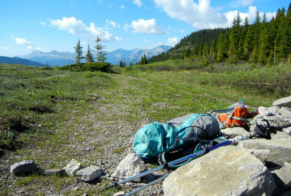
Good hiking boots, poles, and your usual day pack kit.
Overview
From the trail head off Highway 66, hike up the ridge to the pass. From there, hike up to the south summit. To nab the north summit, continue on the trail at the pass. Return the way you came.
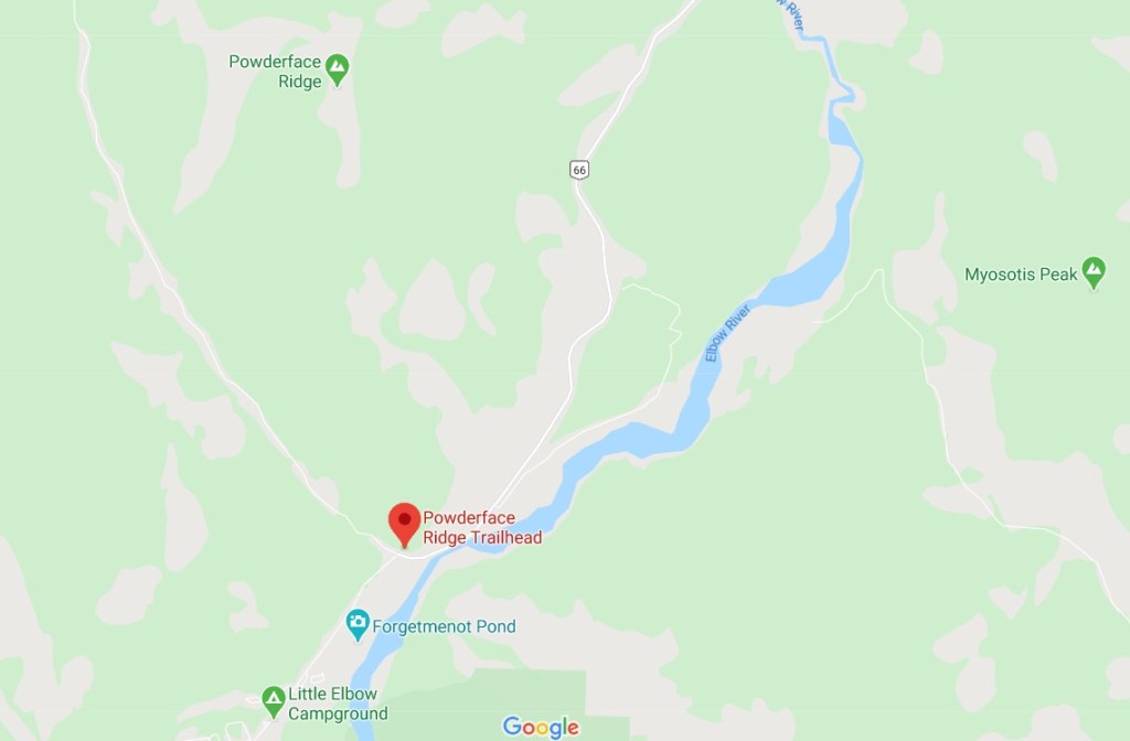
Trail Head
You would think that the Powderface Ridge trail would start from the Powderface parking lot, but you’d be wrong. I like to stop here though, as it’s the last outhouse before the hike. Continue past this parking lot to the winter gates. This is where Highway 66 makes the big left turn. Park on the side of the road.
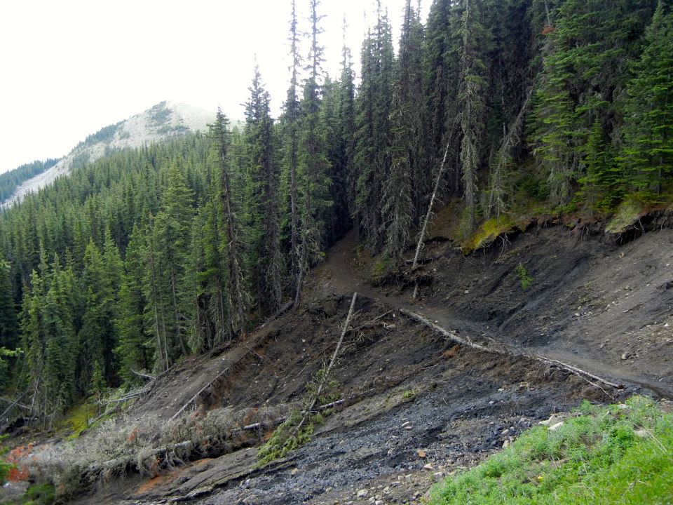
Powderface Ridge Main Trail
From the south trail head off Highway 66, there is a very prominent trail right from the highway. Start hiking up here.
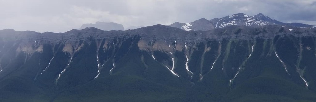
The trail is in the trees for several km, however the scenery changes often.


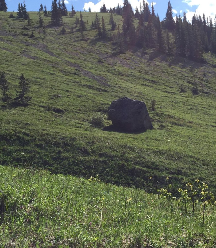
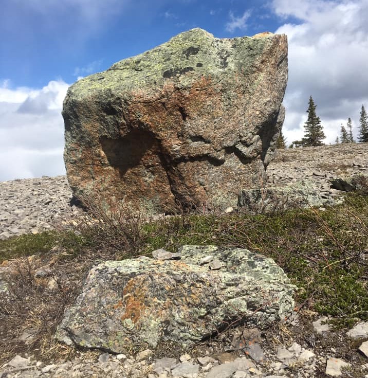
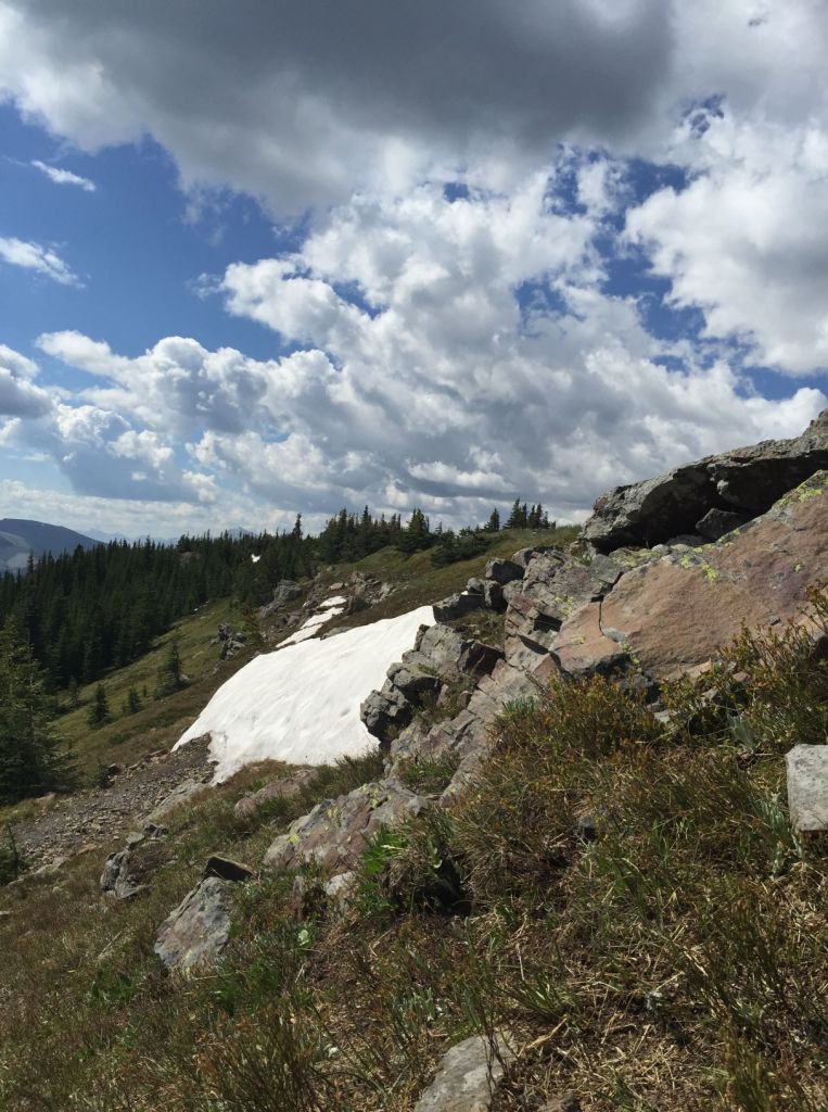
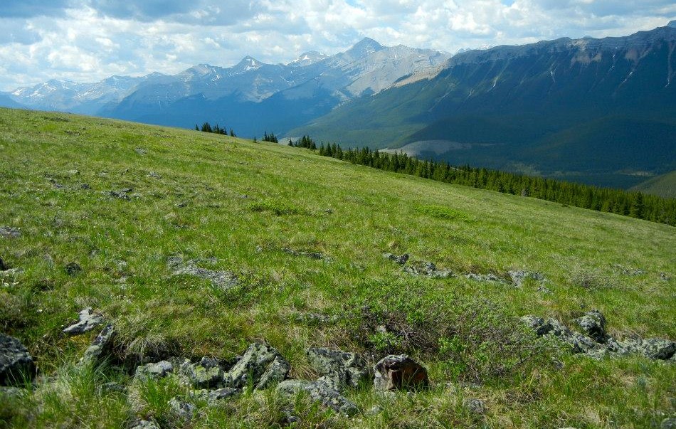
As you get closer to the south summit, you will hike through gorgeous meadows. Keep your eyes open for an erratic that is in a meadow off to the right. An erratic is a large boulder carried here by a glacier, and deposited when the glacier melted.
Continue up the trail. You will leave the forest, which stays on the west side of the trail. The meadow to the east is gorgeous.
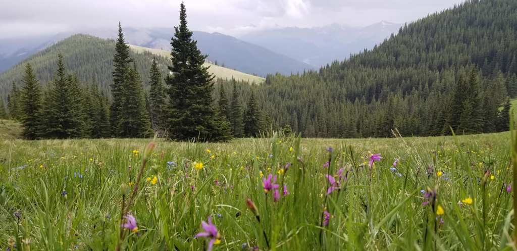
Continue hiking up through the meadows, staying on the trail, until you come to the pass. You will know you are at the pass, because there is a small pile of stones. If you were to continue on the trail, it starts to descend.
Powderface South Summit
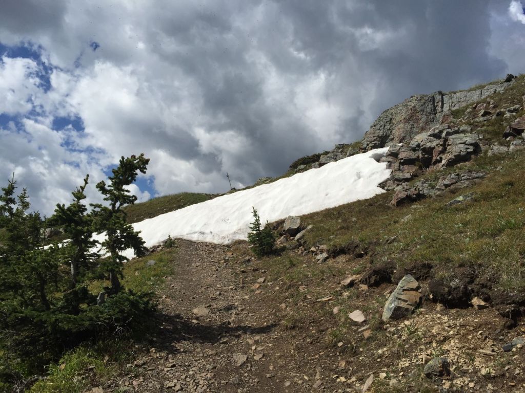
To gain the South Summit, at the pass, turn right (east) and start hiking up. Please hike up the left side of the ridge. If you look closely, there is a faint trail. Please do your honest best to stay on the trail. This is a fragile alpine environment. Hundreds of people trudge up here annually. All the vegetation would be destroyed if we didn’t take the extra care and attention to stay on the trail.

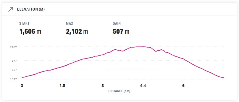
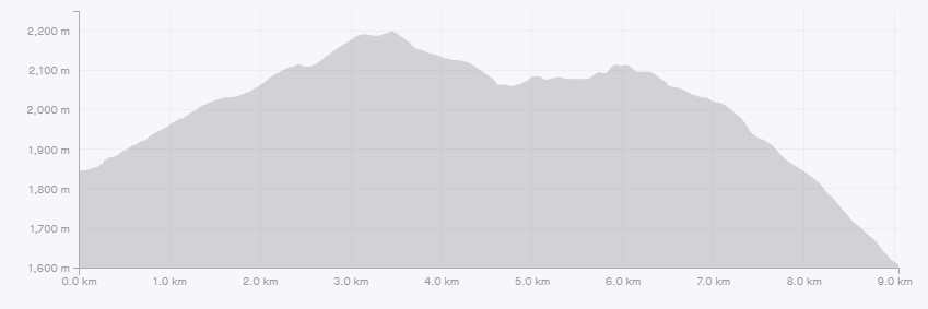
Distance to the south summit is about 4.5 km. Elevation gain is 507 m.
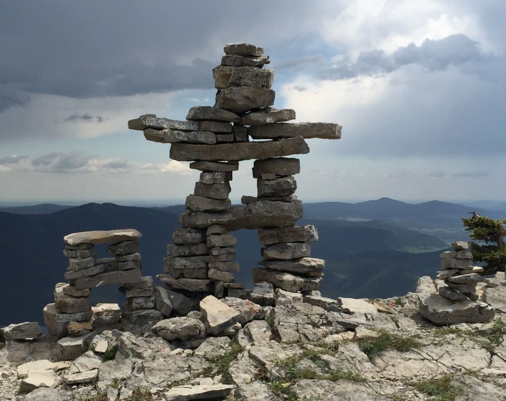
Years ago, there was a gorgeous inukshuk on this summit. Unfortunately, some self righteous person decided he didn’t like structures in the mountains and purposely destroyed this work of art. The debate on cairns and other markers rages on. For me, if someone is going to be creative, then go for it. It’s not like Powderface is some remote location rarely seen by humans. It’s a massively popular trail close to Calgary. Live and let live.
From the South Summit, return the way you came. Go back down to the pass, and then return from there.
Powderface North Summit
To get to the north summit, continue beyond the Pass heading north. From the pass, the trail is slightly to the left, and starts heading downhill.
Do not be alarmed when the trail dips down considerably. It will climb up the other side to regain all your lost elevation.
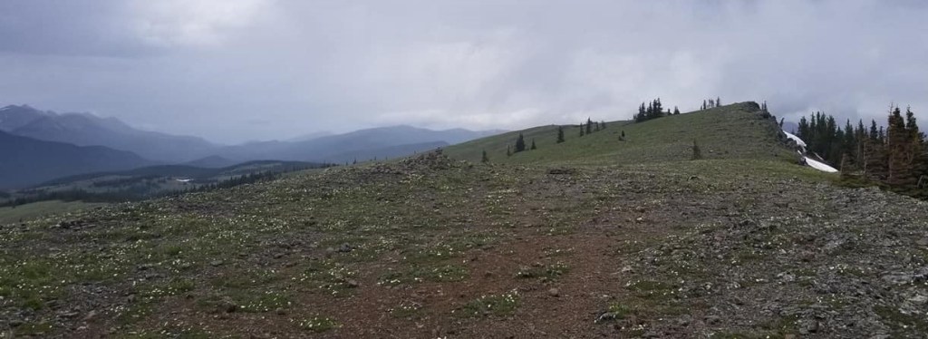
When you are almost at the North Summit, the trail emerges from the trees. Above this point is a lovely rock ridge. Hike up and over this, without going too far left.
Once on top, turn to the right and walk along the ridge to the north summit cairn.
Distance to the North summit is about 5.6 km. Elevation gain was 589 m.
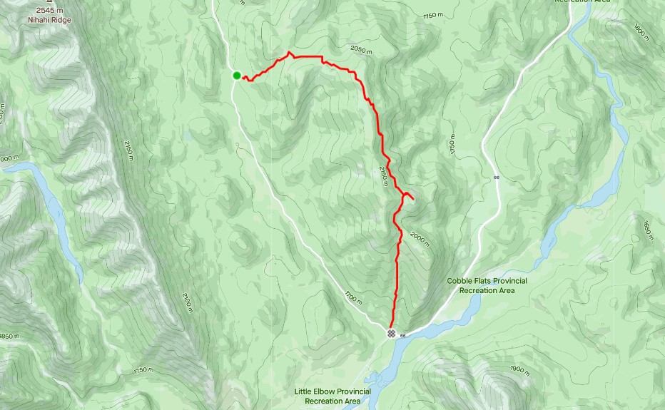
Powderface Ridge Return
Return the way you came to the pass. From there, continue back on the main trail back to Highway 66.
If you found this post useful, please do me a huge favour and click the Star button to “Like” it. You can also follow my blog, follow me on Instagram, or join my FaceBook page Al’s Adventurers.
Alisen
I love all things mountains! I live next door to the Canadian Rocky Mountains, however I travel the world to enjoy the many different mountain environments and cultures that I can. I hope you enjoy these trip reports, and that it inspires you to accomplish your own adventure goals.

Love the Inukshuk 🙂
I know. It’s too bad it’s gone 😣
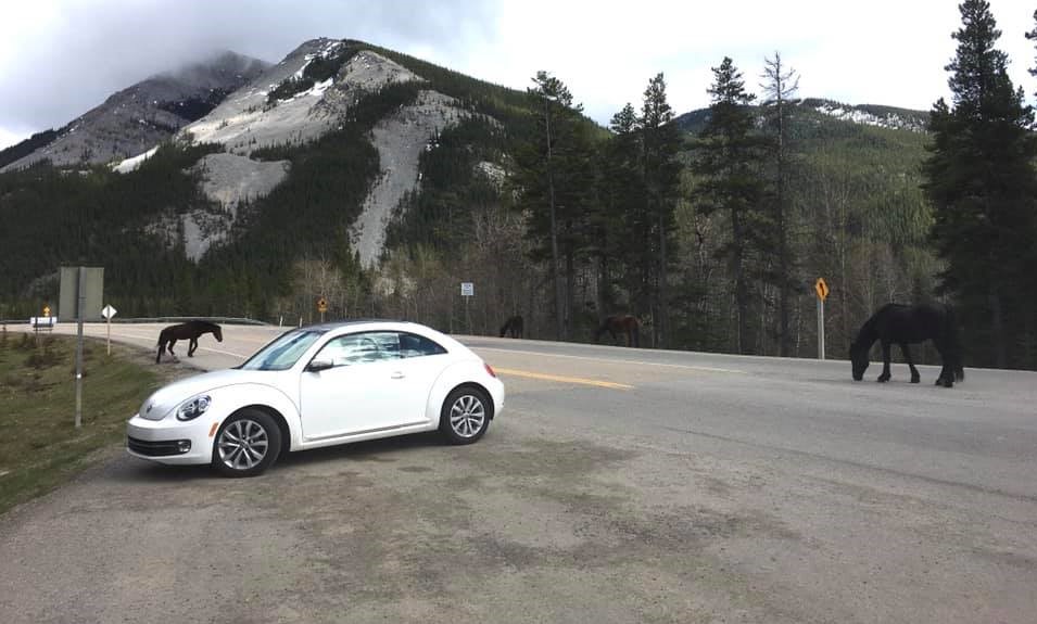
Love that photo with the horses! How cool!
The wild horses are pretty special. You can normally only see them in the spring and fall. They stay out of sight in summer when it’s busier.
Love the photographs of the meadow and the summit if Powderface Ridge.Great photography.Thanks a lot for sharing.Take care.🌹👍🙏
Thank you my friend. I am so glad you are enjoying the scenery. It’s a special part of the world for sure. Blessings to you.
Amen.🙏
Pics 😍
LOL! Glad you liked them 😀
Good postt
Thanks. It’s an oldie, but a goodie.