July 27, 2022
This is Day 4 of 6 days climbing at International Basin with the Alpine Club of Canada General Mountaineering Camp. All climbs are guided by ACMG guides and experienced volunteer leaders. To see an overview of climbs in this area, please click here.
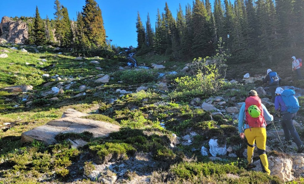
As this was my forth day in a row, and after two big glacier traverse days, I was getting tired. Amber and I were grumbling about the lack of a Rock School day, which is code for “rest day” 🙂 Miners Peak was offered today for the first time, and there were 4 groups heading up. I was definitely dragging my butt as we hiked across to the base. In fact, I got so far behind at one point, that I couldn’t see the group. Thankfully Iwona stayed back with me, and her fiancé David noticed she was missing.
Once we got to the base of the climb, it was a matter of hurry up and wait as my group was last. I guess I didn’t need to cough up a lung on the way over. To be 100% fair, the meadows on this side of camp are a nasty cesspool of mosquitoes. There is no good reason to dawdle. Make sure you have some quality bug spray, or you’ll regret it. Just ask Simon! Once we started climbing, we were out of the bug zone.
Gear
Boots, helmet, harness, climbing rope, and climbing tackle. Poles are handy for the trek there and back.
Miners Peak Overview
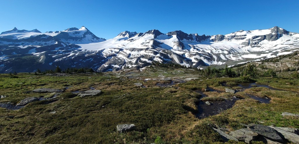
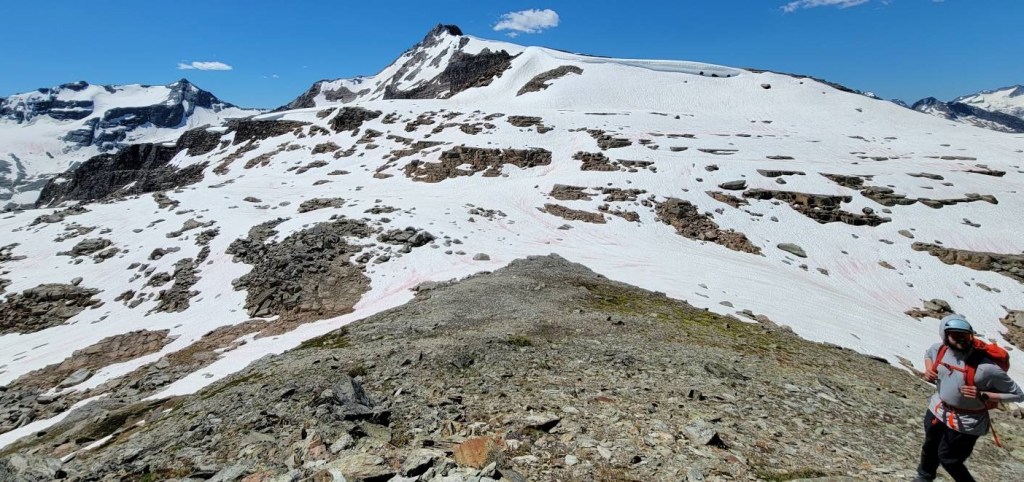
From camp, we headed towards Kingsbury Hut. After crossing the stream, we hiked past Mary’s Peak to the far side SE side of Miners. Now the climbing could begin, and we did short pitch after pitch of fun climbing. There is one spot where we downclimbed and then crossed a chasm. Then more pitches to the summit. To return, there is a really nice hiking trail down the NW side of Miners, which connects with our trail back to camp.
Totals – Downloadable Tracks on Gaia. Displayed on Strava.
Date: July 27, 2022
Group: 3 (Camp Manager Simon, Camp Cook Rita, and Alisen)
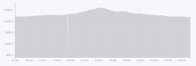
Distance: ~6.5 km
Elevation: 406 m (1,340′)
Time: 6 hours 30 minutes total time. Actual moving time is closer to 4 hours.
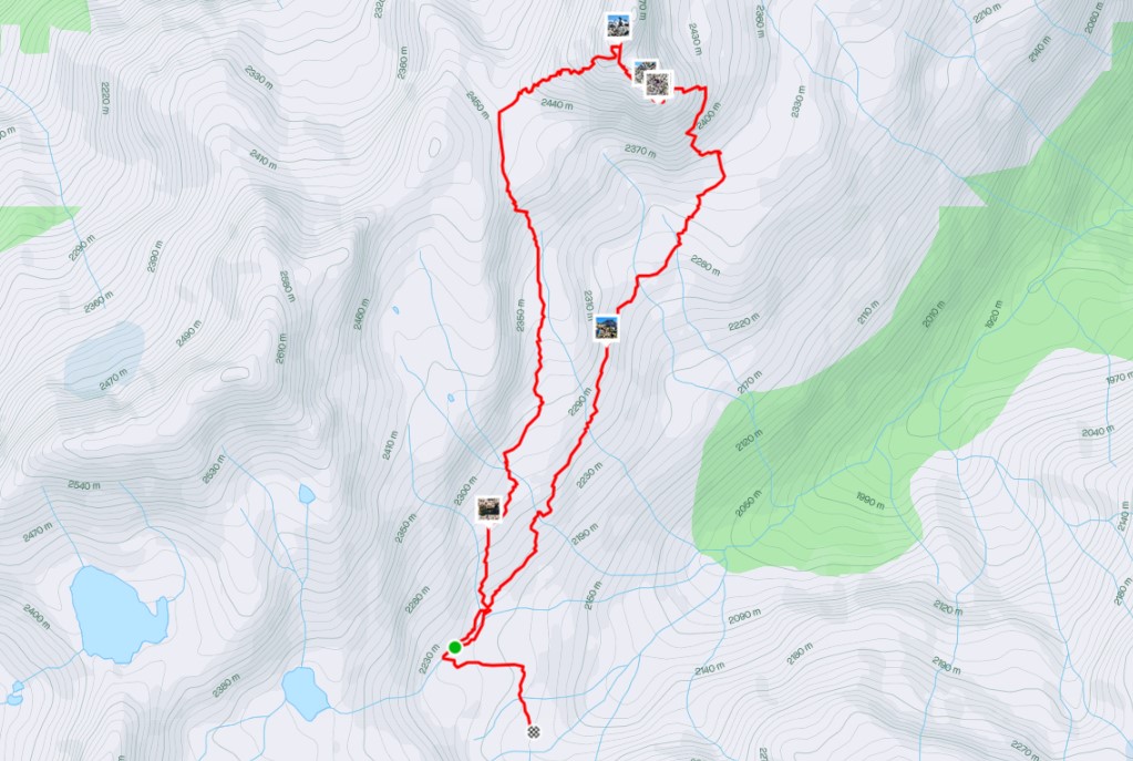
Miners Peak Route
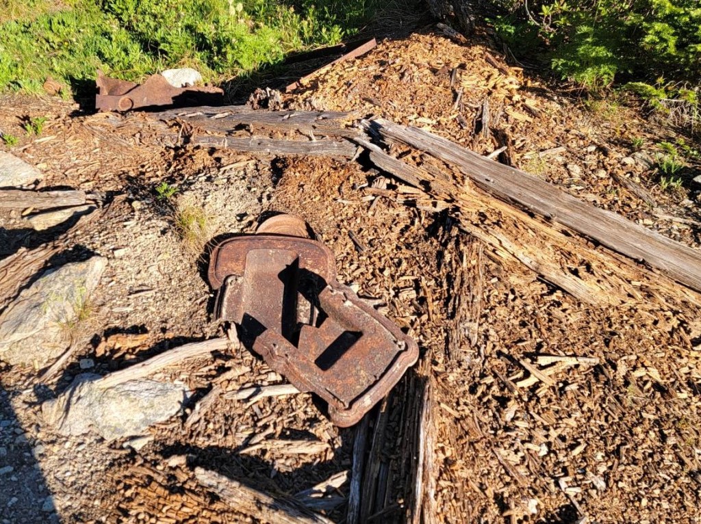
From camp, we headed straight north, and immediately crossed Bobby Burns Creek. I crossed this creek three days in a row, and it changed every day with the high temperatures and the large amount of snow melt. Once on the other side, we angled north west as we hiked to the base of Miners Peak. Along the way, there was no shortage of leftover equipment and materials from past mining operations.
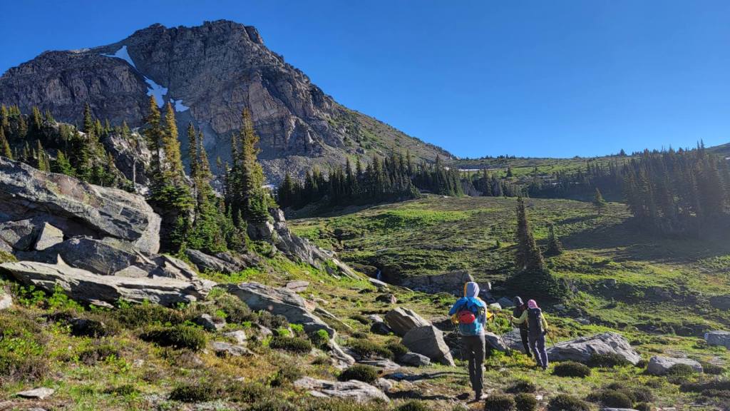
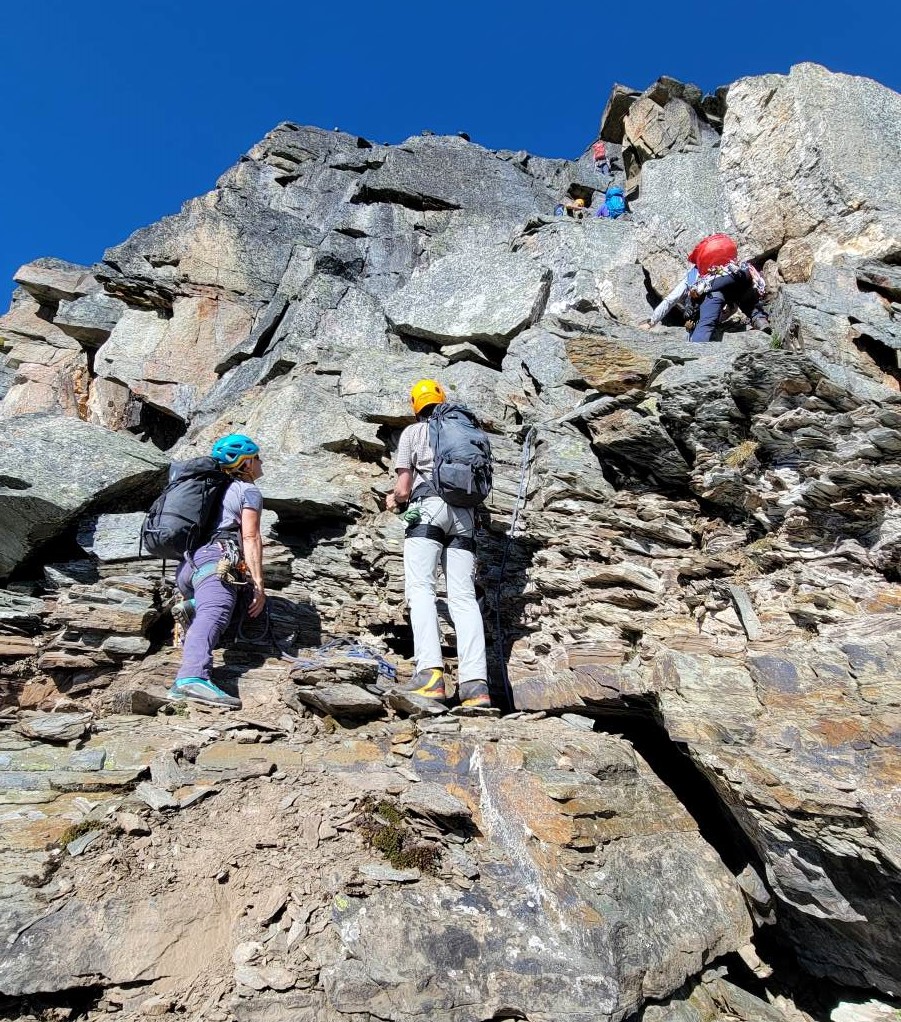
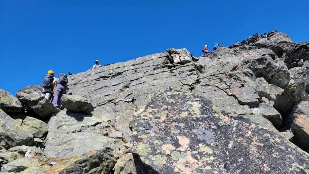
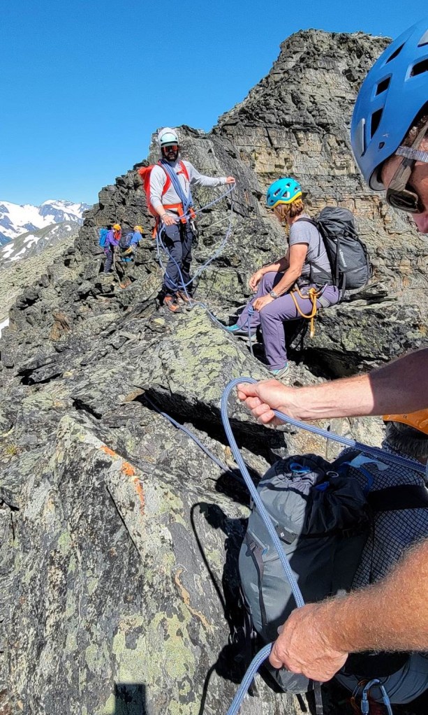
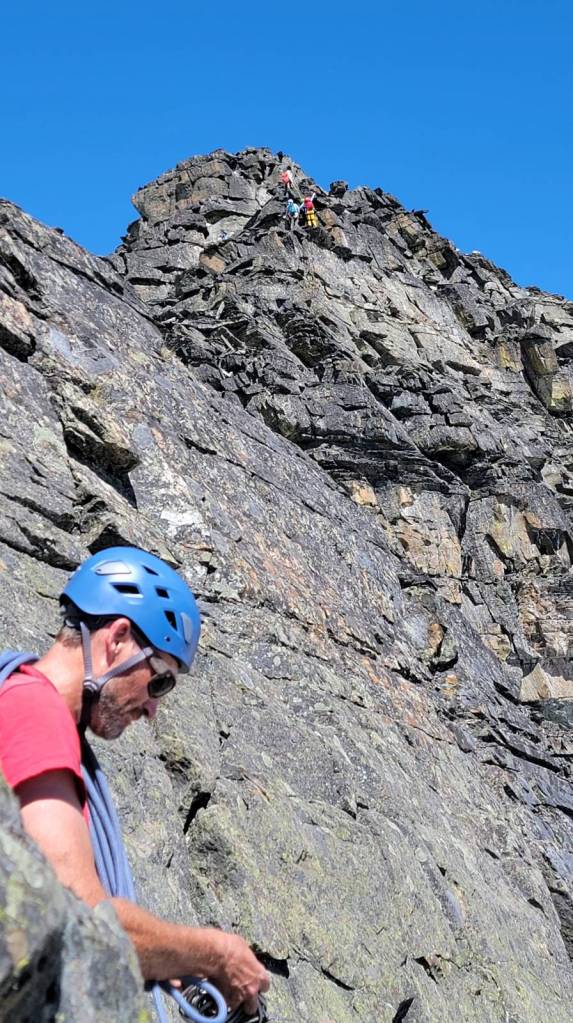
Once we hiked to the base of the climb, the guide’s split the group into four rope teams. Each rope had three to four people. I was with Simon, who I climbed Sibbald Peak with on my first day. Camp head cook Rita was able to sneak away for the day, and joined us on the rope.
Hiking time to the base was about an hour, with a distance of 2.25 km.
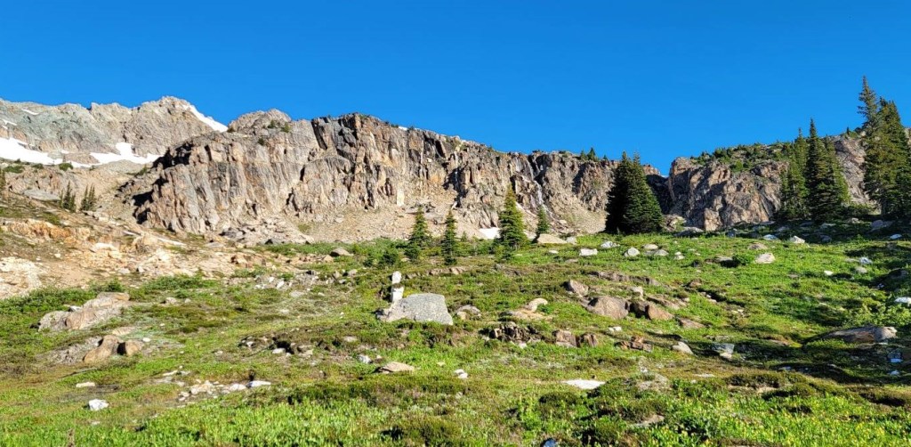
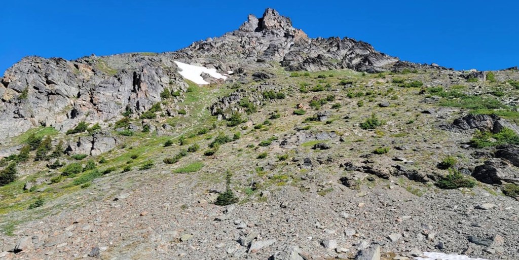
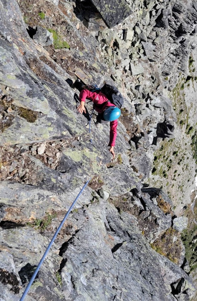
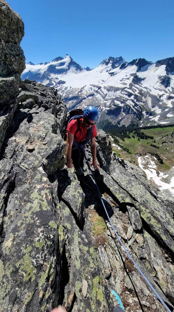
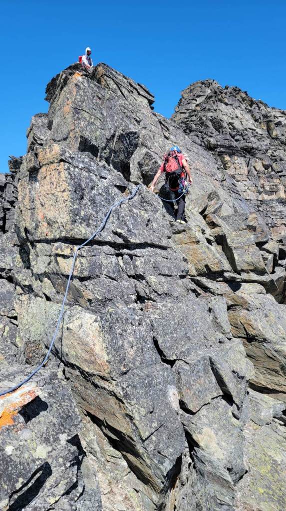
The climbing was short sections, followed by short traverses. The rock was solid and grippy, and fairly straight forward. It was excellent fun, especially for a non-technical climber like myself.
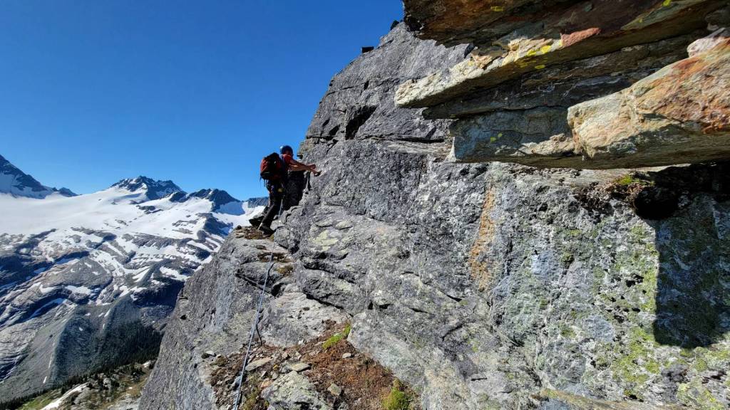
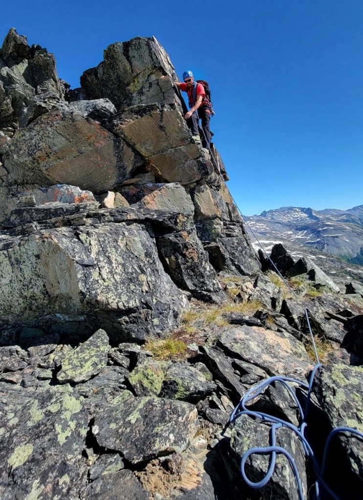
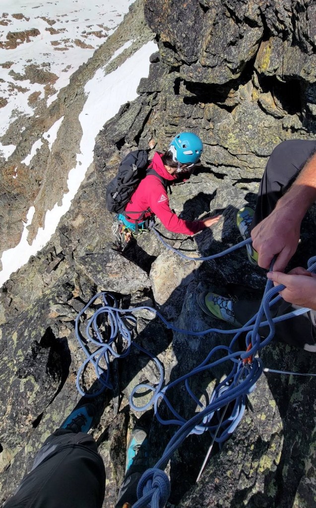
This next section was the trickiest. It is a downclimb, followed by a confidence move to get across a chasm. It’s a bit of a reach to either the hand or foot hold, whichever you felt more comfortable reaching for. We were waiting our turn on the flat area above. Mike McMinn was first, and made everyone on his rope team hollar as they got across the chasm. We had no idea what the heck was going on, other than hearing random screams coming up from below 🙂
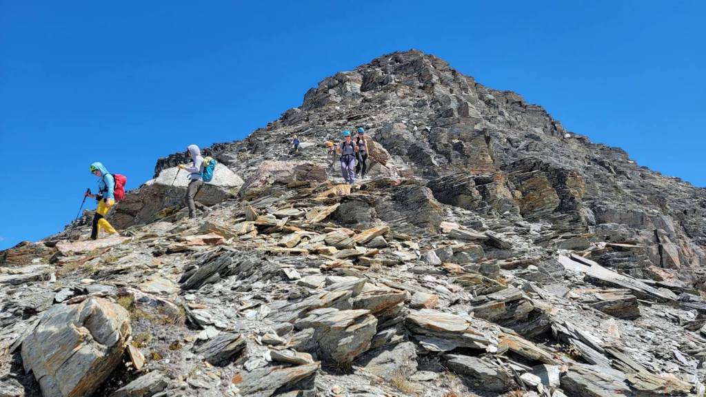
Total distance to summit was about 3 km. It took a long time to get all four groups up. Our climbing times won’t be accurate for smaller groups.
Miners Peak Return
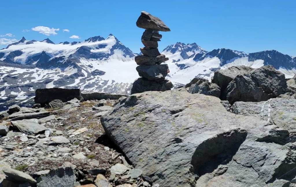
As we were the last ones up, the groups ahead enjoyed a long summit lounge and lunch. We ate quickly, took some photos, and then started down the backside of the mountain. We were greeted by a very tame hiking trail through the scree. It was such a nice trail, that another group decided to hike up this way on our last day in camp.
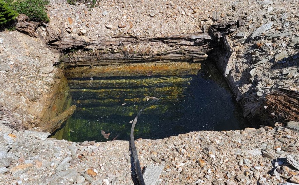
We took a slightly difference route back, and found some of the old mining shafts. These were flooded with water, which would arrest your fall. Still, I’d not want to fall into one of these. An early snowfall and a thin ice cover could make these particularly dangerous.
Miners Peak is a popular destination for anyone staying at the Kingsbury Hut. It is a fun climb, with one spicy section. The hiking route off is a nice way to end the climb, and allows time to gird your loins for the mosquito fest in the meadows below.
Join me for the next adventure of climbing Mary’s Peak.
Thanks for reading! Please do me a huge favour and click the Star button to “Like” it. You can also follow my blog, join my FaceBook page Al’s Adventurers, or follow me on Instagram
Alisen
I love all things mountains! I live next door to the Canadian Rocky Mountains, however I travel the world to enjoy the many different mountain environments and cultures that I can. I hope you enjoy these trip reports, and that it inspires you to accomplish your own adventure goals.

Awesome!
Thanks bud. It was a fun day, and not too strenuous.
Wow, looks fantastic. I hope you can take me up here some day!
Ha ha. If you lead!
I’ve never done this, what grade is the climbing? Maggie
Good question. Maybe 5.6? Perhaps 5.7 in places? We didn’t discuss grades – just got our butts up the mountain. Mary’s Peak (just next door) has the harder/more technical climbing.
Waddya mean, no pics of the chasm? I suppose you were up there for the adventure and not the photo ops, eh? 😀 … (just pulling your leg, in case you’re worried. 😀 ) … how wonderful it must be to stand on what feels like the top of the world and just breathe it all in. 🙂
Right? Suck it up Alisen 🙂
I will admit to a slight terror at this point 🙂 Simon was a bit miffed – he wanted me to take photos of him in the chasm, but that meant I had to be in a very exposed area. SO not going to happen! 🙂
It’s always great to have a Simon in your group to give the bugs an easy target! Sounds rough for him though. Looks like you had nice weather for your climb. How interesting to find some old mining stuff along the hike. No wonder it’s called Miners Peak.
Oh poor Simon! He got nailed.
The bugs were actually not bad that day. Two days later when I hiked past this area to get to David’s Peak, the mosquitoes were so big and plentiful, they are in every single photo! It’s disgusting. I’m not sure how I handled it.
Wow! You have my admiration 👏you are an inspiration. 😊
Thank you so much!!! I surely do appreciate that. I’m a mere mortal – the guides are the true heros.
I still think it’s fantastic that you are able bodied and energetic 👏👏