July 29, 2022
This is Day 6 of 6 days climbing at International Basin with the Alpine Club of Canada General Mountaineering Camp. All climbs are guided by ACMG guides and experienced volunteer leaders. To see an overview of climbs in this area, please click here.
David’s Peak was my last summit of an amazing week of mountaineering at the International Basin. I was thankful to have had two shorter days on Miners Peak and Mary’s Peak, but I was struggling with sleep deprivation.
I was in the throes of hot flashes, and they were keeping me up most of the night. The nights were cold, so I had to bundle up to not freeze to death. Then a hot flash would hit, and I’d have to completely strip down. Then I’d start to freeze, and have to bundle up again…only the start the whole process all over again. I was probably averaging about 4 hours of sleep per night. By the time Day 6 rolled around, I was so exhausted that I slept right through my alarm. We were supposed to leave camp earlier, but there was some delay so I was able to quickly eat, get my gear, and be ready to leave camp without anyone being the wiser.
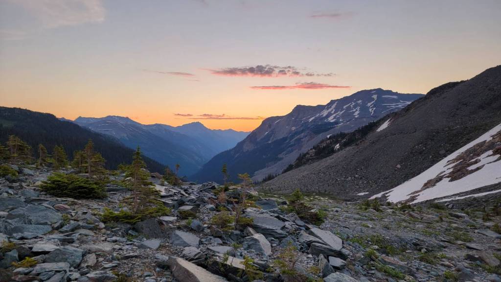
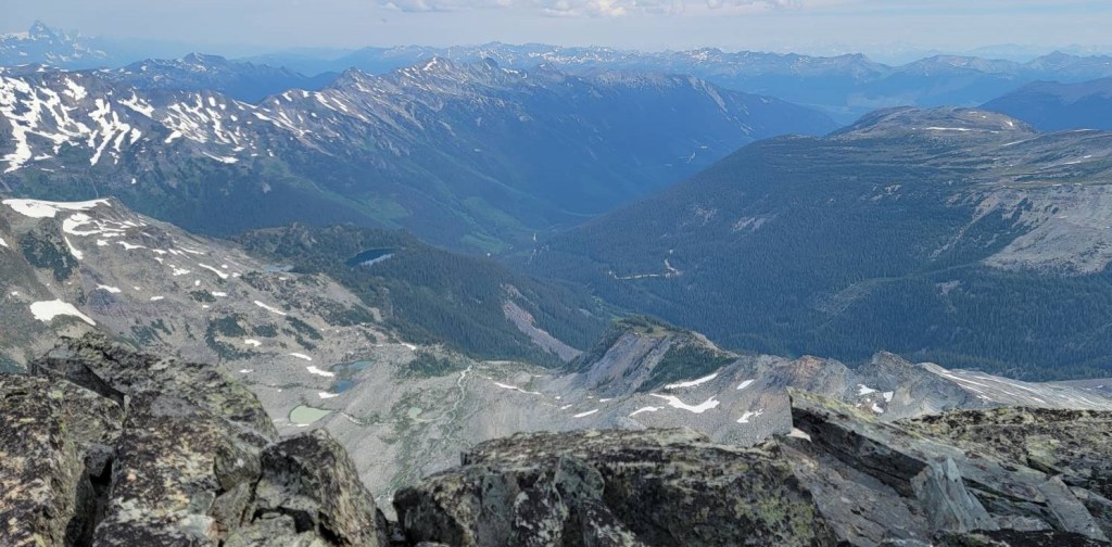
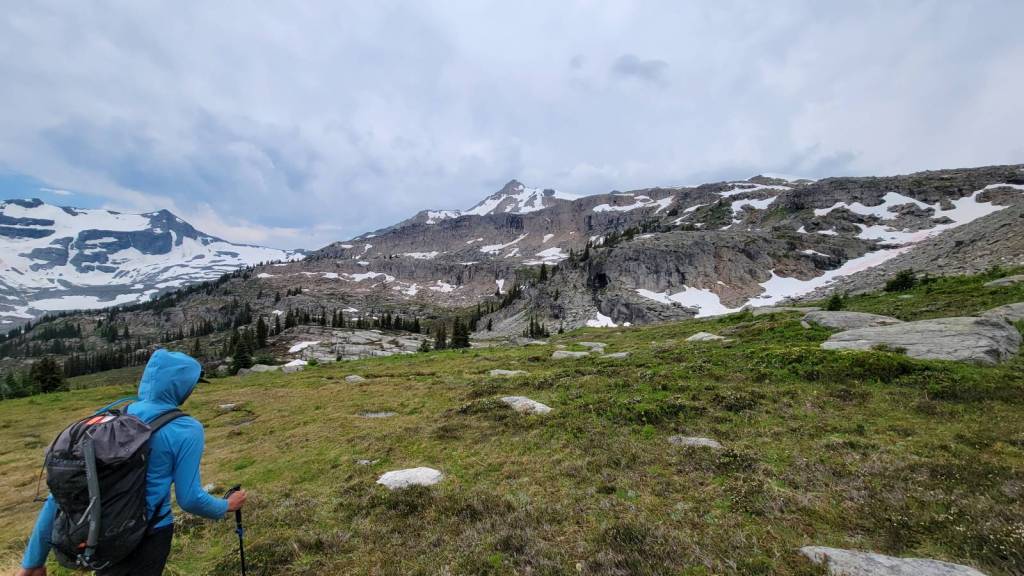
David’s Peak is a long ways away, but the terrain is interesting and undulating. The mosquitoes were getting worse. They are now so plentiful and large, they show up in all my photos. Indeed, I have photos of mozzies all the way to the col. When you see everyone walking with hoods up, it’s not because it’s cold, but to fend off the little blood suckers.
We had a major time crunch today as a storm was brewing and we wanted to get off the mountain before it hit. We hustled all day, and got back in a record time of 7 hours. I dove into my tent just as the heavens opened for our one and only rain of the week.
Gear
Mountaineering boots, helmet, crampons, ice axe, harness, rope and climbing gear for the lowers. Snow pickets for anchors are an option. Gaiters are an option depending on your pants. Collapsible poles for the long trek.
David’s Peak Overview
From camp, we crossed the creek and hiked 4 km across the meadow past Miners Peak. As we wrapped around the north end of Miners, the ground was still snowbound. This long trek undulated down, before we gained elevation back up to the col. As we approached the col, we roped up, but no crampons as there was a section of rock to go through. At the col, we added crampons, and got mentally prepared for almost an hour of kicking steps straight up to the summit. At the top, we crossed a small moat, climbed a short wall, and viola! The descent was two lowers, a nasty scree section, and a steep snow slope before we hit the frozen lake at the bottom. Skirted the lake to the left, and climbed back up to the snow slope above the meadow. We put away our gear, and then hightailed it back to camp.
Totals – Downloadable Tracks on Gaia
Date: July 28, 2022
Group: 6 (ACMG Guides Fred and Adam, Dr Jeff, Keith, Michaela and Alisen)
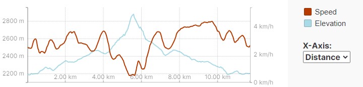
Distance: 11.7 km
Elevation: 778 m (2,567′)
Time: 7 hours 15 minutes
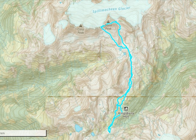
David’s Peak Route
After sleeping through my alarm, I had a frantic breakfast, grabbed my gear, and left camp at 7:00 am. We had a long ways to go, but with several young people the pace was super quick. Keith with his long legs could keep up no problem. I was lucky to not be the eldest on this trip. Dr Jeff held that honour.
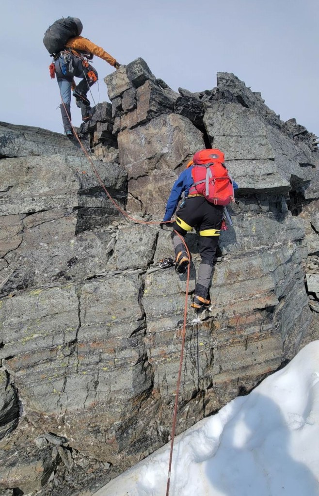
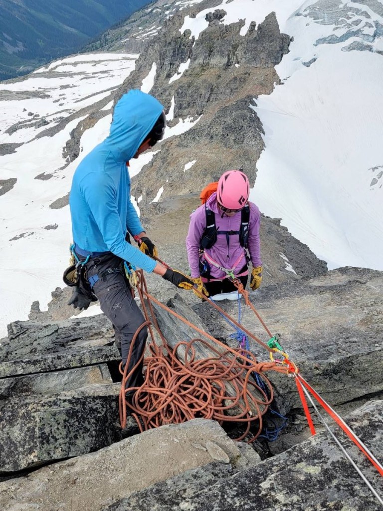
ACMG Guide Fred was mentoring Adam today as he is going for his full Alpine Guide. Adam did all the route finding, lead the trip, and set up the first anchor for lowering off the summit.
We started the day crossing that same stream, which had changed even from yesterday afternoon. Then it was about 4 km of fighting off swarms of giant mosquitoes. I am SO thankful that our camp has enough wind from the glacier to keep the mosquitoes at bay.
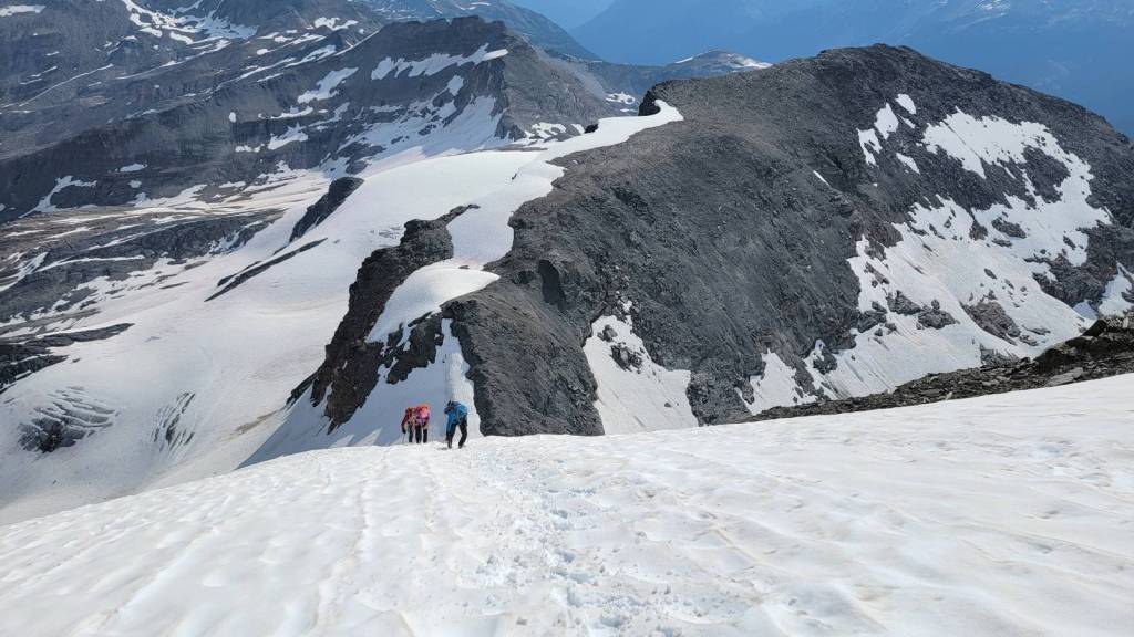
We traversed the full length of Miners Peak, and then wrapped around to the north to access the base of David’s Peak.


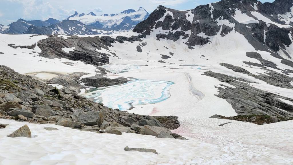
We left the meadow and started up the snow slope. In a less epic snow year, this might be melted out. The terrain then loses elevation, just to regain it as we make our way up to the col.


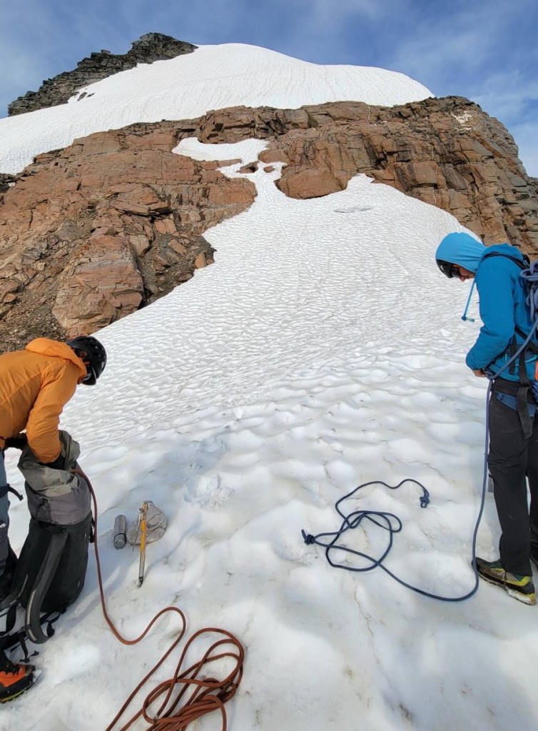
Once at the col, we roped up and added crampons. Dr Jeff and I went first with Fred, while Adam had Michaela and Jeff. For the next 45 minutes, we kicked steps and rammed our ice axes into the very steep snow slope. It was pretty much straight up, and felt like a giant staircase. Add in the intense heat, and the mugginess from the impending storm, and it was HOT!
The group that summited David’s Peak yesterday chose to use snow pickets as anchors, and put in four on the way up. Fred thought our snow was in a bit better condition today, so we relied on our ice axes and a commitment to not slipping.

As this was the last day of camp (everyone was so done), and we were outrunning a storm, there was no time for photos or much chit chat. I was so freaking hot, that I was jamming fistfuls of snow down my top whenever I could. You know it’s hot when snow just feels slightly cool.
I wouldn’t have gotten any photos climbing the snow slope to the summit, but Keith had an issue with his borrowed crampons. When I saw both Jeff and Fred whip out their phones, I knew the view down must be something special.

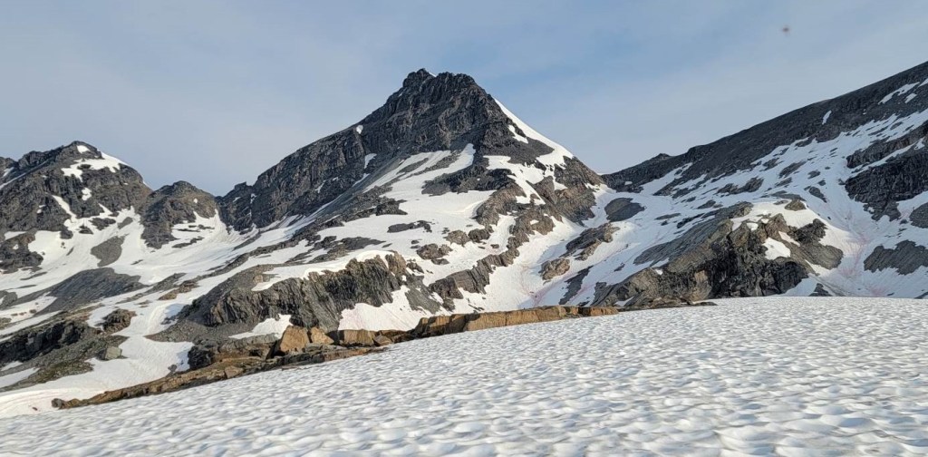
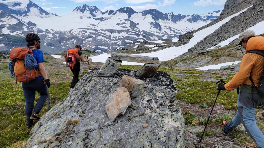
The angle finally backed off a bit right at the summit. We crossed a small moat, then climbed up the rock face to the summit. We were greeted by a giant cairn to mark the summit.
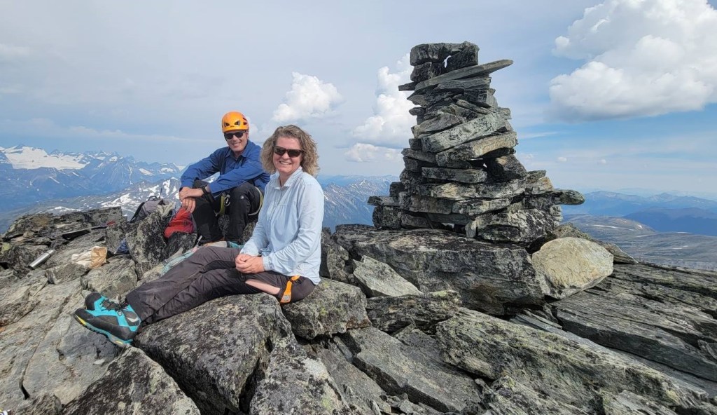
Time to summit was about 3 hours, 30 minutes. Distance was approximately 5.5 km, with an elevation gain of 778 m.

David’s Peak Return
As soon as we got to the summit, Fred put Adam to work setting up the anchor for the first lower on the other side. Fred went first, so he could quickly set up the second anchor below.
I absolutely loved the first lower, because it didn’t end at the rock wall. Nope! We got lowered past all the rubble, drastically increasing our speed.
In the background is the shoulder of David’s. We had to take a sharp right and hiked around the bulge on the right.

From the bottom of the first lower, I hustled over to Fred for the second lower. This one was shorter, but thrilling as it is a vertical wall.

Once everyone was down, we stowed the ropes and hiked down the shoulder. It looks like we can head straight off the end, but not so. We made a hard right turn, and worked our way down and around a bulge until we got to the col. The angel was steep, and the rock chossy. Fred actually cut steps in the rubble using his ice axe. Thank you Fred!


Once we were back on solid ground, we kept up the fast pace to outrun both the bugs and the storm.
Poor Adam! He didn’t get a chance to eat at the summit, and was hiking while stuffing a sandwich down his throat. Fred was urging him to hurry up anyway.
By the time we got back to the stream, the water levels had risen considerably. We got out the ice axes, and used them to pry up big stones to throw into the water. Fred and Adam were finally happy with their stepping stone bridge, and we were across with dry feet.

We arrived back in camp just as the rain came down, but we were safe and dry in our tents. The rain was a pretty good downpour, and we would have been miserable if we were still on the mountain.
David’s Peak is a trek away from the other mountains in this area, but it offers some challenging terrain not found elsewhere. I thought it was worth the trek, and the views were amazing.
Thanks for reading! Please do me a huge favour and click the Star button to “Like” it. You can also follow my blog, join my FaceBook page Al’s Adventurers, or follow me on Instagram
Alisen
I love all things mountains! I live next door to the Canadian Rocky Mountains, however I travel the world to enjoy the many different mountain environments and cultures that I can. I hope you enjoy these trip reports, and that it inspires you to accomplish your own adventure goals.

Congrats! You definitely have what it takes. You overcame a whole, whole lot to reach that summit.
Thank you so much! This whole trip really taught me how to dig deep, and to just keep going. In the past, I always tempered myself. I held back, stopped, or didn’t go for it all the way.
When I got home, I kinda paid for it a bit with a sore body (hands were swollen for about 2 weeks), but I healed. This year, I kept going and did all the peaks I could. Learning your limits, or lack thereof, is pure freedom.
Sounds like you ended your week of mountaineering with a good one! Glad to hear that you managed to get back to your tent before the storm. Sorry to hear about all the mosquitoes though. They can be relentless. I imagine they’re even more desperate up in the mountains. You weren’t joking about how they turned up in your pictures!
Well, that was fun! 😀 … thanks for the ride. 😀 … all of them throughout the week.
You are so welcome! I’m glad you could come alone for the ride.