June 14, 2024
Pasque Mountain had been on my “List” for a few years. What finally got me off my butt was when my buddy Julie hiked it the prior month. Nothing like a bit of FOMO to get me in gear. As I live down south, I’ve been trying to pick off as many routes as I can. It was high time I got this done.
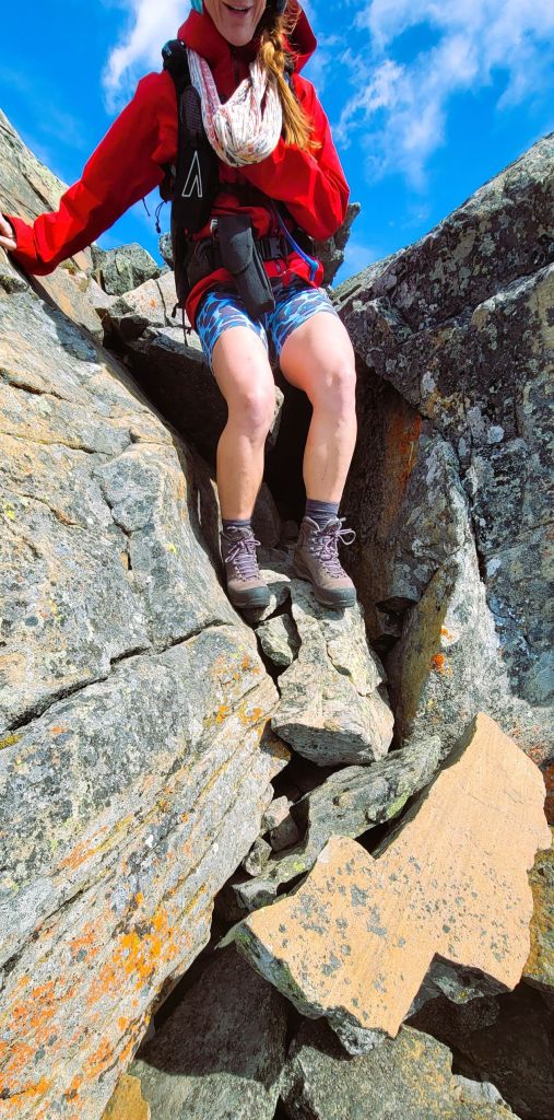
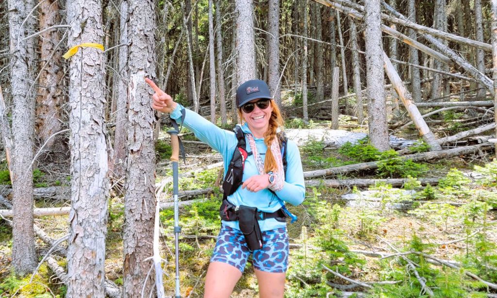
My hiking partner today is Taylor Boyd, who is my chiropractor and athletic therapist. She’s put me back together so many times, and I highly recommend her. You’ll see that she’s wearing a sling. That’s because she had a pretty good crash on her mountain bike the weekend prior. I picked this route because I thought it would be mainly hiking, but we did find a bit of easy scrambling that Taylor tackled like a one-armed pro. However, I was NOT a pro. I had just scrambled a fairly big mountain the day before, and my legs were like lead. I kept expecting them to warm up and get in the game, but it never happened. Not fun.
As this route is normally done on the shoulder season, we were surprised to find the lower trail pretty wet, and even more surprised to find three creek crossings. We would have brought crocs had we known. My bad for not checking with the Queen of K Country Gillean Daffern. Click here for her detailed description on how to start up Pasque Mountain, because it is not obvious.
I use Gaia, and … layers matter! On the Gaia Topo (meters) map, there are no creeks mapped – at all. When I switched to Canada Topo (premium layer), Wilkinson Creek and its various inflows are clearly marked. So again, the beta was there, I just didn’t dig enough.
Gear
Hiking boots, poles and regular day pack kit.
Overview
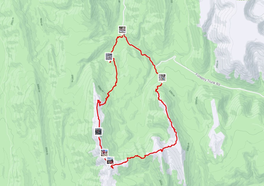
From the trailhead, we hiked southwest, picking our way through some swampy meadows. After three creek crossings, we hit the bottom of the hill that would lead to the north Pasque Mountain summit. We backtracked to the north summit, and then traversed across the ridge to the main Pasque Mountain summit. To complete the horseshoe traverse, we headed east, going up and down four times until finally reaching the east Pasque summit. From here, we descended north to the end of the ridge. We picked our way down the slope, angling slightly right for the cut block. At the cutblock, we hiked across it straight north, and down the steep embankment. Luckily, I nailed the descent and we popped out on the road just prior to the creek. Walked back to the car.
Watch the video.
Totals – Downloadable Tracks on Gaia, Displayed on Strava
Date: June 14, 2024
Group: Two (Alisen and Taylor)
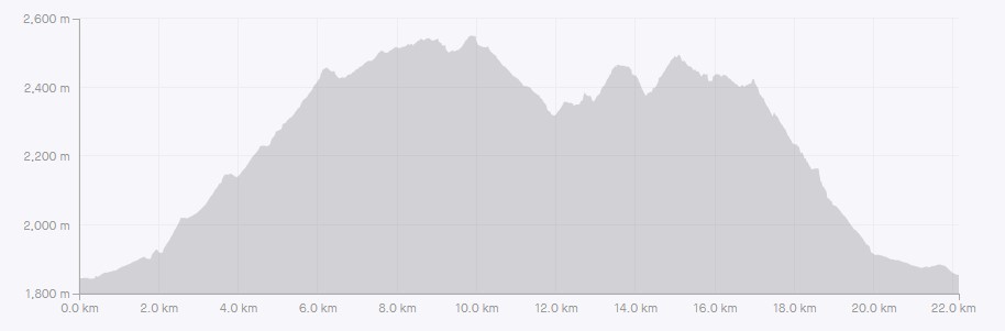
Distance: 22 km
Elevation: 1,293 m (4,267′)
Time: 7 hours 45 minutes (includes lunch and breaks)
Parking and Trail Head
From highway 40, head south at the winter gates (Highwood House) onto highway 940 Forestry Trunk Road. Drive approximately 25.5 km, and turn right onto the small pull out.

Main Trail
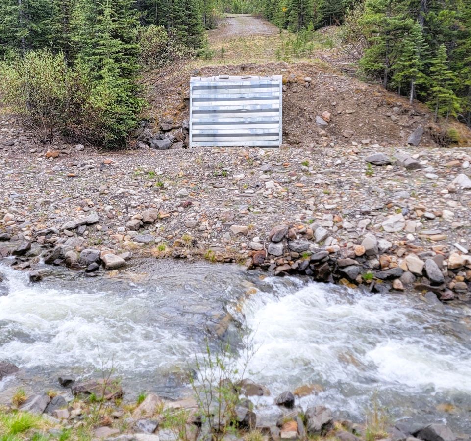
We hiked up the road for a short ways, and soon encountered the Wilkinson Creek washout. There once was a bridge, but I’m assuming it was a victim of the 2013 floods. After crossing the freezing cold creek, we continued down the road, and crossed a real bridge.
2024 was a very late snow year, so all the streams were higher than normal as snow melt was in full force.

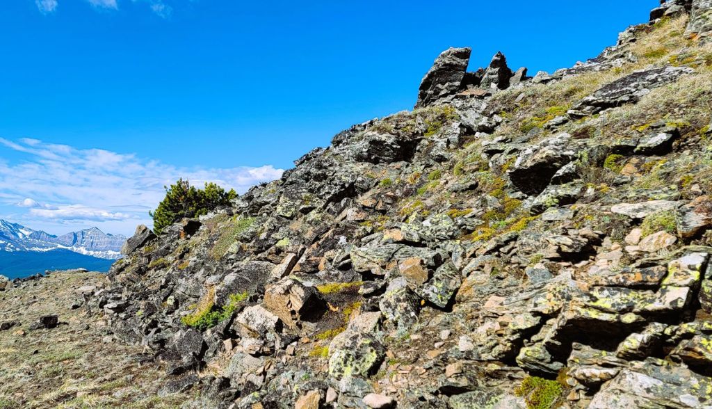
At around 600 m, it looks like we continue straight up (this is a tricky spot!), but we actually needed to veer left to gain a different ridge. This is the most convoluted part of the trail, and many a hiker has gone wrong. As we were in and out of wet marshy ground, we sometimes found a faint trail. Luckily for us, a group had recently come through and the trail was well marked with flagging. As this trail doesn’t get that much use, I wouldn’t rely on the flags.


When we hit the second creek crossing, we were a little dismayed. I imagine this would dry up as soon as the snow melted out. While we took off our hikers for this crossing, Taylor and I agreed that if we came back this way, we’d leave our boots on and just suffer with wet feet for the 1.75 km back to the car.

At around 2.2 km, we came to the last creek crossing, which is marked by two cairns. This was a small creek and we just stepped across it. From here, we ascended a hill that would take us across from the main Pasque Mountain ridge and the north summit.

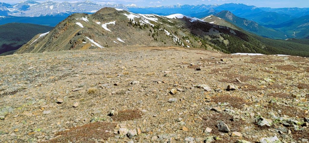
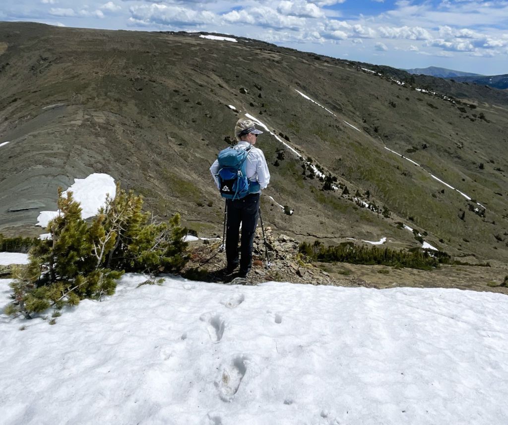
Once we gained this first ridge, we had great views of the Pasque Mountain ridge, and the surrounding vistas.


Once we reached the highpoint of this ridge, there was a slight downhill to connect with the main Pasque Mountain. The trail completely disappeared, and we had to hunt around for the entrance in the thick trees.

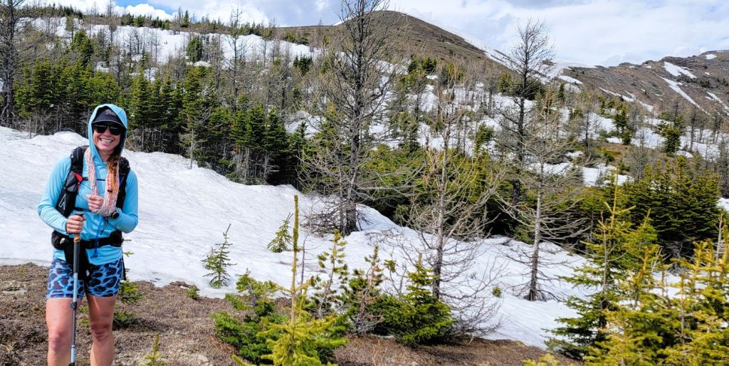
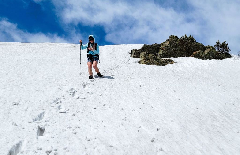
Once we found the trail, we were again on an old road. There was a lot of lingering snow in the shaded trees, and it was a real game to figure out where to step. The snow was warming up and was rotten in places. With Taylor’s injured arm and shoulder, we were trying to avoid unnecessary jarring.

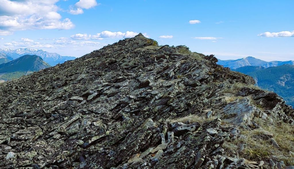
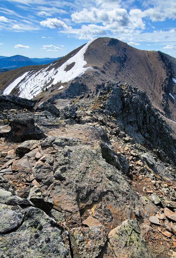
When we left the trees, we were treated to an amazing view of Pasque Mountain, still sheltering snow on its eastern side. The ridge has impressive rock features. From here, we left the road and picked up a hiking trail to the north summit. After a short rock wall, it was an easy hike to the summit.


Pasque Mountain North Summit
Distance to the north summit of Pasque Mountain is 6.2 km. It took us 2 hours and 15 minutes, including two time wasting creek crossings where we removed our shoes. Approximate elevation gain to here is 600 m.
If you don’t have a lot of time, nabbing the north summit is ideal. Lots of elevation, a good 12 km round trip, and amazing views. This would be the equivalent distance and elevation of Raspberry Ridge, right next door.
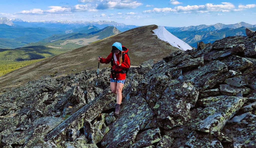
Alas, we were not nearly done! Taylor and I bundled up against the cold west wind, and headed south. For the most part, it was easy hiking on the wide ridge top.
Near the summit, we did find some easy scrambling on large blocks of lichen covered stone. While the whole ridge is a series of ups and downs, there is one pretty big loss right before the summit. As my legs were refusing to warm up and be happy, this elicited a heaving sigh from me. Nothing like keeping up with someone over 20 years younger than me, and having tired legs. Excuses, excuses 🙂


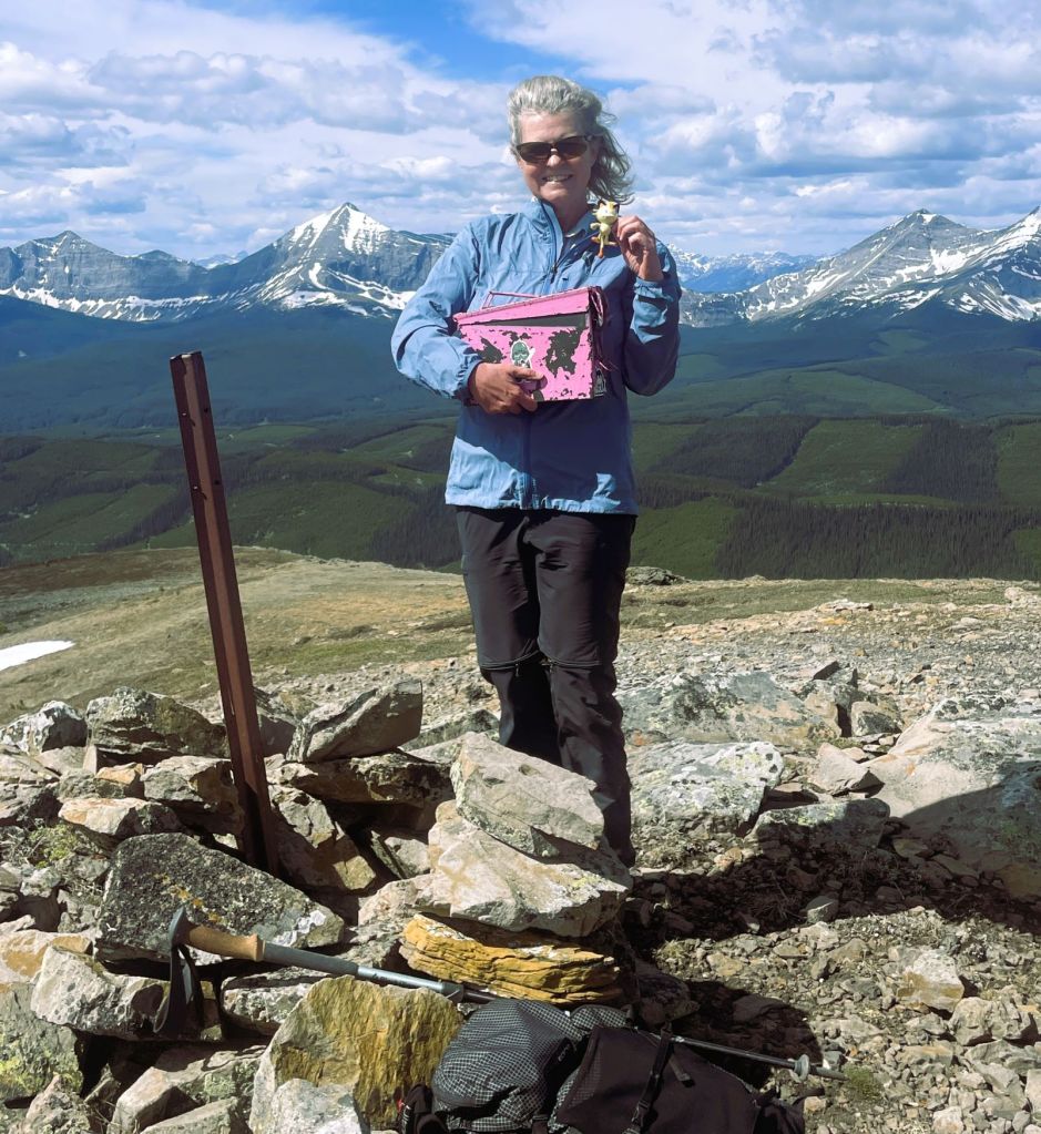
Pasque Mountain Summit
The summit of Pasque Mountain is a wide area with 360 degree views. We spent several minutes pointing out all the mountains we could see. Indeed, there were the usual southern suspects like Mt Burke and Holy Cross, but we could see all the way up to Mist Mountain!
Distance to the summit was 9.9 km, around 900 m elevation, and a time of 3 hours, 30 minutes.
Watch the video for a great summit pano.
After snacking up, and taking a load of photos, we debated our route. Going back through the scrambly bits with a sore arm was not ideal, so we looked east to complete the horseshoe traverse. As I wasn’t planning on this, I didn’t do much (any!) research. I checked my map, and knew we had to go east, gain a ridge, and follow it down to the valley. What I didn’t grasp from the summit was that we needed to go ALL the way across. There are four ups and downs, the final one being the highest. Again…with a heartbreakingly big elevation loss just prior. My legs were really barking, which they normally do not do. Character building.

If you look at my tracks, you’ll see me veering left at every col, testing out my theory that we should technically be able to head straight down to the valley. Indeed, Spirko did that after he summited the East peak. However, I’m glad we stuck to it, and nabbed the east peak for the full experience.


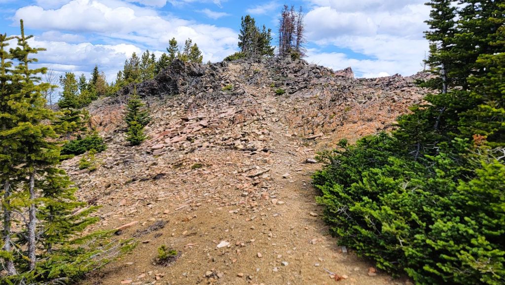


Once we hit the East summit of Pasque Mountain, it was a long hike down the long ridge. The ridge itself is pretty straight-forward. However, it is punctuated with rivers of large, lichen-covered boulders. Nothing as steep as on the other side, but the going was slow through these areas. We kept getting dragged lower, only to regain some elevation.

The wind was now at hurricane strength. At one point, my sunglasses were ripped right off my face, and there was nothing either of us could do as we watched them tumble over the ridge and down the super steep rock face below. So that explains why where are almost no photos from here on out.
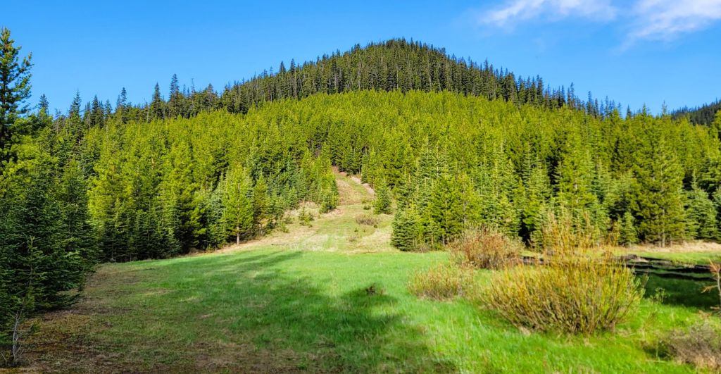
At the end of the ridge, there’s no trail and this is now a full-on “choose your own adventure”. I eye-balled the cut block below and where I wanted to end up, and angled to the north east. To my surprise, we nailed it. We exited the cut block at the bit of flagging.

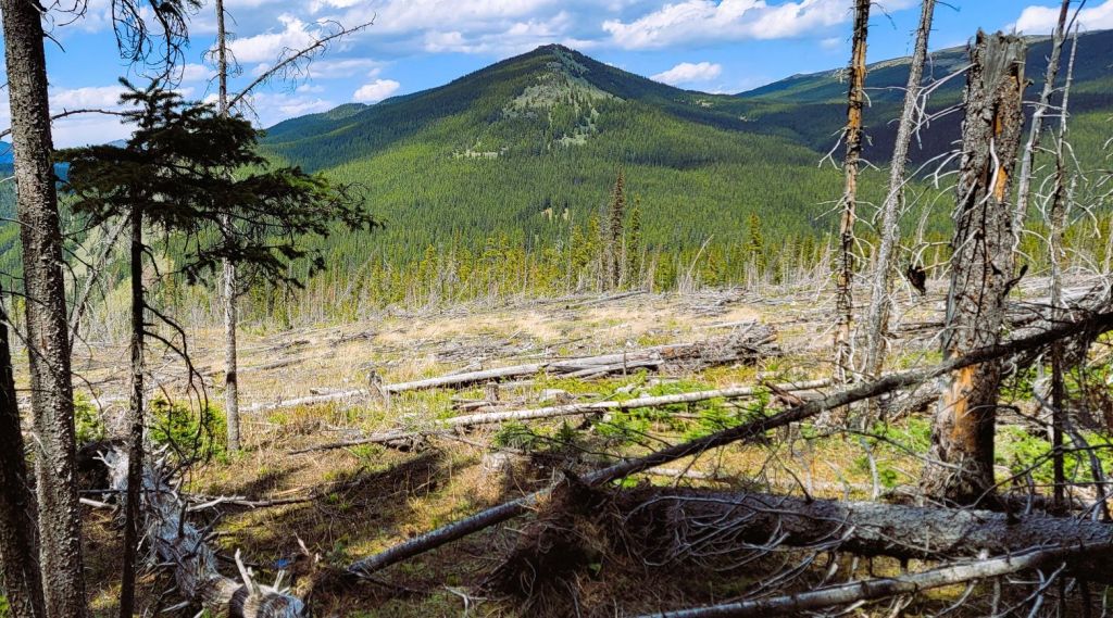
Once in the cut block, I checked my map, and set a north bearing for the road. We crossed a pretty good trail heading straight east – this is for people who took two vehicles or stashed a bike. Anyhoo, we went straight across the cut block, and then descended down a short, but super steep slope. Again! Luck was with us because we popped out at exactly the right spot – we were at a bridge over Wilkinson Creek. Yeah! for dry feet and not having to ford the narrow and fast-flowing creek!

From here, it’s about 2 km back to the trail head and our vehicle. We we really hoping for a truck to come by so we could hop in the back, but no go. The only downside to hiking on a Friday in the middle of nowhere 🙂
WRAP UP
I am SO glad that I finally ticked Pasque Mountain off my To Do List. Whew! I am also glad that I could convince Taylor to do this one instead of Grizzly Peak 🙂 I really enjoyed the views, and the bits of trail finding that was needed to complete the horseshoe traverse. The distance and elevation gain were more than I bargained for after a really big day prior to this one, but hey. Did I die? Nope. No one ever died of tired legs.
Thanks for reading! Please do me a huge favour and click the Star button to “Like” it. You can also follow my blog, join my FaceBook page Al’s Adventurers, or follow me on Instagram
Alisen
I love all things mountains! I live next door to the Canadian Rocky Mountains, however I travel the world to enjoy the many different mountain environments and cultures that I can. I hope you enjoy these trip reports, and that it inspires you to accomplish your own adventure goals.

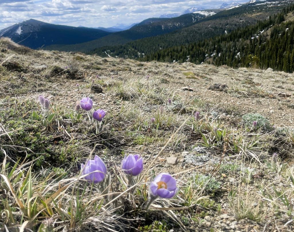
It’s always nice to cross stuff off the list. Beautiful views along the ridge and summit. The crocuses are really pretty. Some of those creek crossings looked a bit dicey. And cold. Hope all is well with you these days. Cheers. Linda
Hello Linda! So nice to hear from you. I took a break from writing, as it was getting too much, but I’m back at it now.
I hope you’re doing well and I can’t wait to catch up on all YOUR adventures.
Chat soon, Alisen
Oh gosh, this sounds very convoluted and difficult to navigate. But it sure looks worth the lovely views from the summit! Props to you both, but especially to Taylor for completing it with one arm. I’m not sure I’d have that level of motivation.
Hey Diana, I’ve been keeping up with your adventures on IG. Way to go!
Yup – lots of navigation. I do love that, as it makes it more intersting for me, but at the end of a long day with high winds, it gets a bit tedius. Sometimes, I just want it to end. I just want to get the heck off this mountain 🙂
Alisen
Oh gosh yes, the wind. It’s one of the hardest things for me to deal with when hiking, it’s just so annoying. So I very much relate to that feeling. And thanks! I was so excited to see some new adventures from you, as I always enjoy living vicariously in the Canadian Rockies.
Thanks for that Diana. Life has prevented me from keeping up with the writing, but I’m trying to keep it going. I’m now cherry picking the better hikes and summits.