August 29, 2023
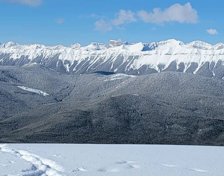
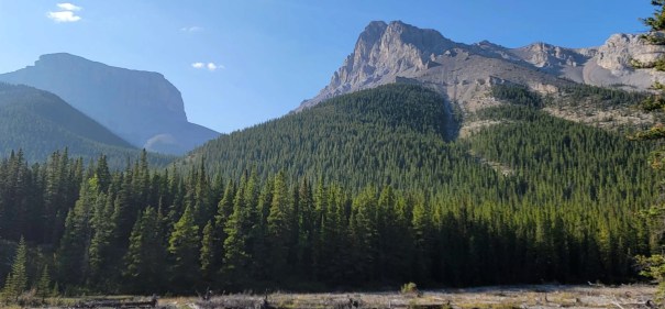
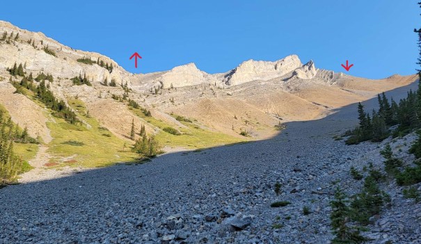
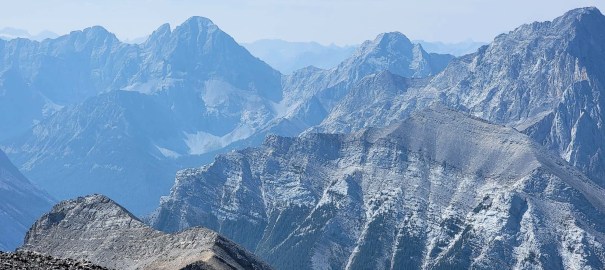
I’ve wanted to summit the twin brothers of Romulus and Remus from first sight. These are the two iconic flat topped mountains seen from Prairie Mountain or Nihahi Ridge. Remus is in front, with his older twin brother Romulus behind.
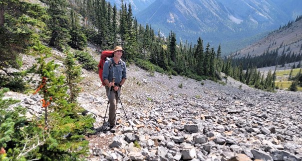
While Romulus and Remus are scrambles, and rated Moderate and Difficult, the biggest issue for me was the access. The base of Mount Romulus is 12 km (24 km return) from the parking lot. It’s a long and boring road. Add in the 12 km and 1300 m ascent up Romulus, and that’s a big day. My solution: backpack in, stay at the very nice and newly renovated Romulus campground, and summit from this home base.
All went well for the Romulus summit. Unfortunately, it rained pretty hard that night, with freezing temps at higher elevations. I did not want to attempt the Remus Chimney in icy conditions, so had to leave that for another day. That day finally came two weeks ago, so it was now time to write about both these mountains. I know it seems weird to wait before writing a trip report for both of the twin brothers. As the mom of twins… well, fairness and equality is everything.
This trip report is broken into two parts: Hike In, and Mount Romulus Summit. Click HERE to jump straight to the Romulus Trip Report.
Gear
Mount Romulus summit: Hiking boots, poles and regular day pack kit. Water crossing shoes and poles if the river is high. Late season has lower water.
Approach: backpack to Romulus campground, all your essential backpacking kit and food, or a mountain bike.
Overview
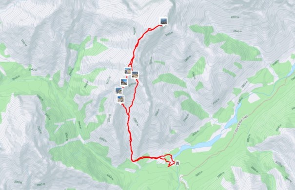
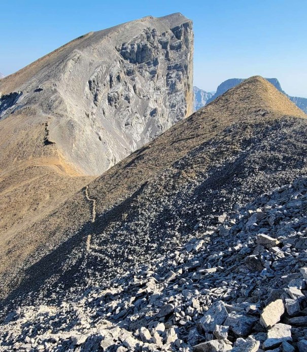
From the Little Elbow Day Use parking lot, head directly west until you reach the Mount Romulus Backcountry Campground. From the campground, cross the Little Elbow River. Go left, making for the draw between the two ridges. Hike up to the headwall cirque. Look for the gully on the left with nice rock. Scrambling up solid steps and grippy slab. Once on top, realize you are only 1/2 way. Take a deep breath, and continue up the undulating ridge to the top. Hike down to the col, and then hike back up to the true summit on the other side. To return, retrace steps. Or, dip down to the left (south) at the col, and traverse across to the original headwall cirque. Enjoy some excellent scree skiing back to the trees. Rejoin trail and return to campground.
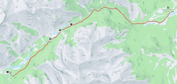
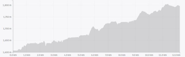
Little Elbow to Romulus Campground
Totals – Downloadable Tracks on Gaia, Displayed on Strava
Date: Aug 29, 2023
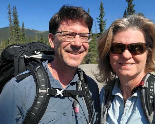
Group: Two (Alisen & Mike)
Distance: 12.2 km
Elevation: 315 m (1,039′)
Time: 3 hours
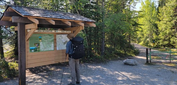
Parking and Trail Head
The closest parking is the Little Elbow Day Use area. We donned our backpacks, and headed past the campground. We joked that it’d be worth booking a campsite just to take off 2 km return of walking.
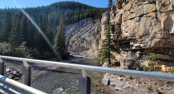
We passed the road gates, the turn off to Nihahi Ridge, and then just kept walking. At 5.5 km, we crossed Little Elbow River at the bridge, followed by a sizable uphill. At about 8.3 km, we passed the trail head to Mount Remus. The campground is at 12.2 km.
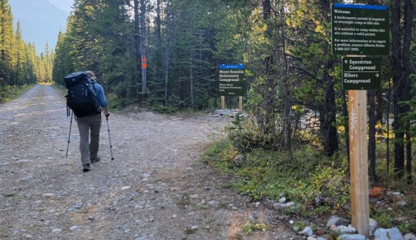
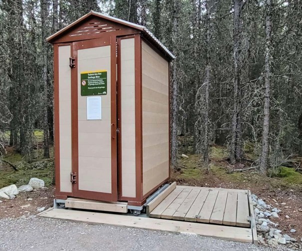
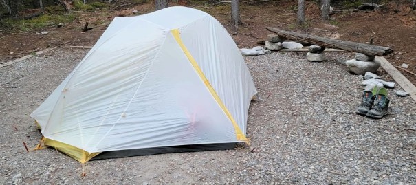
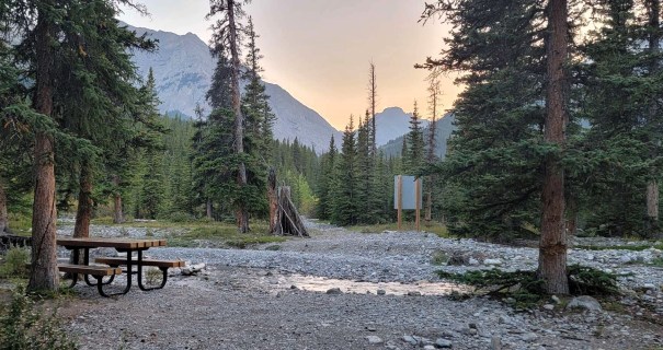
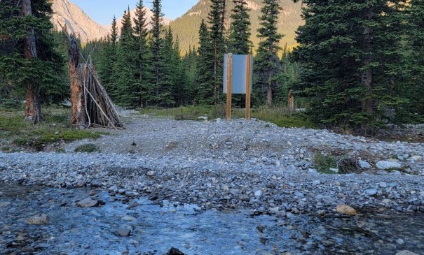
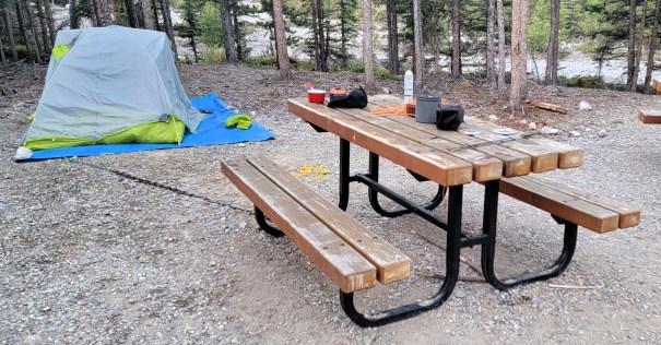
We set up camp in the newly renovated Mount Romulus campground. The campground has bear-proof food lockers, new outhouses, and a well laid-out communal area. The river is just below.
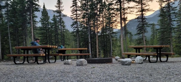
We made dinner, then hopped into our “2 person” Big Agnes Tiger Wall tent. I usually take this tent on solo backpacking trips, but was fine to share with someone you know really, really well. I purchased the optional tent pad, which has wings the width of the vestibules to keep gear clean.
Mount Romulus Summit from Campground
Overview
From the Romulus campground, cross the Little Elbow River. Go left, making for the draw between the two ridges. Hike up to the headwall cirque, and then to the gully on the left. Scramble up the grippy rock. Continue up the undulating ridge to the top. Hike down to the col, and then hike back up to the true summit. To return, retrace steps. Or, dip down to the left (south) at the col, and traverse across to the original headwall cirque. Enjoy some excellent scree running back to the trees. Rejoin trail and return to campground.
Totals – Downloadable Tracks on Gaia, Displayed on Strava
Date: Aug 30, 2023
Group: Two (Alisen & Mike)
Distance: 10.6 km
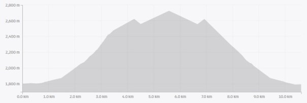
Elevation: 1,136 m (3,748′)
Time: 7 hours 40 minutes (includes lunch and breaks)
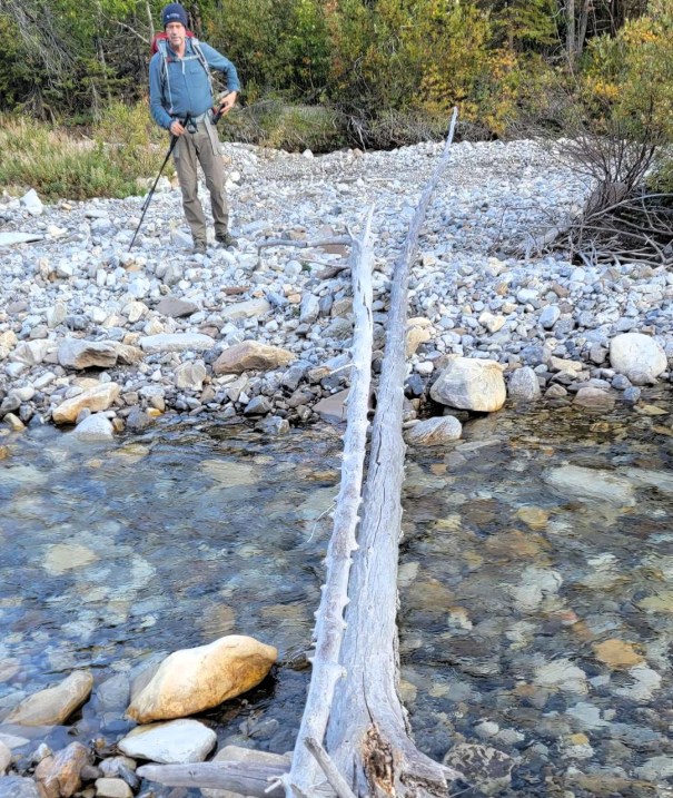
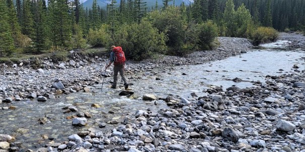
We spent a great night in the campground. We woke to chilly day with a brilliant blue sky. We made breakfast, filtered water for the day, and then headed out. First thing, we crossed the Little Elbow River. This late in the year, the crossing was low with no issues and we kept our boots on.
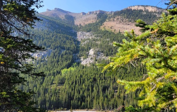
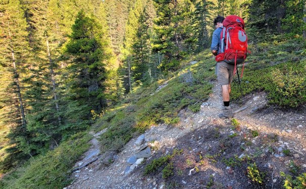
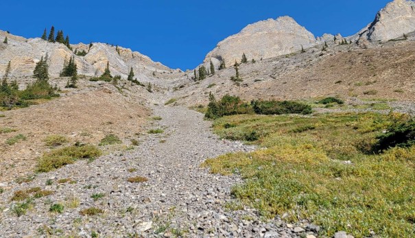
Next, we angled left. We picked up a good trail in the trees that bent around the mountain and led to the headwall cirque. Note: the trail braids quite badly at one point. When in doubt, stay high.
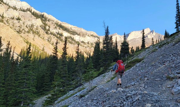
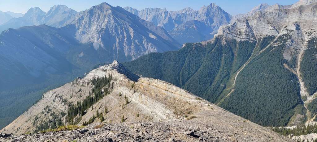
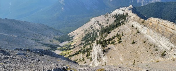
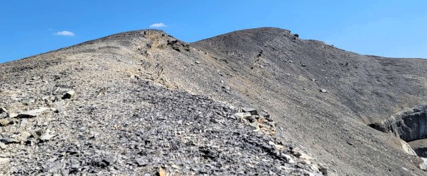
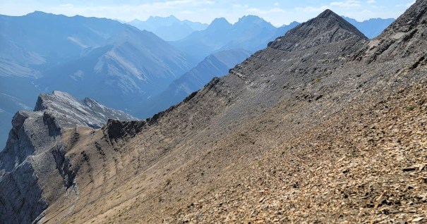
The trail lead to the headwall cirque, which is a big scree gully. This is a great view of the ascent gully (left), and our return cutoff on the right
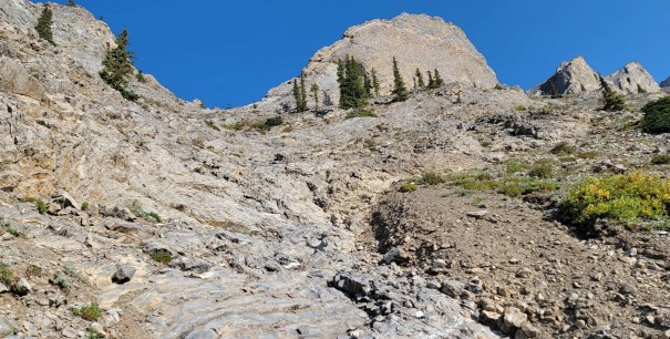
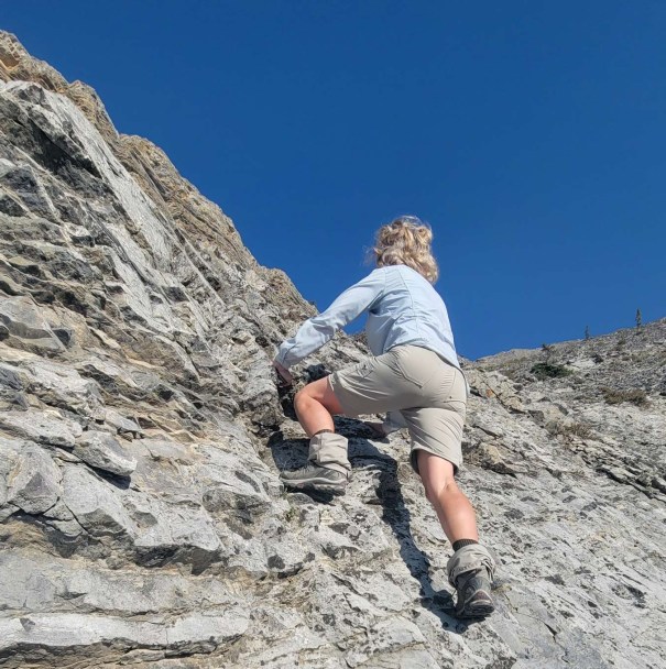
We crossed over to the left, and picked out our ascent gully. This is a natural draw, and the low point on the ridge. This was the best part of the day. Moderate scrambling up natural steps, and grippy slabs. Wonderful.
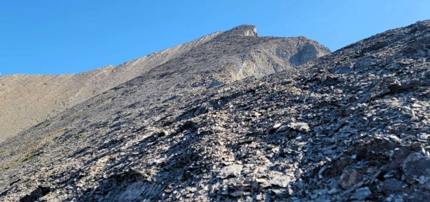
We made one navigation error. We should have kept far left, and continued up the grippy rock. We decided to go straight up through the scree as it looked shorter. Unfortunately, our view was blocked by a hump. Once on the hump, there was still a long scree grind above. Meanwhile, the left rock route had reached the ridge. Oh well. Learn from my mistake.
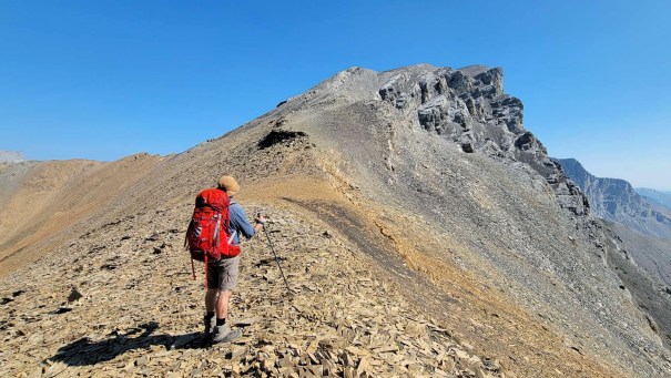
Once on top, we turned right and followed the long and endless ridge as it undulated up and down. It was now smoking hot, and I’ll admit to not putting up a blistering pace. We had all day though, and I’d rather spend the time on the mountain, than sitting in camp for hours.
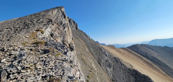
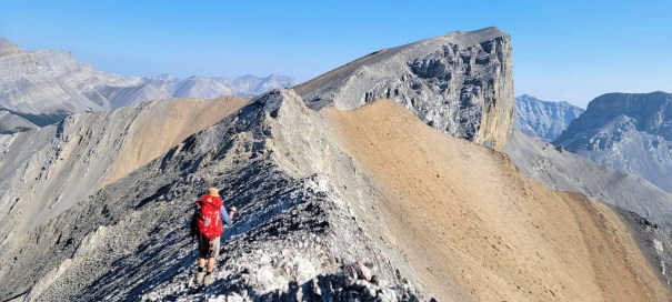
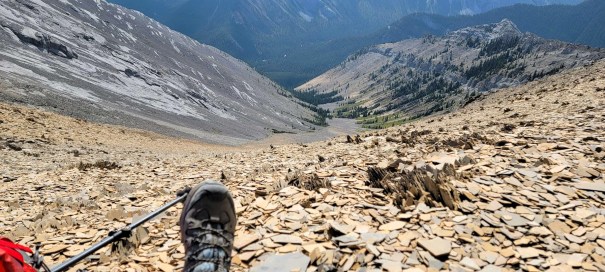
We hiked to what I thought was the summit, only to have the true summit come into view. First, we had to climb down from the high point to the col below. There are a few options to get down. This was picky work, with nothing looking better than anywhere else. We did find some more grippy, steppy rocks to down climb. Right before the col, the rock changed from K Country Grey to a nice soft brown shale. Lovely!
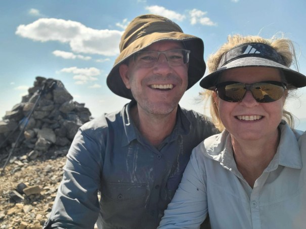
Mount Romulus Summit
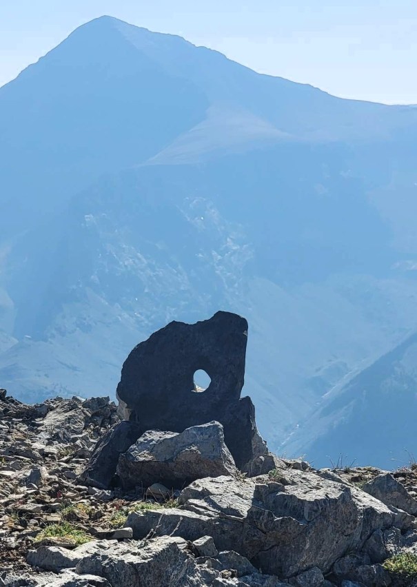
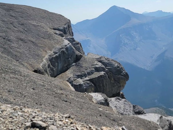
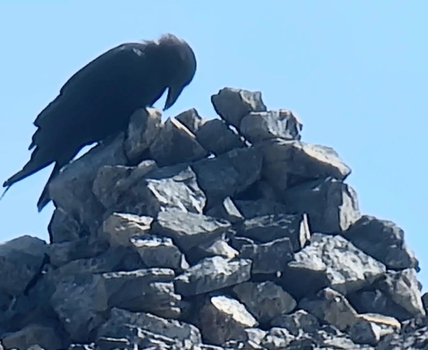
Once on the summit block, we found some fun formations: a window and a turtle. A crow met us on the summit, no doubt keeping an eye on our slow ascent. He knows where to find a free meal.
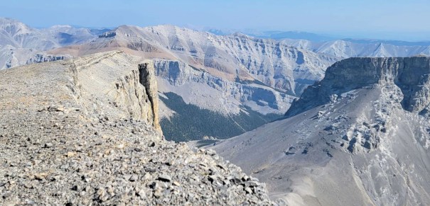
The views are so impressive. Every turn shows off another mountain to its full advantage. I will admit to only having eyes for Romulus’ little twin brother, Mount Remus. From here, it looks super scary. Good thing there’s an easier way up the other side.
Time to summit was 4 hours, 52 minutes. Distance was 5.2 km and ~1,300 m elevation gain.
Mount Romulus Return – Alternate Route
After some summit lounging, we headed back down to the col. To take the shortcut, we went left and hiked across the slope to cut out the high point above. This was endless down-sloping side-hilling. My absolute favourite 🙂 The payoff? We popped out at an exquisite brown shale scree run. Ahhh. We were down and back on the trail through the trees in no time.
Interestingly, we saw a guy coming UP through that scree. We asked why he choose that route, and he said this is what AllTrails had. I double-checked and yup. The ascent route is marked on the map, but the ‘trail’ goes up the scree.
We joined up with the trail, and had a break from the sun in the trees. The river crossing on the way out was lovely, cool and refreshing.
We had dinner, and spent another night in the campground. It rained pretty hard overnight, but we were dry under the thick trees.
In the morning, we found someone had set up their tent right in the middle of the communal eating area. Right next to the picnic tables. Worse? They left out all their food and cooking stuff. Nice. Real nice. Luckily, no bears found them (and us) too tempting. I don’t understand this mentality. Parks went through a lot of effort to fix up this campground. Just use it properly. Of the 10 sites, nine were empty. Pick one!
It was still drizzling when we had to pack up and leave. The plan was to summit Mount Remus, and then hike out. Unfortunately, there was snow and probably ice at higher elevations. Knowing there was a difficult chimney at the summit, we made the hard to decision to return another day. I am happy to report that I was able to return and get this peak.
Wrap Up
Mount Remus is a great mountain. By backpacking in, I had time to spend on the mountain and really enjoy it. I highly recommend the Romulus campground. It’s clean, renovated, and a great place to base for a few days. We only saw five people the entire three days we were there, but it was mid-week in late August. I imagine it’s busier in full summer.
Many people ride bikes in, and that’s also a great option. The Romulus route is a nice approach through the trees, a fun scrambly gully, then a long ridge hike. The actual summit block was further than I thought, but it was interesting the whole way.
Thanks for reading! You can follow my blog, join my FaceBook page Al’s Adventurers, or follow me on Instagram
Alisen
I love all things mountains! I live next door to the Canadian Rocky Mountains, however I travel the world to enjoy the many different mountain environments and cultures that I can. I hope you enjoy these trip reports, and that it inspires you to accomplish your own adventure goals.

How exhilarating! I ascended a few mountains (when I was younger), and remember the rush of reaching the peaks.
It is definitely a thrill, espeically when the adrenaline is up a bit. I found the chimney a bit of a challenge, because I over-hyped it in my brain. It was actually quite straight-forward.
Hope you are getting your adventures in the way you like them now.
Vicariously. I mostly imagine and write about them. ;>)
How do you get down that scree, on your bum? … great adventure and gorgeous pics, as always. 😀
LOL! Yeah, that’s one way to get down 🙂
There is actually a technique – pretend it’s snow! When heading downhill, dig in with the back of your heel, with your toes pointing up to the sky. Then, you have to trust a bit. As the scree slides under you, go with it. The idea is to get a long scree slide for every step. Some call it scree skiing.
It saves time, but more importantly, it saves my KNEES! I good scree descent is way easier than a hard rocky descent where I have to step down repeatedly. I can barely walk after one of those.
Heh, I remember doing that as a kid – such fun! 😀
Yes! You know it. A very Canadian thing. People who don’t know snow find it hard to do in the scree rocks.
Lovely views along the way to the Mount Romulus Summit. Hiking up the scree doesn’t sound fun though. It’s too bad about the rainy weather overnight, but at least you stayed dry. I never understood people who leave all their stuff out while camping too. Have some common sense.
The scree can be annoying for sure. Back in the day, there were so few people in the mountains that all scree was a churn fest – two feet up, one foot down. Hated it. Now, there’s usually a good trail beaten in.
I know, right??? Who leaves food out in the MIDDLE of black bear country??? Thanks dude. Could have gotten us all killed. Idiot.
I know. It’s people like that who ruin it for everyone, including the wildlife. Not cool.
This looks AWESOME! It just sounds like such a fun hike, and the summit views are great. Also, what a great campground! It’s not often that you backpack in and find yourself with an outhouse and picnic tables.
Hopefully the owner of the poorly-placed tent and improperly stored food got back before a bear found it. There’s always that one person that doesn’t get it and ruins things for the rest of us…
Of the two peaks, Romulus was by far my favourite.
I just don’t understand some people. They put the entire campground at risk of a black bear, cougar or coyote attack. So frustrating, especially when the bear bins are literally RIGHT THERE!
I always feel like I am feasting on your photos and the views 🌅🏞️🏞️
Awww – so sweet. I know you appreciate the views Morag. Thanks for visitiing and enjoying the beautify.