August 20-24th, 2025
The Brazeau Loop backpack has been on my radar for years. It’s an unassuming area hidden behind the crazy popular Columbia Icefields Centre. What the Brazeau Loop lacks in PR, it more than makes up for in stunning scenery. While other popular backpacks, like the Rockwall and Skyline are booked solid, Brazeau, not so much. I am not complaining.
The Brazeau Loop is approximately 82 km long. The route is an interesting combination of fairly flat hiking along a river, and three beautiful passes with stunning mountain vistas. Throw in Brazeau Lake, and this hike has everything.
While the distances are long, the elevation is not overwhelming – only 2,344 m over five days. Completely doable. The highest elevation gain was only 653 m on Day 3.
So why isn’t everyone on this trail? It just might be due to the washed out bridge over Brazeau River. Nothing like hiking for two days, only to discover you cannot cross and must retrace your steps. We got lucky, and were able to cross with no problem. Jasper National Park is threatening to replace the bridge soon, but with the Jasper fires, this might take longer than expected.

There are some interesting names on this loop, and I am trying to track down the origins. So far, all I know is that the Brazeau River is named after Joseph Brazeau (1812-1871). One source has him as a surveyor the Canadian Pacific Railway, while the Metis Museum has him as an interpreter, and being helpful to the Palliser Expedition. This documents shows a son with the same name, so perhaps the Joseph Brazeau is the son.
How to Book and Parks Canada Information
At the time of writing (August 2025), Parks Canada was releasing camping spots based on location. The Jasper backcountry campsites were released on January 29th, but that can change at any time. It is an absolute mad scramble to book, so be ready.
Jasper National Park also provides a brochure to help plan this backpack.
Brazeau Loop Brochure by Jasper National Park
In an effort to not scare off people, I need to address the elevation profile that Parks provides. It’s a tad bit intimidating.
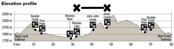
Parks has chosen to show ALL the elevation for the full 82 km loop. This makes it seem like the ups are terrifyingly steep. The reality is below. I am comparing apples to apples – from Brazeau Lake Campground to Jonas Cutoff campground (marked above with the X — X).

Yes, there is still a lot of elevation to gain, but it’s under 700 m, and it’s not gained in a near vertical assault on the mountain.
Backpacking Gear
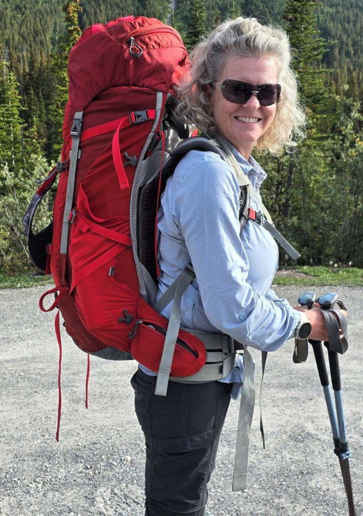
I highly recommend a full backpacking setup. This includes sturdy (high ankle) hiking boots suitable to carry your weight plus your full load. Hiking poles and gaiters are also a great idea, especially if there are water crossings or wet weather. Dress for success. Rain pants and jacket are a must, as is long underwear. I’ve never regretted carrying a bit extra, as I’ve stayed warm and dry.
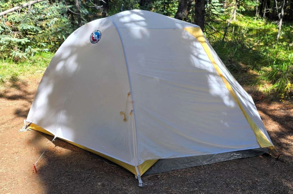
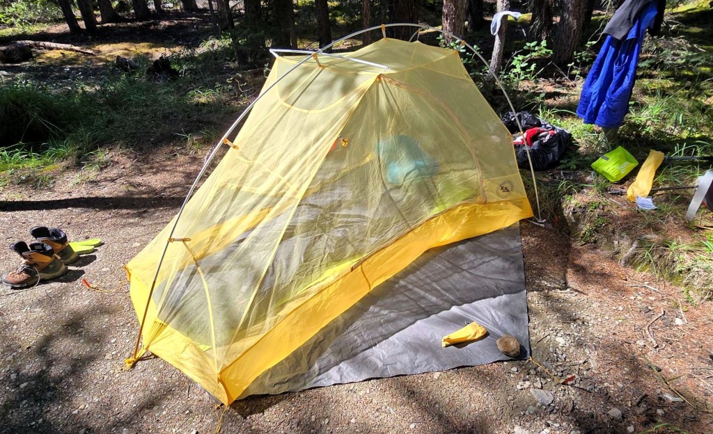
I use a lightweight two person tent – the Big Agnes Tiger Wall. It is quick and easy to set up by myself, and it withstood a pounding rain and hail storm on the Sawback Traverse. I use a lightweight sleeping bag, with an overbag so I can regulate my heat. A thermarest is mandatory. Here is my review of the Tiger Wall tent on FB.
Erin and I shared a stove and fuel, and we each carried our own eating utensils and cups. We also shared a water filtration system, but opted to not bring the UV filter.

Brazeau Loop Terrain
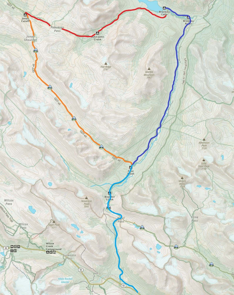
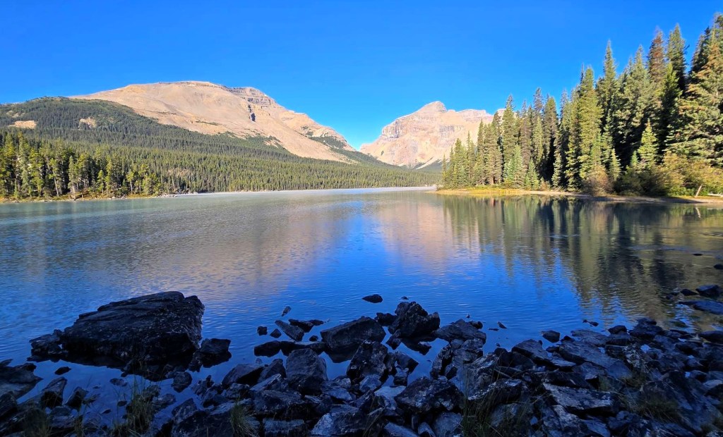
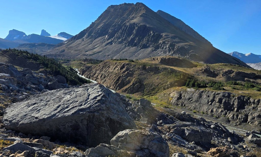
This backpack is an almost perfect lollipop shape. Days 1 and 5 are the same (the stick), with the three day loop making up the lollipop top. The loop encircles Marble Mountain and Flat Top Mountain. The trail is dwarfed by the stunning Sunwapta ‘range’ on Day 4. Brazeau Lake is very long, with a wonderful shoreline. If we had warmer weather, I would be in that water so fast. There is something for everyone on this backpack.
Click the Day Header below to get the full trip report for each day.
Day 1 – Nigel Creek trailhead to Nigel Pass to Four Points Campground
STATS: 14.69 km, 491 m elevation gain, and 4 hours 54 minutes hiking time
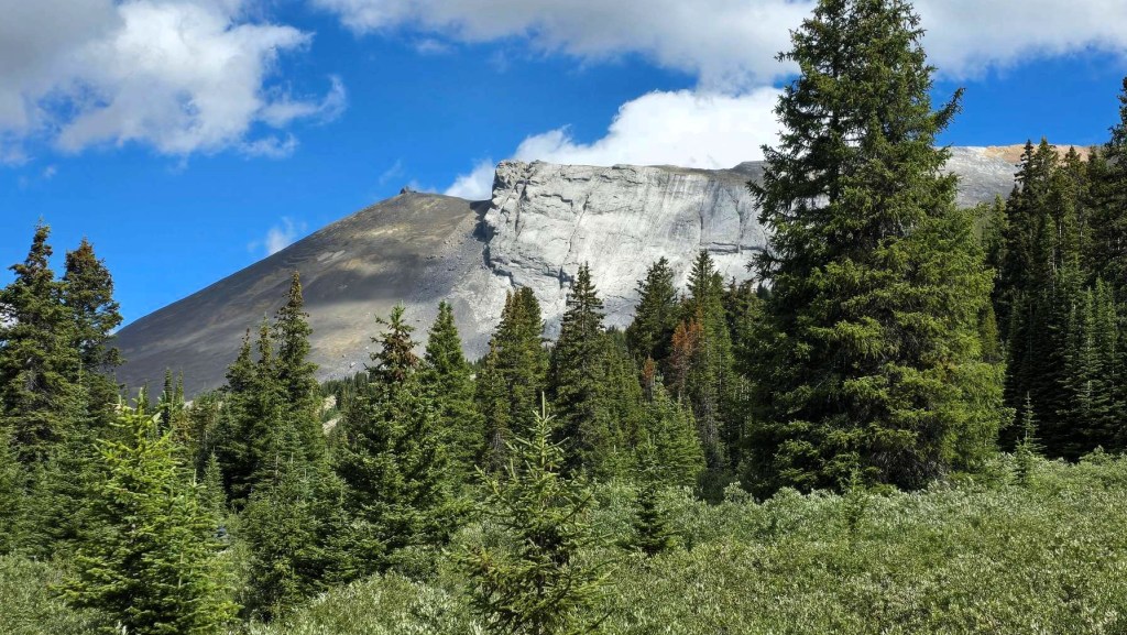
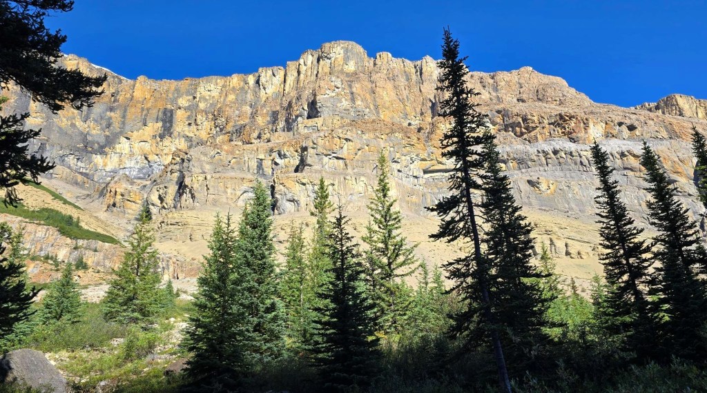
Nigel Pass is a popular day hike, and we ran into my friend Krista and her husband heading up. The real treat was found after crossing the Brazeau River, where we rambled through a massive rock slide. From the high point, we looked down the Brazeau River valley towards our campground.
Day 2 – Four Points to Brazeau Lake Campground
STATS: 18.48 km, 230 m elevation gain, and 6 hours, 8 minutes hiking time.
This was a long day, made longer by the trail. Anytime we were near the water, the trail was bumpy and lumpy. Lots of exposed roots and stumble points. From what I can see, there are several bridges washed out, so perhaps the trail was on the other side, leaving this trail to the horses.

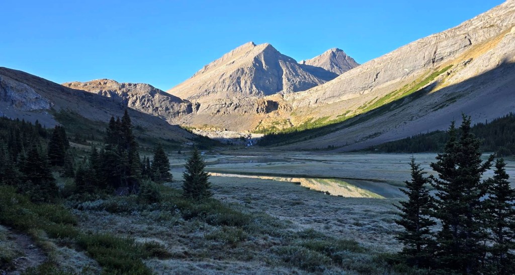
Day 3 – Brazeau Lake to Jonas Cutoff Campground
STATS: 16.02 km, 653 m elevation gain, and 6 hours, 7 minutes hiking time.
Started the day with a VERY cool dip into Brazeau Lake to traverse across. Hopefully the bridge will be fixed soon. After a long time in the trees, we finally emerged to sweeping vista and were blown away by the views. Le Grand Brazeau mountain was on our right all day, while Flattop kept us company on the left. With a lack of named mountains, the massive one in front was nicknamed “Le Grand Chateau”. The other side of the Chateau would keep us company on the next day.
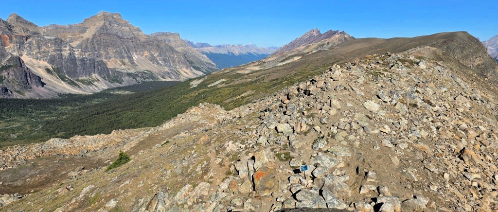
Day 4 – Jonas Cutoff to Jonas Shoulder to Four Points Campground
STATS: 18.81 km, 553 elevation gain, and 7 hours, 22 minutes hiking time.
Not going to lie – this was the absolute highlight of the trip. Hiking up and over Jonas Shoulder was lovely, but it didn’t prepare me for the spectacular views of the Sunwapta ‘range’. This long mountain sports many peaks accessible from the Icefields Parkway. We hiked between Sunwapta and Le Grand Chateau back to the Four Points campground. This section is part of the Great Divide Trail, and we met a few long-distance hikers.

Day 5 – Four Points to Nigel Pass to Nigel Creek trailhead
STATS: 14.61 km, 417 elevation gain, and 4 hours, 43 minutes hiking time.
Today was all about getting up, and making tracks. However, the beauty meant about 100 photos of the same trail, but from a different perspective. This was not a dull day, as I thought it might be. We met lots of day hikers, and a few groups heading in for the full Brazeau Backpack.
Your Brazeau ‘Crew’
What’s unique about this backpack is everyone is going in the same direction, and everyone stays at the same campsites. Who we met on Day 1 at Four Points would be with us for the next five days. Good thing we had excellent company. Sheila and Allen are both school teachers from Salmon Arm, and this was their fourth time on the Brazeau Loop. They have done it from both directions. We also met buddies Rea and Kim who hail from Edmonton. This was their fourth attempt, and were finally successful. I was SO happy for them.
While we didn’t see each other on the trail, we did share the campsites, the picnic tables, and juggled the single throne pit toilet. On our last night, we gathered together at one picnic table and swapped stories of derring-do. Moral of the story? Play nice and make friends, because you’ll be seeing a lot of each other.
Wrap Up
I hope you enjoyed this Brazeau overview. Please click through to each day to get a full trip report, complete with downloadable GPS tracks, distances, elevations and all the pics you’ll need to plan your trip.
Thanks for reading! You can follow my blog, join my FaceBook page Al’s Adventurers, or follow me on Instagram
Alisen
I love all things mountains! I live next door to the Canadian Rocky Mountains, however I travel the world to enjoy the many different mountain environments and cultures that I can. I hope you enjoy these trip reports, and that it inspires you to accomplish your own adventure goals.

I love this hike too, the stunning view from Jonas Shoulder makes up for all the flat parts and the long days. I think we did it in 4 days using John John campground, but that was before the bridge was destroyed. Maggie
Hi Maggie,
That’s a great idea to keep going to John-John campground. Did you cut off the dip down to Jonas Shoulder and walk across the Poboktan Plateau to go up Jonas Shoulder? That woudl definitely save time, distance and elevation.
Hopefully the bridge does get repaired soon, as a four day itinerary is probably more doable for many people.
Thanks Maggie,
Alisen
Yes, we went across Poboktan Pass and Plateau. It was wide open and very scenic, so a nice detour.
Thanks! Yes, a great open expanse. This is an ideal way to cuff off a day. Hopefully the bridge gets repaired soon.
I really like this general overview post about Brazeau Loop, which looks like a really nice hike with great views Alisen.
Thank you! It was such a fun backpack. Long distnaces, but so doable for the average backpacker.
Looks like an incredibly scenic multi-day hike and that you had beautiful blue skies for it. Glad to hear it wasn’t overly busy and that you didn’t encounter any issues with the washed-out bridges and crossing the river.
Thanks Linda. I got SO very lucky with the weather. Erin and I were supposed to go two years prior, but it called for rain and snow. We decided we were just not built for that type of suffering 🙂
Alisen, thanks so much for sharing your awesome story about the 5-day trek on the Brazeau Loop.
We haven’t done this loop yet, but we’ve hiked in the area a few times and I totally agree with you – it’s gorgeous out there.
Besides the great vistas, we also enjoyed the open forests.
I must admit I awaited each new installment of your description with great anticipation, almost as if I were reading a serialized novel back in the day. You really chose a great format for it!
Your report is detailed, useful and fun to read. If we ever get to hike the Brazeau Loop, your blog will be our go-to guide.
We’ll definitely print it out and take it with us.
Hello Jacek,
Thank you SO very much for your kind words. It means a lot to me that a fellow experienced mountain trekker and lover enjoys this blog. You’re opinion matters to me, so thank you.
Brazeau was definitely a fun one. Not too hard either. There are two long days, but with minimal elevation gain, they are very doable. I was getting a bit hot and bothers on Day Four, but finding a few creeks to cool off in really helped.
The bridge is on the schedule to be repaired, so I do hope you can complete this one.
Cheers, and happy trails,
Alisen