August 20, 2025
This is Day One of Five. Click HERE for the full overview, including distances and elevations for each day.
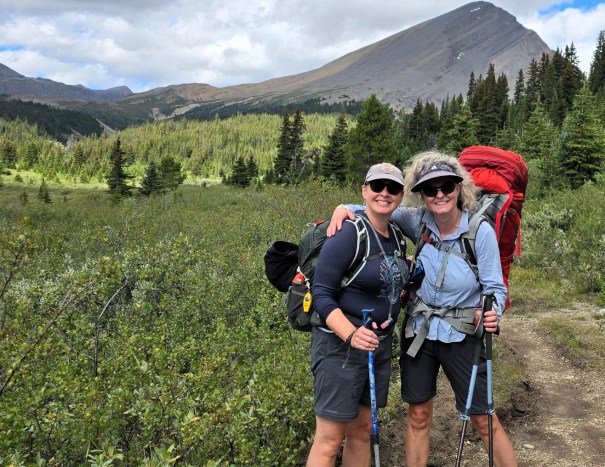
Finally! This is my second attempt for the Brazeau Backpack. Erin and I tried two years ago, but the weather was miserable and called for snow. We decided to postpone and wait for better weather. I am so glad we did.
Today was all about humping a heavy pack up and over Nigel Pass. While I had completed a week of mountaineering at the beginning of August, Erin and I both weren’t feeling particularly in shape. As I hiked down the initial gravel road, I noticed that I needed to back off already. Oi… Luckily, this backpack starts off easy, so we both gained strength and confidence as we went. Plus, it’s amazing how much food weighs.
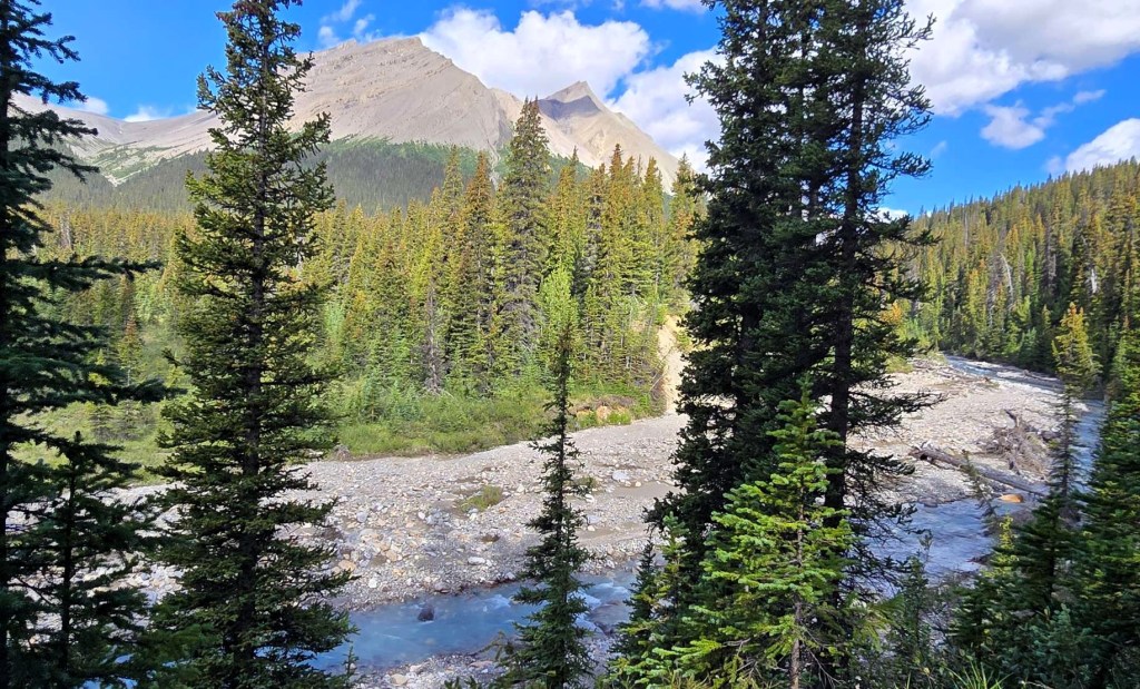
There were a couple of highlights today. One – I met my buddy Krista on the trail. This happens occasionally, and it’s always fun to find a friendly face. Two – while Nigel Pass is gorgeous, the real stunner is across the Brazeau River. Here we found an massive rock garden that tumbled down from the above rock slide. If you go to Nigel Pass, it’s worth the extra 2 km return.
Gear
Full backpacking kit. See Overview page for detail.
Overview
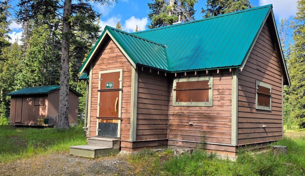
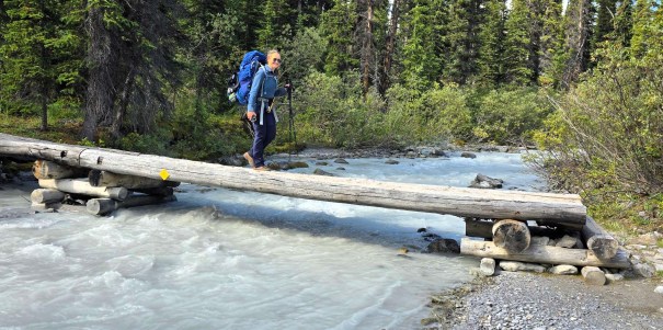
From the Nigel Creek trail head, hike the old gravel road. Take first right and hike down to the valley below. There’s a Warden’s Cabin on the right to explore. Cross Nigel Creek twice on a wide gravel washout. Gain elevation gradually, until the final push to Nigel Pass. Descend a slope to cross the wide Brazeau River (river shoes required if high), and ascend the slope on the left. Hike through the massive rock slide boulders to the end. Descend a very steep trail on the left into the Brazeau River valley. Hike the valley to the Boulder Creek Campground, and stay on trail for another 3 km to reach the Four Points campground.
Totals – Downloadable Tracks on Gaia, Displayed on Strava
Date: August 20, 2025
Group: Two (Alisen & Erin)
Distance: 14.5 km
Elevation: 491 m (1,620′)
Time: 4 hours 54 minutes (includes lunch and breaks)


Parking and Trail Head
From the majestic Icefields Parkway, turn off at the unassuming Nigel Creek trail head. This spot is eclipsed by the epic views of the massive ‘big bend’ switchback on this highway. In the parking lot, you will find who tourists park, walk 10 feet, realize there is nothing close by, and hop back into their cars. If you can’t get a spot, just wait a few minutes.
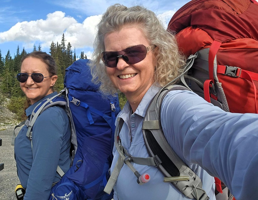
Despite the long drive, we were ready to go at 10:30 am. Rain was forecast for 3:00 pm today, and we wanted to set up camp prior to then. After shouldering our packs (ugh) and doing about a million micro-adjustments, it was time to head down the old road. While this was the worst coming home, it was a nice slow way to start.


Main Trail
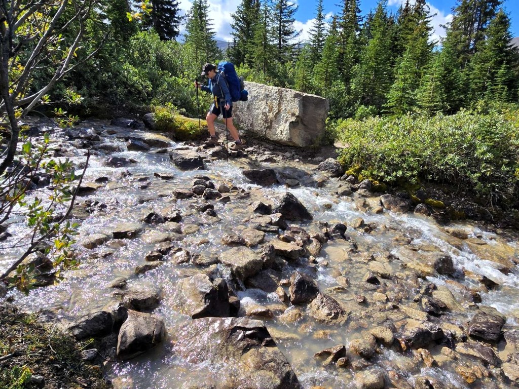
At the first right turn, we took the big path down to the valley. On the right is a closed up Warden’s Cabin. Oh, to spend the night here and avoid the long drive in. After this, we crossed Nigel Creek two times between a large gravel washout.


We climbed just above the creek, and followed this valley to Nigel Pass. We slowly ascending as the valley rose, and kept up a fairly steady pace.
Just before we turned uphill towards Nigel Pass, we came upon my hiking buddy Krista and her husband. We stayed together until the top of Nigel Pass, where we said goodbye. Here we met a solo female hiker who joined them for the return route.

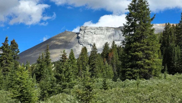
Nigel Pass
Nigel Pass is gorgeous, and is a worthy day hike on its own.
Time to Nigel Pass was 2 hours, 5 minutes. Distance was 8 km and ~350 m elevation gain.

Rock Garden Summit
We hiked down a short slope to cross the Brazeau River. This crossing is very wide, and was done in two sections. There’s been a lot of effort to drop big stones in the river to help with crossing. This has been a VERY rainy summer, and the river was flowing pretty good. We stayed dry, but any higher and I would have taken off the boots and opted for my crocs.
Once across, there’s a T intersection. Right is to the mysterious White Goat Wilderness Area. We went left and hiked up to the high point. We were now on the Great Divide Trail.


We were soon in the Rock Garden, which are massive boulders from an old rock slide. If you are day hiking to Nigel Pass, please take the extra 2 km (return) and hit this as well.


At the end of the mountain, we sat on a rock outcrop and enjoyed our lunch. We had great views looking down the valley, and spotted our fellow Brazeau Loop Buddies Rea and Kim, who were lunching by the river.
We descended down to the river valley, on an excessively steep trail that was hard-packed dirt overlaid with ball-bearings. Not great with big packs. Once down, the valley was wide and lush.

As we passed the Boulder Creek campground, the rain was threatening so we took out the pack covers.

Four Points Campground
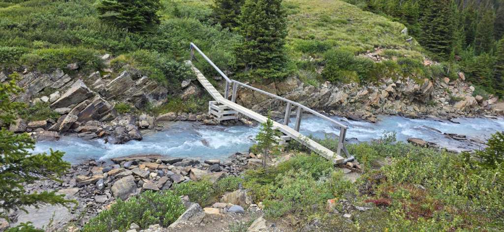
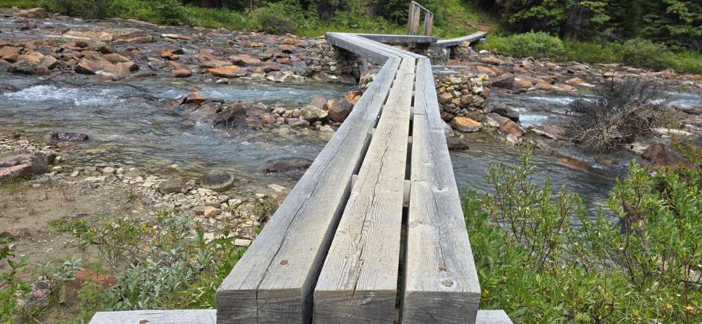
After endless ups and downs through the trees, and another bridge crossing, we pulled into the campground at 2:45 pm. There was a mad rush to get our tents up before the rain started. In the nick of time, Erin and I dove into our respective tents to wait it out. The rain was light, and it came and went all afternoon and evening. We had enough time to make soup, then back into the tent for rain. Then enough time to make dinner and wash up, then back into the tent. It rained on and off all night, and we got more rain than expected.
Distance was 14.5, elevation was 491, and time was just under 5 hours.

We were the first into camp, so had our pick of the 8 spots. We went into the far back corner. It’s a fairly compact campground, with three picnic tables in the middle, and bear bins off to the far end.
The pit toilet is an outdoor throne. I actually like these because the bugs are minimal. Not ideal in the rain though. BONUS – there are TWO thrones at this campground. Take the long way around (don’t step over the stones on the trail), and pass the entrance to the first throne. Go another 10 meters and the second throne comes into view. We didn’t discover this until we returned on Day 4.
Water is from the creek across the trail. The water was high, and quite silty. We had to back-flush our filter a few times on this trip.
Wrap Up
Despite the heavy packs and warm temps, I think we made pretty good time heading into our first campground. Erin was having a hard time getting her pack to be comfortable on her shoulders, but that would ease as we ate through our food. Four Points is a nice campground, and I hear it makes a good home base for day hikes in the area.
Click HERE for Day Two on the Brazeau Loop (coming Sept 3rd).
Thanks for reading! You can follow my blog, join my FaceBook page Al’s Adventurers, or follow me on Instagram
Alisen
I love all things mountains! I live next door to the Canadian Rocky Mountains, however I travel the world to enjoy the many different mountain environments and cultures that I can. I hope you enjoy these trip reports, and that it inspires you to accomplish your own adventure goals.

Hi Alisen,
Thank you for sharing this post. Your backpacks looked quite heavy, but it seems you had a wonderful hike with impressive views, especially overlooking the Brazeau River valley from your lunch spot.
Thanks again for sharing.
Yes, the pack is heavy at the start. I am always amazed at how heavy the food is. I weighed all the food, and it was a bit over 1 km. I try to pack exactly what I need. I only had three extra energy bars left over, which is pretty good.
Everything else in the pack is warm clothes, and some rain gear, which I wear in camp. Happy to report that I wore or used everything in the bag, except for the First Aid kit.
Still, Erin and I use the Buddy System to get our packs on/off. Saves straining or twisting our backs. Anything to stay healthy over a five day trip.
Amazing scenery as always! This seems like one of those hikes where the harder you work the more it pays off with views and solitude.
I lvoe getting into the backcountry. Lose the crowds, and gain the views. It felt like a private Park for the most part, as we didn’t see anyone except at breakfast and dinner.
It’s always nice when a trail starts off gently. How fun to cross paths with one of your hiking friends on the trail. And of course you’re both hiking, seems very fitting. The Rock Garden and views of the valley are beautiful. Glad to hear you got your tents up just in time before the rain.
I love it when I meet people I know in the backcountry. I wear a really distinctive outfit (visor and clothes) so I am readily recognizable. I am an intense introvert, so it’s usually up to them to make say Hi.
One of the women we met on the trail reads my blog! That’s always gratifying to know people read and use the information.
Ha, I love that you have a unique style on the trail so that you’re easy to spot! It’s a great idea. And clearly it works given that you ran into someone on the trail that reads your blog!! How cool is that! I hope to run into you on the trail one of these days!
Now THAT would be amazing! I think you, me and Diana from Handstands should organize a hike equal distance from us all.
I love it! And agreed, the three of us should totally get together for an epic hiking adventure!
Whoot! Another multi-post adventure. 😀
He he. Yup. Need to string it out 🙂 Seriously though, it’s so much easier to write them this way. I feel if it was one big blog, it would drag on forever.
Bite-sized chunks, and cliff-hanger chapter endings. 😀