October 8, 2024
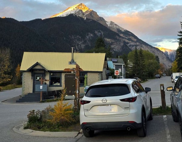
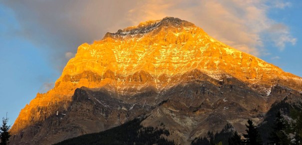
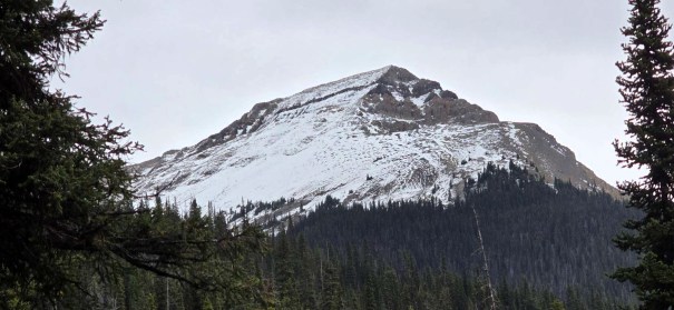
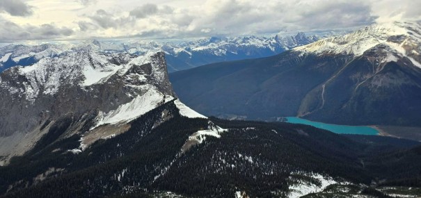
Have you ever looked at a mountain and said ‘Nah, I’m good,’ only to be proven wrong? As I was driving west along Highway 1, I always get excited to see the valley leading to Takakkaw Falls, and my favourite area – the Little Yoho Valley. Guarding the entrance is the impressive Mount Field. Seen from this view, I definitely said to myself. No thanks, I’m good.

Later that night, we had an excellent dinner at the Truffle Pig Bistro with Mike and his paragliding friend Robert Bernier. As we left the restaurant, I again looked up at Mount Field. This time, from this opposite view, I felt an overwhelming desire to climb it. Considering I had zero plans to ever scramble Mount Field, this was interesting.
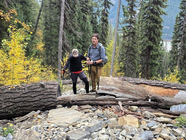
We spent the night in Steve, the 6 Million Dollar Westphalia Van, and did not have a great sleep (not Steve’s fault). We woke up late, it was cold, and I felt we missed our chance at an early start. Bummer. Then Robert called. He changed his plans, and wondered if we still wanted to head up Mount Field? Oh hell yeah!
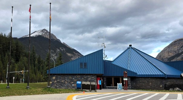
So with a late start at 10:30 am (I know, right?!!?), we met Robert at the Field Visitor’s Centre, and set off across the highway to see what could be done on a chilly October day with a mountain top covered in snow.
Gear
Hiking boots, poles and regular day pack kit. We also had micro-spikes, and a good attitude.
Overview
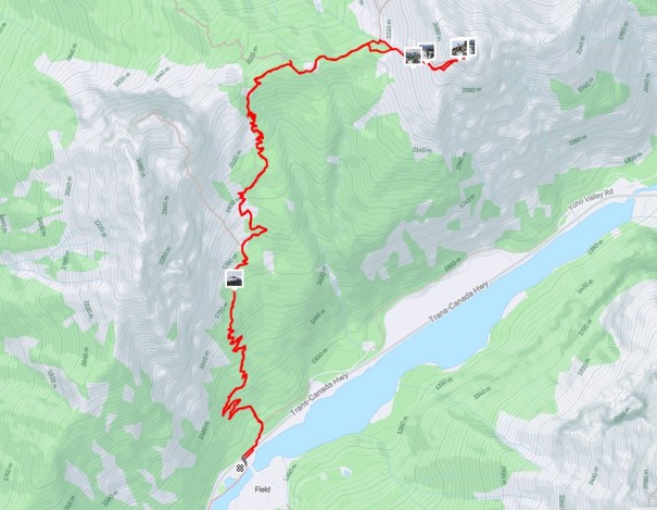
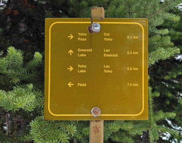
Most people park at the Burgess Shale trail head off Highway 1, but we started from the Visitor’s Centre. Crossed the highway, and found the trail head. We connected with the Burgess Shale trail, and hiked up to the ridge. At the intersection with Walcott Quarry, we veered right to Mount Field. We aimed for the far right ridge, and trudged up to the rock band, aiming for the obvious weakness. At the summit block, there is one short scramble through the rock band, then a hike to the summit. Return the way we came.
Totals – Downloadable Tracks on Gaia, Displayed on Strava
Date: October 8, 2024
Group: Three (Alisen, Mike and Robert)
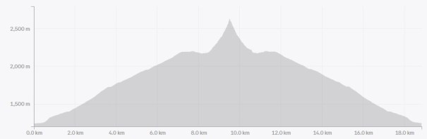
Distance: 18.83 km
Elevation: 1,466 m (4,838′)
Time: 7 hours 58 minutes (includes lunch and breaks)
Parking and Trail Head
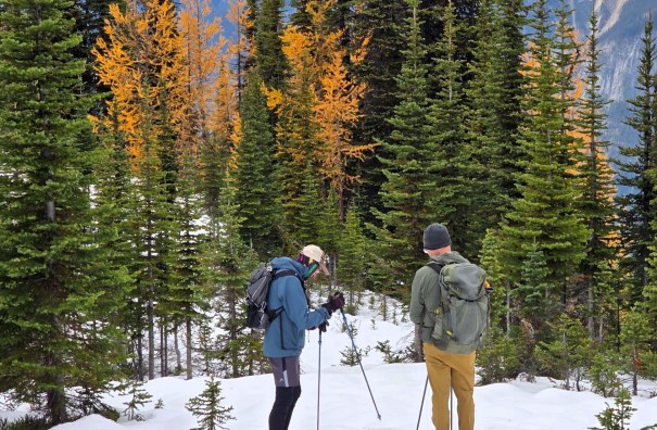
We parked at the Visitor’s Centre in Field, but there is a real trail head parking lot on the opposite side of the highway. Look for the unmarked lane on the north side of Highway 1, just east of the Field street lights. From the Visitor’s Centre, we crossed the highway, and picked up the trail immediately.
This trail went straight up for the first 750 m, and I thought, well, this is going to be a long day. We then connected with the Parks’ Burgess Shale trail, and we relaxed into endless sweeping switchbacks. Ahhh, so nice.


Main Trail
As with most official Parks Canada trails, this was delightful. Such a nice break from the straight-up Kananaskis peaks I’d done recently. To be 100% honest, I had NO idea I was on the Burgess Shale trail. I thought it was pretty laid back, even for a Parks trail. With the amount of tourist traffic going on guided Burgess Shale treks, the trail does need to be moderate.
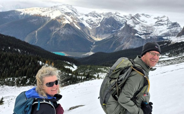
This gave me lots of time to get to know Robert. He is one hell of an athlete. He used to be Canada’s top triathlete, and is still going strong. He tried to summit Emerald Peak the day before, but there was too much snow up through the tricky scramble areas to be done safely. Good decision making.
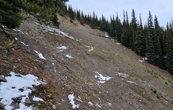
Just when I thought the endless switchbacks would never end, we finally gained the ridge. After hiking along the flat trail for a few meters, we came to the Burgess Shale Do Not Enter sign. Ah, so THAT’S where it is 🙂
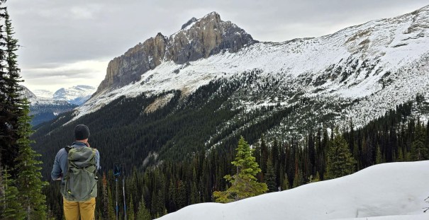
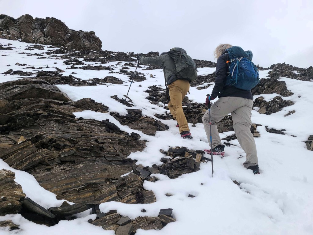
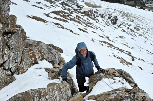
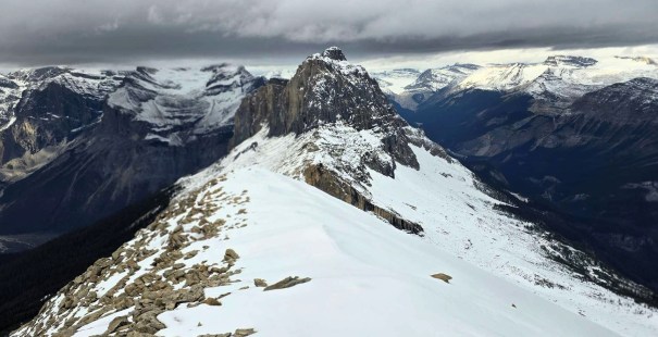
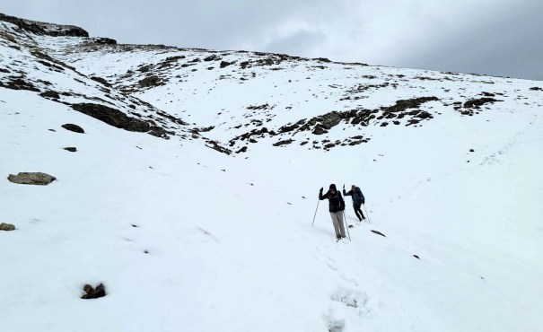
We were now firmly in the snow. If there’s a trail in the scree, we didn’t find it hidden under the snow. Instead, we generally aimed for the ridge ridge, and trudged our way up the jumbled, rocky slope. The snow was in great condition at this point. It was frozen hard, and fairly easy to walk on.


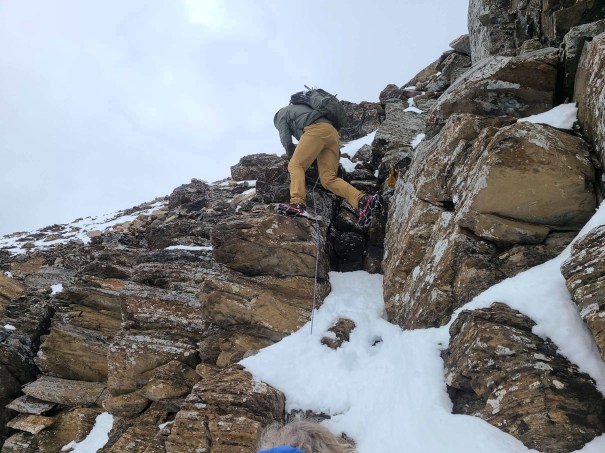
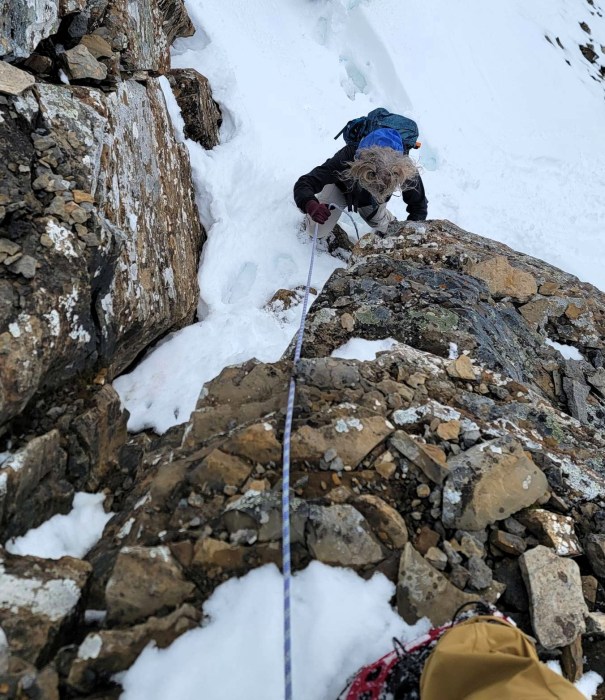
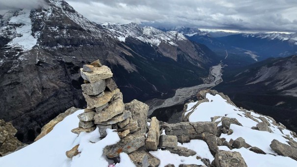
Mount Field Summit
Once we arrived at the summit block, we found a short scramble up through a rock band. There was a rope, which confirmed we were at the correct weakness. The snow gave enough of a platform that we easily scrambled up this section. Once above, it was a short hike to the summit

Time to the summit was about 4 hours, and 30 minutes. Elevation gain was 1,466 m and about 9.5 km.
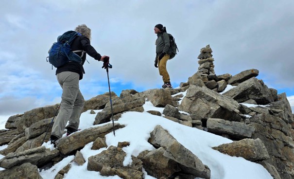
We took a fair number of photos, and I eyed up the winter ski route to Mount Field…. Hmmmm….
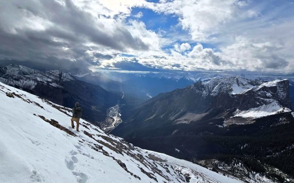
Mount Field Return
Both Mike and Robert were noting the lack of high winds at the summit, and both were lamenting their lack of a Hike n Fly paragliding wing. They definitely misjudged that, but I was happy to not be alone for the endless descent. Due to our late start, it was now close to 3:00 pm. I know – who is this woman??? The sun was finally starting to break through the clouds, and it heated up the snow. Ugh. We were now punching through the snow, and elected to try and follow our up track as much as possible.
Robert was having a grand time. He would hurl down giant snowballs, in an effort to take out Mike 🙂
Once back on the Burgess Shale trail, Robert asked me what I thought our chances of summiting today were. Without thought, I said 100%. He then asked Mike the same question – again, 100%. After doing this for over 25 years, I have a feeling for when a route will or will not go. If it’s a no, I will generally wait for better conditions as I really, really do not like doing the same route twice.
While I appreciated the mild trial heading up, it took forever to get back down to the highway. When we finally left the Burgess trail, and then descended the straight up section, that felt a bit more like it. We said good-bye to Robert at the Visitor’s Centre, as he was going to explore Lake Louise, and we continued on to the Vernon area for cycling, and paragliding.


Wrap Up
Mount Field is a very doable, straight-forward mountain in Yoho National Park. It’s got an amazingly easy trail up the massive wall to the ridge, and then a short scramble to the summit. I am sure there’s a good trail in the scree, but if not, head for the ridge and go up. Very straight-forward route finding.
Thanks for reading! You can follow my blog, join my FaceBook page Al’s Adventurers, or follow me on Instagram.
Alisen
I love all things mountains! I live next door to the Canadian Rocky Mountains, however I travel the world to enjoy the many different mountain environments and cultures that I can. I hope you enjoy these trip reports, and that it inspires you to accomplish your own adventure goals.

Oh boy can I relate to that journey from “no thanks, I’m good” to “heck yes I’m gonna climb that.” In this case, it seems like it was well worth it!
I am so glad I did it, because it’s a mountain that is seen from many different vantage points. I was across from it on Friday. Pretty sweet to point to it and say – Done!
I am interested to hear your story from No Way to Heck Yeah!
I think my main story at the moment is my goal to climb all the 14ers in Colorado… something I never thought I’d do. I even at one point wrote in a blog post that there were two of them in particular that I will never be climbing. I haven’t done them yet, but one of these days I’m probably going to have to eat my words.
I’ve never done this trail. You make it quite tempting. Maybe next year. Maggie
I just did Emerald Peak. If I had to choose… 😂
It’s funny how you felt an overwhelming desire to climb Mount Field … after eating dinner. Glad to hear it worked out and you managed to make it to the summit relatively easily considering the snow. Beautiful views from the top.
LOL…funny when you put it like that 😂