September 12, 2019
Carnarvon Lake had been on my hiking partner Annette’s list for a few months, and for good reason. We Biked, Waded, Hiked, and ‘Climbed’ to reach the lake. If it had been a super hot July afternoon, I would probably add Swim to this list.
Why go to Carnarvon Lake? If you’re a scrambler, there are some excellent mountains to climb and the lake makes a great base camp. I recommend visiting Explor8ion for his trip reports. Fishers really like this lake too, as it’s quieter than some of the other lakes in Kananaskis Country. There were three guys fishing when we arrived at the lake. We met another two guys as we descended the chains, and they asked if the fish were biting. This is also equestrian terrain. We didn’t see any horses today, but there was lots of, lets say evidence, of their travels. Most of my horse friends have ridden up to the waterfall.
This is a very LONG day hike. I could not imagine walking the whole way for a couple of reasons. One – it’s a pretty uneventful hike as you’re in the trees for 80% of the time with no views. Two – the elevation gain is slow and gradual, with no switchbacks to liven it up. This makes it ideal for horse or bike riding. Three – it’s a long way! I clocked just over 24 km return on Strava.
If I did return to Carnarvon Lake, I would do a backpack, stay a few nights, and try bag a summit. The lake is outside the Kananaskis park boundary so random camping is allowed. This does NOT mean you can abuse the environment. There have been several reports of people ignoring fire bans, and not cleaning up. I passed four campsites on the way to the lake and was disappointed. Broken beer bottles, paper, plastic, and other debris scattered about. If I had known how bad it was, I would have brought a garbage bag with me and did some clean up.
TRAIL HEAD – Cat Creek Parking Lot
The hike starts at the Cat Creek parking lot. You can park in the lot next to the outhouses, or drive to the far north end. From here, take the trail heading north that goes past the barricade. You are parallel with the Highwood River on your left and Highway 40 on your right.

I waited until September to allow the Highwood River to drain down for the river crossing, but that was in vain. We had two days of rain prior to going, so the river was pretty much at July levels. Regardless, it was a pretty easy crossing, even with bikes. On the way out I changed into crocs to keep my boots dry. The trail was very wet and muddy, so I left my dirty boots on for the return river crossing in the hopes of getting them clean. It helped. A bit.

The Highwood River crossing is about 2.3 km from the trail head. Keep your water shoes on, because there are two small creek crossings about 500 m further.

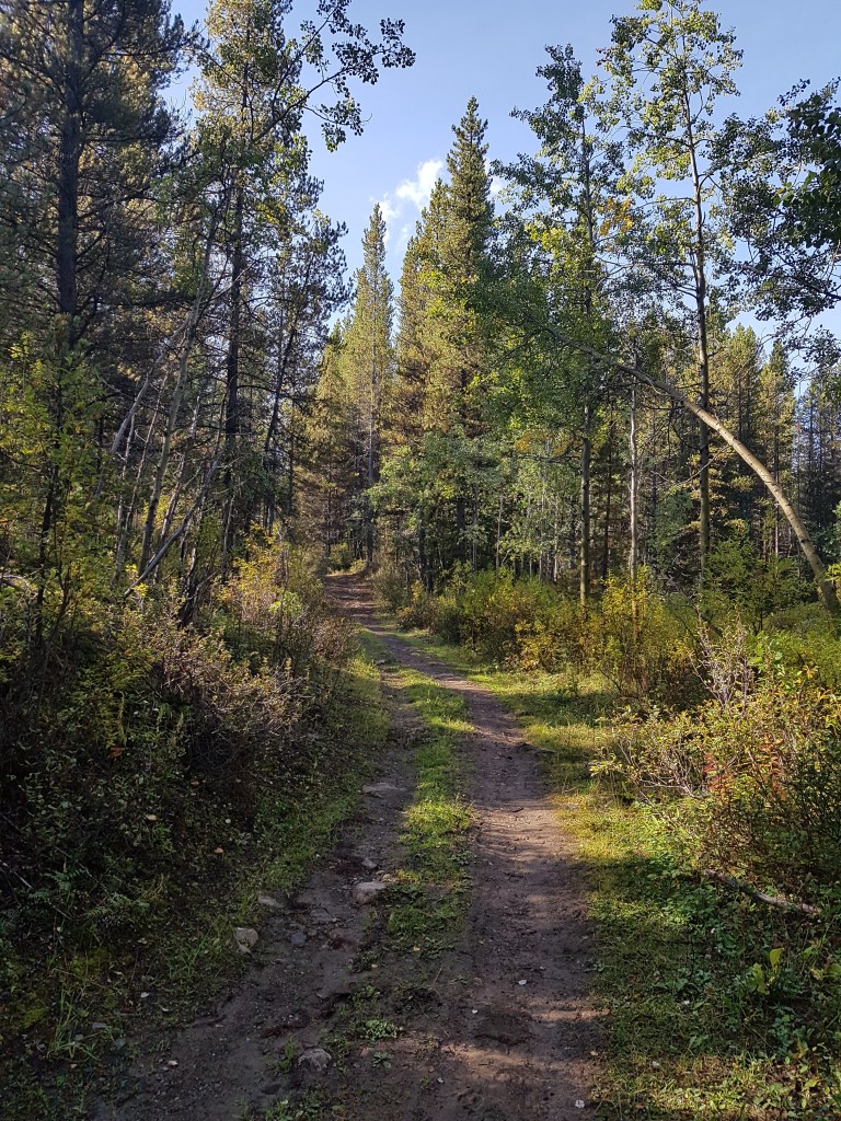
We biked for a total of 6 km from the trail head. The trail was muddy with pooling water from two days of rain, which meant it was pretty slow going. It was on the bike section that we got a glimpse of our objective. Take the time to enjoy these sights as they are few and far between.

This is the view for most of the hike. Trees, trees, and more trees. Thankfully I have a very interesting hiking partner and we never seem to run out of things to talk about. If you are having marital problems, I highly recommend this hike to work things out.
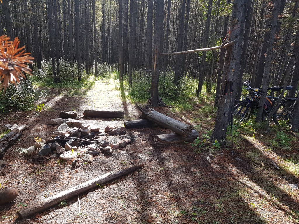
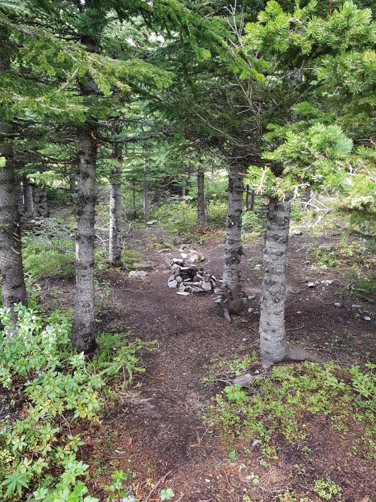
At the 6 KM mark (according to Strava, but 5 KM according to my map), we decided to park the bikes. This spot is easy to find. It’s a large open clearing, with the hiking trail continuing to the right, while another (probably equestrian) trail leads straight ahead. We found a camp area, and locked up the bikes. Be careful – lots of broken glass.
From this open area, take the trail on the right. It is marked with stones and painted arrows. The trail is now noticeably narrower (single track), and is also the start of the sustained elevation gain. The trail was very wet and muddy, so we were glad to be on foot. I am not a mountain biker, but for those who are, you can stay on your bike until you reach the top of the treed elevation gain. Before you is the view right before you descend down to the scree. Stash your bike here.
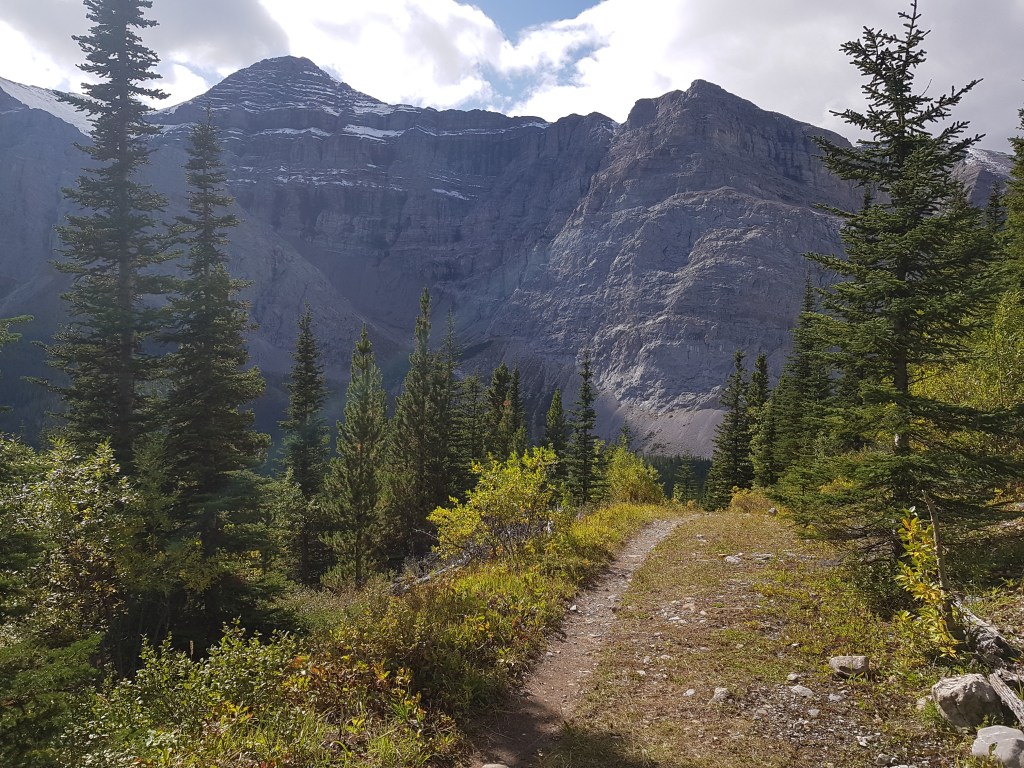
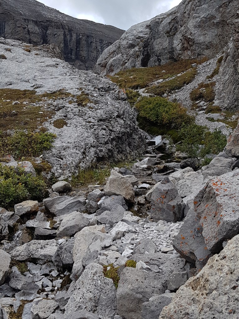
From here, it is a quality scree trail over to the waterfall. Highly enjoyable.
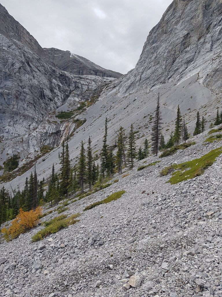
You can see the scree trail heading off towards the waterfall. Specifically, to the bottom of the first pitch of the waterfall. This is where the chains start.
The waterfall itself is gorgeous. If you’ve run out of water at this point, you can consider refilling your bottle here.
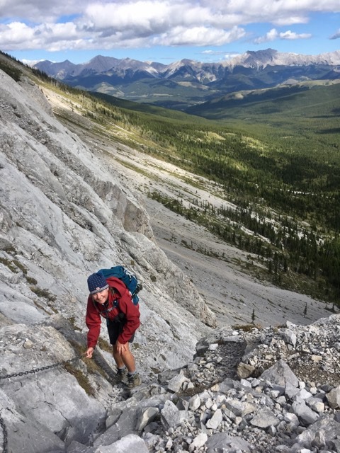
NOW the fun really begins. If you’re backpacking, going up and down the headwall can be tricky. This trail is getting quite popular, so the once sticky limestone rock is now getting worn smooth in several spots. My hiking boots are ready for retirement, so I really felt the slippery spots.
The chains begin to the right of waterfall. Look up until you see the end dangling down. I recommend one person at a time, but you do you.
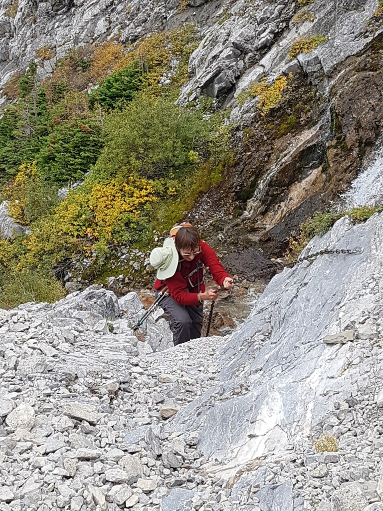
From here, you traverse to the right some more until you pick up the next chain. This section has several chains bolted in. This is where I noticed the rock was being worn smooth.
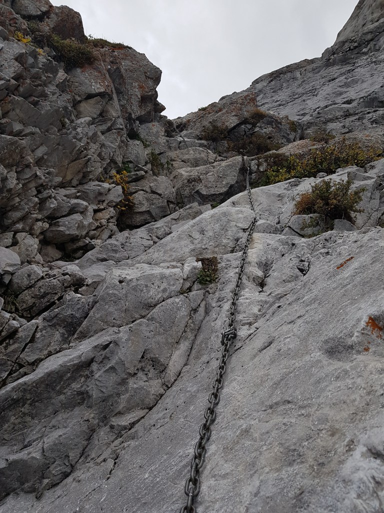

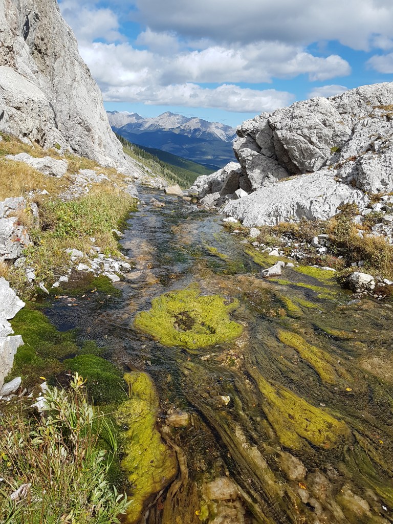
At the top of the final chain section. In the background of this photo is the scree trail leading back into the trees. Highway 40 is way back there, before the wall of mountains start.
The trails winds up to the right of the lake outflow.
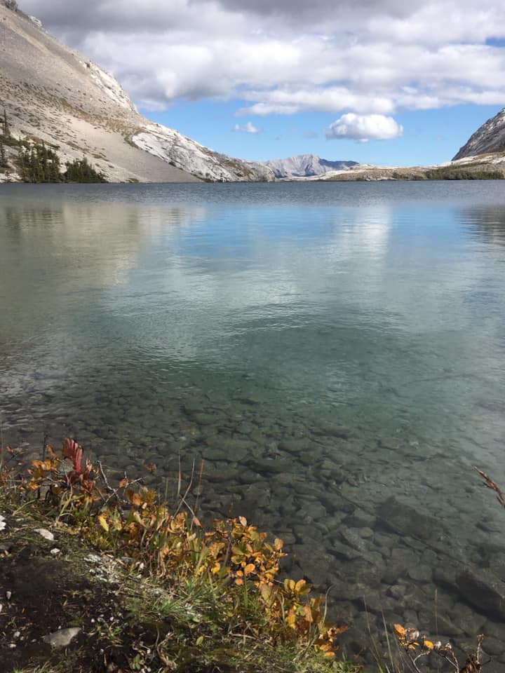
Follow the trail to the right of the lake. This will take you to the back of the lake where the wind blessedly eases off.

Carnarvon Lake is small but most spectacular. We were not seeing it at it’s best condition with low light from the clouds and a brisk fall wind whipping up the lake. Some people have described Carnarvon Lake as the most gorgeous lake in Kananaskis. While I think it IS beautiful, I also suspect Carnarvon Lake of having the best publicist in the business, and is using this claim to lure hikers out for the long slog in.
As mentioned before, this is outside the park boundary so random camping is allowed. Please try and use existing sites, and do as little damage as possible. This truly is a pristine location and the only ones messing it up is US! Also remember that this is prime bear country, and with all the people pulling fresh fish out of the lake, it’s to your advantage to keep a clean campsite. Eat and store your food well away from your tent (and everyone else’s tent too).
Annette and I spent some time at the lake, dreaming about what we would do next time we came. We chatted with the three fishermen – two from Scotland! – before heading home.
On the way back to the waterfall, we took some time to admire the outflow a bit more. So beautiful in early fall, I can imagine this place being drop-dead gorgeous in full summer.
The trail back to the bikes was muddier than ever with the sun warming up the ground. Again, thankful that we hiked this bit, but more advanced bikers than us managed the trail up to here.
After we picked up our bikes, it was a very fast descent back to the creek and river crossings.

I was so muddy from the bike and hike, that I decided to leave my hiking boots on for the creek and river crossings in an attempt to get them clean. The water did help a bit, and the wet feet were quite refreshing for the final KMs back to the car.

TRIP TOTALS
Return KMs – 24.2 km (according to Strava)
Elevation gain – 566 m (1,868′)
Total Time – 6 hrs 58 m

I love all things mountains! I live next door to the Canadian Rocky Mountains, however I travel the world to enjoy the many different mountain environments and cultures that I can. I hope you enjoy these trip reports, and that it inspires you to accomplish your own adventure goals.

Leave a comment