August 21, 2019
This is Day Three of our Three Day backpack on the Skyline Trail. To read about the first two days, click Day One or click Day Two.
We awoke early on the morning of August 21 to bright sunshine. I was eager to be done with the trip, as all the real fun stuff was behind us. My family was packed and ready to go, but the third teenager was not getting out of bed. My daughters finally applied a little “peer pressure” to get her moving.
As before, the loo was a three person Triplet. However, this one had a lovely view of Mount Tekarra.

The View from the Loo! Mt. Tekerra in the morning light.
By this time, everyone was looking a bit ragged. One of my daughters was sporting the worst hair ever. It took her over an hour to brush it out when we got back into civilization.

This was my daughter’s hair on the morning of Day 3. What a mess! Now her sister – her sister uses braids….
Everyone was packed and ready to go at 9:15. The first thing we did was cross the unnamed creek that we enjoyed the night before. After the creek crossing, we began a gentle climb up the side of Signal Mountain to gain our elevation for the day.
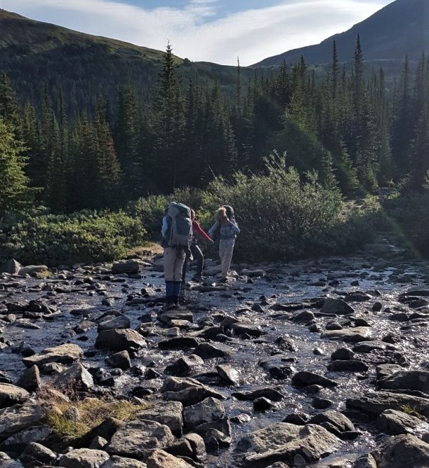
All three teenagers making their way across the creek to start the day.
On the morning of the third day without rain, the trail was finally drying out. Mud patches were still visible, but they were almost dry. I am hoping the rest of the trail has been able to dry out as well. Once we get above the creek, we have one final look back at the Skyline Trail. It truly was a spectacular sight and so worth the effort.

Looking back at Amber Mountain, and our descent route to the valley below. The Tekarra Campground is directly below us.
Today’s hike would take us up and over three little humps on our way to Signal Campground. While Signal Campground (2,014 m) is lower than Tekarra Campground (2,062 m), we had to hike up, across, and then down to reach it. Total elevation gain for today was 185 m (610′).
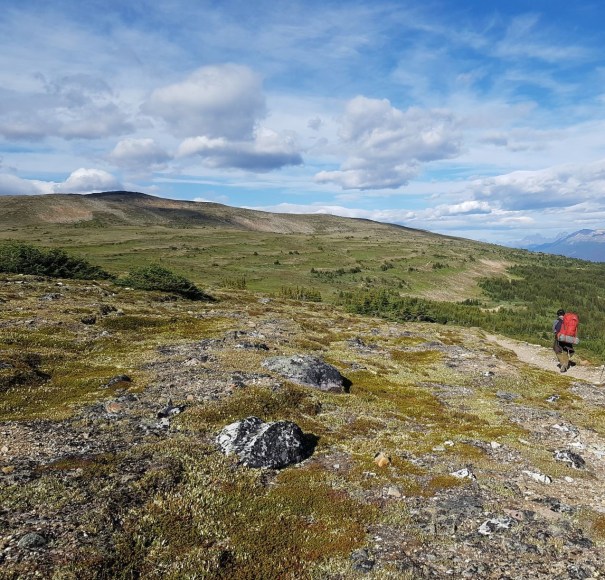
A completely different landscape on the shoulder of Signal Mountain.
This part of the trail was very enjoyable with – again – completely different scenery and landscape than the days before. Once we got above tree line, it felt very barren, yet the wildflowers were amazing. With all the rain, the flowers have lasted way longer and were putting on a great show.
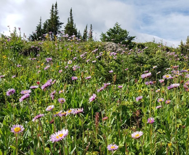
The wildflowers were blooming way later than normal, thanks to all the rain.
We also had a great view of Grisette Mountain, which is across the valley from the Maligne Lake road. Again, we are incredibly close to Jasper, and just getting closer. We can’t see the Yellowhead #16 highway from up here, but you can see this ridge while driving!
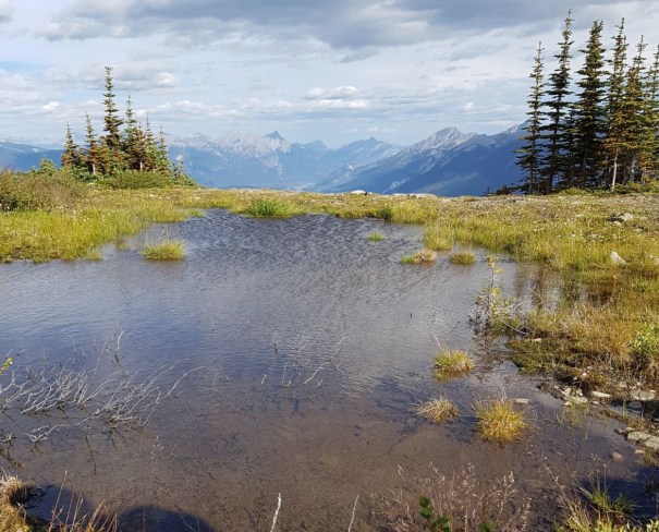
Grisette Mountain is to our right. This view points east down the #16 Highway valley.
We are spending the day on the lower slopes of Signal Mountain. The summit of Signal is to our left, and looms above us as we hike along.

Signal Mountain is quite a ways above us. It kinda looked like we could hike over to gain the summit ridge, but there was no discernible trail from the Skyline trail.

Entrance to reach Signal Campground. It was an extra 1 KM return to go see it. I decided that was waaayyy too far and skipped it.
We arrived at Signal Campground at 11:10, after about two hours of hiking at a slow pace. The official distance is 4.8 KM, but again Strava logged me further, closer to 6 KM. I was going to walk into the campground to check it out, but it was 500 m to reach it. This would have meant an extra one whole kilometre with the return trip! So, I skipped it. I imagine it’s the same as all the others.

No bikes? They mean no bikes beyond this point heading TOWARDS the Skyline Trail. Forget about a car shuttle, I would have paid very good money to have someone shuttle some mountain bikes up to the Signal Campground for me. It would have made the next 8.5 KM so much faster and enjoyable. We did see one mountain biker coming up the trail, and the two Parks employees we saw the day before had left their bikes at Signal campground for their return journey.
After Signal Campground, the trail is now an old fire road. The positive is we can now walk side by side, which makes chatting a lot easier. The down side is that it’s an old fire road. In order to prevent Mike and I from bolting ahead again, we positioned ourselves in the middle of the pack. As a result, this was my view for the rest of the trip.

A great view of Mike’s new backpack. It was only 30 years since he bought his last backpack, so I guess he was due.
We finally arrived back at the Signal trail head at 1:40 pm. Total elevation loss from the high point on today’s trail was about 990 m (3,267′).
We only had one car at Signal trail head, so we stashed our packs in the parking lot. The three guys drove to Maligne Lake to pick up the other two cars, while the rest of us walked down to Maligne Canyon. In my opinion, there is nothing better than walking into a major tourist area after multiple days on the trail, smelling to high heaven, and wearing sweat stained clothing. The line to buy snacks at the Canyon gift shop magically disappeared.
I really wanted to see Maligne Canyon, so I was very happy to spend some time here. It’s a cute little stroll down a paved path with several bridges. There is an option to do a longer hike if you’re keen.

One of the many amazing views of Maligne Canyon.
Thank you for coming along on my traverse of the Jasper Skyline Trail. I hope this inspires you to try an adventure of your own. Perhaps even this one! If you missed the previous two days of this trek, click Here for Day One, and Here for Day Two.
If you have done this trek, please leave a comment that might help other people who are planning to do it. If you have any questions, please also leave a comment so others can learn from the feedback.
Happy Trails!
Daily Totals – Tracked on Strava
Distance – 14.9 km. (Hiking guide says 13.2 km)
Elevation – Gain 185 m (610′), Loss 990 m (3,267′)
Total Time – 4 hrs 20 min (Moving time 3 hrs 37 min)

Started the day at the base of Mount Tekarra, and hiked past the summit of Signal Mountain. The descent was basically following the spine of Signal Mountain to the Signal trail head next to Maligne Canyon.

The elevation profile shows what an easy time we had on Day 3. The elevation loss from the campground was gradual enough that I did not need to wear my knee braces.
I love all things mountains! I live next door to the Canadian Rocky Mountains, however I travel the world to enjoy the many different mountain environments and cultures that I can. I hope you enjoy these trip reports, and that it inspires you to accomplish your own adventure goals.

Looks like an amazing hike! Beautiful photos!! Great post!
Thanks very much! We were very lucky with the weather. Maybe I’ll see you on the trails on day.