March 12, 2021
We always celebrate my husband’s birthday with some sort of ski adventure. This year, it was Crowfoot Mountain. Our Westphalia campervan had just come back from a year in the shop getting a completely new mechanical overhaul, so we decided to take it skiing for its maiden voyage.
While the mechanical is now top notch, there were still a lot of other issues to sort out, like the lack of heating in the back of the van. I absolutely froze trying to sleep, and I could tell how close to dawn it was when the temperature dipped even lower. When we finally dragged ourselves out into the chilly air, Mike’s coffee set up didn’t work properly. Under-slept, decaffeinated, and hungry after a very light breakfast, we started out across Bow Lake. Despite the rocky start, we nabbed the summit and actually had a pretty fun day.
Gear
In the winter, this is a ski touring trip, with full avalanche gear and training.
Overview
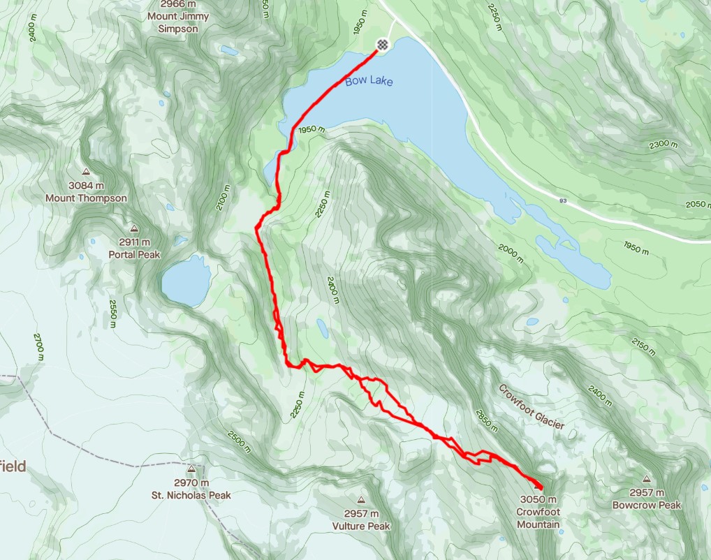
From the Bow Lake parking lot, ski across the lake to the canyon. At the top of the canyon and above the trees, instead of going straight ahead to Bow hut, turn left and head into the final set of trees, towards Crowfoot. Once out of the trees, you can plan your route up the undulating mounds. Summit ascent is either to the subpeak to the north of the summit, and then continuing along the ridge, or taking a long line below the summit. Return the way you came.
Parking and Trail Head
Park at the Bow Lake parking lot, which is the turnoff at Num-Ti-Jah Lodge. This is a fairly large parking lot with several outhouse buildings. Do not park on the highway pull out.
The trail head starts from the south end of the parking lot. This area gets enough use that the trail towards the lake should be in. If not, then enjoy your early season ski as you break trail towards to the lake.

Crossing Bow Lake can take forever, especially if there is a sharp wind.

Main Trail
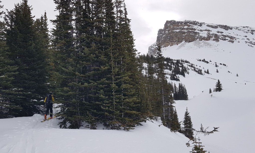
At the end of the lake, head over to the trees at the base of the initial climb.
This section of the trail is a lovely, curved path that gently starts the elevation gain. On the way out, it is a super fast luge track, so keep your eyes open for downhill skiers if you are coming in later in the day.
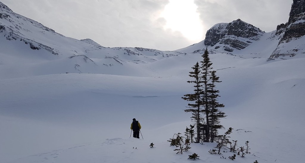
We skied out of the trees and into an open area. This used to be thick trees, but a massive avalanche did some major logging. It is growing back now, but be aware.
Skirt around to the right, and continue across until you reach the top of the moraine.
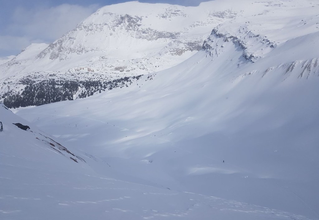
At the base of the moraine is the entrance to the canyon. This area is absolutely gorgeous.

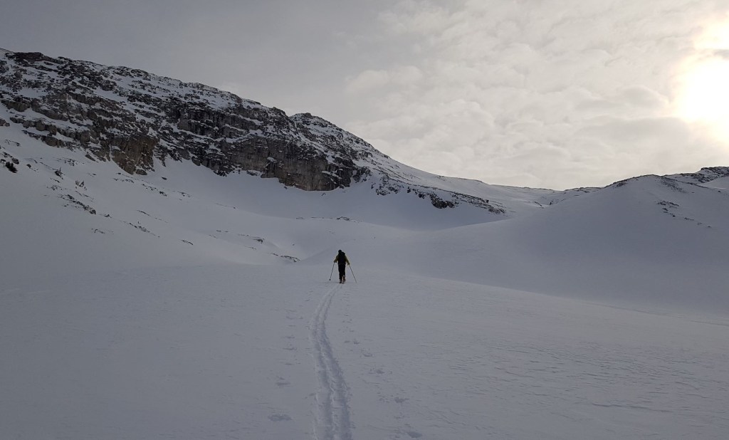
Head up the creek, and into the trees above the canyon.
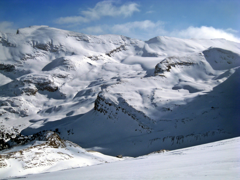
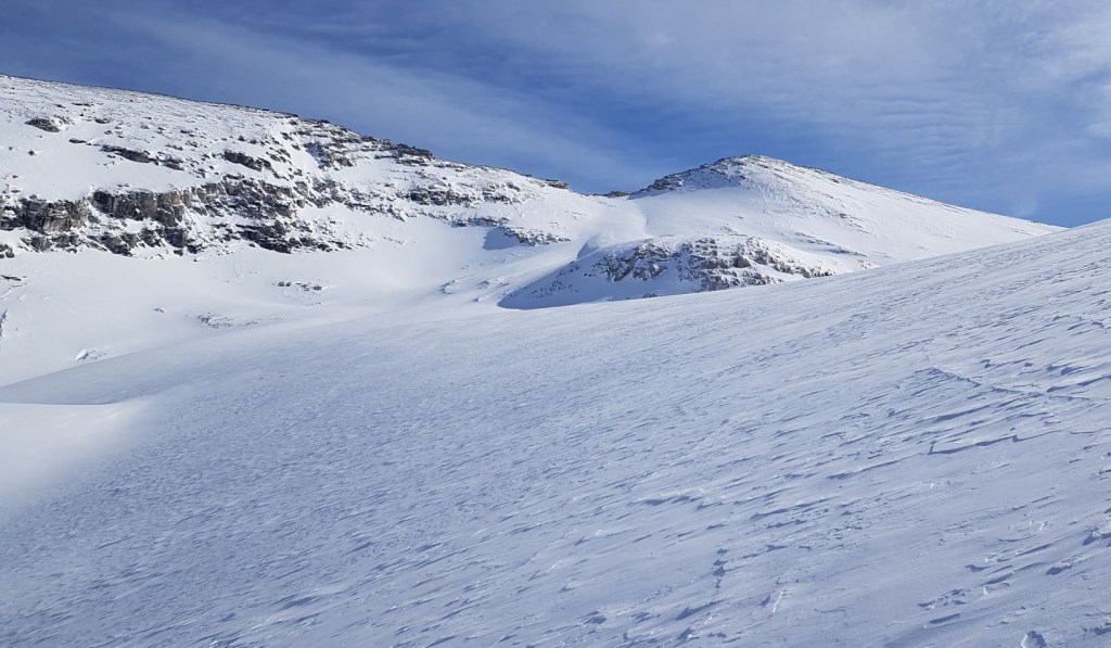
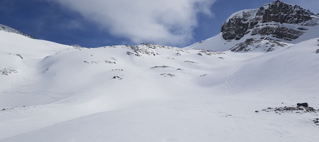
At the end of the treed section, a wide panorama opens up. Up to the left is the route to Crowfoot Mountain. Straight ahead is the impressive headwall of Vulture Peak, and directly across on the right is Bow Hut, sitting on a rocky shelf.
From the trees, turn left and make your way up. This section is actually pretty steep, but also short.
Once out of the trees, there is a partial view of Crowfoot Mountain. The true summit is beyond the subpeak on the left.

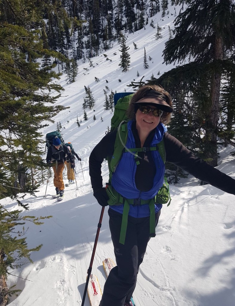
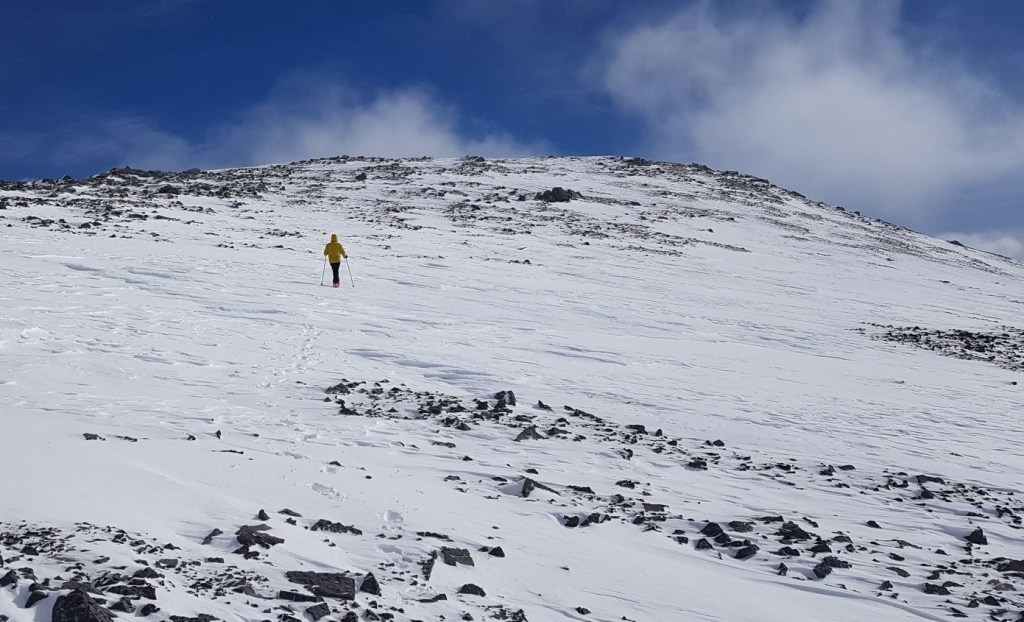
Depending on conditions and hazards, pick a route up the undulating mounds. On climbers right are several skin and ski tracks from people skiing laps. We stayed in the middle to give us options for the final ascent of the ridge to the summit.
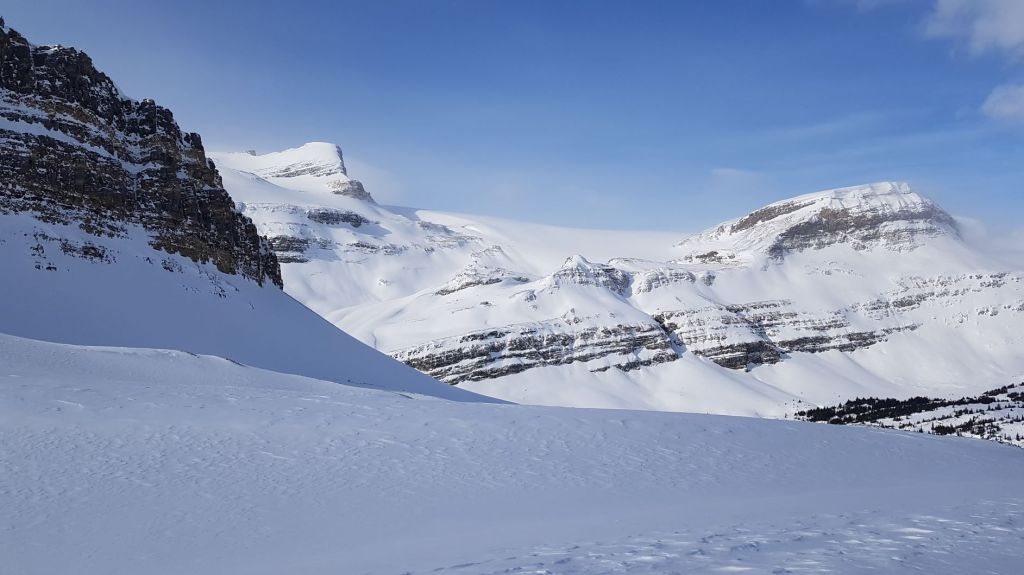
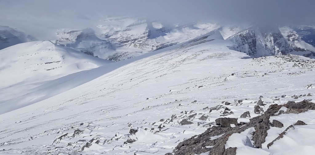
As we stood on a small mound just to the right of the subpeak, we got a great look at Mount Balfour, and the route to Balfour Col from the hut. It seemed like forever since I was there.
As the weather was warming up, Avalanche Canada was warning about collapsing cornices, so we decided to avoid the subpeak and more specifically, the walk along the ridge. We instead angled our way up the the final slope to the summit.
We eventually ran out of snow, and reluctantly left our skis behind. The final boot pack to the summit was actually pretty nice, with intense winds pushing us up.
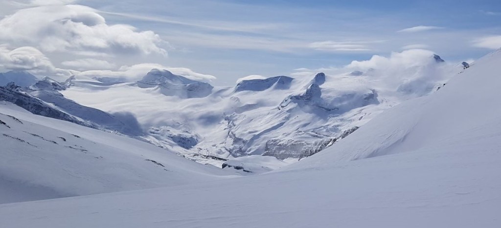
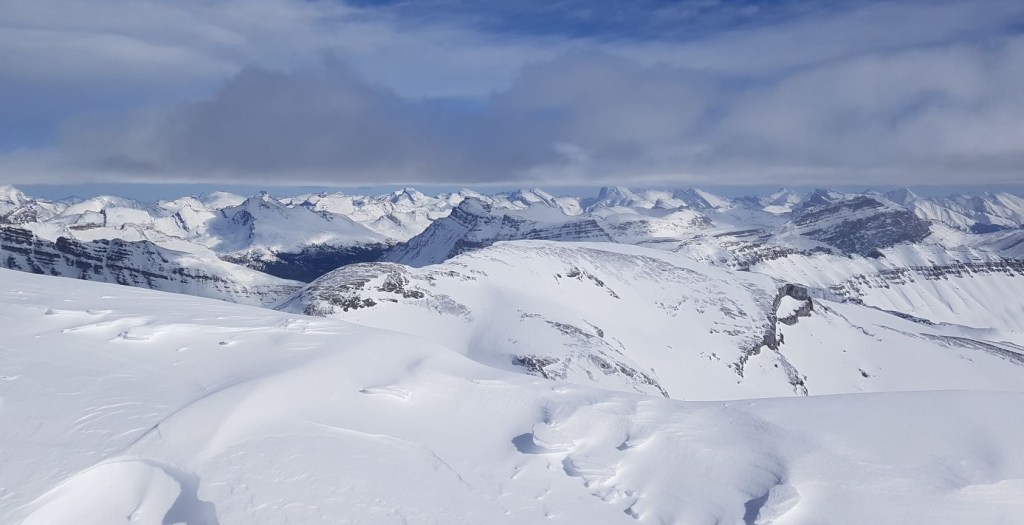
The views were good to the south, but getting obscured by clouds to the north.

Distance to summit was 10.4 km, and 1,103 m elevation. Time to summit was 5 hours and 30 minutes on no coffee and little food. Not my best outing, but I got it done.
Crowfoot Mountain Return
We walked back to our skis, and followed our skin track back. Unfortunately, the snow was thinner than we thought, and we both caught some rocks. Good thing Mike is pretty darn talented at ski base repair and waxing.
Once back in the main basin, we kept to the middle. However, next time I might choose to go skiers left and try that line instead.
Near the bottom of the basin just above the trees, we went to the right of the creek drainage, and then skied down through the narrow trees. Next time, I would go left of the drainage, and then ski across to the top of the canyon.
Once we were above the canyon, it was a straight shot back down, up and over the moraine, and back across Bow Lake.
If you found this post useful, please do me a huge favour and click the Star button to “Like” it. You can also follow my blog, follow me on Instagram, or join my FaceBook page Al’s Adventurers.
Alisen
Totals – Tracked on Strava
Date: March 12, 2021
Group: Two (Alisen and Mike)
Distance: 20.7 km
Elevation: 1,103 m (3,640′)
Time: 8 hours (includes lunch & breaks) Elapsed time is 5 hrs 50 min.

I love all things mountains! I live next door to the Canadian Rocky Mountains, however I travel the world to enjoy the many different mountain environments and cultures that I can. I hope you enjoy these trip reports, and that it inspires you to accomplish your own adventure goals.

Wow! That’s amazing. I would hate to be that cold when starting out😅
Yeah, it was a bit of a shock. All in the name of fun, right? LOL!
😄
What a trek! I love all the details you gave. You seem to really know the route to Crowfoot, but my guess is you’ve been there often!
Thank you Doug. I’m glad you enjoyed the virtual tour. While I have been to that general area lots, I have never been up Crowfoot before. That comes from putting in 20+ years of mountain time 🙂
The reason it’s so detailed is because other people use trip reports to plan their own outings. We all learn from each other.
Thanks for visiting, and I hope you have an adventurous day – however that may look for you!
Very nice trail description Alisen.
The photo where you look to the east, with all the high peaks is really nice! I love to see all those peaks covered with snow!
Yes, those are some fantastic peaks. I’ve skied and hiked in that area quite a bit. You have great taste, my friend 🙂
Ah, nice to know you have skied and hiked in that area. I guess you have it in your blog and I will search for it through your older posts.
I haven’t blogged about those peaks too much. Backcountry skiing is a bit touchy. My exploring was prior to blogging, so I need to go back and redo some routes. So much to do and see 🙂
Great report of the trail up Crowfoot. It’s such a beautiful area, we’ve hardly been there this year. We’ve never seen an avalanche in that spot after the lake, but I’m always leary of it. We have seen a few slides in the narrow gulleys beyond the canyon. Gorgeous picutres. Maggie
Hi Maggie,
Thanks again for the photo. It was absolutely perfect for a whole view of the route.
I know! I’ve not spent much time there either. Did Crowfoot Glades and Crystal Ridge, but not too much on the Wapta.
Yes, I’ve seen slides in the gully, but I also skied a massive slide below the headwall going up to Bow hut (triggered by the overhead environment). The entire basin was debris. I now move just a little bit faster through that area…
Alisen
Oh ya, I’m always nervous before the headwall below the hut.
You must have found some good touring around Golden though.
There’s a lot here too, but it’s harder to find since the locals don’t share a lot of the access routes. We’re figuring it out. 🙂
Is a lot of it snowmobile access? We have a place in Windermere, but to backcountry ski there requires a sled. Not willing to commit to that.
A lot of it is by snowmobile, which I won’t do either. There are a few we can reach from the resort, or from the base of the resort but it took us most of the winter to find the safe access.
That’s such fascinating place to visit 😊.
Thank you. It’s a pretty special place. There is a small glacier there, but the main glacier is across the way. One day I’ll do a Wapta Ice Sheet post.
Incredible outing.
Happy birthday to your husband. What a wonderful way to celebrate a birthday. How brave to sleep in your campervan overnight without any heating in the back of the van! But looks like it was all worth it because this looks like such a lovely area to go cross-country skiing. I’m impressed at your ability to navigate through all the snow without getting lost.
Thanks! I will pass that along to Mike.
Well, had I KNOWN the heating wasn’t working, I might not have been so keen to go 🙂
Normally, we would be at a remote hut for his birthday, but with covid, it’s almost impossible to book an entire hut with just immediate family. Too expensive. So, this was a good consolation prize. Next year! Right? Please tell me next year will be better 😦
I sure hope so, but considering where we’re at now in terms of variant cases and the vaccine roll-out, I’m not so optimistic. Ugh.
Stunning photos!
Thanks! The scenery does the hard work 😉
So much snow still!
Oh, we are not even CLOSE to being done. I hiked yesterday in knee-deep snow. I’ll be lucky to have dry trails sometime in late June / early July. THAT’S why I ski 🙂
Woah!
Wow! The scenery is breathtaking! I’m glad you had a great time! 🙂
Thanks Cherie – it was a great time. It’s nice when you put a mountain on your list and it gets ticked off so quickly. That is NOT always the case 🙂
I totally agree. Sometimes we don’t get to tick off as many things on the bucket list as we’d like. I’m so glad you got that opportunity and I wish you many, many more! 😀
Beautiful treck, Stunning Pictures!
Thankyou so much. I was looking at your GR4-GR400 hiking photos. Oh my goodness! So spectacular. What scenery. So lucky to live so close to that.
That’s amazing hello
Thank you!