Numerous Times
I have a few ‘go to’ mountains for solo hikes, and Yates is one of them. More commonly known as Barrier Fire Lookout, this mountain is never empty. It doesn’t matter what early hour I start, there is always someone coming back down. The trail is pretty wide in most parts, which means it can handle the extra traffic. There is one narrow steep part, but luckily there is a lookout point below this for anyone who doesn’t want to tackle it.
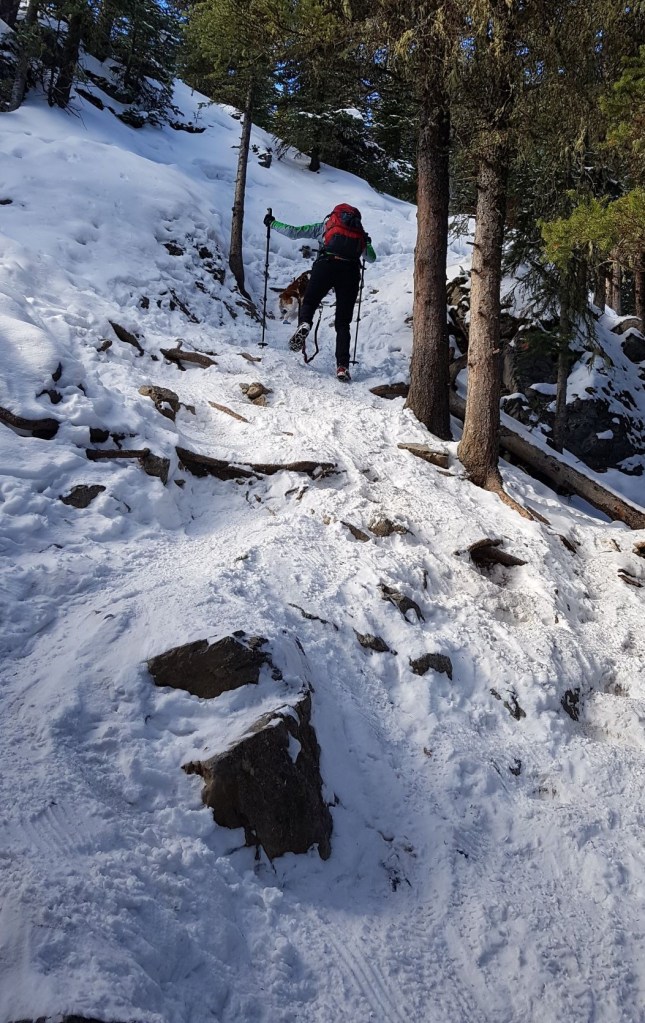
Barrier is also a popular winter destination. The trail is almost 100% in the trees, and does not cross any avalanche paths. I have to admit that this is one of the few trails that actually benefits from a layer of snow, especially the narrow bit at the top. Fat bikers also use this trail in the winter, so please be aware of these cyclists huffing and puffing up the trail behind you. Even though the trail is wide, please move over and let the cyclists pass. It’s incredibly difficult for them to stop and start up again.
Barrier can be done as a There and Back, or it can be done as a Loop via Jewel Pass.
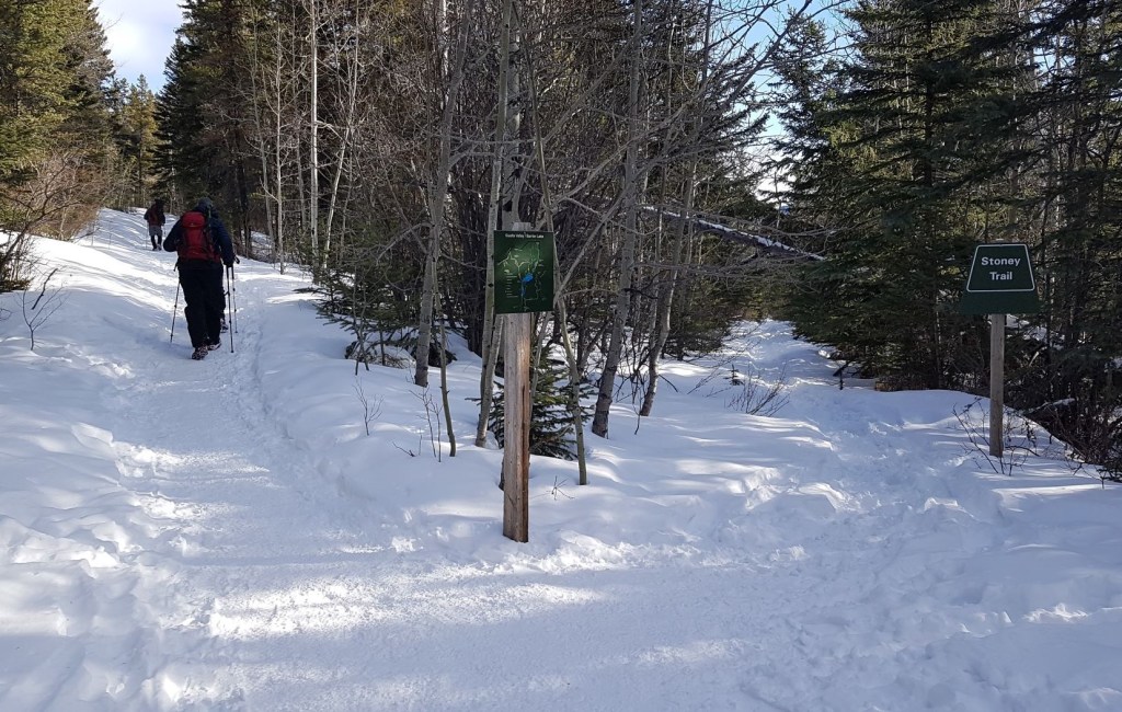
To make this as confusing as possible, the mountain is called Yates. The hike is known as Barrier Fire Lookout. The trail up is called Prairie View (not to be confused with Prairie Mountain off Highway 66). The return loop from the lookout is called Jewell Pass Trail, and the haul back along the lake is called Stoney Trail. Whew!
Gear
Summer is hiking boots, poles and regular day pack kit. Winter is all that plus microspikes, gators and warm layered clothes.
Overview
From the Barrier Lake parking lot, head across the dam to the far side. The trail head is to the right of the lake. Go straight up at the two close intersections. Once on the main trail, hike up until you reach the rocky outcrop with the view over Barrier Lake. From there, either return the way you came, hike up to the summit (return the way you came), or continue the loop via Jewell Pass.
Parking and Trail Head
As this area gains in intense popularity, the parking lot seems to get smaller and smaller. With the limited parking, vehicles are lined up all down the road. Please keep an eye on kids and dogs. In the winter, the actual parking lot is closed, so there is only parking on the loop.
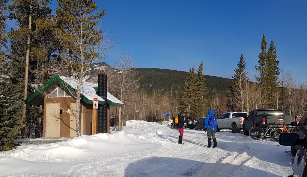
From the parking lot, skirt around the right side of the lake, heading uphill towards Yates Mountain.


Main Trail
At the first intersection, continue straight uphill. The major trail coming in on your left is Stoney Trail, the return route from Jewell Pass. Note that Stoney Trail splits – a lower route follows the lake, while an upper route cuts across higher, and eventually goes all the way to Highway 1.


Continue up the hill to the T intersection with the higher Stoney Trail. Turn right, and then immediately turn left to stay on the Barrier Lookout Trail.

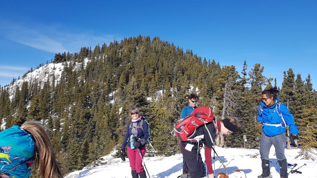
With big groups, this is a common sight. One person stops off to the side to strip, but then everyone else just stops in the middle of the trail. It’s pretty poor etiquette. Luckily, no one else came up the trail just then, but do try and do better than us.
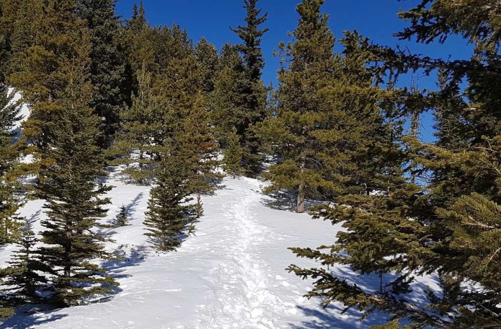
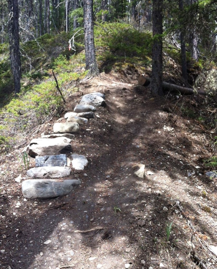
From here, it is a straight shot to the top. The trail is a pretty gradual uphill, with a few well placed switchbacks to lower the elevation grade.

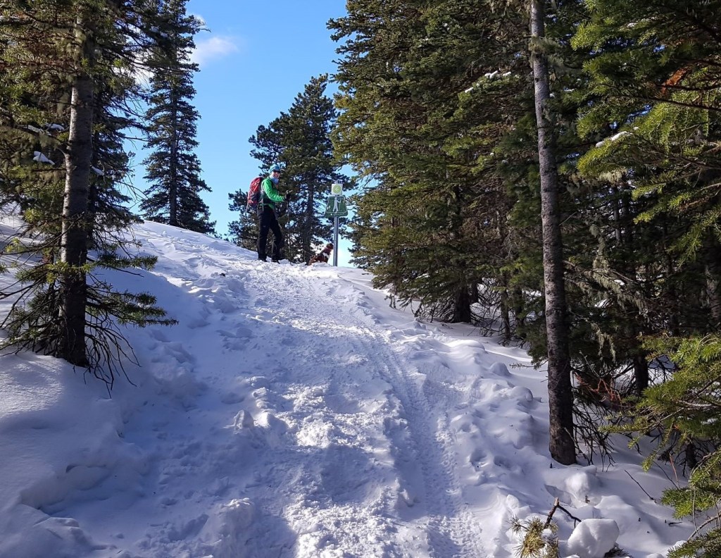
First Lookout
The first lookout is ideal for anyone who doesn’t like the look of the steep and narrow bit that comes next. You get pretty much the exact same view from here as you do from the main lookout above. I had two guests from Quebec and Mexico with us. They were troopers and went the whole way, but if you’re new to hiking, then this is a great place to turn around.
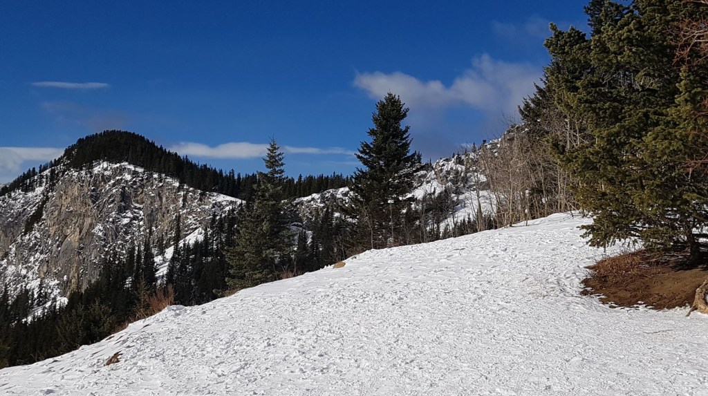
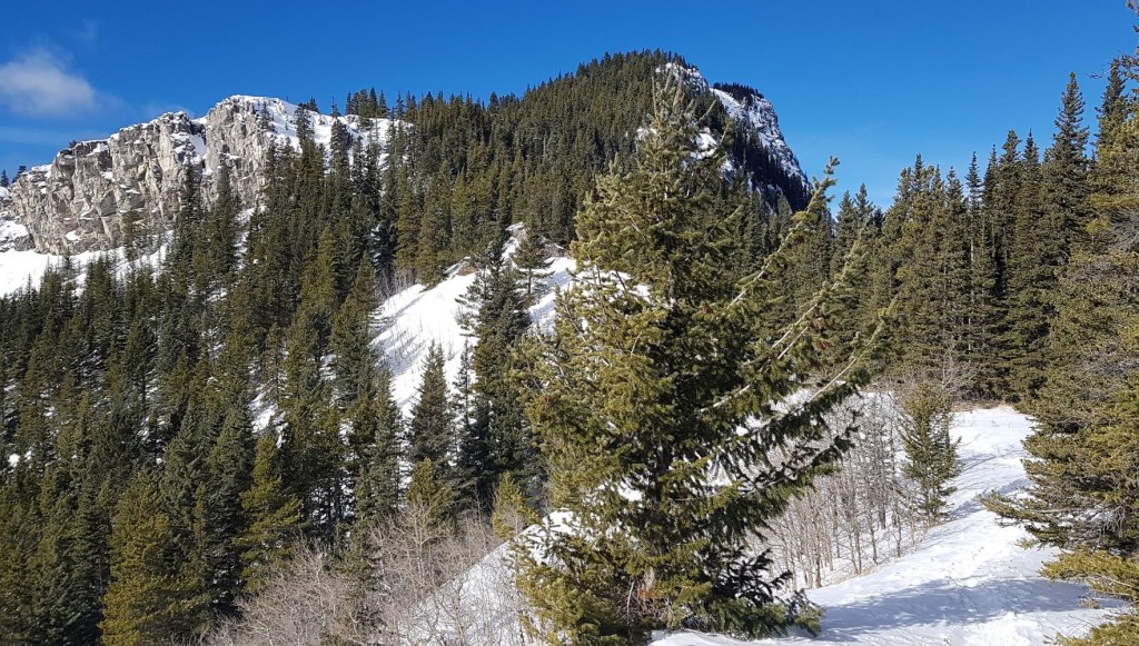
From the first lookout, continue up the trail. There is a bit of a walk near the ridge, which affords some relief from the trees and a nice view of the Yates sheer cliffs.

Right before the main lookout is a rather steep, but short section. When I said this was one of the few trails improved by snow, THIS is where I mean. In the summer, this section can be hard-packed and very slippery. I’ve seen more than my fair share of people just barely getting down without wiping out. The snow softened the angle, and the micro-spikes gave great traction up and down.
Just when you think it won’t end, the trail turns the corner and guess what? You’re done! See? Steep, but short.
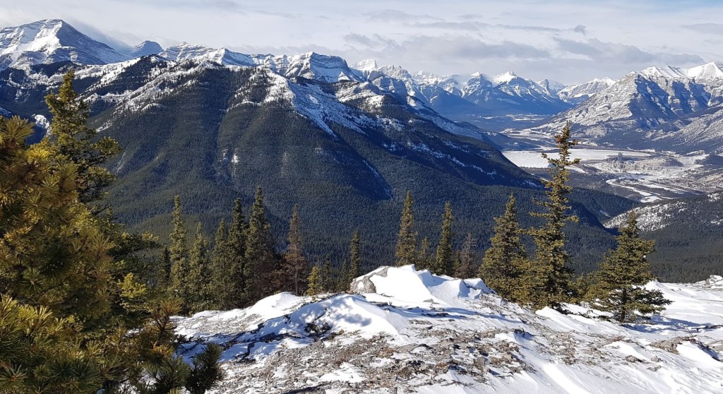
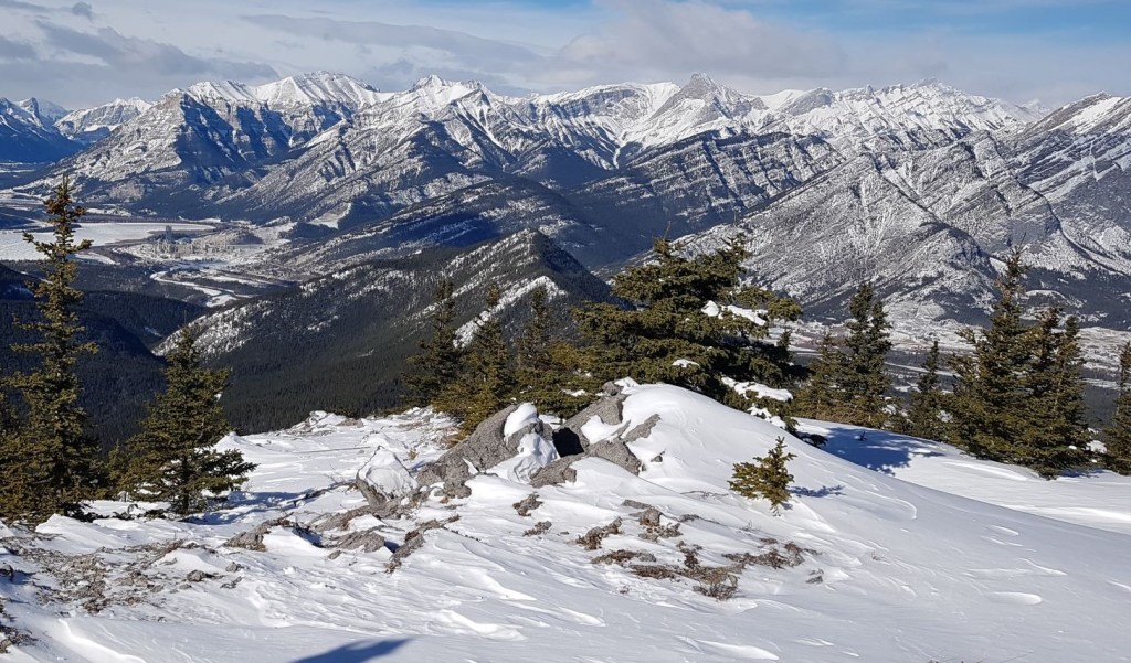
Main Barrier Lookout
This is the main lookout on the Barrier / Yates Mountain trail. There is an abundance of giant, flat rocks on which to spread out and eat your lunch.
Funny story. My very first hike was with my friend Cindy to this very lookout. When we turned to head up to the summit, we found some dude stark naked on one of the higher rocks sun bathing. We decided to switch course and go down Jewell Pass instead.

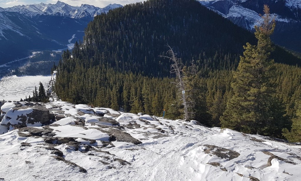
Barrier Fire Lookout Summit
You might be wondering, just where is the actual fire lookout? To access, turn towards the mountain, and find a trail that is heading up.

This is also a section of the trail that benefits from some snow. This trail can be steep and slick. On one of my solo summer trips, I was asked to escort down a woman who was having a hard time with the steepness.
In the winter though, there is a troubling trend whereby people sit down and slide through the steep parts. Please do NOT do this. It absolutely ruins the trail for anyone else coming up or down after you. When hiking down in steep snow, here are two tips:
- dig in with your heels, so your toes are pointing to the sky. This will give you maximum traction, and will create a little ledge for your foot to remain relatively flat.
- if the trail is slick or icy, then walk in the deep snow on the edge of the trail. Deep snow slows you down, and reduces the steepness of the angle. Again, dig in with your heels.


The advantage of nabbing the summit of Yates is the view from the Barrier Fire Lookout. This gives you an unprecedented view off the other side to see the full extent of Bow Valley.
Distance to the summit is 6.7 km. Elevation gain is 557 m. Time to summit was 2 hours.

Yates Mountain Return
To descend off the summit, return the way you came. The other side is a sheer cliff for mountain climbers.
Once back at the main lookout, you can return on the Prairie View Trail. Or, you can continue down the other side of Yates via Jewell Pass.
Jewell Pass
I’ve done Jewell pass twice, and to be quite honest, I did not really enjoy it. The beginning is a fun descent, followed by a lovely little romp past the waterfall. After that, it is just a long slow slog back to the parking lot. Skirting around the base of the lake is particular soul-sucking. I know lots of people who enjoy this route and like a long flat section. I’ve been accused of being a horse racing back to the barn, so the long slow slog back is not fun for me. But you might love it!
From the main lookout (not the summit), continue west, and head down the other side of Yates on the Jewell Pass trail. There are some markers to guide the way.

The trail is steep in parts, but some effort has been made to make it easier. Distance From the lookout to Jewell Pass is just under 2 km, with an elevation loss of about 750′.
At Jewell Pass, turn left and keep heading downhill. There is a big yellow sign to prevent people accidentally going down Quaite Valley and ending up on Highway #1 instead of back at the parking lot.


The highlight of the trail is Jewell Falls. Depending on the time of year, this can be spectacular, or almost dry. When I was first here, there was no bridge. Now, there is a pretty big one over the creek and falls.


After the falls, continue down to the lake. Turn left to take Stoney Trail back to the main Prairie View Trail. This will lead you back to the dam, and then to the parking lot.

The Barrier Fire Lookout / Yates Mountain is a relatively easy hike with amazing views. It has a few route options to suit just about every type of hiker. No wonder it is so popular.
If you found this post useful, please do me a huge favour and click the Star button to “Like” it. You can also follow my blog, follow me on Instagram, or join my FaceBook page Al’s Adventurers.
Alisen
Totals
Yates Summit and Return (tracked on Strava):
Date: February 28, 2021 (latest trip)
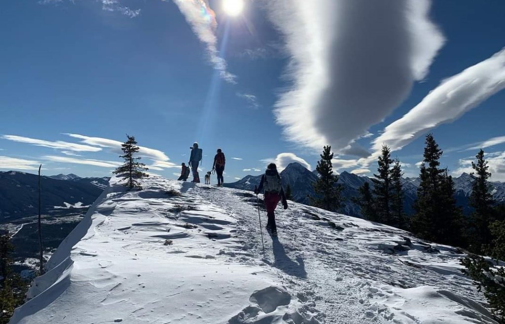
Group: Eight (Alisen, Mike, Mackenzie, Sonya and Ross, Rosalie, Mom, and Aura)
Distance: 13.31 km
Elevation: 557 m (1,899′)
Time: 4 hours 20 minutes (includes lunch & breaks)


Barrier Fire Lookout Summit and Jewell Pass Return Loop (tracked on Map my Hike):
Date: June 4, 2014
Group: Two (Alisen and Susan)
Distance: 16.5 km
Elevation: 625 m (2,062′)
Time: 5 hours (includes lunch & breaks)


I love all things mountains! I live next door to the Canadian Rocky Mountains, however I travel the world to enjoy the many different mountain environments and cultures that I can. I hope you enjoy these trip reports, and that it inspires you to accomplish your own adventure goals.

Once again, thank you Alisen for the great post!
Is really nice to follow your blog.
The Anklebiter Ridge looks really interesting and I will soon check your dedicated post about this ridge.
It’s a pleasure to follow YOUR adventures. I am not a climber, but admire you and your routes.
I agree … this is always a busy hike …
What would you suggest at the moment in the Banff/ Kananaskis area – given we are in avalanche season? I’m thinking of something that would take around 3 hours. Recently, we did Ribbon Falls to the point where the “avalanche risk” sign was (and people were very good at NOT treading on xcountry tracks). Also, Boom Lake, and we dd Chester Lake last year. We’ve also done the various creeks in the Canmore area. You highlighted Sulphur mountain so that might be worth a try … Open to suggestions!
There is a lot of options right now. Anywhere in the Chinook zone is good, like Highway 66. I just did White Buddha and the Prairie Creek connector. Prairie Mountain is also in shape.
The close spots on Highway 40 like Yates, Old Baldy, Wasootch, Porcupine, etc.
And anything east of Dead Man’s Flats is fairly clear of snow too, like Anklebiter and Loder Peak. So many good early season options right now. Nothing exciting, but lots to choose from.
Skiing is still good too. I climbed Crowfoot Mountain last Friday. Have to start early, but wow! What a day!
Great. Thanks so much. I’ll let you know what we do 🙂 You have such a fun outdoor life!!!
So do you!!! I’m skiing Louise tomorrow if you are going out. I’m there again on March 31st.
Like you, I love the great outdoors!
We’d really like to go to Lake Louise tomorrow. However, there are some things we need to tie up in Calgary so I’m not 100% sure it will be possible. The other week, I asked a ski friend with a red helmet if she was you. Obviously it wasn’t you!!! I can look out for you if we do manage to go. Anything that could help with the identification process? I have a white helmet, red jacket, and wear sunglasses rather than goggles.
LOL! Yes, we all do look alike 😁 I forgot that there was another red helmet on my team. I do have a name tag, and we are all at the base lodge between 830 and 930 am, either on the deck, or near the parking lots. Once we are on the hill, it’s hard to track people down. I DID hear you tried to find me one day. We all got a kick out of you saying you were a “fan” 😂😂😂
I can easily see why Yates Mountain is one of your go-to solo hikes. The area looks beautiful covered in a layer of snow. I never understood why people stop in the middle of a trail, especially when it’s busy. Move to the side, please and thanks!
I agree – which makes it doubly bad that this was MY group LOL! It’s been a while since I’ve had a big group with me. Usually I’m on top of it, but with no ski tours this winter I guess I’m out of practice. Next time 😂
Beautiful pictures.
Thank you!
You are very, very welcome.
What amazing views (especially for a relatively easy hike, with little avalanche danger!) I love following your adventures Alisen! 🙂
Hi! Thank you for the feedback – I do appreciate that. Yes, this is a very good beginner hike (it was my first hike close to 30 years ago!), and a good one all year long. If you try it, please let me know how it went.
Alisen
Beautiful scenery. And I love the short videos. The trails and lookouts seem crowded. I didn’t realize there were that many people out there.
Yes, well, this is a very popular spot. Generally, I avoid the crowds by 1) going to more remote places and 2) not going on a weekend.
This hike was different in that I not only went to a very popular spot, but it was a weekend. Also, I brought the crowd with me 🙂 The people in the video and photos are all my group. I am normally just in a small group of 2 to 4, but this was a bit of a special occasion.
As to crowded – well, there are worse places. Go to Sentinel Pass in Larch season (September) and you’ll see hundreds of people.
People are flocking to the mountains this year because they cannot travel. In Alberta, this is our form of entertainment. It’s a big trend right now.
I see! That all makes sense, especially due to the pandemic most have faced. It looks like you and your group really enjoyed it. Especially with those views!
The pandemic has driven thousands to the mountains. We ARE experiencing overcrowding in a lot of the spots closer to town, or the spots where you don’t have to hike that far to get to. I really try to avoid those, or go during the week. People are NOT being good about it either. The amount of trash, dog poop, broken trees, trashed trails is truly disheartening.
That’s a shame. The more we vaccinate the more people will not be so desperate to be free. Or at least we hope so. I’m guessing next year will be a lot better. Blessings and peace.
Great post, so in-depth, and the photos you posted are incredible.
Thanks for the feedback – I do appreciate it. I have people who follow the descriptions when they are out hiking, so I try and be accurate.
I love your site. I might do a guest spot where you highlight the best shoes for a trail run in the Rockies.
Sounds great. It’s a bit of a struggle at the minute- I only started a couple of months ago. I don’t really get much traffic at the moment
That will change. Keep producing good content, and then promote your site on other mediums. When I first started, I posted twice a week for a few months before I finally started to see the traffic increase.
Hopefully, I get more traffic from Bing and DuckDuckGo at the moment, even though the userbase is a pretty small.
This would be a great place explore. Like you said the weekends are always crowded. I always go to Alberta to see our family in Cochrane..and the mountains.
Then this would be a very close hike for you. I hope you get to visit your family soon and take some time to recharge in the mountains.
🥰
Wow I love the amazing view. You are an adventurous person. I love this
I like to think that we are all adventurous in our own ways. I absolutely LOVE the mountains, and I need them to ground myself. I hope that I can encourage others to be courageous and follow their passions and adventures, whatever those may be.
Thanks for your like of my post, ” Salvation In Christ . The Book Of John 1:15-18 . 26 A.D. ;” you are very kind.
Thank you for the very detailed description of this trail. I have always wanted to do it but as soon as I see the amount of cars parked by the road, we take a detour. Your description and photos made me now even more eager to do it. Last Sunday, this hike was our plan but the cars were parked like as if someone is giving/handing cash rewards, it was looooong! So we ended up in Rawson Lake, Upper Kananaskis instead! It’s also a very beautiful hike. The frozen lake is amazing!
But now I will probably have to tell my husband to leave home as early as 5am next time we plan it, in order to get a good parking spot.
Thanks again for your blog. I enjoyed reading it and it cannot be anymore detailed the way you did. Love the photos too!
Keep it up. I’ll be following you from now on because you give so much care in your writing to people like me who are not at all fitter than younger generations of hikers. I started hiking only 4 years ago and this year is my first doing winter hiking and I looooved it as much as Summer hiking. I’m a brain aneurysm survivor and hiking is the best fitting physically activity for me.
Thanks again.
Evelyn
Hello Evelyn,
Congratulation on thriving after a brain aneurysm! I am so happy to see you are out hiking and enjoying life.
The best thing about hiking is, it’s not a competition. Just don’t ever stop. Every little bit helps another little bit. Hiking is ideal physical activity because it uses the whole body (when you use poles), and it clears the mind. Do not ever worry about the younger / fitter people. Someone will always be more fit than you, and you will always be more fit than someone else.
Thank you SO much for the kind comments about my descriptions. I am so glad you liked the detail, AND that it is inspiring you to go.
I agree – start early and avoid the crowds. I think if you are there by 8:00-8:30 am, that should be good enough on a weekend. 9:00 or so on a weekday.
So nice to ‘meet’ you Evalyn, and I hope to see you out on the trail some day.
Enjoy!
Alisen
Rocky Mountains High
Hike…?
What a view…
Too true! And that is not even that high 🙂
Oh wow! That looks so incredibly amazing!
It is a lovely hike that is pretty easy to get to. The views really are stunning. Thanks for stopping by!
You are very welcome. Any discussion on hikes and with views like that, gets my attention quickly.
I see you are a fellow lover of mountains. There is something special about mountains that feeds my soul, and grounds me like nothing else. I am a real **** if I don’t have my mountain time.