June 18, 2021
I just bought at new pair of mountaineering boots, and I needed a short-ish hike to start breaking them in. Unlike hiking boots – which fit like slippers the first time out – mountaineering boots have a full shank that provides maximum stiffness. This is necessary when wearing crampons (not icers) on glaciers or ice climbing, but they are unforgiving!
When I was researching this hike, I discovered that part of the trail is on an old coal mine from the early 1900s. The mine was owned by the Pacific Coal Company, a subsidiary of the CPR. The coal was used for their train engines. The trail goes past several old mineshafts, and a cement building still stands. The trail head parking lot is Upper Bankhead, which used to be a town of about 1,000 people before the mine closed in 1922.
The official Banff National Park trail is 4.2 km (one way) to a view of the C Level Cirque. There is a side trail to a tiny tarn that is a beautiful blue colour. You may elect to go beyond the cirque viewpoint on an unofficial trail that is more or less straight up, but it provides a very nice view of Lake Minnewanka and area.
Gear
Hiking boots, poles, and day pack kit.
Overview
From the Upper Bankhead parking lot, hike up the trail until you reach the cirque. To continue past the official trail, hike on the right side of the cirque, over a boulder field, straight up through the trees, and then into another boulder clearing. Seek a look out from there, or continue up to the rock wall. Return the way you came.
Parking and Trail Head
Parking is at the Upper Bankhead Day Use Area. While it is a fairly big lot, I imagine it fills up quickly in the summer or weekends.
The trail head is at the far end of the parking lot. The trail starts as a wide, gravel path as access to the day use area picnic tables, but soon turns into a normal hiking path.


Main Trail
The first part of the trail is an uneventful uphill trudge. However, after a short one km or so, an old cement building from the Bankhead coal mine comes into view. It is so unexpected to see old buildings like this in the Rockies. I just love it!

After the building, there are several open shafts, which I am told were ventilation shafts. These are all fenced off, but by holding up my phone I could get some photos peering down. Bob Spirko says that the C Level refers to the level of the mine.


The hiking trail through here is black with coal.

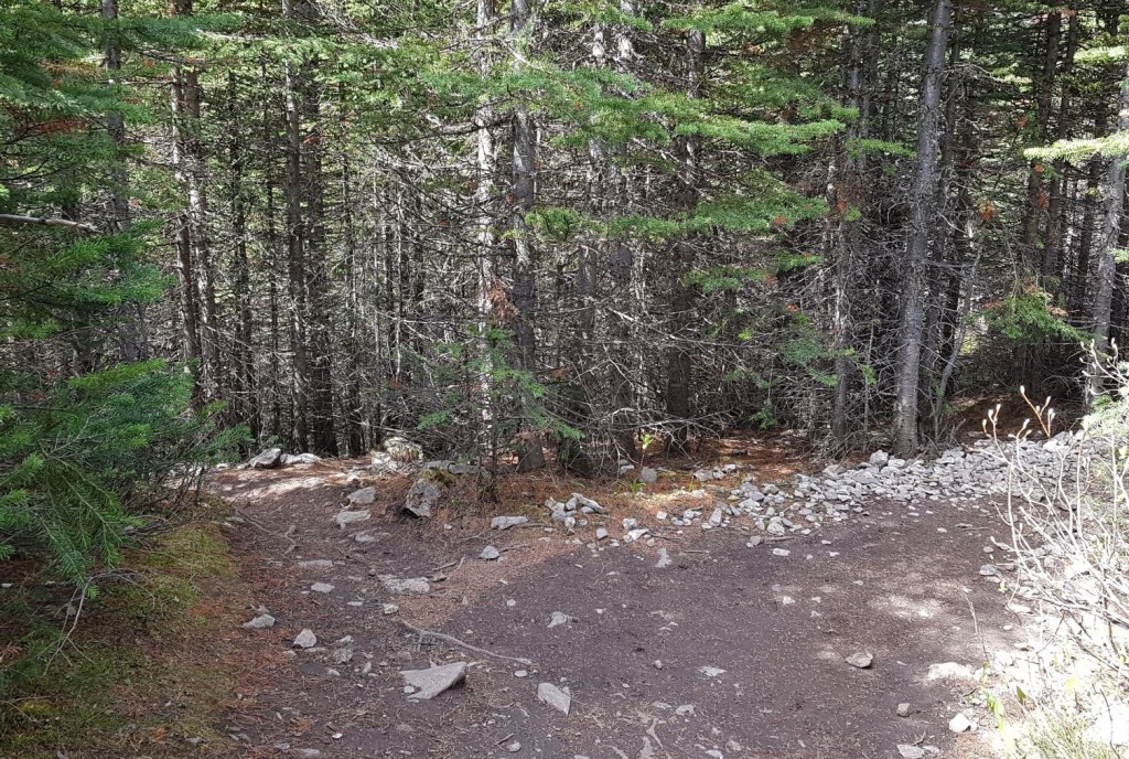
You know you are past the mine shafts when the trail turns from black coal to a dirt trail with gnarled roots. The trail is in the trees the whole time, which is nice for shade but means no views.

While there are no views, the trail is typical of Banff: it is nicely graded, a solid trail, and no trail braiding. The only view you get is right before the cirque, when the trees give up a glimpse of the side of the massive mountain that is Cascade.

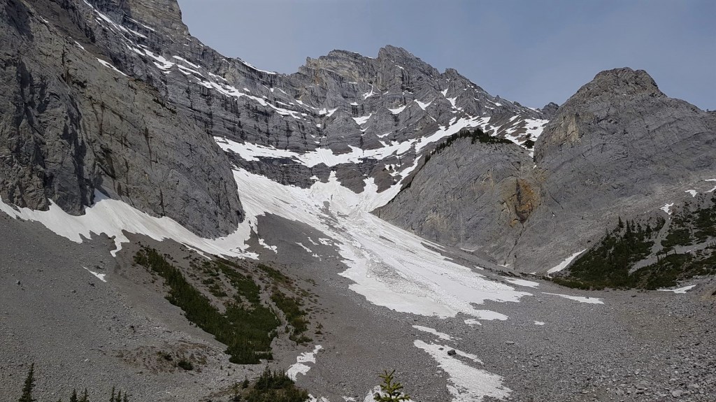
At the 4 km mark, there is a little rise of rocks. This is ideally placed to show off the impressive Cascade Mountain C Level Cirque. Avalanche debris filled the basin, and a small snow and rock avalanche came down just as I was leaving the high point of the trail.
Hiking time to this point was about 1 hour, with an elevation gain of 455 m over 4.2 km.
Keep your eye out for marmots and pikas living in the large boulders. I was lucky enough to see both as they were keeping a wary eye on the onslaught of hikers.
This is the end of the official C Level Cirque trail.
To continue to the Lake Minnewanka viewpoint, I took the unofficial trail. The trail grade and ease of use reflected this. This is also where I gained elevation in earnest. While it took me about an hour to hike the 4.2 km to the cirque, it took me another 45 minutes to go 1 more kilometer with 200 m elevation gain.
To access the viewpoint, I took the trail along the right side of the cirque.

At the end of the boulder field, the trail makes a right hand turn. I scrambled up some easy rock steps to another boulder field.
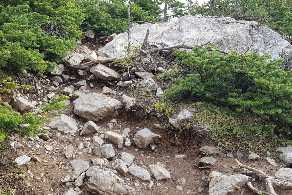
Once I crossed the boulder field, I re-entered the forest. Here, the trail was pretty much up, and then more up.

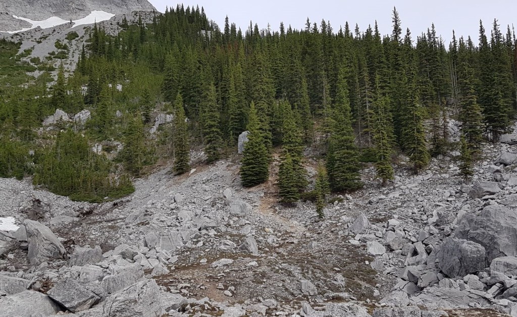
The forest section is surprisingly long, and feels like it’s straight up. While I had the hike up and summit area to myself, as I descended, I ran into several parties coming up through the trees. All were huffing pretty good and wanted to know how much further.
The trees end in another, smaller boulder field.


At the top of this boulder field, you can skirt around to find a lookout spot. Or continue up the ridge until you hit the rock wall.


From here, there is a great view of Lake Minnewanka and the surrounding valleys and peaks.
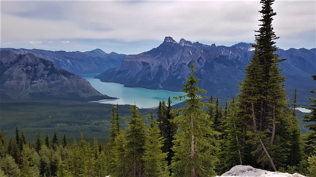
Distance to the Lake Minnewanka lookout is 5.3 km, with an elevation gain of 632 m. Time to summit was 1 hour and 45 minutes.
C Level Cirque Return
Return the way you came. The views coming down are just as spectacular as the lookout. Enjoy, because the trees will again block out the view.
On the way down, I got a great view of the cute little tarn that is just beside the rock pile.

I chose to visit the little tarn on my way back down. I thought I might eat my lunch here, but there wasn’t a shore and the trees were really tight, so I just headed back to my car.


After I got back to my car, I drove to Two Jack lake to soak my aching feet in the cool water. I might have to get these new boots blown out at the toe box…
C Level Cirque is a great little hike. If you have young kids, just going the 1 km to visit the old mine site is a grand adventure. If you don’t care about eyeballing Lake Minnewanka, then the official trail to the cirque is a respectable 8 km on an excellent trail. The full trek to the end is just over 10 km, and provides some additional route finding and exploration for the adventurous.
If you found this post useful, please do me a huge favour and click the Star button to “Like” it. You can also follow my blog, follow me on Instagram, or join my FaceBook page Al’s Adventurers.
Alisen
Totals – Tracked on Strava
Date: June 18, 2021
Group: Solo (Alisen)
Distance: 10.78 km
Elevation: 632 m (2,085′)
Time: 3 hours 36 minutes (includes viewing mine shafts and tarn)


I love all things mountains! I live next door to the Canadian Rocky Mountains, however I travel the world to enjoy the many different mountain environments and cultures that I can. I hope you enjoy these trip reports, and that it inspires you to accomplish your own adventure goals.

This is fabulously helpful! We did this hike about 10 years ago but, on our couple of attempts since then, have never been able to reach the point where you see the lake. I think on both occasions there was too much snow higher up and we couldn’t figure out the trail. I will save this article and take it with me when we next decide to hike it. Thanks for including so much detail!
Hey Anne!
So glad it was helpful. I can imagine it would be a pain with a lot of snow. The trail was rather faint, even in the summer. I can send you my gpx tracks if you want to try in the winter again.
Take care!
Al
Alisen, thanks! We did it last Friday. Fantastic views and photos. Your information was really helpful. I appreciate all you do here ❤️
Wow! You do NOT mess around 🙂 I’m glad you went, and got yourself the view. Were you able to find the bits of the old mine and townsite at the base? I didn’t know about that until after I got home.
Yes, we saw the bits of the old mine. However, we were mainly focused on getting to the top – and back – as it was such a hot day 🙂 We canoed on lake Minnewanka the next day and had fun looking up at C level cirque!
That’s fantastic. Minnewanka is lovely when it’s calm. So glad you got to canoe it. ❤❤❤
If you have a photo of C Level from the canoe, let me know! I will add it to the trip report!
Hi. Is there one mountain you’ve climbed/hiked that you like better than all the others?
What a lovely question. Thank you.
Absolutely. I rate mountains by how many times I’m willing to climb them. I’ve summited Mount Yamnuska more than any other, so yes, this is definitely my top favourite. It’s also the mountain where I go to have a think, a good cry, or just be ridiculously, deliriously happy. When I really like someone, and I want them to have a roaring good time in the mountains, this is the first place I take them.
Hi. You and that mountain have a strong bond that has endured. My wife and I have a similar feeling about Cape Cod. We love being there. We’ve vacationed there for over twenty years.
That’s so lovely. I’ve heard a lot about Cape Cod, and it must be a very special place. It’s interesting how some places imprint on us. Thank you for sharing.
Looks like a very rugged and beautiful place! Thanks for sharing.
Thank you for visiting. The Rockies are definitely rugged. That’s their special beauty for me. I visit other mountains, but the jagged peaks of my beloved Rockies stirs my soul.
I understand! Blessings.
Buying a new pair of boots sounds like a great excuse to embark on a “short” hike to start breaking them in. I’ve been to Banff three times but haven’t hiked this trail yet. It looks interesting and I love how you can see remnants from the old mining days on the trail. The view of Lake Minnewanka looks stunning!! I bet it felt great to dip your feet into the cold water afterwards. Best of luck breaking in those boots.
Thanks so much! These darn boots are the death of me. As mountaineering boots, they have a full metal shank, so the boot doesn’t bend … at all. Plus the toe box is narrow, with a reinforced toe so I can wear crampons. I bought the best boot I could that would fit my feet, but they are no hiking boot, that’s for sure. Slowly, my feet will adapt.
Oh my goodness, that cirque and view of Lake Minnewanka are beautiful!
So beautiful! Thank you.
My pleasure 🙂
Awesome post! I love the history! And I cannot imagine being around so much snow.
Ah, yes. Snow. I LOVE it! Finding snow on a hot summer day is the holy grail. Not enough snow to be of any danger, yet more than enough to use to cool off. I put some in my hat and let it melt out while hiking. Hmmmm…. divine 🙂
You’re tremendously blessed to have been around snow in the summer! I barely see snow in winter out in my neck of the woods.
Yes, I was getting that No Snow vibe from you 🙂 It’s okay. Winter and snow is not for everyone. However, if you do happen to live in a place with snow for 6 months of the year, I highly recommend that you find a snow sport you love. Makes you look forward to the winter.
Gahh that sounds awesome!!
The earth is just a different place in the snow. I love camping in the snow.