July 19, 2017, June 21, 2021
2017 was a devastating year for forest fires in my neighbouring province of British Columbia. There was over thirteen hundred fires, more than 1.2 million hectares burned, and a state of emergency was declared.
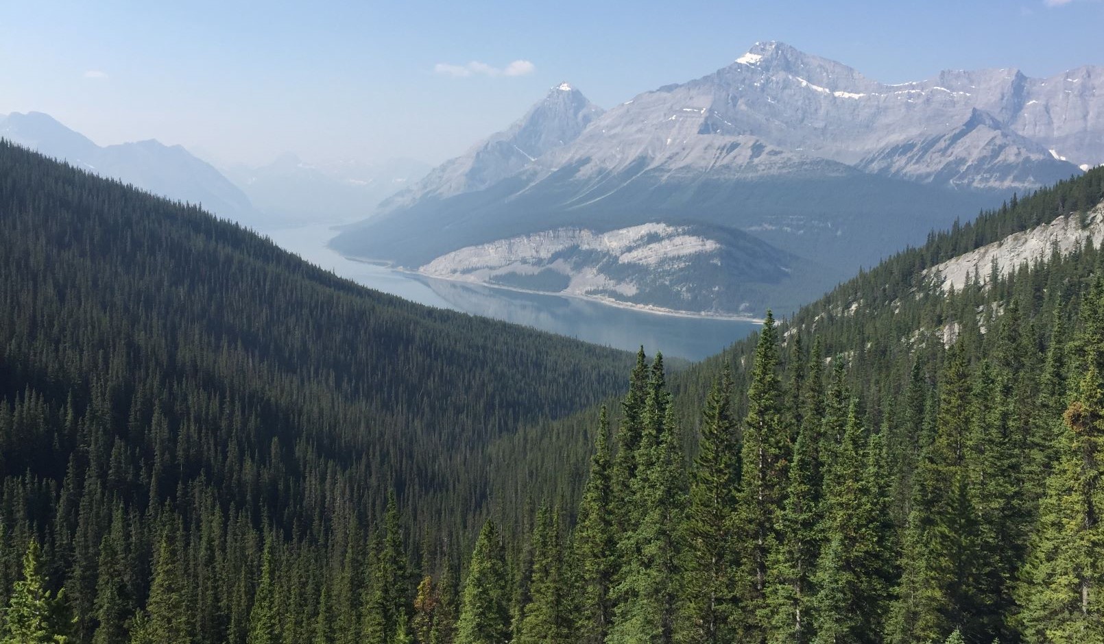
As the prevailing winds are from the west, Alberta was engulfed in smoke for most of the hiking season. I remember being very happy heading up Windtower this day, because there was an inversion – the smoke cleared the higher we went.
When I returned in June of 2021, the sky was clear of smoke, but there were major changes to the trail. What had been a very straightforward hike to the pass, was now a bit of a braided mess. Since the sharp rise in the popularity of hiking, this trail is seeing a lot more usage.
Gear
Hiking boots, poles, and your regular day pack kit.
Overview
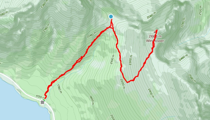
From the Smith Dorian highway, hike up the only trail. Shortly after starting, turn right at the Y junction to stay heading uphill. Keep the ravine on your immediate right, avoiding the trail that leads you up to Rimwall on your left. At the pass, there are several look out spots. From here, the option is to summit Windtower. Return the way you came.
Parking and Trail Head
There is no parking lot or facilities at the trail head. We choose to stop at one of the Day Use Areas along the way to use the pit toilets before getting to the trail head. There is a small pullout on the east side of the highway, but the better spot is the nice wide pull out directly across the highway from trail head. On a dry day, expect your car to be completely encrusted in dust by the time you get back.
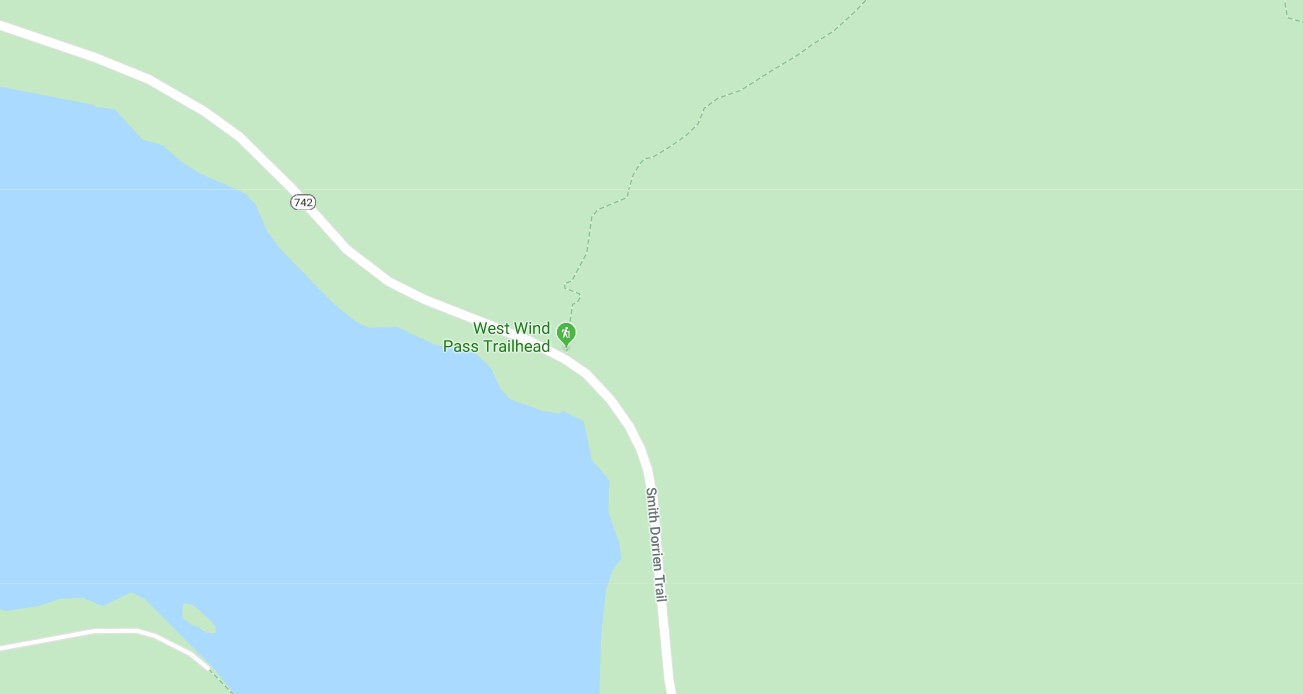
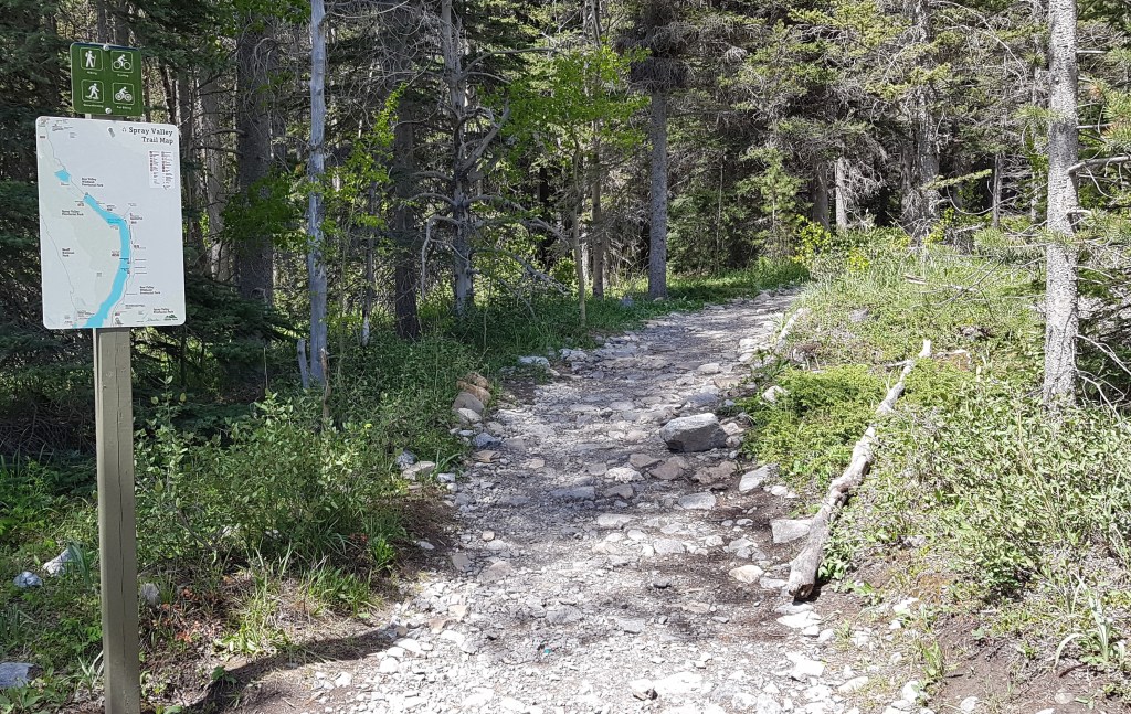
The trail head is the obvious trail in the roadside rubble, marked by the big yellow sign.

The trail starts next to the stream, and begins to climb almost immediately.
After 200 m, take the right fork at the Y junction to stay on the West Wind Pass trail.
Main Trail
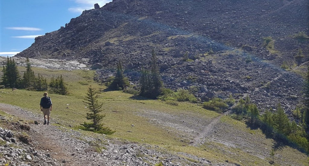
Once on the main trail, it is 2.5 km from the trail head to the Pass, with nary a view unless you turn around and look back at the lake. My seasoned mountain goat teenage daughters were not impressed with this trail.
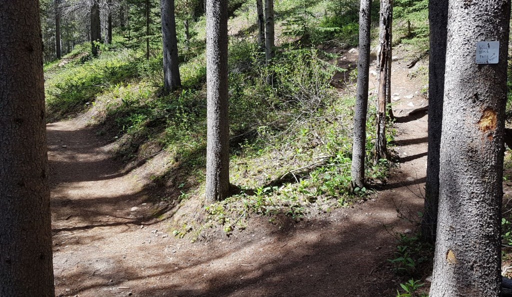
With so much recent usage, the trail is now braided. The first braid to avoid is a weird Y junction. The left trail, which is blocked by a log across the trail, feels like the correct one. This has sucked in two of my friends, both very experienced hikers, so don’t feel bad if you accidentally take it. This is an alternate route to The Rimwall. Instead, turn right and head downhill, which feels so wrong, but is indeed the correct route. Look for the bit of flagging on the right.


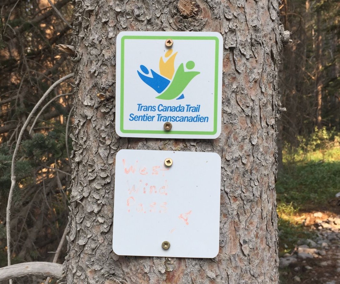
There are a few other places with trail braiding. To stay on the correct trail, look for obvious signs of trail blockage, like rocks or logs, or keep an eye out for flagging in the trees.
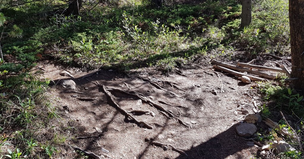
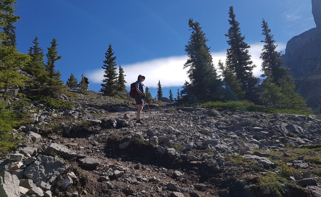
There is one section that even gave me trouble, and that’s the smooth rocks. Just keep going straight across, avoiding the urge to go above or below them. A word to the new hiker. This is a scary spot for some. Experienced hikers will cross with ease, but someone new to hiking can be easily freaked out here. While the rocks are grippy, the view is straight down into the gaping ravine below. On my way down, I came across a woman who had been left behind by her group. She was in tears after crossing this section by herself.

The photos don’t do this view justice. In 2017 there was a layer of smoke from the BC forest fires, but the air cleared the higher we got.
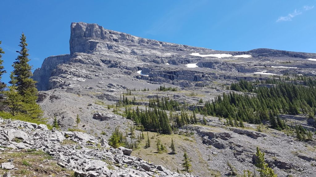
As we approached the pass, there are several trails heading off to our right towards the base of Windtower mountain. Choose the biggest trail. It is 3 km from the turn-off to the summit of Wind Tower. If you go all the way to the Pass lookout, you must then backtrack to the turn-off. This of course adds a couple hundred meters.


Distance to West Wind Pass is 2.5 km. Elevation gain is 370 m. Time to pass was 1 hour, 10 minutes.
WindTower Summit
If you want to keep going and summit Windtower, then click the link above.
West Wind Pass Return
Return the way you came. Be aware that you need to pay just as close attention to the blocked off trails on the way down as you do on the way up. We could hear several parties above and below us as we made our way down.
Once back at the car, we drove north towards Canmore, and stopped at the boat dock day use area. We took advantage of the cool water to soak our feet and clean off some of the sweat, salt and dust from the trail.
If you found this post useful, please do me a huge favour and click the Star button to “Like” it. You can also follow my blog, follow me on Instagram, or join my FaceBook page Al’s Adventurers.
Alisen
Totals – Tracked on Gaia (Strava display)
Date: 2017, 2021
Group: Three (Alisen and daughters) & Seven (hiking group)
Distance: 5.4 km
Elevation: 400 m (1,320′)
Time: 2.5 hours (includes lunch & breaks)

I love all things mountains! I live next door to the Canadian Rocky Mountains, however I travel the world to enjoy the many different mountain environments and cultures that I can. I hope you enjoy these trip reports, and that it inspires you to accomplish your own adventure goals.

Awesome! I’m jealous. I’ve always wanted to go to British Columbia.
Yes, BC is pretty. Unfortunately, this is in Alberta 😂😂😂
I’d hike and camp both!
I’m so scared that we’re headed for another summer of horrible fires and my heart breaks for all the destruction that happened last year. I’m glad you were able to see this again without smoke… it looks really beautiful!
We have been lucky with clear skies so far. Now we can hope for rain. Hope you can visit it soon.
What a wonderful hike! I almost feel like I was there too.
Beautifully described, Alisen
Stay wealthy healthy safe and happy
Thank you – same to you!
Awesome! I really enjoyed West Wind Pass last year!
Hey Tia!!!
Yes, it’s a good one. Did you go up Windtower? Such an accessible summit, especially for that area.
Your backpack trip to Grey Owl’s cabin looks amazing. Comments are closed otherwise I’d put this there. I love how adventurous your aunties are. Lucky you! Enjoy your summer!
I remember that time in 2017… We have a lot of fires here and a group of South African fire fighters flew over to help if I remember correctly. Like you said you can’t see for days.
I found the braiding you described very interesting. We have paths that need upkeep after the fires too.
I feel surprised and sad that someone would be left behind or separated from a group, so important to look out for the stragglers.
Awww, that is so cool that SA fire fighters came to our rescue. Thank you! I think the kinship between fire fighters is pretty strong, and the people who go out to fight these blazes are pretty special. I imagine our fire seasons, like everything else, are opposite times of the year.
I have no time for people who don’t keep their groups together. It’s mean, and uncalled for. My friend Annette once got annoyed at me for always waiting while she took photos. Then she went on a group hike and was left behind by the leader. Now she likes it when I wait 🙂
😁 Yes our fire fighting surely is at opposite times…
I am glad your friend appreciates you now 👌
This looks like another fantastic hike with such great views. I’m terrible with navigation and would probably get lost on this trail with all the different junctions and wrong ways to go! The section with the smooth rock slabs definitely looks a bit sketchy. But if you have proper hiking boots (and it’s not raining), this shouldn’t be an issue. The key is to just not look down!! I feel so sorry for the woman who you passed who was in tears after crossing that section by herself after she was ditched by her group!
I agree – don’t look down! Most people don’t know this about me, but I have a real fear of heights. Sometimes it ruins a good day out, but I work on it constantly.
I agree – I have NO time for people who don’t keep their groups together. It’s mean and unnecessary.
I actually have a real fear of heights too. I tend to overthink things and usually have to give myself a bit of a pep talk to make it through sections that are steep or close to the edge of a cliff or ravine. It’s good to get out of my comfort zone every once in awhile, but it’s definitely something that I’m working on as well!
Good for you!!! I call it self inflicted exposure therapy 🙂 It does help. We were recently building a deck on a second story. After three days of walking around with no railings paid off. My next day scrambling, I was able to move through rock bands way easier. Every bit helps so keep doing it!!!
This is awesome👏👏