September 15, 2021
This is Day Three of a five day trip to Tonquin Valley with the Rocky Mountain Section of the Alpine Club of Canada. Click the links to read about Day One – Hiking In, and Day Two – Mt. Clitheroe Summit.
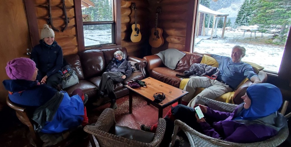
I woke to a very cold and snowy day. Looking out my cabin door, I could tell we were the first ones up. Time to start the wood stove in the main lodge, put on the coffee, and hope the water pipes were not frozen. Gilbert left us lots of water in giant jugs, so we wouldn’t go without, but running water is always nice.
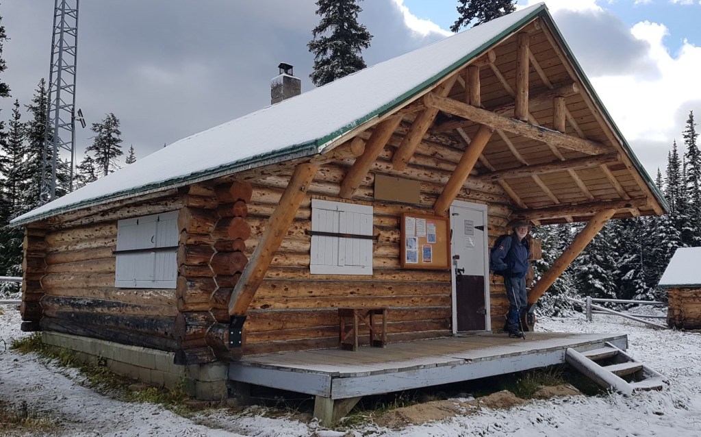
After a lengthy debate about the day’s plan, we decided to just go for it. We bundled up and finally left at 9:25 am for the Alpine Club of Canada Wates-Gibson Hut. I’m on a mission to visit all of the ACC huts, and this one is hard to get. Better nab it while I was close. Our Trip Leader Ivan called the National Office to see if we could get the code and go inside, but were denied. It’s a shame too, because someone left one of the windows open and we could have closed it up tight. Just saying…
Apart from visiting the hut, we also saw the Warden’s Cabin, and two of the campgrounds in the area. We also talked with several backpackers. They were in good spirits considering the rain and snow, and being soaked themselves. We make ’em hardy up here in Canada.
Gear
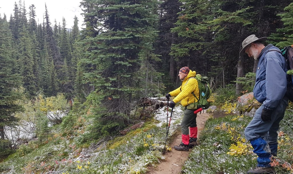
Hiking boots, poles (for pole vaulting and getting over bog creeks), gators (wet!) and your regular day pack kit.
Overview
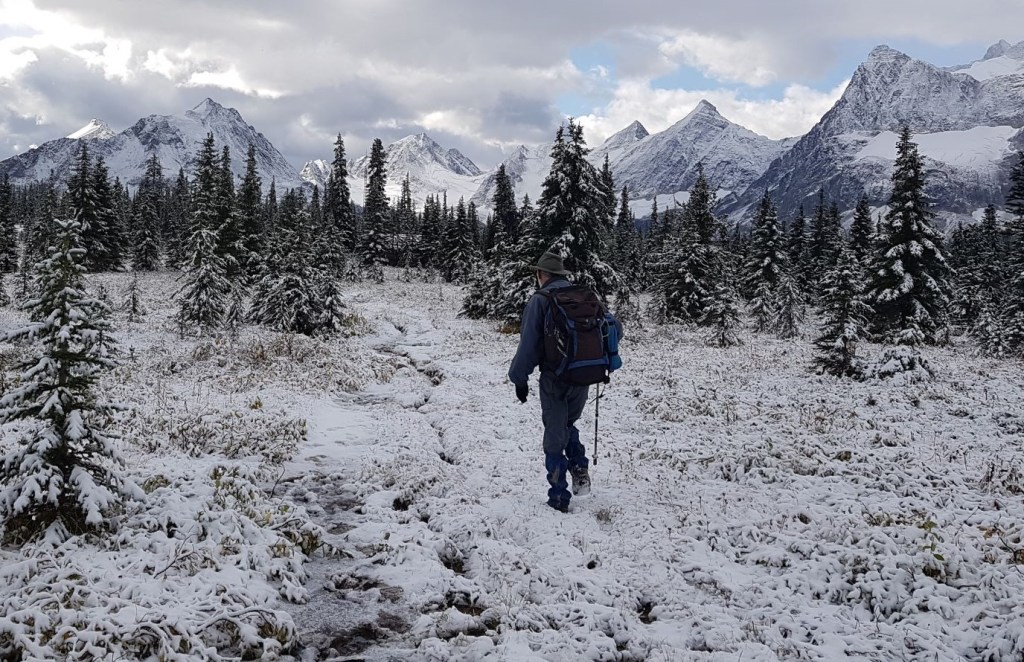
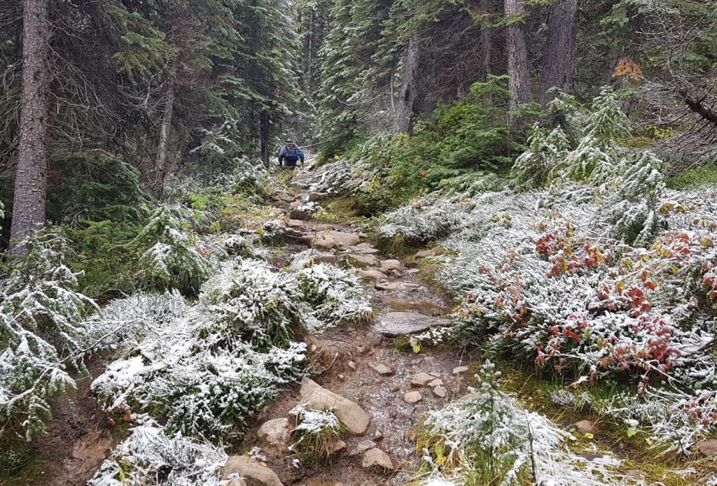
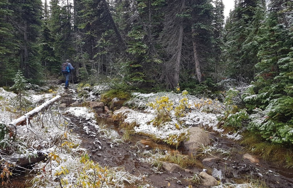
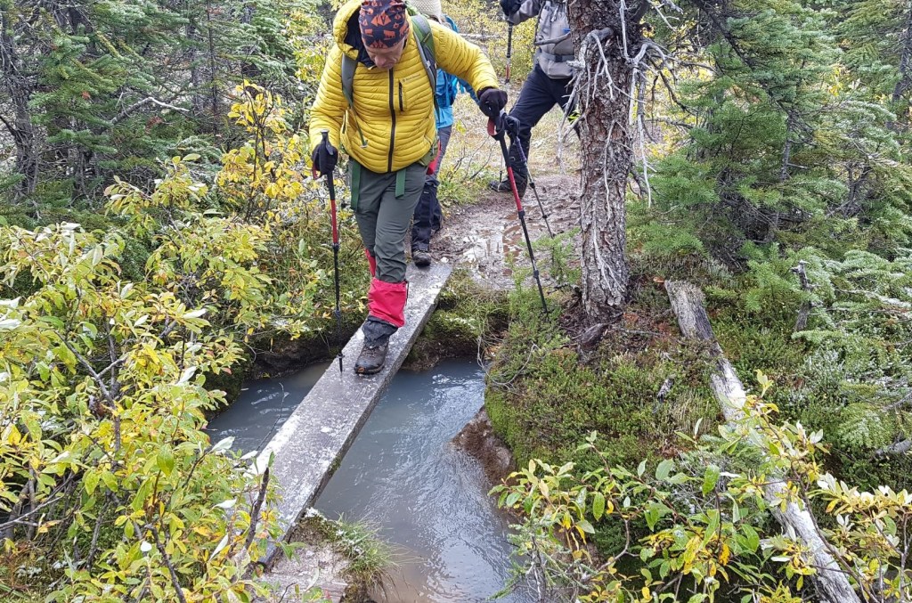
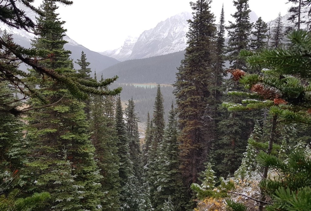
I have to say, this was not a typical hike. We started at the high point, and lost 400 m of elevation as we descended into the marsh lands. The trail was wet and muddy, and travel was agonizingly slow. Sometimes the trail was almost lost in bog grass, and we had to leap across small creeks. Even the bridges were wrong – one was so off kilter we had to use microspikes or risk going for a swim.
From Amethyst Lakes, head back towards the Astoria River trailhead. At the T intersection, continue straight to the Clitheroe Campground. Head south, going past the Warden’s Cabin, and Surprise Point Campground. Connect up with the Astoria Trail (the direct route from the Cavell Lake trailhead), cross the stream. and hike up the final incline to the Wates-Gibson Hut.
Trail Head
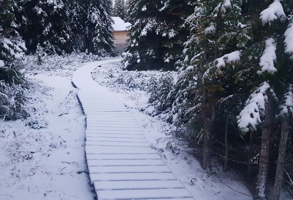
From the Tonquin Adventure Lodge, we crossed the meadow once again, and headed towards the main trail.
Main Trail
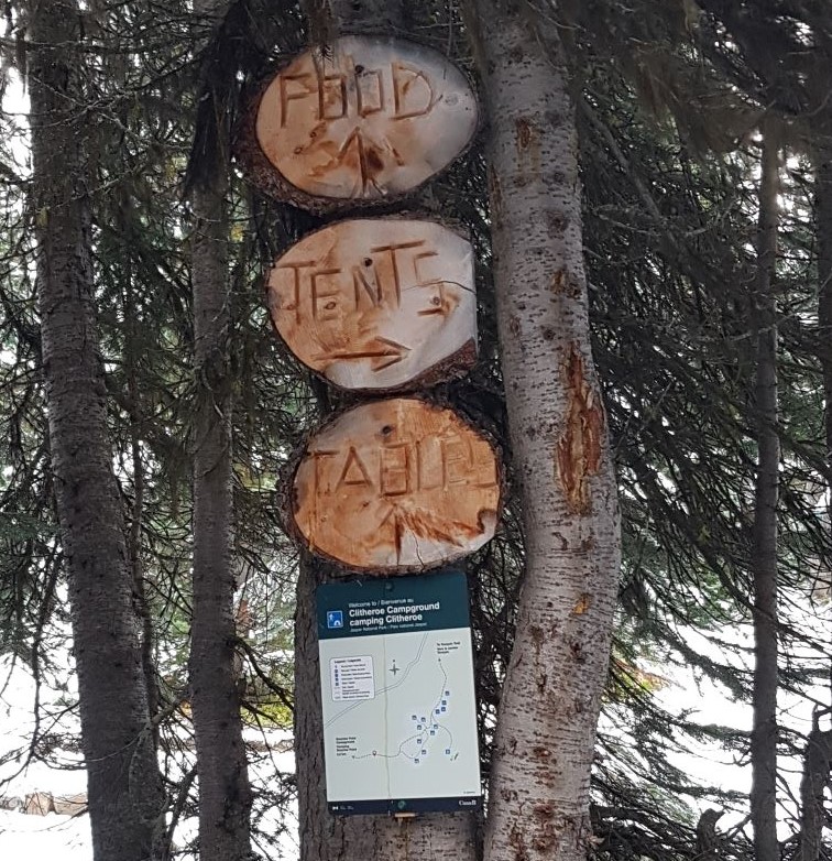
We hiked for about 2 km from the lodge, retracing our steps back to the T Intersection. We kept straight for the Clitheroe Campground, which was only another 200 m down the trail.

For those interested in backpacking, Ivan said Clitheroe Campground is one of the best sites. It’s in a great location for doing day hikes, close to water, and is above the marshy/swampy stuff lower down. I think this is code for “not as many mosquitoes” but don’t quote me as they were all dead when I was there. This turned out to be the highest elevation point on our hike.
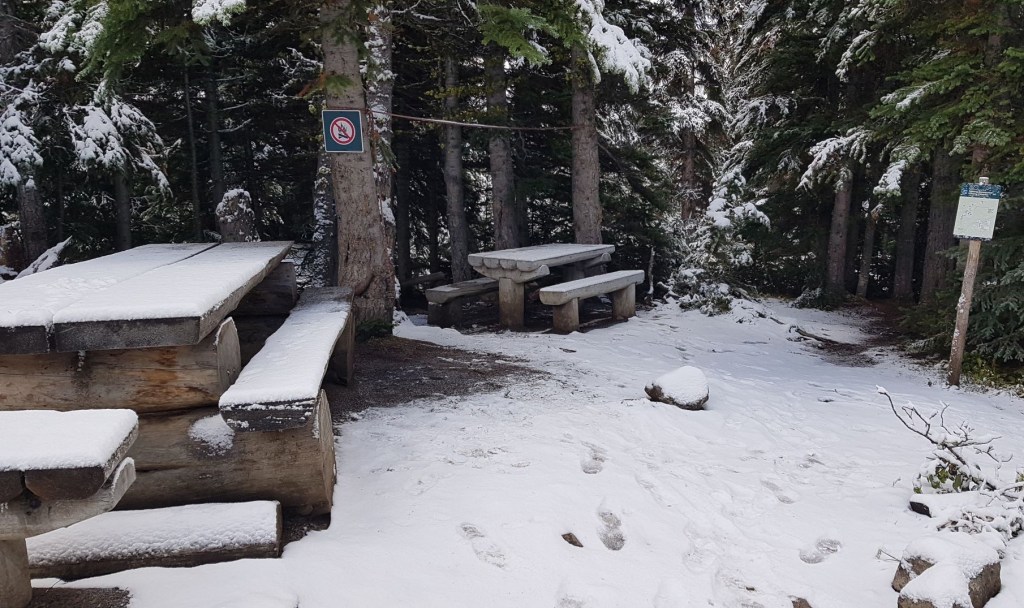
We continued down the trail for another 800 m or so to the Warden’s Cabin. Ivan said THIS was the very best spot as it was the only high ground and no mosquitos.
Distance to the Warden’s Cabin was approximately 3 km from the lodge, and it took us just over an hour. It was here that Agnieszka and Pamela decided they’d had enough of the wet muddy trail. As we all carried radios, they went back to the lodge, dried out their boots, and prepared dinner.
The remaining six of us continued on to Surprise Point Campground, which was only another 1.8 km…of pure hell. Good thing I was SO determined to see this hut. We were now hiking through tall, marshy grass. There were a few stream crossings which really could have used a wooden bridge. I almost forgot about the wind! Gahd! It just cut through all my layers. Freezing!

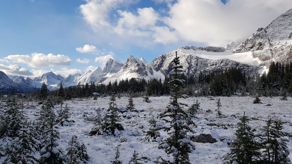
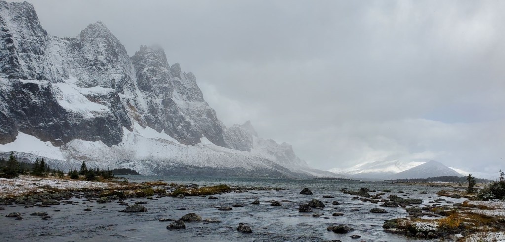
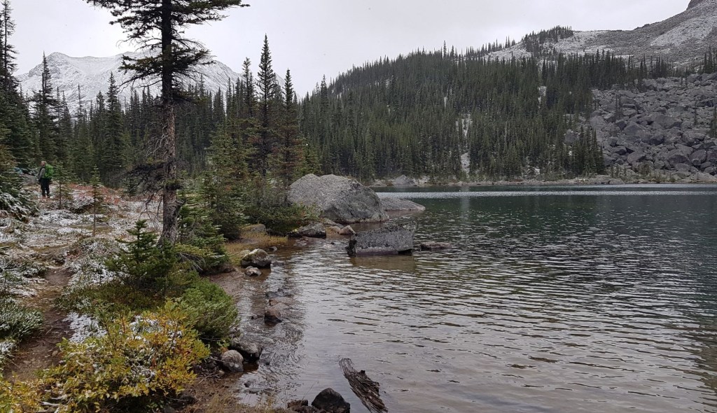
The highlight of this section was crossing the outflow of Amethyst Lakes. Thankfully there was a bridge here. Despite the weather, we got some beautiful photos. I imagine it’s even more gorgeous with fall colours.
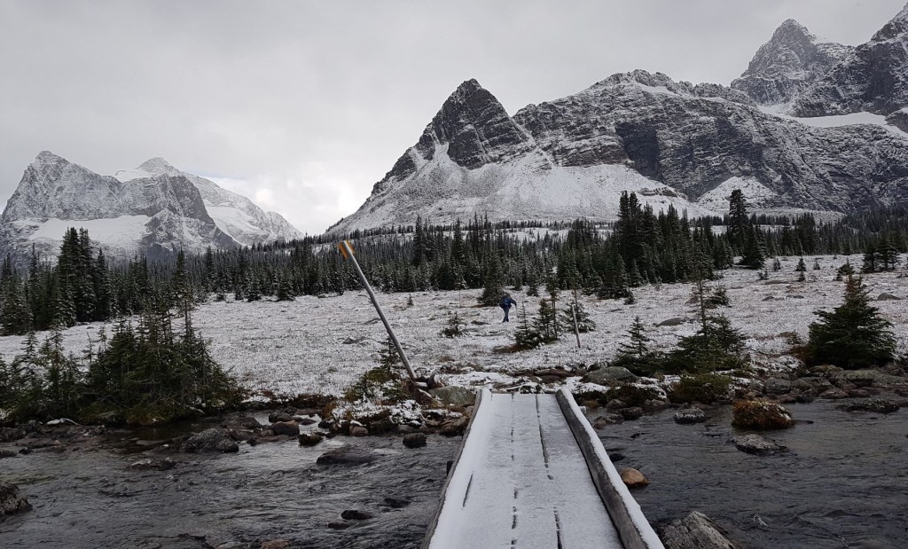
After about another 500 m or so, we came to Surprise Point Campground. Total distance from the Lodge the Surprise Point campground is about 4.5 km.
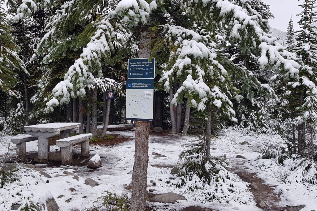
We chatted with several backpackers. They had spent the night, and were in various stages of packing up and moving on. We’d see them again over the next few days. Most were well outfitted, but one guy lacked gators and his pant legs were wet to above the knee. I felt for him as there was no way of drying that out in a tent. We did offer to feed and dry him out in the lodge, but he was enjoying his adventure and kindly declined.
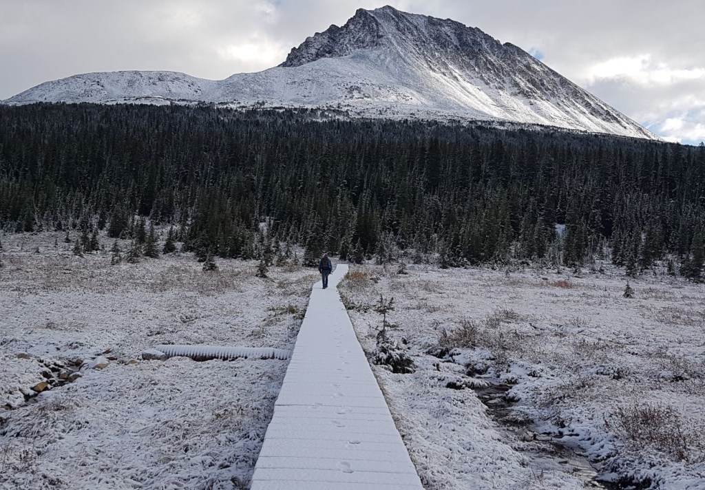
From the Surprise Point Campground, we lost some more elevation heading down into the valley, towards Chrome Lake. This would be our lowest elevation point. Just past Chrome Lake, we headed west at the junction. This trail leads directly to the Wates-Gibson hut. Shortly after the junction, we crossed two bridges over Penstock Creek.
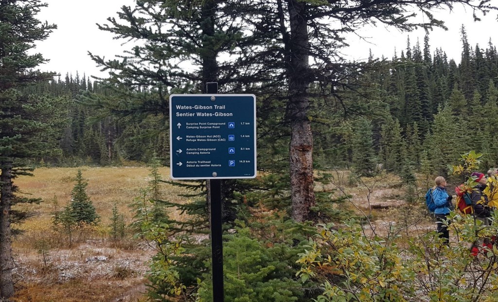
At both sign posts, just keep heading towards Wates-Gibson Hut.
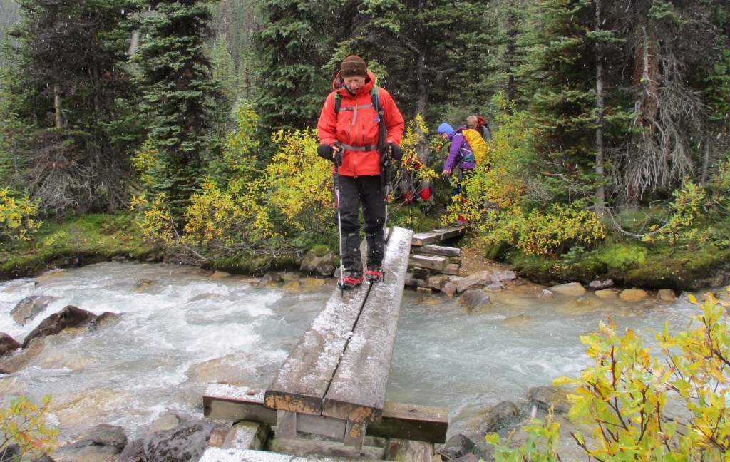
Solution? We had two pairs of microspikes between us. One person would cross, and then we’d throw the spikes to the next person. It took a while, but we all crossed safely and dry.
After the two water crossings, we paralleled Penstock Creek for a little while as we gained elevation for the final spurt to the Wates-Gibson Hut.
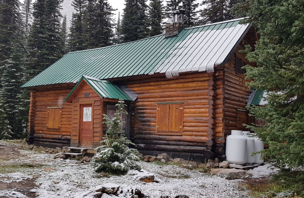

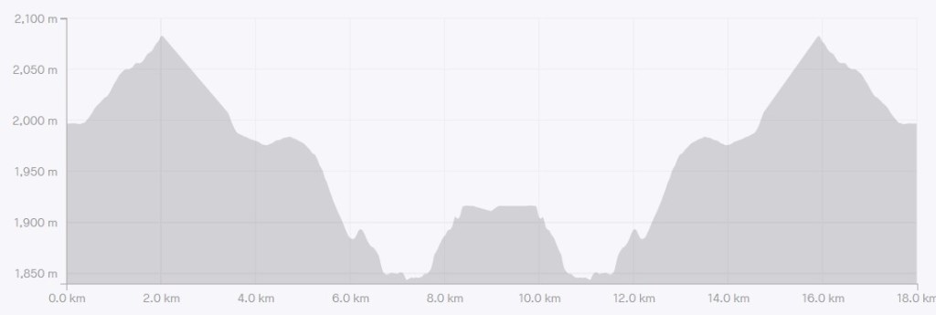
Distance to the Wates-Gibson Hut from Tonquin Adventure Lodge is officially 7.2 km, but I logged closer to 8.5 km. Could have been a GPS error because the trail was so slow going. Either way, it’s a long day. Not because it’s a long distance, nor is there any significant elevation gain/loss, but because the trail is so muddy and messy. Every step is like a game of Lava where you can’t touch the living room floor.
Time to the hut was about about 3 hours and 30 minutes. Elevation loss was about 400 m. We’d gain it all back heading home.
But Wate(s), there’s More!
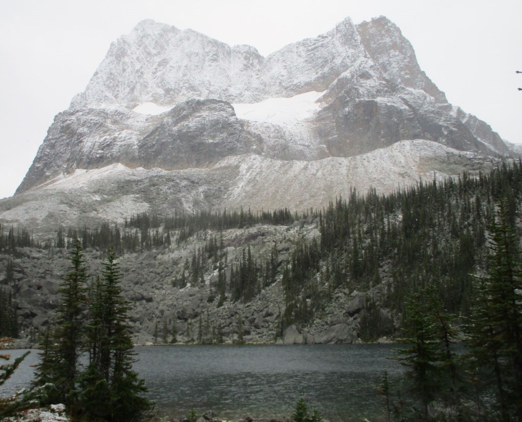
This is the third Wates-Gibson Memorial Hut. We hiked down to Outpost Lake, directly below Outpost Peak, so visit the ruins of the first hut, located right on the shore of the lake. This is an absolutely beautiful spot, but I can understand why it was impractical. The hut would have been very tight, with water contamination perhaps being an issue.
We walked to the end of the lake, and admired the view down to Chrome Lake and the route into the Wates-Gibson hut from the main Astoria River trail.

Wates-Gibson Hut Return
After enjoying Outpost Lake for a little while, we hiked back up to the Wates-Gibson Hut and ate our lunch. It had now started to rain in earnest. Jacek, Phyllis and I huddled in the porch of the hut, and Jacek shared his pound cake with us. It’s the little things that matter. Ivan, Pat and Monica were nice and dry under a giant spruce tree.
We returned the same way we came. When we got back to Surprise Point campground, some backpackers told us the caribou were resting nearby on the little pond. While we could see them, the photos did not turn out.
If I didn’t mention it before, this trail is in rough shape. It was nearly impossible to get any kind of speed up. Four of the six actually fell on the trail, which is saying something. Two of our group ended up getting quite wet when they fell into the stream beside the trail, while Ivan and I just had bruised egos 🙂 Again, poles and gators are a must.
Click the links if you missed Day One – Hike In, or Day Two – Mt. Clitheroe. Click for Day Four – Majestic Ridge.
If you found this post useful, please do me a huge favour and click the Star button to “Like” it. You can also follow my blog, follow me on Instagram, or join my FaceBook page Al’s Adventurers.
Alisen
Totals – Tracked on Gaia, displayed on Strava
Date: September 15, 2021
Group: Eight, then Six (Alpine Club of Canada, Rocky Mountain Section)
Distance: 16.4 km
Elevation: 401 m (1,323′)
Time: 7 hours 33 minutes (includes lunch, breaks, spike tossing, and falling down)

I love all things mountains! I live next door to the Canadian Rocky Mountains, however I travel the world to enjoy the many different mountain environments and cultures that I can. I hope you enjoy these trip reports, and that it inspires you to accomplish your own adventure goals.

This sounds cold and exhausting, but from your photos I can see why it was worth the struggle. So so beautiful!
A summer trip would be much warmer. September can bring any kind of weather.
The plus side that I have failed to mention is NO BUGS!!! I think I’ll gladly suffer a bit of cold to avoid being eaten alive by Mosquitoes. 🤣
Oh same. Layers are a worthwhile trade off in exchange for not being eaten by bugs.
👍🏻👏🏻👏🏻👏🏻
I loved the moody views, but the mud!!!
Yeah, the mud. That about sums it up. If this was a climbing trip, the mountain trails above the hut would be dry and manageable. It’s just the approach that is an issue.
Mud! Mud. Glorious mud! 🙂
Yeah, lots of mud. Not for the lighthearted, that’s for sure!
Still, it’s an amazing part of the world and the fact that it’s not easy to get to makes it all the more special.
Very nice Alisen!
Outpost Peak and Outpost Lake look very nice. I also like the log cabins you have there in Canada.
Mud can be a bit disturbing while hiking, but is perhaps the most normal condition for people that hike often.
Our mountain huts are like a treasure chest in the mountains. We are so very lucky to have such a large network of huts in Alberta and British Columbia.
True – mud happens while hiking 🙂
Even though the trail was wet, muddy and slippery, the landscape sure looks beautiful covered in a light layer of snow. I’m surprised that some people were backpacking, but I guess it’s a great time of the year to avoid the crowds and the bugs.
I think people are backpacking so late in the year because the summer months are pretty much all filled up. If you’re allergic to crowds 🙂 then the only solution is to push the seasons and hope for the best. As I get older, my tolerance for freezing in a tent definitely decreases. I’ll take a warm hut or lodge any day. And yes! No bugs!
It’s the same over here as well when it comes to camping and crowds. We’re actually planning on heading out west this summer and it took me over an hour of waiting in the virtual line to reserve a campsite at Jasper. I’d trade a warm cabin for a cold tent as well!!
Did you get a spot or two??? Do tell!!! I’m so excited to hear where everyone is going.
Thank goodness I was able to book all the sites I wanted. We’ll be staying at a few national parks including Elk Island, Jasper, Lake Louise, and Mount Revelstoke.
That’s pretty darn good. Many people didn’t get anything. Are these front country car camping sites? All the backcountry sites are long gone.
They are all car camping sites. We tried to snag a campsite at Lake O’Hara, but had no such luck. We’re hoping to snag a reservation for a day-use visit though. Fingers crossed.
Lake O’Hara is almost impossible to get a spot. Keep an eye on Parks website for last minute cancellations. Sometimes people post cancellations on FB.
A day visit is nice too. Lots of great hikes, but my favourite is Lake Oesa. The trail building was done by Lawrence Grassi, and is sublime.
I’m not surprised that it’s hard to snag a spot at Lake O’Hara. It looks beautiful!! Good to know that Lake Osea is your favourite hike in the area. If we manage to get a day-use reservation we’ll make sure to hike that trail.
Good luck Linda! I know you’ll have a wonderful trip.