January 22, 2022
I was lucky enough to be invited on a hike to the wildly popular Green Monster – a frozen waterfall along Evan-Thomas Creek. When I say “wildly popular” I mean amongst the winter hiker crowd. This has long been a known spot for ice climbers, and I bet they are none too keen to see their secret stash being overrun.
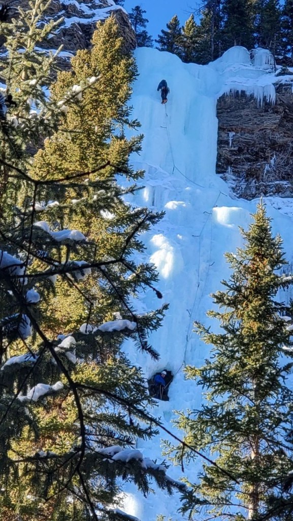
If you take the time, there are numerous short side trails that lead to many other waterfalls and ice climbs. We watched several teams climb on the way in and out. The Green Monster is just one such ice climb in this area.
Gear
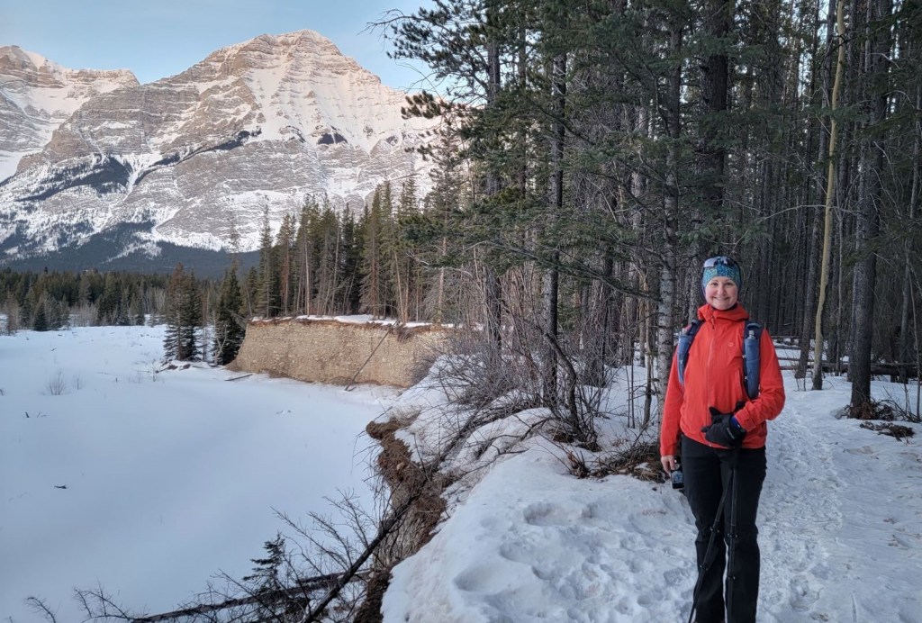
While you can hike here in the summer, this is a winter trip report. You’ll need to dress warmly, and bring extra layers as the temperature cools considerably once you’re in the canyon. I wore my hiking boots with heated socks (because I’ve frozen my toes several times this year and my feet are super sensitive). Spikes are a necessity. Gators are advised. We had a tramped down trail with no fresh snow, and my pants covered my boot tops. Hiking poles are ideal for stabilization walking on the snow.
Overview
From the Evan-Thomas Day Use Area, take the main trail heading south east. Around 1.8 km, take the right fork to descend down the embankment to the meadow below. From there, continue roughly south to follow the Evan-Thomas Creek. When stopped by a narrowing of the creek, head uphill on the left to go up and over the ridge. Continue along the creek until you see Cascade Falls on the right. Return the same way.
Parking and Trail Head
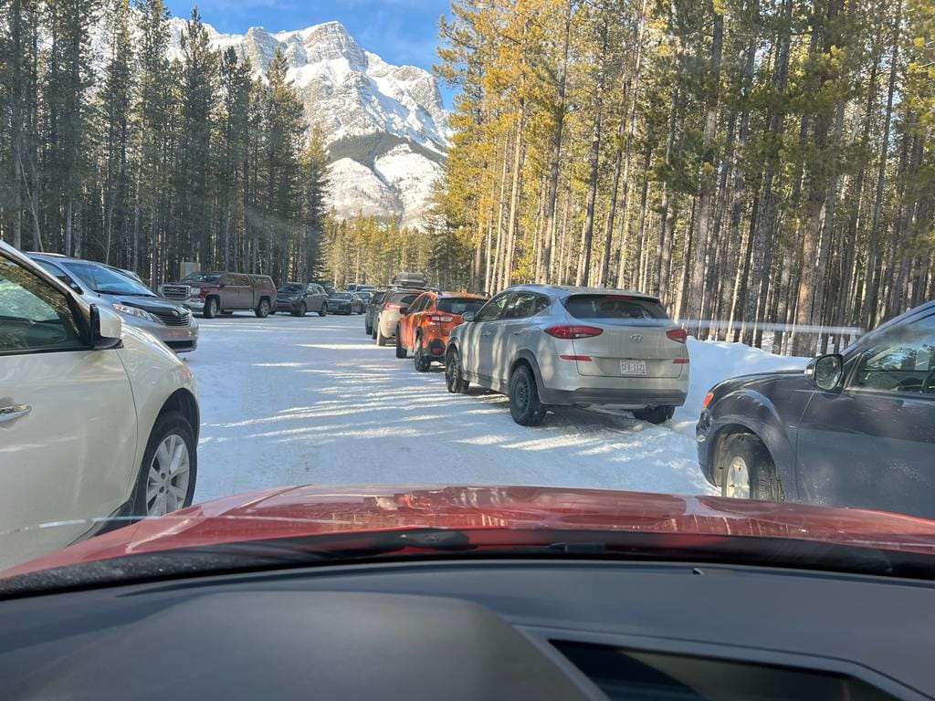
Park at the Evan-Thomas Day Use Area on the east side of Highway 40. This is a small lot with pit toilets. While it is disappointing to get to your destination and see that the parking lot is full, instead of clogging up the lot or parking on the highway, have an alternate destination and move to your next choice.
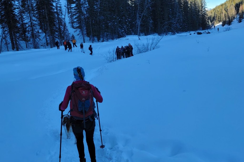
This is where Sonya, Erin and I met Stephen’s group of five (Stephen, Matt, Dylan, Scott and Darlene). I was looking forward to meeting Stephen ever since he Sherpa carried Erin down from Prairie Mountain when she broke her ankle last year. “I need a hero” plays in my head whenever I think about Stephen 🙂
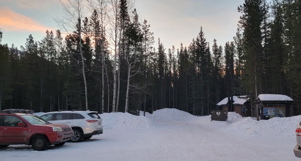
The outhouse and trail head are both on the right.
From the parking lot, take the main “Old Baldy” trail. After about 50 m, turn left to continue on this trail for another 1.6 km. This is a groomed ski trail.
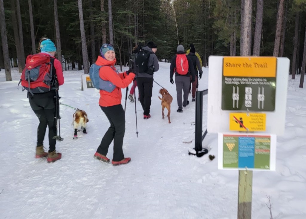
Please note this is track set for cross-country skiers. Be courteous and do not walk on the tracks. You can walk in the middle of the tracks in this location (many other locations do not allow walking down the middle because that’s used for skate skiing).
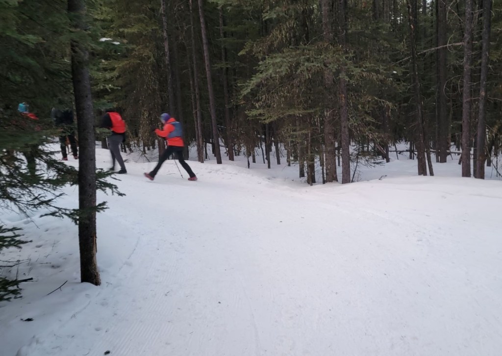
Main Trail
At approximately 1.2 km, there is a side trail to the right. This takes you off the groomed ski trail and is a lovely walk through the forest. This also gives you a great view of the mountains across the valley that you don’t see from the ski trail.
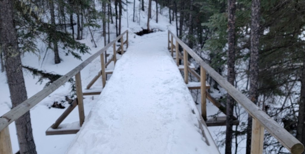
After the side trail reconnects with the main trail, there is a Y junction at about the 1.8 km mark. Going left (or straight) continues to Old Baldy. We went right, crossed a bridge, and then descended into the open meadow below.

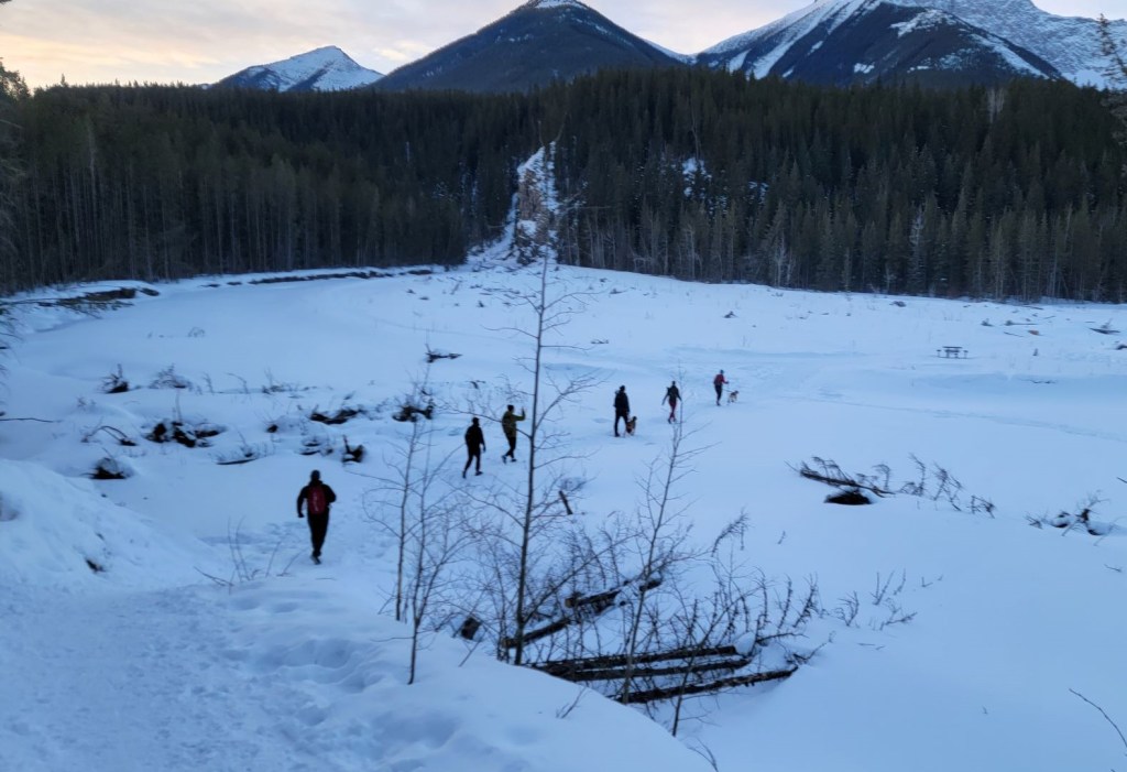
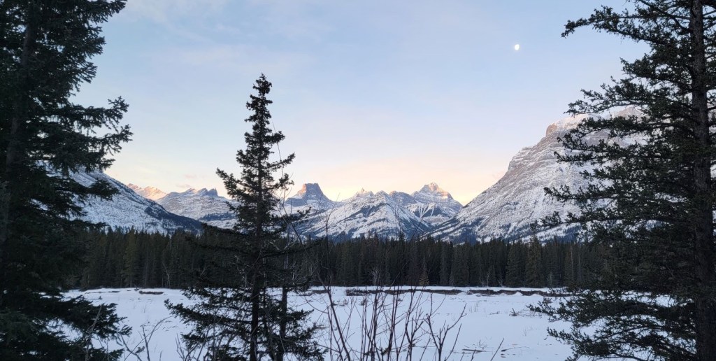
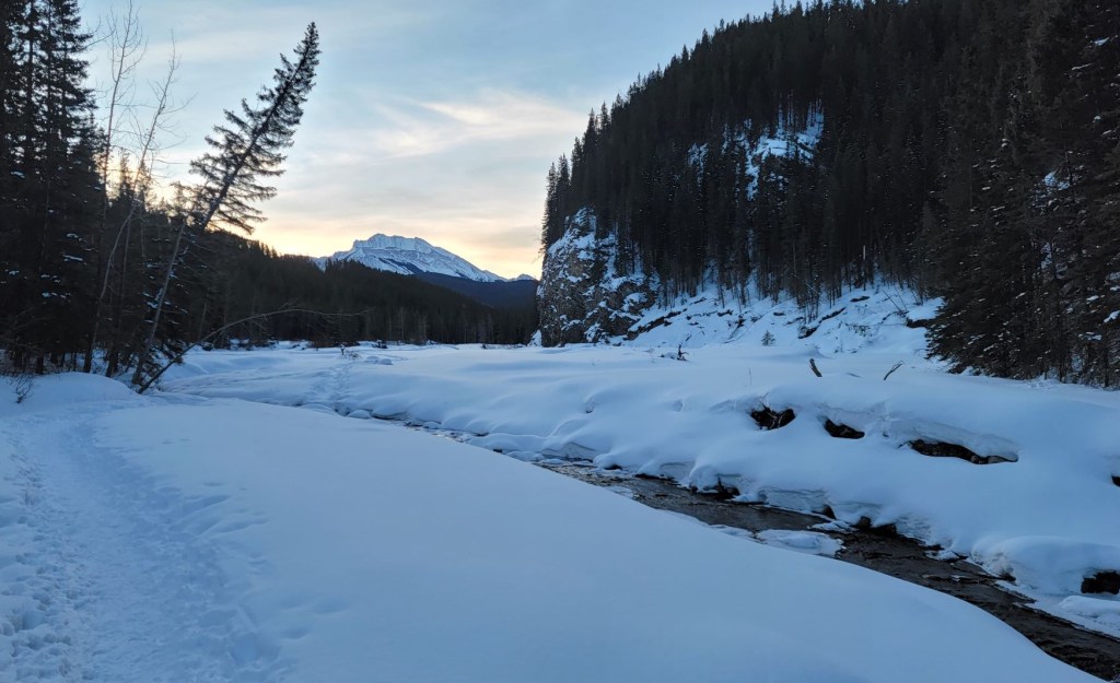
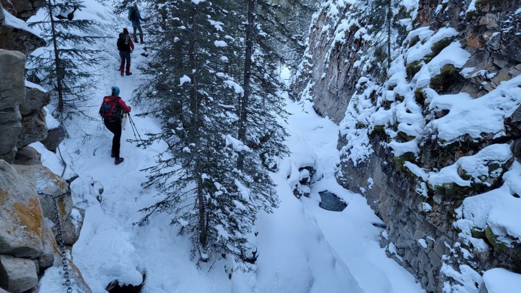
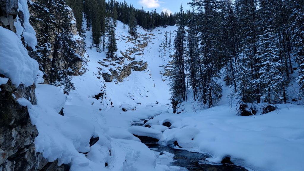
Once in the open area, we picked up the Evan-Thomas Creek Trail. We followed it to the end, with the Mackay Hills overhead on our right.
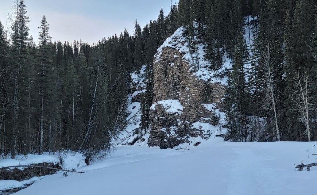
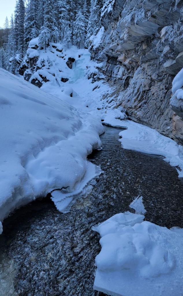
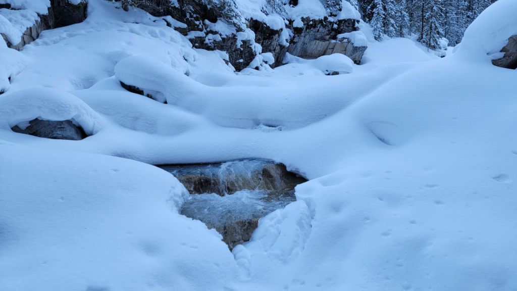
The scenery in the canyon is simply stunning. Each twist and turn gave another fantastic view. I could have taken a million photos. The trail will be slightly different each year, depending on how the snow is and where the initial trail is put in. We could see remnants of older trails that are no longer in use. We had one creek crossing, but there could be more depending on snow levels.

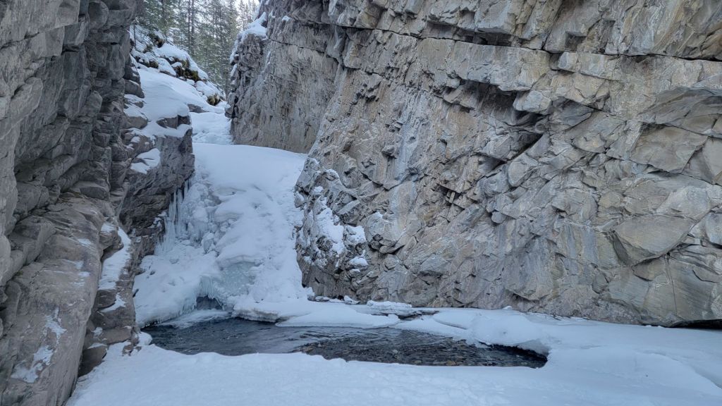
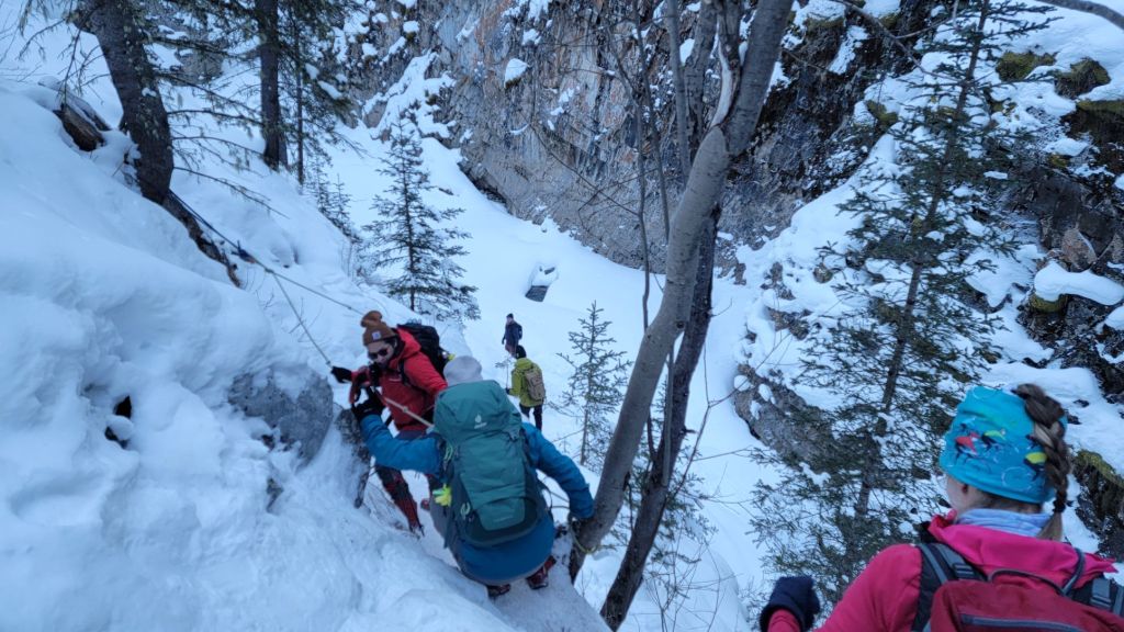
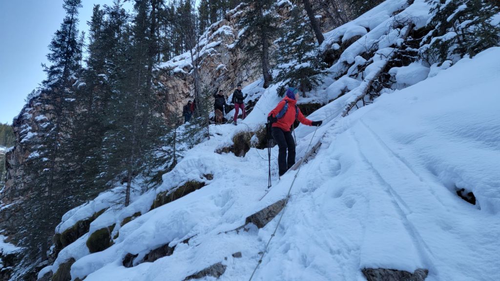
At around the 5 km mark, the creek narrows considerably and is impassable. After a quick photo op, we headed to climbers left to hike up, across, and then back down the embankment. There are chains and ropes in this section to hang onto. Please be aware that these have been added by the ice climbers. Please do not abuse their equipment. They carry their own ropes and have the ability to remove the ropes with no consequence to themselves. Also, do not blindly trust the ropes.
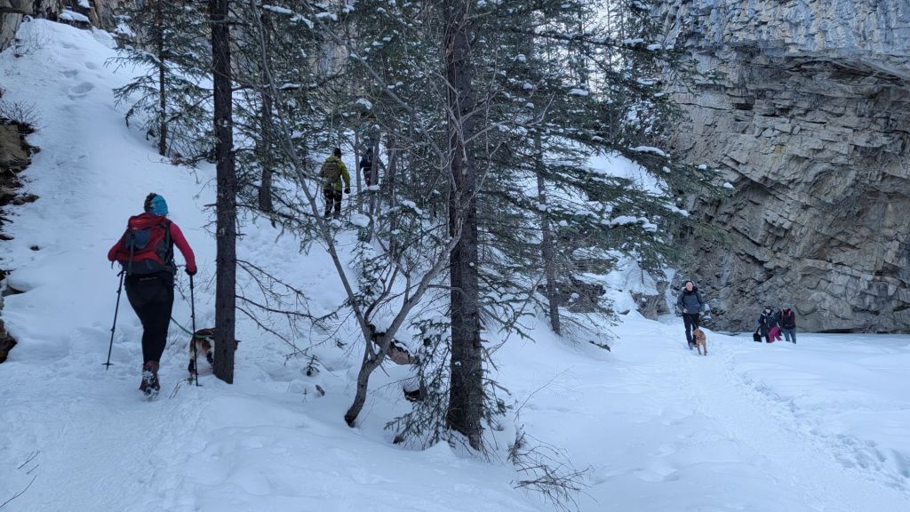
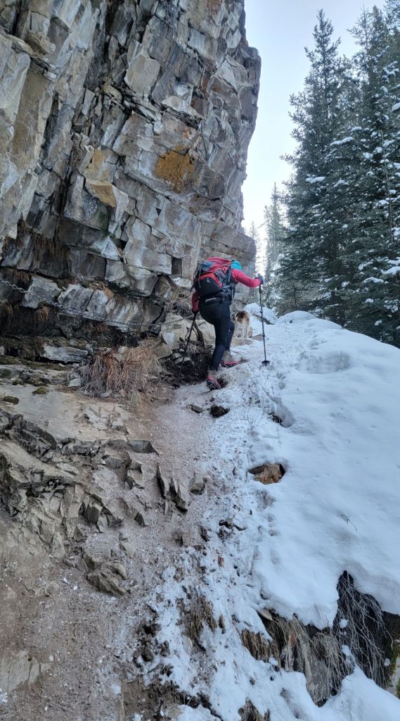
After the initial climb, there is a chained section that traverses across a flat bit. Then there is a short drop, before the final steep section that goes back down to the creek bed.
Please be aware that this is steep. Very steep. There is also a major drop on the south side. Consequences of falling here are severe, as in you’ll break something or you’ll die. The up and down section is also one at a time. We had to wait our turn, despite there being less than 12 people here. On a busy day, you could be standing here for some time waiting your turn.
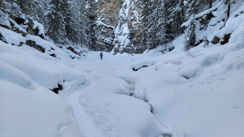
At around the 5.7 km mark, we went around a bend in the creek. On the left is an avalanche slope. While there was very little snow when I was there, there is potential for a slide after a big snow storm or major snow accumulation. If in doubt, cross one at a time and do not linger.
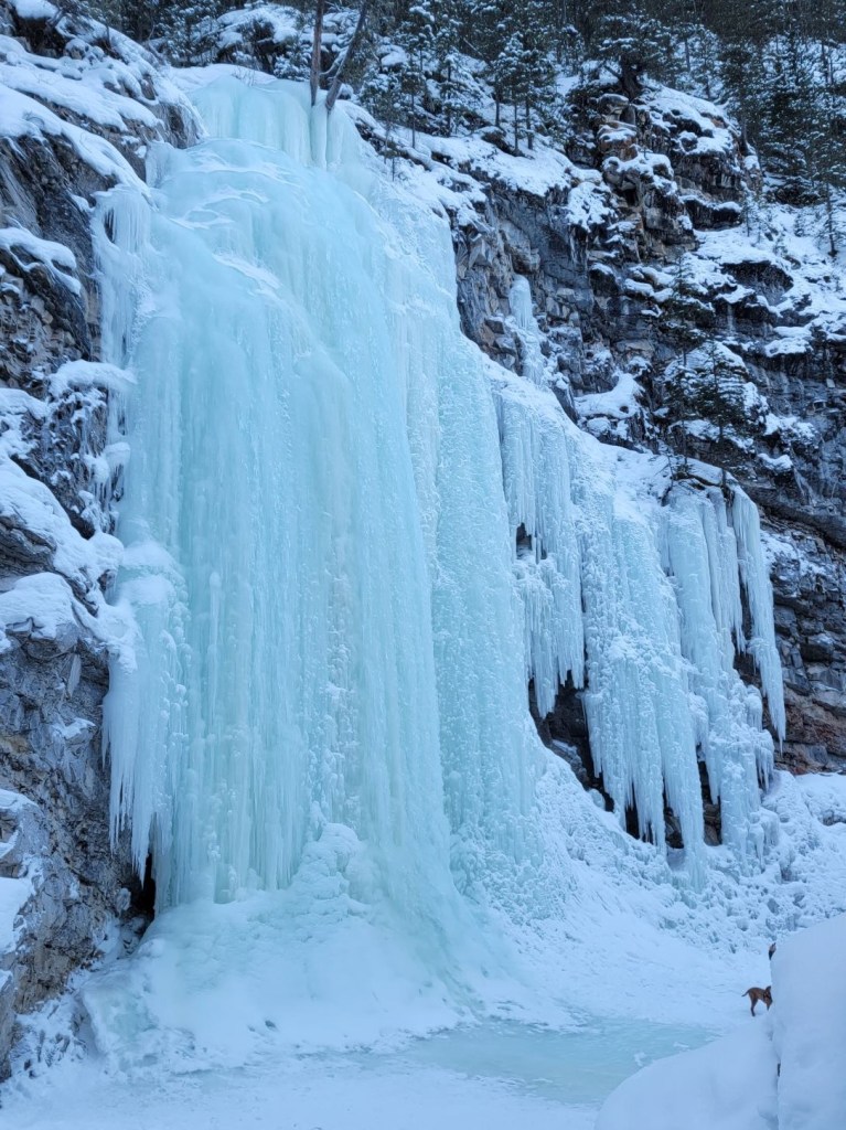
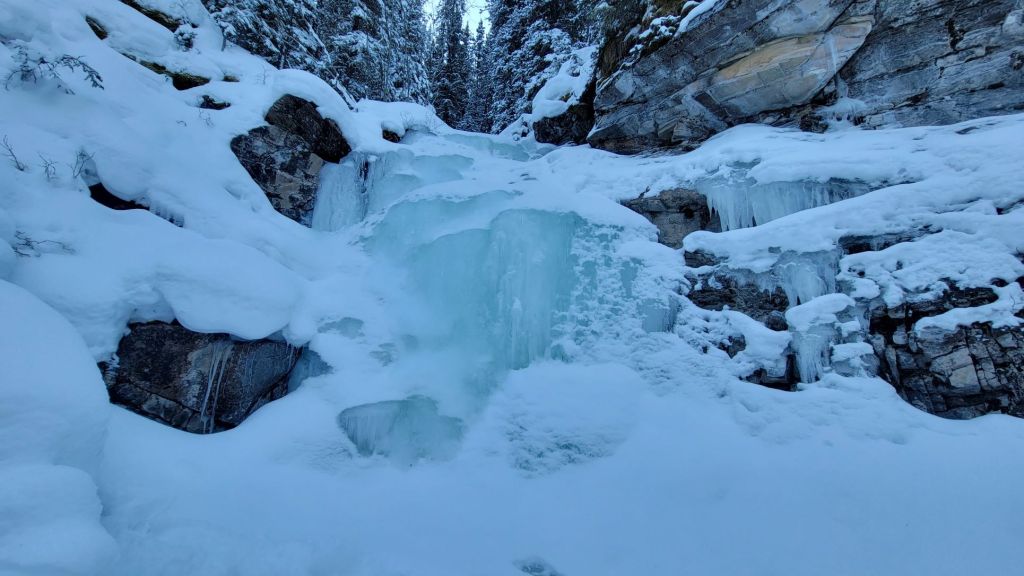
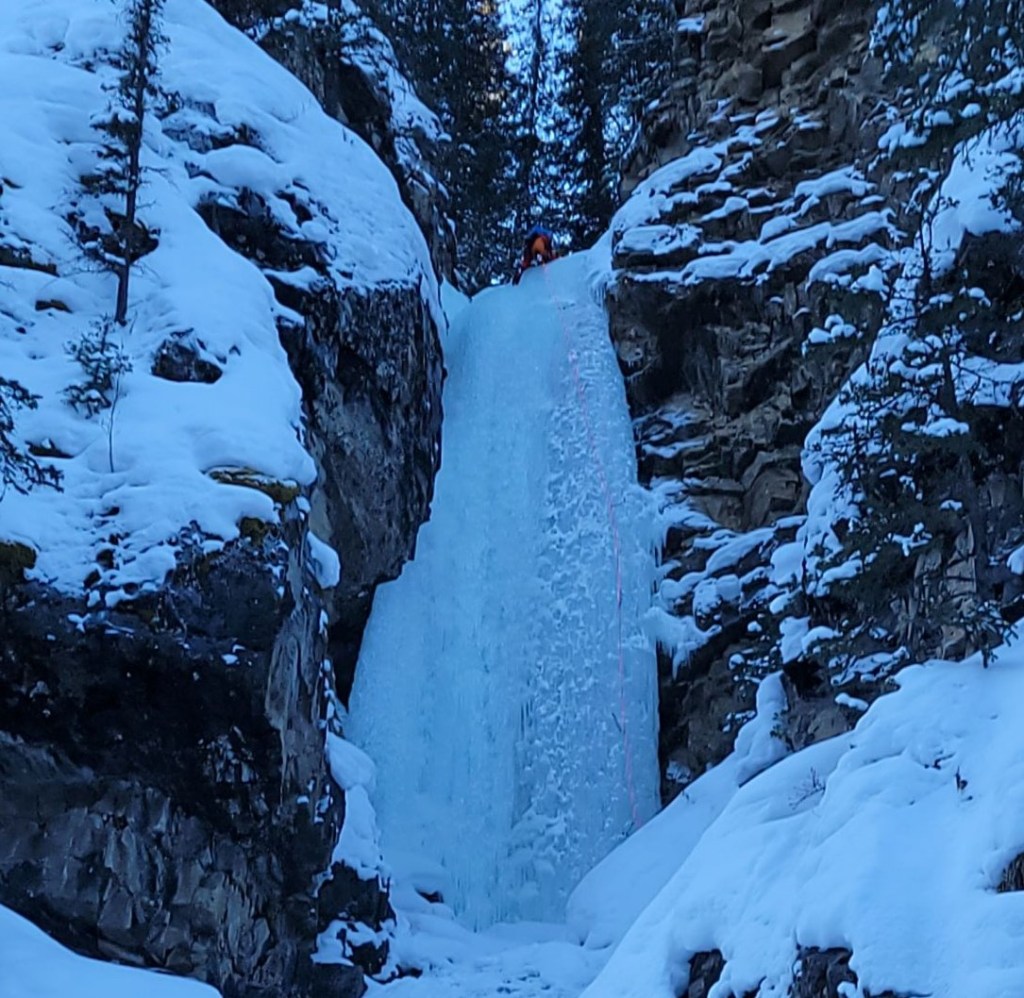
We arrived at the main attraction – Cascade Falls, with the ice climb The Green Monster – after about 6 km of mainly flat hiking. We were the second group there, so had the falls to ourselves and could admire the beautiful green colour.
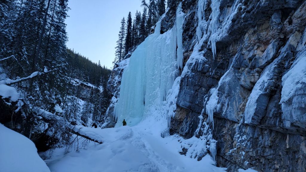
We had a pair of ice climbers getting ready to ascend The Green Monster ice climbing route. If you see climbers, please be courteous. This means never walk on their ropes or touch their gear. Please also do not get between their ropes and the ice. If in doubt, just ask them where is a safe place to walk.
We were curious as to how far the trail continued after The Green Monster, so we hiked on. After a short water crossing, we found a lovely little open waterfall, and then a small frozen fall. This was now definitely the end of the trail as boulders clogged the Evan-Thomas Creek bed.
Cascade Falls / Green Monster Return
We returned the way we came. On the way back, Sonya, Erin and I let the rest of our group go ahead while we checked out the side trails leading to the various ice climbs. We were lucky enough to see several climbers on some impressive ice.
On our way back, we found the masses of people who were now hiking in. It was like several tour busses had stopped and let everyone off at once. We were very thankful for our early start. I cannot imagine how backed-up the chain and rope sections are with this many people trying to access the area all at once.
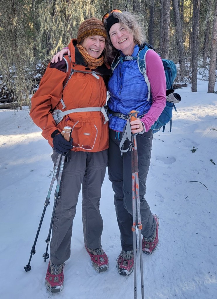
While I had a fantastic day, the absolute BEST part was seeing my friend and scrambling partner Annette near the trail head. After a harrowing medical incident last year that left her unable to even walk, seeing her back out on the trails was … I don’t even have words. We just hugged and hugged.
When we arrived back at the parking lot, there were several cars circling the lot. When we tried to leave, it was touch and go as to whether we would be able to without scraping some of the poorly parked cars.
Our trip to The Green Monster, otherwise known as Cascade Falls, was a fun and easy winter hike. If you go, especially on a weekend, leave early.
If you found this post useful, please do me a huge favour and click the Star button to “Like” it. You can also follow my blog, join my FaceBook page Al’s Adventurers, or follow me on Instagram.
Alisen
Totals – Tracked on Gaia, and displayed on Strava
Date: January 22, 2022
Group: Eight (Alisen, Sonya, Erin, Stephen, Matt, Scott, Darlene and Dylan)
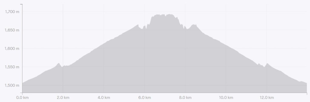
Distance: 13 km
Elevation: 229 m (755′)
Time: 3 hours 10 min (includes snacks, and gawking at ice climbers)

I love all things mountains! I live next door to the Canadian Rocky Mountains, however I travel the world to enjoy the many different mountain environments and cultures that I can. I hope you enjoy these trip reports, and that it inspires you to accomplish your own adventure goals.

Yikes, what a mess at the parking area. It’s very reminiscent of Colorado. People just park everywhere without a care. What a pretty waterfall, though, I can see why it’s so popular! Lovely mountain views too. Also, I need to get some of these heated socks you mention. I have perpetually cold feet.
They are Lenz brand. Super expensive ($400.00 CDN) but worth it. The batteries last all day, they are pretty thin, so I can wear in my ski boots and hiking boots, and the heat coils wrap around the toes. Not all heated socks have heat around the toes, which is insane in my opinion.
I was skiing two days this week in -20 and then -30 Celsius cold. Heated socks both days absolutely saved me.
Oh yikes, those are pricey! They sound worth it though, if your feet stay cold in those temperatures.
I also use Boot Gloves over top of my boots to keep the heat in. These work even without heated socks, as they keep the cold and wind out. You can also put a toe warmer in your boot, and add the boot glove on top to maintain the heat.
Super !!!
Beautiful hike. Thanks for the great photos!
You are so welcome. Frozen ice really is amazing. I don’t normally seek out frozen waterfalls, but I will gladly go if invited.
Yes, the landscape was wonderful.
Glorious, as always. 😀 … any idea why the water (frozen waterfall) is green?
That is such a good question, and unfortunately I don’t have an answer. Most ice is blue. Maybe there is moss on the wall behind the falls? I’d have to visit in the summer to see what’s up.
Upon thinking thoughts … might be because it’s glacier meltwater? … some minerals in the frozen water refract certain colours of the spectrum? … it’s a mystery! 😀
Yes, some glaciers are green because of the minerals in the water. While this ice fall is just frozen regular stream water (no close by glaciers) I think you are right that some minerals in the water are causing the refracting. What’s interesting is none of the other ice falls in the same area are green. So perhaps this water is from an underground stream or karst? Definitely something for a geologist to consider.
It’s great, what you guys do, more strength for more adventures dear ❤️
Thank you! I appreciate that because I do need strength to do all this stuff. I’m recovering right now, when I’d normally be in the mountains. Taking a few days off to recuperate.
You need all the rest dear 🥰
Those steep sections look a bit dodgy, but seems like it was worth the effort as that frozen waterfall looks gorgeous. I like to hit the trails early to avoid the crowds as well. I also don’t like to feel pressured to hurry up if there are people behind me, especially on the sections where you can’t pass. The parking lot afterwards looks like a nightmare!
I agree. So many advantages to starting early. Yes, the steep section was pure sketch 🙂 I’m okay with it, but a lot of people get freaked out. I try and not downplay the danger, but then everyone has to make up their own minds.
Beautiful ! 💕🎉
It truly is! I was lucky to see it in all it’s glory.
Yeah of course ! Stay blessed 😊💕❤
Nice post ! Thanks for sharing
You’re very welcome. Thanks for stopping by.
Meeting you unexpectedly near the trailhead, was a benefit of my late start!!!
Despite cars already parked along the side of the highway I was lucky….somebody must have left early or not completed the full hike, as i found and took the one open spot in the parking lot!!
There were indeed lots of people on the path, some in large groups, at times holding up hikers behind them, but we were able to pass them. I doubt they made it past the steep chains and rope section as we did not see them again all day. They seemed a happy bunch though, I am sure they still enjoyed themselves.
Thank you for the update on the crowds Annette. Good to know that most people turned around prior to the steep section. I was worried about a major traffic jam but sounds like it was averted.
That looks like fun… and so cold! 😀
Ha ha! It looks cold, but we had a beautifully warm day. Even got to strip down to my long underwear top on the walk back. Warm for Canada in January 🙂
How lovely Alisen!
As you can imagine, I payed some extra attention to the ice climbers! 🙂
Thanks for sharing.
Ha! I bet you did. It turns out that my good friend from Poland actually ice climbed many of those routes the last time he was in Canada. Small world.
I love these trip posts because even I can follow and not get lost. The details speak to my organizational self!
You always make me laugh Jacquie 😃 Yes, even you can follow and not get lost. I’m looking forward to seeing some of these trips on your stava!
Uhg! Strava not stava!
I still made a navigation error! The right turn is a hard right, not a post hole bushwack. I should’ve known you would not send me into the unknown!
Trail update- it was very soft and getting worse as the day went on. One step off trail and you sunk to the thigh. There are spots opening up on the water which forced us to make a new trail. Thanks to Alisen’s training and good advice I was able to make safe and prudent decisions during the hike!
Thanks for the update on the trail conditions. When winter hiking, especially on a canyon with water crossings, it is so important to be able to make your own trail, and to be aware of thin ice, etc. Well done you!!!! Despite your one small navi error, it sounds like you had a wonderful day. I’m so glad you were able to follow the trip report and get some fantastic photos.
Alisen
This location looks amazing! My favourite hikes are always winter ones due to the amazing scenery and colours. Waterfalls in particular. Thankyou for sharing this. 🙂
You are so welcome. I had to look up where in the world the Peak District was, but I should have known just by the name. When I visit that part of the world, I’m usually in old churches and castles, because we just don’t have that over here, but I really need to spend a good six months just hiking around there.
Enjoy your adventures,
Al
I’m very fortunate to have this National Park on my doorstep. There are so many great National Parks here but the Peak District is the oldest one in England. There’s so much history here. I too love castles. 🙂
I didn’t know the Peak District was the oldest. Banff is Canada’s oldest national park too. Something about being the first makes it that much more special.