August 28, 2022
This is Day 3 of 4 in the Little Yoho Valley. Day One is hiking in via Laughing Falls. Day Two is the Whaleback Mountain Traverse, and Day Four is hiking out via the Iceline Trail.
From the Stanley Mitchell Hut / Little Yoho Campground, Mount McArthur is an accessible peak. Kane describes it in his guidebook as an easy hike, with one sketchy downclimb. With lower snow levels, this is now avoidable by hiking around the downclimb to the right. It’s also avoidable if hiked in the opposite direction using the “alternate” route, which I did. Big thanks to Doug Lutz who was here the year prior. His photos and tracks were invaluable for my trip planning.
I was leading a group of 18 Alpine Club of Canada Rocky Mountain Sections members, but I was lucky to have several other trip leaders on the trip. This meant we could offer several trips daily – hiking, scrambling and mountaineering. On this day, there was a group on the President, Mount Kerr, and a third group below us at the base of the des Poilus glacier. It was fun to look around and know who was where, and to keep track of their progress.
We carried ACC provided radios, and did check-ins at set times throughout the day.
Gear
Hiking/scrambing boots, scrambling helmet, poles and regular day pack kit. I also had gators as it was raining, with snow at the summit.
Overview
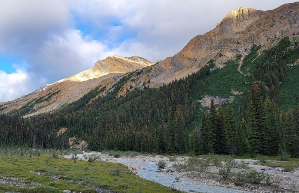
From the Stanley Mitchell hut (directions to there), go south and cross the Little Yoho River at the bridge. Turn right and head west. Cross the stream below the President glacier. Then cross the Little Yoho River again. Immediately turn right, and plan your ascent up the steep, tree-infested slope. At the top, the elevation gain backs off, as the trail follows the basin between McArthur and Pollinger. At the back of the cirque, angle up and to the right to gain the wide saddle. There’s a good trail from the saddle to the summit, but I kept losing it in the snow.
Hike down from the McArthur summit, heading straight for Mount Pollinger. At the base of the crux, either climb it like the badass you are, or simply go around to the left. Don’t forget to backtrack to tag the summit.
From Pollinger, maintain the same trajectory, descending down the steep scree slope to Kiwetinok Lake. Skirt around to the far west side to the lake. Cross the stream, and follow the trail back to the Little Yoho River. Follow trail back to Stanley Mitchell Hut.
Totals – Downloadable Tracks on Gaia, and Strava
Date: August 28, 2022
Group: Five (Alisen, Mike, Sonya, Erin and Cathy)
Distance: 11.6 km
Elevation: 991 m (3,270′)
Time: 5 hours 58 minutes (includes lunch, breaks and lake visit)


Trail Head
If you start from the parking lot at Takkakaw Falls, follow this route to the Little Yoho Valley.
If you start from the Little Yoho campground, either ford the Little Yoho River, or walk east 500 m to cross at the bridge.
If you start from the Stanley Mitchell Hut, walk down to the bridge over Little Yoho River, and turn right towards the Iceline Trail sign. Continue straight. All distances are from the Stanley Mitchell Hut.
Main Trail
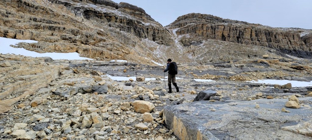
Around the 1 km mark, we crossed the first stream coming down from the President Glacier. This is probably the harder of the crossings. During high melt times, I’ve had the water level raise up throughout the day, making the return trip a bit spicy. Look for some cairns to indicate good places to cross.

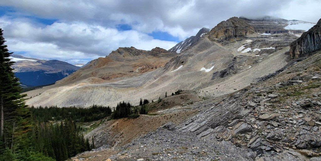
We hiked another 500 m, and then crossed the Little Yoho River again. The main trail continues straight, and up to Kiwetinok Pass. For the McArthur Alternate Route, we turned right, and picked out a line heading up the avalanche slope. There is no trail through the thick trees. This is also the steepest part, but with fresh legs and good company, it went by fairly quickly.


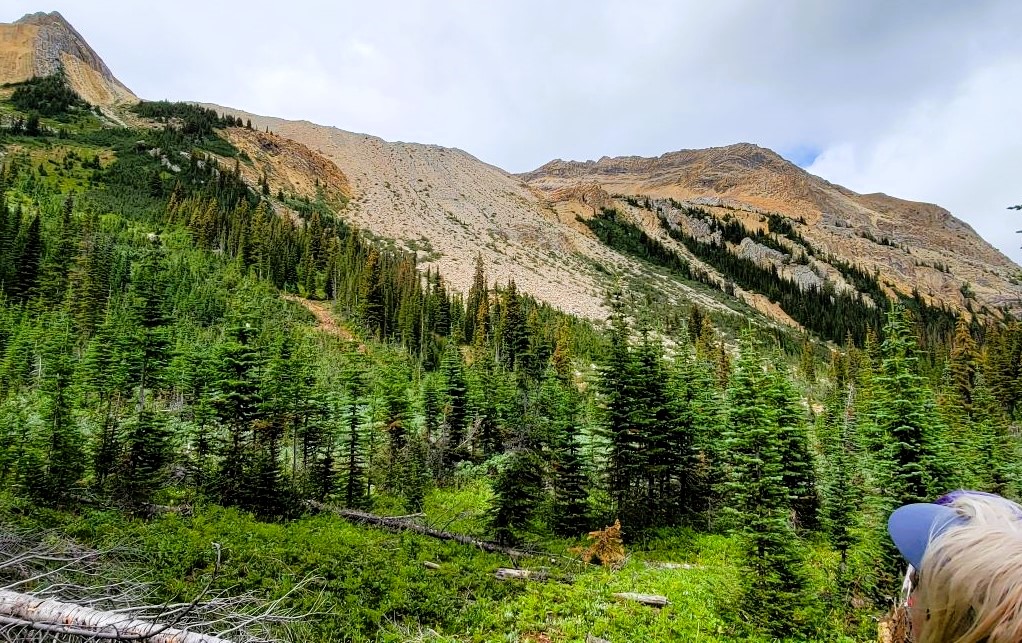

Once above the trees, we realized we were too far to the left. We worked our way sideways to the right, crossing over a moraine. This put us into the middle of the basin. From here, it was a long hike to the end of the cirque, slowly gaining elevation as we went.


Once in the basin, the trail came and went, but the way was obvious. As we neared the end, we picked out our route to climb out of the cirque. This was slightly right of the end, and was a natural weakness in the wall.


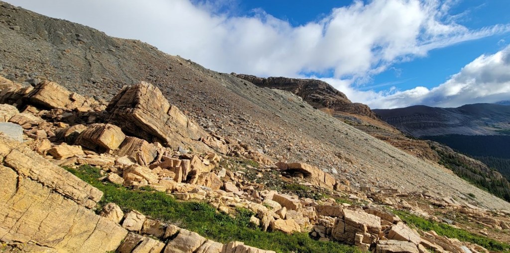
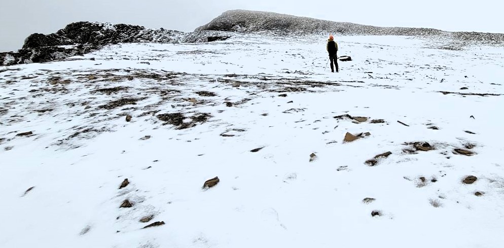
Once we were out of the cirque, it’s a long and wide saddle between McArthur and Pollinger. The route to the summit of McArthur was very straightforward, with a good trail. With the fresh snow, we lost the trail several times, but generally just stayed to the summit ridge.


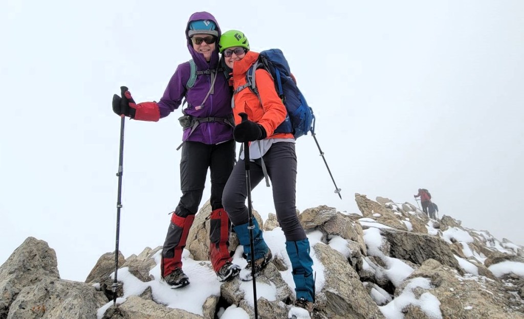
Distance to summit from Stanley Mitchell hut is 5 km, with ~977m of elevation. Time to summit was 3 hours 20 minutes.
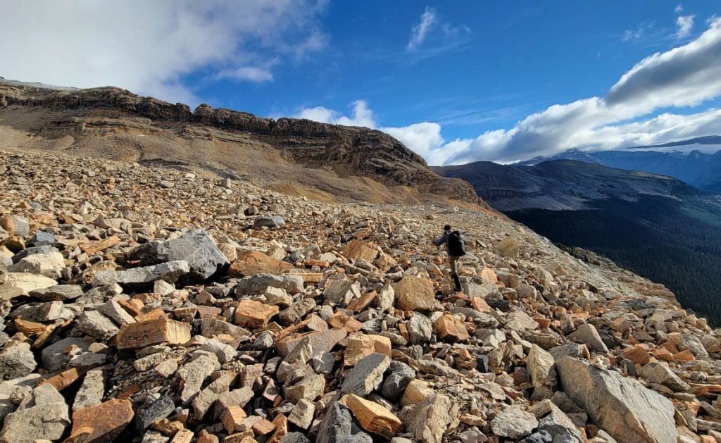
Mount McArthur to Mount Pollinger
We quickly descended from the cold summit of McArthur, beelining it straight for the wide saddle and the sunshine below. The wind was now howling, but we needed to eat. I went to the left to hide behind some rocks, but the wind found us there too. We quickly ate a snack, and headed for Pollinger.


As we reached the crux as described by Kane, we took advantage of the excellent trail to the left. Near the end, we scrambled up the side, and then hiked back to the summit of Mount Pollinger.


Distance to Mount Pollinger from McArthur summit is about 1.6 km, or 6.6 km from the Stanley Mitchell Hut.
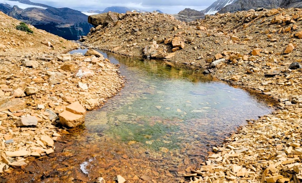
Mount Pollinger to Kiwetinok Lake
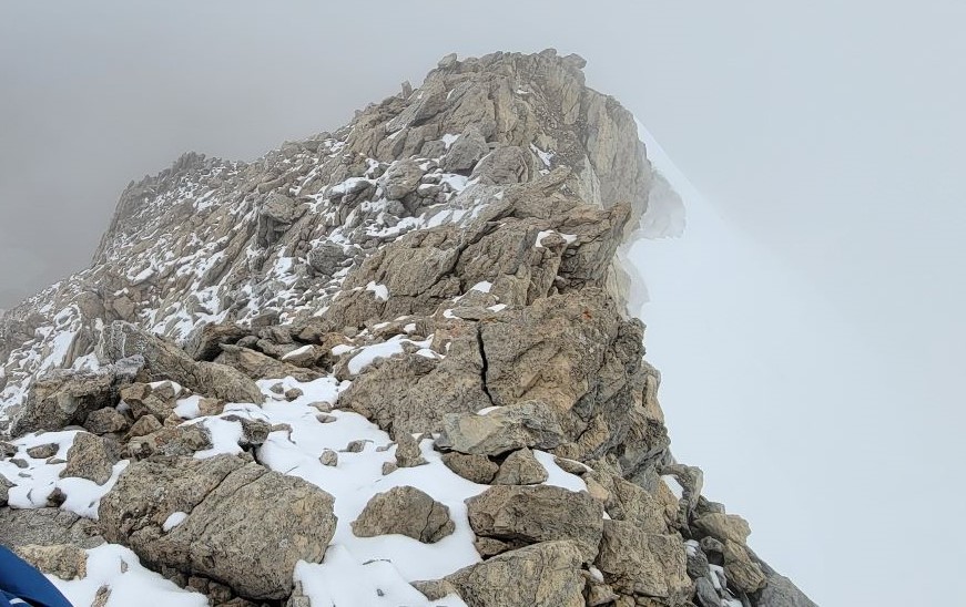
From Mount Pollinger, we angled to the right, heading for Kiwetinok Lake. The edge rolled over, so we couldn’t tell what was below us. From this photo, it looks like we found a faint trail heading down. We kept to this angle, and then skirted the lake on the right (west) side of the shore.

As we were churning down this choppy rock, I felt an intense sensation that we had a direct radio line to Jacek and Agnieszka, who were scrambling Mount Kerr that day. We were two hours away from our next radio call, but I asked Mike to radio Jacek anyway.
He refused. “There’s no way he’ll have his radio on.”
I persisted. “That’s okay. Just try him.”
“No.”
“Mike! Radio Jacek NOW!”
“FINE!” Mike radiod Jacek. Jacek immediately responded, like he held the radio in his hand. Jacek DID have it in his hand, because he ALSO felt like we would be radioing him. He had just taken out his radio and turned it on when Mike’s call came through! Always listen to your hunches, especially in the mountains. We agreed to meet at the lake, and hike back together.


Distance to the far end of Kiwetinok Lake from Mount Pollinger is about 1.7 km, or 8.4 km from the Stanley Mitchell Hut.
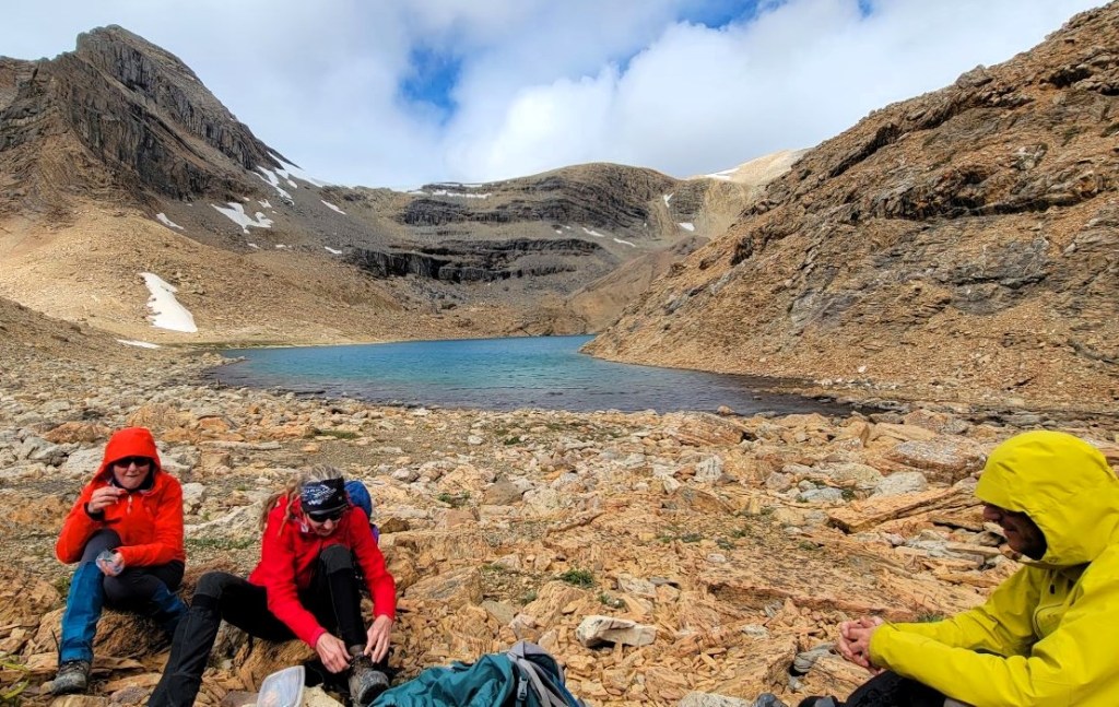
Kiwetinok Lake to Stanley Mitchell Hut
After we had a bite to eat, we put away our helmets, tied up our boots, and headed down. The scenery here is eerily stark, yet also incredibly beautiful.


We were soon at the crossing of the Little Yoho River, where we initially turned off to hike up the alternate route to Mount McArthur. We now retraced our steps back to camp.
Wrap Up
What an incredible day! I was so happy to summit McArthur and Pollinger, but even more happy to share these peaks with my special friends Sonya and Erin. It was also delightful to meet up with Jacek and Agnieszka, and catch up on the trail as we descended from the lake.
We spent the night at the hut with all the groups swapping tales of derring-do. I then got the four newbies to change the outhouse barrel. Loads of laughs with that.
If you missed the Whaleback Traverse, click here (coming soon). Join me for tomorrow’s hike out via the Iceline Trail (coming soon).
Thanks for reading! Please do me a huge favour and click the Star button to “Like” it. You can also follow my blog, join my FaceBook page Al’s Adventurers, or follow me on Instagram
Alisen
I love all things mountains! I live next door to the Canadian Rocky Mountains, however I travel the world to enjoy the many different mountain environments and cultures that I can. I hope you enjoy these trip reports, and that it inspires you to accomplish your own adventure goals.

another splendid hike
💫🌿✨🦎☀️💖☮️⚛️♾️🦀🐉🙏🏻😌🙋♂️
Thank you kindly.
Thank you for refreshing our memories about this great trip Alisen!
Our telepathy communication worked pretty well before we turned our radios on 🙂
Meeting at Kiwetinok Lake was epic after we all were done with our objectives.
Hello Jacek,
This was such a great weekend with you both. I always enjoy our time together in the mountains. We will have to plan something again soon.
Alisen
So amazing. Truly an epic trip! Love all the information and photos 🙂
Thanks Ann. When are you going up there? 🙂
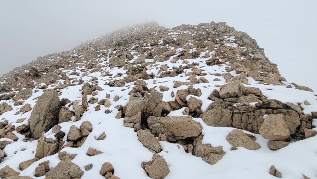
Navigation sounds tricky, especially with the snow. It’s too bad about all the fog as you neared the summit of Mount McArthur, but the conditions looked much better at the top of Mount Pollinger (minus the wind).
Yes, the fog and rainy weekend did put a damper on things. I missed out on getting one of the planned peaks, but that just means I’ll have to go again. Oh well 🙂
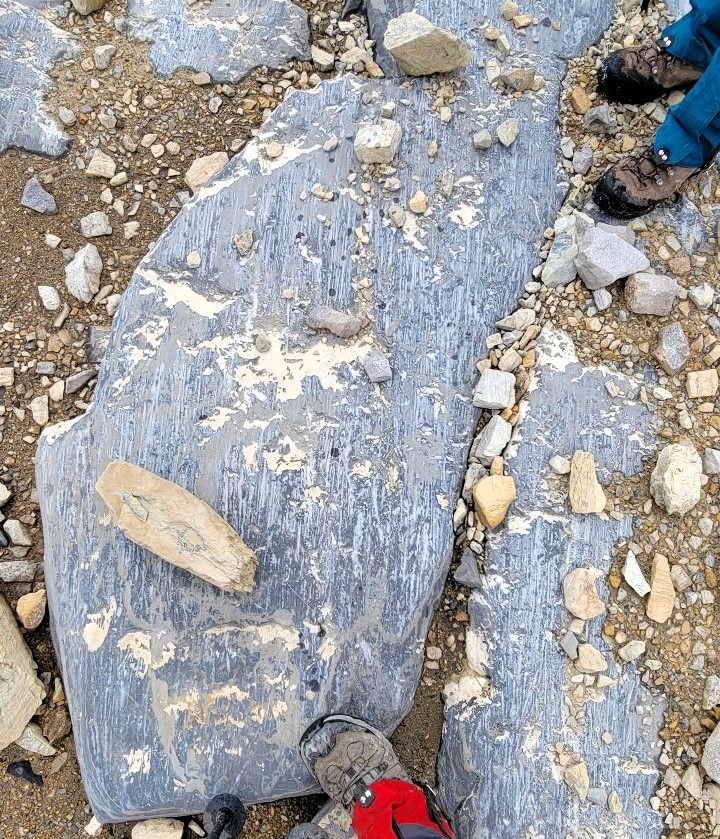
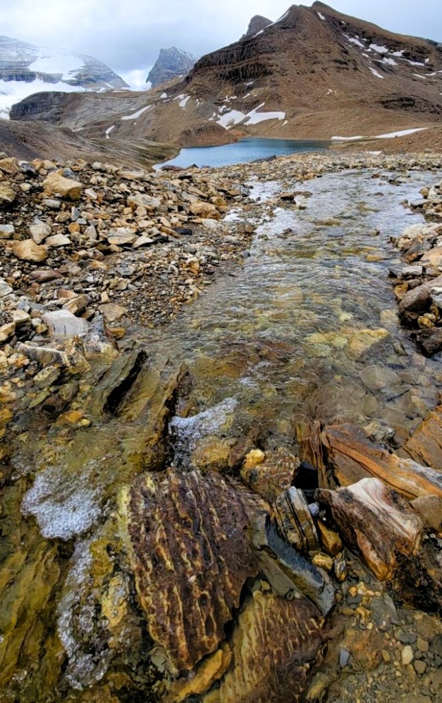
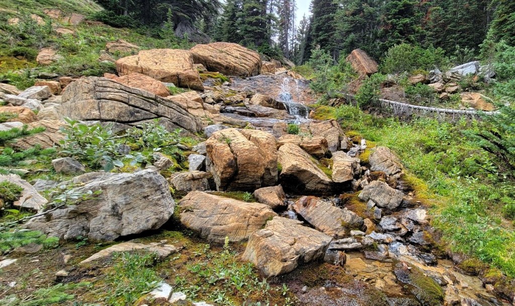
Loved your trek as always.. But what piqued my interest is your coverage of glacial erosion, closely.. Geology has always fascinated me and thanks to you, I learnt something new..
Be safe, keep trekking, keep exploring and keep teaching us more.. 🙂
Oh yes, the joys of travelling with a geologist. My friend Cathy is a PhD hydro-geologist, and she was kind enough to point out that feature on the rocks. I too learned something. I would spend another week with Cathy the following summer at Lake O’Hara where she spends a lot of time doing her field work. I was happy to have found a spring for her to explore there.