October 16, 2023
Odlum Ridge is a quiet mountain, hidden in plain sight right next to some VERY busy trails. While Picklejar Lakes and Mount Lipsett are swamped, Odlum Ridge is completely empty. This is probably due to the Highwood River crossing, and the beastly Willow Whip to access the base of the ridge.
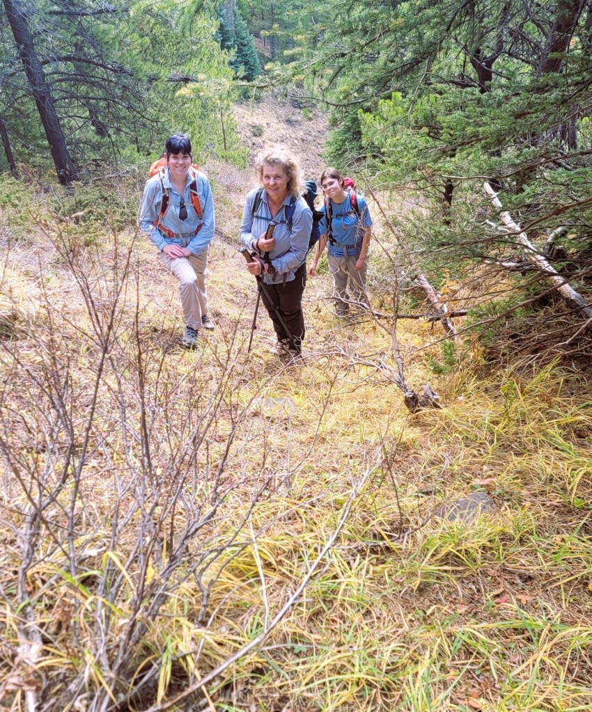
While the ridge itself is quite picturesque, getting up to it is steep, typical of any unofficial trail. I’d read about the Willow Whipping, and thought this was NOT a trip to take friends, but instead decided to subject my family to this treat 🙂
Gear
Hiking boots, poles and regular day pack kit.
Overview
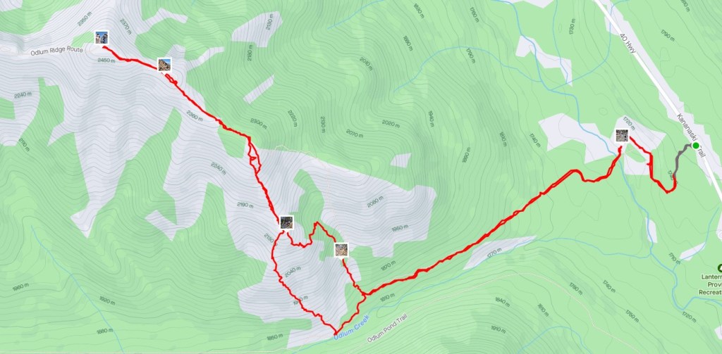
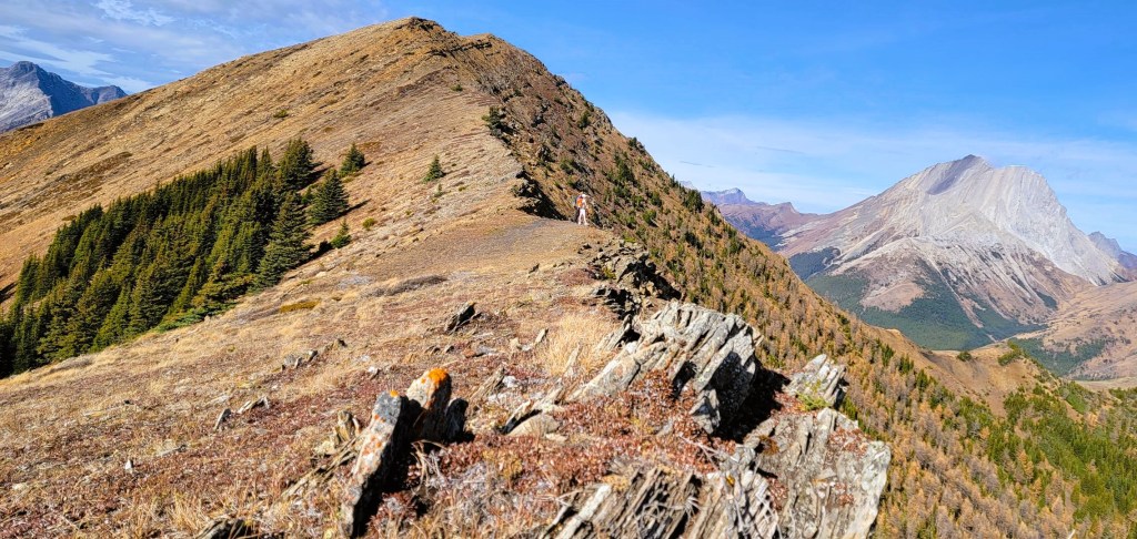
From Highway 40, we parked on the side of the highway, at the small cairn, We hiked in, and found a good trail. This lead to the Highwood River, where we hunted around for a good crossing point. On the other side, we found a marker for the cut line, and the start of the Willow Whip. We took our first opportunity to gain the ridge at the drainage, which wasn’t the best ascent route. Once on the ridge proper, it was an easy hike to the summit. We went to the hightest point, enjoyed the amazing views. On the return, we took an alternate descent route off the ridge, and I would recommend this one.
Totals – Downloadable Tracks on Gaia and Strava
Date: October 16, 2023
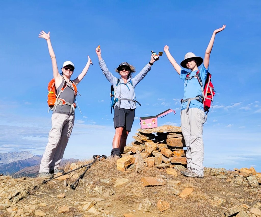
Group: Four (Alisen, Mike and daughters Kayla and Mackenzie)
Distance: 12 km return
Elevation: ~850 m (2,805′)
Time: 5 hours 50 minutes (includes lunch and breaks)

Parking and Trail Head
There are two options. We parked on Highway 40, and found a small cairn to mark the spot. However, after hiking in about 50 meters, the trail intersected with a good trail that came from the Lantern Creek Day Use Area. So if you want a bathroom and an actual parking spot, then start from there.


Main Trail
Once on the main trail, we doodled around until we came to the Highwood River crossing. I purposely chose to wait for the fall, to ensure the water flow would be as low as possible. It was still freezing cold.


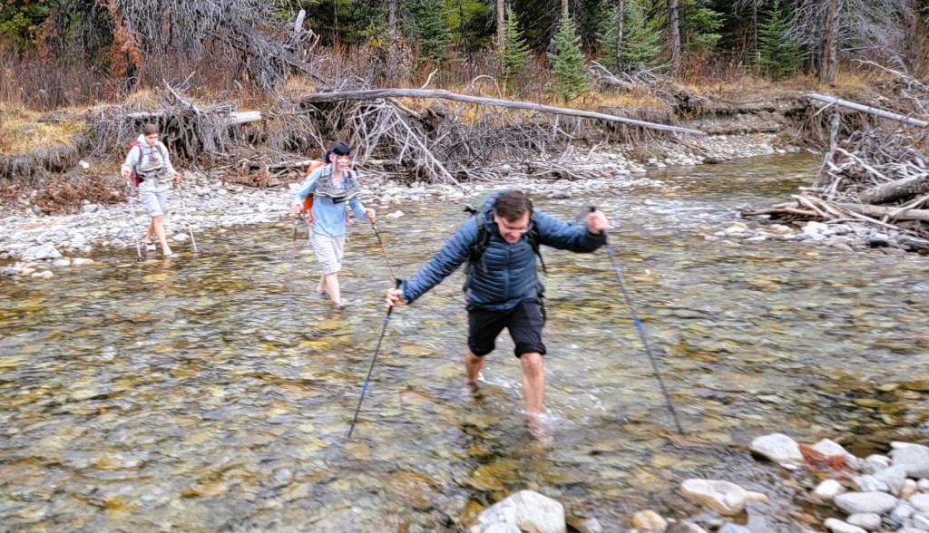
Once on the other side of the Highwood, it was important to find our route. There was a small blazed tree, and that led directly to the cut line.
This is where the Willow Whip started. When I look at Spirko’s pictures from 2008, there wasn’t much willow. Now, the trail is completely overgrown with it. We had to hold up our poles in front of our faces to stave off the worse of the whipping. This was so nasty! On the way back, we could see where someone had pruned back the willows for a bit. Perhaps someone could leave an old pair of pruning shears at the start of the willows, and each time someone goes through, they can just hack them back a little bit.


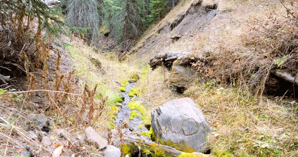
We were eager to get away from the willows, and took the first opportunity to head uphill at the drainage. This wasn’t the best, and we ended up making a hard left turn to get off the side-slope, and hit the ridge proper.


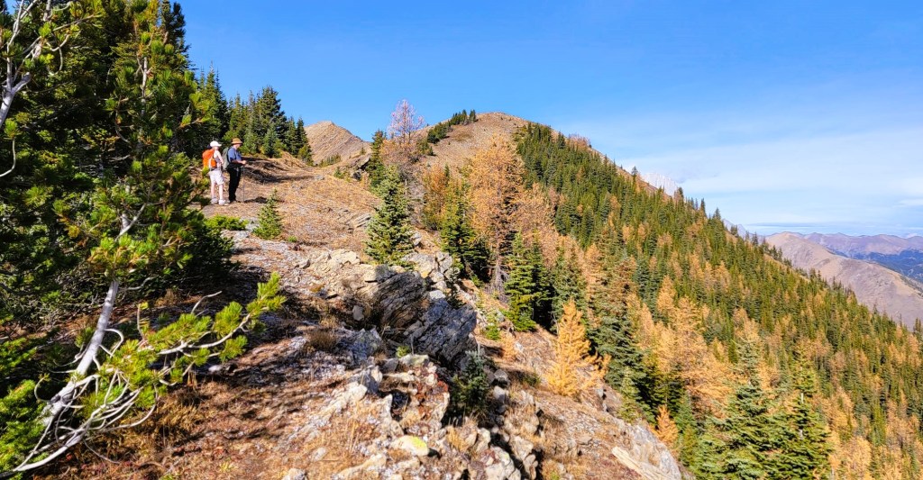
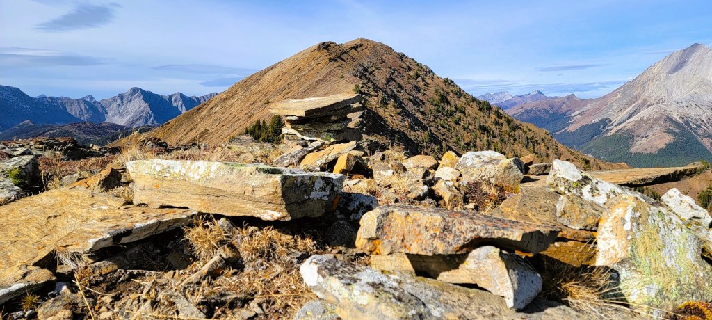
Odlum Ridge Summit
Time to summit was 3 hours even. Elevation gain was about 850 m, with a distance of about 5.5 km.
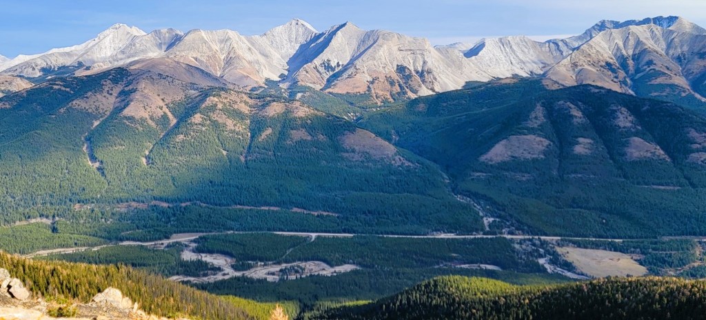
The summit pano was absolutely stunning. While the fall can have some horrific winds, we had a calm day, clear skies, and the views went on forever.

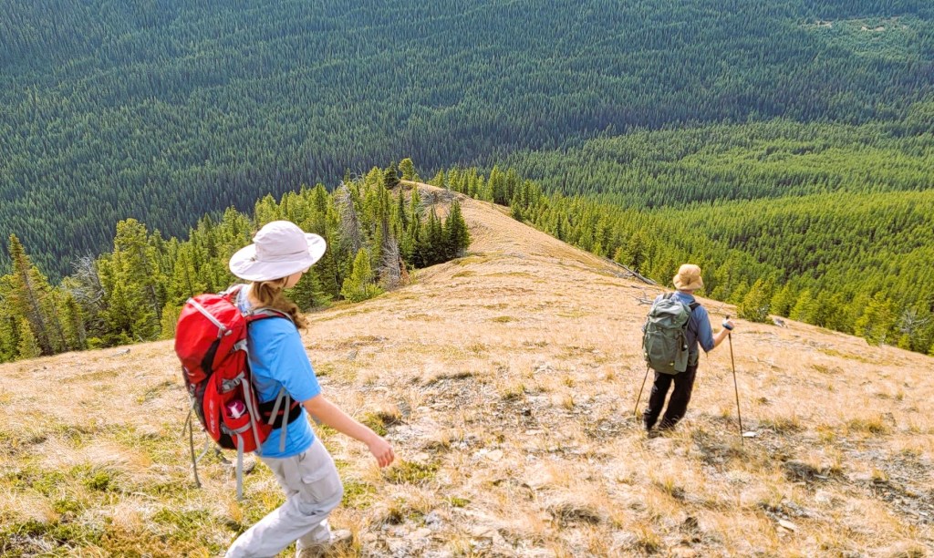
Return Route
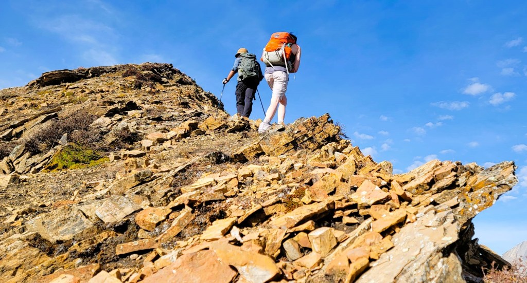
We hiked back down the main ridge, but decided to continue straight down to the valley floor. This was further west than our initial uptrack. This was a great idea because A) there was some interesting rock features, and B) it was a better trail. Once in the valley, we easily picked up the return trail for another 3 km of Willow Whip. Yeah 🙂


Wrap Up
While the actual Odlum Ridge is gorgeous with some amazing views, it’s only 1/3 of the trip. 1/3 is spent in Willow Whip hell, and the final 1/3 is on the steep ascent to the ridge. I’m glad I got this one done, and that I not only had my family with me, but that we had the mountain all to ourselves. If you want a quiet hike with great views but without the crowds, then cross that river and come enjoy Odlum Ridge.
Thanks for reading! Please do me a huge favour and click the Star button to “Like” it. You can also follow my blog, join my FaceBook page Al’s Adventurers, or follow me on Instagram
Alisen
I love all things mountains! I live next door to the Canadian Rocky Mountains, however I travel the world to enjoy the many different mountain environments and cultures that I can. I hope you enjoy these trip reports, and that it inspires you to accomplish your own adventure goals.

The river crossing and navigating through the overgrown willows does not look fun. I guess that explains why it’s called the Willow Whip! But it sounds like it was worth the effort as the views from the ridge are gorgeous. Love the picture of you with your daughters at the summit!
That Willow Whip was awful. We actually didn’t go the extra distance to the far peak, because the return route would have meant even MORE willows. Brutal. I don’t think I *sold* that peak, but a few adventurous souls will try it.