September 17, 2015
June 28, 2021
We had a very unusual heat wave hit western Canada in late June. Temperatures were north of 35 degrees Celsius in some places. I can handle the cold, but that much heat so early in the summer? Blah! What to do? Go high and get wet! Our plan was to hike to see all four Picklejar Lakes, and then cool off with a swim in the third lake.
My friend Nancy has a fun hiking group, and she invited me along to hike Picklejar Lakes. On my first hike here in 2015, Annette and I had the entire trail to ourselves. It was such an overlooked hike, that when we saw fresh bear tracks, we seriously considered turning around. This time it was a different story. Despite our early start on a Monday morning, the parking lot was already full.
Picklejar Lakes is a straight-forward, there and back hike. At just over 500 m elevation gain, and anywhere from 8-12 km, it’s one of the easier hikes in the area.
Gear
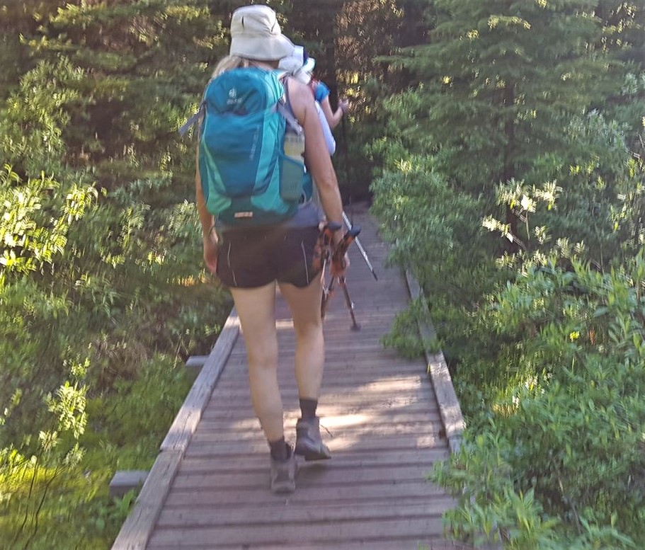
Hiking boots, poles and regular day pack kit.
Overview
From Lantern Creek Day Use Area, cross the highway and hike through trees to the high point. Go over the rock outcrop, and descend into the valley. Make your way through meadow and boulders to see as many lakes as you want. Return the way you came.
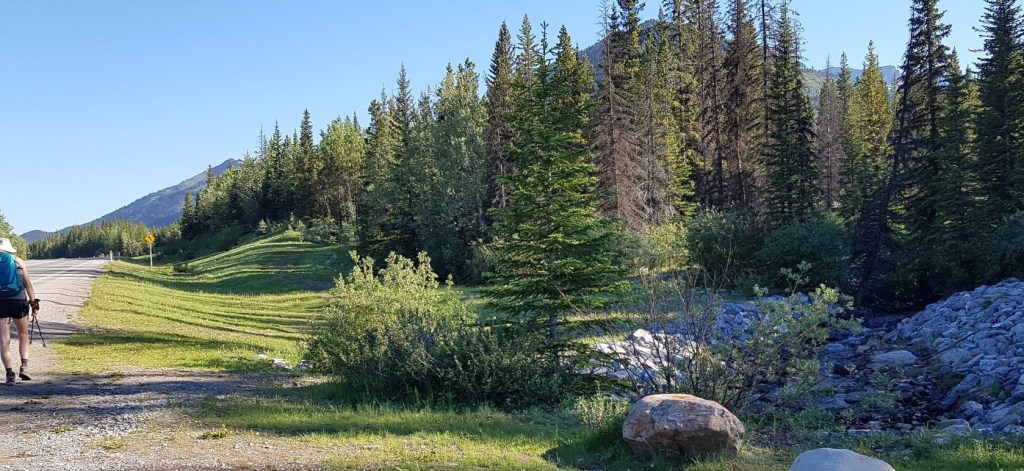
Parking and Trail Head
The Lantern Creek Day Use area is on the West side of Highway 40 in southern Kananaskis Country. Cross the highway, and walk north. Immediately after crossing what I assume to be Lantern Creek, the trail head to Picklejar is clearly visible.


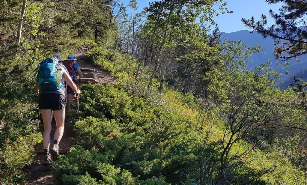
Main Trail
Once on the main trail, it is a straight shot to the lakes. The first 2.5 km or so is a hike along the side of the ridge, well above the creek. After immediately gaining some elevation on the north side of the ravine, we passed several large avalanche slopes. These open meadows are ideal for wildflowers, but they also make this a place to avoid in the winter. The highway is closed from December 1 to June 15th, but early snow would make this area dangerous.
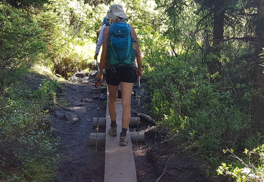
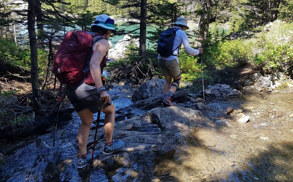
Around the 3 km mark, we dropped down to cross a creek. There are three little bridges here. The first two are really just raised areas to keep you out of the mud and muck. The final bridge is the actual creek crossing.

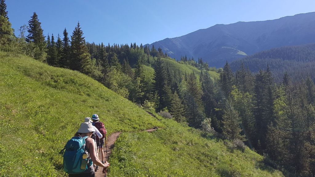
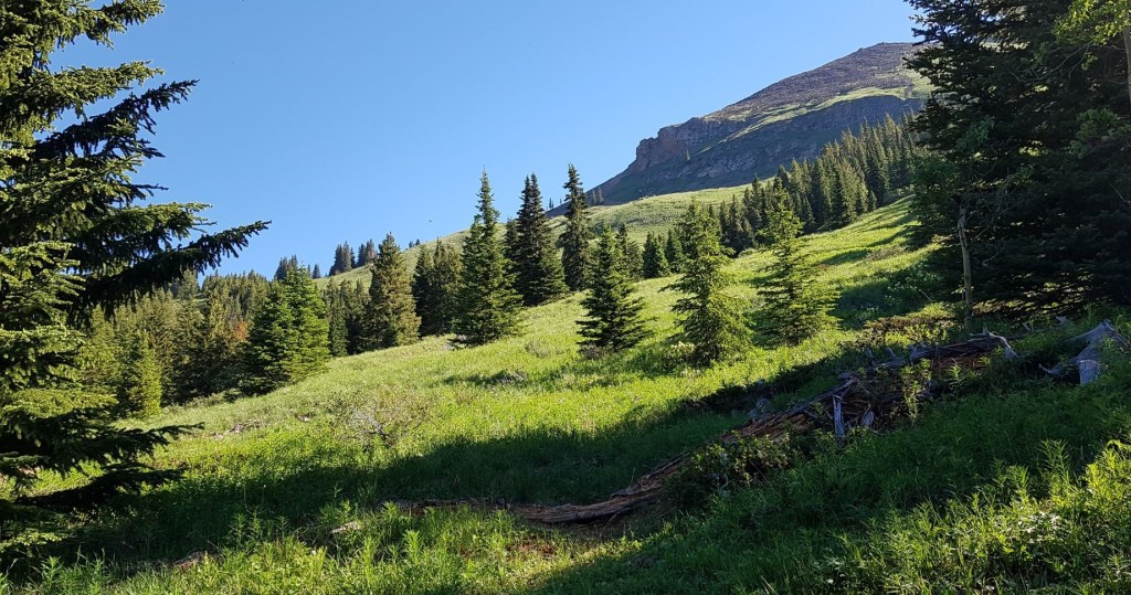
Once we crossed the creek, it was time to regain our lost elevation. That’s okay though, because we had a beautiful meadow to walk through. I remembered this meadow from my first trip, and I was very much looking forward to admiring its beauty again.
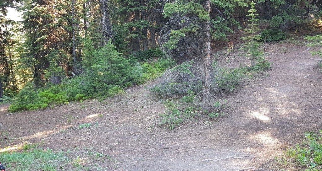
Once past the meadow, we re-entered the forest. Now is the time to keep your eyes open to stay on the correct trail. Some side trails have been obviously blocked off, while others just peter out.

At around 4.2 km, we hit the Lineham Ridge spur. We stayed on the main (lower) trail. There is a trail heading up to the right, but that’s a scramble route to hit the summit of Lineham Ridge.
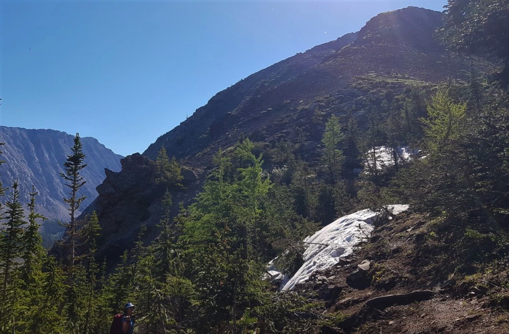
This looks imposing, but it’s an easy up and over. If you’re new to hiking, just take your time. We took advantage of the clear skies to nab a few photos.

This is the high point of the trail at 2190 m. Elevation gain from parking lot is 461 m.

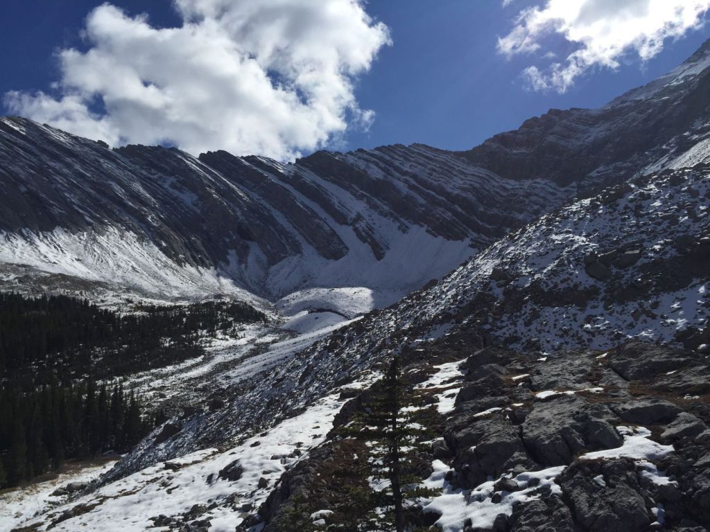
From the high point, it’s a walk down a well trodden scree slope to the first lake. Be aware of the avalanche chutes on the side of Lineham Ridge.

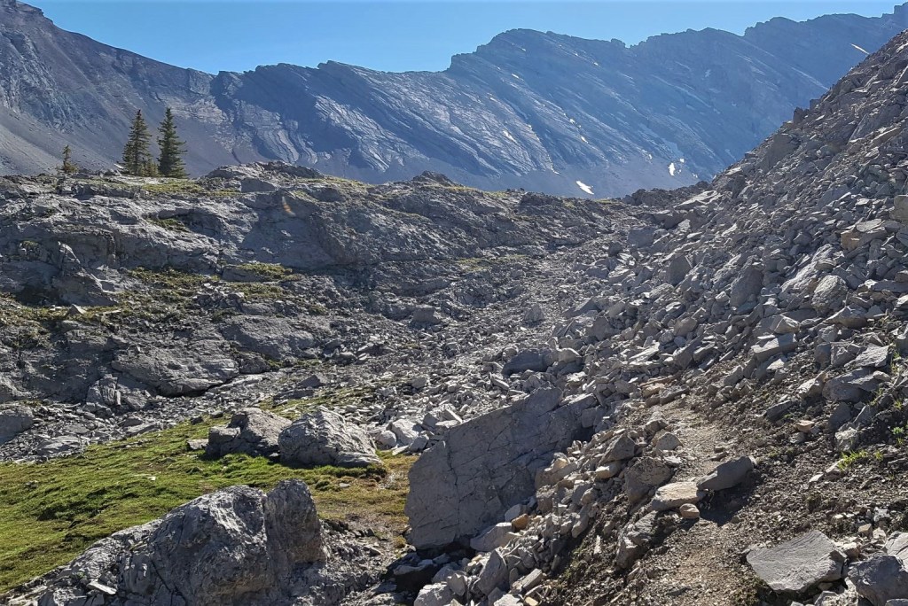
Once past the first lake, the trail leads to a boulder field.

By keeping an eye out, we easily found a trail on the other side of the boulder field. This lead to the second lake.

From the second lake, take the trail to the right. This leads to another boulder field. From here, we could easily pick out the trail through the scree that leads around the far south edge of the third lake.
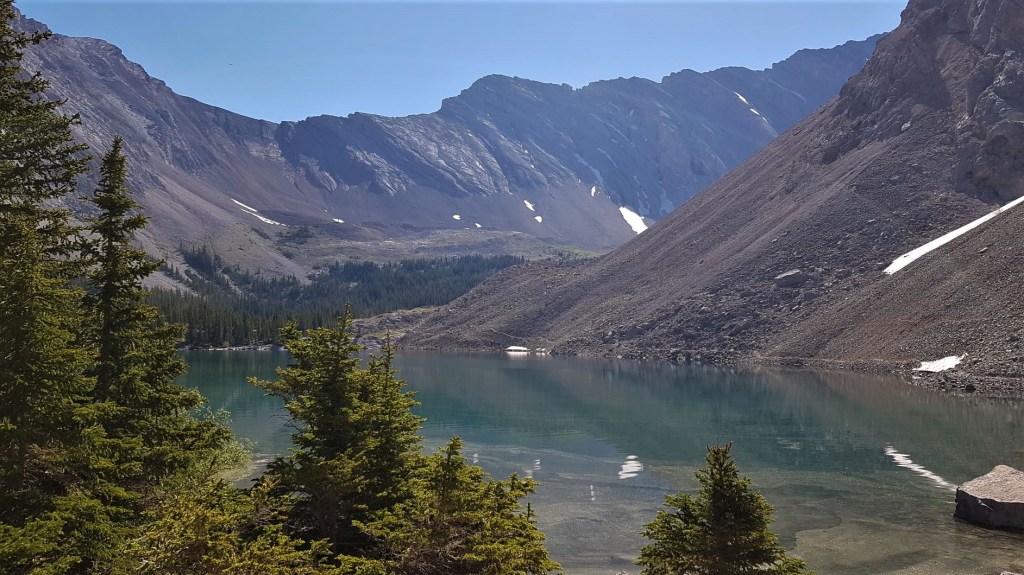
At the far end of the third lake, we turned right and headed up the small scree slope. The other side gave us an amazing view of Lineham Ridge, and a view down onto the fourth lake.


Distance to the far point is about 5.5 km. Total elevation gain for the trip is 526 m, but the high point is back at the Lineham Ridge spur. Time to this location is 2 hours, 15 minutes.
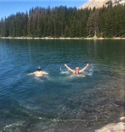
After we got our fill of good views, we descended to the far east end of the third lake. There is a rocky shore here, with large flat rocks that gently lead into the water. After some lunch, we all stripped down and jumped in. I’m not one for water, especially cold water, but this was absolutely delightful. I went in twice, which says a lot about the intense heat and the lovely lake.
Picklejar Lakes Return
As we were down on the shore, we continued around the other side of the third lake. This required some creek crossings, and a bit of hunting for the right trail. It wasn’t really worth it. If you are just admiring the lake from above, then return along the scree slope to the second lake.
Once we passed the first lake, there was the final climb back up to the high point on Lineham Ridge. While this looks daunting, the grade is quite nice and we were up in no time.

From the meadows, there are fantastic views of the mountains across the Highwood River valley.

We were back at the cars in no time. They were super hot after baking in the sun all day, so thank goodness for air conditioning. My hair was dry by the time I got back, but that swim made the difference between not hiking, and having a great day in the mountains.
If you found this post useful, please do me a huge favour and click the Star button to “Like” it. You can also follow my blog, follow me on Instagram, or join my FaceBook page Al’s Adventurers.
Alisen
Totals – Tracked on Gaia, displayed on Strava
Date: June 28, 2021 (fourth lake lookout, swim, return far side of third lake)
Group: Four (Alisen, Nancy, Carol x 2)
Distance: 11.98 km
Elevation: 526 m (1,735′)
Time: 5 hours (includes lunch & swim break)


I love all things mountains! I live next door to the Canadian Rocky Mountains, however I travel the world to enjoy the many different mountain environments and cultures that I can. I hope you enjoy these trip reports, and that it inspires you to accomplish your own adventure goals.

We did Pickle Jar lakes as a loop including Mist Ridge a couple of years ago. We didn’t see anyone except when passing Sheep River campground. I never would have thought this trail was ever busy.
I agree. Things have changed a lot in the last few years. Many trails that were faint outlines are now beaten into submission.
Beautiful photos! I think I like lake 3 the best. Do you happen to know where the name “Picklejar” comes from? It seems like a strange name for a lake.
I could be wrong, but years ago someone told me that because Parks stocked the lake so full with fish, that it was like fishing in a picklejar. Super easy. 😂 No idea if that is true, but it’s a great story.
Hah! I’d buy it, it sounds like a reasonable explanation to me.
What a beautiful place. And a cool lake on a hot day is the best!
To be clear, the lake is COLD (it is fed by snowmelt) and I would never normally get into it. On that day though, I think I would have jumped into an ice bath 🙂
I understand! Peace and blessings.
I heard about the extreme heat wave you had out west. I applaud your efforts to still get outdoors to go for a hike. What better way to reward yourself and cool off than by going for a swim in the lake! The third lake looks gorgeous and I bet the water was refreshing!
I don’t think I would have made it without the swim. Like a lot of Canadians, cold is no problem. Heat just saps me.
Many Things have changed
Wow super!
It’s a pretty super place!
It seems that is right
Love these beautiful lakes. Like you being a Canadian..I am used to cold DAYS . LOL
I know!!! 🙂 Do you find it takes forever to get your summer blood in? I find by the time I get used to the heat, it’s almost fall. Then I freeze for all of October and November until we get a -20 cold snap.
Yes.. temperatures go up and down.
.
Awesome Place. There so many beautiful lakes in Canada. Thanks for sharing one of them. Superb photography…💖💖
Thank you very much. The scenery does all the hard work and makes the photos easy 🙂
Nice
Glad you liked it.