May 1, 2025
This was my second hike of 2025, and only 1.5 days after my first hike – summit of Swansea’s south and north summits (13 km and ~850m). My legs were tired, and my feet were swollen. I had to wear my widest pair of boots, and even then it felt like a tight fit. Was I ready for a 1,550 m and 23 km day? Not really, but I had committed, and it looked like an interesting objective.
I signed up with the Alpine Club of Canada’s Rocky Mountain section with a new trip leader named Bradley. He’s posted some interesting trips, and I was looking forward to joining him. Turns out, we have a similar pace, and the conversation never lacked once. I’d never been to this side of Waterton, so I was all ears as I soaked up Bradley’s intel.
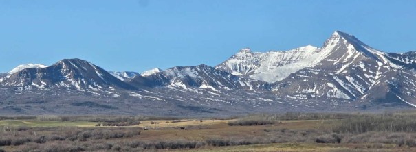
For May 1st, the day was very warm, the sky was clear, the trail was dry, and there was very little lingering snow near the summit. We didn’t see any bears (a first for me at Waterton), but we did get covered in ticks! Despite our best efforts, we had them on our clothes and our backpacks. We found one in the car on the ride home. I jumped in the shower the second I got home (threw my clothes right into the washing machine), and dislodged a tick from my hair. SO gross!!!!
Despite the ticks, this is a great early season objective as the snow does melt here faster than up north.
Gear
Hiking boots, poles and regular day pack kit.
Overview
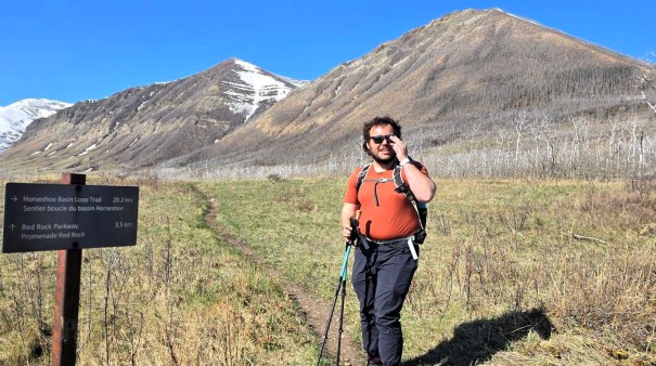
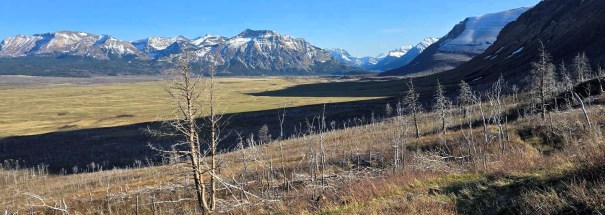
From the trailhead, go Left at the first Horseshoe Basin sign, and then veer right at the second sign. Continue on this well defined trail, crossing a few creeks. Continue to the end of the valley, and take the switchbacks to the col. Turn left, and head up the spine to the summit of Dungarvan SE2. Return to the col. Hike past the switchbacks, and ascend the high point of Lakeview Ridge. Head south to complete the ridge. At the end, we descended off the west side for a lower angle descent. Connect with the trail, and hike back to the trail head.
Totals – Downloadable Tracks on Gaia, Displayed on Strava
Date: May 1, 2025
Group: Two (Alisen and Bradley)
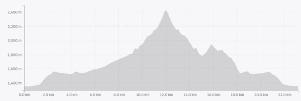
Distance: 23.15 km
Elevation: 1,552 m (5,122′)
Time: 9 hours 30 minutes (includes lunch and breaks)

Parking and Trail Head
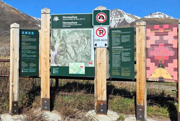
We drove to the Bison Paddock in Waterton National Park (prior to the gates), and parked at the end of the road. Other than an info board, there are no facilities or outhouses. We unlocked the gate, and secured it behind us.
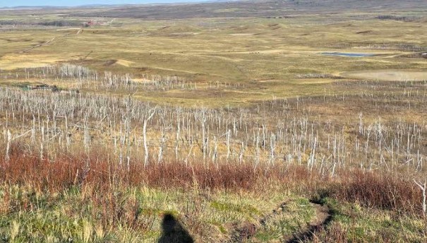
This is also the start of the Horseshoe Basin, a 20 km loop of the lower hills in the area. We followed the trail around the Indian Springs, and then turned Left at the first sign for the Horseshoe Basin. After about 1 km, we veered right to stay on the Horseshoe Basin trail.

Main Trail
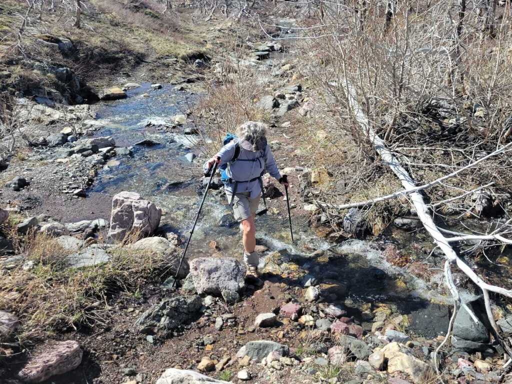
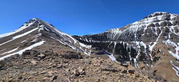
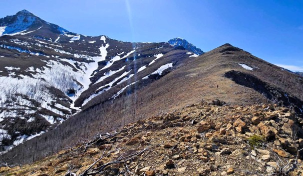
The trail went up and over a small hill, and then descended down to the low point, and a creek crossing. There was a good crossing spot, with lots of nicely placed rocks. We then followed the creek bed, gently gaining back some elevation. We crossed the creek two more times. At the end of the valley, we hit a wall. Not to worry, there’s an excellent National Park switchback trail up the col. Barely even broke a sweat.


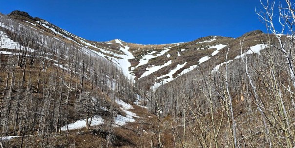

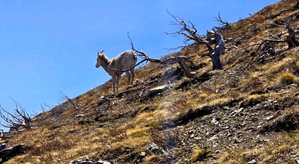
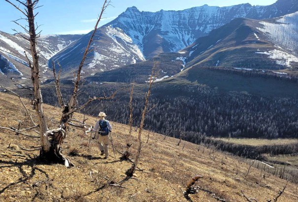
At the col, I shook off one tick from my pant leg, and then we went left to ascend the Dungarvan ridge. There was a really big trail beaten in, so we followed it around to the right. We thought it would switchback up the backside of the ridge, but it never really did anything. We abandoned the trail, and hoofed it straight up to the first big nubbin. We saw a female Rocky Mountain Sheep on this section, so all was not lost.
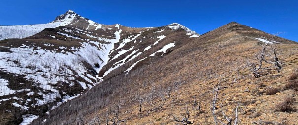

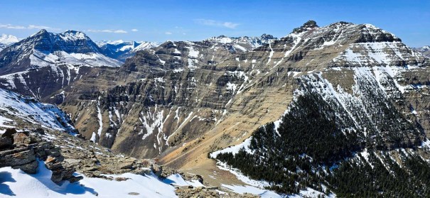
Once on the ridge, we stayed as close to the ridge top as possible. At the dark wall, we skirted to the left. I was tired from my previous summits, and Bradley is a new dad, so neither of us were overly stoked. There was a stiff breeze on the ridge, but no gusts. Nothing that required more than a light windbreaker.
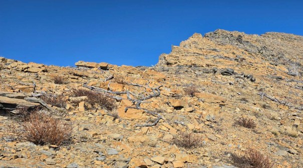
Once at the base of the steep climb to the summit, we eyed up the route a bit. There was some lingering snow, that we elected to avoid as much as possible. I’d probably just stick to the ridge edge in dry conditions, but we needed to skirt to the right. We weren’t the only ones, and found a few nice trails starting to develop in the scree.


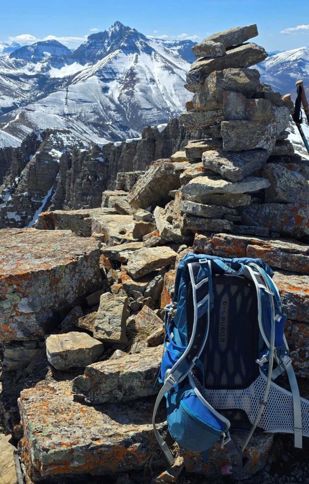
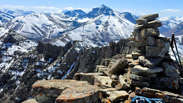
Dungarvan SE2 Summit
As we neared the summit, the rock changed to larger slabs, with a few bigger boulders to navigate around or over. The summit is a short ridge to a nice big summit cairn. We had the option of continuing to the next lower point, but the hard packed/icy snow was not enticing.
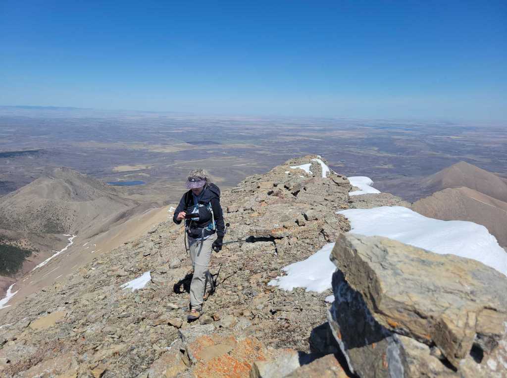
Time to summit was five hours. Distance was 12 km and ~1,050 m elevation gain.

We had a quick bite to eat, brushed off a few ticks that hitched a ride on our packs, reapplied the DEET, and then started down the same way we came up.
We followed our up track to get off the mountain summit block, and then stayed on the ridge spine almost to the end. We were now on top of the scrambly wall we avoided on the way up, and took a side gully get down.


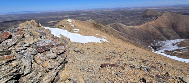
Lakeview Ridge Summit – High Point of Horseshoe Basin

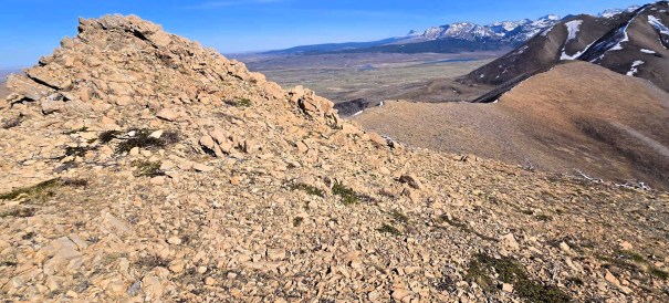
Once back at the col, we hiked past the top of the switchbacks, and made our way up the ridge to hit the high point of the Horseshoe Basin – Lakeview! There are some bigger boulders to scramble over on the left, or just plain old scree on the right. At the top, we found a cairn and a geological survey marker.


Total time to the top of Lakeview was seven hours. Total distance was 15.8 km and elevation gain of about 1,550 m.
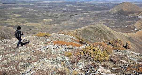
As the day was getting on, we both turned off Airplane mode to text our families we were still alive, and still going. We then headed south to hike the several bumps that make up Lakeview Ridge. Before the final bump, we decided to take the more gentle descent off to the west, instead of going straight down the south side. We angled down to the creek bed and trail below. It was SO nice to be on a flat trail again, and we picked up the pace for this section.

At the big creek crossing, we took 5 minutes to splash off the sweat and dust, and felt reinvigorated for the final 3 km or so back to the car.
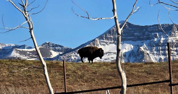
The Bison decided to wander over to us, and we saw several of these big and beautiful beasts very close to the fence. A nice way to end the hike!
Back at the car, we both shook out our hair and clothes to rid ourselves of any ticks. I even switched into a full set of new clothes. Bradley found one tick on his arm while driving home, and I found a tick in my hair during the shower. Bradley said he found four more ticks in his car after he got home. I left my backpack in the garage, and my clothes went straight into the washing machine. Fingers crossed I found all the ticks!
Wrap Up
I love Waterton for early season routes. While May 1st is pretty darn early, the Dungarvan and Horseshoe Basin routes were both in excellent shape. Even if you don’t want to summit Dargarvan, the Horseshoe Basin is a worthy hiking objective.
Thanks for reading! You can follow my blog, join my FaceBook page Al’s Adventurers, or follow me on Instagram
Alisen
I love all things mountains! I live next door to the Canadian Rocky Mountains, however I travel the world to enjoy the many different mountain environments and cultures that I can. I hope you enjoy these trip reports, and that it inspires you to accomplish your own adventure goals.

Fantastic and honest trip report! The mix of scenic beauty, tough climbs, and tick chaos really brought the hike to life. Loved the route breakdown and your reflections—especially powering through after Swansea. Despite the pests, sounds like a memorable day in Waterton. Thanks for sharing!
Awww, thank you very much. I love YOUR recap of the day. The powering through is the hardest part. I will admit to being done on the final ridge, and just wanting to get back down. Thank you so much for stopping by!
You’re so welcome! Totally get that feeling on the final ridge—sometimes it’s sheer willpower that gets us through. But you did it, and your story captured that perseverance so well. Looking forward to reading more of your adventures!
Ticks can survive being washed; they can’t survive being dried. During tick season (which starts now where we are), we dry first, then wash.
I’m hoping they cannot survive a trip down my drain pipe! 🙂 My hiking buddy told me that ticks can survive for up to 300 days without blood. Whole new terror unlocked.
Lovely views as always! But ew ew ew, I think the ticks might have chased me away from this one.
I hear you Diana. Unfortunately, spring is always tick season, but they are particularly bad this year. Last weekend was the first mountain I did this year when I did NOT bring home a tick. So gross!
Sounds like a nice hike minus all the ticks! And here I thought you only really get ticks when you’re hiking near or in the grass or bushes. Beautiful pictures from along the trail. Looks like you had nice weather. Love the bison sighting at the end!
You are absolutely right Linda – ticks usually get you in the long grass. I’ve heard that this is a really bad year for ticks. Usually they are way worse in BC, but I think with our lack of cold winters, and shorter winters, the Alberta ticks are increasing in numbers. They are absolutely gross. Good news – the tick season is almost over and last weekend I came home with ZERO ticks. Woot! Woot!
It seems like they getting worse every year. It’s the same here in Ontario too. Glad to hear that tick season in Alberta is almost over! Happy hiking!