May 27, 2025
My daughter Mackenzie had a day off from work, and said she wanted to hike at a moment’s notice. No problem! I had the Tunnel O’ Fun route in my back pocket for just such an occasion. I had looked at the route from several different vantage points – Mount Hoffman, and on my way to Shunga-la-she, but I will admit to not doing any research. It looked fairly straight-forward – head straight up the ridge to the summit.
After hiking and scrambling in these mountains for about 25 years, I sometimes like to surprise myself. By surprise, I mean do little or no trip planning. Why? For me, it adds to the fun to do some on-site route finding. Did this route surprise me? Yup! In several ways.
A little background is needed. My daughters have grown up in the mountains, and they are very competent scramblers and climbers. Indeed, they are both better than me and move really well in the mountains. What’s new, is they are now leading themselves. It’s a very different ballgame between following mom and dad around, verses leading routes themselves.
To start leading routes, my daughters have redone several routes they did with me. Two weeks prior to this trip, Kayla and Mackenzie re-did Mount Baldy. Unfortunately, they got off route at the start and ended up doing the entire traverse from south to north. This is advanced scrambling, but they kept their heads, and found their way through. To make matters worse, just days after their Mt Baldy traverse, a man died falling off the same mountain. It is with this background knowledge that we made our biggest decision at the summit.
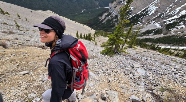
In the spirit of helping Mackenzie learn how to route find and lead, she did the majority of the leading, especially when we got out of the forest and into the scrambling. I acted as back-up, and to discuss options.
Gear
Hiking boots, poles and regular day pack kit.
Overview
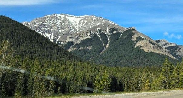
From the Junction Falls trail head at the end of the Sheep River Highway (#546), hike south down to the Sheep River and cross. On the other side, look for the start of the trail on the right, or just start bushwhacking up. Aim for the ridge, where a trail magically appears. Hike straight up, passing some rock walls and open slopes on the ridge. At about 2.6 km, scramble up a short headwall, then continue up the ridge. Around 3 km, bend around a rock wall to the right, which leads to the Tunnel. Access is via the back, or northwest side. The southeast side is a Class 5 climb. Descent route is either return the way you came, or do the loop down the scree/boulder field to the Junction Falls trails in the valley.
Totals – Downloadable Tracks on Gaia, Displayed on Strava
Date: May 27, 2025
Group: Two (Alisen and Mackenzie)
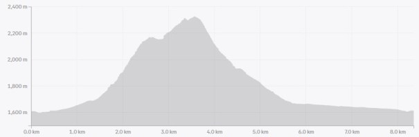
Distance: 8.35 km loop
Elevation: 806 m (2,660′)
Time: 6 hours 30 minutes (includes lunch and breaks)

Parking and Trail Head
We drove the Sheep River highway to the very end, and parked in the lower lot, closest to the river. We hiked down to the Sheep River, where I got my first surprise. Dang. No bridge. In May. With high water flow due to the spring run-off. I guess if I’d done a tad bit of recon before running out of the house, I might have noticed this.
Mackenzie thought she had her hip waders in the car, but no such luck. She did have a pair of water sandals. She waded across first, and then threw the sandals back to me. I waded across, and we hid the water shoes on the bank. No sense carrying wet shoes.

Main Trail
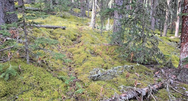
Once across the Sheep River, we turned right almost immediately to start hiking up. There was a faint trail through the moss to start. This trail petered in and out, until we veered left enough and hit a major trail heading up. Awesome!


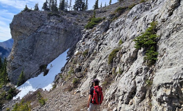
Just shy of 2 km, we left the forest and hit the first rock wall. This short scramble had nice holds, with several choices of routes.

Above was a typical straight up scree churn, but it lead to a mini “Tunnel O’ Fun”. I handed the camera over to Mackenzie as she’s a better photographer than me. There was some scrambling to get above this feature. This lead to the ridge, with a clear view to the large rock wall above.


Once at the rock wall, we traversed left. This was steep, soft ground, and I discovered that my hiking boots were not up for the challenge. I was slipping back down, which wasn’t ideal. I should have worn my stiffer scrambling boots.

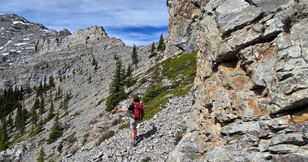
My topo map contour lines didn’t show this rock wall. No matter – we had to find a weakness to scramble up. I had a track on Gaia, but the ideal route was plugged with snow. Mackenzie and I found a weakness just to the right of the snow. We made sure we could down-climb it in case we wanted to come back this way.
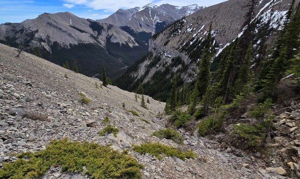
Above the rock wall was a short scree churn up to another long ridge. It was hard to tell where this route was going to end up from here, but that was part of the fun – the not knowing.

At the end of the ridge, we found another wall of solid rock, with amazing views of the surrounding peaks – Gibraltar, Burns East, and Junction. We hiked around the end of wall….and there it was! The Tunnel O’ Fun! There were some jumbled boulders in front, but the going was good.


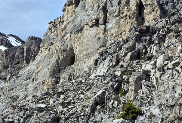
Tunnel O’ Fun Summit
Now for the big decision of the day. We did not like the direct route on the southeast side. Deciding I finally needed some intel, I turned on my cell and got 5 bars. I found a trip report by Michael Kurth who did the route the summer before. He kindly graded the SE approach as Class 5 climbing. He describes it as a down climb:
“Left side two 5.8 moves (overhanging) into 4th class. Right side two 5.5 moves into 3rd class.” My worn out hiking boots would not support any class 5 moves. That was out.
We checked out the NW side and found too much snow. While it looks doable from the photos, a slip leads to a 1,000 m drop to the valley below. With my crappy boots, and no ice spikes, we didn’t feel that tackling old, icy snow was the safest decision. Mackenzie was still stung by her Mount Baldy experience, and was keen to be safe, not sorry. As a mom, I heartily supported her decision. The mountains are not going anywhere, and as this is only an hour from my home, we can easily come back another day.
We made the tough decision to end our day here. We sat down, enjoyed the view to the east, and ate our lunch. Time to the summit was 3 hours 30 minutes. Distance was 3.6 km, with 800 m elevation gain.


Tunnel O’ Fun Return Loop
I wasn’t sure I wanted to take the gully route back, but looking at Michael’s photos on his trip report made me think it was worth a try. As with most direct descents, it starts out fine, and gets old really quick. At the top, we found a few lines of good scree skiing. That of course, didn’t last as we were quickly in jumbled rocks of various sizes.
The Gaia track showed a hard right, which I followed. Good thing as staying straight leads to a rock wall. We traversed right at the choke point, and found very smooth rocks. Luckily, they were dry.


Below is a tight gully. We went left into the trees for a bit, then popped out again to see a massive chasm. Truly, the rock formations on this route are something else. Not just a straight up scree slope at all.


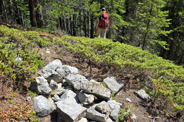
When we were nearly to the Junction Falls trail, a cairn appeared on the well trodden trail – the first one all day. Why? Who knows. I can’t imagine hiking up this section!
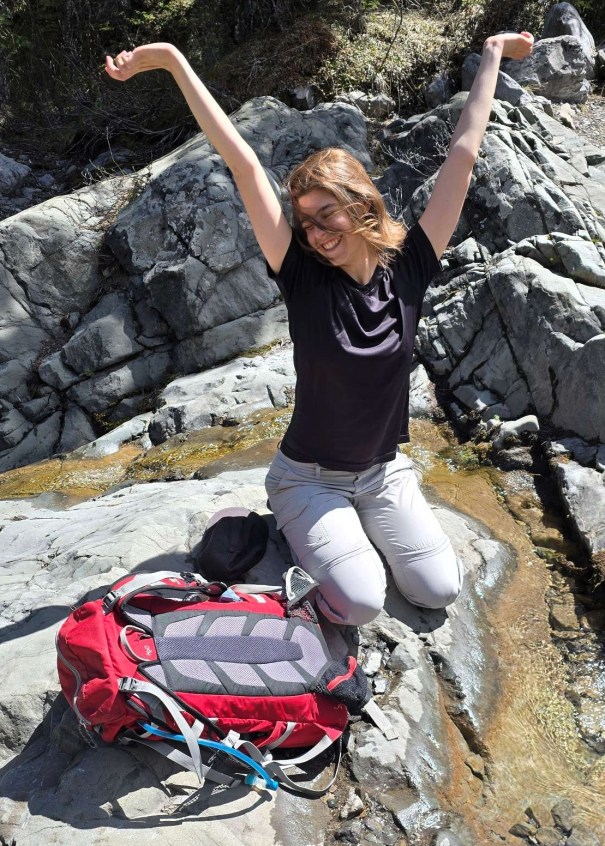
At the Junction Falls trail, we found a small watering hole. It was such a hot day, so Mackenzie dove right in. We soaked our shirts, and hats, and got as wet as possible for the long walk back to the Sheep River.

Wrap Up
The Tunnel O’ Fun route was a fun and interesting traverse. My only regret was not waiting another two weeks for all the snow to melt, as this would have made the route to the tunnel possible. I was proud of Mackenzie for leading the whole thing, with the occasional support and encouragement from mom. One day, she will be leading me around, and I cannot wait!
Thanks for reading! You can follow my blog, join my FaceBook page Al’s Adventurers, or follow me on Instagram
Alisen
I love all things mountains! I live next door to the Canadian Rocky Mountains, however I travel the world to enjoy the many different mountain environments and cultures that I can. I hope you enjoy these trip reports, and that it inspires you to accomplish your own adventure goals.

Well done to Mackenzie! And a stunning route by the looks of all your photos ❤️
Loved the different layers of rock in the wee Tunnel O fun. Slate topped with granite? … it’s going to be some awesome rockslide when that underpinning finally wears out/gives way. 😀
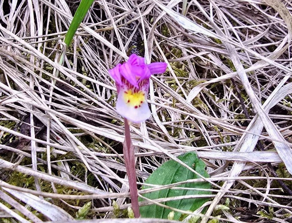
Sounds like a fun hike to do with your daughter and to help build her route finding skills. That river crossing looks intense! The Fairy Slipper Orchid is gorgeous. What a lovely surprise to find on the trail. It’s too bad about all the snow, but you ladies made great progress!
What a great hike! I love that ridgeline and the views. I admit, from your photo it doesn’t look class 5 at all to get up to the tunnel. Very deceptive.