July 15, 2021
I had been eyeing up Shunga-la-she from several vantage points in the Sheep River, including Mount Hoffman, Little Ware and Missing Link. I will admit I’m not a fan of the overly long approach, and every mountain in this area has one. Time to just suck it up and get ‘er done.
Shunga-la-she was on the top of my Mountain To Do List for 2021, after having missed the summit last November. Mike was recovering from gall bladder surgery, and had several bouts of intense abdominal pain while we were climbing up. Despite being 2/3 of the way, we made the conservative choice and headed back down. The mountains are not going anywhere, and there is always another day to summit.
Today was already much better! We were at the trailhead by 6:00 am to try and beat the heat from the unusually long and sustained heat wave. There was smoke from the Kelowna forest fires, but we were hoping for a few good views.
I wanted to know the meaning behind this interesting name, but the only thing I could find was in Gillean Daffern’s Kananaski Country Trail Guide, Volume 4 (4th edition). This is word for word, so don’t blame me: “Shunga-la-she, a beautiful-sounding name meaning ‘the mountain white man shit on,’ according to Rob Z. who used to man the Bighorn ranger station eons ago.”
Shunga-la-she is a scramble that requires route finding skills, and the ability to climb multiple short ridges.
Gear
Boots suitable for scrambling, day pack kit, and hiking poles. This route avoids the river crossing.
Overview
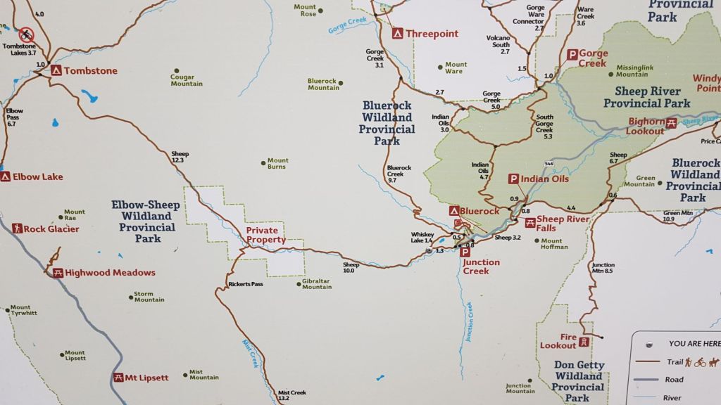
From the Junction Creek trail head in Sheep River Provincial Park, take the closed road west. Cross the bridge over the Sheep River. Hike another ~250 m to the trail head on the left (south). Follow the trail through the forest, heading towards the base of the ridge. Follow the ridge to the tree line, and churn up the short but steep scree to above the pinnacles. Pick up the trail in the scree to the right, and follow it to the spine of the ridge. Go around the steep wall to the right, then hike up to the col. The fun scrambling now begins, and continues until the final scree push to the summit. Cross the scree/talus slope, making for the low point on the east/west ridge. Once on the ridge, turn east until you hit the summit. Return the way you came.
Parking and Trail Head
Vehicle parking is on the lower loop of Junction Creek. The upper loop is reserved for horse trailers. If the lower loop is full, find somewhere else to park as the horsey people need all the space they can get.
Hike back up to the upper loop, and head west at the trail sign. This is an old road that used to be open to cars waaaayyyy back when. Mike remembers driving on it as a kid, despairing when his folks’ campervan got stuck in one of the river crossings.
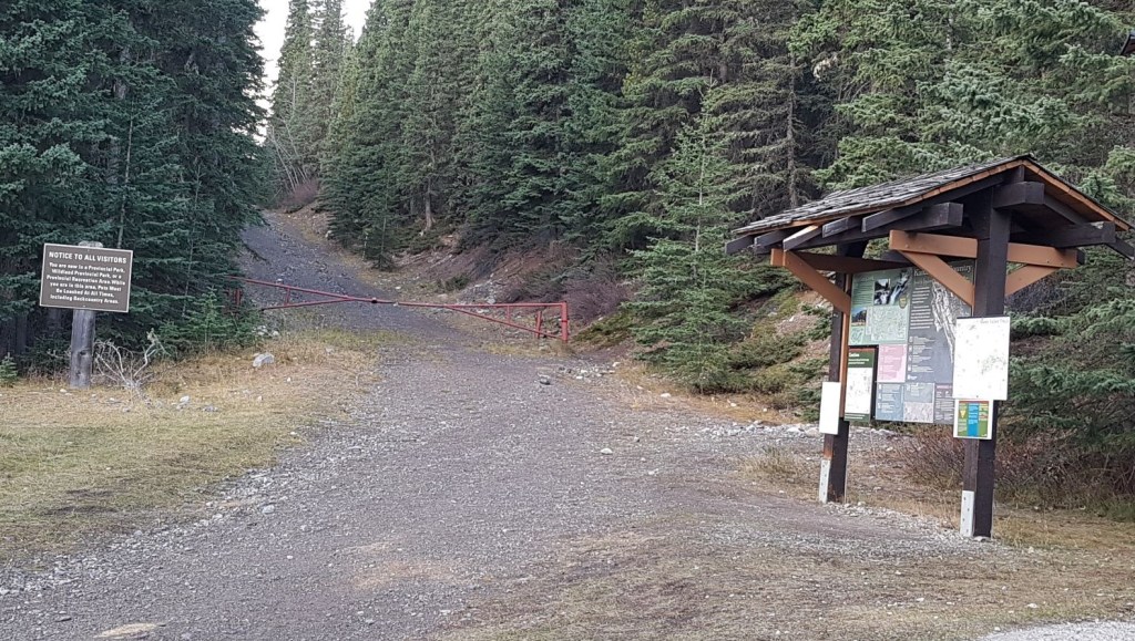
Main Trail
The road is a long slog with only a few views of the surrounding mountains to keep us entertained. I shouldn’t complain, as boring means nothing bad is happening. We were attacked (again!) by a grouse who was upset that we had the nerve to walk past.

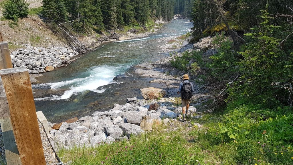
At about 3.5 km, we crossed the Sheep River on a lovely wide bridge. The Spirko Route crosses the Sheep further east.
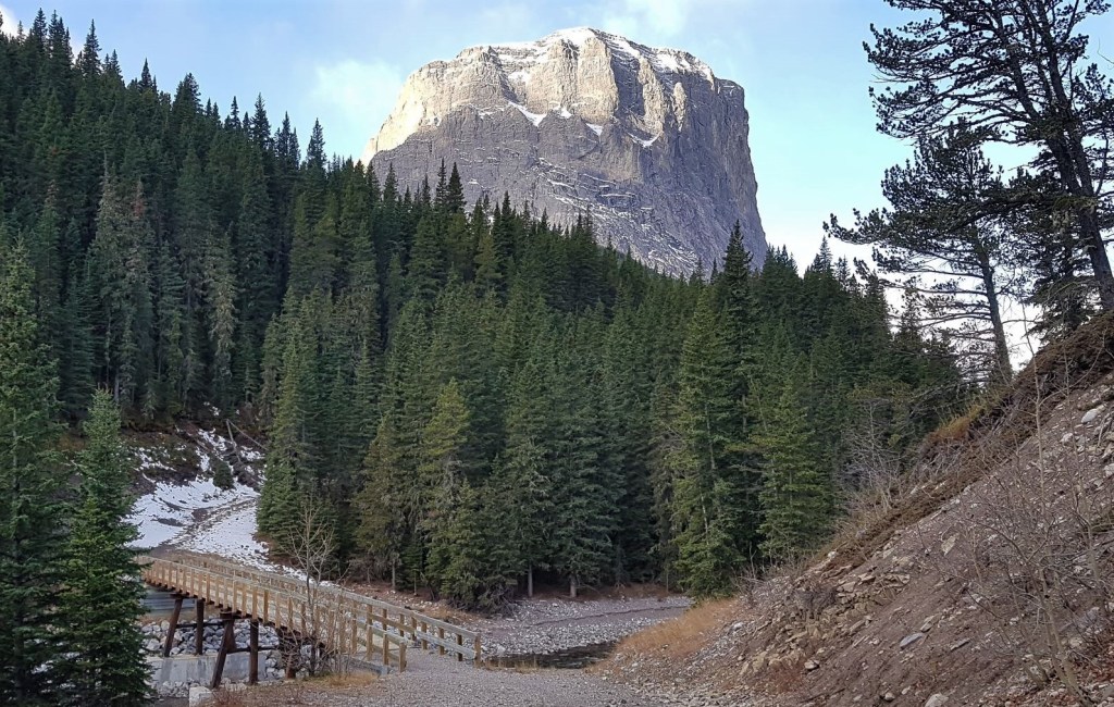
Past the bridge, we hiked for another 250 m or so, and found the main trail head on south side (left). On my trip last year, we turned left immediately after the bridge and bushwhacked straight up to gain the ridge at a cairn. If you’re in a hurry, this is definitely an option but not as enjoyable as the trail further along.

From the main trail head, we hiked through a gorgeous forest, keeping a sharp eye out for any and all flagging. I’ve been in this forest three times now, and have managed to lose the trail all three times. I always find it again, but just so you know, it’s not you 🙂

Once we found the ridge, it’s a long hot slog through the forest. We hiked past the cairn that marks the direct route back down to the Sheep River bridge.
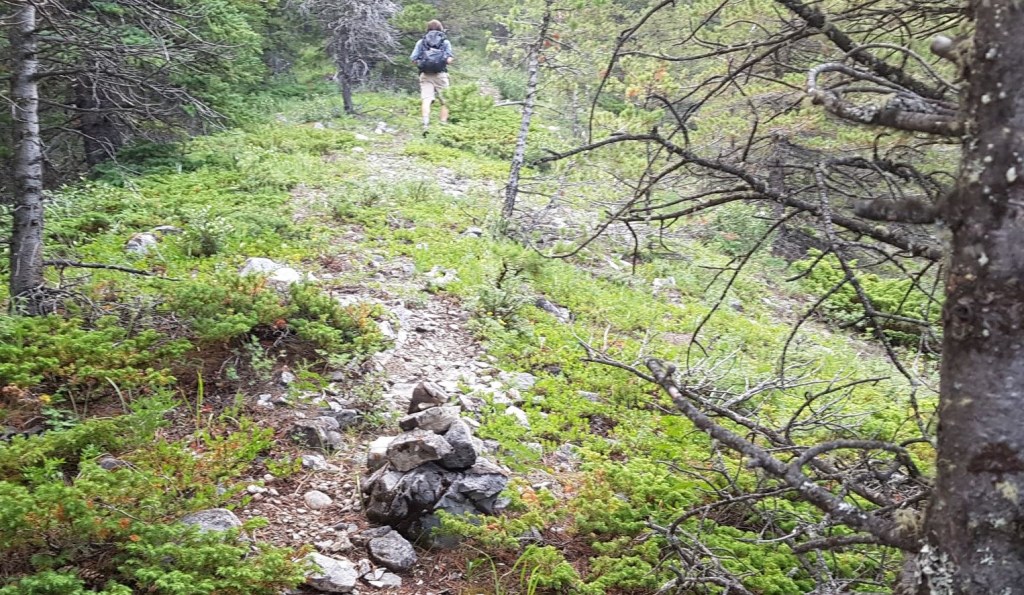
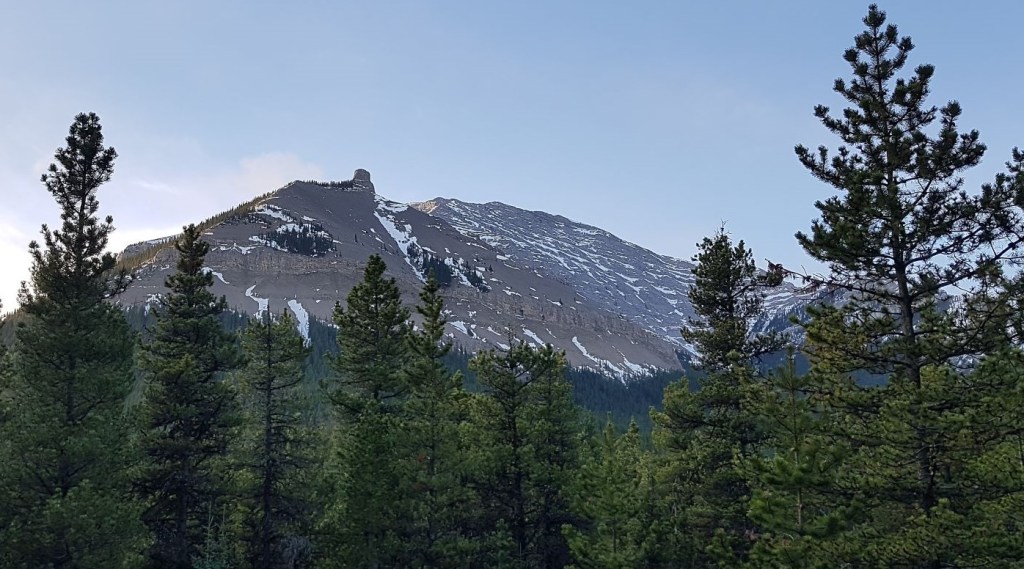
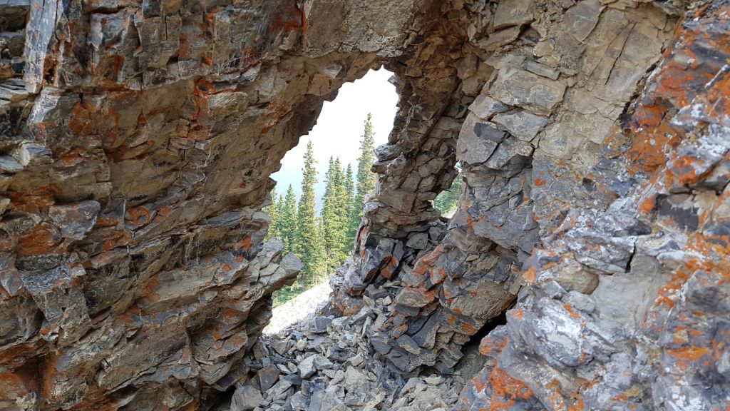
After passing a few rocky outcrops, we came to the end of the forest trail. The initial scree slope is probably the hardest. It goes straight up between rocky pinnacles, and is ball bearing on slabs or slick ground.

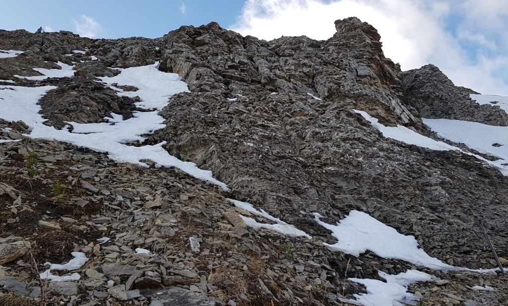
Above the churning mess, the trail is to the right. It turns into an absolutely delightful hike through the scree on a well worn path.
The scree ends in a large boulder pile.
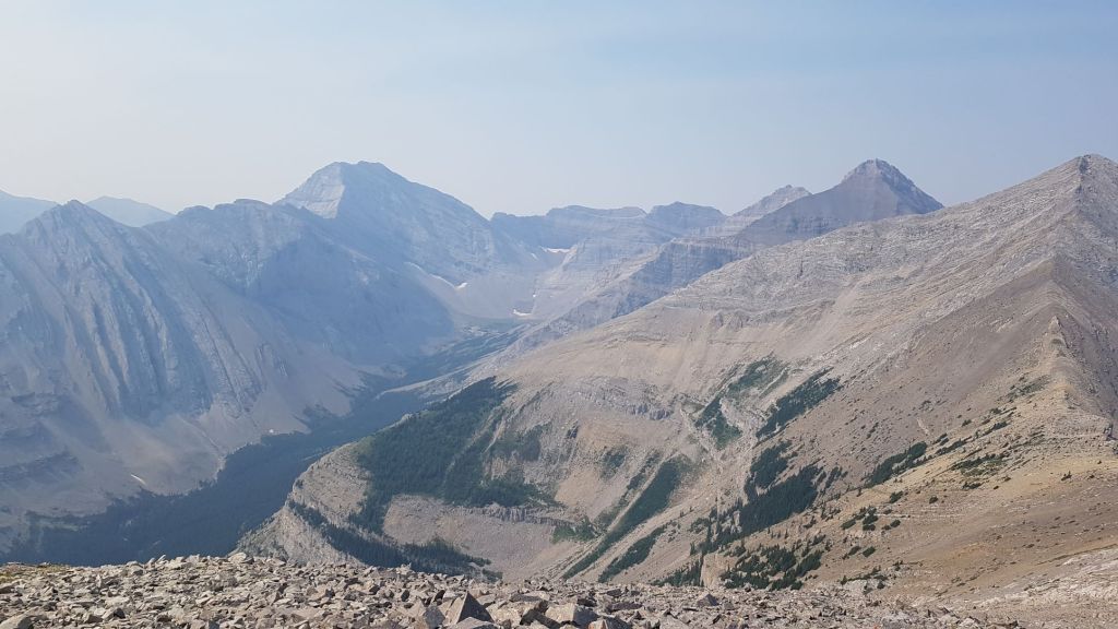
On the other side of the boulder pile is our first view of the approach ridge, with the band of fun scrambling above.
We avoided the steep wall by hiking around it to the right. Then continued to curve around, hiking up to a col.


After the wall, the trail keeps curving around, heading for the low point below the wall above, which is the start of the scrambling.

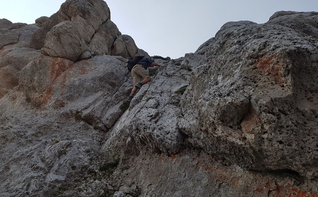
At the col, we turned right and started up the scrambling section. This particular route is marked by a bit of flagging, just to the left of the two snow patches on the right side.

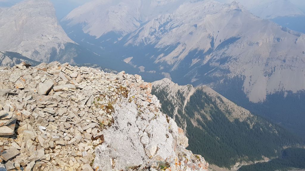
There are some amazing views from this spot. Be sure to turn around and enjoy.


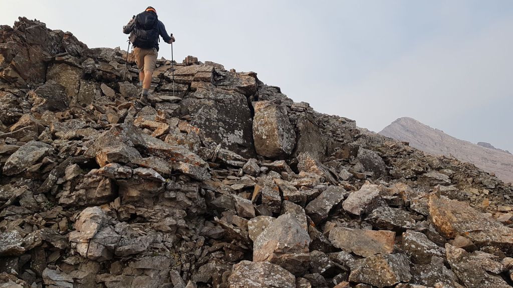
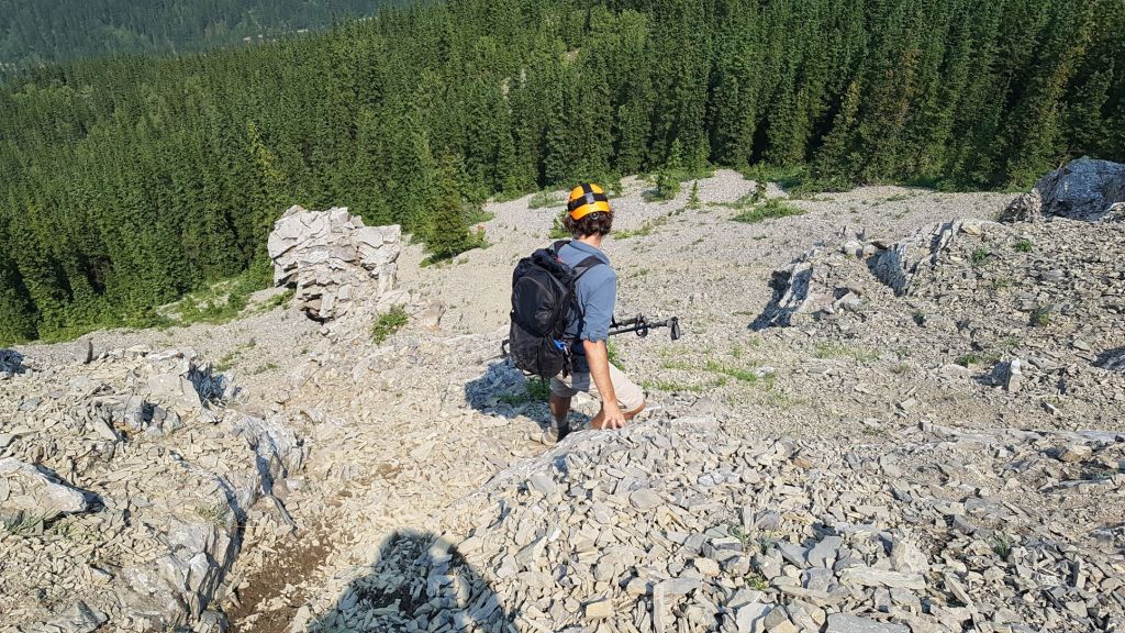
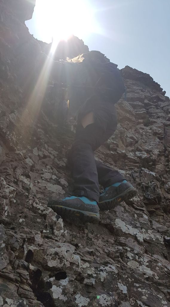
The scramble section was a lot of fun. It is one short section after another. These are just some highlight photos. Lots more to be had.


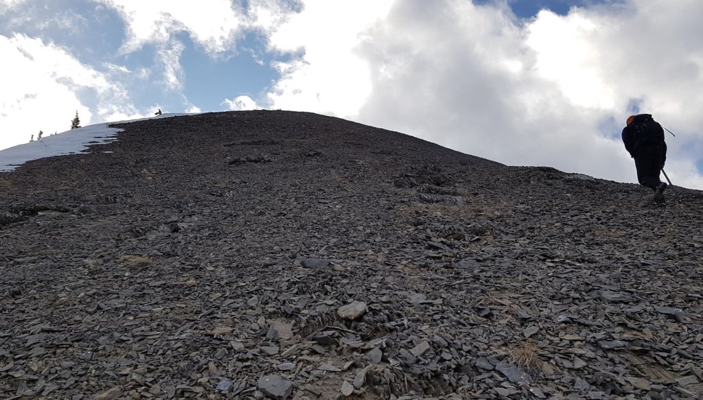
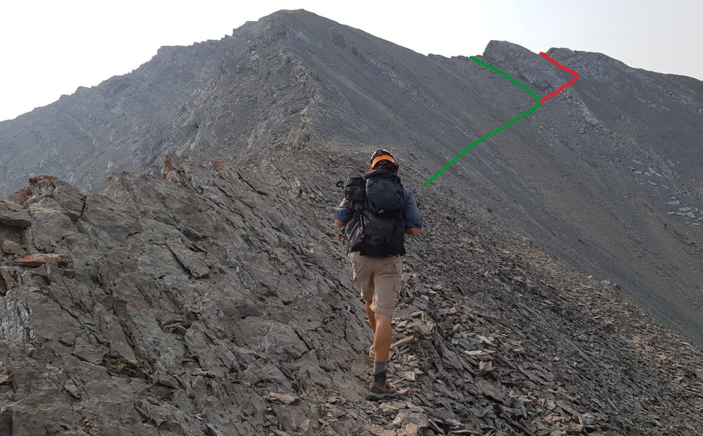
Once above the hands on section, we were on the final section that would lead to the summit route. Instead of staying straight ahead on the ridgeline, the trail traverses across the talus slope to the right. Here we came across a family of Rocky Mountain Sheep, and together we followed the trail to the ridge.
While the trail that continues past the outcrop to the right is in great shape and indeed avoids a churning scree slog to the ridge above, the unfortunate by-product is an overhanging drop (just to the right of the green line) that is impassable without a rope. How do I know this? The hard way…

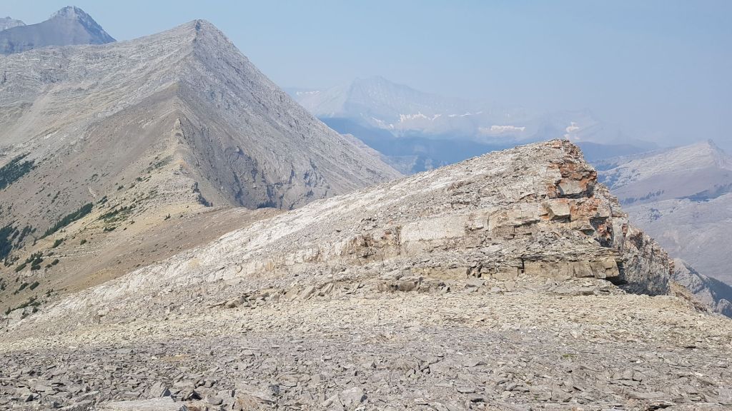
Once at the col, we turned left (east), and hiked up the ridge to the false summit. Then continued along a bit further to the summit.


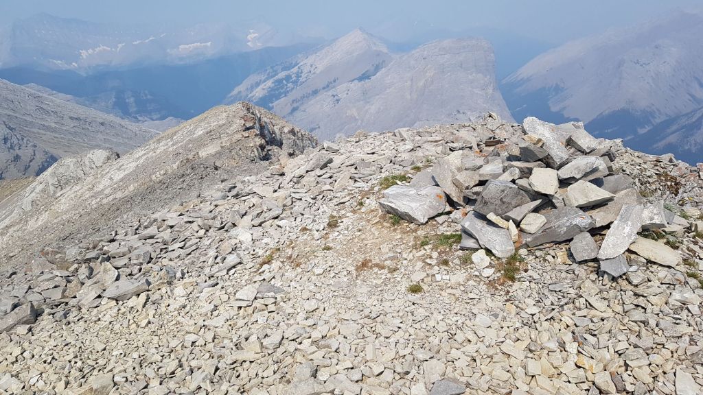
The summit of Shunga-la-she.
Distance to the summit is about 7 km. Elevation gain is 1,014 m. Time to summit was just shy of 5 hours. This includes the hour we wasted going up the wrong side of the outcrop, and then dicking around to find a way down.
Shunga-la-she Return
We hiked back down to the col, and then headed right. This steep slope was more talus than scree, which was not ideal for skiing.


Once again, we had to get through the steep section right above tree line. Not wanting the same ball bearing slip ‘n’ slide, we picked out another route through the pinnacles. This turned out to be vertical.

Once we were off the scree, it was the long walk back through the forest. Yet again, I managed to get off trail, but picked it up before the road.
Back at the Sheep River bridge, we took the opportunity to head down to the river. There is nothing better than an ice cold foot soak. We refilled our water bottles, washed off the salt and sweat, and mentally prepared for the boring walk back to the trail head.
While I really do not like that long road in, Shunga-la-she was well worth having to do it twice. It’s an interesting mountain with constantly changing terrain, lots of fun scrambling, and a bit of route finding.
If you enjoyed this trip report, then please do click the Star button to “Like” it. You can also follow my blog, follow me on Instagram, or join my FaceBook page Al’s Adventurers.
Alisen
Totals – Tracked on Gaia, displayed Strava
Date: July 15, 2021
Group: Two (Alisen and Mike)
Distance: 16.6 km (including our summit navigation error)
Elevation: 1,052 m (3,471′)
Time: 8 hours 30 minutes (includes lunch, breaks, navi error and river lounge)


I love all things mountains! I live next door to the Canadian Rocky Mountains, however I travel the world to enjoy the many different mountain environments and cultures that I can. I hope you enjoy these trip reports, and that it inspires you to accomplish your own adventure goals.

I can see from the photos why trail-finding skills are a necessity. Beautiful views and a gorgeous sky. And the translation of the mountain’s name. Um… I hope that’s not really it. It’s too majestic a mountain.
I’m 99.9% positive that is not the right translation. I’m hoping by writing about it, someone else might know the real meaning.
Take care!
Alisen
That’s a relief. Lol. I hope you discover the true meaning.
Me too! I might have to update the post and ask people to send in the correct meaning.
I actually tried to find something and couldn’t. How interesting!
Oh! Good for you! We were trying to figure out what language it was. We might have to contact the Stony Nakoda first nation and ask them directly.
If you find out, post the answer. 🙂
Absolutely!
Guess what???!!???
I contacted the one and only Gillean Daffern, author of the Kananaskis Guide Books where I found the naming of Shunga-la-she. This is what she said:
“Hi Alisen,
The name was told to me by ranger Rob Z about 40 to 50 years ago. Unlikely it is a Stoney name — though I have yet to check that out. (Does not appear in their book Stoney Place Names.) More likely it was made up by Rob as a joke because some say one of the pinnacles on the north ridge resembles a penis when seen from down below near Whiskey Lake. Could be. Shunga also is a name for erotic Japanese art. All sounds very sexy!! Anyway, it is definitely not an official name.
Keep on scrambling,
Gillean.”
So, I’m calling this Mystery Solved. Ranger Rob Z sounds like an interesting guy, who enjoyed a bit of fun. Shunga-la-she is not an official name, nor is it in any other language. This is likely just the last peak on the larger, semi-circular mountain that is known as Highwood Peak.
Thanks for playing along. You really spurred me on to try and figure this out.
Take care,
Alisen
Wow. How fun. That’s so cool that you reached out to the author and got the real scoop. Ron Z sounds like a character. He’s probably been chuckling to himself for 50 years. Hehe. You solved the mystery, Alisen. Thanks for letting me know! Job well done. 😀
Thanks so much! I had another reader this week solve the mystery around Sandy McNabb, so it’s been a good week for super sleuthing 🙂
Take care, and thanks for the encouragement.
Really beautiful. It looked like a tough hike and some rock climbing but worth it.
It was a long day, but fun. I was breaking in a new pair of mountaineering boots for a different trip, which is probably why I was grumbling about the road distance so much. No fun when your feet are killing. The rock climbing was the whole point of it 🙂 I was happy we had so much of it.
Alisen
Wonderful! Blessings.
Even though you made a wrong turn, you got to the top. Good job!
Wrong turns are inevitable. It’s my reaction to the wrong turn that will dictate whether I get back on track. Sounds like some Zen musings 🙂
One of the things I enjoy about these adventures of yours is following along with Google maps. 🙂
No way! That is so incredibly cool!!! Thank you so much for telling me that. Now I want to look on google satellite to see how much detail there is.
I hope you have a wonderful day full of adventure.
Alisen
There wasn’t a lot of detail for this one, but it gives me a frame of reference.
I spent most of the day dozing, recovering, being fussed over. It was wonderful to just let everything, every expectation go and drift. 🙂
Lovely post Alisen and the view from the summit of Shunga-la-she is really nice.
I also like to see some snow patches and of course the way you structure the post. Very informative, with plenty of information.
Looks challenging but so worth it for those views 😍
What a funny name for a mountain. Glad you were able to finally make it to the summit this time. The scramble section definitely looks like it would have been a lot of fun to climb up, but not so much on the way down.
Incredible
Shunga is the Anglicized pronunciation of Stoney sûga ‘dog’, & la she looks suspiciously like la chien ‘the dog’ from French or more likely Michif. So it seems this mountain is called ‘Dog-dog’, but with words from two different languages.
Doublet names like this aren’t uncommon in places where people from different linguistic backgrounds spent a lot of time together, like the Celtic Isles, where Celtic & Germanic elements are often combined, or alternatively Norse or Norman French in the areas where they were present.
I certainly like this explanation way more. Thanks for diving deep into the name. I quite like “Dog Dog”. This is a nice mountain, and it deserves a good name like Dog Dog.