October 4, 2020
Rehiked and Revised – November 16, 2024
As this autumn just keeps going and going, I am continuing to hike as much as I can. After a few big weekends doing Mount Temple and Crypt Lake in Waterton, I decided to take it easy. I was invited to go hiking with my cycling friends who needed to be home early – Mt. Hoffman fit the bill perfectly.
Mount Hoffman is a little mountain in Sheep River Provincial Park. We used to take our daughters up to the falls when they were three years old, but the bridge was washed out in the 2013 floods. Even though the bridge was replaced around 2016, this was my first trip back to that side of the Sheep River. I was very happy to be back, and was already eyeing up various mountains that I hadn’t seen for a while.
I live south of Calgary, so the Sheep is close and convenient. I have hiked and cross-country skied just about every trail in the area, as well as cycled the road several times. Ah – it was good to be back!
Update: I rehiked this trail in 2024 because Alberta Parks had taken an interest in this unofficial trail, and decided to upgrade it. There was one really steep, and rather slippery headwall section, and I was suspecting that Parks smoothed this out. I was not wrong.
Gear
Hiking boots, poles and day pack kit.
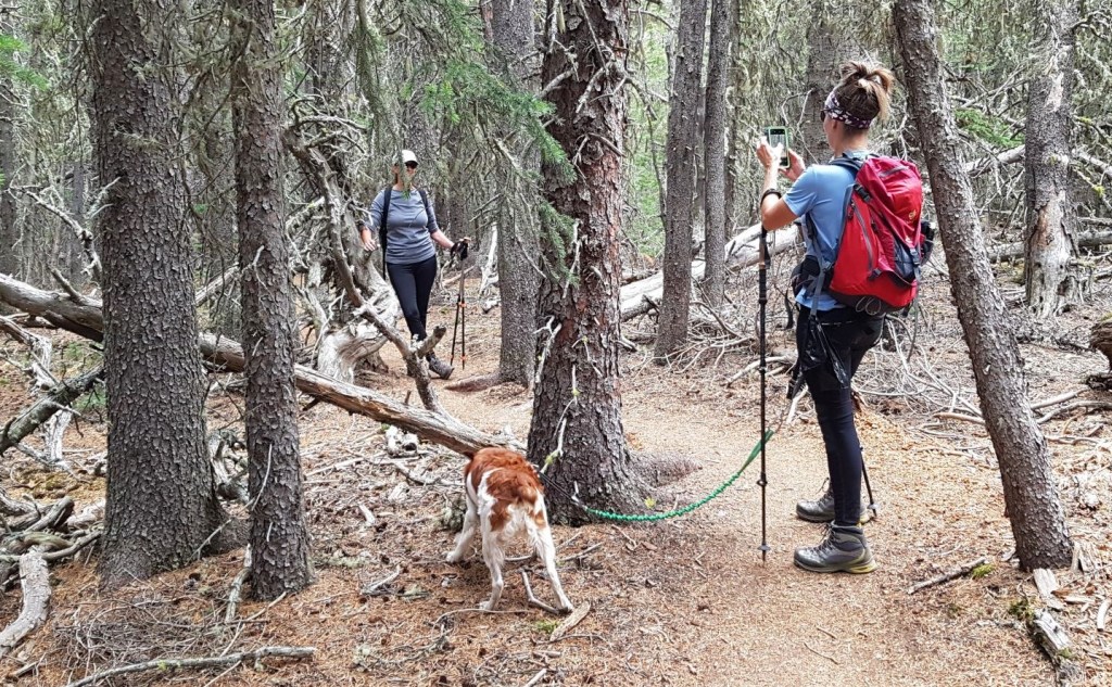
Black bears are really common in the Sheep River, so bring bear spray. Also, keep your dogs on a tight leash. Within seconds of starting on the Mt. Hoffman trail, we had a black bear come check out my friend’s dogs. Bears really do not like dogs, and will charge a dog. We were a group of five, and this bear had no problem coming right up to us.
UPDATE: at the parking lot, we saw a couple with two dogs. One dog was aggressive, barked and did a little lunge at me. As we caught up and passed them on the trail, we saw that their dogs were off leash. We asked them politely to please leash their dogs for bear safety. They replied “our dogs, our responsibility.” To this we replied – no, your dogs attracting bears affects everyone on this trail. Your off leash dogs are now making it my problem and my responsibility to have this uncomfortable conversation with you. They kept their dogs off leash UNTIL they saw that every other dog was leashed. Oh, the power of peer pressure.
Overview
From the Indian Oils Day Use Area, head towards the Sheep River. Cross the bridge above Tiger Jaws Falls. After the bridge, turn left onto Sheep Trail. Turn right at the junction to Mt. Hoffman. Stay on this trail to the summit. Return the same way. Side trip: turn right at the junction and enjoy some hands-on scrambling.
Totals – Downloadable Tracks On Gaia and Strava
Date: October 4, 2020 / Nov 16, 2024
Group: Five (Alisen, Mike and three friends) / Two (Alisen & Kayla)
Distance: 8.8 km / 9.13 km
Elevation: 440 m (1,542′) / 459 m (1,514′)
Time: 2 hours 45 minutes (includes side trip to river) / 2 hrs 24 min (includes side trip to Scramble)


Trail Head
Park at Indian Oils Day Use area in Sheep River Provincial Park. Walk down to the Sheep River, and cross the bridge over the Sheep River.


Main Trail
Once you cross the bridge, turn Left (east) onto Sheep Trail.
Stay on this super wide highway for about 2 km.


Keep an eye out for the Mount Hoffman trail heading off to the right. It is fairly big and marked with a cairn, but I’ve heard reports of people marching right on past. If you hit the really deep seasonal creek gorge, you’ve gone too far.
UPDATE: there is now a sign at the turn off, and the entrance has been widened. The whole trail has been widened significantly from this point.


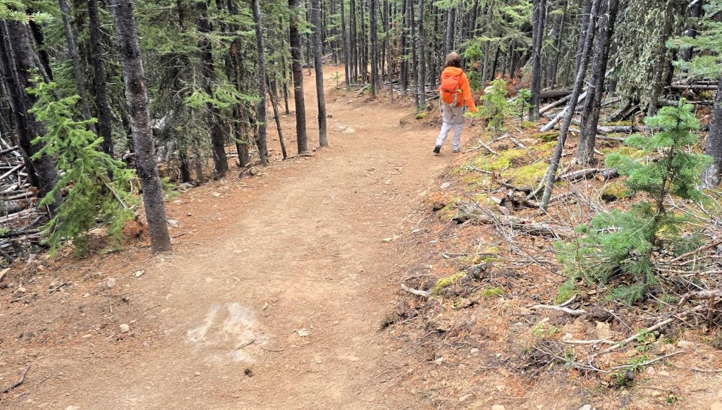
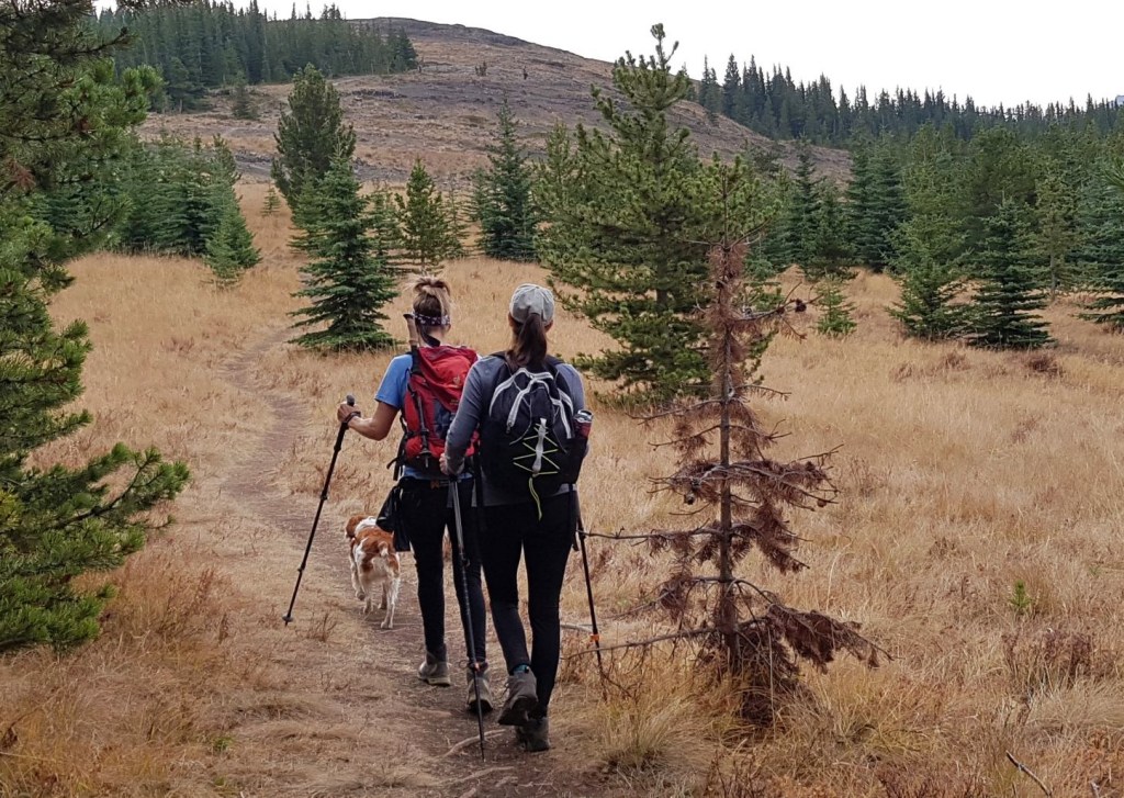
The initial hike up through the trees is very nice. The trail is on a steady ascent grade as it snakes around the lookout.


THIS IS WHAT I WROTE ABOUT THE FIRST ASCENT:
A flat, open area signals the start of the steep ascent.

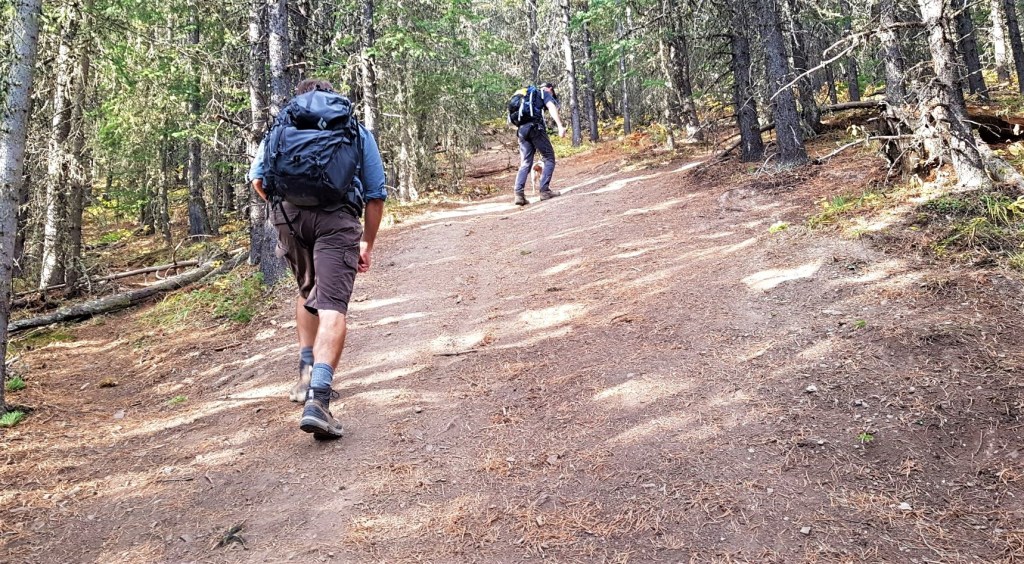
For whatever reason, this trail literally goes straight up at the 3 km mark. The good news is this only lasts for 500 or 600 m.
There is nary a switchback as it climbs pretty much ALL the elevation gain. I did find some attempts at short switchbacks in the trees, as the main trail was dry and slippery. This was especially important coming down.
THIS IS WHAT IT LOOKS LIKE NOW: The steep section has been replaced with a series of gentler switchbacks. Much nicer, especially on the descent which saw people hugging trees to keep from slipping down.

Mount Hoffman Side Quest – Scrambling Rocks
If you want an extra challenge, then take the side route on the right, about 1/3 of the way up. After a short but steep hike, we arrived at a gorgeous rock outcrop. These were very fun to scramble, as they are very grippy, and have excellent foot and hand holds. We went up one way with lots of scramble options, and came back down in a tight channel.
Added bonus if you’re not up for the full hike, the views from this spot are just as good as the summit.
If you didn’t know about this, then you really need to buy Gillean Daffern’s Kananaski Hiking Guide books.


Once we finished playing around on the rocks, we hiked back to the main trail. Once at the top of the steep section, we were rewarded with the best little forest – wide trees in interesting shapes and sizes.

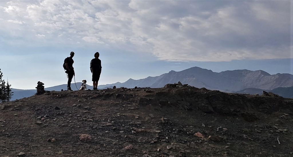
You’d be forgiven for thinking that this was the top. Indeed, I was looking through the trees and didn’t see any higher ground. That was until we broke out onto a meadow on the south side of the mountain.
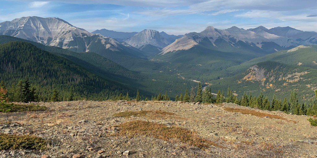
This gave us a lovely view of the summit directly ahead.
Mt. Hoffman is a miniature of every other mountain in Kananaskis, including the ‘scree’ slope to the top. This was highly enjoyable, as the air was nice and cool.


The distance to the summit of Mt. Hoffman is 4.4 km. Elevation gain is 430 m or 1,419′. Time to the summit is 1 hour, 20 minutes.
Mount Hoffman Return
After a short summit lounge, we retraced our steps back.

It was a good thing we started out fairly early (9:00 am on a Sunday) because the trail was now packed with people coming up. There were several big hiking groups, an entire ringette team, plus lots of smaller groups heading up.
Once we were back on the Sheep Trail, it was even busier.
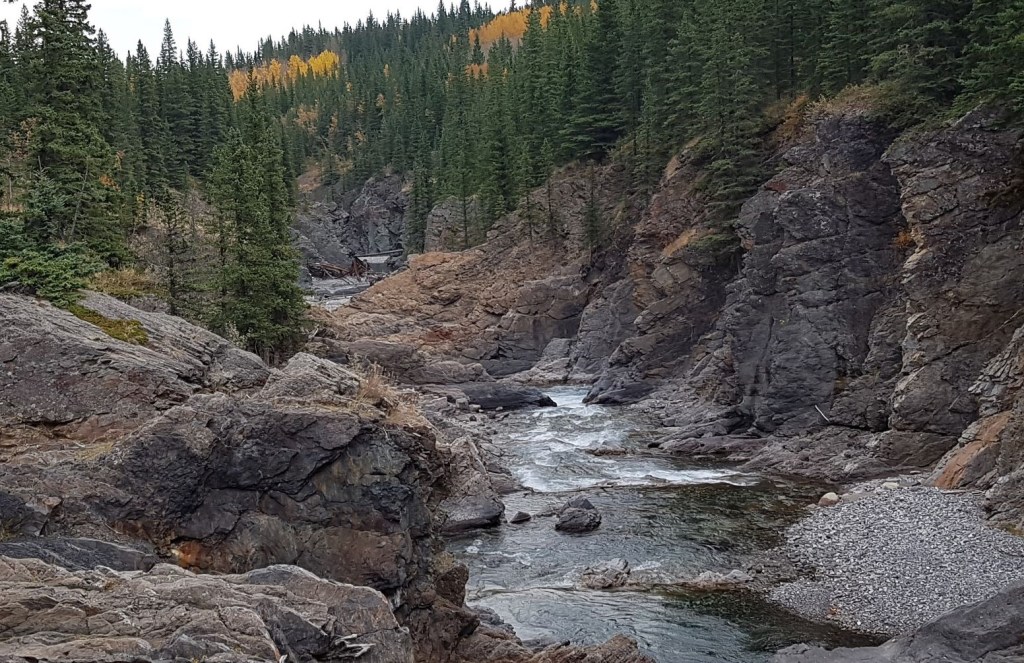
On the way back, we stopped at the Sheep River and enjoyed the Tiger Jaws Falls.

The hike to Mount Hoffman is close, short, and enjoyable. It is an ideal ‘first summit’ for beginners and kids.
If you enjoyed this hike. You can follow my blog, follow me on Instagram, or join my FaceBook page Al’s Adventurers.
Alisen
I love all things mountains! I live next door to the Canadian Rocky Mountains, however I travel the world to enjoy the many different mountain environments and cultures that I can. I hope you enjoy these trip reports, and that it inspires you to accomplish your own adventure goals.

Interesting. I’d never heard of this trail. A good one to check out!
I agree! Me neither. If it wasn’t suggested to me, I would never have found it.
Thanks! I just caught that on FB and shred your blog link to Carlene. Great write up. 😀. You’re fun to hike with, that’s for sure!
Happy Thanksgiving!🍁
Sent from Sonya’s iPhone
>
Thanks Sonya! And you’re fun to bike with. As I said to Ross, you are actually quite nice on the bike LOL!
And thanks for sending to Carlene. If you want me to use your IG for the photos, let me know.
Thanks for the love of nature you have. For I love to read your blogs because just to read through made me to be there
Awwww – that is so sweet! Thank you very much. I do LOVE mountains and nature. It fills my soul and makes me a better person. Whenever I can’t get out, then I’m a bit difficult to be around 🙂
Wawoo that such a blessing to humanities and am happy to know that you praise God that way. You know whenever we love what God created its one way to praise God
Might as well make the most of it before it starts snowing. This looks like a lovely area to go for a hike. But then again, I consider any area that has a nice view of the mountains lovely.
Too true! However, I did manage to find the snow yesterday. I was breaking trail in about a foot of snow at the pass. Unfortunately, no views of the glacier were to be had. I’ll go back in the summer.
Wooooooooo…. Awesome dear❤️ i have done trekking… Hiking yet to do😃
Way to go! Good for you. I have been trekking through Peru. I wonder if they are two words for the same thing? I’ve often wondered why it’s trekking there, but hiking here? I’d like to know. Anyone? Thanks for giving me something to think about.
Yeah… Even i feel too🤔 but google gave me this answer, hope makes some sense🤔😬Hiking involves a long energetic walk in a natural environment on hiking trails or footpaths for a day or overnight.
Trekking involves a long vigorous hike in wild natural environment for multiple days. It can be done off hiking trails.
Ah. I see. We would say Backpacking instead of trekking. Interesting. Thank you!
It seems like ages since I went for a hike. You really boosted my spirits for an adventure soon!
Yeah! I am SO glad to hear that. I am a firm believer in adventure. It’s 100% if it doesn’t go as planned, because that’s what makes an adventure so … adventuresome!!! Enjoy.