January 9, 2020
The avalanche danger just keeps getting higher and higher with an abundance of storm snow and high winds. I really needed a mountain ski fix, plus I had new Scarpa boots to break in. We had to find a route with low to no avalanche danger.
Gear
My new boots are the Scarpa Gea. I had the Scarpa F1s for a few years, but I found they had no sense of adventure. The Gea’s are a stiffer boot, and a tighter fit. As my dps skis are a bit longer than I’d ideally like, the more aggressive boot goes a long way towards control.
If I were to do this route again, I would take my light touring (cross-country skis with metal edges) skis and boots. While there are some fun turns in the logged area (and a possibility of turns on Rummel Ridge during a low avi cycle), the amount of ups and downs on the trail towards the lake is better suited for a waxed ski.
Overview
Rummel Lake is a classic ski tour in Kananaskis Country. It’s easy to get to, mellow elevation gain, and very straight forward. People also hike it in the summer, but it’s one of those trails I’ve only done in winter.
Trail Head
Drive to the entrance to Mount Engadine Lodge on the Smith Dorian highway. Park on the highway, directly to the east of the entrance. On the east side of the road you will see the trail heading off into the trees.
Main Trail
The trail is very straight-forward. Due the extreme popularity of Rummel Lake, the likelihood of the trail not being set for you in the winter is very remote. We did have to clean the track as we were the first ones there, but it’s not trail breaking. Be prepared for a slew of snowshoers and winter hikers.
From the highway, follow the trail south (paralleling the highway) for about 700 m. The trail then switches back to the NNW for another 1 km.
At the 2 km mark is the intersection for the High Rockies Trail, which is part of the The Great (Trans Canada) Trail that runs from Elk Pass (Alberta – BC border) to Banff.
Once at the T Intersection, there are three signs, which may be a bit confusing. The first sign is saying that the High Rockies Trail is running along the top of the T – or going North / South. The way back to the highway is on the stem of the T, or heading west.

The T intersection with the High Rockies Trail. You can either go left (north) or right (south) from here. To return to the trail head, turn around and head West.
The second sign is a bit more useful. If you go Right (South) you will be on the connector trail that takes you to Chester Lake. I skied this route with the Calgary section of the Alpine Club a few years ago. It’s not much of back-country tour, and would recommend using light touring gear.

This sign lets you know how to get to Chester Lake, and how to backtrack to the trail head. Still no sign for Rummel Lake. Not to worry though…
If you are at all worried that you might be on the wrong trail because there is no reference to Rummel Lake on any of the professional signs, that’s okay. Someone has put up their own sign that alleviates all confusion. At the T Intersection, head left (North)!

I’m not sure how much longer this sign will be legible. Whatever state the signs are in – go LEFT (North) at the T intersection.
Be sure to turn around every now and again to admire the view across the valley. You will be trapped in the trees for most of the trip, so be sure to enjoy the views while you can.

Looking directly across at Tent Ridge. This is a SUMMER ONLY hike. People have been killed on that mountain in the winter, and it just had another huge avalanche last week that took out mature forest.

Looking south towards Commonwealth Peak, which also had a massive slide this week.
At around 3.3 km, look for the Rummel Lake turn off on your left (east). It is marked with an arrow, and should be very obvious.

Summer or winter, it will be very easy to find the turn-off for the Rummel Lake trail.
Be prepared to say good-bye to the sun. This area has not been logged or burned, so the trees are tall and thick. It’s a lovely trail, but be prepared for a drop in temperatures in the winter. It was -17 in the sun, and it dropped well below -20 in the trees. My nose froze going in, despite working hard with skins. On the way out, I was absolutely frigid. My hands were frozen despite using hot shots in the my gloves.

There is a distinct line between new growth on the left, and the old growth on the right. In the summer, these trees will be a lovely respite from the beating sun. In the winter, be prepared to drop a good 5 degrees.
The trail to Rummel Lake is an uneventful 1.7 km ski. While the trail feels fairly flat, you are indeed gaining elevation the entire way. Be prepared for two or three big dips along the way. This is more of a problem on the way out when the skins are off and you have to side-step up the slopes. We were lucky with all the fresh snow, but on a tracked out icy trail, it might be easier to walk up.
There are several flags to guide you through the trees if you happen to be the first ones here after an early fall snowfall.

The first yellow flag also has a little Skier icon. All flags after this are the yellow flags only.
It’s a good thing the ski trail flags are up so high…

The summer hiking trail signs will be soon be buried.
Breaking out of the trees at the lake is pure joy! Lo and behold! The sun is indeed shinning.

Maybe it was just the cold winter day, but finally getting out of the trees was a real delight.
Rummel Lake is in a tight area, hemmed in by none other than Mount Galatea. We are so lucky in Alberta to have access roads up and through our mountains. Galatea is usually hiked from Highway 40 as you go towards Lillian Lake and the upper Galatea lakes.

Rummel Lake is on the backside of Mount Galatea.
With the avi danger high, we didn’t venture further than the lake. The Tower had several natural slides down it’s flank. All the more reason to stay away from any run out paths.

The Tower is to the left of Mount Galatea. It’s hard to see in this photo, but there are a few natural avalanche slides.
Rummel Lake Return
Return back to the trail head the way you came. If you are in touring gear, then take advantage of the open areas to get some low angle, avalanche-free turns in.
I hope you enjoyed this post and found it useful. Please do me a huge favour and click the Like button below. Or you can go to my facebook page Al’s Adventurers and like my page.
Alisen
Totals – Tracked on Strava
Date: January 9, 2020
Group: Two (Alisen & Mike)
Distance: 10.24 km
Elevation: 416 m (1,405′)
Time: 3 hours 45 minutes (includes lunch and skin breaks)

The route to Rummel Lake is very straight-forward.
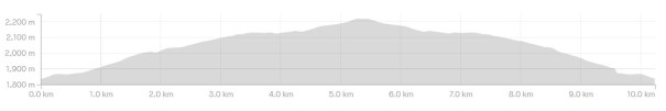
The elevation gain to Rummel Lake is so subtle, we didn’t notice it until we swooshed out from the lake.
I love all things mountains! I live next door to the Canadian Rocky Mountains, however I travel the world to enjoy the many different mountain environments and cultures that I can. I hope you enjoy these trip reports, and that it inspires you to accomplish your own adventure goals.

Best post yet. I loved how you grouped and organized the report.
Thanks! I’m glad you’re finding the posts useful!
nice ❤️🌸