August 25, 2020
Devil’s Thumb is an outcrop sandwiched between the Big Beehive and Mount Whyte in the Lake Louise area. The main benefit of hiking up here is the amazing views of both Lake Agnes and Lake Louise. This is such an iconic view, that it was featured on the front cover of National Geographic Canada magazine. Ever since I saw that photo, I wanted to go.
As I have mentioned in previous posts, Covid means a drastic decrease in the number of international tourists, which allows locals to finally have access to the Gem of the Rockies.
Parking
If you are staying in Banff or Canmore, PLEASE take the shuttle from your hotel to Lake Louise, or take the Roam Transit bus. If you drove from Calgary, you can park in Banff and then take Roam to Lake Louise.
In the winter, almost all our ski guests take the shuttle, but in summer people insist on driving. There is VERY limited parking at Moraine Lake and Lake Louise. If you take the shuttle, you are dropped right at the front of the line and are guaranteed to see the sights. You can also take the shuttle from Lake Louise to Moraine Lake to see them both in one day. If you drive, you will only be able to park in one lot (not both) and will have to choose which lake to visit.
Gear
This is a summit, so think of it more as a scramble than a hike. Bring hiking boots, poles, and your usual day pack kit. With so many people on the trail, we were concerned about the overhead environment and falling rocks. We chose to wear our scrambling helmets to be safe instead of sorry. While I did see a lot of people up there with nothing more than running shoes, this is not recommended.
Overview
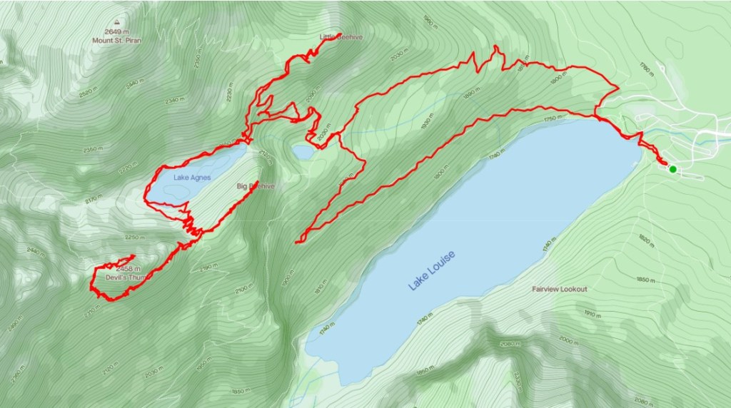
From Lake Louise, hike up to Lake Agnes. Hike to the back of the lake to the Big Beehive pass. At the pass, turn right and head uphill. Follow the trail around to the left (south) side of the mountain. At the base of the col, head straight up until you reach the Whyte/Devi’s Thumb Col. Turn right and continue to the summit.
Trail Head
Start from the Lake Louise parking lot, or where the shuttle drops you off. Make your way to the Lake Agnes trail head, which is located at the far, north end of of the Chateau Lake Louise hotel.
For a detailed description of hiking to Lake Agnes, please click here.
Main Trail
Once at Lake Agnes, take the switchbacks to the Big Beehive pass. Again, for a detailed description to hike to the Big Beehive, click here.
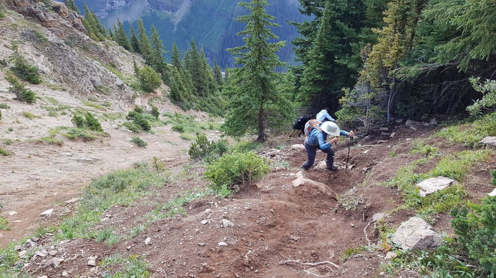
Once at the Big Beehive pass, turn right (roughly south west), and head into the forest. There is no signage, and you will see several large logs placed over this very obvious trail. This is to keep the causal tourist from continuing up. I do not ever want to discourage anyone from hiking in the mountains, however I did see a few people who were ill equipped mentally and physically to head up to this summit. The Parks Search and Rescue must have had one too many rescues.
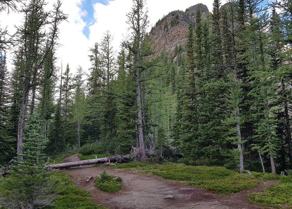
After hiking short ways, start following the obvious flagging to stay on the correct trail.
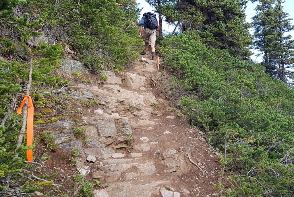
Shortly above this is a small scramble section, which is just enough to deter the super casual tourist.
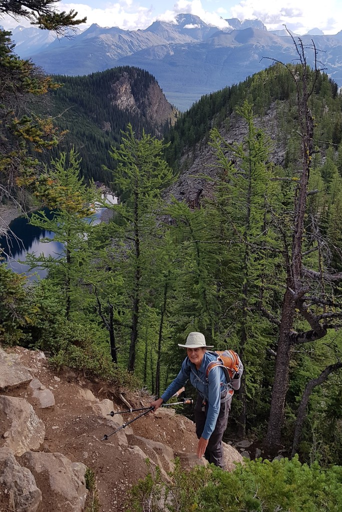
Follow the trail along to the left of the mountain.
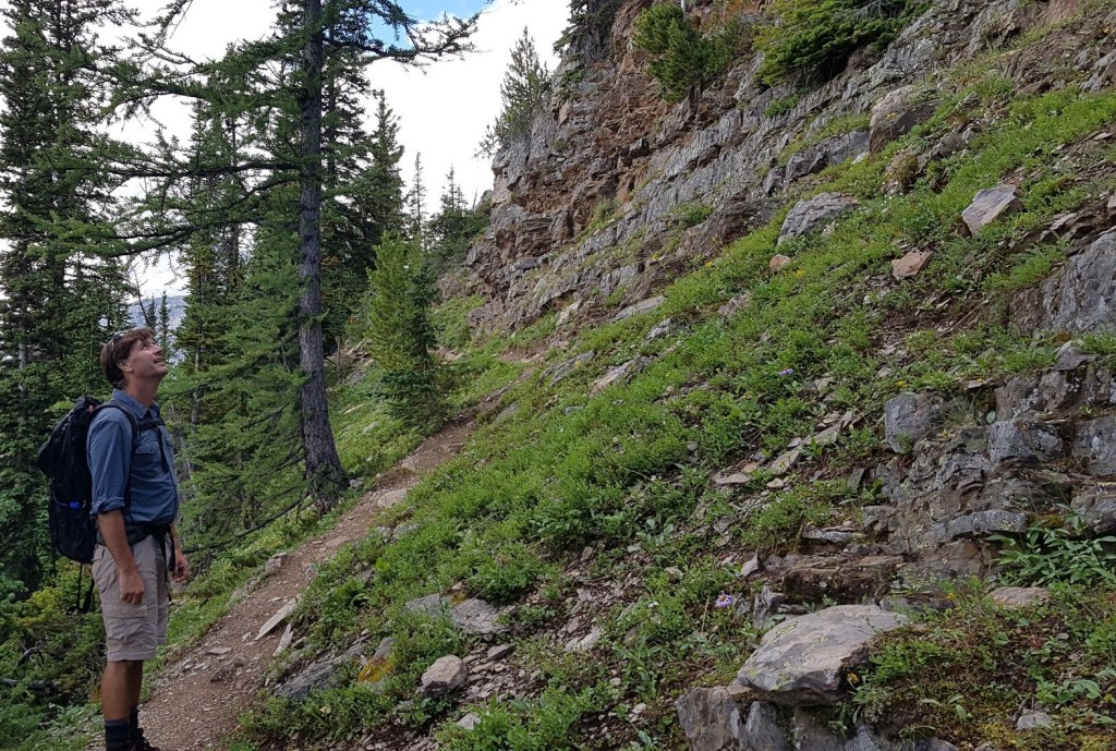
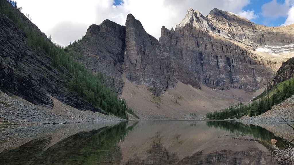
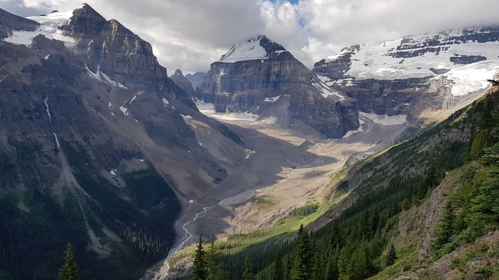
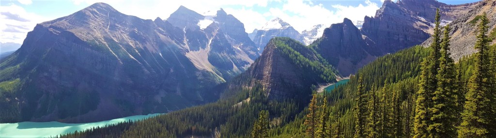
This is by far the best part because of the absolutely stunning views of Mount Victoria and the glaciers.

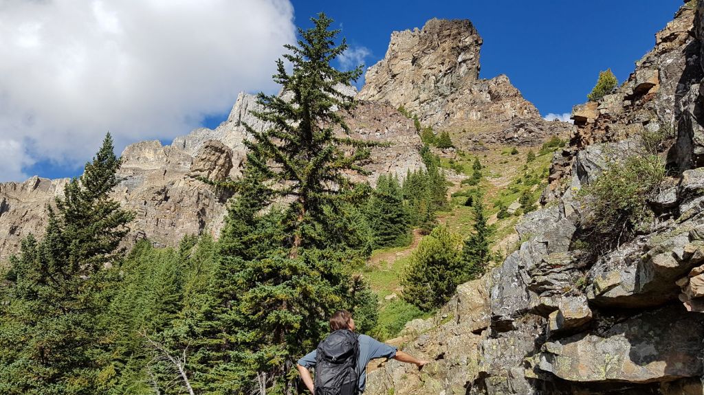
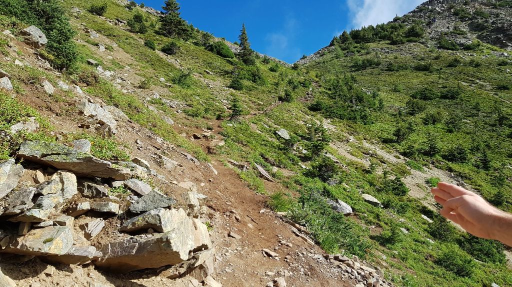
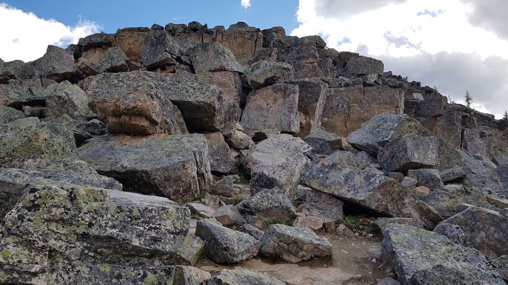
At the end of the trail, we turned the corner to start looking straight up the mountain. This was our first view of the Whyte/Devil’s Thumb col.
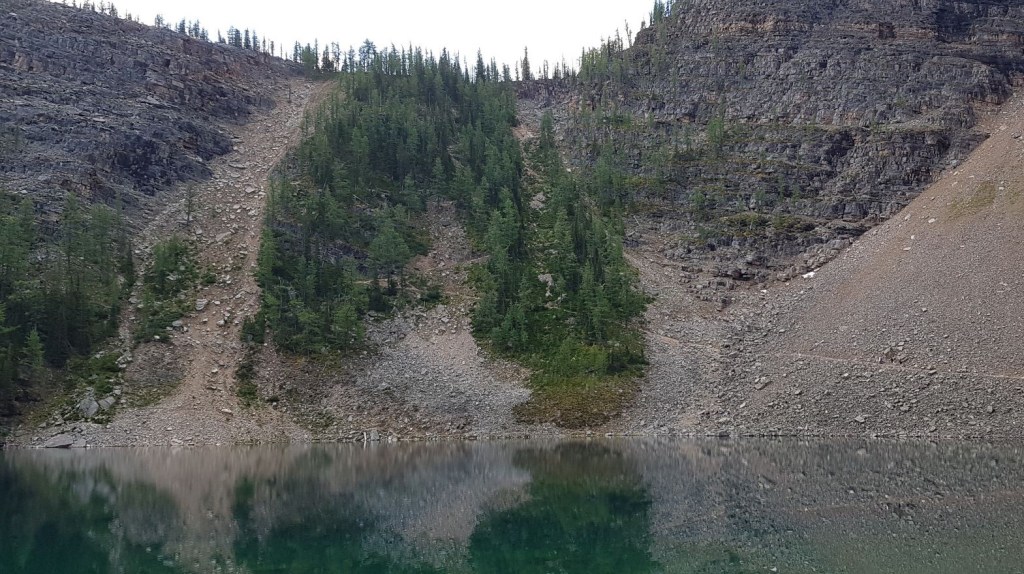
We basically hiked straight up this section. The trail is getting pretty beat up here, and it’s more or less a steep and slippery dirt track.
Above this section, the trail angles off to the right to the top of the col, which is the base of the Devil’s Thumb final ascent.
At the col, we stopped to admire the views.
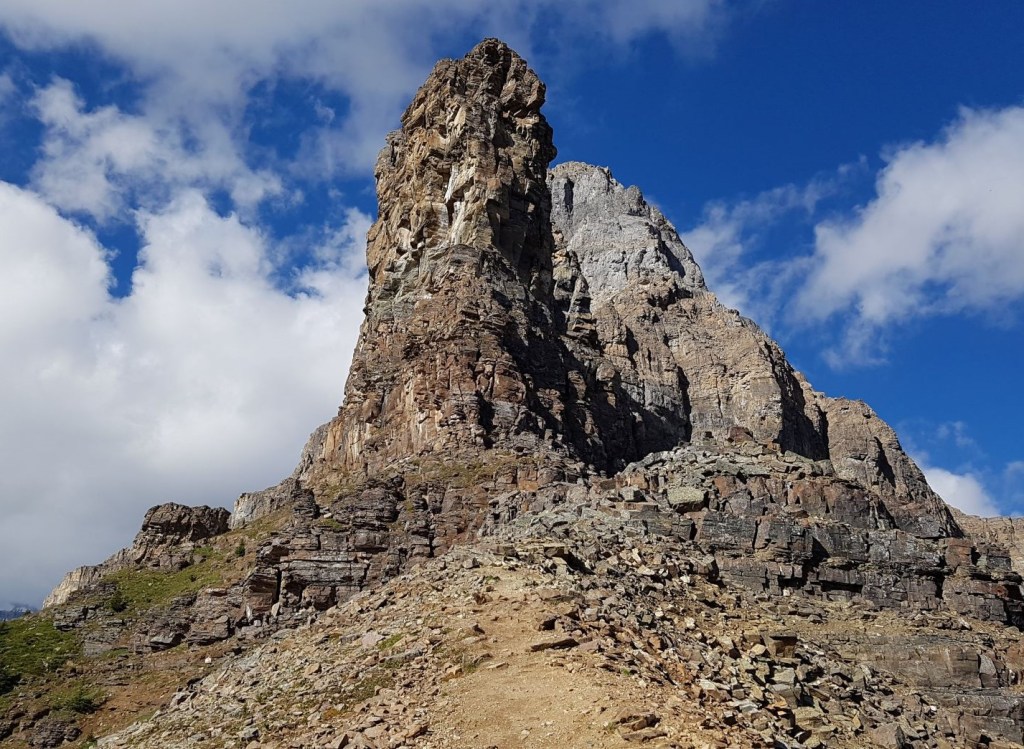
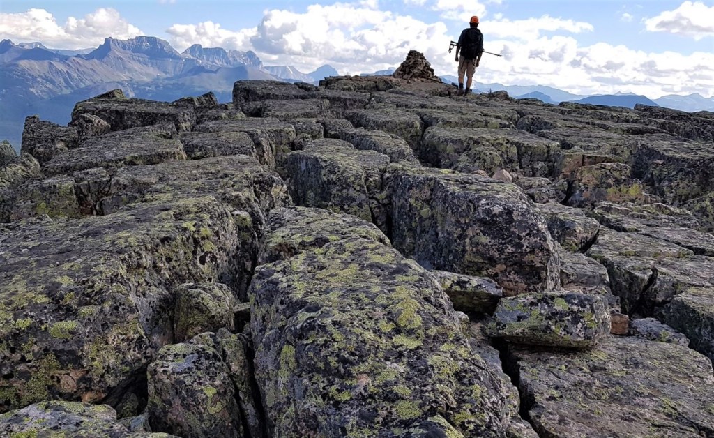
At the col, we turned right and had some more fun. I absolutely love these large quartzite boulders. We strayed from the main path just to be able to clamber over the solid rocks.
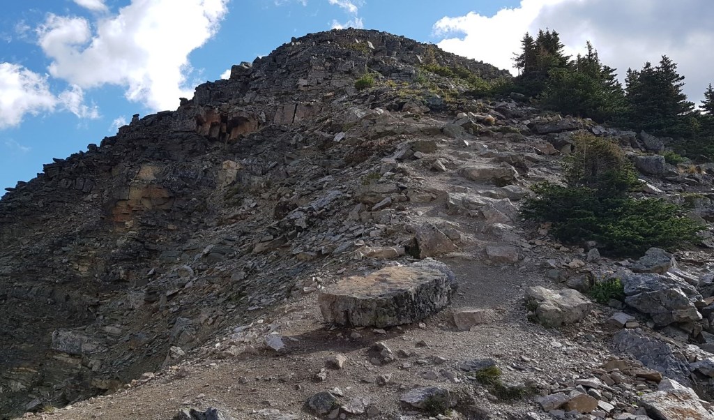
The summit of Devil’s Thumb is a flat expanse of cracked quartzite rock. This is very similar to the summit of The Tower of Babel, located above Moraine Lake.
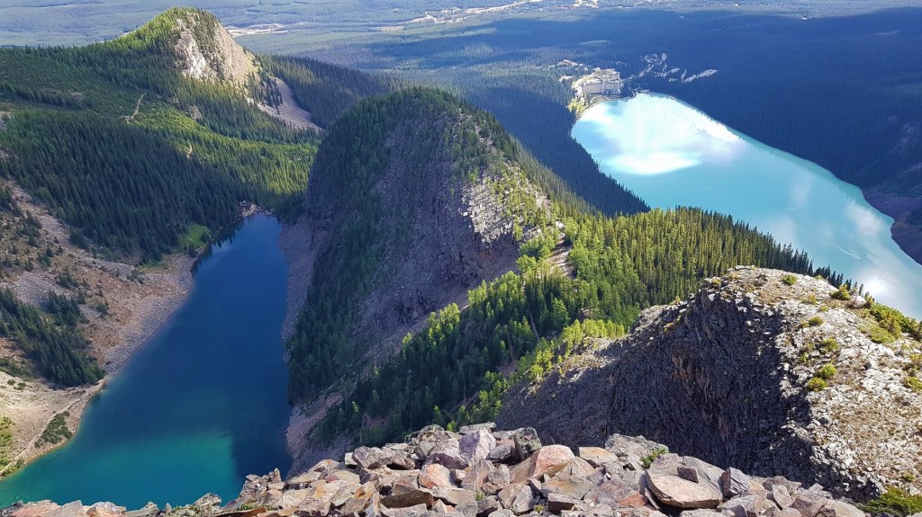
This is where I finally had the big view payoff! Lake Agnes glittered to the left, while the stunning turquoise waters of Lake Louise did not disappoint. It was a cloudy day, so we sat up there and ate our lunch, hoping for the sun to pop out. It did short little appearances, but not enough to light up the entire lake.
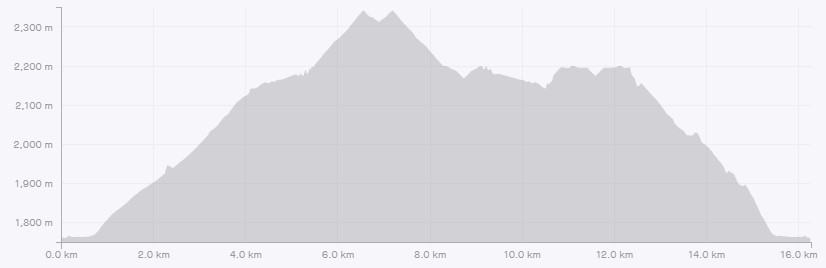
Time to the summit of Devil’s Thumb was exactly 2 hours and 30 minutes. Distance is 6.7 km. Elevation gain is 738 m.
Devil’s Thumb Return
Return the way you came, back to the Big Beehive pass. From here, we extended our day by heading out to the Big Beehive outlook. We were still not done though, so decided to head across to the Little Beehive. This provided great views back towards what we had just hiked, and was well worth the effort.
To see a detailed description of hiking to the Little Beehive, click here.
If you found this post useful, please do me a huge favour and click the Star button to “Like” it. You can also follow my blog, follow me on Instagram, or join my FaceBook page Al’s Adventurers.
Alisen
Totals – Tracked on Strava
Date: August 25th, 2020
Group: Three (Alisen, Mike and Annette)
Distance: 13.4 km
Elevation: 738 m (2,435′)
Time: 4 hours 30 minutes
(time is estimate as we continued to the Big and Little Beehives after Devil’s Thumb)
I love all things mountains! I live next door to the Canadian Rocky Mountains, however I travel the world to enjoy the many different mountain environments and cultures that I can. I hope you enjoy these trip reports, and that it inspires you to accomplish your own adventure goals.

Beautiful pictures.
Thank you!!! I hike for a variety of reasons, however this one in particular was 100% based on the summit photo. So lucky to have finally nabbed it!!!
When you set out a goal and accomplish it. Such an amazing feeling. I’m sure the beauty alone was worth it.
You are correct! The beauty was the award. How very astute of you. Blessings.
I went to Banff last summer and hiked to Lake Agnes and Big Beehive. We contemplated hiking Devil’s Thumb, but I forgot to bring my hiking poles. So we decided to hike to the second tea house at Plain of the Six Glaciers instead. Glad we did that as I’m not sure I could have survived this hike without them. Especially the downhill portion. Those views from the top look amazing.
You can never go wrong by visiting the Plain of the Six Glaciers! Indeed, you would have the same view as us of Mount Victoria and the glaciers as we did. I am glad you got to visit both tea houses!
In 2009, my husband and I went up to Abbot Hut and attempted Mount Victoria. Unfortunately, an electrical storm kicked off, and we were the highest things on the highest mountain. We had to retreat. Shortly afterwards, the rain turned to snow. The entire mountain was encrusted in ice. So, no attempt the next day. I always thought I would be back, but with Abbot Hut in jeopardy, I may have been wrong.
One to add to our list. Great description and beautiful pics.
Absolutely!!! The larch are in full fall colour right now too.
Great images! Thank you for sharing.
My pleasure! I hope they inspire you to create your own adventures, whatever that may be.
I already feel inspired🧚♀️ Thank you for sharing positive messages during these difficult times.
Yes, it is a hard time for many of us. It’s a time for a reassessment, and to find what really matters to us. I think we can all find what we really want to do during this time.
🌷🙏🌷❣
Awesome 😁🙏👌💙
Thank you!
My pleasure 😇👌🙏💙
Beautiful
Thank you! The scenery does all the hard work – I just have to point the camera 🙂
I think so.That moment will be amazing when you recording a short video [that level]. Phenomenal views![ pics] and also a short video [capturing moment]!!
I am so glad you enjoyed it. Thank you for you comment on the video. I am now trying to do more video and to share that with people.
Wow such pretty shots
Thank you! It was a dream come true to go there.
Indeed it is
Amazing…❤
Thank you!
Awesome pictures n lovely post thnx to share this lovely post
Thank you so much. It’s a beautiful part of the world.
Beautiful picture ❤️ peace 🌼
Thank you. I am glad you liked it.
Those photographs look gorgeous! ❤️✨
I have been wanting to do this hike for a while (I read about it in the “don’t waste your time in the Rockies book”), but this is the first time I saw the views – wooooowza!
Thank you so much for sharing them Alisen! I can’t wait to get back out on these trails next summer!
I read this post and followed you straight away… but I thought I should come back and comment so you feel appreciated. 🙂
Oh, that is SO SWEET of you! Thank you for commenting and sharing your thoughts. Yes – I DO appreciate it. When I first saw that view on the cover of National Geographic, I knew I needed to go. When you get up there next year, please come back and tell me how it went. There were a dozen more photos I could have used, so take your time and enjoy it.
Alisen