20+ Years
Whenever I’m feeling blue, and I need a solid hit of positive mountain vibes to fill my soul, I grab my skis and head to Chester Lake. I often come here by myself, because the peace and majesty of the towering mountains allows me to calm and reconnect. I’m also alone here because it is extremely safe from avalanche danger.
While Chester Lake is a worthy summer destination, I will admit to only coming here once in the summer. It’s a wonderful spot year round, but this is a favourite ski destination.
Gear
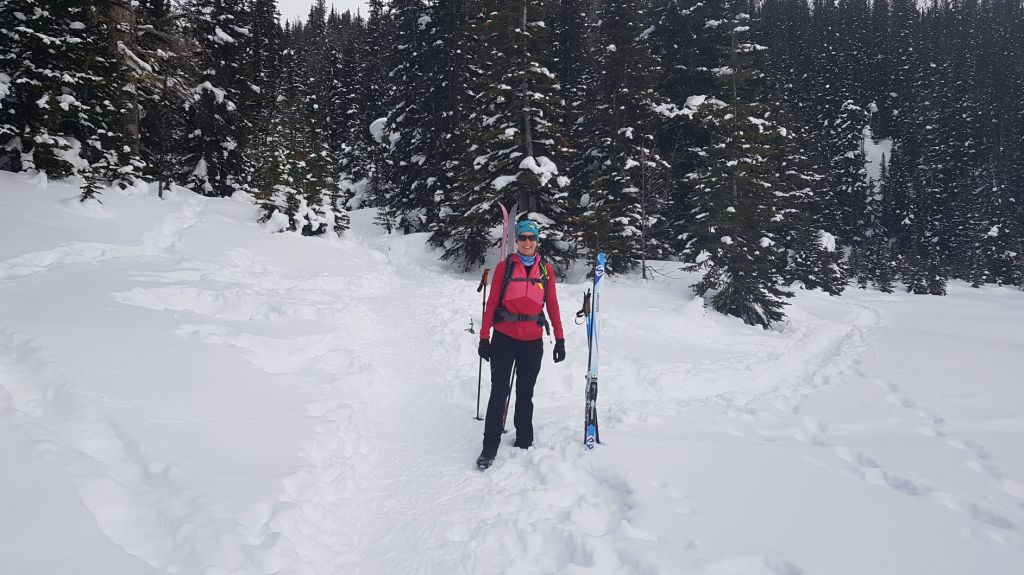
Light touring skis (like cross-country skis, but wider, heavier and with metal edges), gators, and light touring ski boots (heavier than regular cross-country ski boots, good ankle support, and a thicker binding bar).
I have several warm layers, including a light puffy for my lunch break. I also have my usual day pack kit. For winter trips, I bring a small thermos of hot tea.
Trail Confusion
There is a great deal of confusion as to where exactly showshoers / winter hikers and skiers are supposed to go. This is because the winter ski trail and the summer hiking trail are the same route. Unfortunately, winter hikers have erroneously assumed that the summer only hiking trail also means winter hiking. It does not. Hikers in the past two winters have trampled the ski trail so such that it is unusable by skiers. I am in talks with Alberta Parks to get the signage changed to clearly show where the winter ski and hiking trails are (and are not).
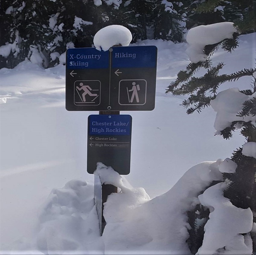
Don’t take my word for it! Friends of Kananaskis have been instrumental in cutting new and specific snowshoe / winter hiking trails in the Chester Lake / Sawmill area. They have created a brochure and map that clearly defines where each group is supposed to travel.

Damage to Ski Trails
The Chester Lake ski trail is not maintained by a groomer. It is 100% track set by skiers. When someone walks on a ski trail, the damage is done for the year. There will be no magical reset once a week.
Post-holing is dangerous to skiers because we cannot simply walk around a hole. Skiers have a limited area in which to gain purchase on our skis, especially when going up hill. The bottom of our skis HAVE to make contact with the snow the entire length of our ski. A gaping hole under the ski means the skier can no longer get a grip, and they will fall. Walking on ski trails puts holes in the snow, ruining the trail.
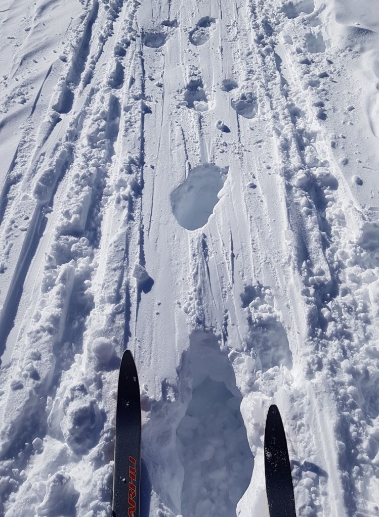
Walking on ski tracks also digs up the smooth track. This is incredibly difficult to ski over, but it also makes skiing down a death-defying experience. I am not kidding. Cross-country skis are very limited in their ability to navigate hazards. The only control is a snowplow, which is incredibly difficult to do on a trail that is dug up by hikers.

Walking on ski tracks also creates a narrow groove on the trail. Skiers need a wide track so they can herring bone up, and snowplow down. Walking on a ski trail causes the centre of the track to sink down. This divot prevents skiers from using their own trail.
As you can see, walking on ski trails is not just poor mountain etiquette, but it is actually causing harm to other people.
Overview
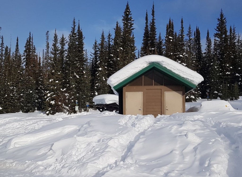
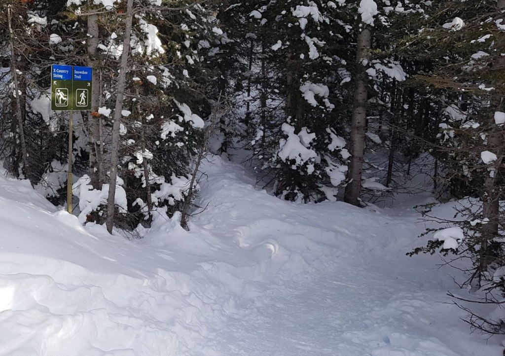
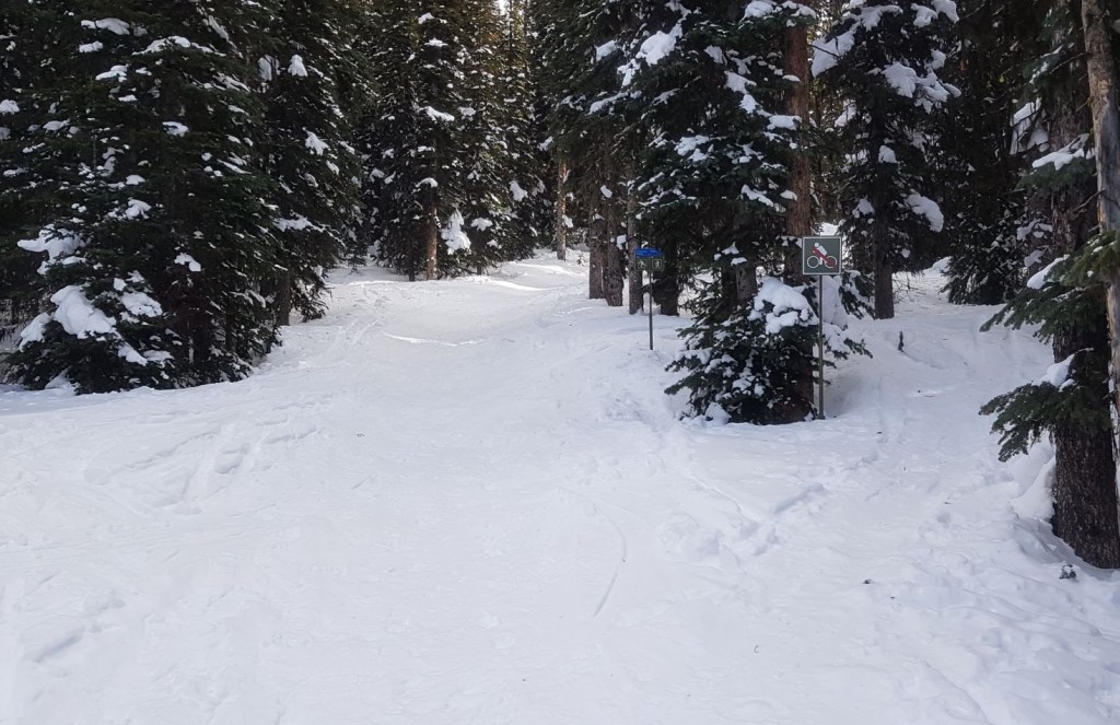
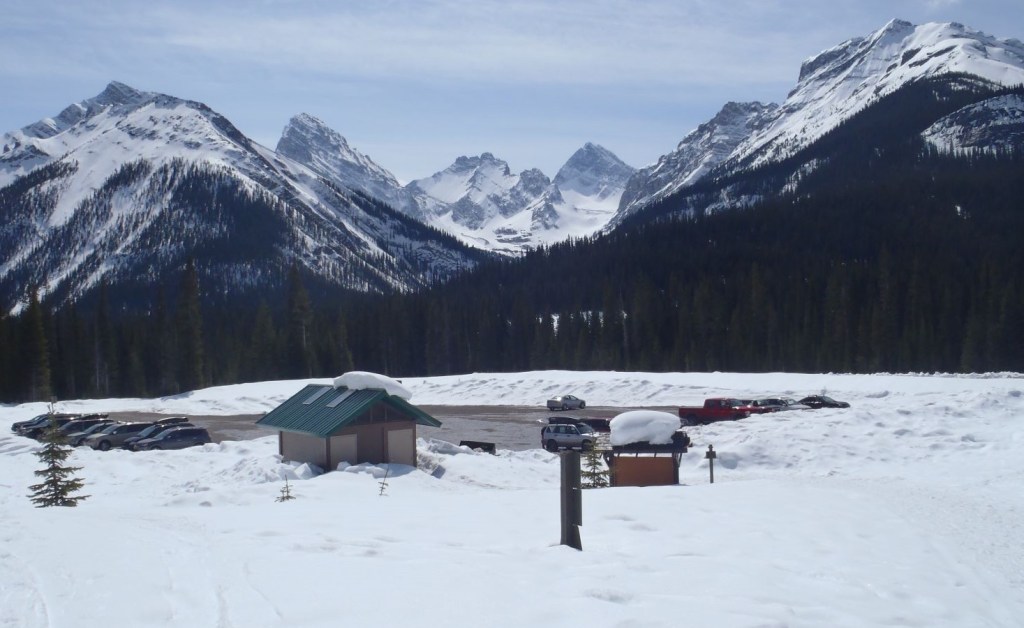
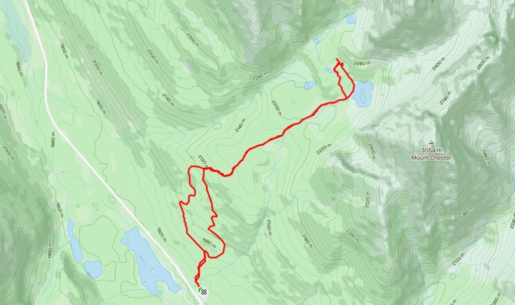
From the Chester Lake parking lot, start at the trail head directly behind the washrooms. The first 200 m is a mixed use ski and snowshoe trail.
After 200 m, there is sign for snowshoers to turn right and pick up the main snowshoe/winter hiking trail. Snowshoers keep on this main trail for the 3.4 km until you reach Chester Lake.
Skiers (and skiers only!) go straight at the 200 m sign. After another 400 m, turn right at the Y intersection to head uphill. After 1.6 km, turn right at the T intersection and keep going until you reach Chester Lake. Make note of this T intersection. On the return, instead of turning left (which is the way you came up), stay to the right (straight ahead) and ski the wider path back down to the first Y intersection.
Once at Chester Lake, the skier and snowshoe trails combine. From Chester Lake, you can continue up the hill to the Elephant Rocks.
Return the way you came. Chester Lake IS NOT A LOOP. Skiers return on the ski track and showshoers / winter hikers must return on the snowshoe trail.
Parking and Trail Head
From the Smith Dorian Highway (you can go either way from Canmore or Highway 40 in Kananaskis), pull into the Chester Lake parking lot. Depending on how massively busy it is, grab a parking spot where you can. Head towards the outhouse building. The ski and snowshoe trails begin directly past the outhouses.
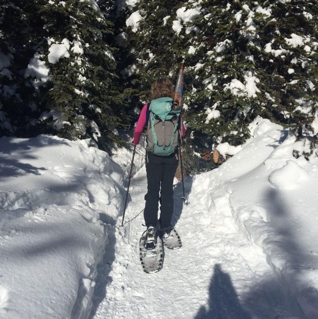
Snowshoe / Winter Hiker Only Trail
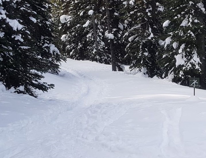
From the north side of the outhouse building, start on the mixed use trail heading into the trees.
After 200 m, turn right at the Snowshoe Trail sign. ALL non-skier traffic MUST take this route. This trail was specifically cut several years ago by Alberta Parks for the exclusive use of snowshoers and winter hikers. You will note that there are no skiers on the snowshoe trail, so please return the favour and do not walk on the ski trail.
The snowshoe / winter hiking trail is delightful. It is narrower than the ski trail, and has more interesting twists and turns. It also has some steeper spots, which adds challenge and interest to this otherwise very easy winter hike.

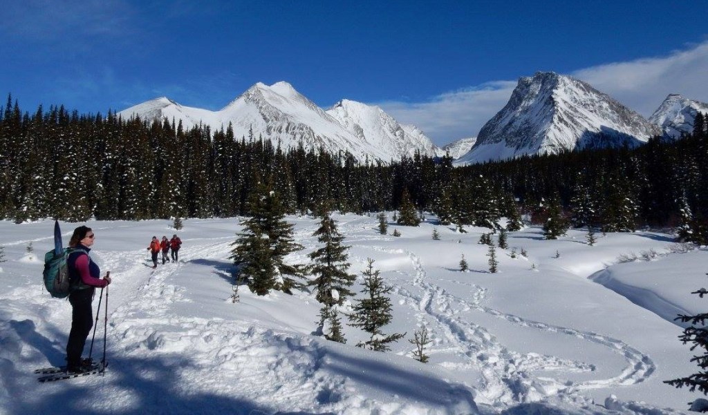
Once through the treed section, you will hike into an absolutely gorgeous meadow surrounded by Mount Chester on your right, Little Gatatea on your left, and the narrow wedge of Gusty Peak straight ahead.
You know you are at Chester Lake when you find the flat round area, ringed by spruce trees. Don’t laugh – many people (including me) have walked right onto the middle of the lake and then asked – so, where’s the lake?

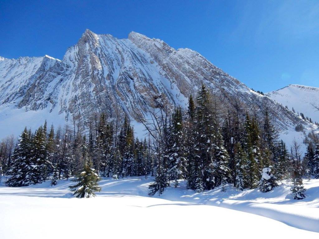
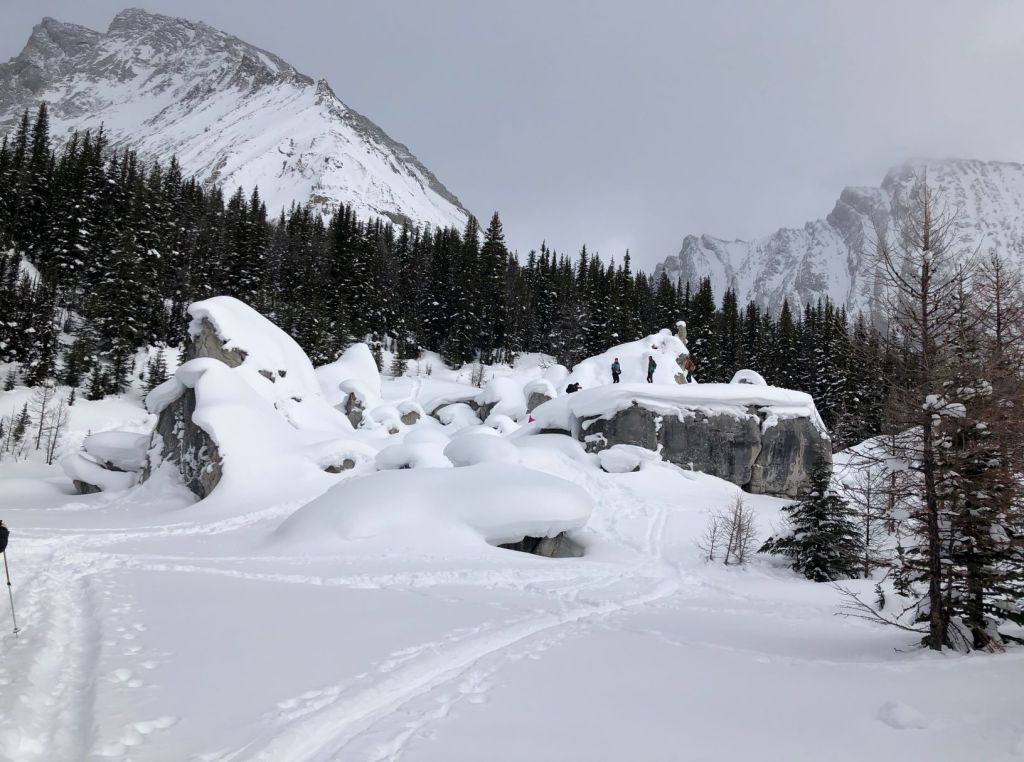
From the far end of Chester Lake, it is possible to pick up a narrow trail through the trees that heads up to the Elephant Rocks. Once you’ve gotten your fill of these amazing stones, then head west to find the smaller bunch of Elephant Rocks. Either place is a great place to stop and eat your lunch in the sunshine.
Snowshoe / Winter Hiker Return
From either Chester Lake or the Elephant Rocks, return the way you came on the snowshoe trail ONLY. Chester Lake is NOT a loop. The trail on the other side of the meadow is a skier ONLY trail. Walking on this trail damages the trail beyond repair, ruins the experience for skiers, and causes harm as many skiers fall while trying to ski over footprints.
Skier Only Trail
From the Snowshoe turn off sign (200 m from the trail head), continue skiing straight for another 400 m. This is the first of two intersections – Y and T. At this first Y intersection, go right. The trail narrows here, and ascends through a heavily treed area. It has a few switchbacks to get over some of the steeper terrain.

After skiing up for about 2.2 km, we hit the second of two intersections – the T. We turned right at the T, and continued up another narrow trail. The initial section of this trail is steep and twisty, but it soon levels out into the first of two meadows.
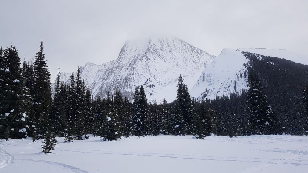
After a short stint back in the trees, we emerged into the main meadows surrounded by Mount Chester on our right, Little Galatea on our left, and the wedge view of Gusty Peak straight ahead.
The ski trail curves around the left side of Chester Lake. When you can’t go straight any longer, the lake is on your right. Distance to Chester Lake is 4.5 km. Time to the lake was about 1 hour, 50 minutes.
To extend your day, turn left at the end of the lake and take the narrow trail through the trees up to the Elephant Rocks. This is now a mixed use trail. I used to be able to ski right up here, but it’s useless now (well, perhaps with skins it would work). For the first time in 20 years, I removed my skis and walked up this trail.
The Elephant Rocks truly are spectacular. I always hike up the back to the tallest one, and have my lunch up here. Once you have your fill of the views (or the crowds), then ski along the top of the hill to see the second, smaller mound of rocks. You can descend from the far side of these rocks back to the main ski trail.

Chester Lake Ski Return
Skiers, please return on the skier trail ONLY. The snowshoe trail is for snowshoers / winter hikers only. Skiing down that trail will cause you to collide with hikers as they make their way up.
The downhill skier has the right of way. The downhill skier will yell TRACK, which is your cue to move over to the side, and allow them to quickly ski past. Downhill skiers – please tell the uphill skiers how many are in your group so they know when it’s safe to return to the trail.
At the T intersection, be sure to stay to the right (straight ahead on the return). This will take you off the narrow trail, and put you on a wider, flatter trail. If you like to go fast, then this is the place to let ‘er ride. The wider trail also makes a snowplow possible.

Stay on the wider trail until you reach the initial Y intersection (1.6 km between intersections). At the Y, continue straight. Going left will put you back on the up track, which is fine if you want another loop. From the Y intersection, it’s another 600 m back to the parking lot.

Chester Lake is an absolutely gorgeous meadow surrounded by epic peaks on three sides. It’s ideal for a winter adventure due to the wide valley being well away from avalanche danger. Alberta Parks has done a great job of creating separate trails for both skiers and snowshoers/winter hikers. It is now OUR job to ensure we respect each other’s space and trail systems, and stick to the designed trails.
If you found this post useful, please do me a huge favour and click the Star button to “Like” it. You can also follow my blog, follow me on Instagram, or join my FaceBook page Al’s Adventurers.
Alisen
Totals – Tracked on Strava
Date: February 19, 2021 (plus 20 years of prior trips)
Group: Three (Alisen, Sonya and Nancy)
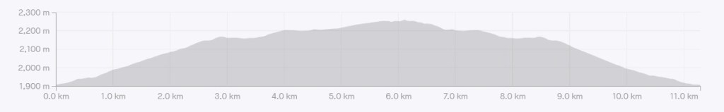
Distance: 11.3 km
Elevation: 384 m (1,267′)
Time: 4 hours 15 minutes (includes lunch & breaks)
I love all things mountains! I live next door to the Canadian Rocky Mountains, however I travel the world to enjoy the many different mountain environments and cultures that I can. I hope you enjoy these trip reports, and that it inspires you to accomplish your own adventure goals.

One of our favourite places to go when avalanche conditions are high. And I completely agree how dangerous it is to have hikers and snowshoers use the ski trail. I’ve gotten in several arguments over the years. You gave great descriptions for all users. Maggie
Oh yes… I’ve also had words with hikers. When you look at ALL the terrain they’ve cut for hikers, I really can’t understand their mentality. I’m hoping Alberta Parks will take this seriously and update the signs.
What an amazing landscape and how detailed description about the trails of the area. Also, I was not aware that you have different trails for hikers and skiing.
Of course, sounds very obvious, but here in Greece, due to the fact the winter season is very short, we don’t have such ski trails.
Thank you if the very nice post with all the good info.
Well, normally I don’t go into such detail about the separate trails but we are having issues right now with hikers absolutely destroying the ski trails. I think some do it on purpose.
Gorgeous views!
Thank you. It is a spectacular place.
Beautiful photographs. I had no idea hiking and trail damage was such an issue for skiers. I will be extra careful when I go out.
Thank you for acknowledging that. I don’t think people realize the damage they cause can actually hurt someone else. In many areas, the trails are 100% split, so the two cannot interact. Education will be key.
Yes, no one wants to see people hurt. Peace.
✨✨❤️
I can easily see why that sign creates confusion. Hopefully Alberta Parks listens to your concerns and fixes the issue. That must be incredibly frustrating (and dangerous) to have your cross-country tracks ruined by hikers.
The Parks have responded that they are “aware of the situation and are working on a solution”. Fingers crossed it’s a good solution, and not just a removal of the ski signs…
Wow! You are blessed live in a country where it’s safe enough to go places alone. I would love that. I remember going about on my own as a teenager but not anymore.
Yes, in general, Canada is really safe. That’s a shame you don’t feel safe where you are. I think that would be very restrictive to not be able to move about on your own. Is this just for women, or does everyone have to travel in groups?
Sorry I meant to answer you sooner, I had to think about how to answer… I think the answer is: it depends… Mostly it is much more unsafe for women to go hiking on their own and so normally we have hiking groups that go out together, safety in numbers. But a lot more caution is taken into consideration generally. I think unusually so compared to many other places but if caution is followed we can still enjoy the great outdoors we have which is the draw card for our tourism… And for living here.
Ah, I understand. Safety in numbers does definitely help. I am glad you have a hiking group that you can go out with. I am lucky that I know several women who are keen to hike, but that wasn’t the case. About 10 years ago, if I wanted to get out to the mountains, I had to go alone.
Take care! Al
This looks so beautiful! What state is this? (Sorry if I missed the details.)
Hi Heather,
It’s actually in a province 🙂 This is in Alberta, Canada, west of Calgary. The Provincial Park is called Kananaskis Country. It’s our private mountain paradise that is off the beaten path, because most tourists go to Banff National Park, which is just next door.
Maybe when the pandemic is over and our borders reopen, you’ll be able to visit some of this amazing winter wonderland! Until then, take care and thanks so much for visiting.
Alisen
Thank you for the clarity. Yes, as a tourist, Banff is on my bucket list, but the area you describe here looks amazing.
Sssshhhh! Don’t tell anyone 🙂 Yes, K Country is beautiful. It’s very rugged though, with almost no services. It’s great for car camping and hiking/backpacking.