June 25, 2021
Lineham Ridge is an unofficial trail that is situated in front of the way more impressive Lineham Ridge scramble. I guess technically, this is a side spur off the bigger Lineham Ridge / Lineham Peaks mountain. While those other routes require scrambling with some exposure, this is a lovely ridge hike.
I was of two minds to write about this hike. With trails getting more and more crowded, I kinda wanted to keep this one a secret. I found it by trolling through the maps, and quickly realized it was being overlooked. However, if there are people willing to dig this one up, then hopefully my trip report will help them have a successful day. Erin and I had the entire trail to ourselves all day (which is always the dream but rarely happens), and the only other car in the lot was a father/son team backpacking on the other side of the Highwood valley.
This was my first time hiking alone with my buddy Erin. Erin is a cycling phenom, and is also getting into hiking. It was a lot of fun to see the topography, flowers, and even the grass, through her eyes.
Gear
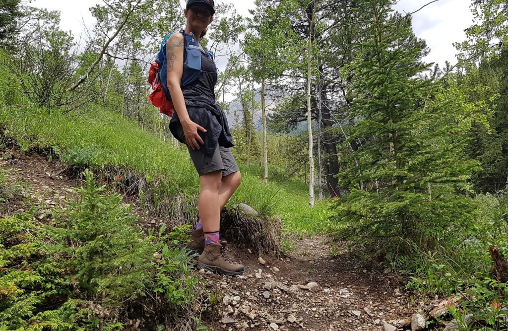
Hiking boots, poles and regular day pack kit. Erin didn’t use poles, but we found it made a difference between standing upright on the narrow ridge, and having to reach down and hold onto rocks for stability.
Overview
From the Lineham Creek Day Use Area, start hiking from the trail head on the east side. At the creek washout and embankment collapse, stay on the left bank. Cross the small stream that enters Lineham Creek on the north side. After crossing, pick up the trail that will lead to the ridge. Hike through a long forest, and then continue up the open ridge. There is a ‘high point’ that is marked by a small cairn. Return the way you came.
Parking and Trail Head
We parked at the Lineham day use area, which is located on the east side of Highway 40 in south Kananaskis Country. This was completely washed out in the 2013 flood, and it took a LOT of effort to repair. After the flood, the highway was actually rerouted through the day use area until they could repair the road. The vegetation has grown back so much that it’s hard to tell this was once completely destroyed.

From the parking lot, we looked for the trailhead starting on the east side of the parking lot, just down from the outhouse. There is a big yellow Bear Aware sign to mark the start, but no trail sign.
Main Trail
Once on the trail, we hiked up the side of the ridge to stay away from the creek below. This section of the trail undulated up and down several times.
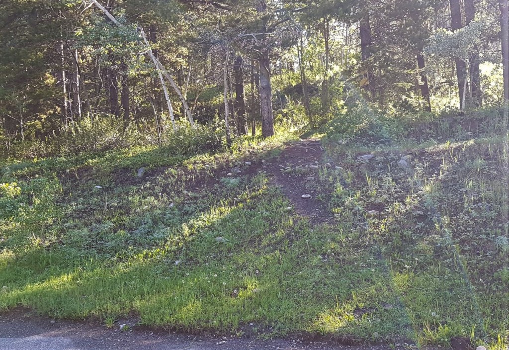
At around the 1.5 km mark, we came to a large washout area from the 2013 flood. At first, this wasn’t too bad as we could pick our way through the rocks on the faint trail.
Further up, the north side of the embankment has collapsed, wiping out the trail. I will freely admit that trying to find a way through this on the way in was confusing.
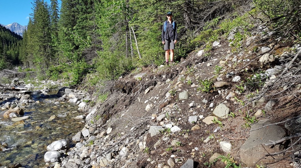
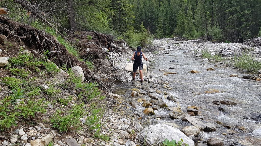
There are a few places to cross Lineham Creek to avoid the slump, but the run off was happening, and the water levels were too high for my comfort. I imagine this would be a solution with lower water levels, but I didn’t relish the idea of getting wet feet.
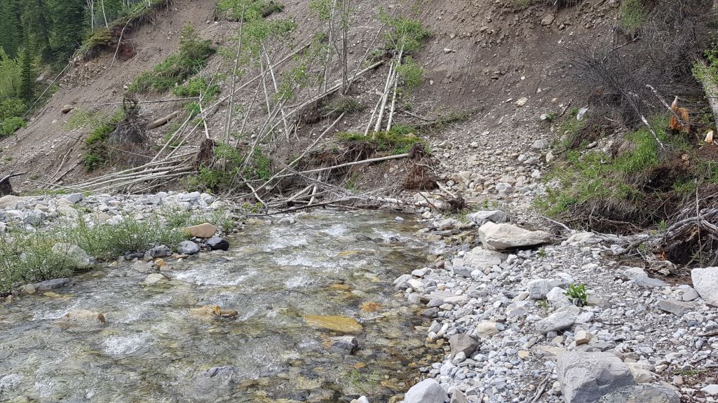
Instead, we stayed on the left bank, and made our way through the slump as best we could. We went over and under the fallen trees, many of which had lush green foliage.
Just past the collapsed bank, a stream enters Lineham Creek on the left. We were able to step across this. A few meters beyond the side stream, we picked up the trail that leads to the base of Lineham Ridge.
Once we were back on the hiking trail, it lead to the base of Lineham Ridge. This is about 2 km from the trail head.
I should point out that this is where the Lineham Twin Peaks Route veers off to the right. We knew we were on the correct trail, because it abruptly went uphill to start gaining Lineham Ridge.

The only braid in the trail was just beyond the initial uphill. It turns out, the right (straight ahead) fork is the enjoyable switchback up, while the left is the straight up option.
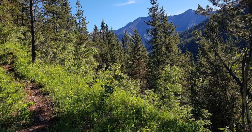
Once on top of the ridge, we entered the forest. This lasted for a good 3 km. I didn’t really notice the Forever Forest on the way in, and I was thankful for the shade on this hot summer day. However on the way out, it was hot and dank, and I just wanted it to end.
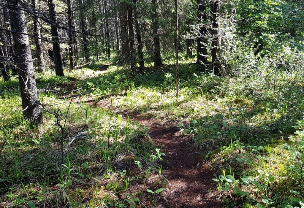
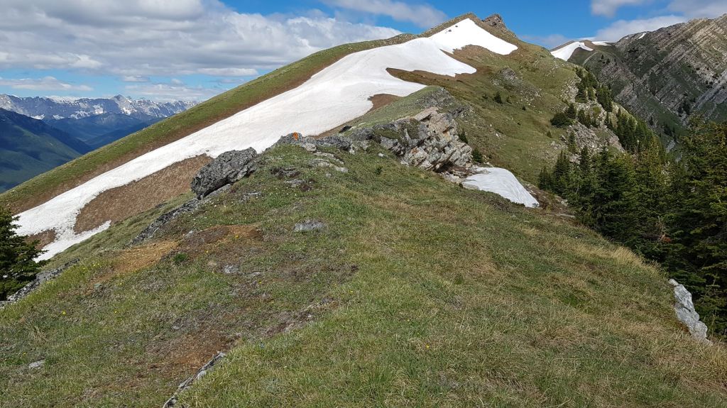
Every now and again, there would be a break in the forest and we’d get some fresh air and a lovely view of Lineham Ridge.

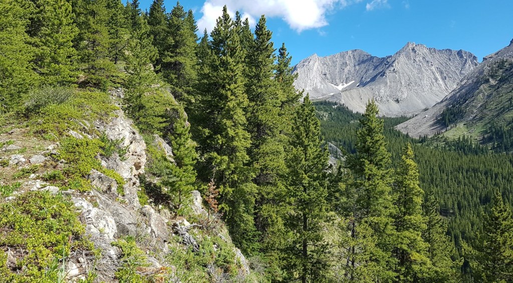
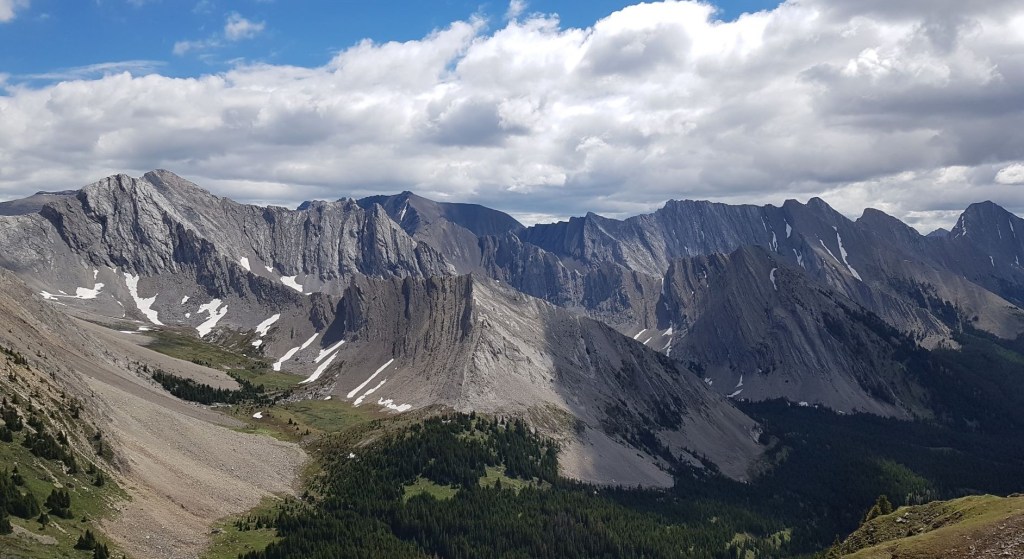
As the forest eased off, we started hiking up the rocky ridge. I have to say, this is one of the more beautiful ridges I’ve been on. The rock changes frequently, and the views are stunning.
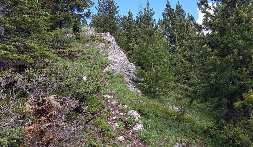

There is some fun rock ridge hiking to be done. In some places, I would weave back and forth over the ridge, finding the best option. Other times, the right side would abruptly stop, and we would scrabble over the top to the left side.
Part of the fun of hiking with someone new to the sport, is to see the landscape through their eyes. Here, Erin was amazed to find this beautiful ‘lawn’ on top of the ridge.
This would have been quite the cornice in the winter. For us, it was an opportunity to show Erin how to safely cross snow slopes, and how to kick steps up to the ridge.

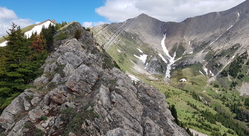
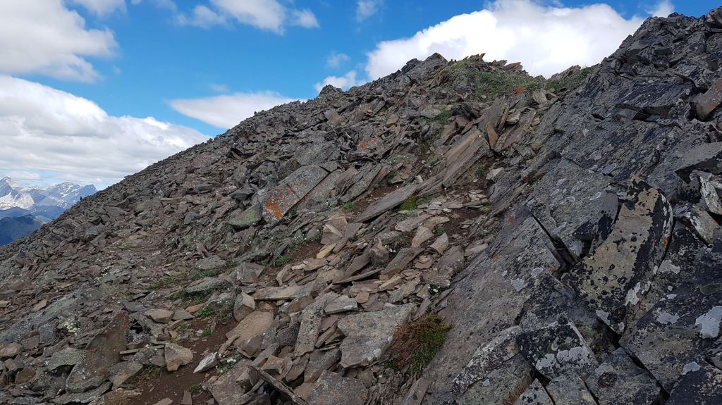
Just below the high point, the meadow changed to chunky rock. This was the hardest part, with some side slope and slabby rock.
Here is the ‘summit’ of the Lineham Ridge hike. It is possible to continue to the next undulation, but after that the trail changes to a scramble wall.
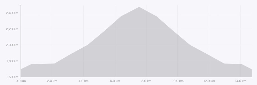
Distance to the summit of Lineham Ridge is 7 km, with an elevation gain of 830 m. Time to the summit was 3 hours 10 minutes.

Lineham Ridge Return
This is a there and back route. We stayed on the summit for a good 30 minutes, enjoying the views and drying off. It was one of the first super hot days, and I was definitely feeling the heat.
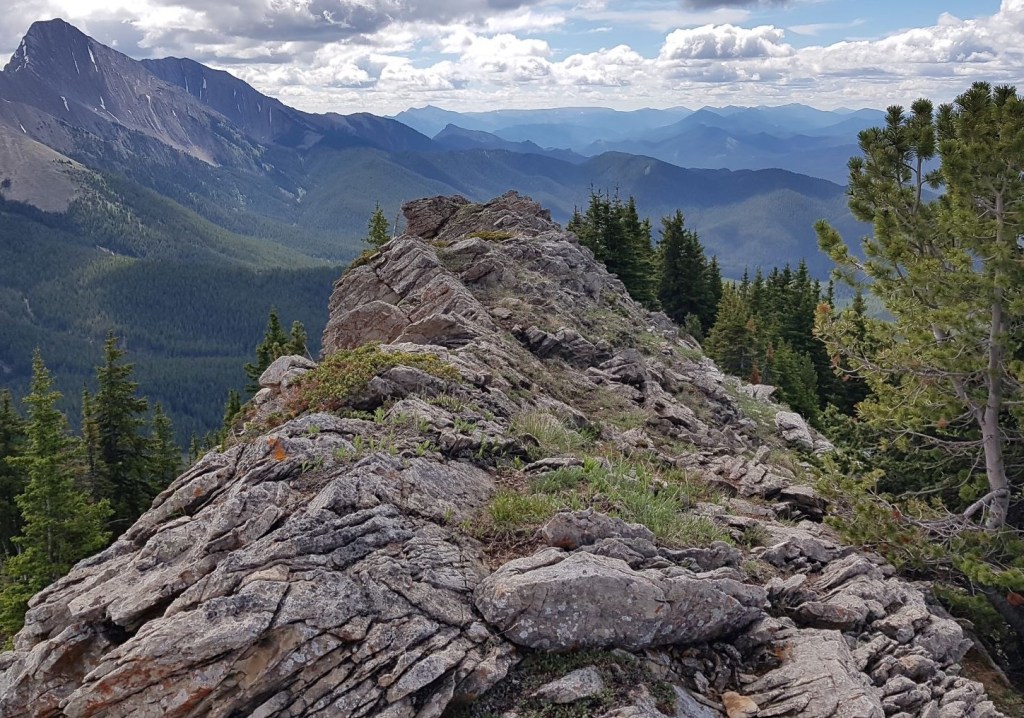
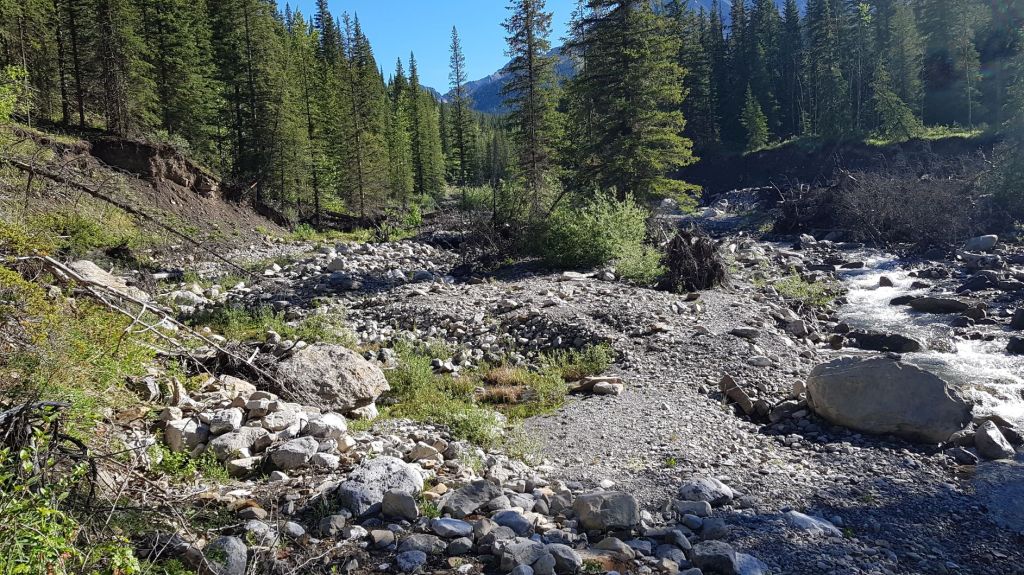
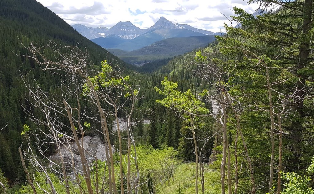
After we exited the Forever Forest, we got a view down to Lineham Creek. There is also an impressive view of the mountains on the far side of the Highwood Valley.
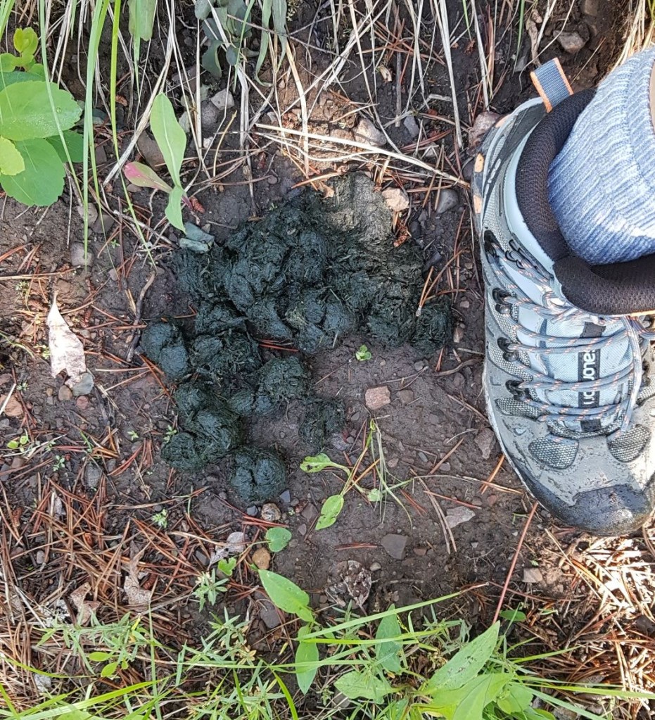
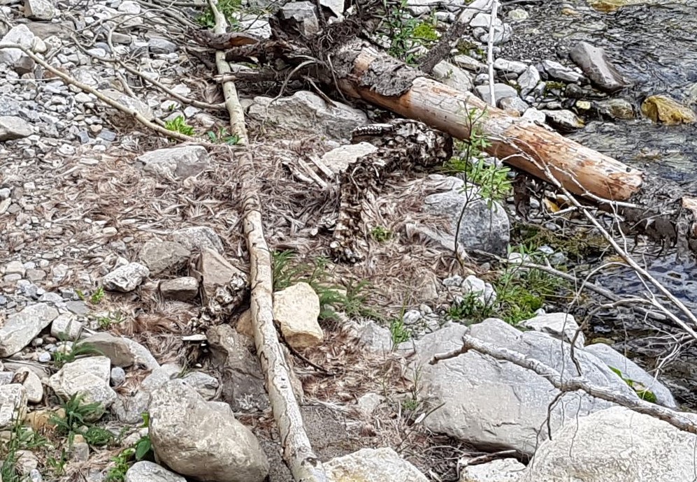
One of the last things I found was the carcass of some ungulate, perhaps a sheep. I lost my sense of smell about a decade ago (for unknown reasons), which is not ideal. I was basically standing right on top of this thing, waiting for Erin to cross the stream. When Erin walked up to me, she started to sniff, and then look around. When she pointed out the smelly carcass right at my feet, I nearly jumped out of my skin.
Lineham Ridge is a rare find in today’s over crowded hiking trails. This route is definitely on the wilder side, with animals freely roaming and going about their business. Be prepared for an animal encounter (dead or alive).
If you found this post useful, please do me a huge favour and click the Star button to “Like” it. You can also follow my blog, follow me on Instagram, or join my FaceBook page Al’s Adventurers.
Alisen
Totals – Tracked on Gaia (displayed on Strava)
Date: June 25, 2021
Group: Two (Alisen and Erin)
Distance: 13.7 km
Elevation: 830 m (2,739′)
Time: 6 hours even (includes 30 minute lunch & breaks)

I love all things mountains! I live next door to the Canadian Rocky Mountains, however I travel the world to enjoy the many different mountain environments and cultures that I can. I hope you enjoy these trip reports, and that it inspires you to accomplish your own adventure goals.

beautiful
How are you doing?
Nice meeting you
Thank you!
Absolutely wonderful. I love these photos of the mountains. Definitely looks like bear country!
Thank you. The scenery does the hard work – I just point and click. Most photos as taken while I’m walking 🙂 Yes!!! Definitely bears everywhere. I had to stop several times to listen, or to yell out.
You are very fortunate to be so close to this type of wilderness. Peace.
Oh my goodness!!! Yes, I am. So very thankful and blessed. I can feel all the tension leave my body as I head towards the mountains. Sometimes, it’s so powerful I just can’t stop the tears of joy.
Wonderful. Nature has a way of healing us. Peace and blessings.
Having a trail all to yourself is a rarity these days and must have felt a bit eerie, especially after finding some carcasses! But it must have felt rewarding to discover this trail off the beaten path. The views from the summit look stunning.
I honestly could not believe my luck 🙂 K Country is so overwhelmed, that to find a quiet trail is abnormal.
Really nice Alisen! The scenery and of course your photos are really really nice!
Awww, thanks so much. You are too kind.
I wouldn’t want to leave.
Tis beautiful. A famous mountain guide named Conrad Kain was known to be a Summit Lounger as he too did not want to leave. ❤💕❤
I don’t blame him!
Great image..
Beautiful photos! How awesome to have this trail all to yourselves. Other than that bear lurking around 😉
I hear ya. Bears and cougars are always lurking though. I just try and discourage a full frontal encounter. Lots of yelling, singing and belting out the Canadian Yodel 🙂