September 6, 2021
Ever feel sad or melancholy? I rarely do. When it does happen, the only thing that can cheer me up is a solo trip to the mountains. I find that the slow methodical plodding up a mountain gives me the peace and time to think about what’s troubling me. Then the pure majesty of the mountains works its magic, and I feel better. Except for this time…
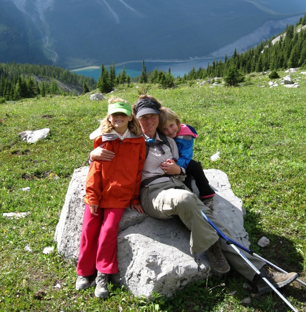
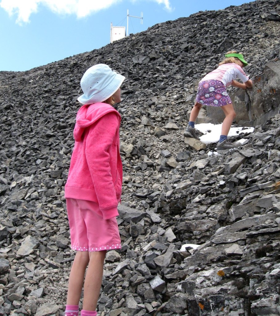
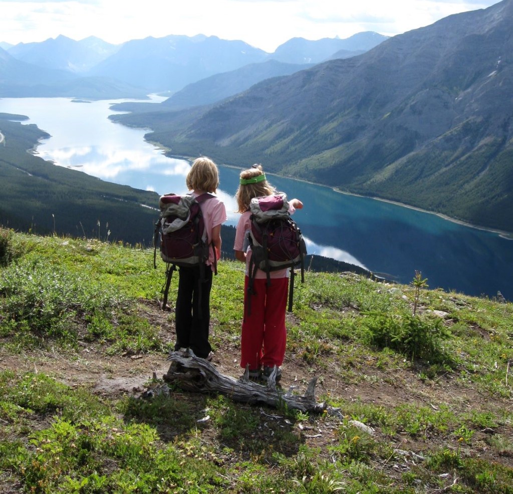
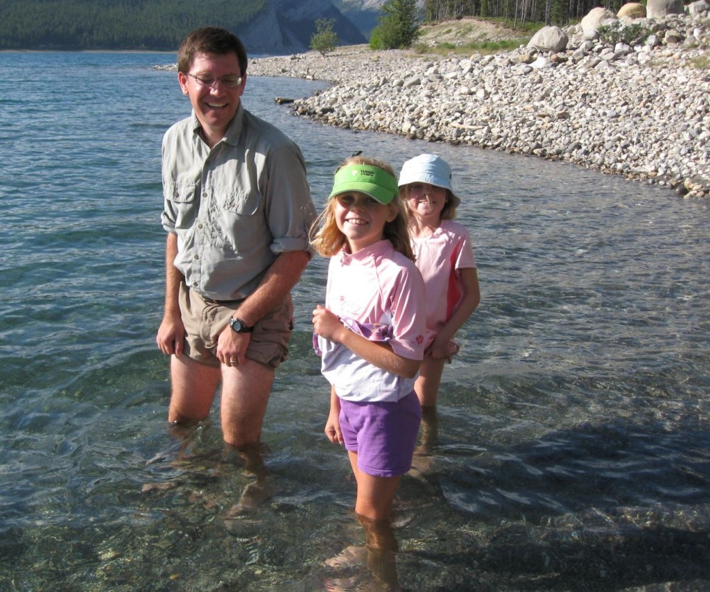
I have twin daughters. What’s great about twins is that they are built-in playmates, and each other’s best friends. With two kids but only one pregnancy, I could take them both into the mountains at a younger age, knowing they’d be at the same pace and endurance levels. Only one dance class, one soccer practice, one P/T Interview… You get the idea. The downside? They both left for university at the same time. I thought I was ready for them to spread their wings, but I wasn’t.
I thought the best way to feel better was to climb Mount Sparrowhawk, which was my daughter’s first summit when they were 8 years old. This would be a ‘coming home’ moment, and I’d feel better afterwards. While I had a gorgeous climb and clear skies, I still felt pretty crappy after. I guess I needed more time.
Gear
Sturdy hiking boots, poles, and your regular day pack kit.
Overview
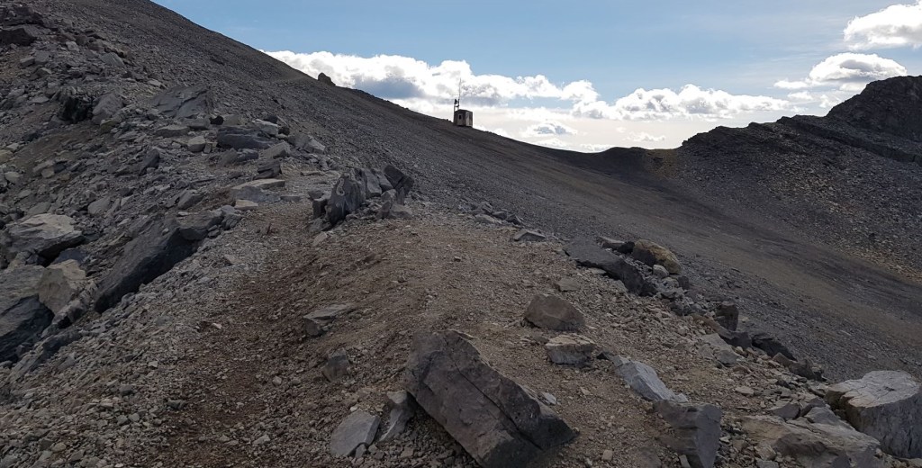
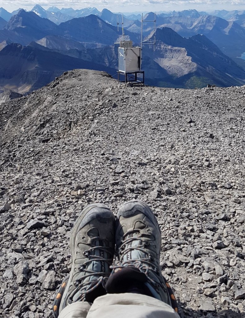
From the Sparrowhawk Day Use area, cross the Smith-Dorian Highway and start up the trail on the other side. At the intersection with the High Rockies Trail, keep going up, while the other trail traverses across. Continue up through the forest, all the way to a wide ridge. From there, I descended into a small cirque below Read’s Tower. Climb up the steep headwall to the pass between Mount Sparrowhawk and Read’s Tower. The scree now turns big and chunky. Follow a trail, or find your own way. The trail goes up and around to the south side of the mountain. From the weather station shack, climb straight up for the final push to the summit. There are lots of steps, but they are nicely covered in ball-bearing pebbles. Return the way you came.
Parking and Trail Head
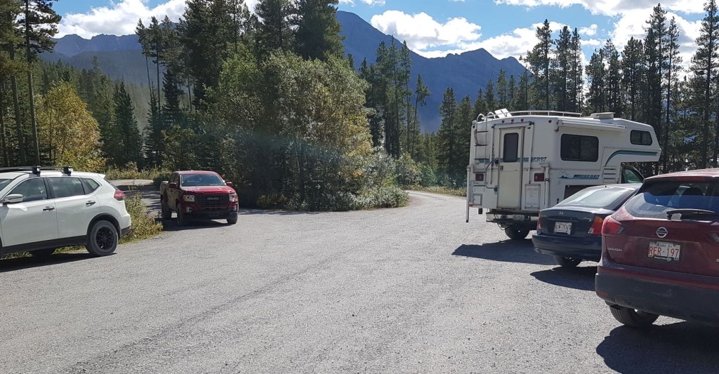
Park at the Sparrowhawk Day Use area, which is not much more than a small parking lot and pit toilets.

I was the only car at 7:30 am on a quiet Monday in September, but the lot was fully subscribed by the time I returned. I’d hate to see it on the weekends.
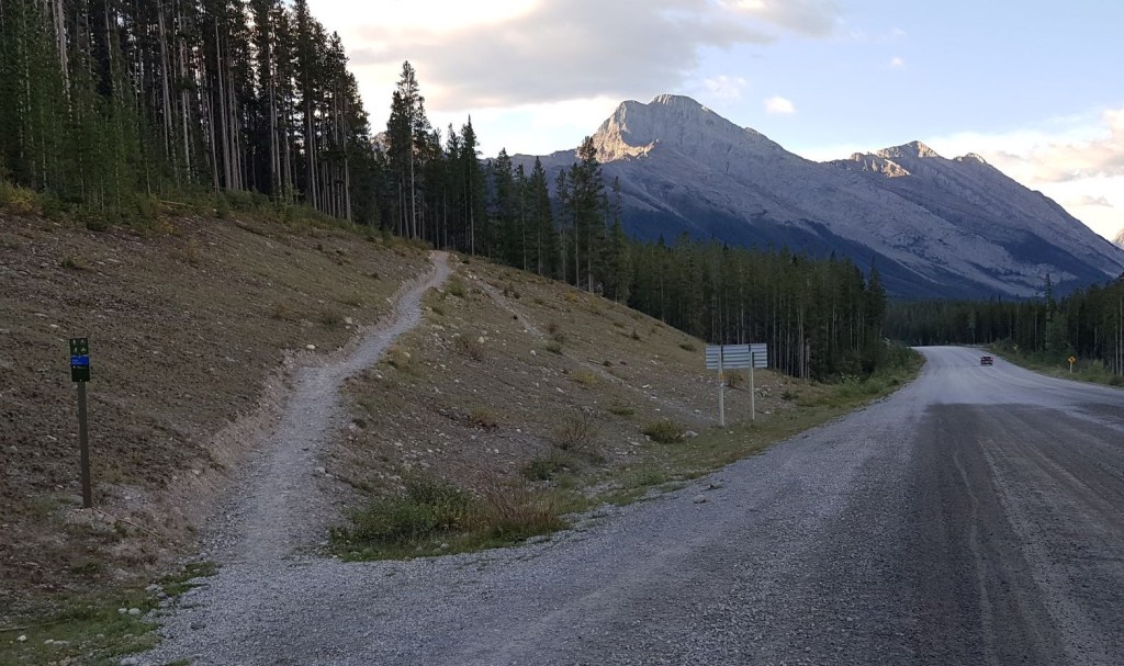
At the big information sign, continue past to the trail. The trail marker only says “High Rockies Trail.” From here, walk up the short embankment to the highway.

Cross the Smith-Dorian highway, and ascend the obvious trail on the other side.
Main Trail
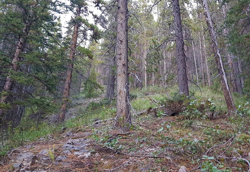
Once on the main trail, it’s an enjoyable couple of switchbacks. Keep to the main trail, and avoid the temptation to take side cuts. Our trails are bad enough.

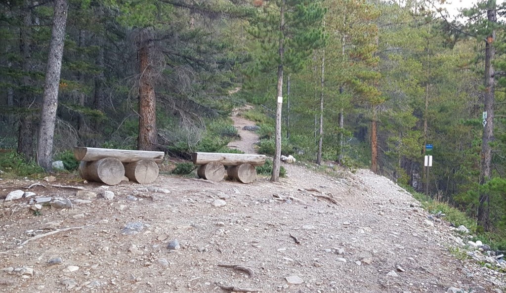
After about 1 km is the intersection with the High Rockies Trail and is marked by a couple of lovely benches. Go straight up here. The High Rockies trail goes north-south and follows the Smith Dorian Trail. This is a lovely mountain bike, hike or winter snowshoe route, BUT there is some avalanche danger so be aware.
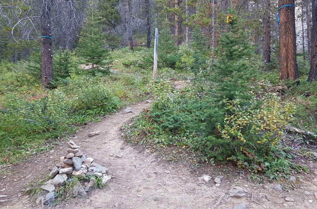
At about 1.5 km is another intersection. It’s marked by a large log, a cairn, and some flagging. Turn left here. Continuing straight will lead to the Sparrowhawk Tarns and Mount Bogart above that.
After about another 500 m is a ‘choice’. The regular route continues straight up (I took this route on the way down). I elected to go left, and I was glad I did. Instead of a miserable crawl up a destroyed trail, I instead found a light trail in the forest. Not only was this in the shade, but it had lots of traction. The trail does fade, but thanks to situational awareness, it was no big deal.

The side trail pops out at an outcrop. There was a bit of hands on rock, which was a nice interlude from all the hiking.

Above the outcrop, the side trail connected back up with the main trail.

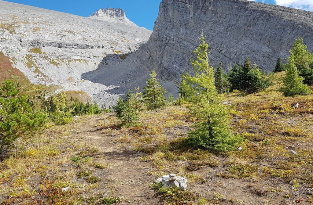
Right above where the two trails converge is a small rock band. It’s easy to follow it across and get off course, so look for the large cairn. This will draw you onto the correct trail and into the forest on the left. Basically, when in doubt, go straight up 🙂

If you don’t already do this, start now. Every so often, turn around and look back at the trail, especially at junctions. Where the trail in the forest ends, there are two trails. One is blocked off. Take note of which one you came up.
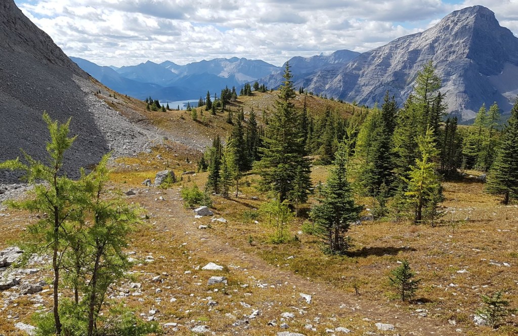
As I neared the tree line, I was now on a wide ridge.
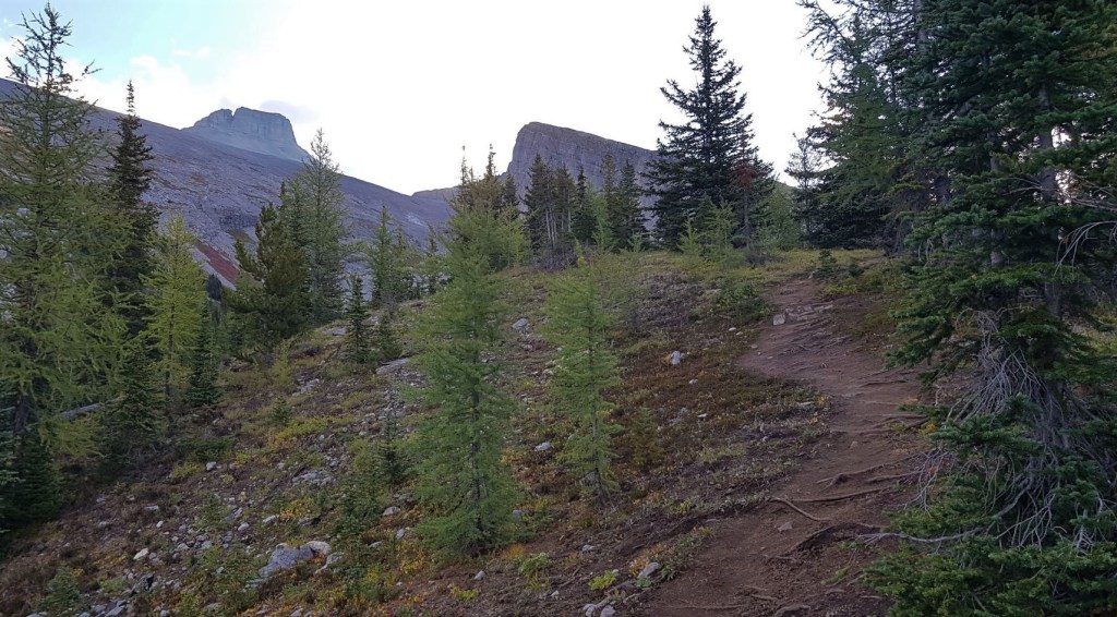
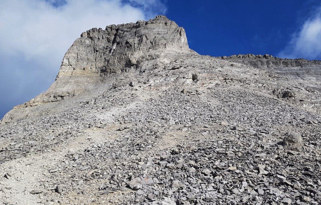
Going straight leads to the base of Read’s Tower. To access Mt. Sparrowhawk, I had to drop down into a small cirque.

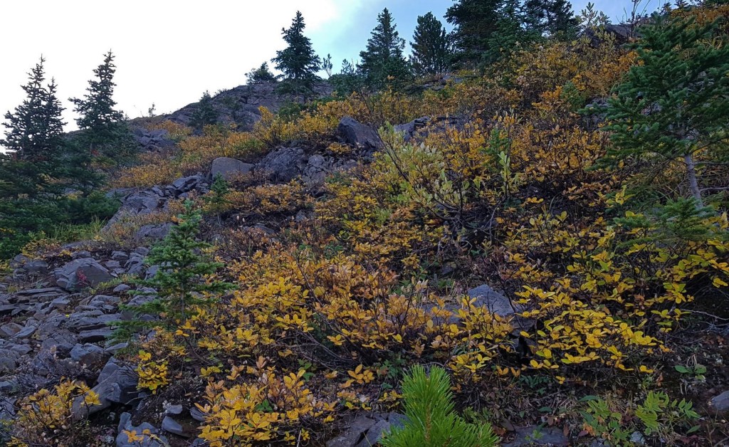
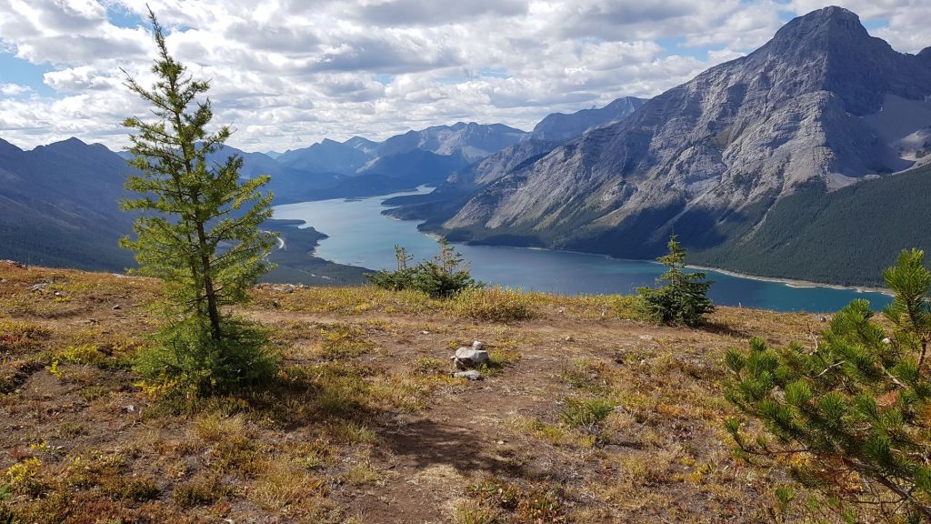
Look at all those Larches! You can find these beautiful trees just about anywhere. Check out this link to see where the most popular spots are, but also how to find other beautiful fall foliage.
This is when the melancholy really started to set in. I have fond memories of hanging out with my kids in this lovely meadow. It’s amazing how fast they grow up. On top of that, when I was here 11 years ago, there was a monument to a fallen climber and dad. A lovely friend had just lost her dad, and I’d recently lost my father-in-law, so passing the site of the memorial was also tough. Ann – anytime you’re ready, we can visit this beautiful meadow.


From the meadow, I hiked over to the base of the headwall between Mt. Sparrowhawk and Read’s Tower. The headwall is surprisingly steep. It’s also longer than it seems, as the top lays back out of sight. When water is flowing, stay to the scree trail on the right. As I was here in September, the rock in the middle was dry. I elected to scramble up the steep rocks and forgo the grinding scree. From looking at the time stamps on my photos, it took me a solid 30 minutes to hike up this section!
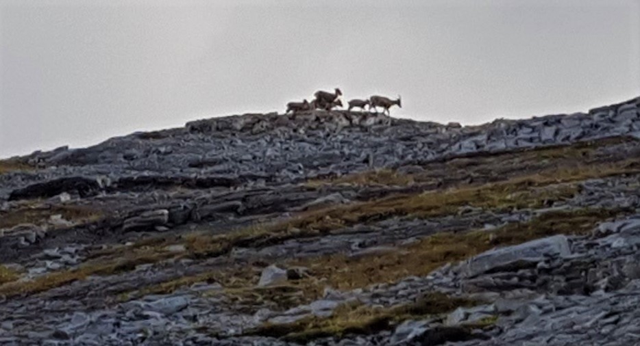
As I was all alone, when I heard some falling rock, I took the time to stop and listen. I was rewarded by seeing a family of Rocky Mountain Sheep traversing above me.
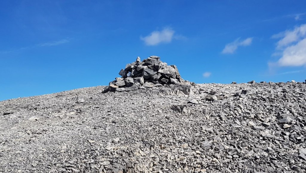
At the top of the headwall is a large cairn. I stopped here for a snack and a water break. I had been hiking for a solid two hours at this point, and travelled just shy of 4 km. Elapsed elevation gain is 880m, but it’s a bit more due to the elevation loss down into the meadow.

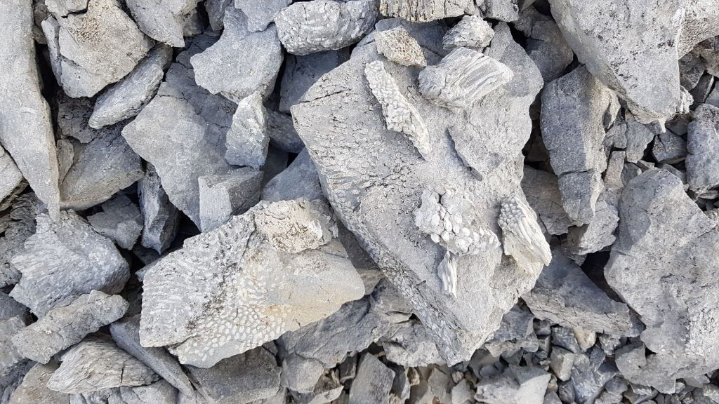
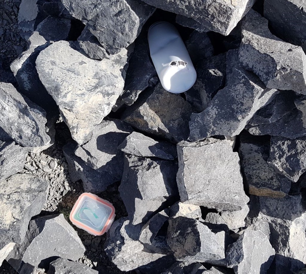
One of the best features of the Sparrowhawk scree is the abundance of fossils. While they are not everywhere, finding a vein of them is so much fun. Please do not take them home. Instead do what this kind person did – make a nice pile for others to see.
The scree section is an exercise in dedication. While it’s straight-forward enough navigation, working my way through the rivers of scree trails kept my mind otherwise occupied. Basically, I made my way up and over to the right, angling for the low point between Sparrowhawk and the lower flank of Mt. Bogart. But not too low, as I’m not one to give up an inch of elevation once I’ve gained it.


It’s hard to tell from the photo below, but at this point I started to hike directly towards the face of Mt. Sparrowhawk, to intersect with a low shelf. There is a large cairn, and then a short walk along the top of a small moraine. From there, it’s a straight shot across the base of the Mt. Sparrowhawk face.


Once I arrived at the foot of the Mt. Sparrowhawk summit block, I needed to take stock. I was still all alone, and the wind was freezing. It was the first cold day after a very hot summer, and I was feeling the chill. I always keep a package of hand warmers in my pack, but it must have been tossed in the 30 plus degree temperatures over the summer. My hands were cold, and I idly wondered if my fingers would work if I had to use the InReach for any reason…

On the final push to the summit. The trail is more or less straight up, on downward sloping steps, covered with small ball-bearing scree. Just enough to make footing a little unsure.

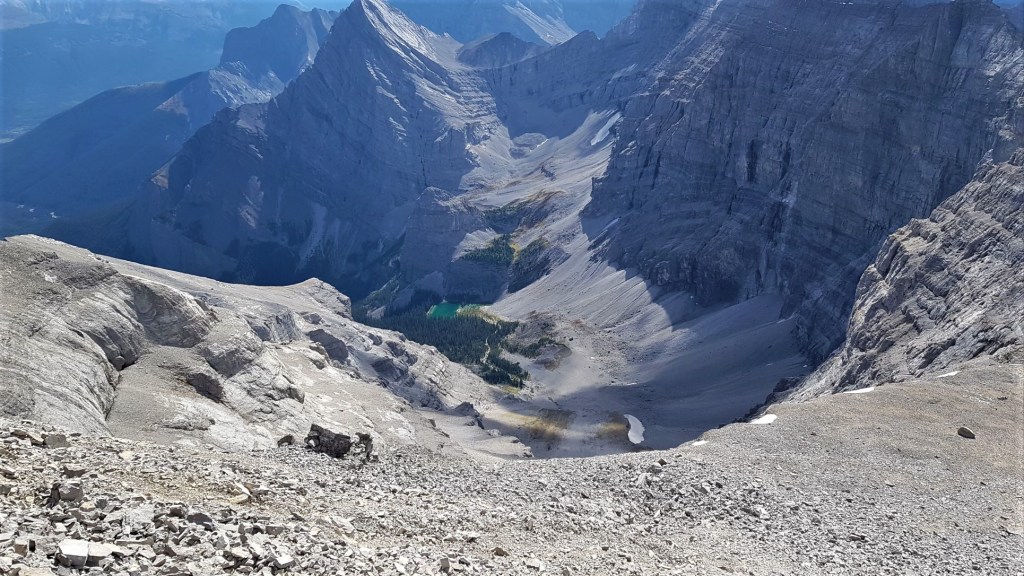
Be sure to turn around on this section and check out the impossibly gorgeous view down the backside.
With no preamble, the summit just pops into view. Two steps up, and viola! I was there.
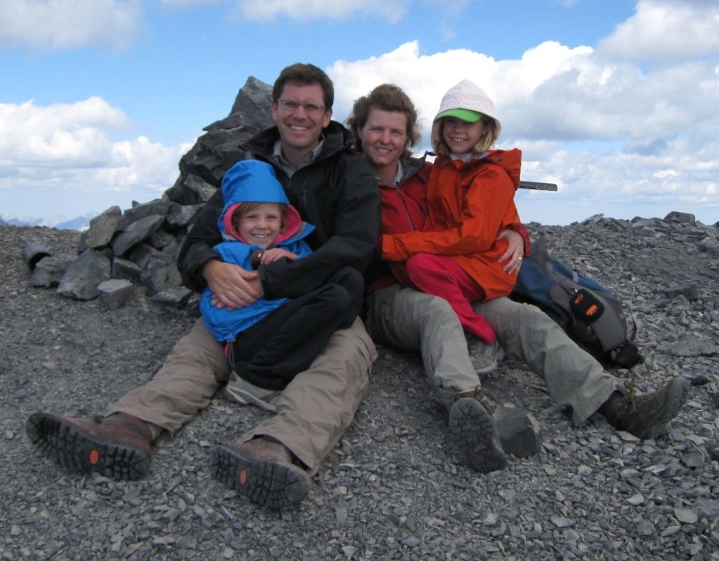
Instead of the usual summit elation, I again was sad. No kids – or anyone! – to share the summit. I took some photos, poked around at the various bits that made up the summit register, and then started to make my way back down.
Time to summit was 3 hours 30 minutes. Distance was 5.19 km, and elapsed elevation gain is 1,401m. One of the reasons I really like Mt. Sparrowhawk is that it’s one of the few mountains in K Country that is over 3,000m, sitting at a respectable 3,121m. The elevation gain is also a big draw at over 1,400m. Even big mountains like Eiffel Peak and Mist Mountain have less elevation gain.


Mount Sparrowhawk Return
To descend the summit block, instead of taking the down-sloping steps, I went skiers left and went down the scree to the side. Not only did this save me some time, but it also put me out of the way of the couple of other people that were making their way up. If at all possible, try not to kick rocks down onto others. The best way to do that is to avoid each other’s lines of ascent/descent.
Once off this scree section, I had another short break at the cairn above the headwall. I stripped off my extra clothing as I was now out of the wind and the day had warmed up nicely. To descend the headwall, I kept to the scree on the left, and churned my way down.
The meadow was even nicer in the early afternoon with the sun shining. From this view, it’s easy to see the trail leading back up to the short ridge.
I elected to go back down on the main trail. Holy hanna! What used to be a small, tight trail through the trees is now a super wide, washed out, and majorly slippery baked mud mess. THIS is why you don’t hike in the shoulder season, or when the trails are super wet and muddy. All the vegetation gets washed/skidded away.

Once back to the car, the parking lot was now full, with more people circling to try and squeeze in. I changed out of my boots, and hiked down to Spray Lake for a well earned wash and foot soak. There is nothing better than rinsing off the scree dust and sweat, and literally cooling my heels, before climbing back into my car for a long drive home.
If you found this post useful, please do me a huge favour and click the Star button to “Like” it. You can also follow my blog, follow me on Instagram, or join my FaceBook page Al’s Adventurers.
Alisen
Totals – Tracked on Gaia, displayed on Strava
Date: September 6, 2021
Group: Solo
Distance: 11.2 km
Elevation: 1,417 m (4,676′)
Time: 6 hours 30 minutes (includes lunch & breaks)


I love all things mountains! I live next door to the Canadian Rocky Mountains, however I travel the world to enjoy the many different mountain environments and cultures that I can. I hope you enjoy these trip reports, and that it inspires you to accomplish your own adventure goals.

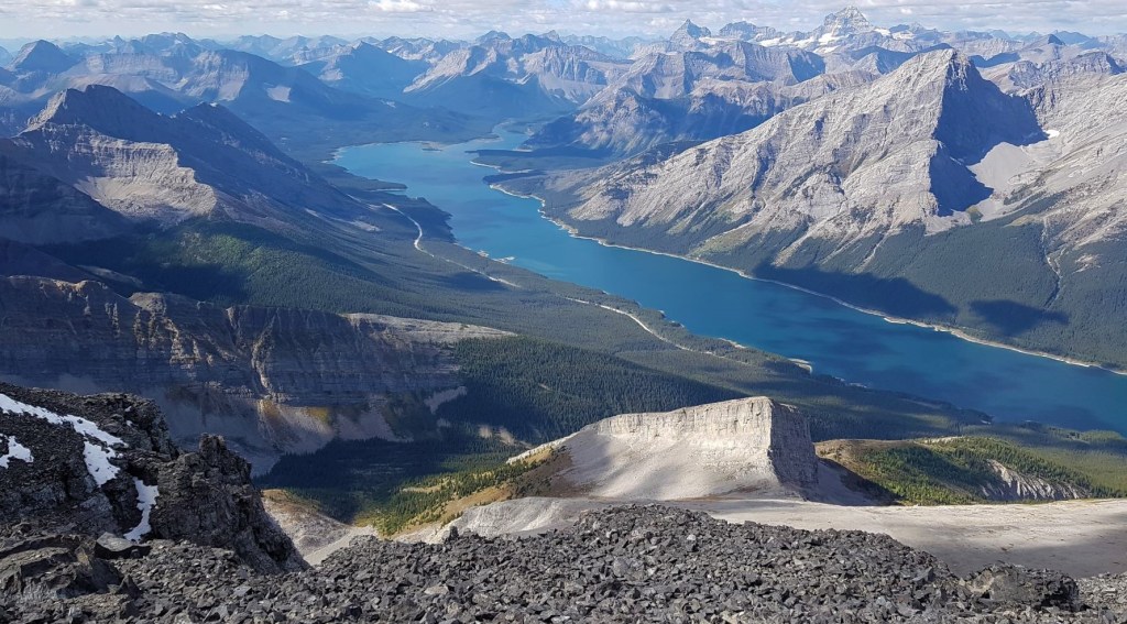
The views of Spray Lakes from the summit are amazing! I also enjoyed the before and after photos of your hikes up this mountain. What lovely memories!
It really was a stunning and clear fall day. After the smoke from the summer, I have to remember that these views are not to be taken for granted.
Hi. Some day in the near or pretty near future, when your daughters are home on school break, maybe you’ll take this hike with them once again. Take care. See ya.
Lovely. Made me sad.
You can haul your butt back up there and get over it 🙂
What a trip down (and up) memory lane (or rather Mount Sparrowhawk). I imagine this hike would bring back memories of your daughters, which is both heartwarming and heartbreaking at the same time.
It’s great there!
Amazing location Alisen!
Also, the ridge line that starts from the weather station shack looks very appealing too.
But i guess, Spray Lakes might be the highlight of this hike.
As a climber, I bet you’d love that ridge to Mt. Bogart! It’s limestone, so not sure how the holds are. I guess you’ll have to come over and give it a go 🙂
I generally like ridge lines and here in Greece we mostly have limestone, so this type of climb would be familiar to me.
Let’s hope the traveling restrictions will end soon some can travel again freely and be able to visit other countries, like once upon a time.
How wonderful. I love your little hikers!!
Awwww, thanks. I look back and see them doing a major summit in a skirt 🙂 Too funny, but that’s what they liked to wear. Anything to keep them smiling, right?
Wow! So much embedded in this hike…the past, the present, and the faith – very nice!
Thank you. Sometimes a hike is just a hike, and sometimes it’s so much more. The mountains have the power to heal, and I’ve seen them work their magic more than once.
Love the image 💚, great post
Thank you very much. It’s a very pretty location.
You are most welcome dear ❤️
Such a great place to hike ..and those kids look happy.
Heck yeah! They LOVE the mountains. We took them because later that month we were going to spend several weeks in Austria climbing mountains. I had to know ‘for sure’ they were strong enough to climb over 10,000′ (3,000m). The Austrian trip was a success. They climbed the first peak my father-in-law (who is from Austria) ever climbed. The age difference on the trip was 8 to 78.
Awesome 😇🙏💙
Thanks Craig. It was good then and now.