September 14, 2021
This is Day Two of a five day hiking trip to the Tonquin Valley in Jasper National Park. To read about Day One and the hike in, click here.

Today was a “Choose Your Own Adventure” day. As this was an Alpine Club of Canada trip, our leader Ivan was effectively responsible for us all. As such, we were to stay together. However, as we ate breakfast and drooled over the the tantalizing sight of Mount Clitheroe that we could see from the dinning room window of the main lodge, Ivan had an idea.
After talking to Gilbert about the route, which he assured us ‘was a highway’ and was also ‘worth every step of the way’, Ivan appointed me Trip Leader for the side trip up Mount Clitheroe. Together with Janek and Agnieszka Krolikowska, who are very accomplished climbers, we also had Pamela. While this was her first scramble, she did great. Ivan would take the main group and go up Clitheroe ridge, just to the west of the summit.
Gear
Hiking boots, hiking poles, gators (because it’s always pretty wet in the Tonquin Valley), and your regular day pack kit.
Overview
From the Tonquin Valley Adventures Lodge, take the main trail back towards the Astoria River Trail. After about 1 km, turn left onto a faint side trail, heading straight towards the base of Mt. Clitheroe. Hike up through the meadows. At the boulder field, pick you way up, keeping an eye on the ascent route up the face of the mountain. Once at the base of the scramble, make your way straight up to the summit. Return the way you came.
Trail Head
After a lovely sleep in the warm cabins at Tonquin Valley Adventures, we had a leisurely breakfast in the main lodge. Owner and Adventurer Gilbert was still there, so we took the opportunity to ask him questions and get advice on going up Clitheroe. Gilbert is quite the mountaineer, and had no doubt been up Clitheroe many times. After some photos, we set off as a group.
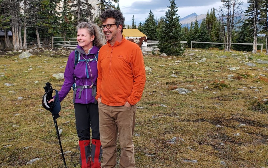
Photo credit: Jacek Krolikowski.
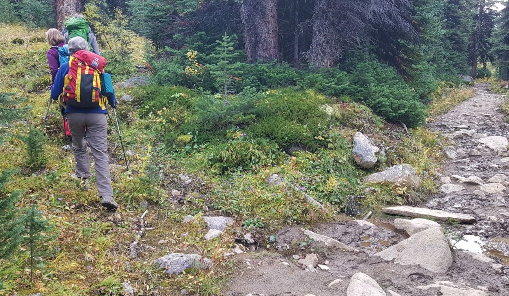
We retraced our steps from the day before when we hiked in, heading back towards the main Astoria River Trail. We crossed the meadow, and began our ascent on the muddy trail. After about 1 km, we took a very faint side trail. Honestly, if it weren’t for our Leader Ivan’s guidance, I probably would not have seen this side trail.
Main Trail
We stayed on the faint side trail for a little ways, before it opened up into an expansive meadow.
After a leisurely stroll through the meadow, with Ivan pointing out various features and telling stories to keep us entertained, the group split. Ivan took his group to climbers left to ascend the ridge, and my merry band of four continued straight up to find the start of the scramble. The ascent route is the first gully on the left. We were generally aiming for the very small snow patch.

From the meadow, we aimed for a break in the lower rock garden, trying to stay on solid ground for as long as possible. This turned out to be the home of a marmot, who greeted us on both the way up and when we returned.

Once we entered the rock garden, there really was no ‘right’ way to go. I thought I spied several faint trails, but they all petered out. Eventually I gave up, and just beelined it for the base of the scramble. I will admit to not loving rock hopping at the best of times, and this expanse of large rock rubble seemed never-ending.
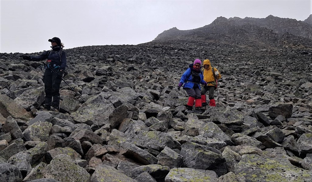
Once we got to the base of the scramble, which is the first gully on the left, we had a decision to make. We could stay left and take the obvious scree trail, but instead elected to stay climbers right. On this side, we were up against a rock wall, and had lots of steps to scramble up. I have to admit, this was fun and easy hands on rock.


When the ridge finally came into view, we turned right.
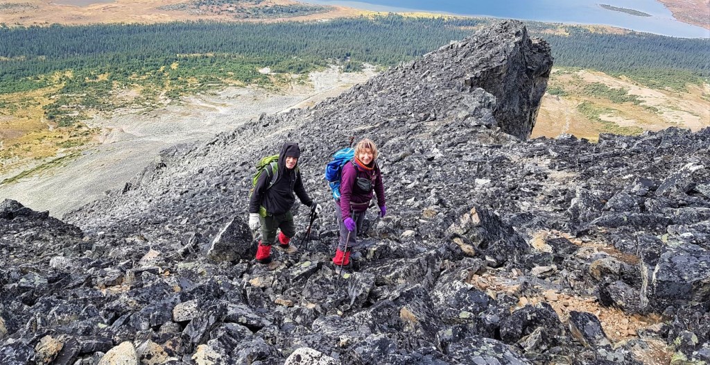
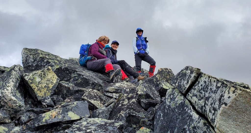
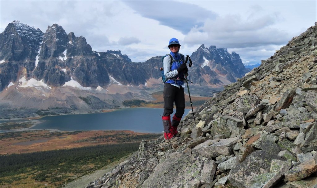
Full disclosure – the true summit is just behind me. With the weather changing quickly, the temperature dropping, and a partner on her very first scramble, we decided this flat rock was a good place to stop. Ivan was trusting me to be a responsible trip leader, and I didn’t want to let him down.
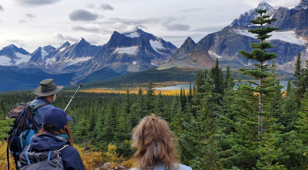
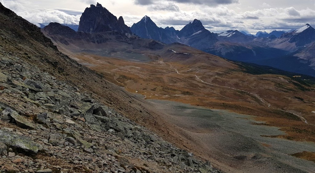
As Gilbert promised, the views from the top of Mt. Clitheroe really were worth every step of the way. The three photos below span the valley from east to west.


Distance to the summit of Mt. Clitheroe is about 4 km. Elevation gain was 738 m. Time to summit was approximately 3 hours at a very leisurely pace up and through the meadow, and we definitely didn’t rush the trip up the mountain.
Mount Clitheroe Return
We were quickly losing our sun and warm weather as a system was moving in fast. We didn’t want to be caught out, so after a very short bite to eat, we started back down.
Instead of retracing our steps, we went further along the ridge to the west. We descended on the obvious scree trail, which was easier on the knees and a faster route down than downclimbing on our ascent route.


Our scree trail lead directly to the patch of snow we had spied from the dining room window of the lodge below. I love it when stuff like this works out.
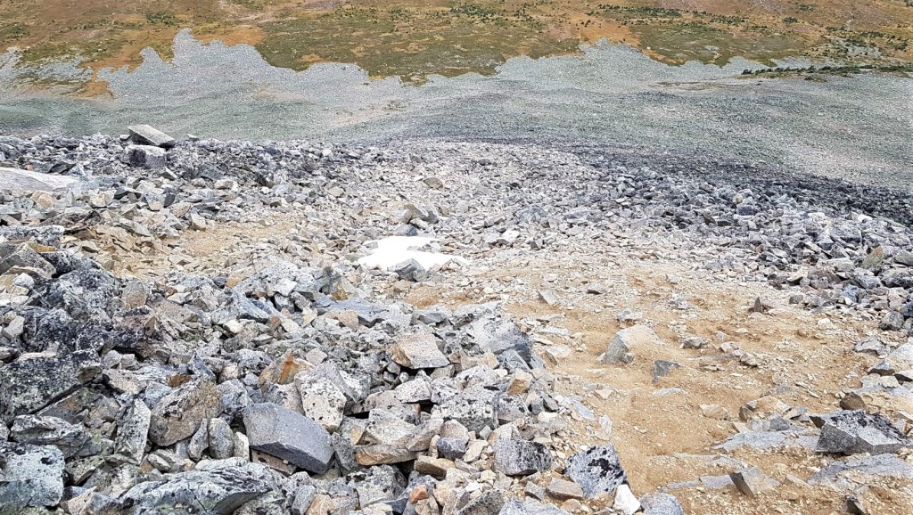
Once the scree route ended, we were back into the never-ending rock garden above the meadow. I was hoping there was a route out from the scree line, but nope! Random rock hopping it was!
Once back in the meadow, we picked around to find the trail Ivan had taken us in on. After stomping around in wet bushes for a bit, we eventually found it, and made quick work back to the lodge.
For the full trip report, click for Day One – Hiking In, Day Three – Wates-Gibson Hut, and Day Four – Majestic Ridge.
If you found this post useful, please do me a huge favour and click the Star button to “Like” it. You can also follow my blog, follow me on Instagram, or join my FaceBook page Al’s Adventurers.
Alisen
Totals – Tracked on Gaia, displayed on Strava
Date: September 14, 2021
Group: Four (Alisen, Pamela, Jacek and Agnieszka)
Distance: 8 km
Elevation: 738 m (2,435′)
Time: 6 hours 15 minutes (includes lunch & breaks)


I love all things mountains! I live next door to the Canadian Rocky Mountains, however I travel the world to enjoy the many different mountain environments and cultures that I can. I hope you enjoy these trip reports, and that it inspires you to accomplish your own adventure goals.

Wow wow wow! That view from the summit does indeed look to be worth every step. So beautiful!
LOL! Yup, so we were told 🙂 Seriously, The Ramparts are truly stunning. It’s serious climbing on those rocks, so looking at them is probably as close as I’ll get.
I love this area, such a beautiful view from the summit. Maggie
Thanks Maggie. We were lucky to get there before the snow and rain arrived. Just good timing.
Alisen
Wow Alisen! Looks wonderful and views from the top of Mt. Clitheroe are simply stunning!
I would love to hike one day in that location!
You’d love it! So many great spots. Next week, the post is from the Wates-Gibson Hut in that same valley. You can stay there and climb some of the Ramparts. It’s pretty good climbing from what I hear.
Looking forward to your next post Alisen!
Very cool backdrop! Awesome picture👌
It almost doesn’t look real, does it?
These images make me want to get out into nature!
Yes!!! Awesome!!! I hope you DO go out into nature. You don’t have to climb a mountain, just get out and enjoy your own backyard, whatever that is for you. I’d love to hear what adventures you can get into within an hours drive of your home. Do tell!!!
Alisen
Your pictures are beautiful. I continue to be amazed at your navigational skills. That rock garden/scramble looks like a slow slog and would have never guessed that that was even a side trail!
You’re good for the ego Linda 🙂 Navigation was more or less straight up 🙂
Funny story – near the top I was getting a bit frustrated with the ‘trail’ and was wondering if I was indeed on the right path. Just then, I looked down and found a small candy wrapper. Yup! Just the sign I needed to give me confidence that I was indeed at the right spot 🙂
I guess that’s the good thing about hiking in the mountains is that it’s usually obvious which direction you should be travelling!
LOL! It’s definitely not always the case, but with this one, it was just straight up.
Those views are stunning. What a fabulous hike!
Thanks Ann. You would LOVE Tonquin Valley. Other than the sucking mud, it’s very gentle hiking. And a warm bed at the end of the day.
Such an incredible site to see and hike .great views.
Thank you! It was absolutely stunning. Hard to get into, so I’m glad we had so many days there.
So great.
Another glorious adventure! 😀 … Mt Clitheroe is just a snow-covered blob on my google map, but I got the gist of it. 😀
Right! Google maps must be showing the winter version right now. That’s too bad. It’s quite pretty. However, the next day we got snow so Clitheroe was a big white blob!
Incredible landscapes. Magnificent photos.👏🏻👏🏻👏🏻
That’s a tough climb up that rubble, Alisen, but what a view!! I’ll be in Jasper this summer after Lake Louise. I’ll have to browse your sight for some other trips in both areas. 🙂
Lots to do in Jasper, that’s for sure. Lots to see on the Icefields Parkway on the way to Jasper as well. Many stopping points for views, plus the icefields themselves.
And waterfalls 🙂 We’re looking forward to it.
Feel free to contact me when it gets closer to your trip or when you’re here.
Alisen
Thank you. That’s such a kind offer. 🙂
Beautiful hike! Amazing photos!
Thank you. It’s a beautiful part of the world.
Wow !
This was great day in the mountains Alisen. Thanks for coming up with idea to scramble there and for leading the group!
My pleasure Agnieszka. Thank YOU for coming with me. I wouldn’t have done it by myself, so having you come made it possible.
Here’s to more adventures! We will have to plan some summer trips together.
Alisen
O my! Extraordinary Landscape. And as exquisite images and feelings. Lovely Alisen. Never knew this existed.
Narayan x