September 16, 2021
This is Day Four of a five day adventure in the Tonquin Valley. Click the links to read about Day One – Hiking In, Day Two – Mount Clitheroe, and Day Three – Wates-Gibson Hut.
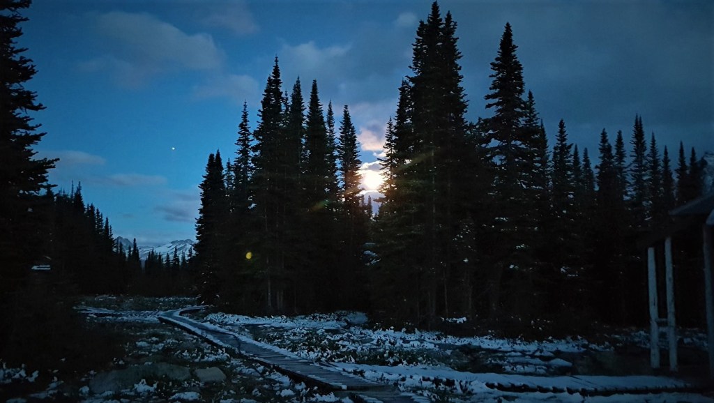
We woke up to even more snow and colder temperatures than yesterday’s trip to the Wates-Gibson hut. Wanting things to warm up a wee bit, we again had a leisurely start to the morning, and didn’t strike out until around 9:15 am.
We didn’t get far though, because Ivan spotted the herd of Caribou out the front door. We spent the next 30 minutes or so moving very slowly and quietly until we could see them from afar. Their footprints are massive, and are about the length of my foot.

Gear
Hiking boots, poles and gators (wet and muddy), and your regular day pack kit.
Overview
From the Tonquin Adventure Lodge, cross the meadow heading roughly north west, to hug the shore of Amethyst Lakes. Pass Amethyst Campground, and continue to Maccarib Campground. Turn Left at the fork and continue to the end of the Majestic Ridge Trail. Return the same way.
Trail Head
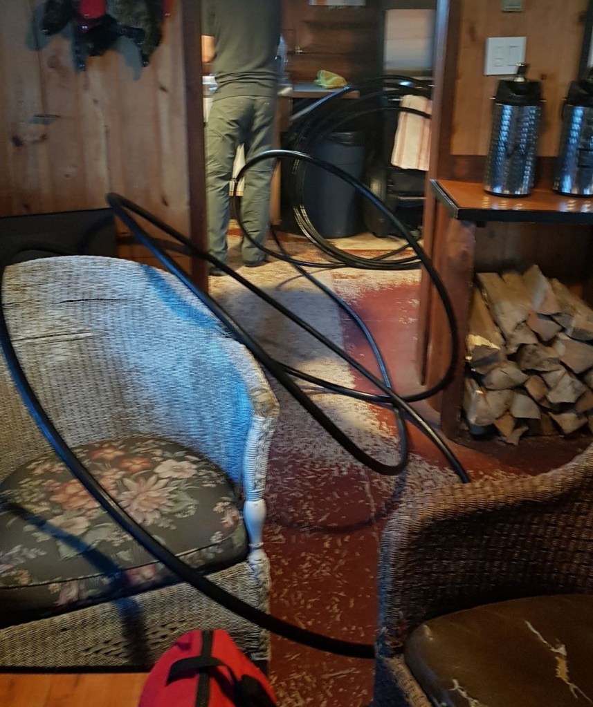
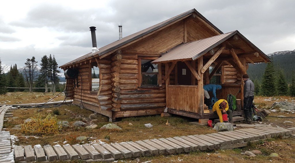
We again had a lovely night at the Tonquin Valley Adventures lodge. However, as it got below freezing, the outdoor pipes that draw water from the lake into the lodge froze. Gilbert had left us lots of water stored in jugs, so there was no shortage. We had two people stay behind today, and they would have fun finding the bit of ice clogging the line.
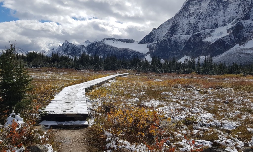
Today we hiked in the opposite direction from the previous three days, and went north west to hug the shores of Amethyst Lakes.
Main Trail
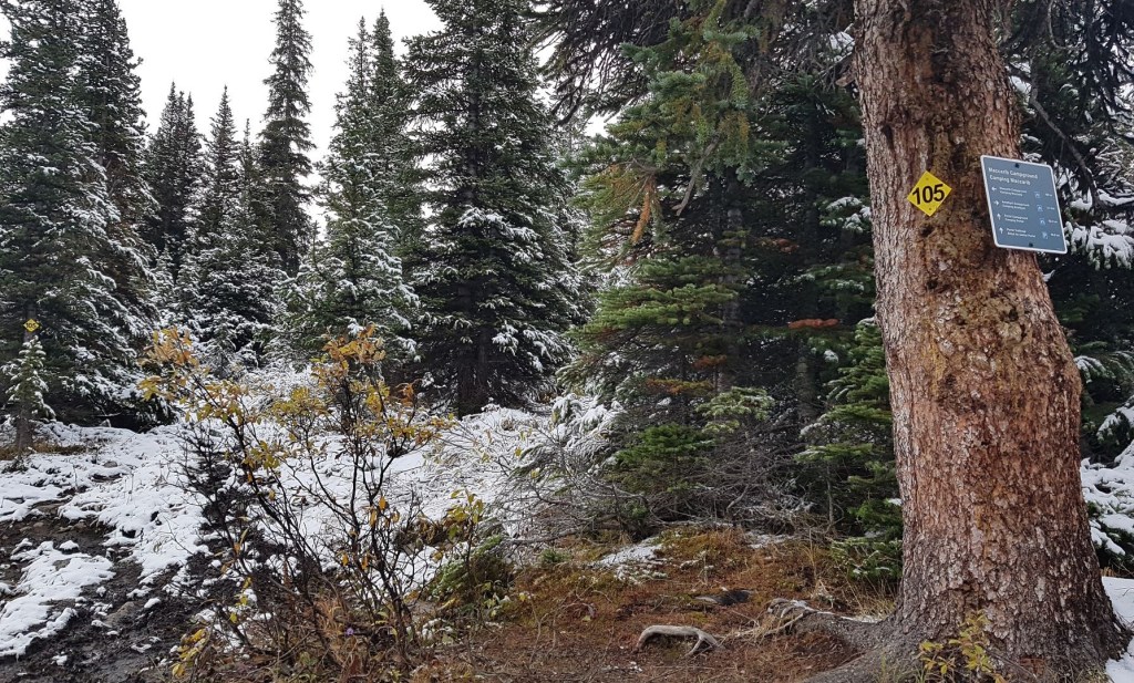
After about 1.1 km, we came to the first of two campgrounds – Amethyst Campground. This campground is in the trees, with the tent sites nicely spaced out. Here we met up with the water-logged backpacker from the day before. He was still alive and still in good spirits, and it was nice to be able to confirm that.

As the ladies went in search of the outhouse, I was deeply troubled and disappointed to see yet another episode of National Park stupidity – the dreaded Triple Outhouse. I first came upon this absurdity while backpacking the Skyline Trail, which is also in Jasper National Park. I haven’t seen this in any other National Park, so perhaps it’s just Jasper that was unlucky enough to sport these?

I am actually a fan of the outdoor loo, because it keeps the bugs down and doesn’t smell. The problem with the triple decker is the absolute lack of privacy. There is no possible way to drop your drawers without giving your neighbour a full view. Now imagine having your Morning Constitutional with your neighbour mere inches away. The little side wall isn’t even high enough to prevent an awkward side eye glance. Gawd! The result? All three barrels are deemed ‘in use’ even when only one person is out there. Can you say morning line up?
But I digress…
After Amethyst Campground, we continued along the trail, heading towards Maccarib Campground.
Since you haven’t heard me complaining about the trail, you are probably thinking this section is pretty good. And you’d be wrong. It was the worst trail yet. Pole vaulting was difficult because of huge sections of mud with nary a rock to hop on to. Several times we had to cut way off the trail to avoid deep sections of water and sucking mud. It was incredibly slow going.

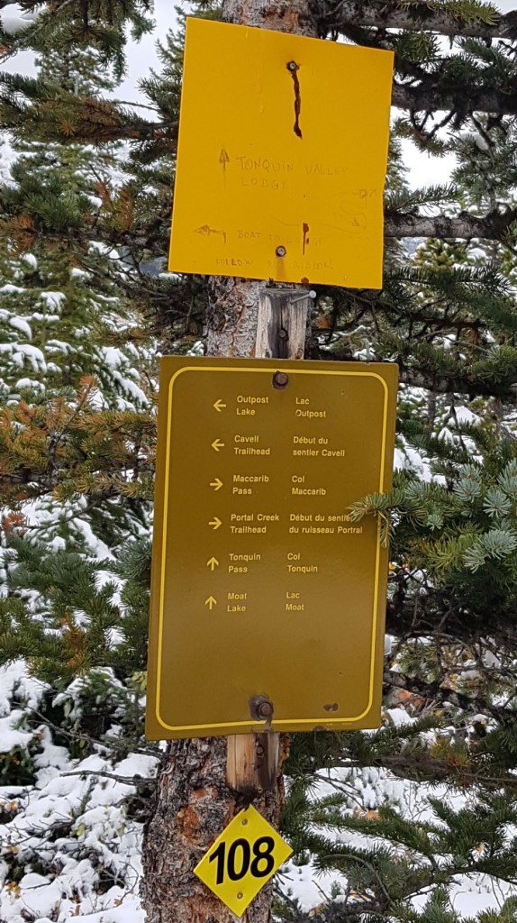
At about 3.5 km, we came to the Moat Lake junction, which heads off to the left (west). We continued on the trail, which now angled north east as we left the lake shore and headed inland towards the Maccarib Campground.
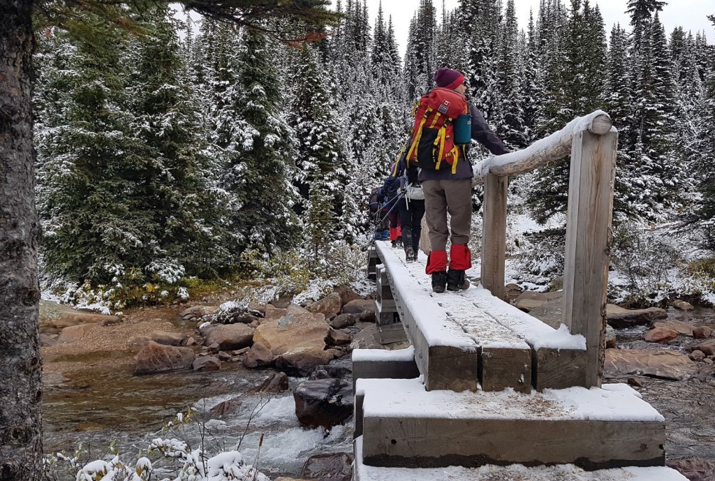
At around the 4.5 km mark, we came to Maccarib Creek, and a nice bridge crossing.
This is an important junction. This trail leads to Portal Campground, and continues on to the Marmot Basin trail head. This trail makes it possible to do a big horseshoe shaped loop and see everything in the Tonquin Valley. Our group left two vehicles at the Marmot Basin trail head to give us the option of returning this way when we hiked back out.

Shortly after the Maccarib Creek crossing is the Maccarib Campground. While we arrived here around 11:30 am, the backpackers were still firmly ensconced inside their tents. And really, who could blame them? It was cold and miserable. I’d wait for the sun to warm things up a bit too. I didn’t take any photos of the campsite because it was fully occupied, but despite the wet conditions, it looked to be fairly dry and above the worst of the sucking mud we found below.
Just past the Maccarib Campground is a Y junction. We went left for Majestic Ridge.

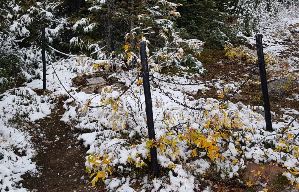
Just beyond the Maccarib Campground is a burial plot for a Jasper Park Warden named Percy Goodair. Read the link for an account of what happened on that fateful day.

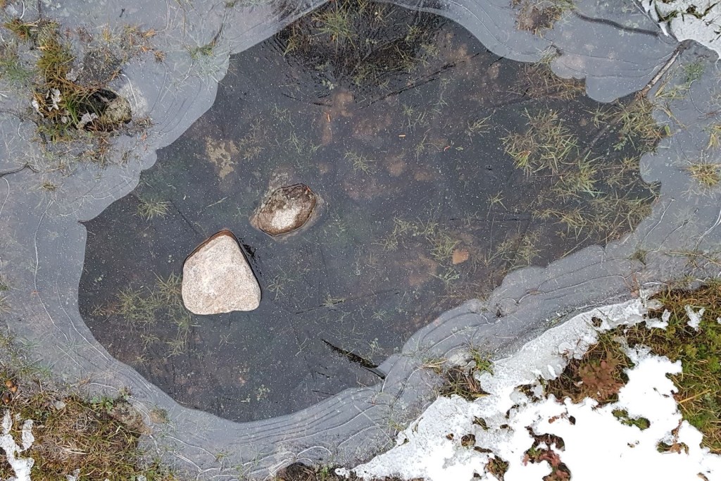
As we ascended, the temperature dropped. This was great because it meant the trail was now frozen and much easier to walk on. The other cool thing were the frost sculptures that were created. I’ve never seen this before. Crystal ‘stalks’ grew out of the mud and protruded straight up. They were beautiful.

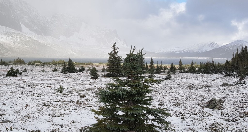
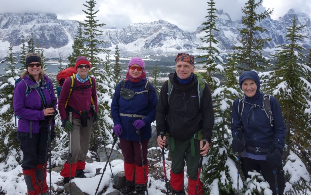
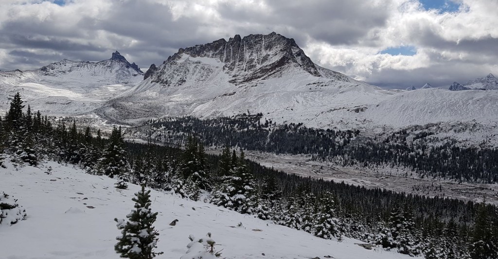
We continued up the trail to the end of the Majestic Ridge Trail. The views here were just as epic as everywhere else, with an interesting look down the backside of Mount Clitheroe and into the Portal Creek valley.

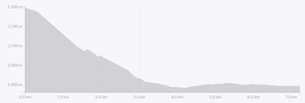
Distance to the end of Majestic Ridge was 7.2 km. Elevation gain is 237 m. Time to the ridge was 3.5 hours, but that included a good half hour creeping around the meadow looking for caribou, plus lots of time for gawking and picture taking.
Majestic Ridge Return
We returned the way we came. Already on the way down, the sun had started to come out, warming up the trail. The adorable crystals were gone, and the trail was now getting slippery.
We raced back down the trail to Maccarib Creek. The section between the creek and the lodge was even worse in the warming temps. Once back at the meadow, we took some time to admire the views.
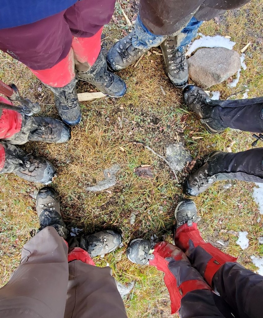
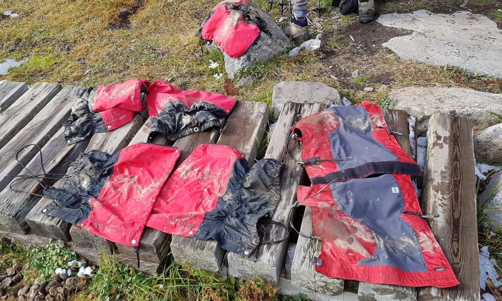
Back at the lodge, it was time to get cleaned up. Our gators had taken a right-royal beating today. We stood in a circle to show off our mud levels. We laid our gators out to dry, but kept a careful eye on them. The marmots live right there, and they are known to steal just about anything that is covered in salt. While the gators probably aren’t that salty, we didn’t want to risk it.
That evening we had some fun and excitement back at the lodge. The two people who stayed behind spent the day trying to find the ice blockage in our water hose. The guys went out, found the offending section, and then brought it inside to thaw out. It was a masterful plan. Unfortunately, by the time the hose was cleared and re-attached, another section of the hose was frozen. Oh well. Good times!
Dinner and cleaning up is always an event. We took turns making dinner meals, and every day was an adventure. Jacek and Agnieszka are from Poland, and treated us to some delights we would not normally have.


Totals – Tracked on Gaia, Displayed on Strava
Date: September 16, 2021
Group: Six (Alisen, Ivan, Pamela, Phyllis, Janek and Agnieszka)
Distance: 14.4 km
Elevation: 237 m (782′)
Time: 6 hours 30 minutes (includes lunch, breaks, Caribou gawking and swamp mud jumping)

Day Five – Hiking Out
The original group plan was to hike out via Portal Creek to get the full horseshoe tour. We had stashed two vehicles at the Marmot Basin trail head in anticipation. The trail was in such bad shape though, that we made the decision the night before to instead hike out the way we came in via Cavell Lake.
We woke up on our final Day Five to no new snow, but by far the coldest day yet. The clear skies had allowed the temperature to plummet, freezing everything.
We did a deep clean of the kitchen the night before, making sure ALL our food was removed. Please do not ever leave food behind in any hut or lodge. The next group will NOT eat it. Left over food clogs up the fridge and cupboards, and leaves Gilbert with a big garbage haul out at the end of the season.
Unbeknownst to us, it actually got cold enough to freeze the mud trails. We actually walked out. Just … walked. No jumping, no pole vaulting, just walking 🙂 Ahhhh….. Had we known the trails were frozen, we could have hiked out via Portal Creek but alas, changing gears with eight people is not an easy task. Best to stick with the plan.

We stayed together as a group until the end of the switchbacks. Ivan, ever the consummate Trip Leader, hustled down the trail to get a photo looking up at the group.

After this spot, we split into two groups. Phyllis, Pat and I raced ahead to do the car shuffle. Phyllis would drive Pat and me back to Marmot Basin so we could get our cars. I had to drive back home, do some quick laundry, and pack my campervan for a girls’ weekend in Nordegg the very next day. We were doing the Fox Via Ferrata, and then hiking up Coliseum Mountain. Needless to say, I had to get on the road!
Time to hike out was 4 hours and 50 minutes. Compared to the time of 7 hours and 30 minutes to hike in, you can see that if you have good conditions, and just put your head down, the 19 km can go by fairly quickly.
I want to thank the ACC Rocky Mountain Section and our Trip Leader Ivan Dixon for organizing this trip. I probably would not have come were it not for the great planning and expertise of Ivan.
If you found this post useful, please do me a huge favour and click the Star button to “Like” it. You can also follow my blog, join my FaceBook page Al’s Adventurers, or follow me on Instagram.
Alisen
I love all things mountains! I live next door to the Canadian Rocky Mountains, however I travel the world to enjoy the many different mountain environments and cultures that I can. I hope you enjoy these trip reports, and that it inspires you to accomplish your own adventure goals.

The latrine situation was lousy, but the scenery was great.
Too true. I should really stop complaining here and put a note into Parks Canada.
Ale super !!!
Thanks. It was a great day.
I was perplexed by those triple seated open outhouses too. Love the snowy Ramparts. Maggie
Yes, as a backpacker through there, you’d totally understand my frustration with these things. So far I haven’t seen them in Banff. Fingers crossed they don’t migrate 🙂
Despite the snow and cold and mud, this was a beautiful trip! I enjoyed all the scenery and your lovely photos. I didn’t realize caribou feet were so large, and it’s so great that you saw some. I also chuckled at the triple outhouse… definitely an awkward design.
It truly was a great day, and the scenery was amazing. I was more trying to get across just how bad this trail can be, because even the most seasoned Jasper people like Ivan and Gilbert were wary of going on that trail.
I don’t want people to avoid, but just to be aware that travel times are going down to 2 km per hour through here.
Awkward – LOL! That is the best description by far 🙂
That triple outhouse looks and sounds awful!! Who would ever use that with someone else!? The conditions on the trail also look terrible with all that mud and water. Even though I usually wear proper hiking boots, I hate stepping in the mud. It becomes dirty, mud gets caked on underneath and everything just becomes slippery. The one bright side is that the snow makes the landscape look magical!
Yup! The triple should be banned 🙂 I think I’ll drop Parks Canada a note about this, in the hopes that it doesn’t migrate into Banff or Kootenay Park.
At best that three-fer-loo could be used with someone one is comfortable with, but otherwise, one-at-a-time sounds great! 😀 … as always a wonderful adventure. 🙂 … love the icicle oozes. 😀
You are on form today!!! I love your word choices. Three-fer-loo. Well done my friend, well done.
Icicle oozes – that explains it perfectly. Have you seen anything like that? I haven’t, and I’ve been out in those temperatures quite a bit.
😀 Thanks …
… probably some poor bloody worm was chomping its way through that nice rich humus-y mud when the freeze hit, and because water expands when it freezes, it could only expand into the worm tunnels and thus to the surface. I imagine Mdme or Msr Worm surveying that mess and deciding it might be time to move to Swamp Heights. 🙂
You all are awesome doing this hiking in cold and snow. Way to go oops hike. You are a hiker for 4 seasons.
Thanks! Sometimes you just don’t have a choice 🤣
Great post dear ❤️