April 9, 2021
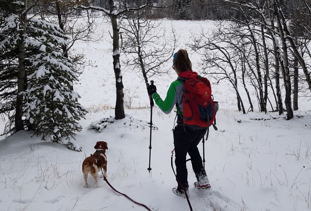
I was on the hunt for a spring hike with no wind and no post-holing. I prefer to ski on snow, but when that season comes to an end, it’s time to search out doable early season hikes. Sonya is originally from Claresholm, so she is always up for a hike down south. I had never done a hike in this area, so I had no idea about terrain or routes. The entire thing was an adventure.
This is an easy half day hike and is ideal for families, if you are camping nearby at Indian Graves or Chain Lakes, or anyone who just wants a quick day in the mountains. We made a loop, but you can easily do a There and Back from either Indian Ridge or Willow Ridge. If you’re used to big mountains or hard terrain, this might not be the trip for you. After seeing Sonya’s reaction to reaching the ‘summit’ (see video below), I am thankful that SHE picked this hike and not me.
Gear
Hiking boots, poles and regular day pack kit. If there is snow, add in gaiters and microspikes.
Overview
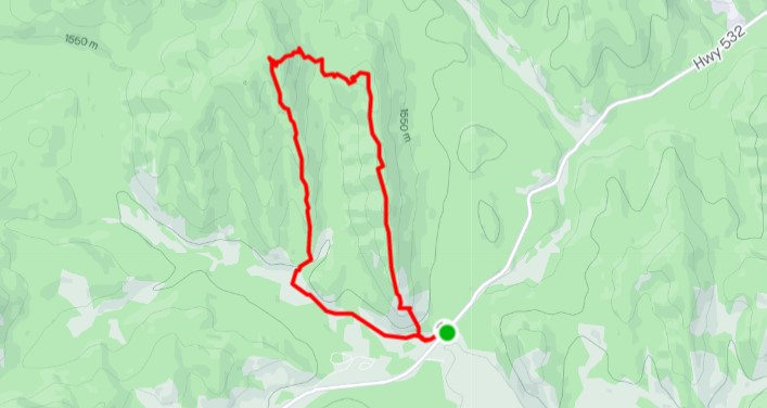
From the pull out on Highway 532, hike up the end of the ridge to gain Indian Ridge. Follow the crest of the ridge to the other end, and then descend west into the valley. Hike across the meadows until you hit the old road. Follow that around to the trail that leads up to Willow Ridge. There is a side trip, but we elected to head straight back down the spine of Willow Ridge. At the end, we descended down Willow Ridge, and crossed a short meadow. When we hit the road, we took it east back to the vehicle.
Parking and Trail Head
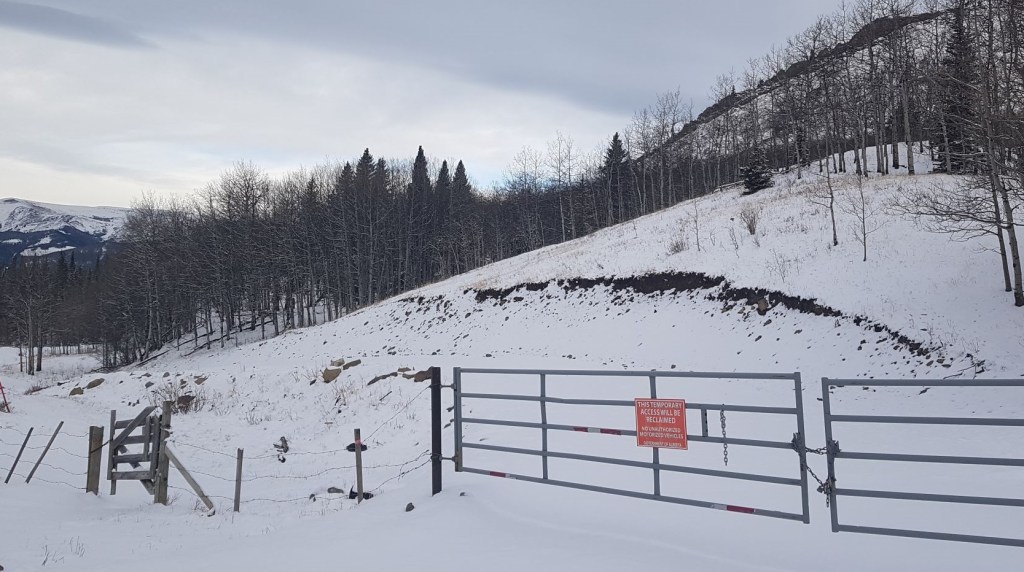
According to Alberta Parks, Highway 532 is closed from December 1 to April 30. I’m not sure when this was put in place, because I was here on April 9, 2021. Anyhoo – be sure to check if the highway is open before you go. This road is unpaved. Expect washboard, ruts, and other conditions normal for a gravel road. In the summer, watch for cattle on the road as this is a free range area.
From Highway 22, turn east onto Highway 532 (just north of Chain Lakes). Drive for 12.1 km. On the right side, there is a gate blocking the old side road. Park well off the highway.
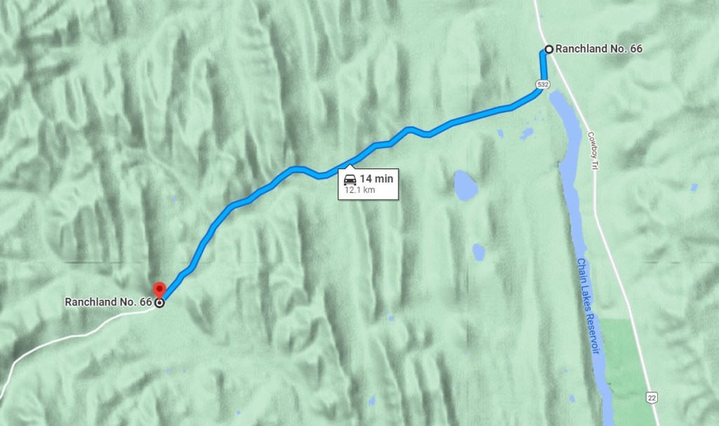
After crossing the gate, we walked down the road for about 300 m, then ascended the slope leading up to Indian Ridge.

Main Trail
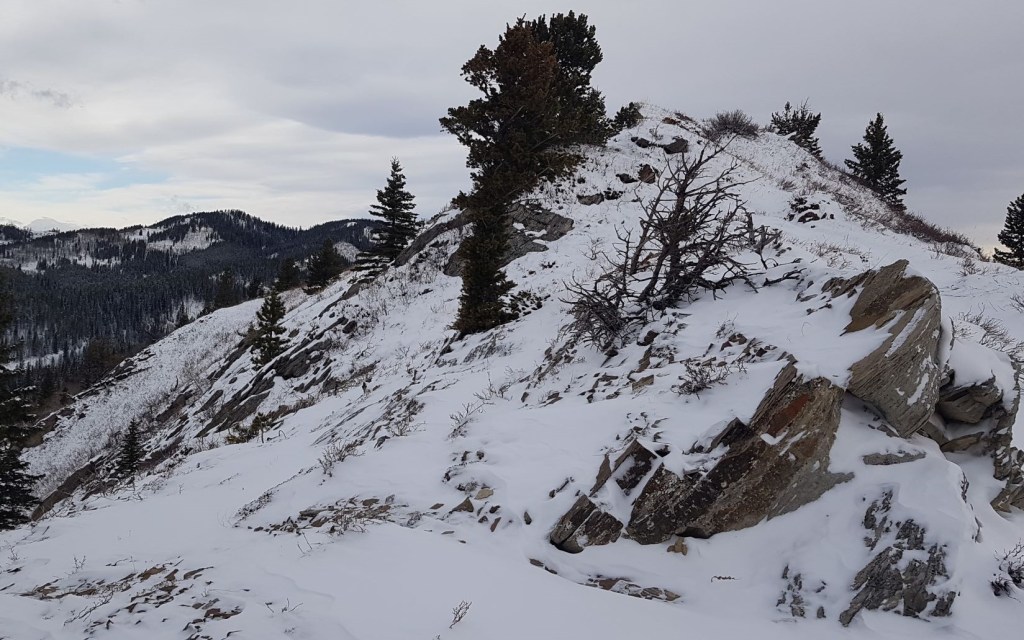
The ascent of the ridge is by far the most fun and scenic part of the hike. We aimed for the rock outcrop. Above that is a short but fun bit of rock to hike over.
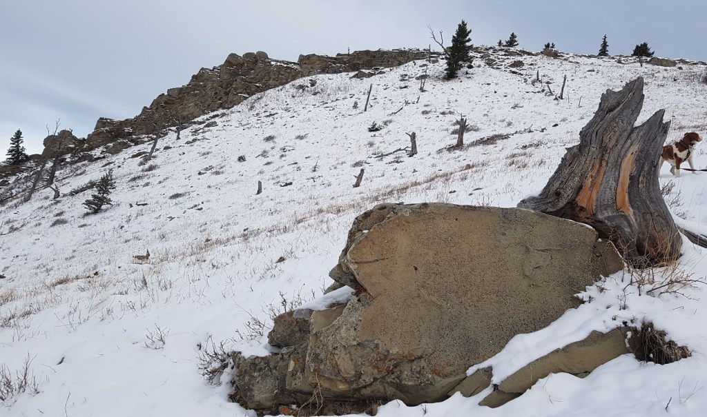
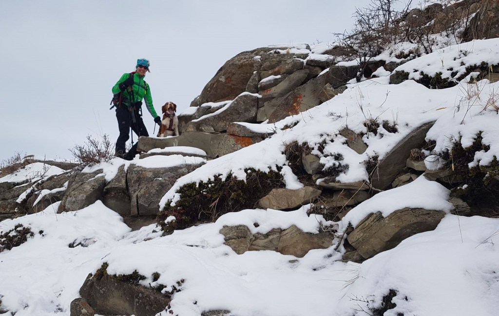

After a short walk among the rocks on the ridge, we came to the old bench. I imagine for young kids, finding this old bench would be super fun. If you turned around here, that would be a great day.

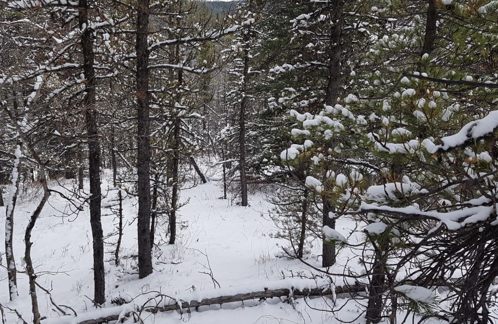
After the bench, the ridge flattens out. The trail also enters the trees. It’s now a forest walk to the other end.
The only navigation issue is to avoid following the fence line. The fence goes down to the east, which will draw you off the ridgetop and into the meadow below too early.
The only way I found the summit of Indian Ridge was by looking at my GPS. While this is technically the high point, it’s surrounded by trees with nary a view or marker to denote the top.

Distance to high point of Indian Ridge is about 2.5 km from trail head. Time was about 60 minutes.
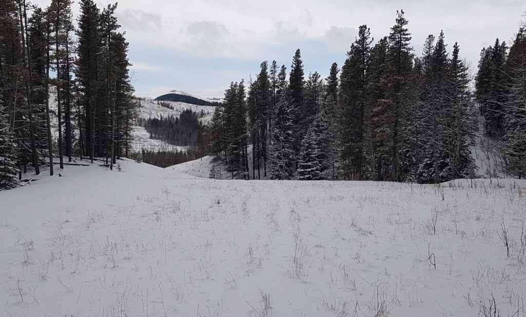
From the high point, we walked to the end of Indian Ridge, which is about 3 km from start. This is now in the open, and we had a lovely 360 degree view. This is a good turn-around spot for a There and Back hike.
At the end of Indian Ridge, I didn’t see a trail, and all tracks in the snow ended. I picked a line, and descended down into the valley between Indian and Willow Ridge.

At the bottom, we met the fence that descended down earlier. We found a spot to get through it, and continued across the meadow.
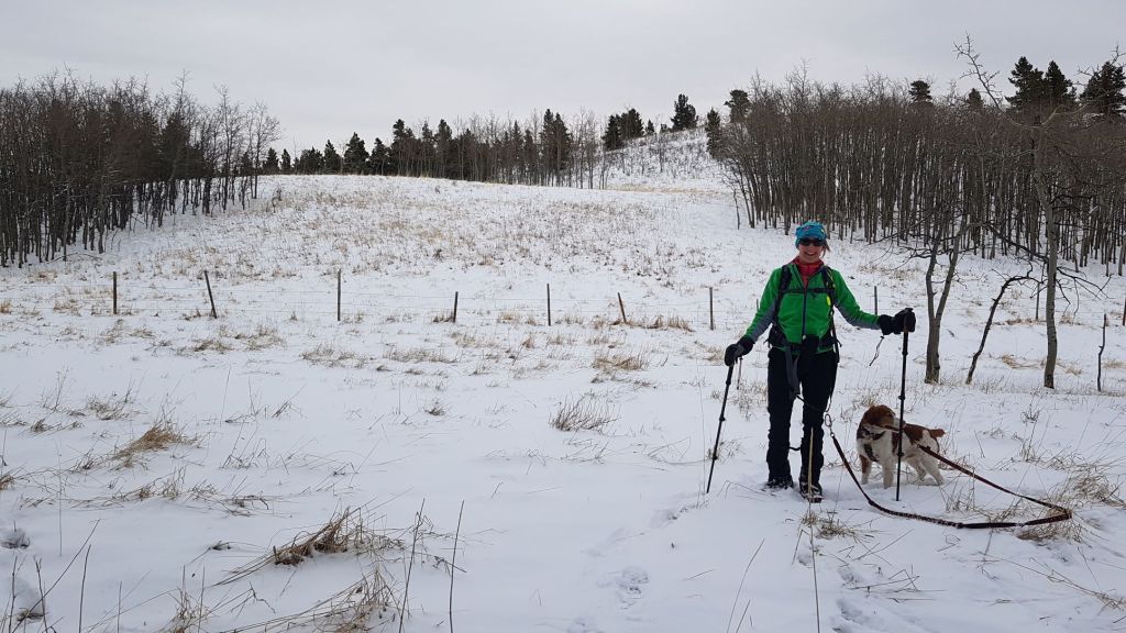
To head back up the other side towards Willow Ridge, I picked a line through the trees, trying to stay somewhat on course. After gaining back some elevation, we came to an old road, which we followed for a bit.
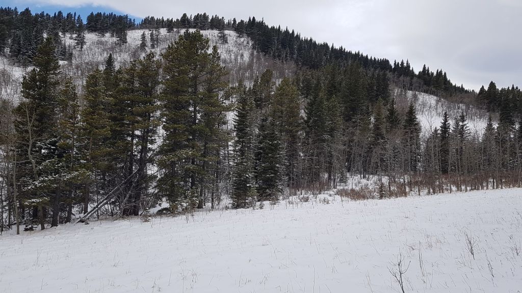
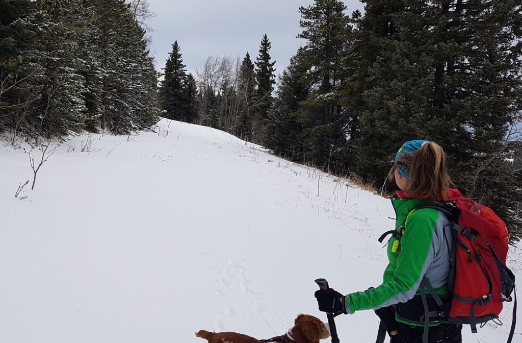
Knowing what I do NOW, I’d have stayed on that road and followed it to the backside of Willow Ridge. Why? Because there is a lovely wide trail that leads from the road to the summit of Willow Ridge.
Instead… I bee-lined it to the summit of Willow Ridge. Just a good old bushwhack straight up the side of the ridge. Nothing pretty about it. We popped out on the ridge just south of the summit, and went back north to tag the high point. THIS is where I saw the other lovely trail coming up the north side, nicely flagged and all. Oh well.

From the summit, there is an optional side hill directly west, but we’d had enough of tromping around in the trees for one day.

Willow Ridge Return
We decided to head back instead of taking the side trip to the west. While the trail descended the west side of Willow Ridge and followed the meadow back to the road, I decided instead to remain on top of Willow Ridge for a few reasons:
- I could stay on a straight line,
- there would be less snow on the ridge top than down below, and
- I could avoid any willow wallowing down in the valley if I couldn’t find the trail in the meadow.

At the end of Willow Ridge, there was an easy and gentle descent on the east side that lead into a meadow. We kept heading south, and came to a bridge on the old road. We followed the road east, and it took us back to the car.


The Indian Ridge to Willow Ridge loop was a half day hike with little in the way of navigation, but also views. To round out our day, Sonya and I drove into Nanton, and spent several hours sipping coffee and walking through the many antique shops.
Thanks for visiting! Please click the Star button to “Like” it. You can also follow my blog, join my FaceBook page Al’s Adventurers, or follow me on Instagram
Alisen
Totals – Tracked on Strava
Date: April 9, 2021
Group: Two (Alisen and Sonya)
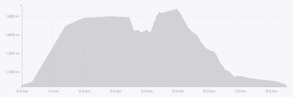
Distance: 8.48 km
Elevation: 257 m (848′)
Time: 3 hours 55 min (includes lunch & breaks)
I love all things mountains! I live next door to the Canadian Rocky Mountains, however I travel the world to enjoy the many different mountain environments and cultures that I can. I hope you enjoy these trip reports, and that it inspires you to accomplish your own adventure goals.

Spring??? Spring Hike??? I think your definition needs some adjustment!! 😉
LOL!!! Too true 🙂 Unfortunately, we don’t really have a spring here, so anytime from the equinox to the summer solstice ‘counts’ as spring.
I guess it is just what you get used to!
Congratulations on completing 1k followers.
Thank you SO much! Especially because I didn’t know I hit 1000! I’ll have to check my stats.
I love how the landscape changes from being out in the open to hiking through a dense forest. And hey, at least you were not in the wind on the “summit”! The view from Indian Ridge Viewpoint is gorgeous with all those rolling hills.
Thanks Linda. You always find the silver lining. True – I achieved my objective of no wind, and that truly is a blessing.
Indian Mountain Ranges form an important part of the topography of India affecting climate, lives, settlement and economy of the country. They are pristine, serene, unruffled and majestic. The swaying snow peaks, lofty crests and emerald meadows blessed with the lush fruit laden valleys, invite tourists, bewitching and mesmerizing them. They also have the capacity to evoke spirituality and sanctity. India begins with the dynamic area of the northern mountain terrain varying from arid mountains in the far north to the lakecountry, and then to the evergreen forests near Srinagar and Jammu.https://www.indianetzone.com/39/indian_mountain_ranges.htm