August 19, 2021
2021 was THE year for me to bang out some mountains that had spent way too much time on my Tick List. I had been admiring Holy Cross from several vantage points for a few years. Now that I’ve done it, I’m not sure why I waited so long. All I can say is that perhaps the waiting made it that much more enjoyable.
It’s a bit of a long approach, but even in the rain we thoroughly enjoyed it. The mountain itself has some lovely scrambling up the ridge, a good scree descent down the bowl, and the views – spectacular!
We had some unexpected rain, which turned into snow at the summit. We were completely fogged in, so our descent route was a big unknown. That slowed us down a bit as we knew there were some rock ledges to get around, we just didn’t know where exactly they were.
If you’ve never heard of Holy Cross, I don’t blame you. It is tucked away, mostly out of view. It is surrounded on three sides by fun hikes like Junction Hill, Gunnery Mountain and Grass Pass. Living down south, I love to find these hidden gems. Holy Cross was worth the time and effort!
Gear
Hiking boots, poles, and regular day pack kit.
Overview
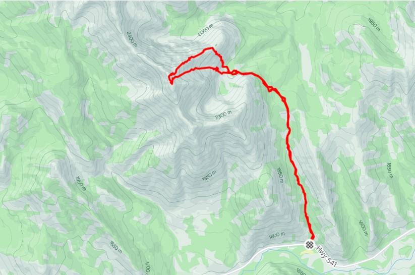
Take the Gunnery Creek trail for about 4 km, then angle left to gain the south flank of Holy Cross. From there, descend into the valley, then gain elevation on the opposite north ridge of Holy Cross. Scramble up the spine of the north ridge to the summit. Return is via the bowl, skiers left of the stream down the centre. Once at the valley again, regain the south flank of Holy Cross, and return via Gunnery Creek Trail.
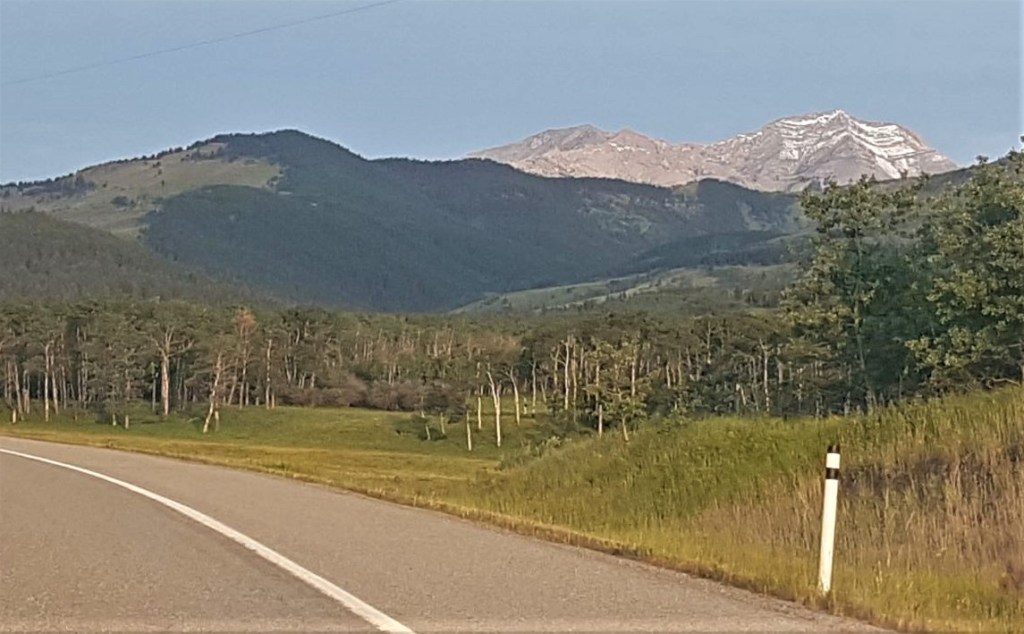
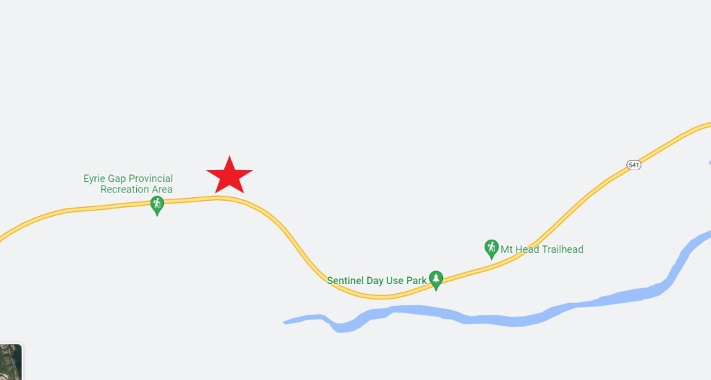
Parking and Trail Head
The parking spot is on the north side of Highway 541, just west of the Sentinel Day Use area, and east of the Highway 40 park gates. Park just west of Gunnery Creek. For specific directions, visit the Gunnery Mountain trip report.
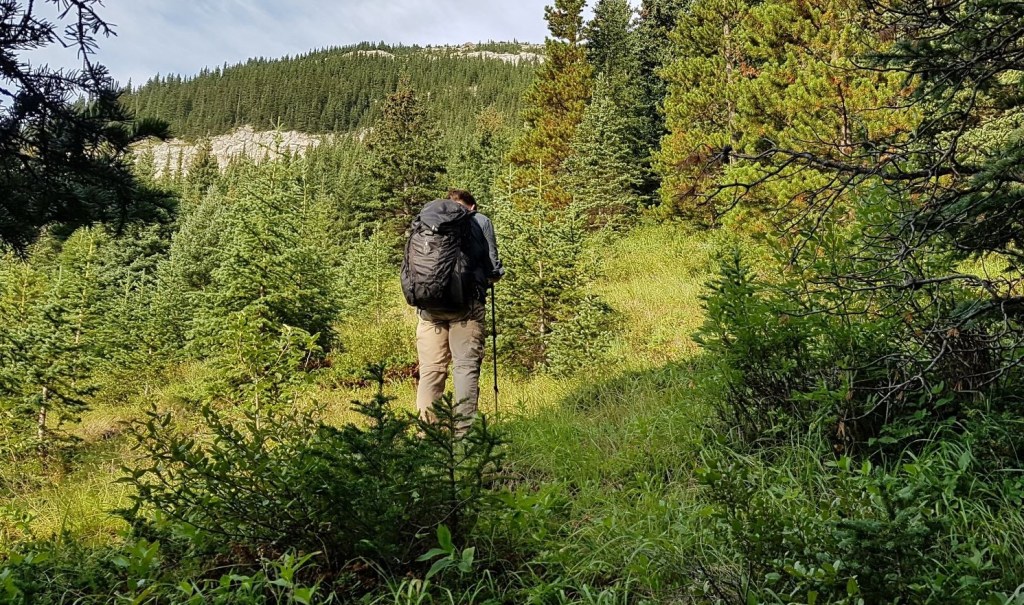
Gunnery Creek Trail to South Ridge of Holy Cross Mountain
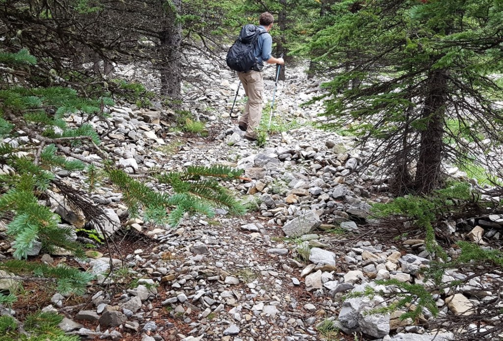
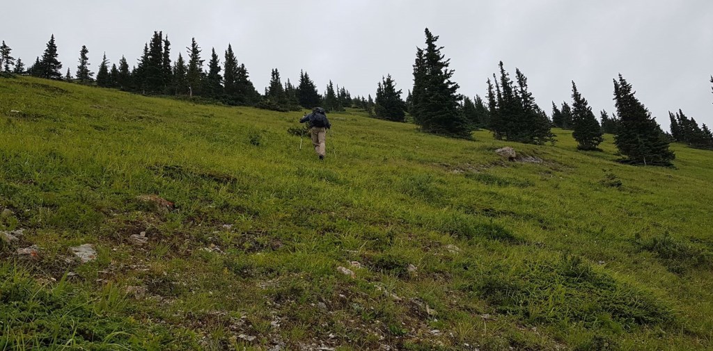
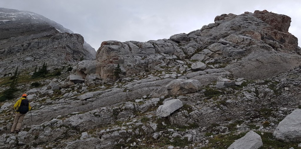
Follow the Gunnery Creek Trail heading north for about 4 km. At around 3 km, Gunnery Creek peters out, but the trail continues through the meadows and into the trees.
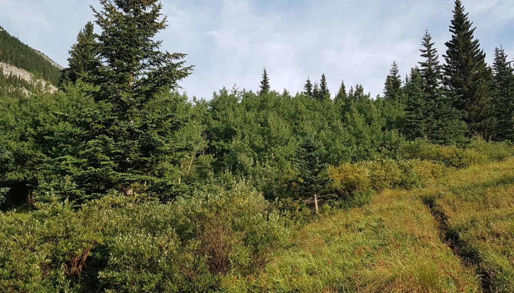
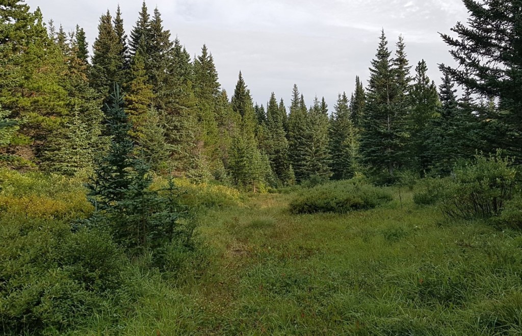
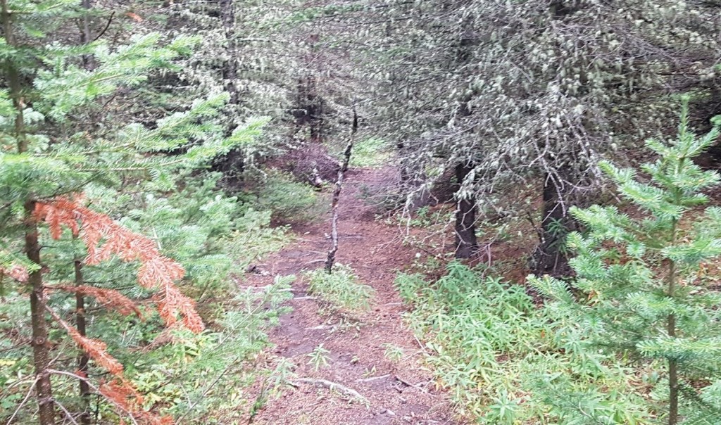
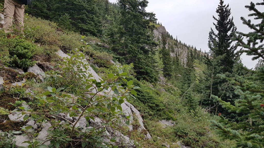
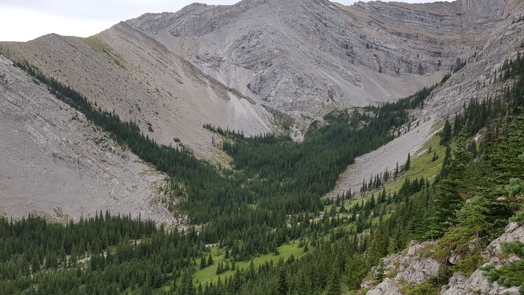
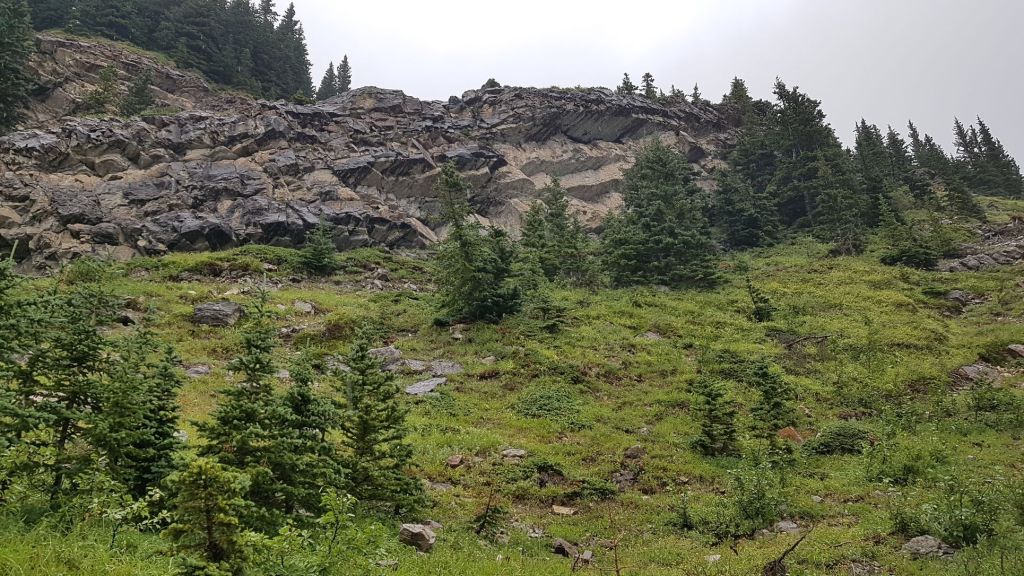
It was in this (above photo) stretch of forest that the trail started to braid. It’s now time to start angling around the toe of the south ridge of Holy Cross, gaining elevation. We came out on a scree slope with a well defined trail, and a great view of our approach up the north ridge of Holy Cross.
Distance to this point is 4.5 km, and about 1 hour and 40 minutes of hiking.
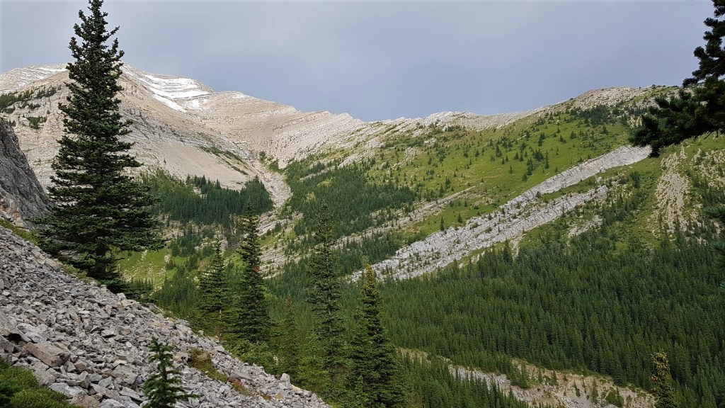
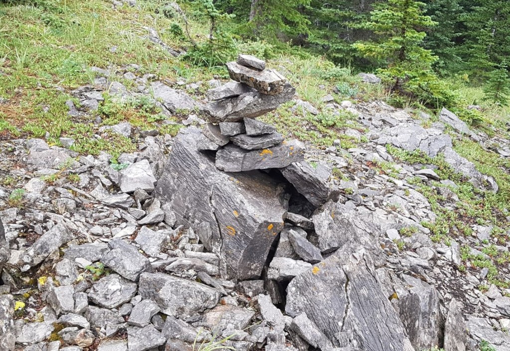
From this high point, the trail heads down into the valley between the two ridges, and ends at a cairn.
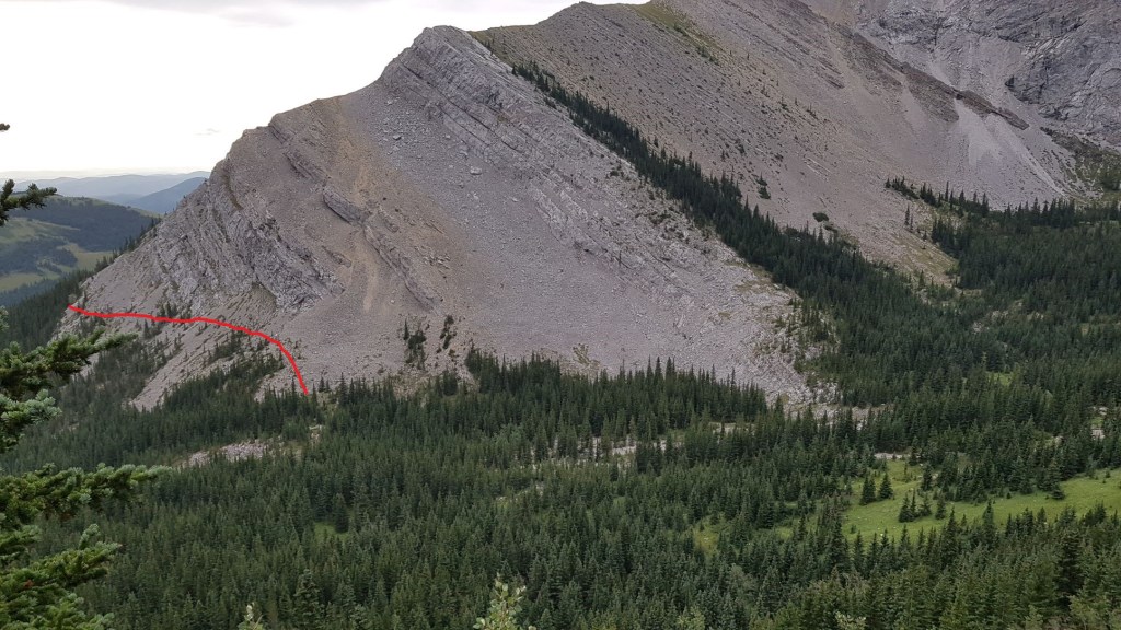
This high point is the ideal spot to plan your route. If you want the hiking route, then head straight west from the valley cairn, and up the gully to the summit. This route avoids the exposure, scrambling, and the knife-edge at the summit.
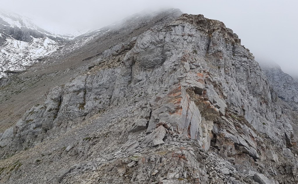
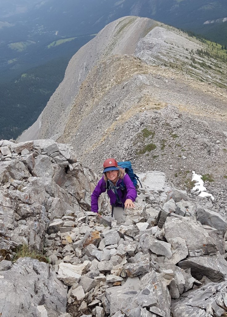
As we had signed up for the exposure, scrambling, and knife-edge summit, we picked a line that would gain us the north ridge fairly low down, so could spend more time on the ridge itself. There is a wall of exposed rock on the right. We picked a line that would take us right above this, and would lead up to the north ridge on far right.
Once we hiked to the bottom of valley, we found the cairn. I will admit we lost the plot after this for a short bit. There are numerous ‘trails’ heading in various directions. Plus, there is some washout from the stream during high melt. After stomping around for a bit, we angled for the rock band we spotted from above. Once we got on that, it was a straight shot to the north ridge.
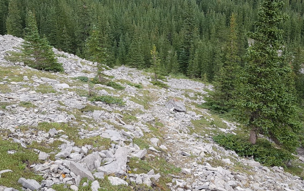
If you wanted to hike up the gully, then stay on this dry stream bed, and simply follow it to the base of the gully. From there, the path up to the summit is fairly clear. That was the route we took down from the summit.

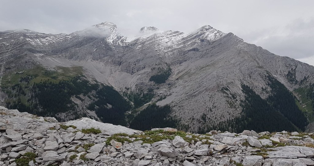
Once on the ridge, we had some amazing views in all directions. I was thankful to have taken so many photos here, because the weather was coming in, and the views would soon be lost to the low clouds.
Distance from the trail head to the ridge was 5.59 km, and time was 2 hours, 45 minutes.

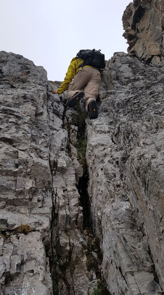
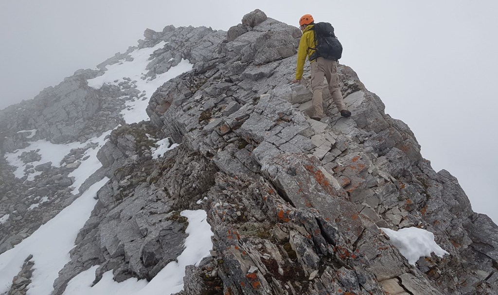
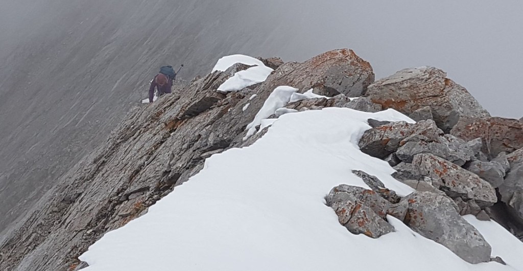
Scrambling the North Ridge to the Summit
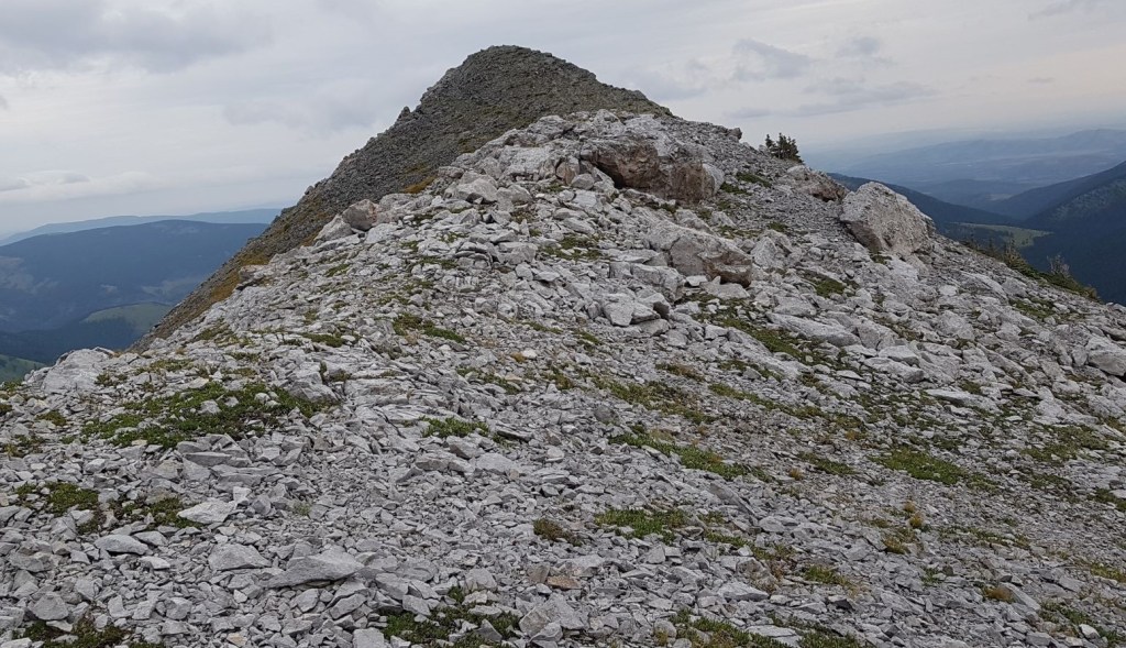
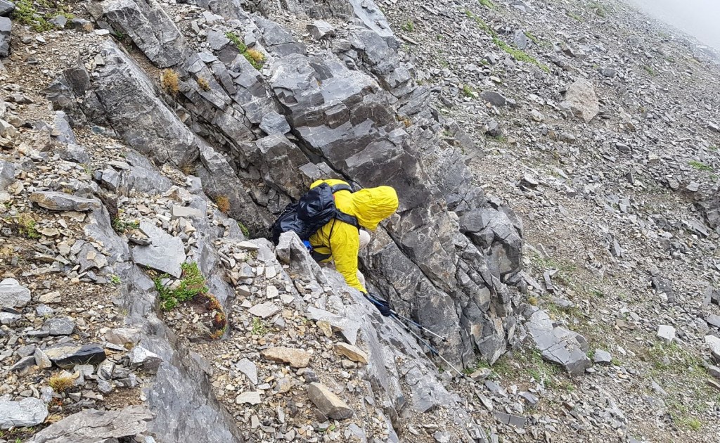
Now the fun could really begin. We donned our helmets, and started up the ridge. I think there were three short but quality scrambling spots, spread out along the ridge.
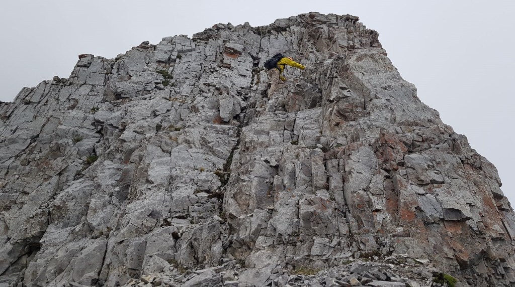
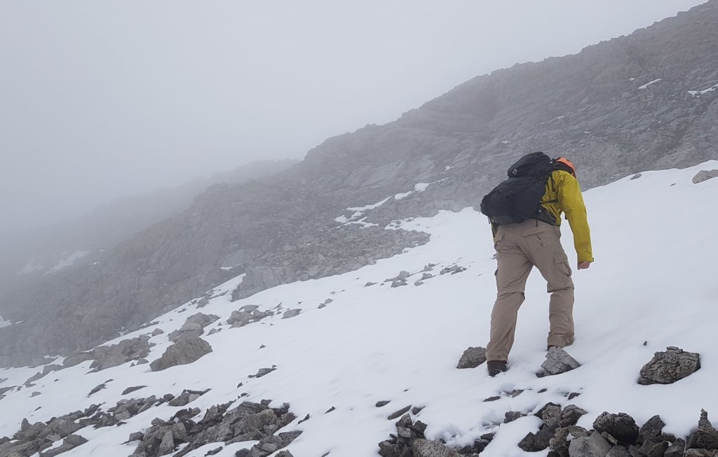
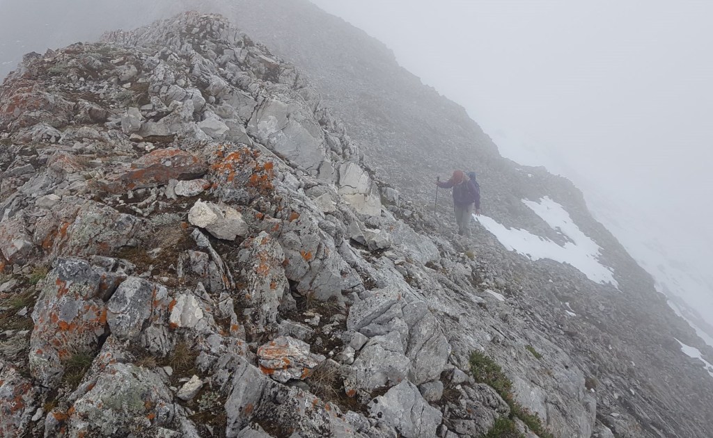
We hiked through chunky rocks as we angled towards the summit ridge. Despite the snow hiding the trail, we managed to more or less stay on track to the final ridge. The clouds were really moving in, and we lost all our views. However, the cloud also blocked the terror-inducing sight straight down either side of the mountain. So, win-win.

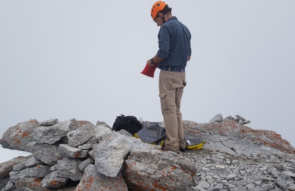
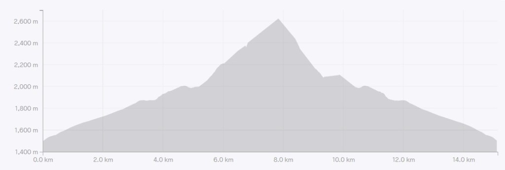
Distance to summit was 7 km. Time was 4 hours, 30 minutes. Elevation gain 1,175 m.
Holy Cross Mountain Return
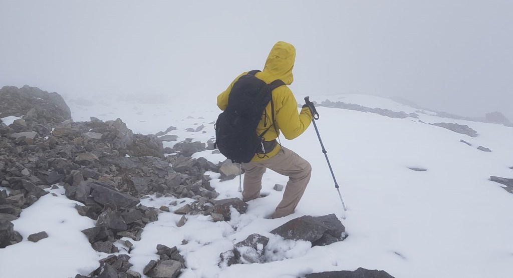
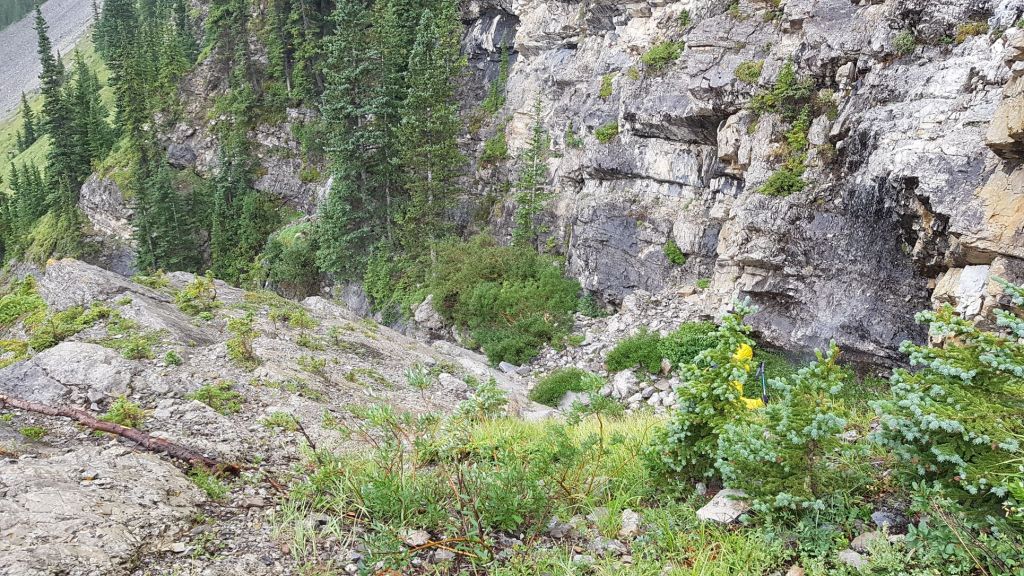
The light mist had turned to snow after we arrived at the summit, so we needed to get off this mountain pronto. The descent route is down the gully from the summit, to skiers left of the stream, once it starts. The upper slope was tricky due to the large and varied rocks, which were snow covered. The low visibility was also a factor in route selection. We knew there were some cliff bands, but didn’t know exactly where they were.

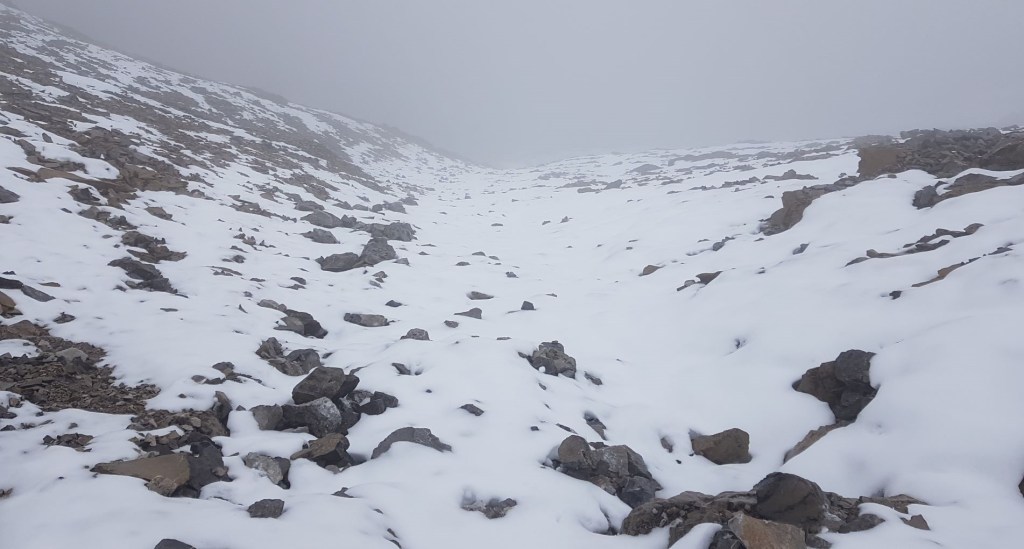
It was straight-forward to get back down. The only real navigation issue was this rock wall. There was a trail to the left and right. We went right, and it didn’t go. It ended in a waterfall. We climbed back up, and went left. It went around the base of the waterfall/lower rock wall no problem.
Other than this one rock wall, we headed straight back down to the valley. After meandering through the same washed out braided trail system, we again found the one cairn. We could then easily retrace our steps, and take the trail back up the south flank of Holy Cross Mountain.
It was still pouring rain, and we were getting soaked. It was a wet 4 km back to the trail head, but we were in great spirits knowing we missed the worse of it on the mountain, and had a car to warm up in.
All in, despite the rain and snow, I really loved Holy Cross Mountain. It was well worth the wait!
Thanks for following along on the adventure! Please do me a huge favour and click the Star button to “Like” it. You can also follow my blog, join my FaceBook page Al’s Adventurers, or follow me on Instagram
Alisen
Totals – Tracked on Gaia, Displayed on Strava
Date: August 19, 2021
Group: Two (Alisen and Mike)
Distance: 13.3 km
Elevation: 1,194 m (3,940′)
Time: 8 hours (includes lunch & breaks)
I love all things mountains! I live next door to the Canadian Rocky Mountains, however I travel the world to enjoy the many different mountain environments and cultures that I can. I hope you enjoy these trip reports, and that it inspires you to accomplish your own adventure goals.

That looks like a tough one at the tough. Well done!
Thanks Ann. I was lucky there was no wind, and no smoke. While our views were obscured, I was actually happy about that because I do not do well with heights. Even looking down from the summit was hard…
Of course you opted for the route that includes exposure, scrambling and the knife-edge at the summit! Your views from the top of the ridge look lovely. That’s too bad about all the fog at the top of the summit, but your pictures look super neat. The descent down in the snowy section did not look like it was fun.
LOL! I’m glad you saw that 🙂
I am actually scared of heights. so to have that summit ridge and the drop below blocked by clouds? VERY happy about that.
Wow! What an adventure. And gorgeous views!
Thank you Judith. It truly was a very special day. I’m glad I took some time before writing about it, because it made me relive it all over again.
Looks like an awesome hike!
Thanks Diana. It was so much fun. It’s nice to be able to take some mountains off my list, but more just seem to take their place 🙂