September 19, 2021
I hiked Coliseum Mountain as a punctuation mark on a full week of mountain adventure. I had spent five full days hiking and scrambling in Tonquin Valley, drove home, did a quick load of laundry, and then left early the next morning for the Nordegg area. It was a girls weekend away, and we climbed The Fox via ferrata on Saturday, and then hiked Coliseum Mountain on Sunday. What a week!
I like to think of Coliseum as the Prairie Mountain of Nordegg. It’s the first mountain coming out of the prairies, with epic views of the more massive mountains to the west. It’s close to town, and it’s an easy, well graded trail. If Coliseum was closer to Calgary, it would be mobbed year round.
It’s not hard to figure out where Coliseum Mountain got its name. I thought it was pretty poetic that less than a month after climbing Coliseum Mountain, I accidentally ended up in Rome and got the see the real Coliseum. Good thing the Canadian version has a much less gruesome history.


Gear
Hiking boots, poles and regular day pack kit.
Overview
From the Coliseum parking lot, take the trail on the east side. Follow the trail to the base of the switchbacks. Gain 80% of the elevation on the switchbacks. We popped out onto a ridge, with a great view of the arcing traverse to the summit of Coliseum. Return the same way, or run your young knees straight down to beeline the parking lot.
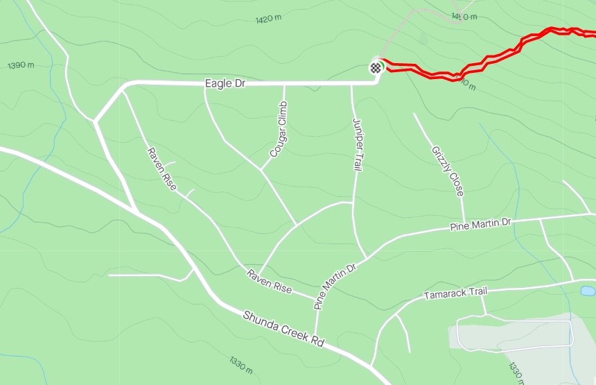
Parking and Trail Head
From Highway 11, turn north onto Shunda Creek Road. At the Y, turn right onto Eagle Drive. Follow to the end, which is the parking lot. Nordegg knows people are coming, so they have made a nice parking lot, the trail has great signage, and there’s even a bonus biffy on the trail!

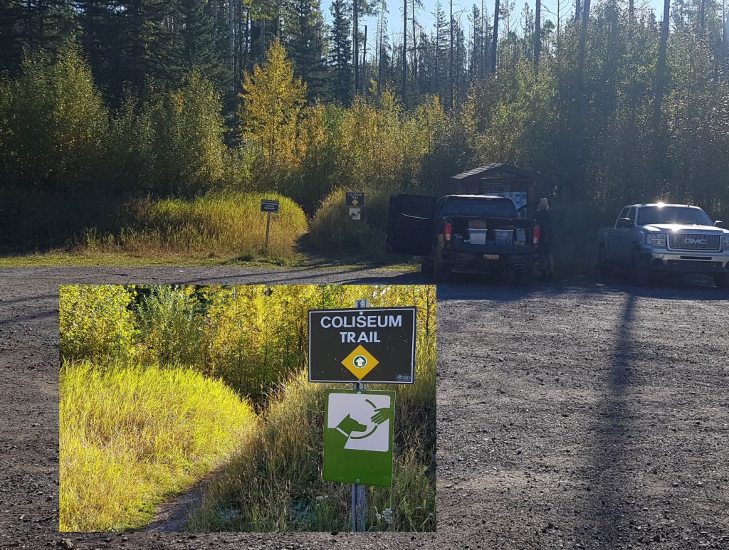
The trail immediately enters the trees from the parking lot, and didn’t emerge again until we crested the high point above the switchbacks. For this, I’d save Coliseum for a smoking hot summer day, when shade is at a premium.
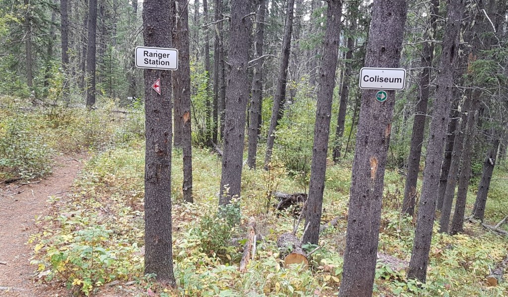
Shortly after entering the forest, we came to a well-marked junction. We continued heading east on the main trail.
Main Trail
At around 1.5 km, we came to the start of the switchbacks. We spent the next 4 km steadily gaining elevation, in the trees, with nary a view. I suggest you do what I did – bring interesting and chatty friends 🙂
Our uphill slog was broken up by one massive rock outcrop. We enjoyed this a lot.

At the end of the switchbacks, the trail backs way off. There is a fairly sizable flat area, which sports an outhouse!!! It’s rare for a trail to have a biffy on it. Way to go Nordegg!


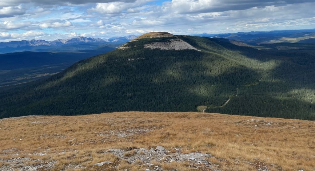
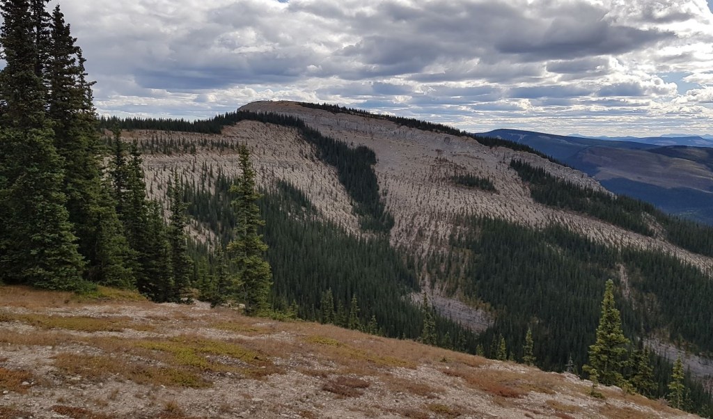
Shortly after the big flat spot, we left the forest and entered a giant rock pile. This is the best part of the trail. We now had our first full view of the summit of Coliseum, and the large arc traverse to get over to it.
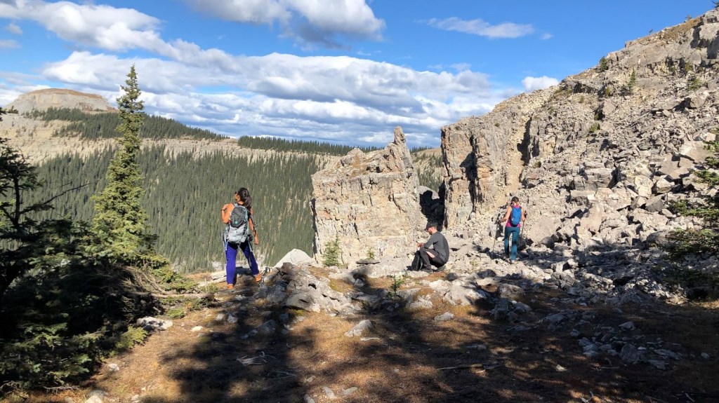
Several people were calling it quits at this point, including several families with young children. It is an ideal spot for a snack or lunch. Distance to this point is about 4.5 km of the full 7.5 km (one way).

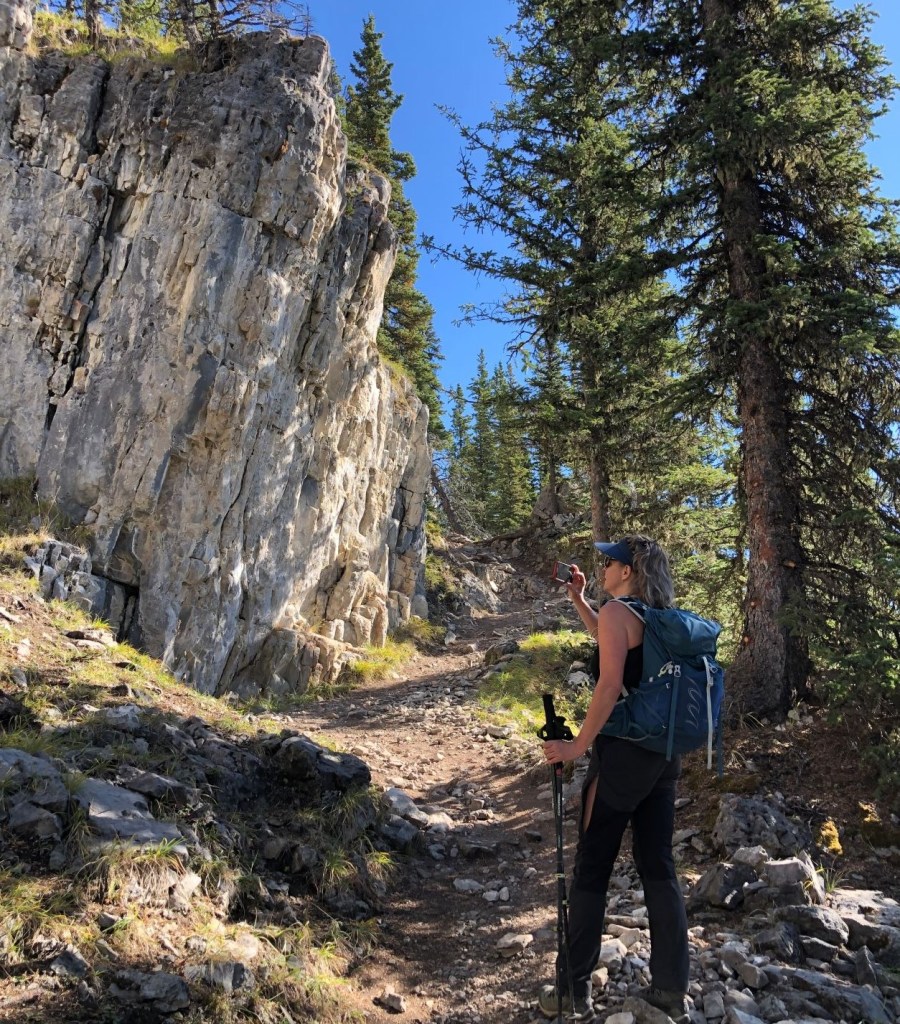
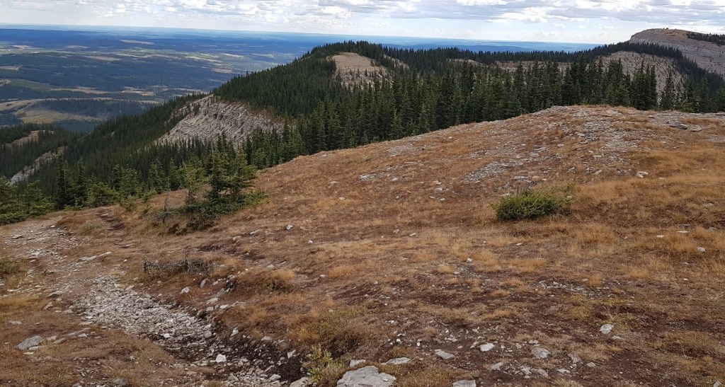
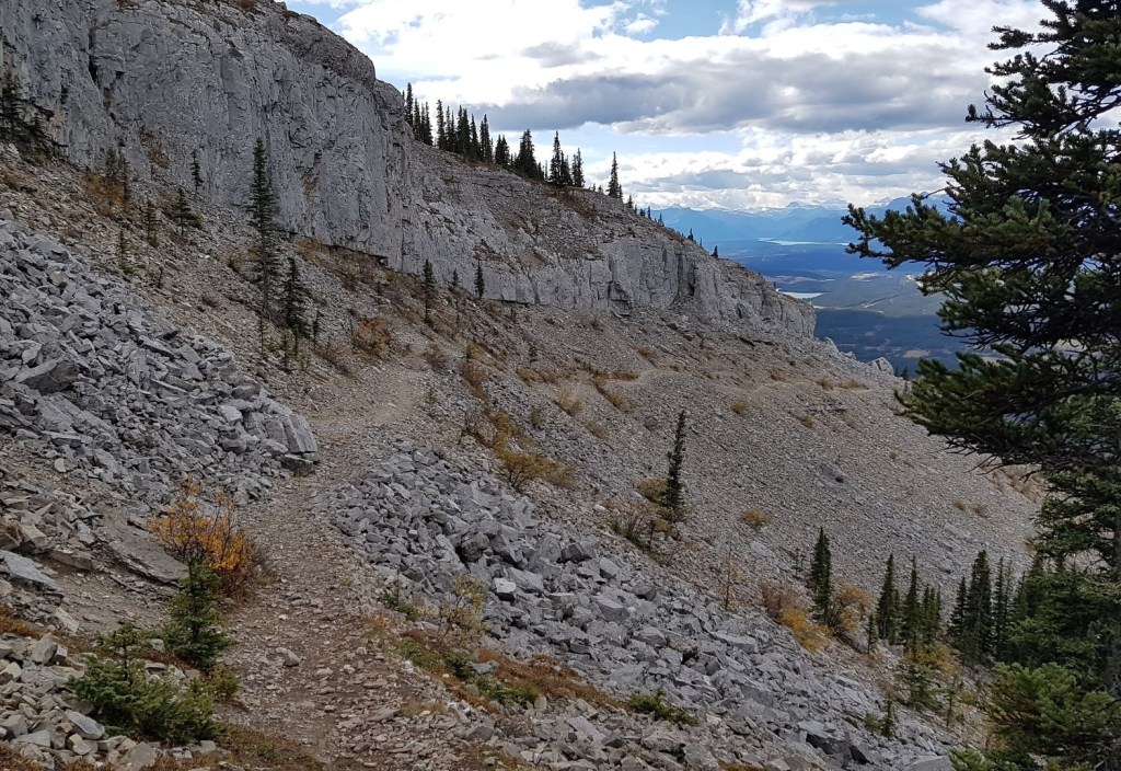
After snack time, we started on the traverse. The trail winds through the rock pile, and then skirts along the lower ledge of the cliff band. There is only one spot where the trail really gets narrow, with a nice long run-out were you to slip.


Once through the scree, the trail enters and exists the forest a few times, always staying on the ridge top.
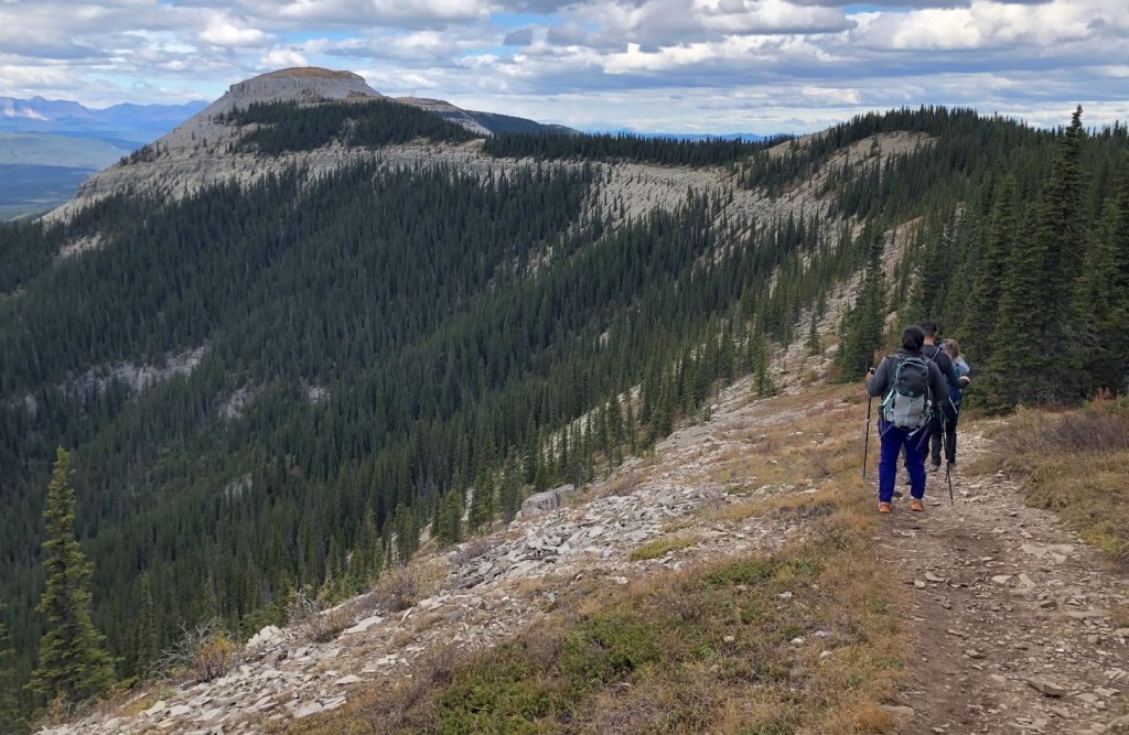
Coliseum has one of those ‘sneaky’ trails, with a drop in elevation for no other reason than to make you work for the summit 🙂 The trail curves around to the left, and drops down into the forest.

When the trail popped out of the forest again, we were now at the base of the summit block. There was a steep bit, and then a surprising large ‘lawn’ at the top as we hiked to the summit cairn.


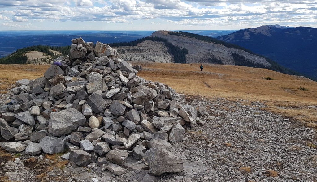
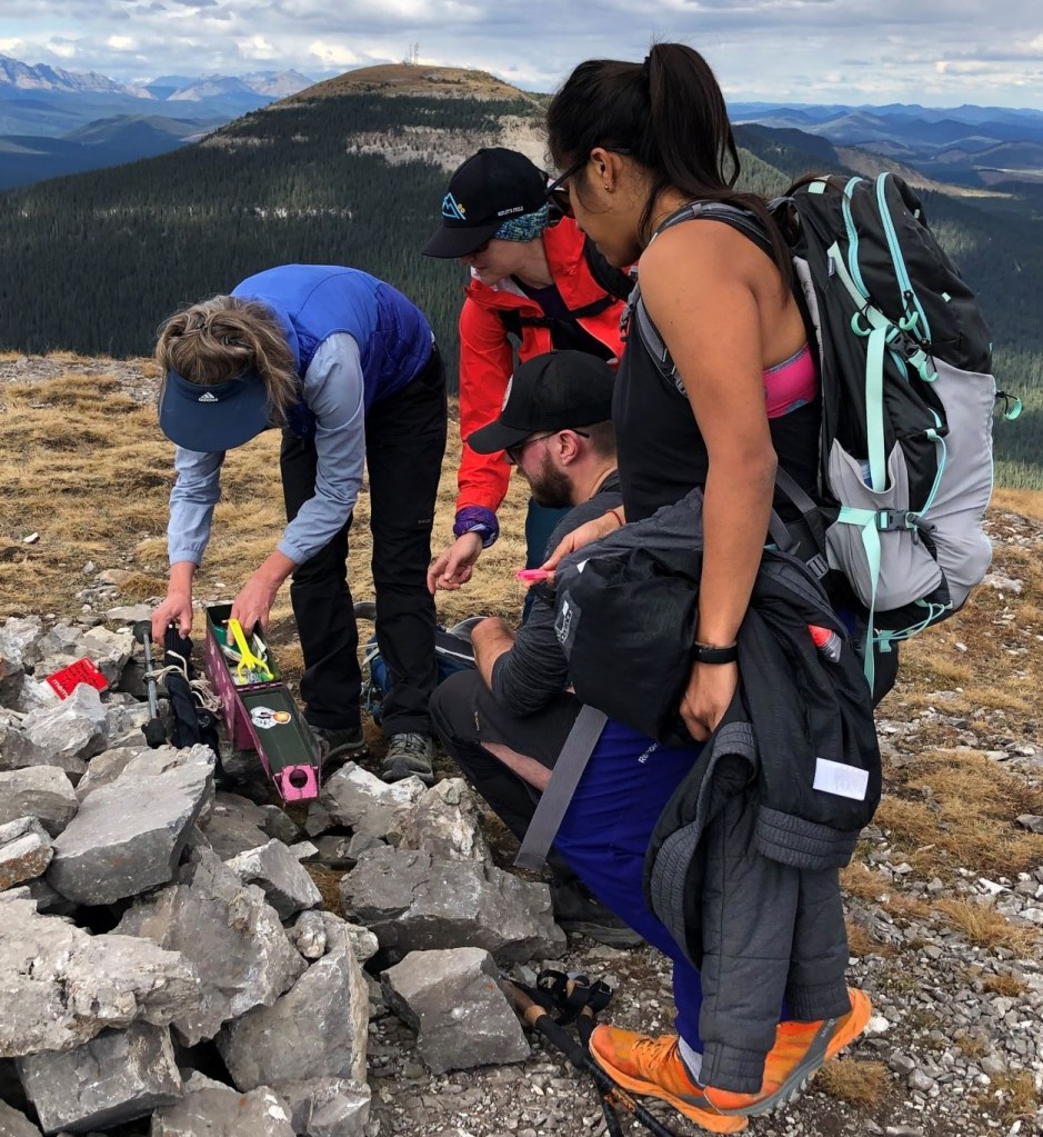
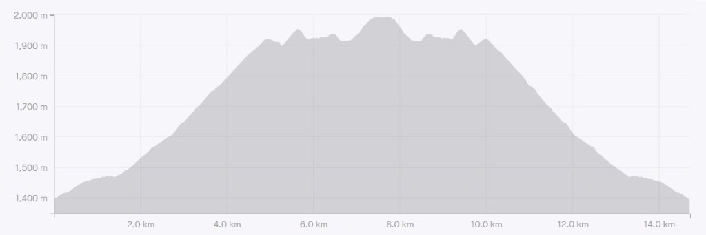
Time to summit was 2 hours, 30 minutes (including snack time). Distance was about 7 km. Elevation gain was 751 m. Ephraim Roberts strikes again with his pink summit register shell boxes full of goodies.


Coliseum Mountain Return
I chose to return the way we came, which is a respectful way to treat knees that have seen way too much elevation over the years. There is an alternate descent, which is straight down the ridge, once you leave the summit block. Be sure to stay on the ridge top, and don’t get sucked down to the eastern side as there is a cliff. Maybe when I’m really old and I get a new set of knees, I’ll be up for tackling some more straight down descents…


After the rock pile, it was an uneventful trip back through the forest. After a few switchbacks, we wished we would have counted them like we did at Sulphur Mountain. This is definitely an easy way to keep kids entertained. If you go, please count the switchbacks and let me know how many there are.
Thanks for reading! Please do me a huge favour and click the Star button to “Like” it. You can also follow my blog, join my FaceBook page Al’s Adventurers, or follow me on Instagram
Alisen
Totals – Tracked on Gaia, Displayed on Strava
Date: September 19, 2021
Group: Five (Alisen, Sonya, Keiran, Erin and Aura)
Distance: 14.5 km
Elevation: ~751 m (2,478′)
Time: 4 hours 22 minutes (includes lunch and breaks)

I love all things mountains! I live next door to the Canadian Rocky Mountains, however I travel the world to enjoy the many different mountain environments and cultures that I can. I hope you enjoy these trip reports, and that it inspires you to accomplish your own adventure goals.

Amazing views of nature!
It sure is, in all her glory!
Sounds like an action-packed week of adventure! The giant rock pile does sound like a fun part of the trail. The views from the summit look stunning.
Breathtaking and you rightly said you can bike every day but can’t hike…glad you came – so true!
My buddies are all massive cyclists to I agree 100%! They do bike a lot so this is a treat.
That’s an impressive hike, Alisen. I love the rock formations and the views. The elevation doesn’t seem too bad for the distance covered. Looks like you had a wonderful day on the trail. 😀
You’re good at sizing up hikes – well done! Yes, it’s a good distance to elevation ratio for sure.
We’re careful about not over-doing it since we’re both in our 60’s and don’t hike as much as we’d like to. We’re weighing whether the Six Glaciers Tea House is too far. May stick with Lake Agnes. We can’t wait.
Six Glaciers Tea House is a completely different view than Lake Agnes. It gets you up close and personal with the …. glaciers 🤣 Sometimes they calve off while you are up there. It sounds like thunder. Impressive!
This trail is long, but the elevation gain is gradual. It’s really pretty and doable. Take your time and enjoy the trail too, because the rock changes as you go.
OMG, Alisen, you just got me so excited. We definitely know how to pace ourselves. The hike sounds wonderful. 4 weeks away!
Ha ha! Can I sell a hike or what? 🤣🥰🤣 That’s how much I love my mountains ⛰️ ❤️
You’re talking to another mountain girl here. 😀
Rome’s not a bad place to end up in accidentally. If you had to choose between being in Rome or climbing Coliseum Mountain, which would you pick?
Now that I’ve been to Rome, I’d definitely choose to go back. I felt like I just scratched the surface.
We were super lucky with our timing. It was a covid lull, so everything was open, no one was sick, but also no one was there. It was only locals. A few weeks after we left, Europe had another major lockdown.
The people were so nice too. Roads get shut down because it’s a major city, and Rome was hosting some big G8 type event. Our bus was rerouted, and no one knew where to go. These two women shepherded us and a family from Spain to where we needed to be. So nice!
Thank you for another wonderful adventure. 🙂 … We did the gondola at Sulphur Mountain in 2014 and then the boardwalk to the hut, that was all my knees could cope with, but oh my, the views, and the air! 😀
Good for you! It’s such a thrill going up that gondola, especially because they are so rare in Canada.
I’m glad you got to experience it.
The Cave and Basin at the base of Sulphur Mountain is one of my favorite places. I used to wander around down there as a teenager by myself. I love Banff ❤️
We soaked our toes in the hot springs there. 😀 … speaking of hot springs, have you been to Lussier Hot Springs, just south of Canal Flats, in Whiteswan Provincial Park? It’s a natural spring that flows out from the rock and into the Lussier river.
I’m a bit of a hot springs junkie. 🙂 … they’re good for the spirit as well as the aches and pains. 🙂
Yes I have!!! They are so nice. It was closed over covid to anyone outside of BC, which the locals absolutely loved. There’s a love-hate relationship between Alberta and BC. The Albertans come over the border and act like yahoos, yet the BC folk love to sell us stuff 🤣
Heh. 😀 … sounds about right. 😀
Hi, were there any creeks to refill water? Thanks in advance!
No creeks along the way.
I recommend that you drink a liter of water before you start, then take no more than 2 litres with you. Each litre weighs 2.2 pounds. That’s pretty darn heavy! By pre-drinking, you stay hydrated longer and don’t dip into your pack water supply as soon.
Enjoy and let me know how it went for you.