August 27, 2021
This is a classic Banff hiking trail, but it’s taken me years to get here. The full loop is 13 km, with over 900 m of elevation gain. Parks Canada rates this trail as Difficult (one of only three trails so rated in the Banff area), mainly because the trail is quite steep in spots, and requires a wee bit of route finding. Nothing seasoned Alberta hikers can’t handle, but I can see this being a big jump up for casual hikers or tourists who are used to the engineered trails like Ink Pots or even Larch Valley.
When I was researching this route, I heard it was very steep descending down into Gargoyle Valley from Cory Pass. While this is indeed true, I thought it was similar to some steep trails in Kananaskis Country, and even easier than some popular routes like Porcupine Ridge.
For those who like a bit of a challenge, the views are gorgeous, and the terrain changes often. So glad I finally carved out the time to hike this iconic trail.
I also made a side trip to scramble up Mt Edith. There will be a separate trip report for that soon.

Gear
Hiking boots, poles and regular day pack kit.
Overview
From the Fireside Day Use area, hike to the Y junction, and go left for Cory Pass. Hike up to the top of the ridge. There is one steep up and down section, then it’s a long haul across the base of Mt. Edith to Cory Pass. From the pass, head down the other side into Gargoyle Valley on a scree trail, which ends at the boulder field. Once past the boulders, head south into the forest to traverse along the east side of Mt. Edith. Go straight at the junction coming in from 40 Mile Creek. Keep going to the initial Y junction, and go left back towards Fireside Day Use area.
Parking and Trail Head
Parking at the Fireside day use area was closed during covid, so we had to walk in from the Bow Valley Parkway gates. While the Parkway is closed for the months of June and September for the Parks Canada three year cycling pilot project, it looks like vehicle access to Fireside will be available. The Bow Valley Parkway from Banff to Castle Junction is a lovely road to cycle. If you want to do it, visit this trip report.
While my overall distances add an extra 2 km or so, I am adjusting distances in the trip report as if we started at the Fireside day use area.
Just as we started hiking, a lone wolf trotted out of the forest and across the road. I just happened to be taking a photo of the Bow Valley Parkway sign, which sports a wolf. We all thought it was very ‘on brand’ for a wolf to be spotted in front of its billboard 🙂

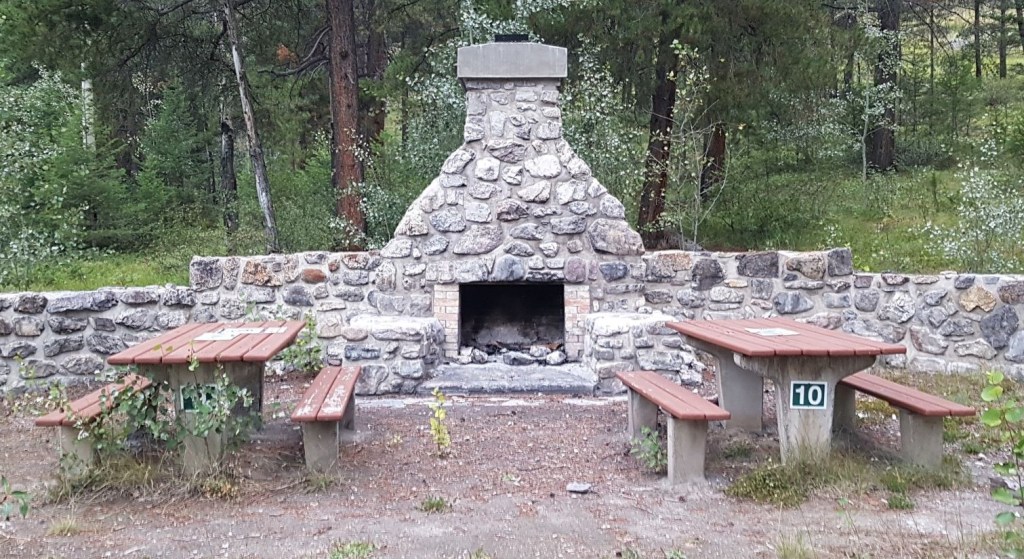
The Fireside Day Use Area is newly paved, and has a new outhouse building. Very nice.

To start the trail, we immediately crossed the small creek to the east of the parking lot. There is a bridge alongside the creek, but I’m not sure if this is a new one waiting to be installed or the old one washed away in the 2013 floods.

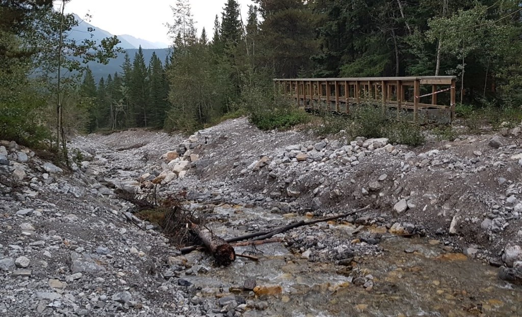
Anyhoo, we crossed to the other side of the creek, and there we found a gorgeous outdoor fireplace, which explains the name Fireside.
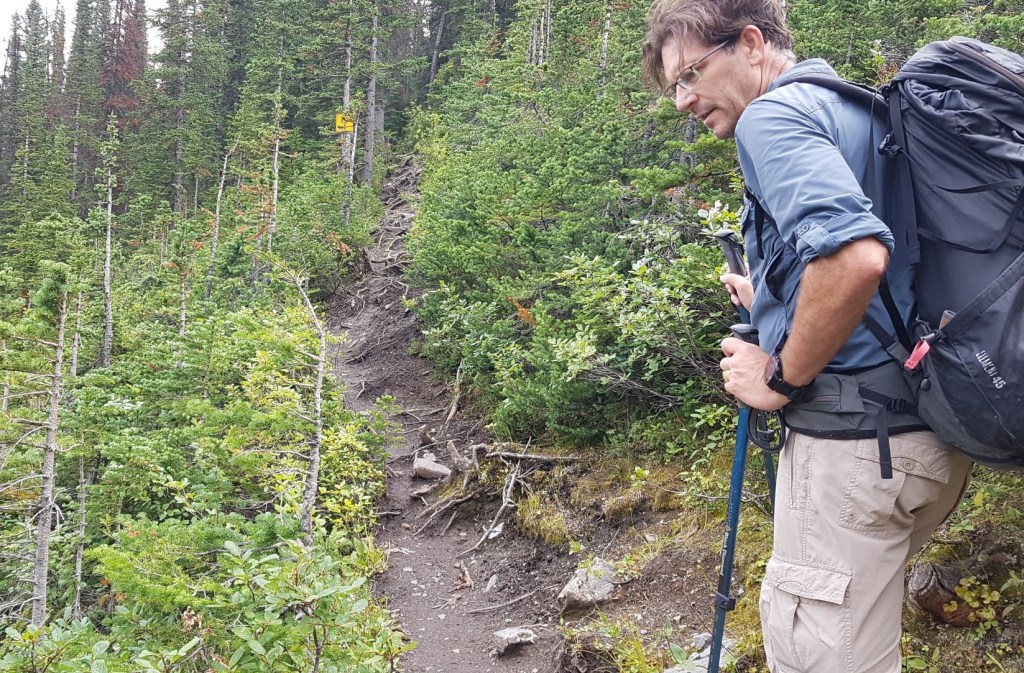
Main Trail
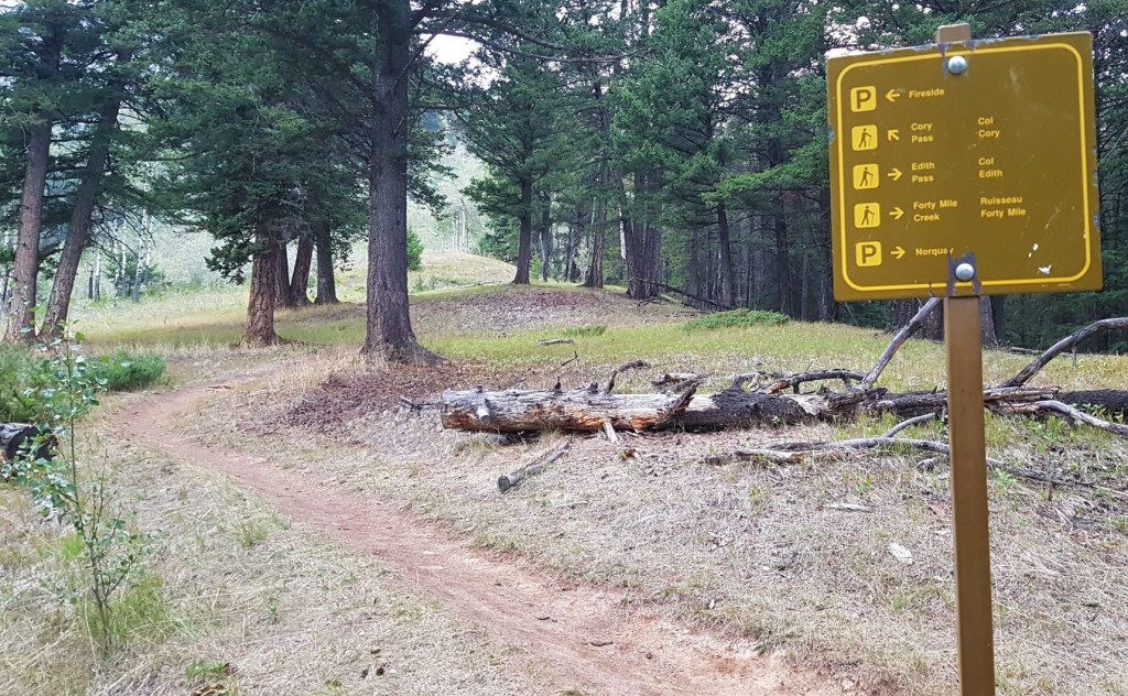
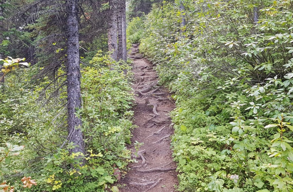
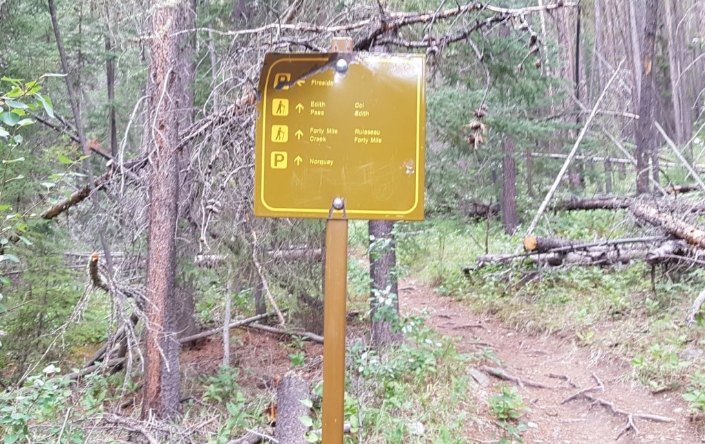
There are several walking trails here, but we went left at the sign showing the hiking distances. After hiking for about 1.2 from Fireside, and came to the very important Y Junction. We went LEFT for Cory Pass.

Cory Pass
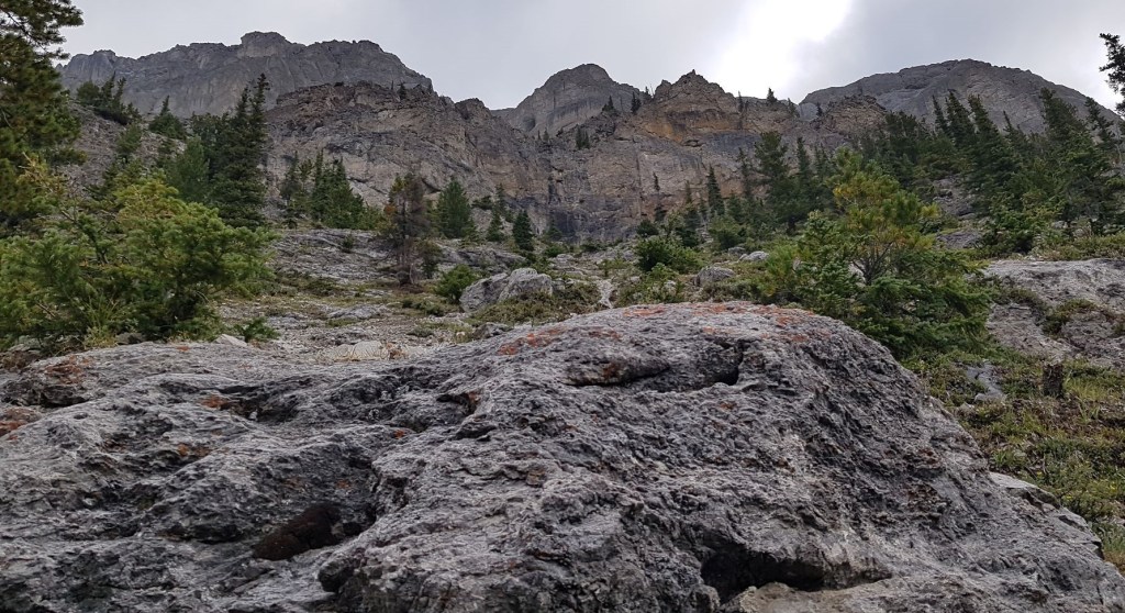
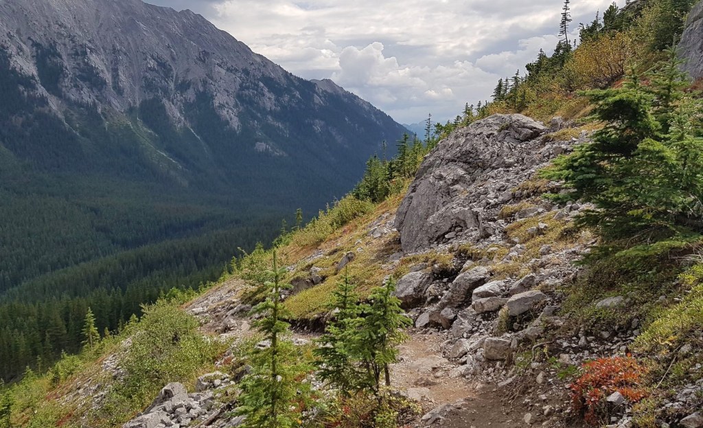
The trail went through a lovely aspen forest, and popped out onto a small meadow around the 4 km mark. This gave us gorgeous views to the south, including Mount Rundle, Sulphur Mountain and Sundance Ridge. Once past this point, the trail gained elevation rather steeply until we reached the top of the south end of the ridge.


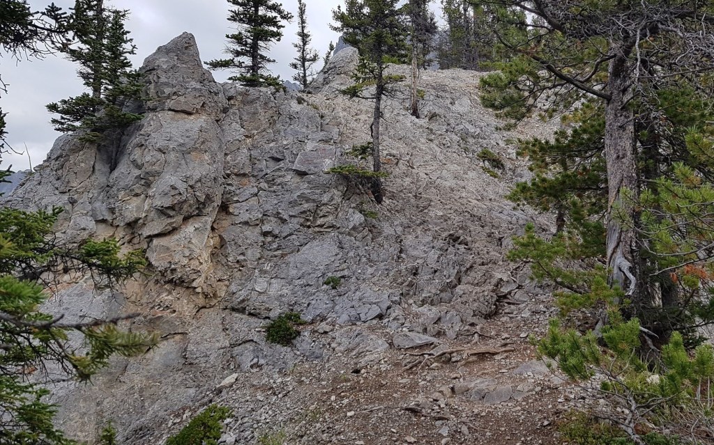
Almost as soon as we gained the top of the ridge, we had a little rock outcrop to get over. On the other side is a near vertical steep descent. There are a couple of hiking signs pointing the way here.


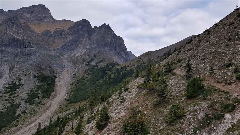
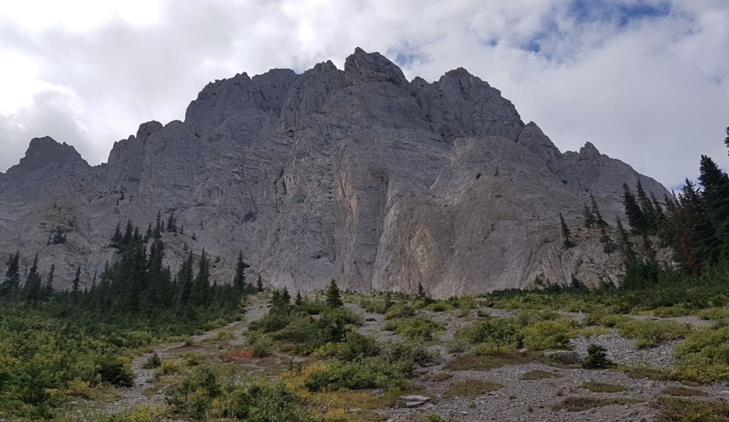
Once we were down the steep section, we hiked out onto the long traverse beneath Mount Edith. The trail undulated in and out as it follows the gullies coming off Edith, with a steady elevation gain that wasn’t too noticeable as we were chatting up a storm. We now got an eyeful of the impressive Mount Cory on the left, where the name Cory Pass comes from.


Distance from Fireside day use area to Cory Pass is 6.2 km. Elevation gain is 915 m. Time to Cory Pass from Bow Valley gates was 2 hours 50 minutes. Time from Fireside day use area is 2 hours 30 minutes.
Cory Pass Return or Full Loop
This is the major decision point. Options are to return to Fireside, back along the same trail. Total distance is approximately 12.4 km. Or continue into Gargoyle Valley for the full loop. This distance is 13 km, but route finding is involved.
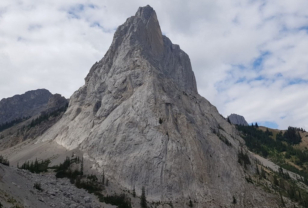
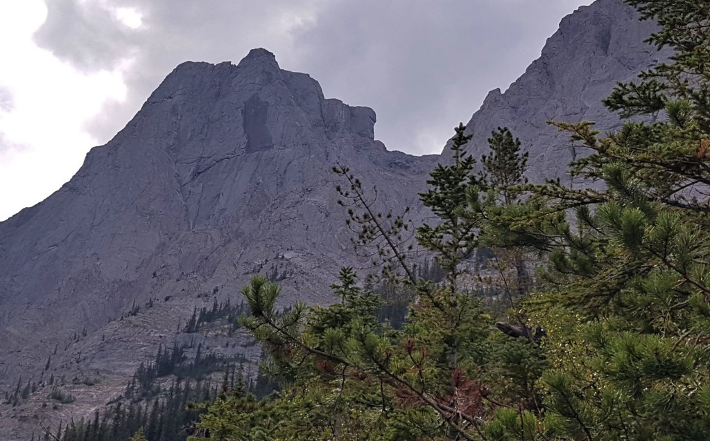
We did a side trip and scrambled up the north peak of Mount Edith. There will be a separate trip report for this, but I’ll share one glory shot of Mount Louis now.

Gargoyle Valley
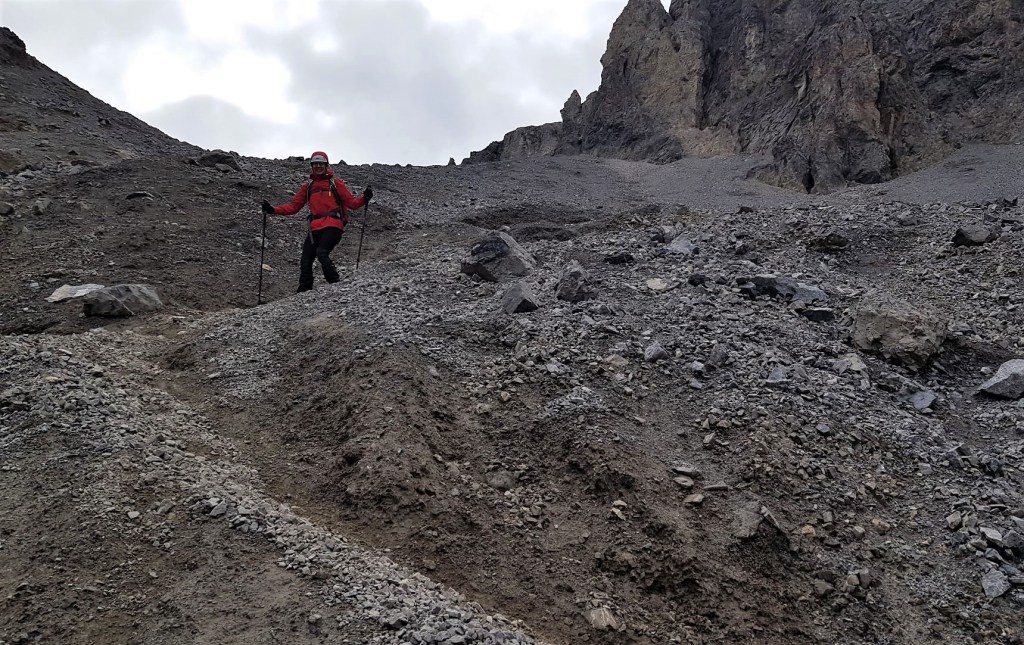
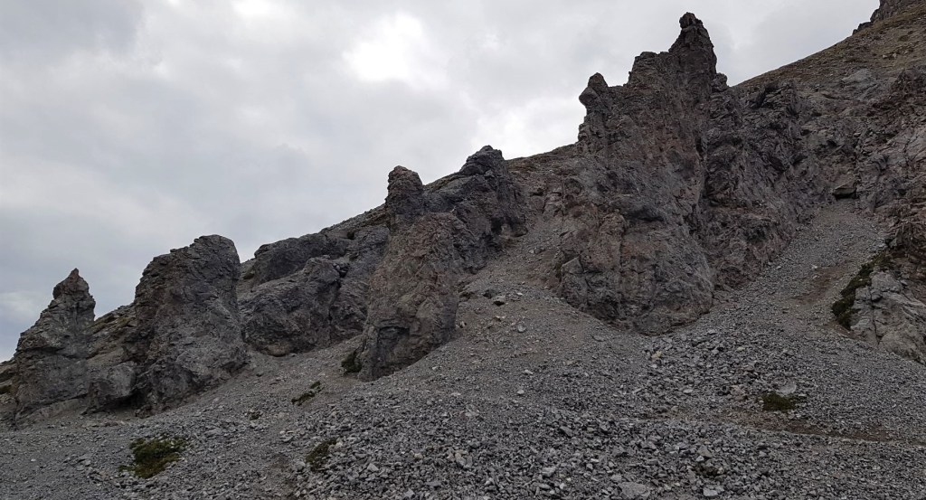
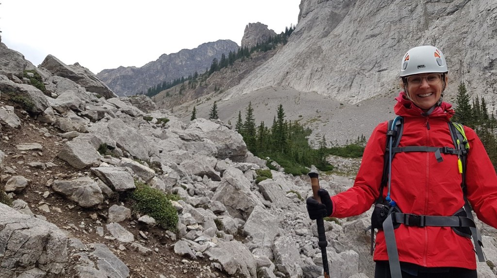
From Cory Pass, we descended almost straight down the scree to the valley between Mounts Edith and Louis. For those used to hiking in Kananaskis, following a scree trail is not a problem. For those who have only hiked on the well engineered Banff park trails, this might be a challenge. We hiked below the ‘gargoyles’ – large rock pinnacles that loom over top of the trail. Once past the pinnacles, it’s a long slow descent to the pass between Louis and Edith.


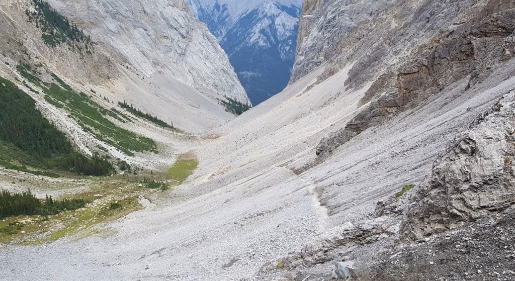
As we neared the end of the valley, the trail drops off, and turns from scree to a large boulder field. This is also the point where we turn right to now hike along the eastern side of Mount Edith.
The boulder field requires route finding. If you look closely, there is a route. I love working my way through these boulder fields, for tourists or those not used to route finding, I can see why Banff wants people to think twice about coming down here.

Once past the boulder field, the trail splits. I took the lower or left trail, as it was stronger. I should have taken the right or upper trail. Why? The lower trail lost more elevation than I would have liked, only to have to regain it. It doesn’t matter which trail you take though, because both join up in the trees.

Now that we were back in the forest, it was now a long, and to be frank, a rather boring hike back through the forest as we circumnavigated the east side of Mount Edith. We did get some views of Mt. Edith, including what looked like a recent flaking. Plus, we got an unexpected view of the backside of Mount Norquay.
There are a couple of major junctions to note on the way back to Fireside Day Use area. The first is the trail that comes in on the left from 40 Mile Creek/Mt. Norquay. We kept straight to continue our downhill trek. The next was a big right hand turn, marked with a sign. Finally, we came to the all important Y junction, and turned left to go back to Fireside.


All in, the Cory Pass, Mt Edith summit, and Gargoyle Valley loop is a big day. However, with great weather, a fit crew who could boogey through the easy parts, we could do it without getting too tired of being on the trail all day. This really is a must-do trail for anyone who spends a lot of time hiking in Alberta. The views and varied terrain are so worth the time and effort.
We hiked back to that all important Y junction, and turned left to return to the Fireside day use area.
Thanks for reading! Please do me a huge favour and click the Star button to “Like” it. You can also follow my blog, join my FaceBook page Al’s Adventurers, or follow me on Instagram
Alisen
Totals – Tracked on Gaia, Displayed on Strava
Date: August 27, 2021
Group: Three (Alisen, Mike and Sonya)
Distance: 13 km loop (official Parks Canada distance)
Elevation: 915 m (3,019′) (official Parks Canada distance)
Time: 6 hours (official Parks Canada time)
My time – 8 hours 28 minutes (includes breaks, lunch and scramble to Mt Edith.)


I love all things mountains! I live next door to the Canadian Rocky Mountains, however I travel the world to enjoy the many different mountain environments and cultures that I can. I hope you enjoy these trip reports, and that it inspires you to accomplish your own adventure goals.

👏🏻👏🏻👏🏻👏🏻👏🏻👏🏻👏🏻 Magnificent images!
Thank you. The scenery does the hard part 🙂
One of our go-to hikes. The last time we did it was a hot day last summer, looks like it was a cool one when you went in August. Maggie
Yes, it was blessedly cool. It was actually quite cold at the top of Mt. Edith, and we didn’t take off our toques until we entered the trees past Gargoyle. I don’t do well in the heat, but I know you’ve travelled to lots of hot countries, so you must be better in the heat.
Gargoyle Valley is my kind of place. Natural sculptures such as the ones there always blow my mind. I’ve been around them in the American southwest, but not often enough.
Ohhh, yes. The American southwest has some very impressive rock features, canyons, and crazy desert landscapes. This part of the world is mainly limestone so the ‘gargoyles’ are pretty rare, hence the big deal about naming them.
Go visit your natural sculptures soon please. You will not regret it.
Al
Great views! Mount Louis is sheer and spectacular.
I know, right!!???!! When my husband said he climbed it, I wasn’t too impressed until I actually saw that monolith. And then I was like “oh, wow honey. You were really good back in the day” 🙂
I’m never a fan of steep descents. The downhill portion in general is my least favourite part of any hike. This looks like a challenging, but fun hike though. Those rock pinnacles look neat. And how cool to spot a wolf!
The wolf was pretty cool. They’ve been flourishing the last few years in Banff, which is why I was a little intrigued to see just one as they are pack animals. We were sure to make noise and keep an eye out, just in case we became a game to them.
Going down that steep stuff is both endurance and technique. I’ve trained many people on a few safe ways to get down, without blowing out your knees. Interesting to note, most mountain accidents happen to women on well maintained trails, all going downhill. It’s a skill that needs to be taught more.
I never would have guessed that most mountain accidents happen on well maintained trails … and that it’s mostly to women. Agreed, it does take skill and practice.
There was a massive study done, and those were the surprising findings. Since then, I’ve just paid attention to various mountain accidents around here and sure enough, lots of women injured on the downhill. So you are not alone in not liking them!