May 28, 2022
I had Thunder Mountain on my list for a few years, but wanted to do it as a shoulder season summit when the peaks further west and north were still snow covered. This was a particularly good year to tackle Thunder because the high snow levels kept most peaks snow bound for weeks longer than normal.
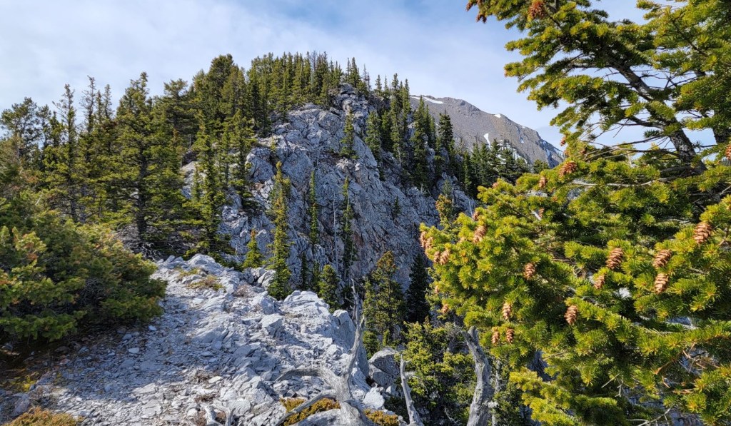
This was a fun scramble for a few reasons. It’s off the beaten path, so Erin and I had the mountain to ourselves…on a Sunday. We only saw one other group coming up as we were heading back down. There was a some route finding due to the lack of usage. Once we gained the ridge, it is mainly a traverse, but there was plenty of back and forthing to be done.
The one downside was the horrendous wind, and I’ll readily admit that it took it out of me. It was howling the entire ascent, with massive gusts that threatened to knock us over. Erin and I were joking that we needed rocks in our packs to provide some ballast. On several exposure spots, we were careful to not take the next step unless we were sure the wind wouldn’t catch and blow us over.
On the final trek to the summit, the wind forced us off the top of the ridge and onto the scree slope to the west, which wasn’t great. Luckily the wind died while we had lunch on the summit, and we could enjoy the nicer ridge top route for the way back down.
Mentally, the wind was exhausting. We couldn’t talk unless we turned and looked right at each other. And my hair! Ugh! Just trying to keep it out of my eyes and mouth and face. This really slowed us down. If I were to do Thunder Mountain again, I’d pick a less windy day.
Gear
Hiking boots, poles and regular day pack kit.
Overview
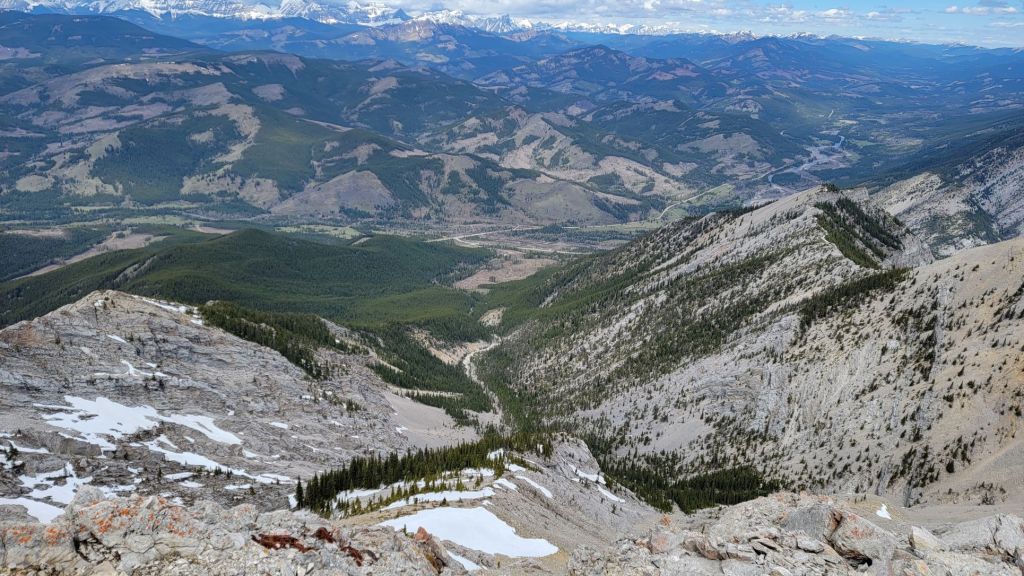
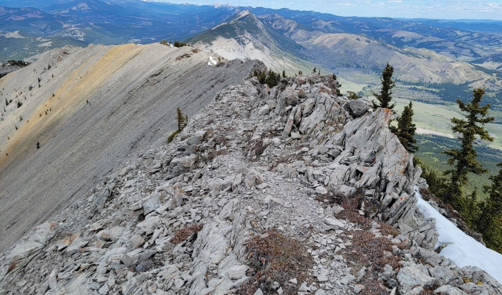
From the trail head, ascend up the side slope to the ridge. Follow it to the near vertical wall, and pick your route up. Once above this, there is a fairly long forest hike. Once on the ridge again, it’s a matter of going east and west over the ridge as we made our way up. For the final ascent, there is a long ridge with an alternate scree trail to the west. The scree route is not ideal, but on a super windy day, it makes it possible to reach the summit. Return the same way.
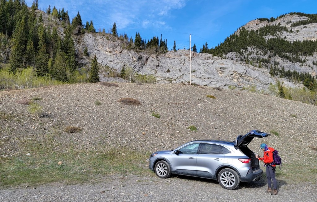
Parking and Trail Head
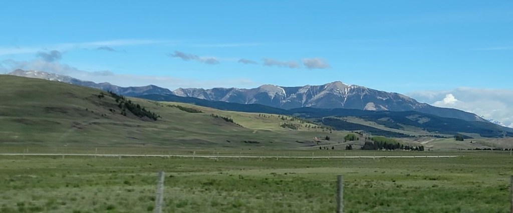
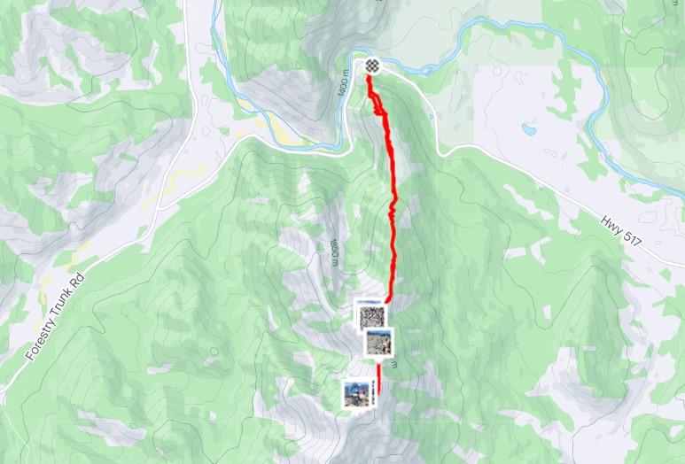
Thunder Mountain starts right at a sharp corner on Highway 517. I drove south on Highway 22, turning west immediately past the Old Man River. The parking is a good sized pull-out on the south side of the road. There are no facilities.

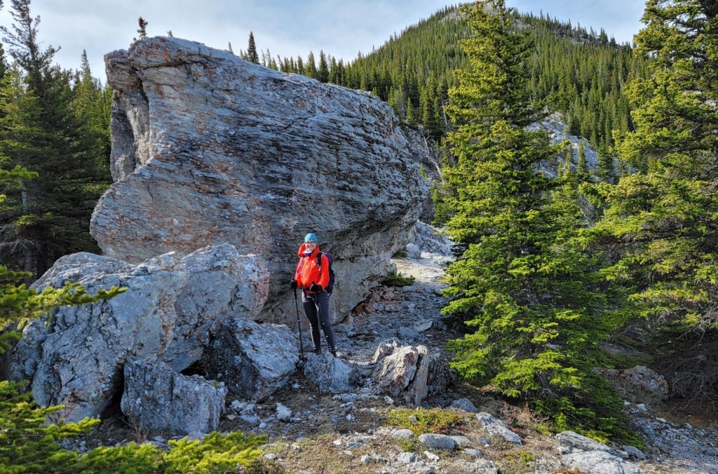
From the car, we hiked straight up the side facing us. It’s steep but short, and leads to the ridge top.


Main Trail
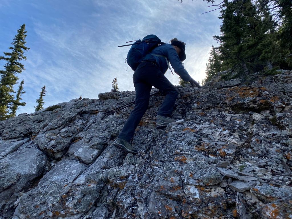
After a few hundred meters, we came to a rock wall. This was fun going up, and I could pick out the route fairly easily. There is the option here to scramble up on the left side, or take the scree route on the right.


Once above the rock wall, there was a long forest hike. This lead to a wide open area. This area was beautiful, but the wind was just deadly. I wrapped up my ears as the wind was giving me an ear ache – but only in my right ear 🙂


There were a couple of sections of forest and ridge tops. The forest approaches were always on the east side, which gave us blessed relief from the wind. We’d go from freezing to boiling to freezing as we went back and forth across the ridge.
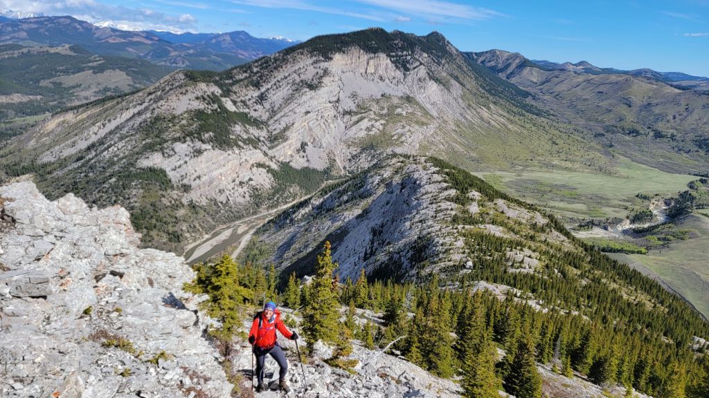


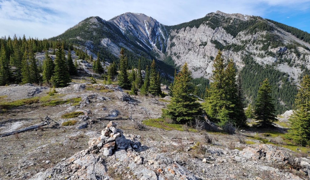
Once past the lichen pinnacles, there was another east side forest hike that was surprisingly steep. This lead to an open scree field, which was actually nice to hike through.


After enjoying the second wide flat area, it was now time to tackle the final push to the summit. The wind continued to howl, with enough gusts to make it unpredictable. Instead of taking the ridge top, we were now forced onto the west side scree slope. Usually, a traverse across scree is no biggie. Not so here. The going was slow as I picked our way across.
Once past the scree and at the base of the final summit ridge, we hiked straight up the ridge, skirting a rather large rock formation to the right.

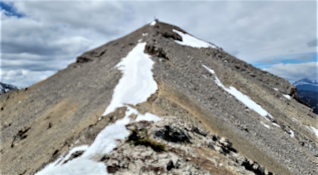


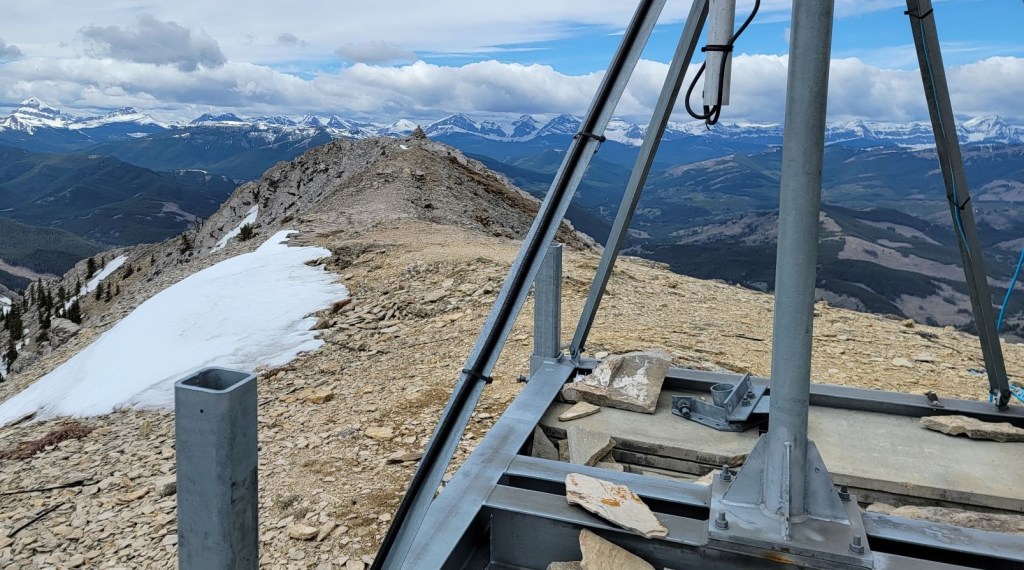
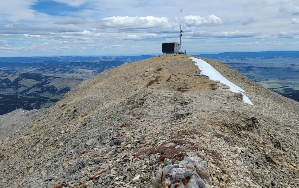
Thunder Mountain Summit
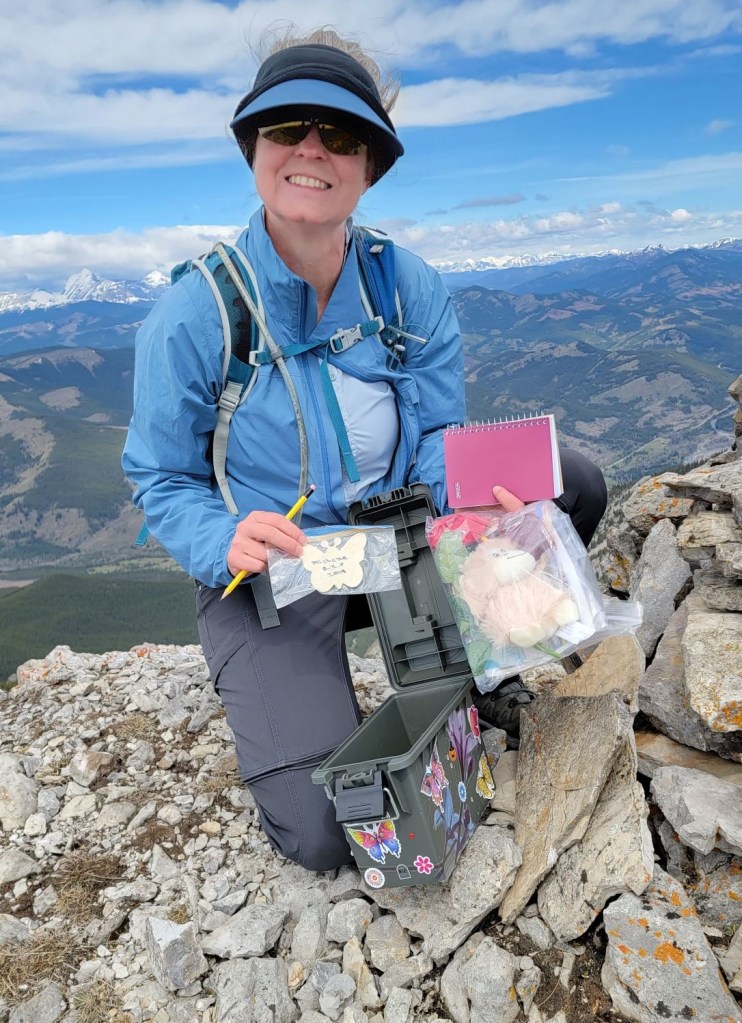
The summit of Thunder Mountain is two high points. The east side has the weather station, which makes a great place to hide from the wind and eat lunch. The west side has the summit cairn, including a new summit register box complete with goodies. Between them is the helicopter landing area, that is marked out with rocks.
Distance to the summit was 5 km, with 928 m elevation. Time to summit was 3 hours 30 minutes.

Thunder Mountain Return
We returned the way we came, but thankfully the wind had died down around noon. We decided to try the ridge top route, and were glad we did. This is a much nicer route than the west side scree, and wished we could have taken this on the way up as it would have saved us time and annoyance on the scree. Again, if I ever come back here, it’ll be on a calm day.
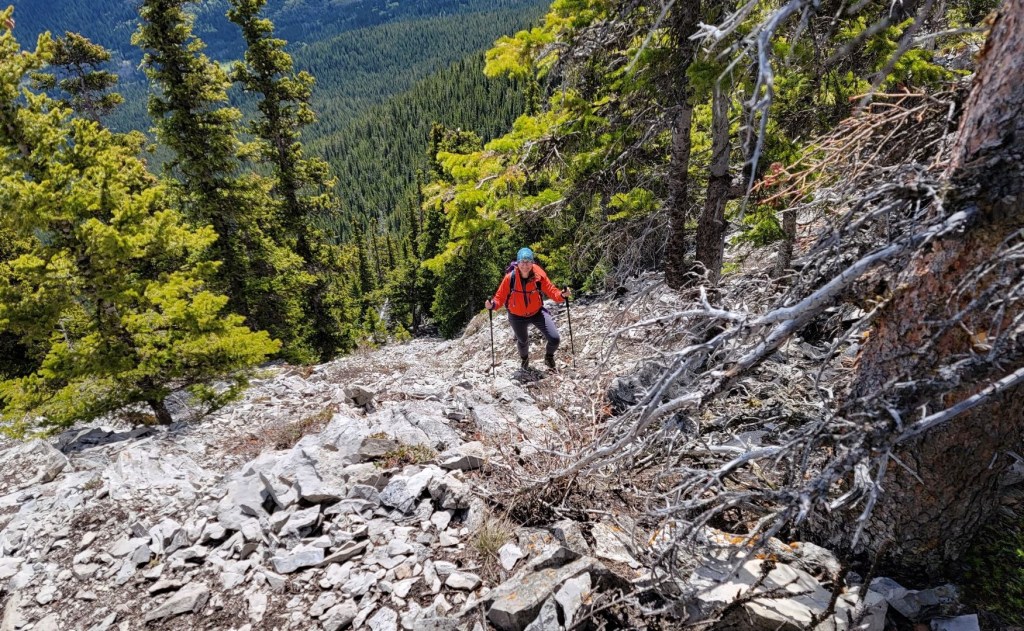
The rest of the trip back was fairly uneventful, except for the final trip down the initial rock wall. I had spied a scree descent route on the way up, but had completely forgotten about it. I wasted some time looking around for a good way down. The scree looked to go too far to the west, but it worked out as the trail then wrapped around the base of the rock wall and lead us back to the initial ridge right above the car pull out area. Yup. The wind really took it out of me. I don’t usually make mistakes like that, but I was done.
I really enjoyed Thunder Mountain for its varied terrain, and super long ridge. It’s not a difficult scramble, but does require some route finding.
Thanks for reading! Please do me a huge favour and click the Star button to “Like” it. You can also follow my blog, join my FaceBook page Al’s Adventurers, or follow me on Instagram
Alisen
Totals – Tracked on Gaia, Displayed on Strava
Date: May 28, 2022
Group: Two (Alisen and Erin)
Distance: 10 km
Elevation: 928 m (3,062′)
Time: 7 hours 25 minutes (includes lunch and breaks)

I love all things mountains! I live next door to the Canadian Rocky Mountains, however I travel the world to enjoy the many different mountain environments and cultures that I can. I hope you enjoy these trip reports, and that it inspires you to accomplish your own adventure goals.

What a wonderful looking hike. Love your shots of the trek.
▪◾◼◾▪▫◽◻◽▫▪◾◼◾▪▫◽◻◽▫▪◾◼◾▪
▫◽◻◽▫▪◾◼◾▪▫◽◻◽▫▪◾◼◾▪▫◽◻◽▫
Thanks Graham. It was a longer day than I was expecting. Good solid day in the mountains.
👌
Lovely pictures. It’s always nice to hike in the shoulder season without the crowds. The rock scrambles look like they were a lot of fun, being in the wind, not so much!
I won’t lie. It was a mentally exhausting day for sure. Wind is the downside of shoulder season. I knew better, so it’s on me.
I’m always in awe of your rock-scrambling abilities … looks far too much like rock-climbing to me. 😀
There was some of that for sure. My next goal is to actually learn how to do technical rock climbing. It’s actually safer because you have a rope and some protection.
Heh, rope is good. 😀
LOL!!!
What a beautiful hike! Amazing photos!
What a fantastic adventure. Love your accompanying photos.
Thanks. It was a long day. The scenery down there is stunningly beautiful.
Amazing!
*Blush* Thanks:-)
Wow! I admire your enthusiasm and tenacity!
LOL! And stupidity??? 🙂 That wind was ridiculous.