May 13, 2022
July 17, 2022
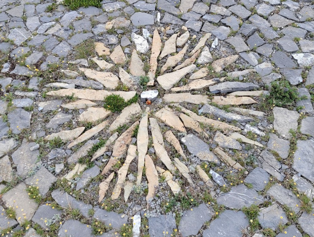
Hailstone Butte is the most southern fire lookout in Kananaskis Country. Both Hailstone and Raspberry Ridge Fire Lookout replaced the old Mount Burke fire lookout in 1954. I wanted to hike this ever since I saw a photo of the amazing rock work done by Tom Johnson, one of the lookouts. Despite having to take two tries at it, I was not disappointed. For more information on the history of Hailstone Butte, visit Friends of Kananaskis Country.
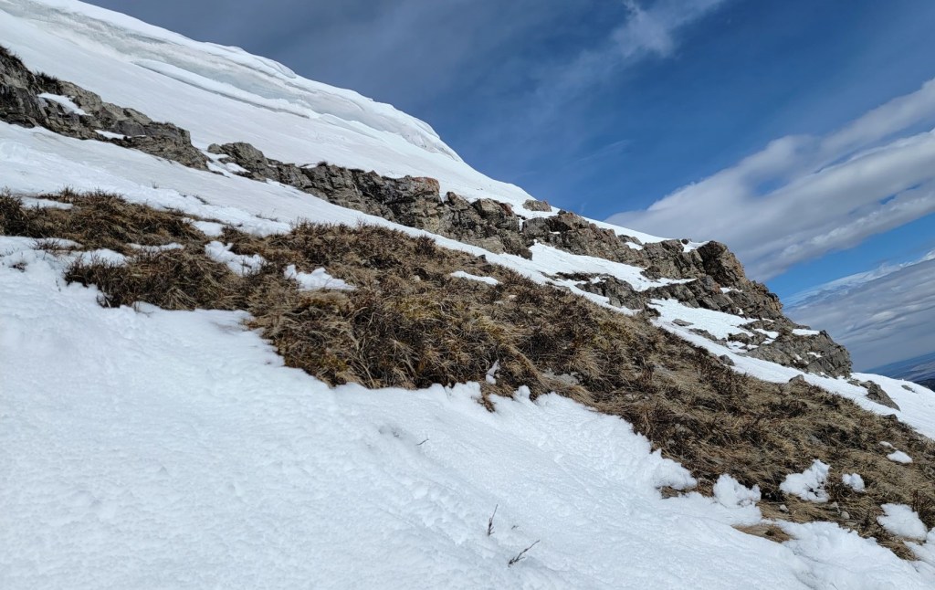
Sonya and I originally tried to hike Hailstone Butte in mid May. Even though this was an epic snow year, I was surprised to see the amount of snow still accumulated here. I was hoping that the mountains further south would have melted out a bit more, but alas, I was wrong. It was still a great day out, and after we got turned around below the cornices, Sonya and I had a ‘consolation hike’ up Windy Peak Hills. I probably would not have made Windy Peak Hills a priority, so this was a win-win in my book.

I came back to Hailstone Butte with Erin in mid-July. I had just done two 20 km days in Waterton National Park, and I was leaving for a week of mountaineering in a few days. I needed a short hit of mountain time, and Hailstone Butte was ideal.
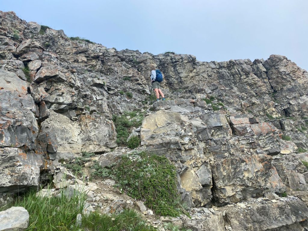
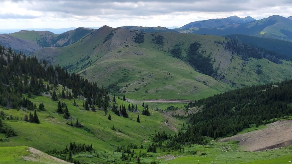
While this is a short hike with not much elevation gain, there is a pretty good section of scrambly bits to get through, both on the way up and the alternate route down. Once on the ridge, the views are endless and gorgeous.
Gear
Hiking boots, poles and regular day pack kit. Due to cornices and road closures, winter travel is not recommended/available.
Overview
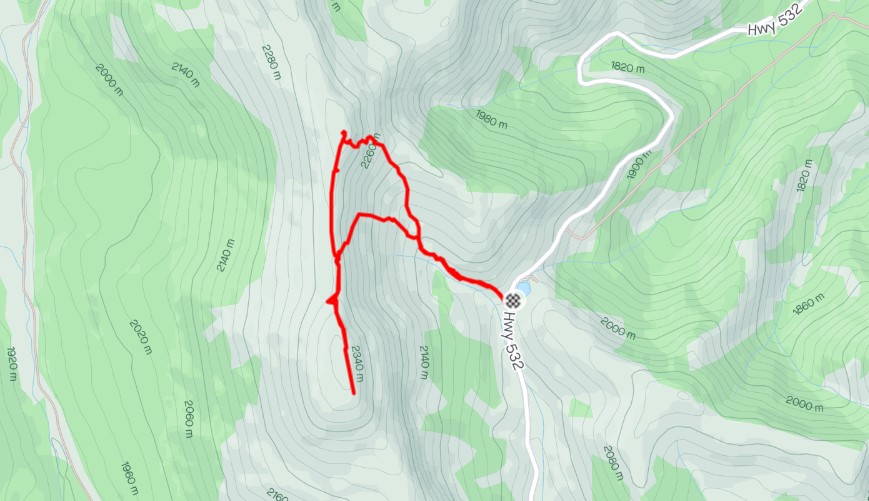
From Highway 532, walk up the trail beside the creek drainage. Once above the creek, angle up to the rock wall. Scramble up. Hike north to the fire lookout, and/or south to the radio repeater. Descend via the ascent route, or take the alternate descent at the low point. Angle towards the middle of the drainage to meet up with the main trail.
Road Closure
Highway 532 is closed between Highway 22 and Highway 940 annually between December 1 to April 30th. Visit Alberta Parks for more information and to check the status of the road.

Parking and Trail Head
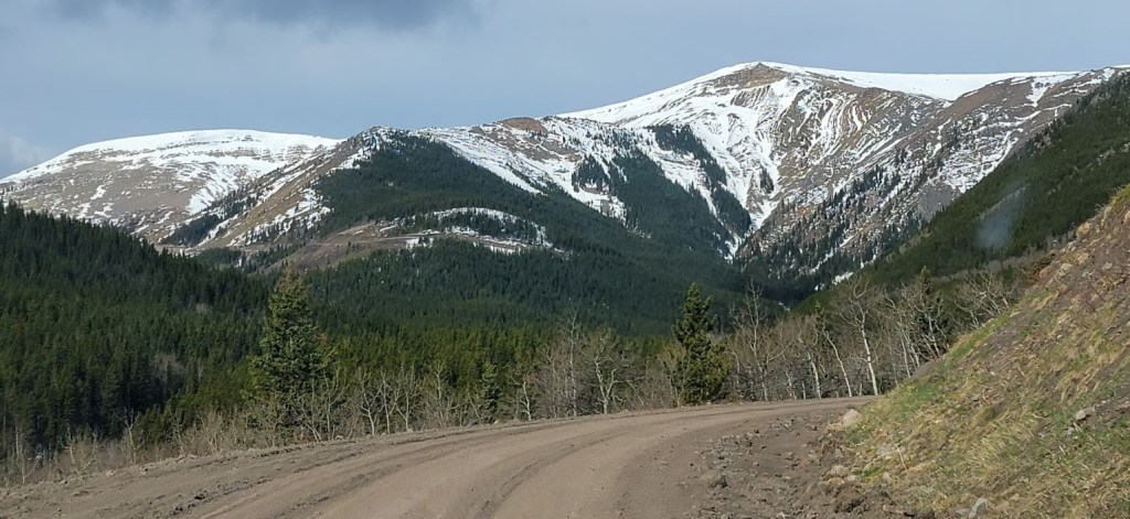
From Highway 22, turn west onto Highway 532. The parking for Hailstone Butte is about 21.5 km from Highway 22. There is a wide pullout on the east side, at the crest of the gravel road. Depending on when the grader has been through, this road can be in great shape, or it can be a washboard nightmare.
This is a multiuse road. The gravel cyclists like this route, so please be on the lookout for them. If you see cyclists (or any other users), be polite and slow down to reduce the amount of dust kicked up.
From the parking lot, cross Highway 532 and walk up the short embankment. The trail, and the whole Hailstone Butte, is now visible.


Main Trail
From the embankment, pick up the main trail. It splits at one point, but comes together at a low point. Both work, but I seemed to take the higher trail both times. The trail dips down and follows the creek for a bit, but then climbs back up. When I was here with Sonya in May, the trail was mostly snow covered, and we had a bit of post-holing to contend with. When I came back in July, the snow was gone, but we were treated to a herd of Rocky Mountain Sheep. As this is hunting territory, they were none too pleased to see us, and quickly vacated the area.


The trail heads off to the northwest, angling towards the base of the fire lookout. The trail begins to fade in and out, as people find their own way up.
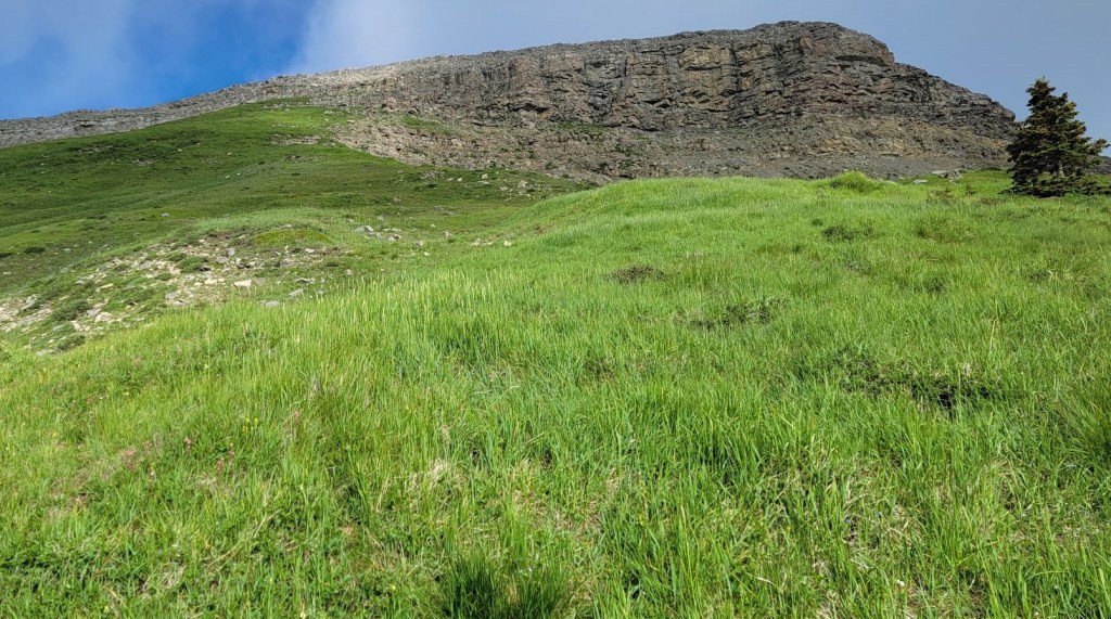


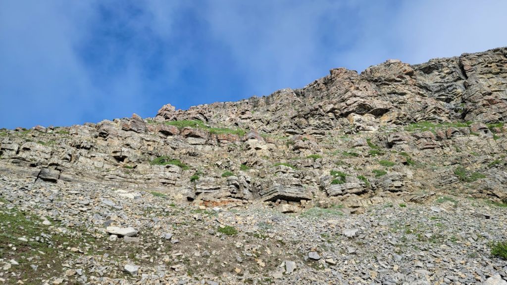
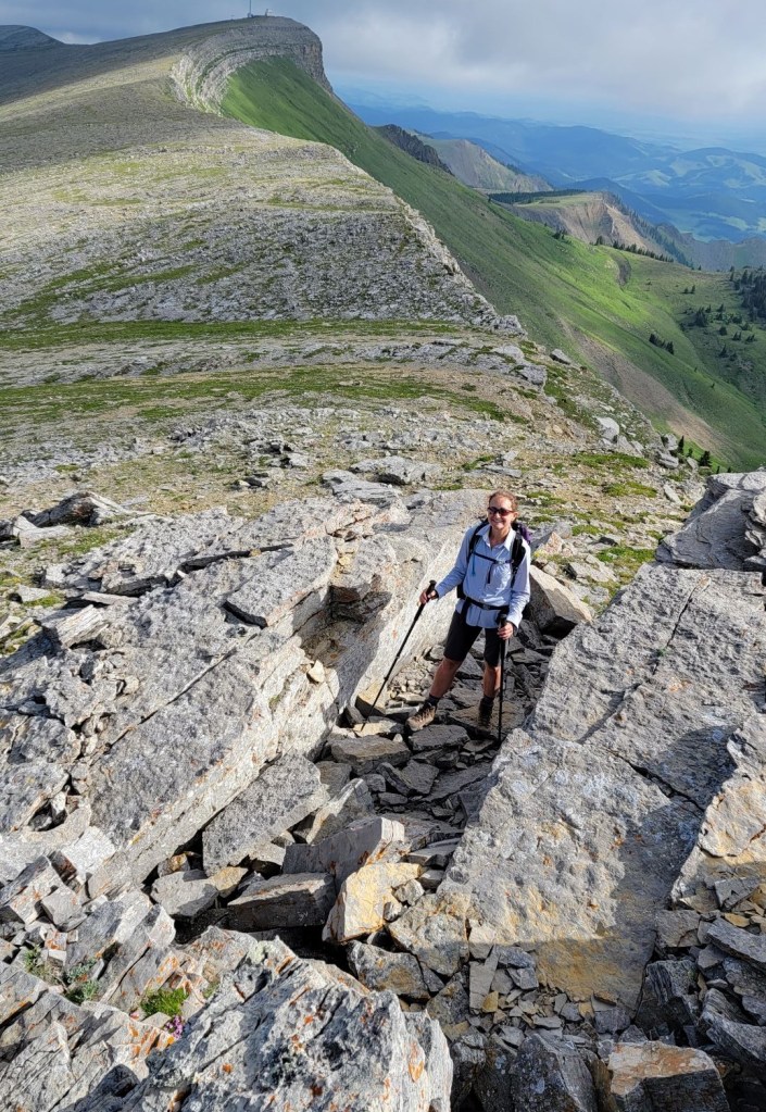
There is a short but fun scrambly bit right below the top of the butte. This is a Pick Your Own Adventure route. I went left, and enjoyed several sections of solid rock.
Once above the rocks, we were now on top of the butte. We turned north, and ambled over to the fire lookout. I am always hesitant to just walk up to an active fire lookout as it is a workplace and a private residence. The shutters were closed on the south side, so we quietly took some photos of the amazing stone work and left before we became a thorn in someone’s side.
Time to summit of Hailstone Butte was 1 hour. Distance was 1.6 km with an elevation gain of 344 m.


South Radio Repeater Bump
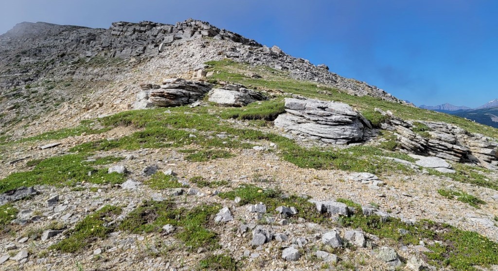
Erin and I headed south along the ridge to gain the second bump on the butte, which houses a radio repeater station. We found some interesting rock formations along the way. It was a very enjoyable walk.


I thought that I would wander down to the third bump on the butte, but when I looked down at it, I though ‘nah.’ The wind was up (Erin lost her ball cap. If you see a gorgeous Ridley’s Cycle hat, please nab it!), and the clouds were in and out. I had a big week ahead of me, and Erin and I agreed that getting home early for once was not a bad thing.

Hailstone Butte Return
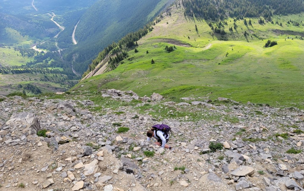
We retraced our steps north along the butte. Instead of descending at our uptrack, we went for the optional descent at the low point on the ridge. This is marked with a cairn. While descending a sight unseen scramble can be nerve-wracking, this was fairly straight-forward as I made my way down a series of short rock bands. I then headed to the middle of the drainage. This lead us directly back to the main trail.


Hailstone Butte was definitely worth a second try. Due to the wind patterns, cornices will build every year. After speaking with local expert Claudia, she only goes to Hailstone from late June onwards. Lesson learned! Don’t push the seasons, and I won’t be disappointed.
Thanks for reading! Please do me a huge favour and click the Star button to “Like” it. You can also follow my blog, join my FaceBook page Al’s Adventurers, or follow me on Instagram
Alisen
Totals – Downloadable Tracks on Gaia, Displayed on Strava
Date: July 17, 2022
Group: Two (Alisen and Erin)
Distance: 4.8 km
Elevation: 370 m (1,221′)
Time: 2 hours 52 minutes (includes breaks)

I love all things mountains! I live next door to the Canadian Rocky Mountains, however I travel the world to enjoy the many different mountain environments and cultures that I can. I hope you enjoy these trip reports, and that it inspires you to accomplish your own adventure goals.

I really love the curvature of the summit ridge! Also, I learned a new word: hummock. I’ve never heard it before and had to look it up.
You’re the second person to question Hummock! My friend Sonya asked if a hummock was the opposite shape of a hammock. I said yes.
She then said – you just made up that word right now, didn’t you? 🙂
Ha! I love it. And upside down hammock 😂
It is a very nice hike indeed. We went there in October 2021, there was a very, very strong wind.
We could hardly stay in a vertical position at Hailstone Butte Fire Lookout. Walk to South Radio Repeater Bump was not an option in these conditions.
Unfortunately, Tom Johnson’s stonework was already covered by new but crusty snow.
We continued north a bit longer until we hit the old fire road and then turned south to the main trail.
“Parking lot” was getting a lot of wind too, we were pleasantly surprised that the ski box mounted on top of the car did not fly away 🙂
The combination of fall colours and new snow on top was awesome.
There is nothing like the shoulder season winds to pretty much ruin an otherwise great day in the mountains. Even in July, Erin lost her ball cap when the win ran away with it.
My first trip in May, we almost didn’t get out of the car it was so windy. Once we got into the wind shadow of the Butte, it let up, but if we’d been able to get on top, it would have been a cold and nasty wind.
So glad you were able to venture south and enjoy a quiet day in the mountains. Not many people come down this far, so it’s nice to avoid the crowds.
Take care, and I’ll see you soon!
Alisen
Glad to hear that you had a second chance to tackle Hailstone Butte. It’s crazy how the landscape can change so drastically in a couple of months. The pick your own adventure route through the rocky terrain sounds like a lot of fun. I didn’t realize that the fire lookout was still active and serves as a private residence. The stone work looks beautiful.
Yes, all the fire lookouts are ‘homes’ for the men and women who serve as lookouts. They are there all summer. It’s an ideal job for a writer 🙂
In the winter, the lookouts are shut up tight.
I’m not surprised. It seems like it can get pretty treacherous up in the mountains during the winter! I bet the landscape looks absolutely gorgeous though.
Heavens to Murgatroid! That shot of you, on the way down, betwixt a steep drop-off and a hard place! 😀 … took my breath away it did. 🙂
You make me feel like a super hero 🙂
The stone works looks absolutely amazing! And the compass too! Beautiful views.