July 1, 2022
Happy Canada Day!
I like to be in the mountains on Fridays to avoid the crowds, and assess conditions for anyone not as fortunate as me to have a flexible schedule. I knew that it was Canada Day and a long weekend, but somehow it didn’t register that it would be busier than usual in the mountains. My first hint was the traffic driving west! It was like a busy Saturday morning. Good thing I left fairly early. When I arrived at the Lake Minnewanka parking lot just after 8:00 am, I had my pick of spots. By the time I returned though, it was a zoo with cars circling.
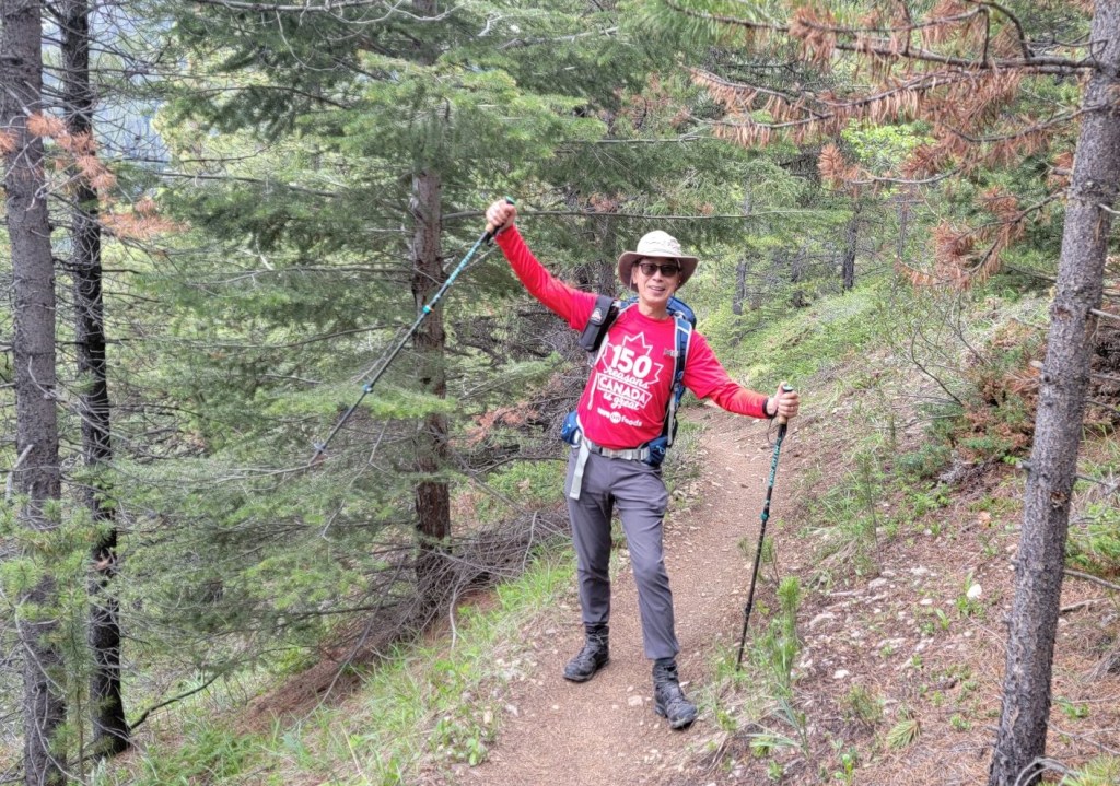
It was incredibly cool to see all the people celebrating Canada Day by going for a hike. It was heart-warming to see red and white and maple leaf emblems all day long. I’m sure glad I remembered to wear a red tank top!
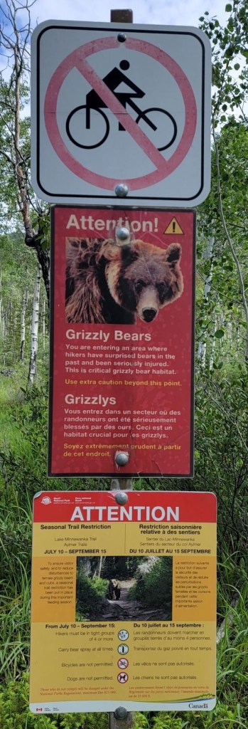
Trail Restrictions
There are annual trail restrictions at Lake Minnwanka from July 10 to September 15th for grizzly bears. All hikers MUST be in groups of 4 and carry bear spray. No dogs. No cycling. When summiting Mount Aylmer (not the lookout), most people choose to cycle the shoreline, so pick your time to go.
Gear
Hiking boots, poles and regular day pack kit. A mountain bike if you wish to cycle the shoreline trail when it’s allowed.
Overview
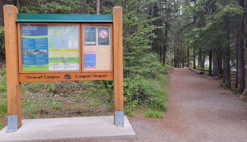
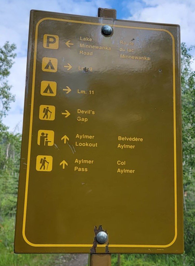
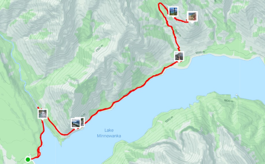
From the Lake Minnwanka parking lot, head east to pick up the Minnewanka Trail on the north shoreline. Go past Stewart Canyon bridge, and continue along the shore. Shortly after crossing the creek, turn left (north) at the Aylmer Lookout (LM 8) Campground to start the uphill grind. This trail has one bend and one switchback. Return the way you came.
Parking and Trail Head
Parking is at the Lake Minnewanka Day Use Area. There are outhouses and a washroom building with flush toilets and running water.

From the parking lot, I was quickly attacked by mosquitoes (first of the season!) and I was glad I brought my bug spray. I hopped on my bike, and headed east, past the little food kiosk (which wasn’t open yet) and tour boat station.

At around 1.8 km, I passed the Stewart Canyon Bridge.

Main Trail
After the bridge, the trail starts heading uphill. I had passed three groups, but his wouldn’t last. I quickly realized the hybrid I was riding (no shocks) was no match for this trail. Once I got into the chunky rocks on the steep rock garden section, I was looking for a place to stash my bike. When I was changing into my boots and locking up my bike, all three groups passed me.


Now I was really feeling behind the ball, so I darn near ran down the trail. I quickly reeled in all three groups that had passed me, but I kept going strong and passed another two groups before I started the uphill climb. I find I go a lot faster when I’m by myself, but even this was a quick pace for me.
Once up and over the big rock garden, the trail flattened and smoothed out. I probably could have ridden this part – next time!
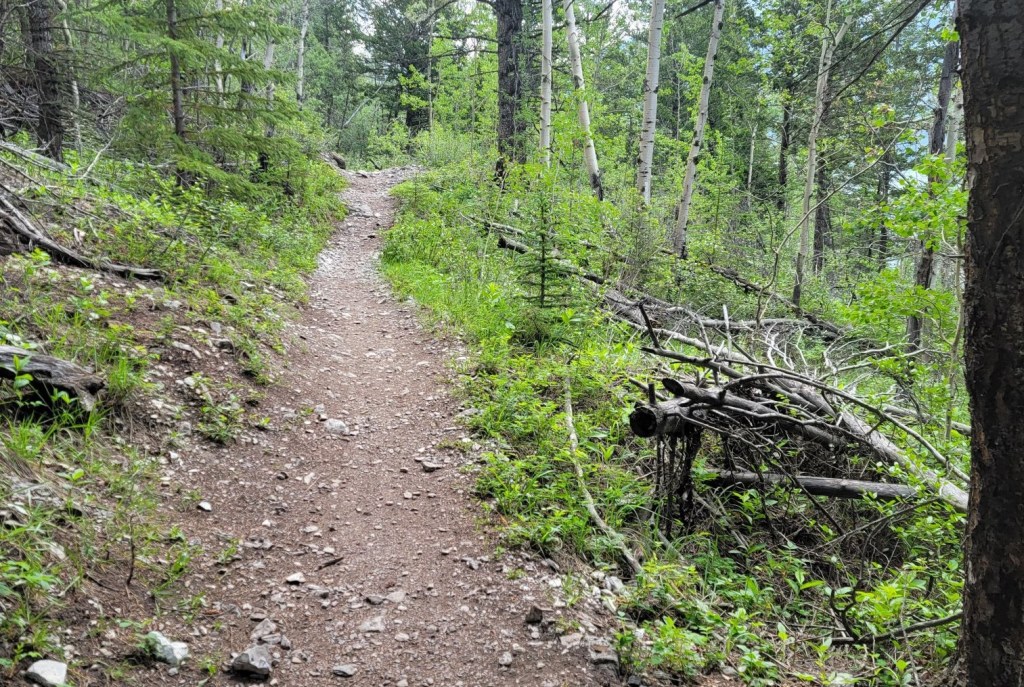
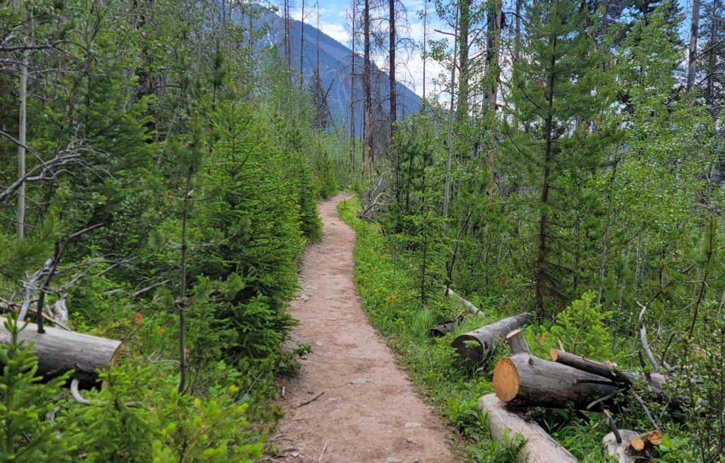
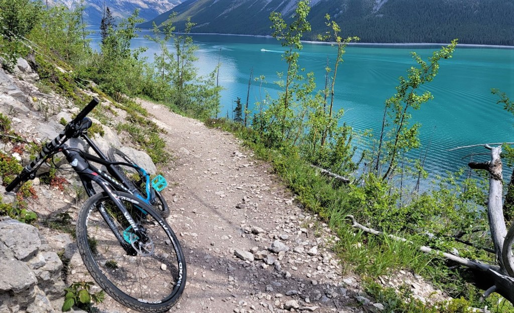
The shoreline trail was wide and lovely, and mainly in the trees which were providing needed shade as it was already warm.
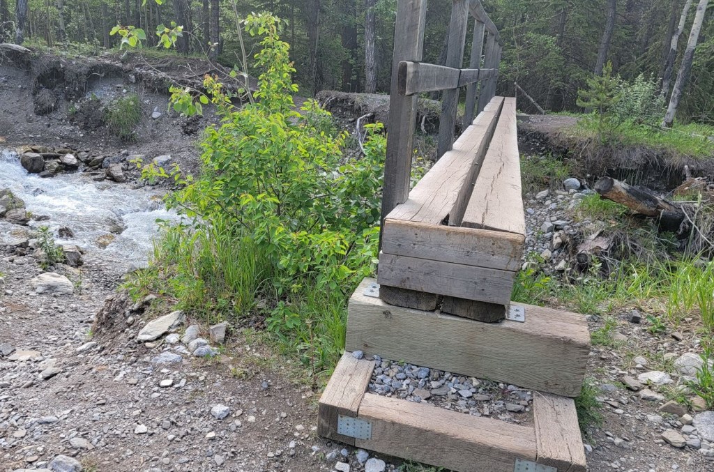
After 8.4 km of hiking, I came to the creek and crossed the bridge. I kept my eyes peeled for the left hand turn to start gaining elevation. I needn’t have worried. It’s about 100 m further along the trail and is a large intersection with the Aylmer Pass (LM8) Campground.
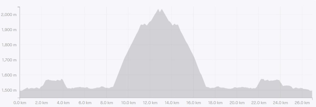
It was now a solid 4.5 km stretch of continuous elevation gain.
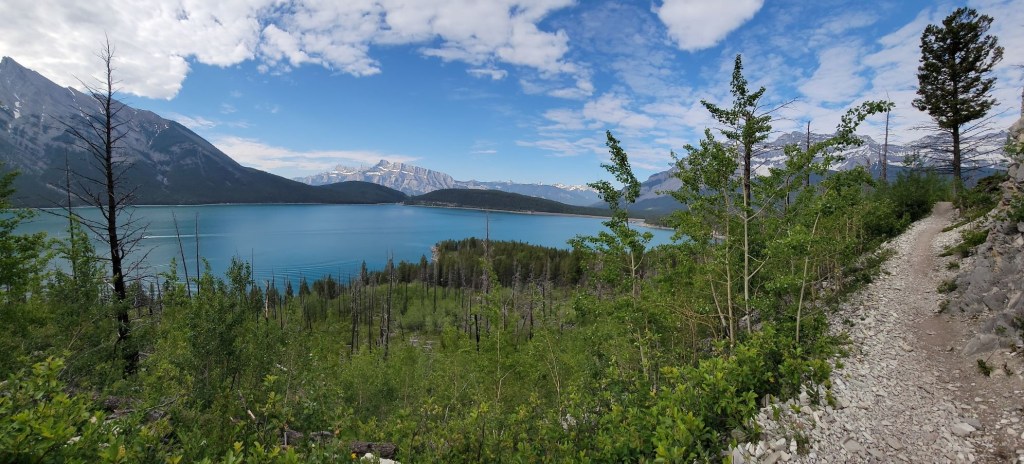
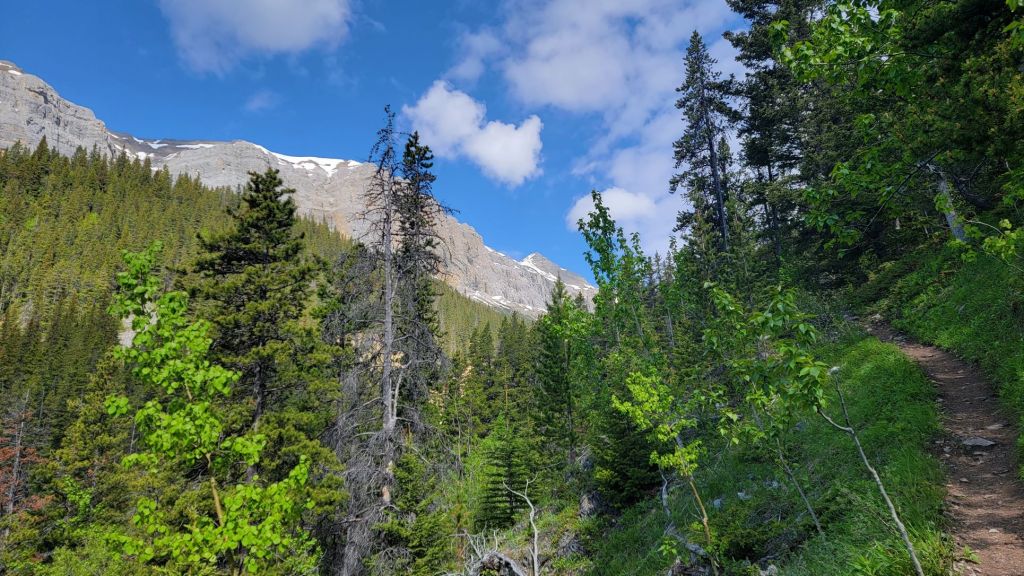
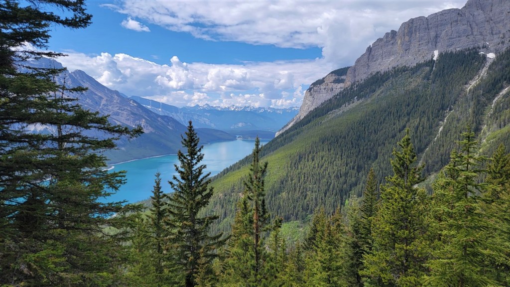
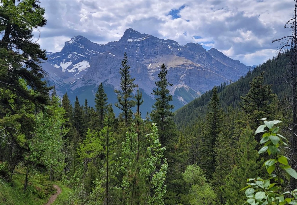
I was very thankful for my early start, because the sun was being blocked by the trees, offering shade for my entire ascent. This trees also ensured the views were blocked. This photo of the view is basically it.

The trail ascends quite sharply, crossing many contour lines as it parallels the creek canyon. I was curious when this fire lookout was created because it’s not a typical trail. Most fire lookouts were built during the age of the packhorse, which meant the trails are well graded with lots of switchbacks to ensure a low elevation ascent for the horses. Not so here! The Aylmer Fire Lookout was built in 1946, and it looks like there is an old helicopter pad. Perhaps a well graded trail was no longer needed.
I was playing a little game I like to call “Is it hot? Or is it a hot flash?” As I’m already hot and sweaty on the trail, it’s hard to tell if I’m having a hot flash attack. My clues are when my heart rate starts to race, which in turn spikes my adrenaline a bit. When that goes down, I’m left feeling worn out. There’s no stopping so I have a drink of water and keep on going.
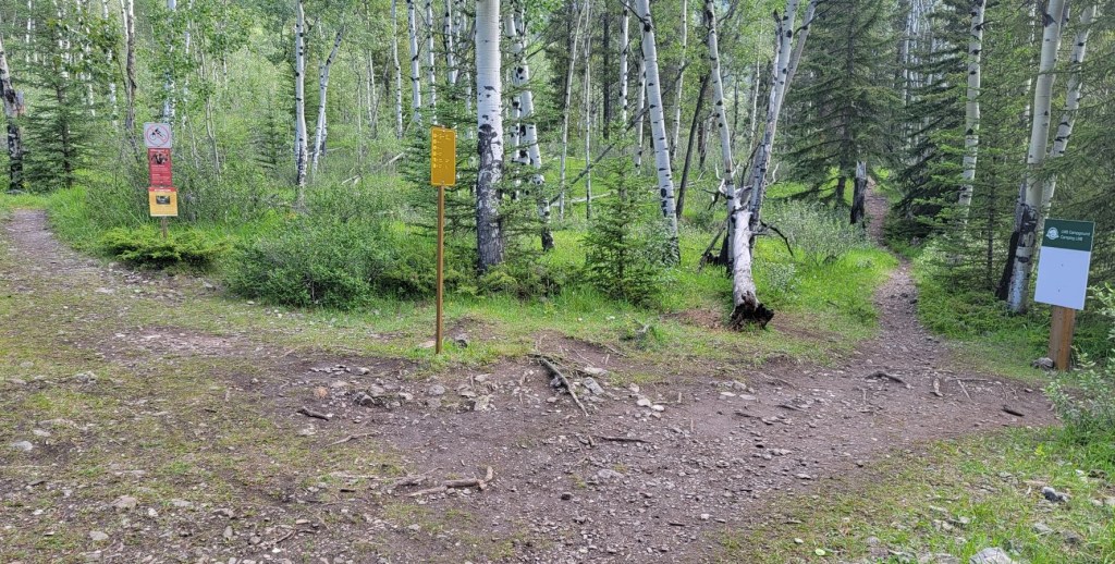
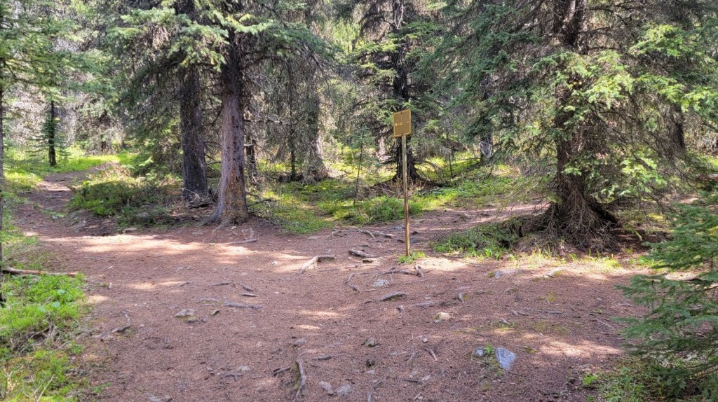
After 11 km of total hiking distance, or 2.5 km since the start of the uphill, the trail makes a big right turn to continue going to Aylmer Lookout. Going straight leads to Aylmer Pass, and the route to climb Mt Aylmer.
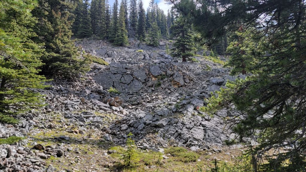
The trail now offered a bit of a reprieve. Not only did it flatten out to traverse across the slope for a bit, but it actually lost some elevation in order to go around a giant rock garden. Soon enough, I was again gaining elevation. I enjoyed the one switchback very much 🙂
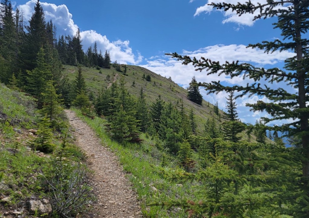
The views here are also limited, except for when I was nearing the lookout and the trees started to thin in a few spots.
I popped out of the forest onto an open slope, and was at the site of the old fire lookout in no time.
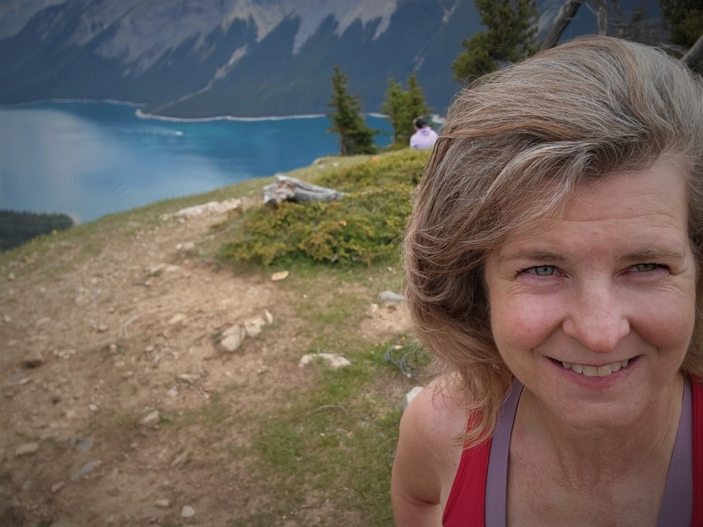
Aylmer Lookout Summit
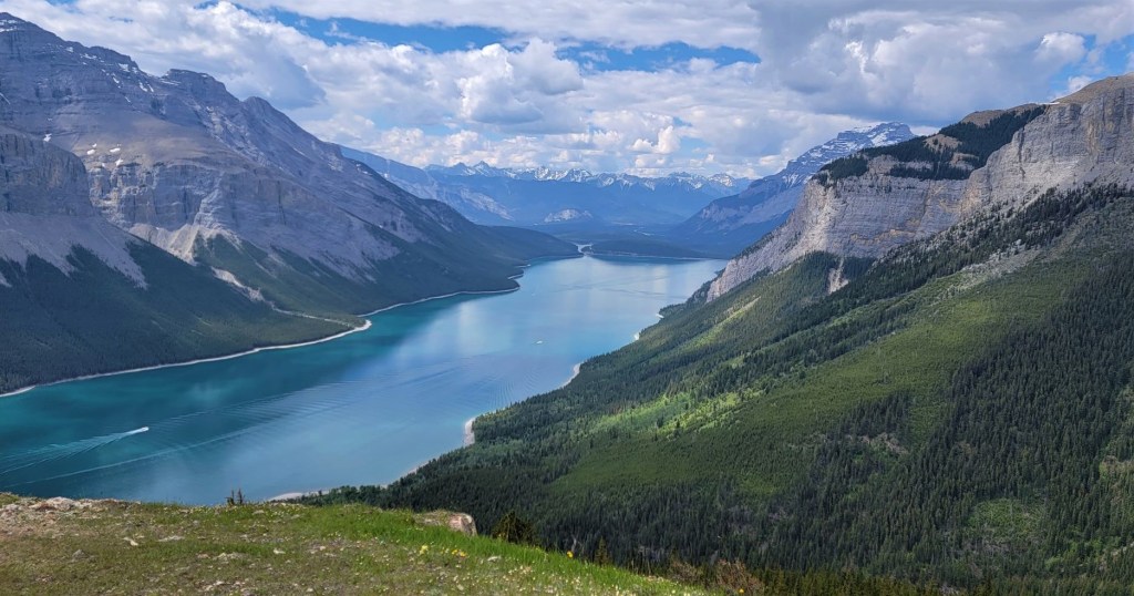
The views here really are incredible. I will definitely have to come back and explore some peaks.
Time to summit was 3:08. Distance was 13 km, and elevation gain was 816 m.
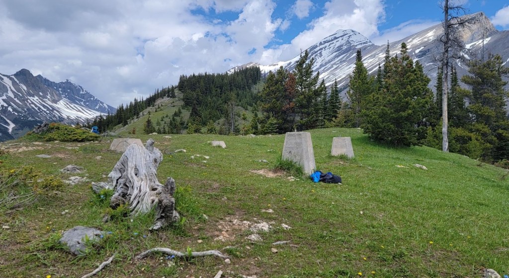


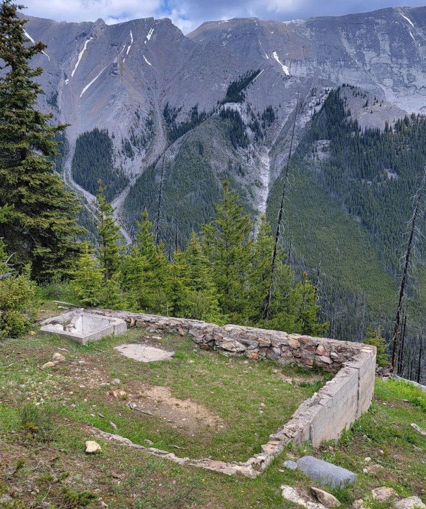
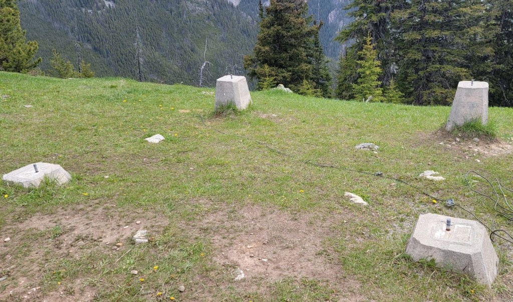
For such a long hike in, it seemed a shame to race back down and not enjoy the views, especially because I had the place to myself for quite a while. I spent about 20 minutes exploring the footings of the old lookout, and chatting with a trail runner (the only one to pass me). She made it up in 1 hour 45 minutes to my 3 hours. Very impressive!
Aylmer Lookout Remains
The fire lookout hut seems impossibly small. It’s too bad the original structure wasn’t maintained. These are a part of our history, even if no longer in service.
Aylmer Lookout Return
After getting my fill of the view, a couple I passed at the campground junction came up. I took their photos, and decided to head off as the rest of the people would not be far behind. On my way down, I met Gita and her band of hikers. They were all decked out in their Canada Day Regalia! It was so awesome to see that, I just had to take a photo of Roman.
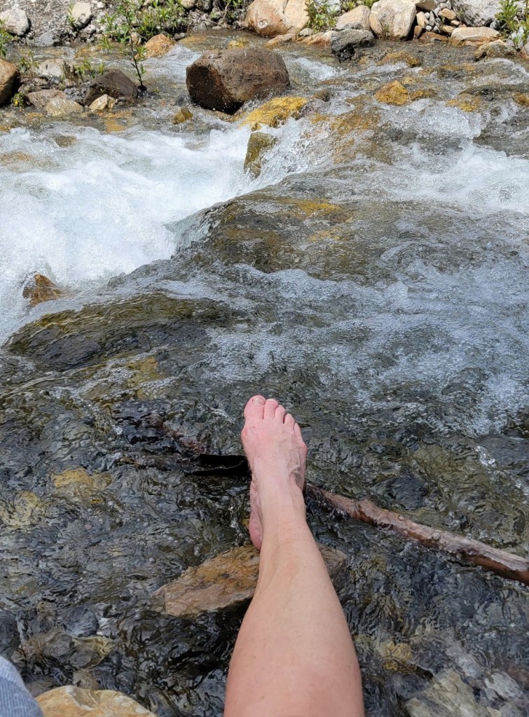
My bunion was absolutely killing me, despite loosening my boot as much as possible. When I returned to the creek, I took the time to soak my feet in the cold water to reduce the swelling. This helped immensely, and allowed me to hike back the 8 km without hobbling.
The Impromptu Shepherd
I knew there were lots of Rocky Mountain Sheep in the area, and had met a herd while cycling up to Lake Minnewanka previously. I wasn’t too surprised to see the herd, but was lucky enough to have them climb down onto the trail in front of me. With nothing to do but slowly wander along behind them, that’s what I did. One baby kept stopping to nibble, which separated her from her momma. Momma was not happy with that, and would bleat at me, as if it was my fault. I found that by gently clicking my tongue, but not crowding, the sheep kept moving.

This worked for a while, until we came to a group of hikers who had stopped on the trail. Now the sheep were trapped between me and the guys. They were above me, so I yelled out for them to move off the trail so the sheep (and me!) could pass. For the next few minutes, I passed about 15 people, all asking if I was the shepherd. I jokingly said “Yes, today I am.” As there were now a lot of tourists on the trail, I’m hoping I didn’t give people the impression that sheep are actually herded in Canada.
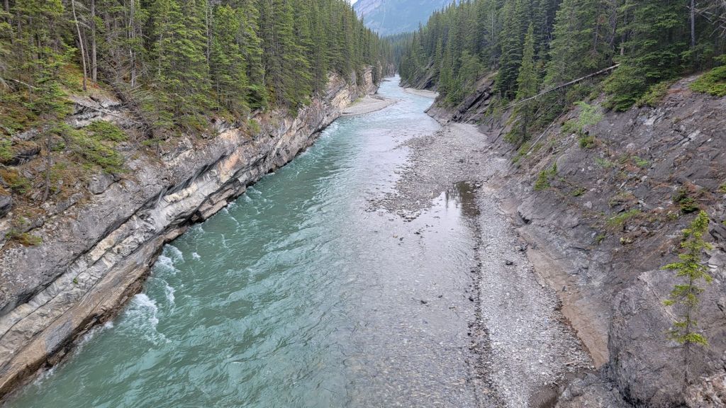
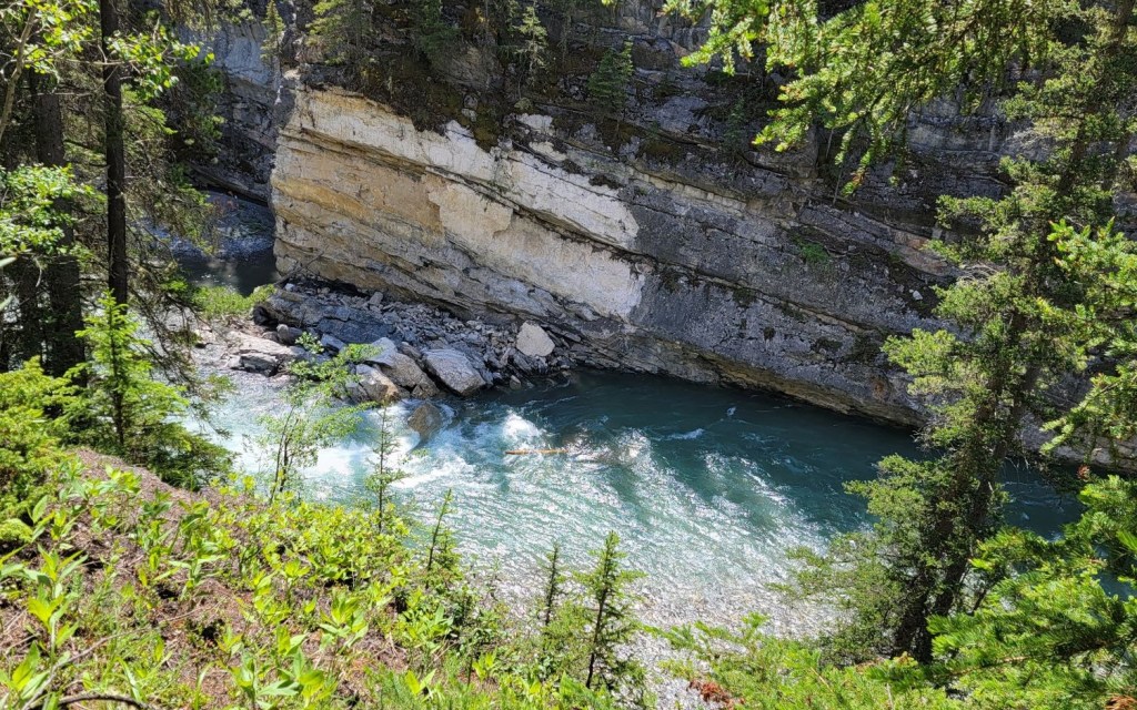
Once all the sheep went uphill, I could hustle down the trail to find my bike. I biked back to Stewart Canyon. I again stashed my bike, and walked up the path for a ways, enjoying the view of the canyon below.
When I got back to the Lake Minnewanka day use area, it was a zoo! There were Parks Canada people everywhere, directing traffic and people. The parking lot was full, with cars jammed packed doing a slow circle, waiting for a spot to open. The smart ones had taken Roam Transit from either Canmore or Banff, and enjoyed a stress-free commute to the lake.

While the distance to hike up to the Aylmer Fire Lookout makes for a long day, the views more than make up for the distance. If you go, remember to check the restrictions and abide by the regulations. Keep an eye out for wildlife of all kinds.
Thanks for reading! Please do me a huge favour and click the Star button to “Like” it. You can also follow my blog, join my FaceBook page Al’s Adventurers, or follow me on Instagram
Alisen
Totals – Tracked on Gaia (click to download track). Displayed on Strava
Date: July 1, 2022
Group: Solo – Alisen
Distance: 26 km
Elevation: 816 m (2,692′)
Time: 6 hours 46 minutes (includes bike dickering, lunch, and side trek down Stewart Canyon)
I love all things mountains! I live next door to the Canadian Rocky Mountains, however I travel the world to enjoy the many different mountain environments and cultures that I can. I hope you enjoy these trip reports, and that it inspires you to accomplish your own adventure goals.

Another great one. 🙂 … love the Herding of the Sheep bit. 😀
Yeah – an experience of a lifetime. I spent last week with mountain guides and they were shocked I was able to get that close for that long.
Happy travels you two!
We were in Banff just before the Canada day long weekend and it was still insanely busy. We pretty much woke up before 6:30a.m most mornings to guarantee a parking spot and to hit the popular trails before they became too crowded. We hiked to Stewart Canyon, but didn’t go further as we were exhausted from hiking to both of the tea houses in Lake Louise earlier in the day. I’ll have to put Aylmer Lookout on my list for next time. I got a good laugh from the game you played on the trail about whether it was hot or a hot flash. It was definitely hot and even hotter on the uphills. How fun to spot some wildlife on the trail too. Great job with the “herding”.
Good job on getting up and after it. That’s the only way to have success in Banff and Lake Louise these days. Crazy busy.
Stewart Canyon is beautiful. You got the best part of the trail.
Awesome job hitting up both Tea Houses! Did you do them in one day? Up and over the Big Beehive? I’m impressed!
No kidding. It helps that we’re both morning people, so it’s not too much of a hassle to plan our day around waking up early. We did both of the tea houses in a single day. Big Beehive was still covered in snow and the conditions were listed as hazardous online. Instead we took the Highline Trail from Lake Agnes to Plain of Six Glaciers. The tea house at Lake Agnes was very popular, but the one at Plain of Six Glaciers was mostly empty. There was still some snow on the Plain of Six Glaciers trail, which probably helped keep the crowds away, so I’d say it worked out rather well.
You are very lucky to have no crowds at Plain of the Six Glaciers. That’s my favourite spot of the two. A bit of snow makes it all that more magical and adventurous. I think the timing of your trip was ideal. While you did have some snow, you also avoided the crowds, which is worth it’s weight in gold.
Agreed, the hike through the Plain of the Six Glaciers is definitely more scenic than the one to Lake Agnes where it’s mostly through the forest. And yes, the snow definitely added an extra element of challenge and adventure on the trail. I’m so glad we wore our proper hiking boots instead of running shoes!
Oh yes – excellent choice. Proper footwear can save your day. Always be prepared for anything in the mountains and you’ve done a great job of that.
Thank you for taking me on a virtual tour with you. The sights are breathtaking 🌼
Awww. You are so welcome!!! It’s a beautiful part of the world 💖💗💖
Indeed😍
I always love reading your trail tails, they are full of adventures and interesting details. The end story about you being a shepherd today was wonderful and also your video. I have some sympathy for your bunion! I have been struggling more and more with my ankle and on the 11th of July I have surgery on two tendons and my ankle bone. I am still recovering (probably due to my age and also having had the injury for so long. But icing in icy water is marvelous for taking swelling down.
I hope you are recovering well from your surgery. My friend had both knees replaced (she’s over 65) and it is taking her a long time to heal and get her mobility back. Please let me know how you are fairing now.