August 10, 2022
This is Day 3 of 6 in the Ultimate Sawback Range Backpack in Banff National Park. To see the trip overview and daily breakdowns, click HERE.
After way too short of a sleep, it was time to get up and do it all over again. Yesterday was a big 20 km day with epic views, high passes, and gorgeous lakes. Today … not so much. You can’t hit it out of the park every time.
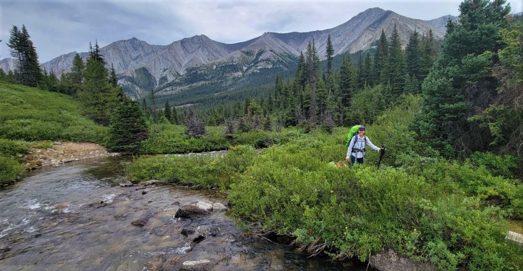
We didn’t leave the campsite until 9:00 am, which was fine for the meager 10 km of distance we needed to cover. After yesterday, I was ready for an easier day. We had big plans to do some side trips, but as this area of Banff doesn’t see too many hikers, the trails were overgrown. The thought of a buggy bushwhack did not appeal to either one of us.
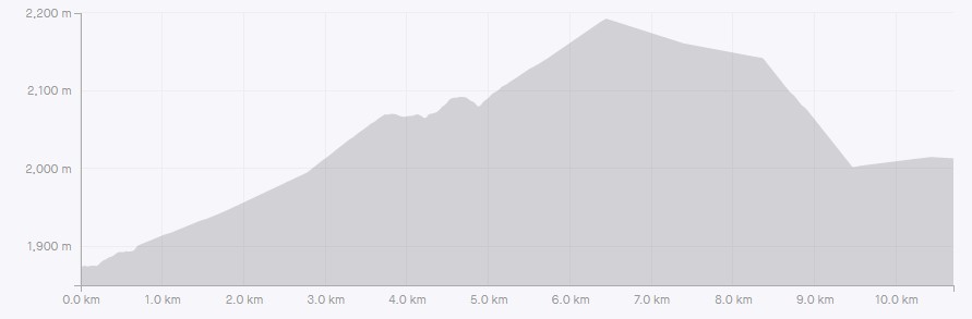
Day 3 Overview – Mystic Junction Campground to Sawback Lake Campground
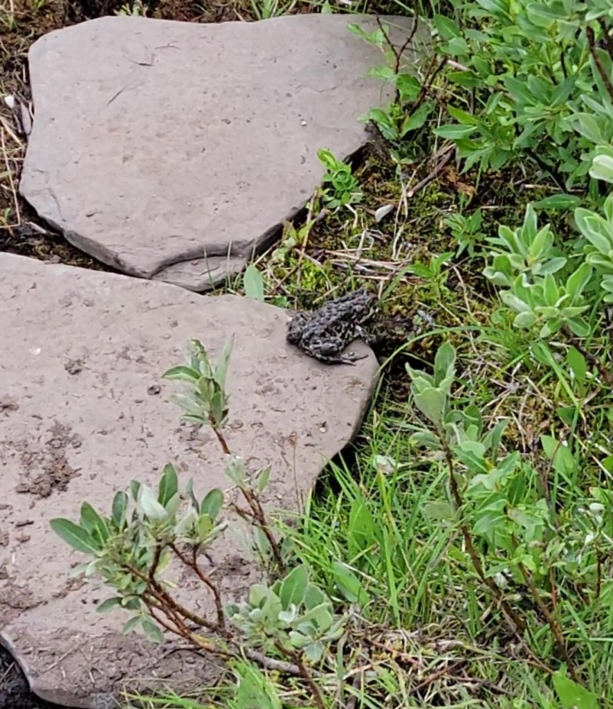
It is a straight shot north to the next campground. Don’t miss the turn off for the campground. The highlight of today’s backpack? The toads!
After setting up our tents, we hiked over to the actual Sawback Lakes.
Totals – Downloadable Tracks on Gaia, Displayed on Strava
Date: August 10, 2022
Group: Two (Alisen and Erin)
Distance: 10.5 km (official distance is 8.6 km)
Elevation: 350 m (1,155′) Gain
Time: 3 hours 10 minutes (includes snack breaks)

Mystic Junction to Sawback Lake
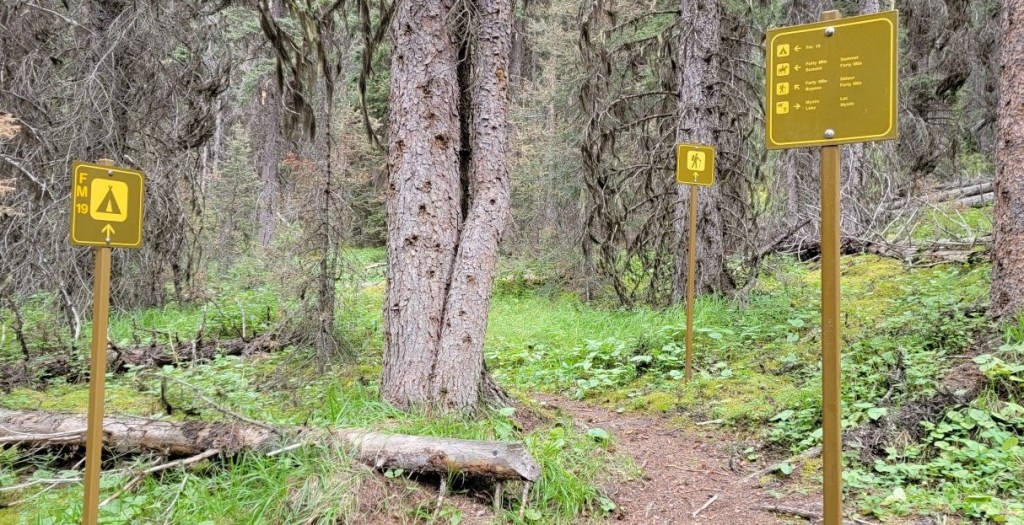
As per usual, the hardest part of our day was finding the trailhead. Since we came in from the Mystic Valley on the west, we didn’t take the main north-south trail system. We hunted around, and finally found the trail above us, on the bench to the east of the campsite.
The day was overcast, and hinted at rain. Fortunately, we stayed dry.
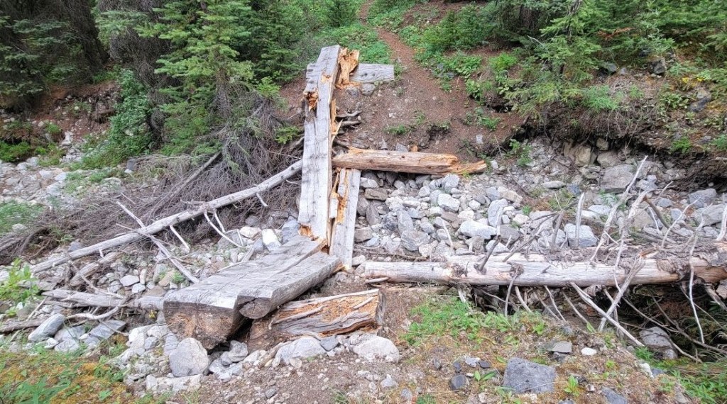
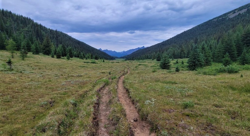
Once on the trail, it was a straight shot north to the next campground. As most people head towards Mystic Pass from here, this trail felt more or less unused. The bushes were overgrown, and the bridges were out in a few spots. We think the horse trail was probably in better shape, but you can never be assured of bridges on a horse trail, so stayed on the hiker’s trail.
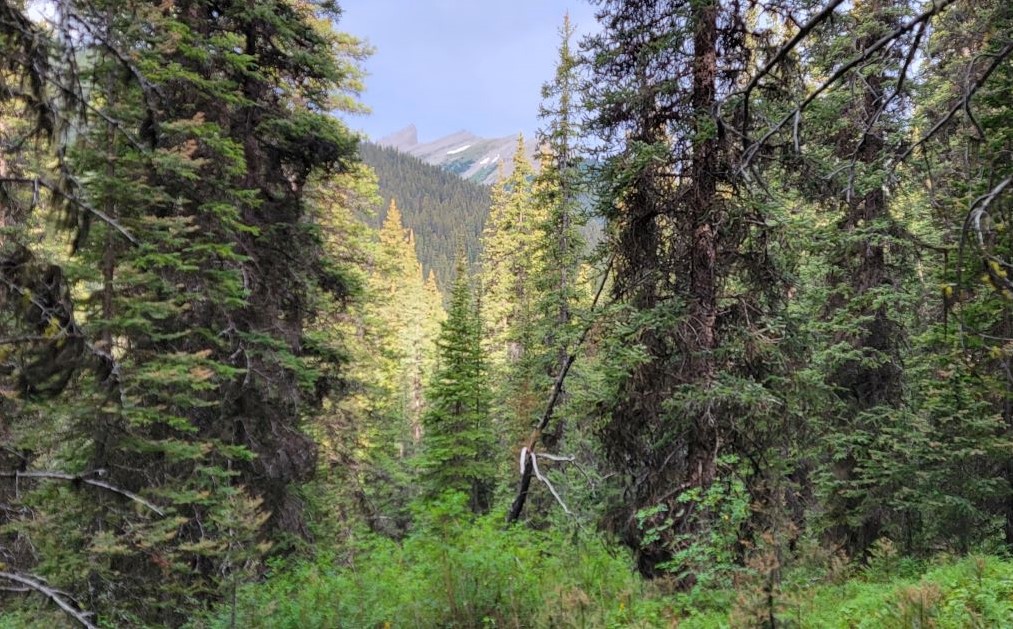
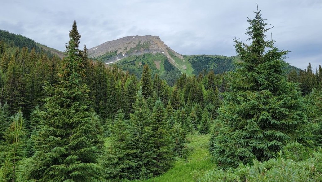
The trail was heavily forested for the first 5 – 6 km, until we hit the “Forty Mile Summit”.

There was one directional sign where the horse and hiking trails came back together. From here on out, the trail was wider and less overgrown all the way to Forty Mile Summit, and onwards to our campsite.
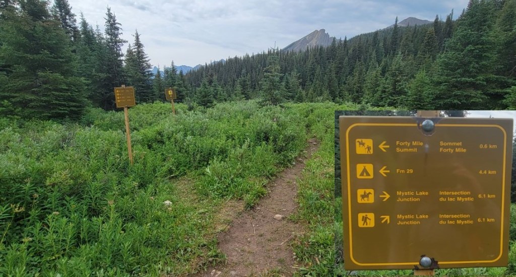
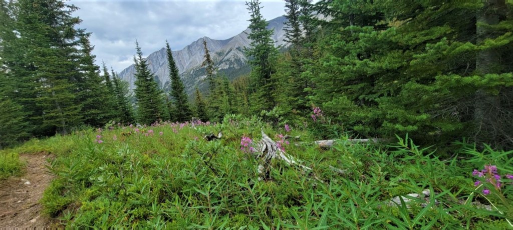
As we neared the Forty Mile Summit, the trees gave way to some gorgeous views of the surrounding mountains.
If you are hiking past Sawback Lake and continuing on to Flint’s Park, look for a side trail on the right that bypasses the cutoff to Sawback Lake. This will save you some distance, and takes you on the Rainbow Lake trail. We were considering going to Rainbow Lake as something to do, but thought the trail looked too overgrown to bother with an extra bushwhack. With all the lakes being closed, we decided to hike to our own Sawback Lake instead.
After about 8 km of hiking, the trail took a steep dive back down into the valley on the other side of Forty Mile Summit. Unfortunately, I didn’t get any photos of this descent. It is very steep, and the trail is eroded and rocky. I can’t imagine riding a horse down that, but people must do it just fine.
Once in the valley, the trail turns west and heads towards Sawback Lake. We crossed a bridge or two before we reached the Fm29 Sawback Lake campsite. The highlight of this entire section were the many leaping toads! We had to watch our step.

Distance to the Fm29 Sawback Lake campsite was 10.5 km with an elevation gain of 350 m. Time from camp to camp was 3 hours and 30 minutes.
Fm29 Sawback Lake Campsite
This campsite (and the whole area) definitely felt underused. We didn’t see anyone on the trail all day, and there was no one in the campsite. We were joined by another couple from the US that evening, but they didn’t arrive until around 7:00 pm.
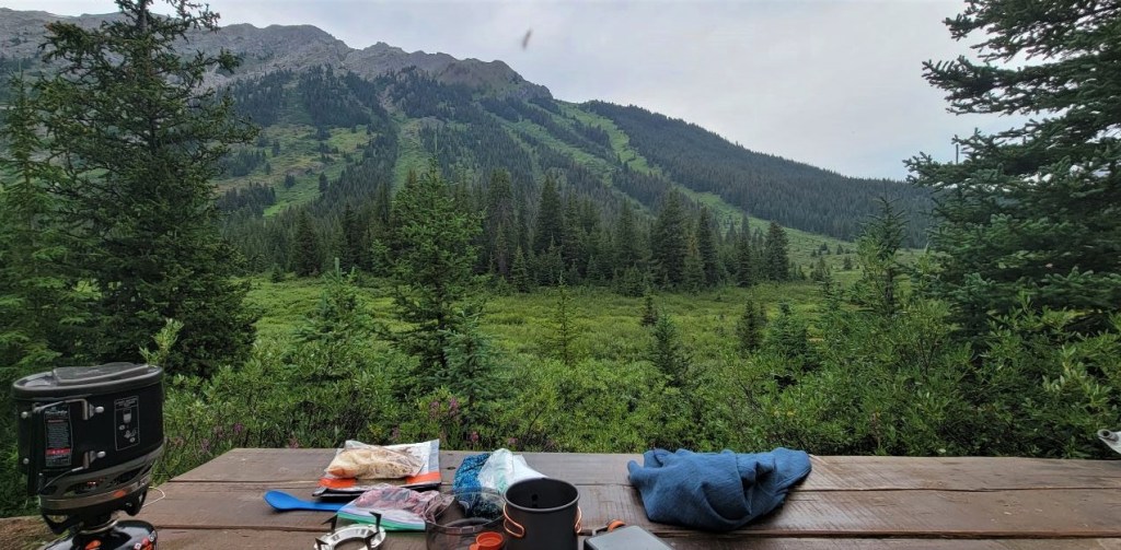
There are five tent pads, and they are all in a row. If there was a snorer, it would keep everyone awake. The tents were closer to the water, but across the meadow from the food storage and prep area. I do appreciate keeping them separate. I also really appreciated our 3 litre water filter bag that reduced the number of trips we need to take for water.
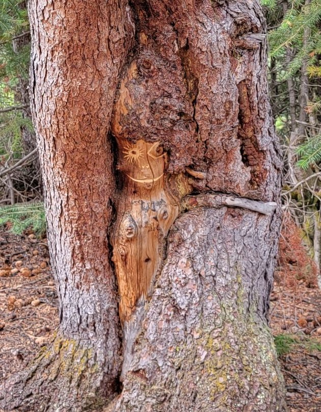
The tent area had some nice touches though, like horseshoe decorations on the trees, and someone carved a little face into one of the trees. The views from the food area were stunning.

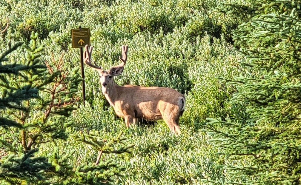
The area between the tent pads and the food prep is a wide flast area completely choked out by willows. I think they used to allow grazing here, but no more. You’d think seeing wildlife in the National Park would be common, but it’s not. This area was quiet enough that a young buck wandered into camp.
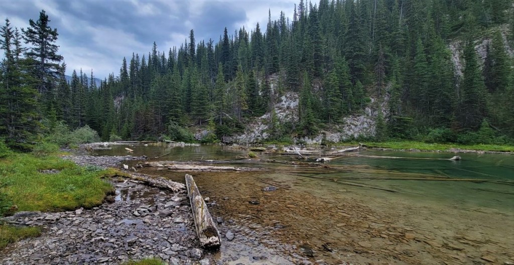
Sawback Lake
We got into camp around 12:30 pm, set up our tents, and ate lunch. With hours to kill, we decided to hike to Sawback Lake.
From the campsite, I clocked a total of 2.2 km return to the lake. The map shows it is 1.8 km (one way) from the trail turnoff to the lake. While not far, the trail was also suffering from the long lasting snowmelt. The trail was very wet and boggy, and we had to jump from dry ground to dry ground. I was glad I wore my hiking boots, even for such a short trip.
Sawback is a long lake at the base of the mountain cirque. The shore was boggy so we couldn’t really go past the initial outflow. Still, it was great to see a lake today, and to kill a bit of time.

Today’s hike was all about getting from point A to B. While not overly pretty or epic, it was nice to have a ‘moving’ rest day. Hiking 20 km every day is a good way to burn out and get hurt. At only 10 km, it would have been easy to keep going to Flint’s at around the 14 km mark. However, that would have made for a very short day for Block Lakes tomorrow, which is the final campsite prior to Badger Pass.
Click HERE for Day Four as we hike out of this valley, and turn west to the beautiful and aptly named Block Mountain.
Thanks for reading! Please do me a huge favour and click the Star button to “Like” it. You can also follow my blog, join my FaceBook page Al’s Adventurers, or follow me on Instagram
Alisen
I love all things mountains! I live next door to the Canadian Rocky Mountains, however I travel the world to enjoy the many different mountain environments and cultures that I can. I hope you enjoy these trip reports, and that it inspires you to accomplish your own adventure goals.

Always impressed with your hikes. Just wish I was 20 or 30 years younger…
I hear ya! I know those days are coming, so I’m trying to do as much as I can now. Still, I encourage people to find adventure anyway it suits them. It doesn’t have to be an epic six day backpack. Adventure can be found in your hometown. I know you’ve travelled the world, and probably have many adventures to share.
Enjoy, and thanks so much for stopping by.
Alisen
I enjoyed reading this account of the hike. You were in a wonderful locale. So much of Canada is beautiful.
Canada is a big beautiful country, and I’ve only scratched the surface of discovering a small corner. I could be at this for years and not feel like I got anywhere.
Lovely post and great hike!
Thanks buddy! More good stuff to come on Day 5.
That is one B52 of a bug! 😀
LOL! I know, right? I often forget the bad parts of trips, but this photo helped remind me of the pain. I have a few photos of my face, pockmarked with giant bug bites. It was brutal.
For being not the most scenic day of the trip, this is still pretty darn scenic!
Thanks Diana. We get back to better scenery on Days 4 and 5. I really shouldn’t be so judgmental 🙂