August 11, 2022
This is Day 4 of 6 in the Ultimate Sawback Range Backpack in Banff National Park. To see the trip overview and daily breakdowns, click HERE.
We had another relatively easy day to hike from Sawback Lake to Block Lakes camp. We were up early and on the trail by 8:45 am. The couple we shared the campsite with were perhaps just beginning to stir when we left. As I really don’t like the heat, and hiking in the hottest part of the day, getting up early is a small sacrifice to enjoying myself on the trail.
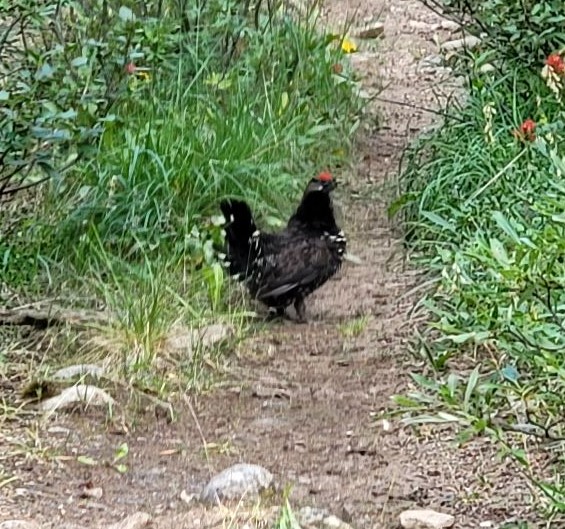
The hike out of Sawback Lake camp was uneventful, other than the dozens of Mountain Chickens (aka Grouse) that we saw on the trail. These birds were surprised to see anyone on the trail, another indication of having the place all to ourselves.
In fact, Erin I wouldn’t see anyone for another 1.5 days, well past Badger Pass.
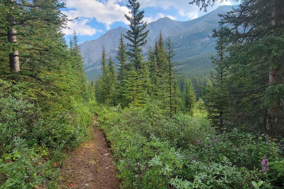
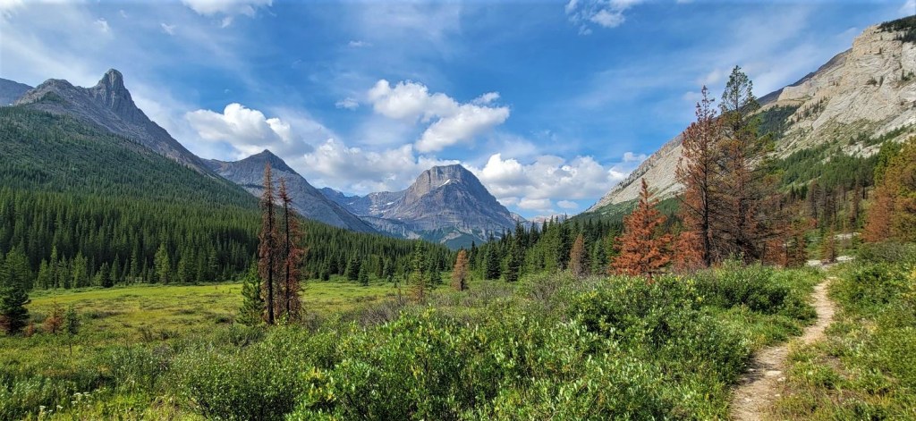
For not much effort or elevation gain, we were rewarded with scenery that just kept getting better and better. Coupled with the animal sightings, it was a fantastic day.
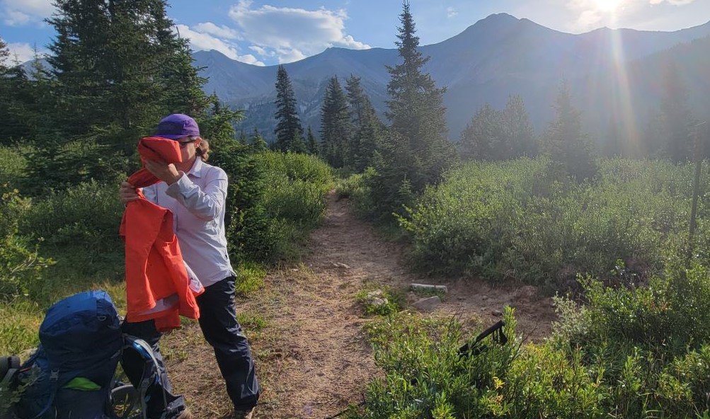
Once at camp, and at the half way point of our backpack, Erin and I decided it was a wash day. We arrived early enough that we could set up camp, and headed to the river to have a proper wash, with bio suds of course.
We just got everything dried and packed up when the thunder and lighting started to roll in. I was getting weather updates daily on my InReach, so we knew this was coming. While I prefer to stay dry, I was suitably impressed with how my new Big Agnes lightweight tent held up in a hail storm. Not a problem!
Day 4 Overview – Sawback Lake Campground to Block Lakes Campground
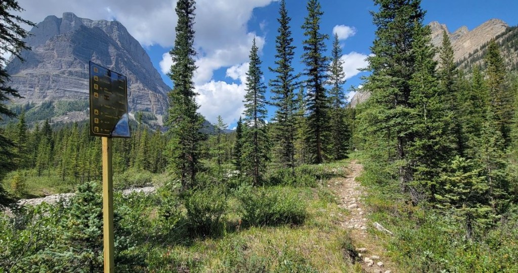
From Sawback Lake campground, we hiked north towards Flint’s Camp. At the Warden’s cabin, we turned west and headed to Block Lakes. There are two navigation spots. The first is a Y junction that is not on the map. The next is a washed out section of trail. This is flagged on both ends with a single bit of orange tape. Once past the washout, it’s a straight shot into Block Lakes camp.
Totals – Downloadable Tracks on Gaia, Displayed on Strava
Date: August 11, 2022
Group: Two (Alisen and Erin)
Distance: 13.5 km (official distance is 10.6 km)
Elevation: 160 m (528′) Gain
Time: 3 hours 59 minutes (includes snack breaks)


Sawback Lake to Block Lakes
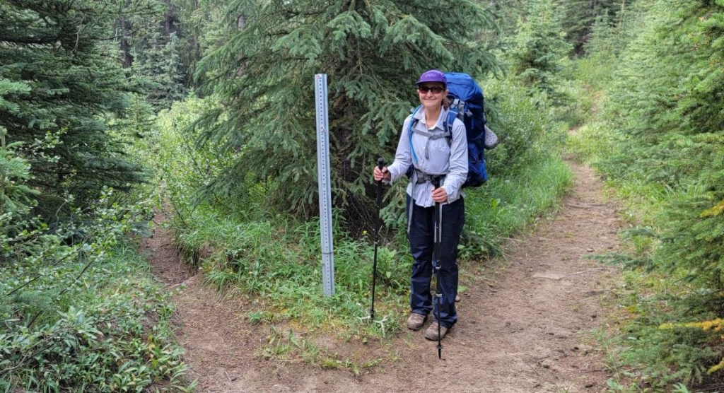
We woke up to another gorgeous day in the Rocky Mountains. Erin and I now had breakfast and decamping down to a science, and we were on the trail by 8:45 am. We continued hiking north on the main trail, which was in pretty good shape to begin. It then degenerated into a Willow-fest. With the morning dew, slapping against the wet leaves of the willows was enough to soak our pants and get our socks wet. Erin was wearing her rain pants, so guess who got to go first and whack off most of the moisture? 🙂


At around 3 km from camp, we came to the Rainbow Lake junction. This is the bypass route if you are not staying at Sawback Lake.
Just after 4 km from camp, we crossed a creek. This outflow is from the next valley over from Sawback Lake.

One of the best parts of today was the wildlife viewing. I spotted a young buck in camp this morning (see yesterday’s post), and there were oodles of cold. sluggish toads as we left camp. Once we were on the trail for a few km, we came across dozens of grouse. There were whole families of birds, none of which were too worried about us. As I’ve been attacked by male grouse before, we didn’t take any changes and gave them lots of warning, and time, to move off the trail.
At around 5.5 km, we left the trees and descended down into the valley. This is an incredible area as it’s the confluence of four valleys, each pointing towards a cardinal point. Plus, it’s the confluence of Cascade River and Sawback Creek. The Flints Park Warden cabin is nestled in the northeast corner, directly below Flints Peak. with amazing views of Noetic Peak and Block Mountain.


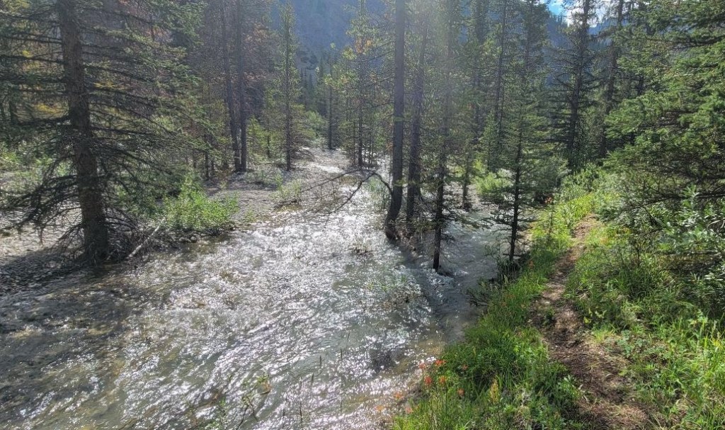
After a short stop at the Flint Warden’s cabin, we turned west for Block Lakes campground, at the base of Block Mountain. This was a very enjoyable trek, as it’s always nice to have soaring mountains to view. The trail was easy to follow, and we even saw a bunny! It was only when we were almost at camp that we ran into difficulty. The trail is washed out, probably from the 2013 floods and high meltwater. There was one little (and I mean little) bit of flagging to warn us. We had to back track a few times until I figured out the way across.
Just a few meters past the warden’s camp, we passed the turn off for the North Fork Pass trail on our right.

After a short stint in the trees, the views opened up for us to view some gorgeous mountains.


We had one navigation aid along the way – a big old arrow! At the time, I thought this was a split for horses and humans. Horses can walk through anything, but humans prefer high, dry ground. However, as we continued, we found the trail was washed out and a detour was needed.


Once on the other side of the flooded area, we found a corresponding bit of orange flagging. I guess we made it!
After this, it was easy hiking into Block Lakes campground. We passed an old sign for what looks like Badger Lakes? I couldn’t see any trails for this marked on my map, but there was a directional sign for people coming out of this area. Hmmm….

We hiked about 13 kilometres today, which included wandering around the Warden’s cabin, and dithering on the washed out trail section. The elevation gain was minimal at ~150 m. Total time to camp was 4 hours, which included snacks, wandering, and ogling the gorgeous scenery, birds, and bunny.
Cr37 Block Lakes Junction Campsite
Block Lakes Campground is a series of five spread out tent sites. As we hadn’t seen anyone all day, and probably wouldn’t see anyone for another day, we decided to camp within eyesight / talking distance, as bears and cougars are always a concern.
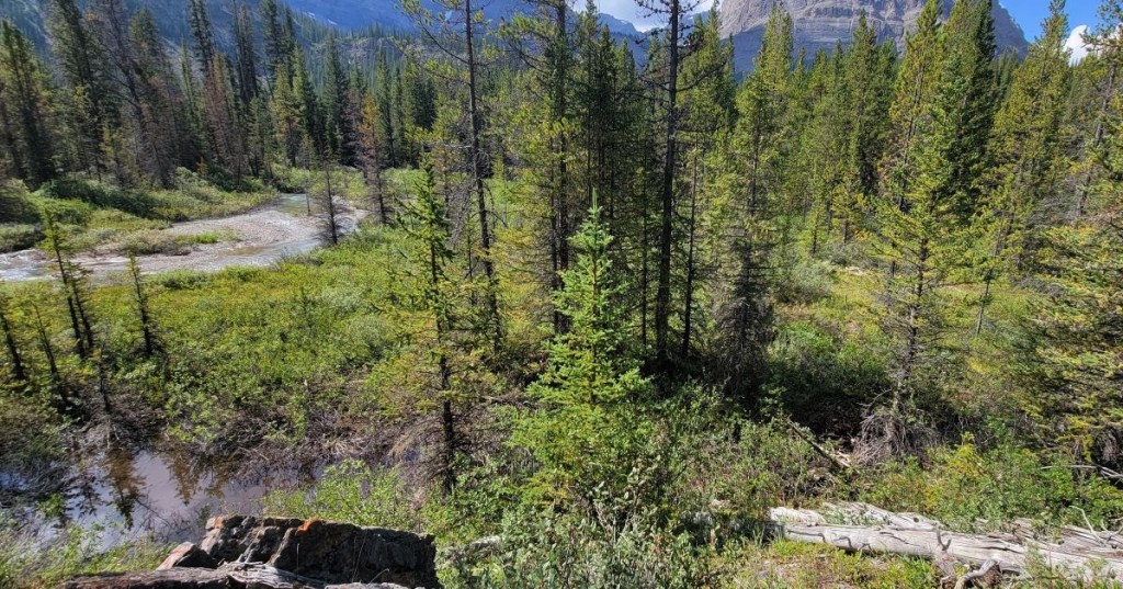
There are two water sources – Cascade River is directly south of camp, and is the closest water. To the west is the outflow from the lakes north of camp. This creek bed is washed out from the 2013 floods, but still pretty. Give it another decade and it’ll be good as new.
As we got into camp just after noon, we set up our tents, and then headed to the creek for a well deserved wash day. Using water-safe bio soap, we had a good wash, and even did our laundry. The temperatures have been around 30 degrees Celsius, and the hiking has been hot and sweaty. To keep my pack as light as possible, I have one hiking shirt and pants, and one set of long underwear that doubles as camp clothes / sleepwear. To get this freshened up? Pure heaven!
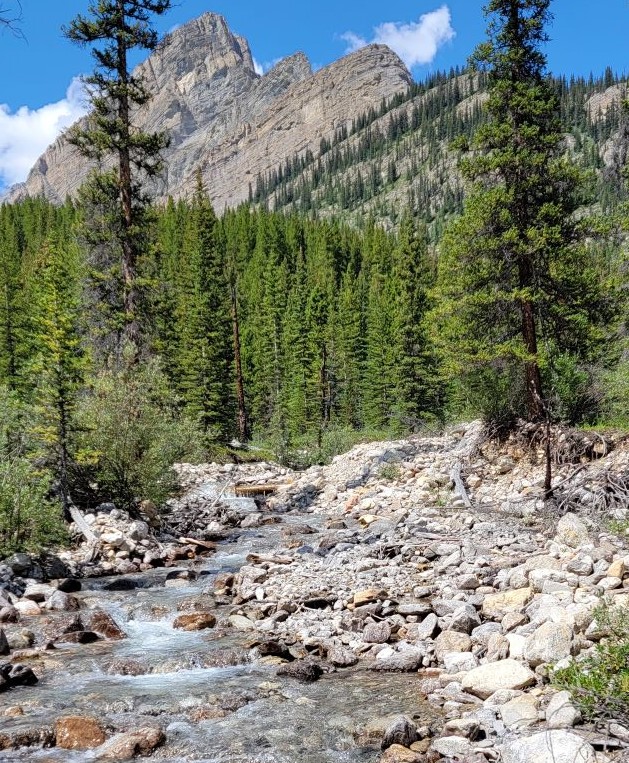
Cascade River is also immediately south of camp, and that’s where we’d get our drinking water.

Today was a delightful day of easy hiking with amazing views, and animal sightings. I feel very fortunate to be in the wilderness of Banff National Park, and being all alone to enjoy the solitude and majesty. While there is a definite reason other backpacks are more popular, one cannot deny the draw of this raw and epic beauty.
Click HERE for Day Five as we tackle our second major pass – Badger Pass. An impossibly beautiful hike that you won’t want to miss.
Thanks for reading! Please do me a huge favour and click the Star button to “Like” it. You can also follow my blog, join my FaceBook page Al’s Adventurers, or follow me on Instagram
Alisen
I love all things mountains! I live next door to the Canadian Rocky Mountains, however I travel the world to enjoy the many different mountain environments and cultures that I can. I hope you enjoy these trip reports, and that it inspires you to accomplish your own adventure goals.

Wow wow wow! Such lovely scenery. I can’t imagine not seeing anyone for 1.5 days, that’s crazy! But it’s good to know there are still some off the beaten path locations in the Canadian Rockies.
I did finally see someone the next day (Day 5). I was so freaked out I screamed 🙂 That poor woman swore at me in French. I’m sure she thought I saw a bear.
I’m sure you’ve found some pretty secluded spots in Colorado. So many places. It’s easy to go to the hot spots, and takes a bit of planning to find something new, but always worth the effort.
MMMmmmmm 😀
🙂 You make me laugh.