August 12, 2022
This is Day 5 of 6 in the Ultimate Sawback Range Backpack in Banff National Park. To see the trip overview and daily breakdowns, click HERE.
This was our second big day of the backpack in terms of distance and elevation gain. We hiked from Block Lakes campground, over Badger Pass, and then down to the next valley to the west. After a long trudge, we finally made it to Luellen Lake campground. I think most people would prefer to spend the night at the Badger Pass Junction campground, but it was fully booked with people heading north into Skoki. This meant an extra 6 km to get to Luellen Lake, but the upside was the absolutely gorgeous lake and towering mountains.
After a long night with three rain storms, Erin and I woke up to wet tent flies. Our tents and gear stayed dry thankfully. We tried to dry the flies as much as possible, but with a really big day ahead of us, we had to pack up and get moving early. I kept my fly and ground sheet on the outside of my pack to prevent getting everything else wet.

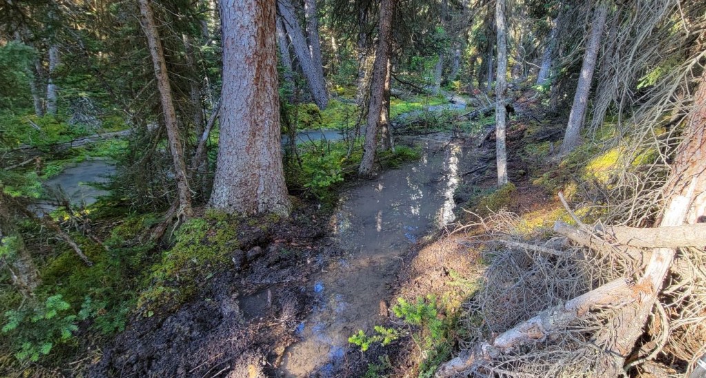
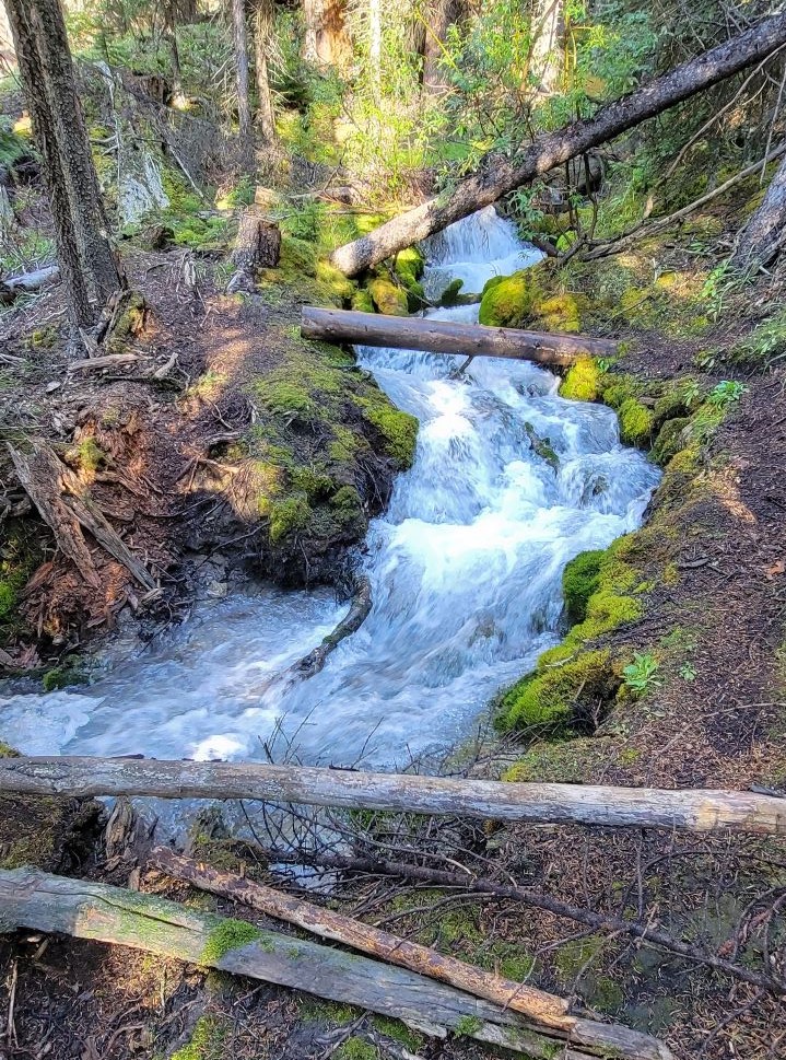
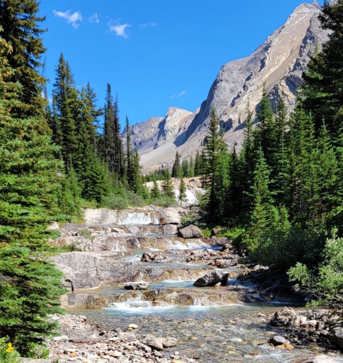
Cascade River was quite swollen due to the rains, and that washed out the trail in a few places. This slowed us down a bit, but the upside was watching fresh water rush over lush green landscapes, which I absolutely love. If we didn’t have such a big day, I could have spent an hour watching the water flow.
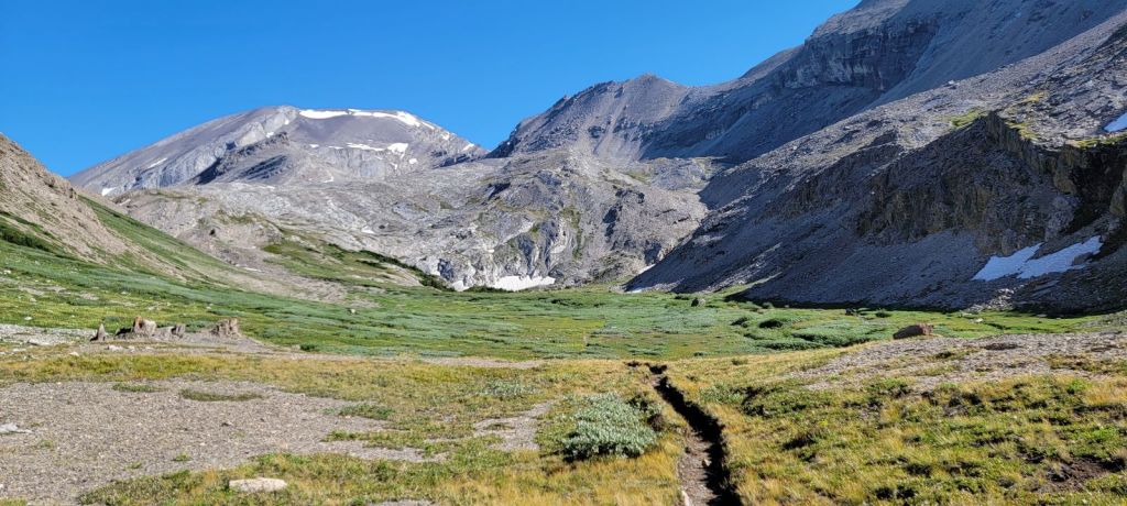
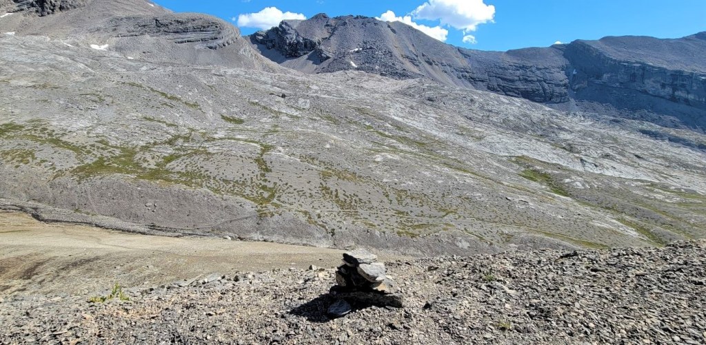
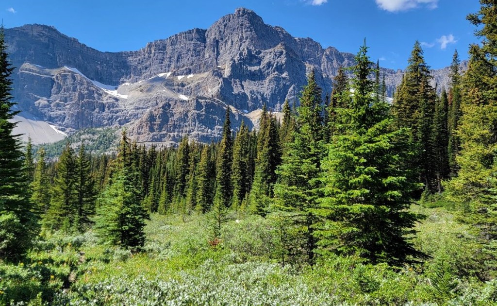
The hike up to Badger Pass was insanely gorgeous, with many beautiful rock formations. Right below the pass I made a navigation error. When doing my planning, I was expecting a certain amount of elevation gain. Since I was short, I assumed we continued north to hit a very steep notch. Good thing I quickly realized my error, as that route leads to Bonnet Glacier.
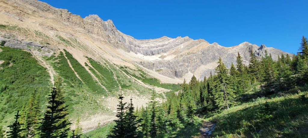
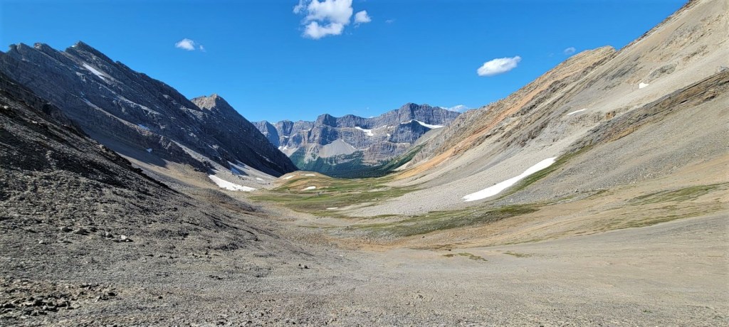
Badger Pass was gorgeous! The rain had cleared out, and we had bluebird skies above. We ate lunch, and spread out our tents and other items to dry before the long trudge into camp. The views – stunning, and we had them all to ourselves. We finally saw people as we were descending off the pass. Indeed, it was strange to see so many people at Luellen Lake!
Day 5 Overview – Block Lakes Campground, Badger Pass, to Luellen Lake Campground
From Block Lakes campground, we hiked west along Cascade River, and turned north to start gaining elevation towards Badger Pass. At about 7.5 km, we crossed a creek and made a sharp left hand turn to ascend a short scree slope to hit the high point of Badger Pass. The valley widened out, and we hiked down through lush meadows, then entered the forest for the long descent. At Johnson Creek, we turned south and followed the trail to Luellen Lake campground.
Totals – Downloadable Tracks on Gaia, Displayed on Strava
Date: August 12, 2022
Group: Two (Alisen and Erin)
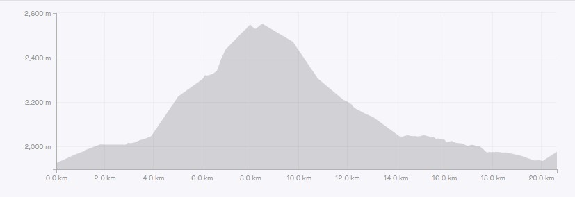
Distance: 19.4 km (official distance is 18.3 km)
Elevation: 753 m (2,485′) Gain, 698 (2,303′) Loss
Time: 8 hours 30 minutes (includes breaks, tent drying time, and lunch)
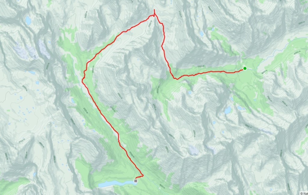
Block Lakes Campground to Badger Pass
Erin and I got right on it this morning, packing up in record time. We hit the trail at 7:45 am, which was ideal for the 8.5 hour day ahead of us. Normally I would prefer to wait for the tent and fly to dry out, but we didn’t have time. We flapped them about to get rid of the majority of the rain drops. I kept my fly and ground sheet on the outside of my pack to keep everything else dry.
I was now getting really tired. I was suffering from hot flashes, which is awful during the day while hiking, but at night in a sleeping bag they pose a different problem. I wear just enough clothes to stay warm but not overheat in my bag. When a hot flash hits, the result is an instantaneous whole body sweat that quickly makes everything damp. When the hot flash ends, I am left freezing cold. It takes me a while to warm up again so I can fall asleep, only to have another hot flash hit. By the end of the night, I’ve maybe slept a couple of hours, none of it long enough to get some quality REM. After four nights of not sleeping, I do not have the mental reserves to power through a big day like I normally would.
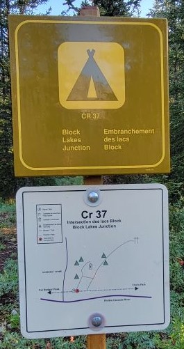
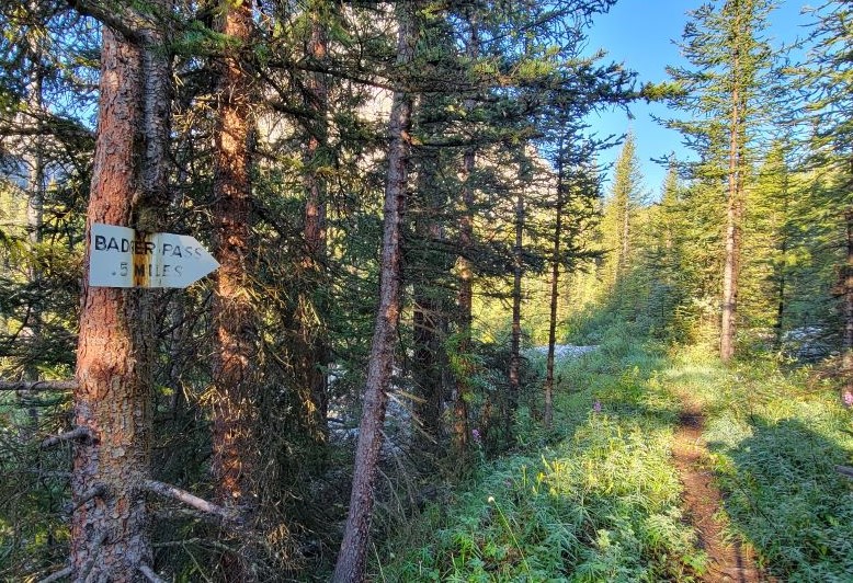
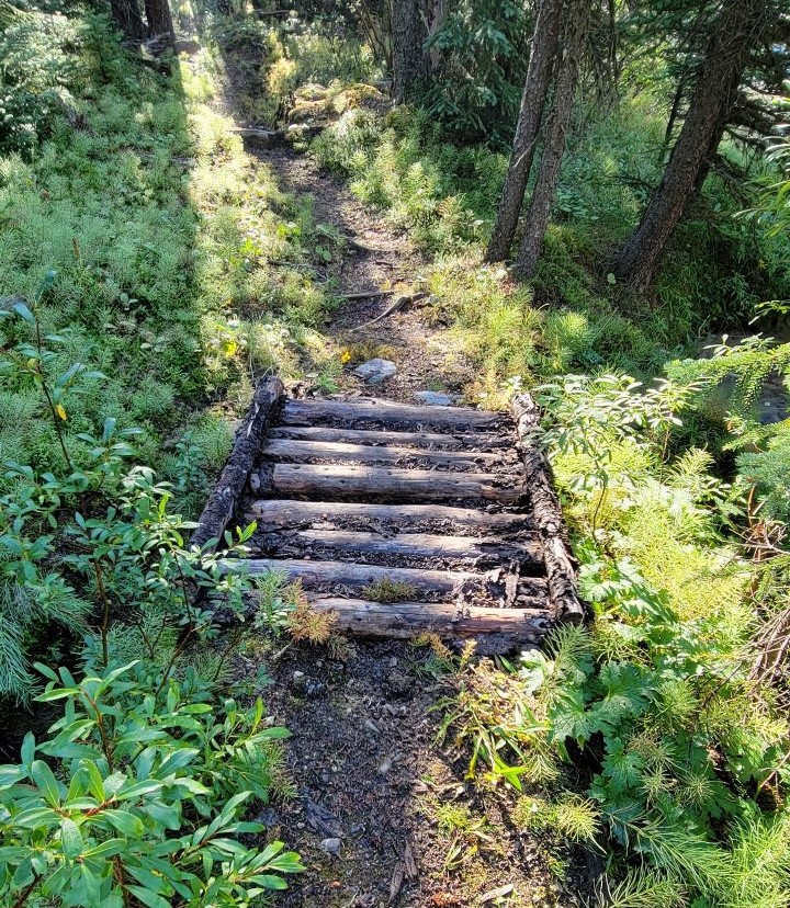
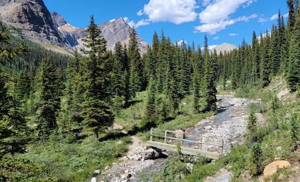
The day must go on though! We hiked west out of camp, following the trail next to Cascade River. There are several braided trails through here, so the map and ancient sign were helpful.
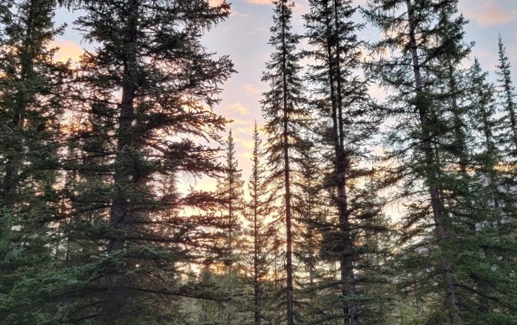
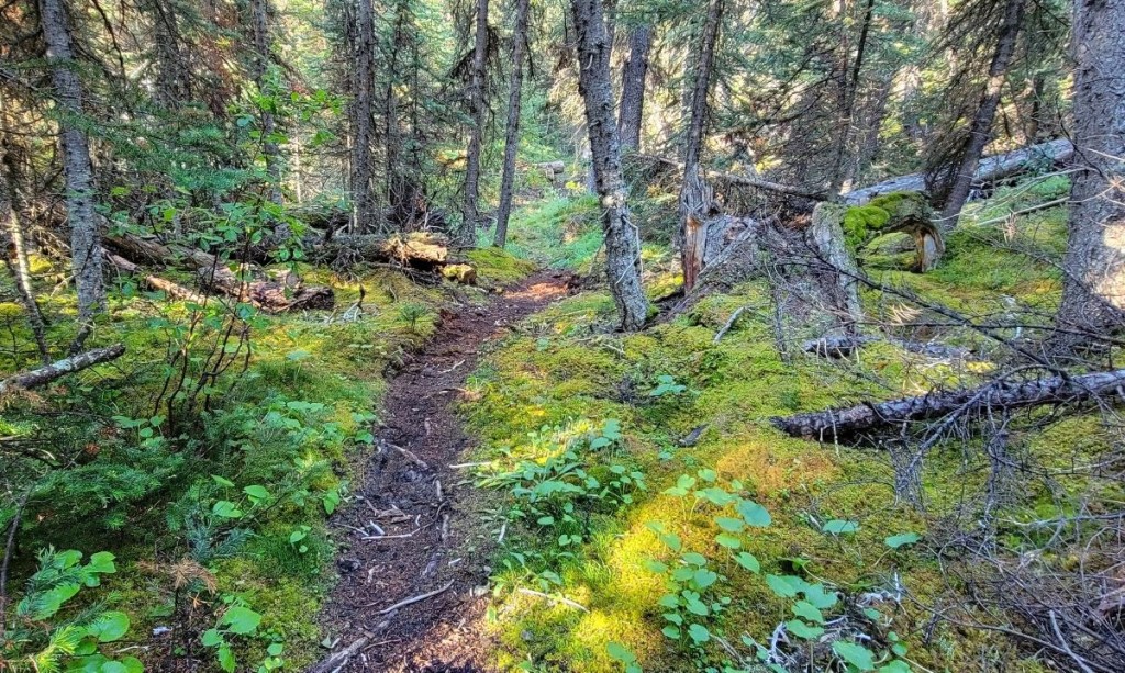
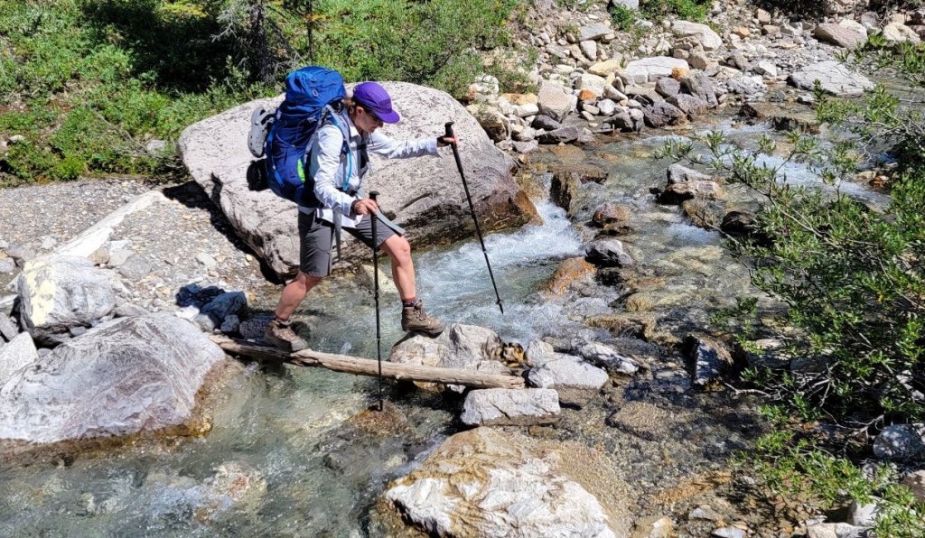
We crossed the first creek, which was pretty easy. After a short but delightful hike through the moss-covered forest, we came to the washed out portion of the trail. Hopefully it’s not this bad every day, but I imagine Cascade River was unusually swollen after all the rain last night.

The hike along the Cascade River is about 3.7 km, but it took us longer to traverse due to the washed out trail. We could pick our way along fairly well, but did have to think about several water crossings. Despite the time, I really enjoyed this section. There is just something special about fresh rushing water, especially on a hot day. It’s pretty rare in Alberta, so I enjoyed it immensely.
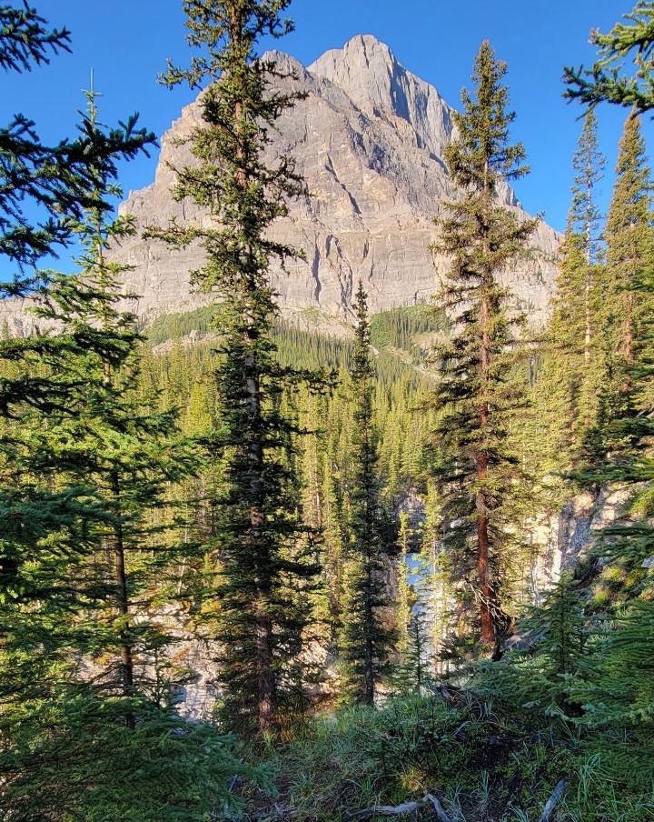
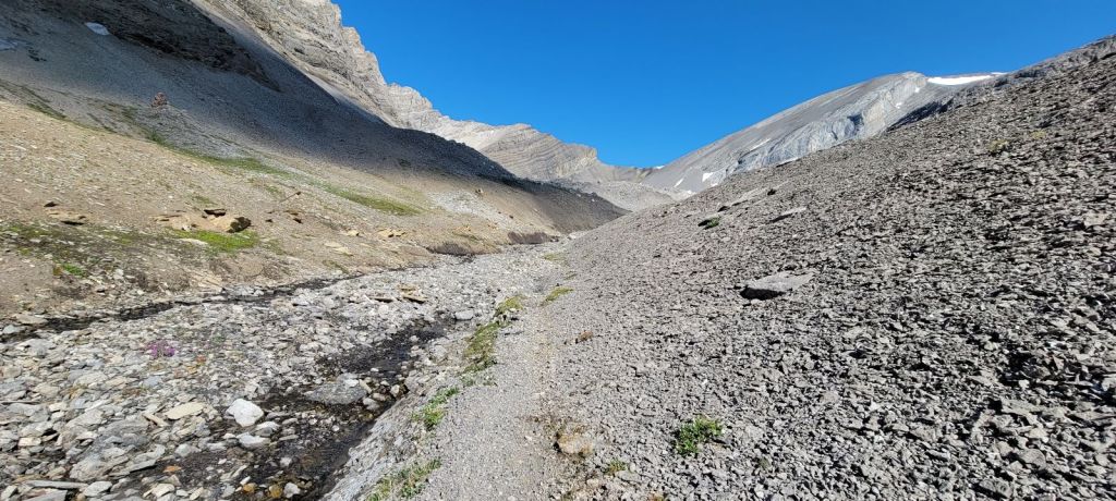
After about 3.7 km, we left the Cascade River and turned north to start gaining elevation in earnest towards Badger Pass. We were between two magnificent mountains, neither are named on my map. The right is the southern most flank of Bonnet Peak, while the left is still the sprawling mass that connects Block Mountain and Noetic Peak. In general, it’s all part of the Sawback Range.
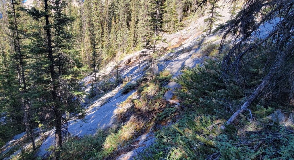
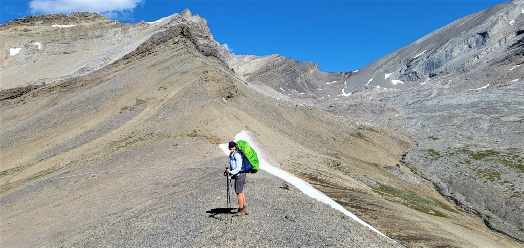
Shortly, the views opened up and revealed one amazing vista after another. We stopped for so many photos, but I’m only including an overview here. You’ll just have to visit yourself to see all the glory this pass has to offer.


What did I miss??? On the opposite side of the creek bed, there is a sign that is almost knocked over, facing away from us. We both walked right past it. Funnily enough, the trail up that side was also obscured from this direction. A quick check of my map would have corrected the problem. While we did put on an extra 500 m or so, it wasn’t the end of the world. What clued me in was how the trail completely disappeared once we got to the top of the plateau. It should have been a bigger trail.

Distance to Badger Pass (including detour) was 8 km from Block Lakes campground. Just shy of 750 m elevation gain. Time to Badger Pass was 3 hours and 40 minutes.
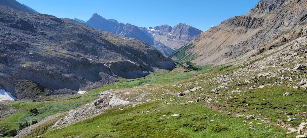
Badger Pass to Luellen Lake Campground (Jo19)
Erin and I hiked down to the meadow, and parked it next to two giant boulders that were brought down from the mountains above. We unpacked and spread out our tents, flies, and ground sheets to dry out our gear. While the rest of the day was downhill, we still had another 11 km to go and every gram counts. By this time, the packs have been cutting into our hips for days, and our shoulders are sore.

We repacked our bags, and then continued down the pass towards Johnson Creek. We made sure to get our fill of the views before we hit the forest.


At the 13 km mark, we hit the turn-off for Badger Pass Junction Campground (Jo29). On the sign, it’s just noted as Jo29, so we didn’t realize this was the location of the campground. We turned south at this point to head towards Luellen Lake.

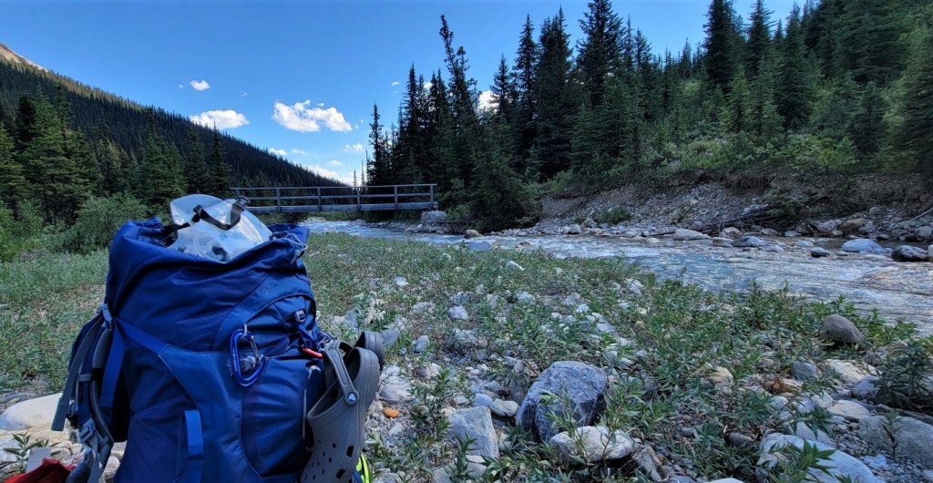
It was another 6 km to Luellen Lake, and I was hot, tired and cranky. My Osprey Ariel 65 litre backpack has a ridiculous chest strap that’s prone to breaking. I have already replaced it once, and it broke again on this trip. It kept popping off, and poor Erin had to fit it back on. I had just completed a 7 day mountaineering trip, and my hands were still torn apart from that trip so I couldn’t do it. Very frustrating for both of us.
After a day in the hot sun, we found a nice spot along Johnson Creek to refill our water bottles. We still had some water, but replacing it with fresh ice cold stream water? Ahhh. That hit the spot.

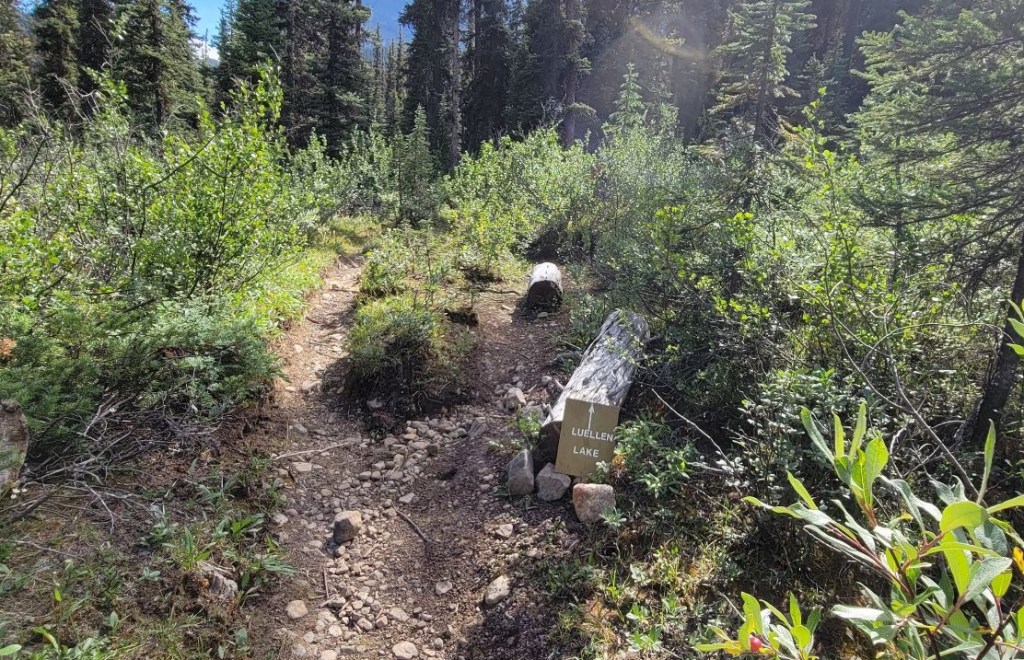
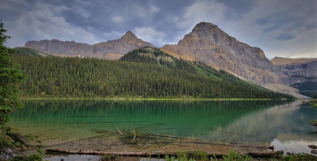
Jo19 Luellen Lake Campground
We wandered into camp, and were surprised with the amount of people! The place was packed. Turns out, there is another campground about 1 km away, but people spend the day at the lake, eat their meals here, and then go back to their campground to sleep.
Like all the other campgrounds on this loop, it had five tent spots. We felt very lucky to have our spots, as we knew this was a very popular location. The lake is gorgeous, perfectly framed by Helena Ridge above.
We made dinner, and then hit the sack after a long but amazing day in the mountains.
I hope you enjoyed this epic journey from Block Lakes to Luellen Lake. Badger Pass is definitely a worthwhile trip. I thoroughly enjoyed all 8.5 hours and 19 km of this day. What a trek!
Click HERE for Day Six as we head back to the trail head, making a detour through the popular Johnson’s Canyon.
Thanks for reading! Please do me a huge favour and click the Star button to “Like” it. You can also follow my blog, join my FaceBook page Al’s Adventurers, or follow me on Instagram
Alisen
I love all things mountains! I live next door to the Canadian Rocky Mountains, however I travel the world to enjoy the many different mountain environments and cultures that I can. I hope you enjoy these trip reports, and that it inspires you to accomplish your own adventure goals.

Excellent a great journey in order to enjoy about mother nature. A thing is sure you need a great rest time.
Thanks for coming along for the ride. I rested when I got home, for sure. During these treks, it’s amazing what the body can do. Just get up and do it all over again!
We body is a unknown machine when We’re in extreme moments, a thing is sure you were the queen in the trek!. Enjoy and all the best
Again a great post Alisen!
Luellen Lake with Helena Ridge above looks amazing and should you go to scramble/climb that ridge, I will be looking forward to read another post from your blog!
Yes, absolutely! The route is actually up the other side, and I was there about 7 years ago??? There was way too much snow, and I missed the summit by a few hundred meters. Disappointing for sure, but I’ll be back one day.
At least the rain came overnight and not when you were hiking, especially given the long day you had on the trail. I love how lush everything looks after a rainfall though. Plus the forest just smells so fresh. The views of the mountains continue to impress. What a beautiful spot to camp for the night. Luellen Lake looks stunning.
Yes, upon retrospect, the rain was timed perfectly. Considering we were out for a week – things could have been way worse. Sometimes you just get lucky. Fingers crossed for future luck to prevail 🙂
For sure. It’s funny how the weather can make or break a trip sometimes. But hey, it’s all part of the adventure!
Wow, what a beautiful section of trail! I love Badger Pass! I’m impressed that you persevered through the rushing water and exhaustion and everything else (packing up wet gear is the worst) and made it through this long day.
Thanks Diana – it was a long day, and I was getting tired, but the scenery kept me going. Once I got to the top of the Pass and looked around. Yeah… big whoops of joy and a massive jolt of energy. I’m easy to please in the mountains 🙂
Another splendiferous day. 😀
Yup. They just keep coming. I’m very lucky.
Our body… sorry from my fatty fingers