June 4, 2023
Waterton National Park is a real treasure. I love it because it is so beautiful, with very interesting topography and brightly coloured rocks. You just don’t get this in Banff or Kananaskis Country. I also love it because it’s not very well traveled. While some routes like Crypt Lake are packed, others like Ruby Ridge are deserted, on a Sunday!
It’s normally not too warm in early June, but this day was smoking hot. I remember dragging my butt up to the first summit, dying in the heat. Once we got on the ridge though, the wind picked up and we cooled down. The views were stunning in all directions. We hiked across to the East peak, and looked down onto the Red Rock Parkway. The descent was a tiresome slog, with a 1 km walk back to the car on the parkway.

Gear
Hiking boots, poles and regular day pack kit.
Overview
From the Lineham trail head, take the main Lineham Creek Trail. Turn right to start churning uphill, directly to the main West summit of Ruby Ridge. Hike to the east to descend to the col, down-climbing on some interesting rocks. Hike up to the East summit of Ruby Ridge. To return, backtrack to the col, and descend down the ridge to the Akamina Parkway. Hike the 1 km from the First Oil Well In Canada pullout back to Lineham trail head.
Check out the video.
Totals – Downloadable Tracks on Gaia, and Strava
Date: June 4, 2023
Group: Two (Alisen & Mike)
Distance: 10 km
Elevation: ~1,000 m (3,300′)
Time: 6 hours 12 minutes (includes lunch and breaks)


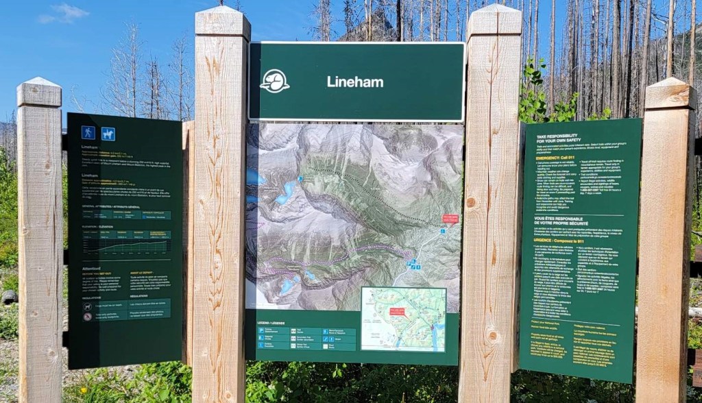
Parking and Trail Head
We parked at the Lineham Trail head, choosing to take the 1.2 km walk at the end of the day instead of the start. As it was already 10:00 am and it was super hot, trying to get the worst of the elevation done sooner than later was a good choice.
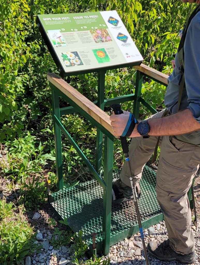
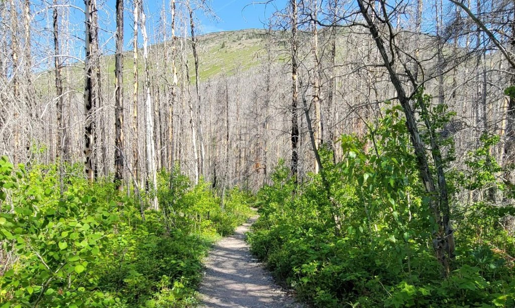
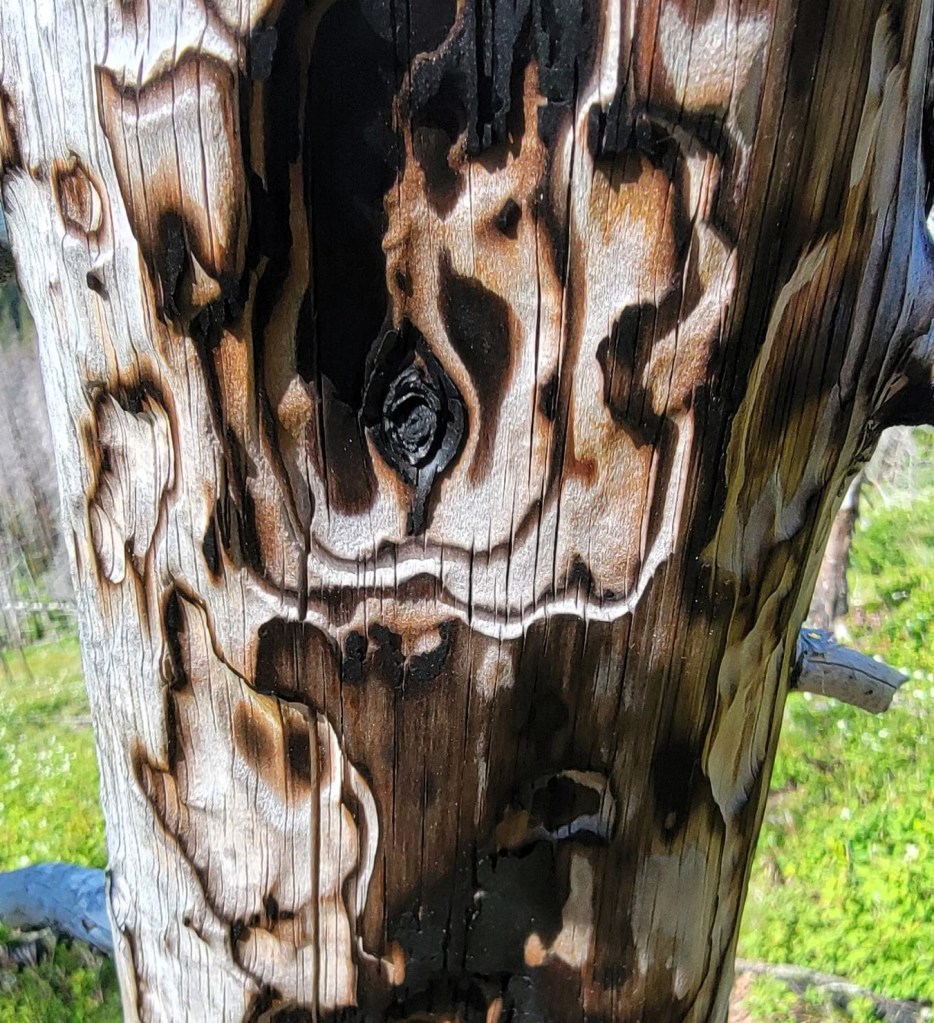
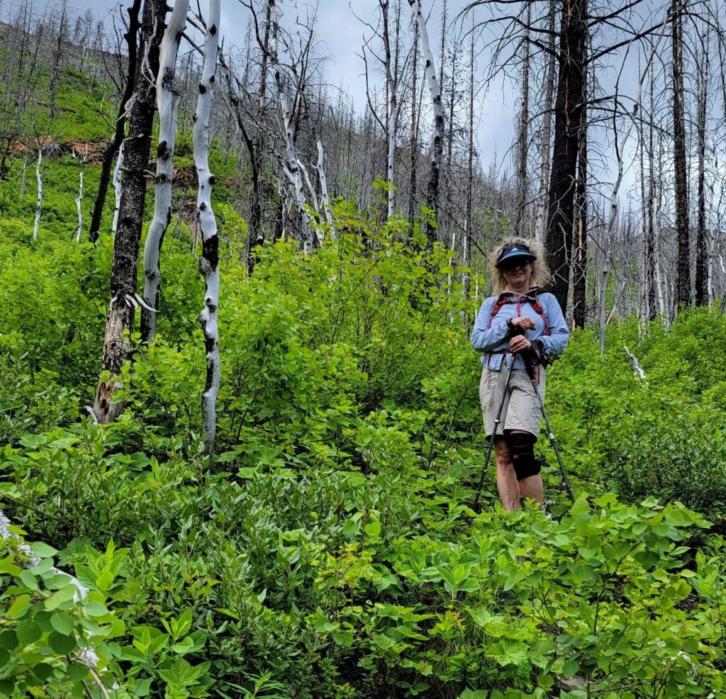
Once we wiped off our shoes to prevent any contamination, we started hiking on the Lineham Creek trail. This leads to the very popular Lineham Falls, which I have never done but hear it’s lovely. This trail is a lesson in rebuilding. The trees and vegetation are coming back quite nicely after the 2017 Kenow Wildfire.
Main Trail
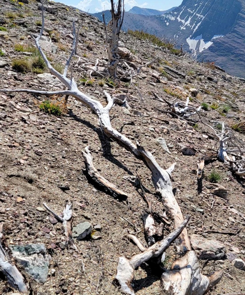
At around the 2 km mark, we started looking uphill for any signs of a trail. Nope. We picked a spot, and headed uphill. Despite this being a straight-up hike, this was a very interesting part of the trail. We passed sections of burnt forest, which was sad to see the loss. However, we also choose to find the beauty.
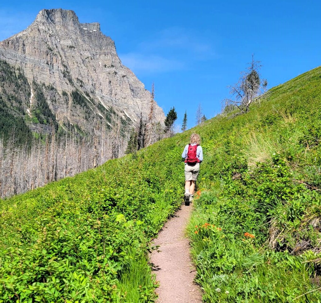

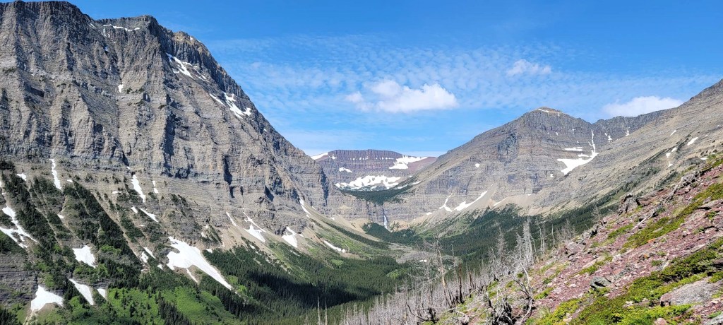
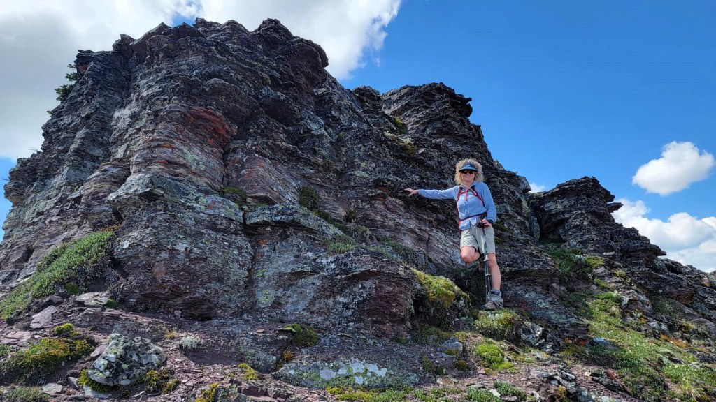
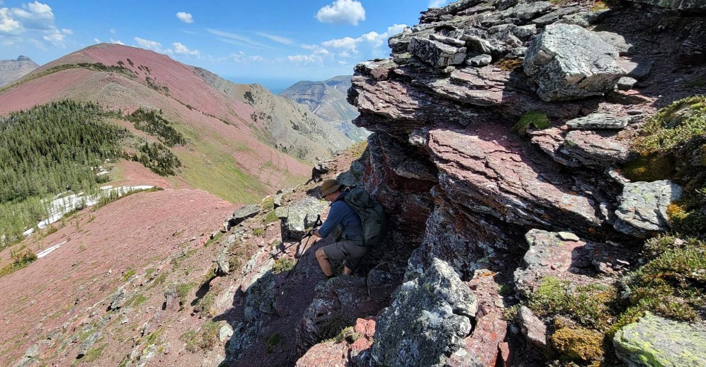
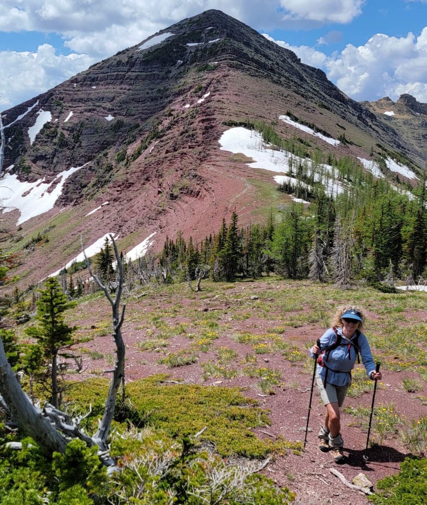
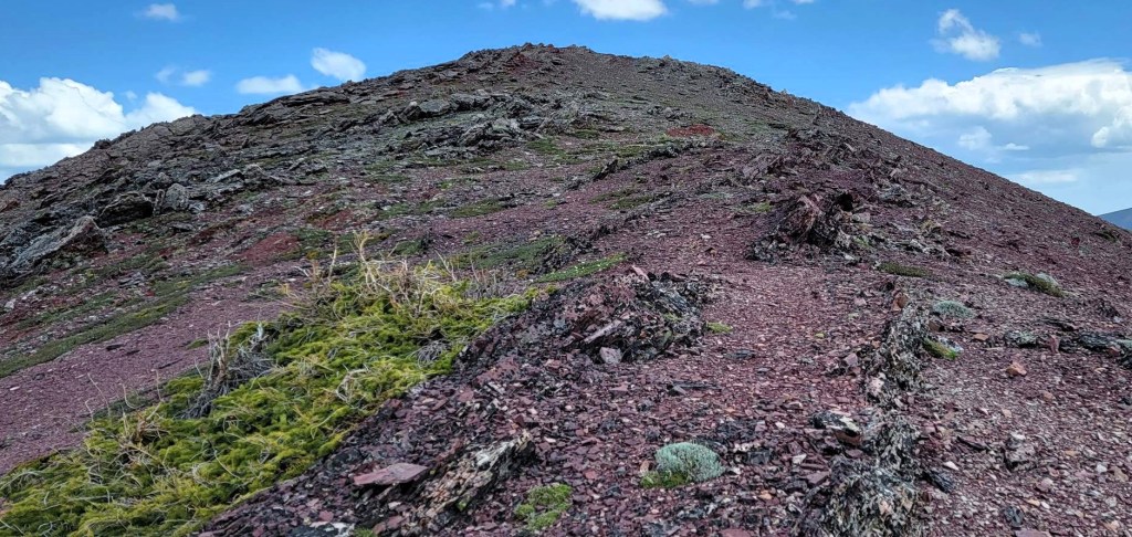
Once we entered the red rock strata, we got some very interesting rock formations. I’m not sure the geology behind this area, but I love it! Anything other than grey limestone is a win, and this was spectacular to see.
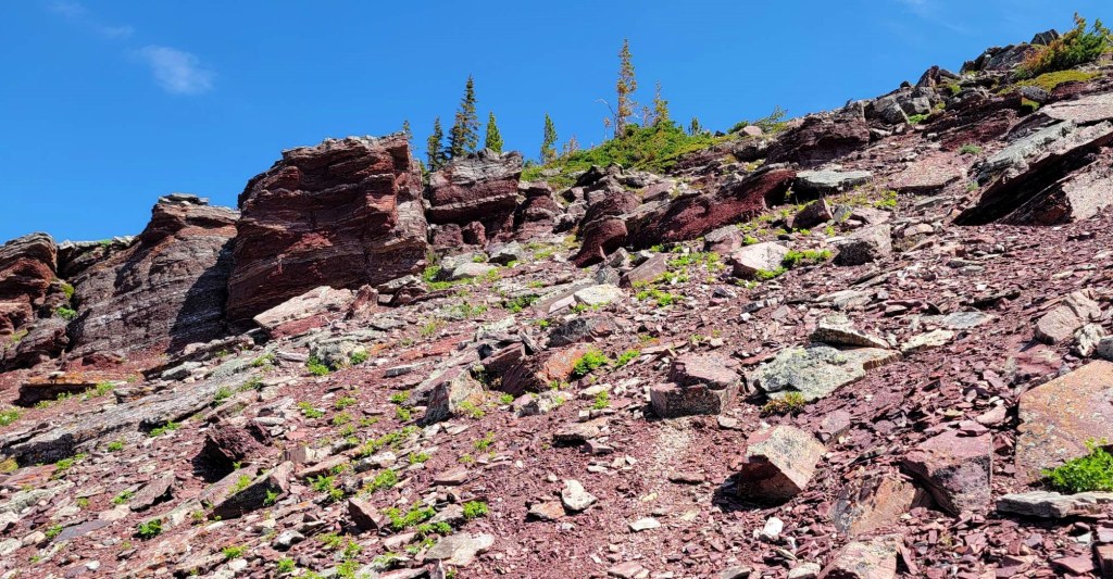
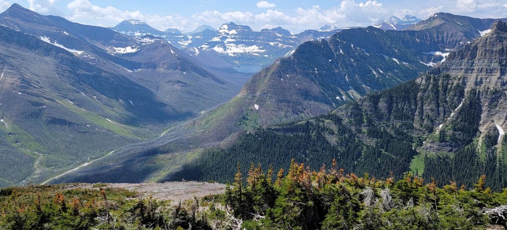
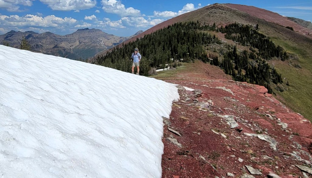
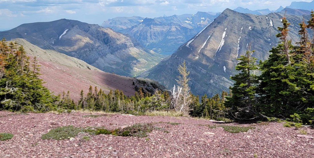
The views along this trail were amazing. The Lineham Falls to the north kept us company for a while, as did the massive peaks surrounding the falls. Simply stunning.

Ruby Ridge West Summit
I remember feeling a bit winded hiking up to the summit, and thinking I wasn’t doing too great. However, when I look at the stats, I think I was too hard on myself. Distance to the summit was 3.77 km, with an elevation gain of about 880 m. We hiked this in just 2 hours and 30 minutes with intense heat. No wonder I was a bit pooped 🙂


Ruby Ridge East Summit
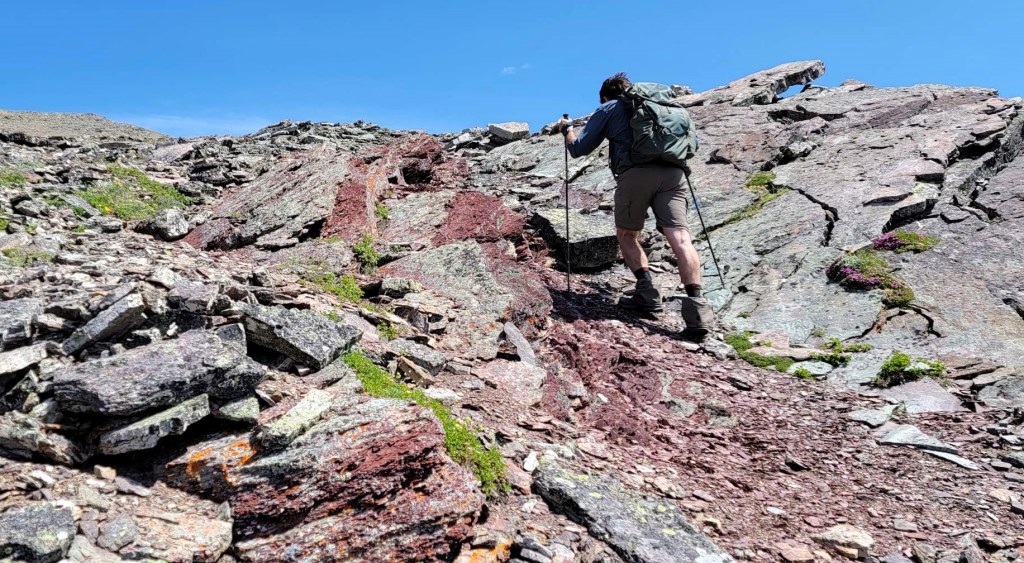
I was super excited to stay up high, and to enjoy these amazing views. We hiked east, and were soon down-climbing a series of short rock bands. This was so much fun! I absolutely loved it. People that are used to straight hiking trails might not be pleased.


Once at the col, we hiked back up to the east summit. There was one steep section, but as it had a cool rock feature, it was all good fun.

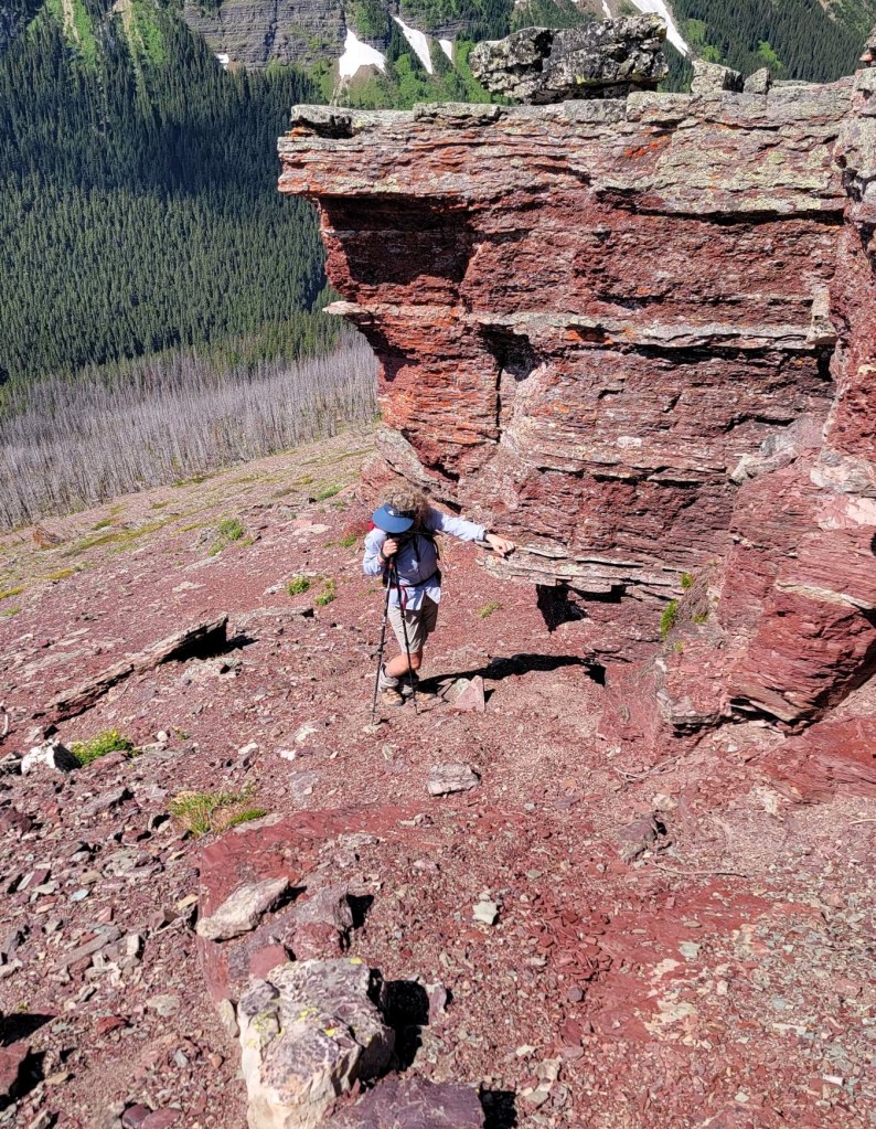
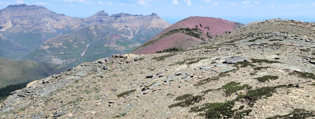
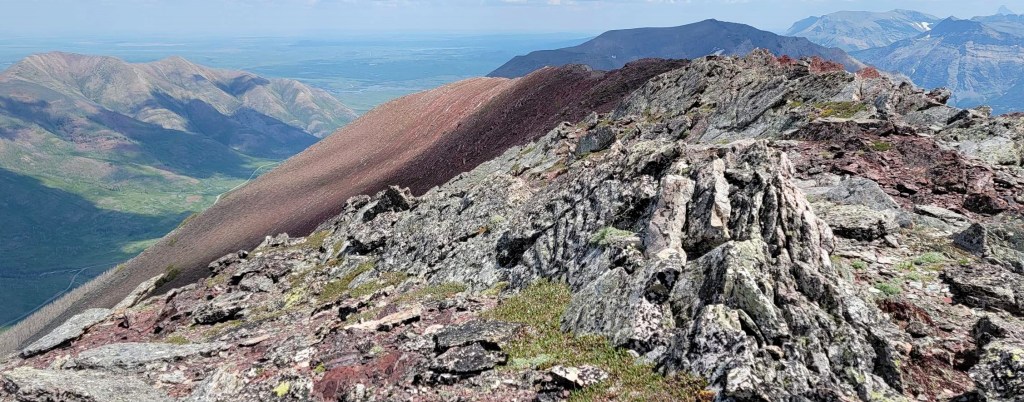
The East Summit of Ruby Ridge has a great views down to the Red Rock Canyon Parkway. I wonder if you had two cars if you could continue on the ridge, and descend down that side. The summit itself is a jumble of jagged rocks, which again you don’t see every day.
Time to the east summit was 3 hours and 30 minutes Distance was 5.22 km, with an approximate cumulative elevation gain of 1,000 m.


Return Descent
To get back, we backtracked down to the col. Again, there’s no trail, so we found a good spot, and headed down. We stayed on the ridge, and were careful to not get pulled too far to the right and into that gully.


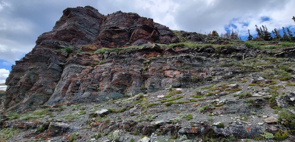
On the ridge, we found a few steep cliffs that we chose to avoid. However, there was one cliff band we could not avoid, and traversed across the face to get past it. I’ve done a lot of scrambling so it wasn’t that difficult, but a regular trail hiker would not thank me for this section.

Once we were below the alpine and into the forest, it was a jumble of dead fall and high bushes – a typical bushwhack. This did slow us down, however we got lucky and found a dried seasonal stream bed. The water had exposed the rock beneath, giving us a free run down.


From the end of the stream bed, we hiked the short distance to the Akamina Parkway road. We ended at the pullout for “Canada’s First Oil Well” historical marker. From here, it was about 1.2 km down the Akamina Parkway and back to the Lineham parking lot.

Wrap Up
I really loved Ruby Ridge. For me, it was a nice mix of route finding and gorgeous scenery. The scenery was both the interesting rock colours and features, while the views were stunning. I don’t think you can go wrong with a hike in Waterton, but Ruby Ridge was really quite special.
Thanks for reading! You can follow my blog, join my FaceBook page Al’s Adventurers, or follow me on Instagram
Alisen
I love all things mountains! I live next door to the Canadian Rocky Mountains, however I travel the world to enjoy the many different mountain environments and cultures that I can. I hope you enjoy these trip reports, and that it inspires you to accomplish your own adventure goals.

I love Waterton, and this is so pretty! What a unique way to see the park. I’m sure these are views very few others ever have.
The view of Blakiston was stunning. I looked up how to climb it, and it’s from the west side. I’m very intrigued now.
It was heartbreaking to hear about the fire that swept through Waterton Lakes in 2017. We were actually there the year before. It’s amazing to see the forest healing itself though. The red rock landscape along this trail is beautiful. And you’re right, it’s quite unique to Canada. That cliff band looks super sketchy based on your picture. I don’t think I could handle that!
Hi L! The fire was devasting, but I’m amazed at how quickly it comes back, especially the pine trees. They seem to grow a foot a year.
To be honest – and I dont want to sound petty because the devastation is real – but the fire opened up quite a few ‘vews’ that were completely hidden before. The Carthew-Alderson Traverse has some great views down to Cameron Lake.
And the skiing through the burnt forest is amazing. As the National Parks don’t prune or do any select logging, the forests get pretty full. They are too dense to ski. So while I don’t recommend a massive forest fire, I think it’s worthwhile to find the upside, if there is one.
Thanks so much for popping in!
Alisen
💙