August 8, 2017
September 18, 2020
Sentinel Pass is a gorgeous and easily hiked trail located above Moraine Lake. On the way to Sentinel, we passed through the lovely Larch Valley, which people flock to in the fall to see the trees turning colour.

Unfortunately, this area is a victim of it’s own popularity. On any given day, it is absolutely overrun by serious hikers and tourists alike. If you can keep your good humour, it’s actually quite fun to watch. On my last trip, I saw an adult man groan like a five year old, arms flapping and feet dragging, as he whined to know how much further.
On the downside, the trail is getting beat up, and people have no thought whatsoever of trampling the fragile alpine vegetation. As the day goes on, I see more and more people sprawled out, picking flowers only to toss them away, moving rocks, taking a pee (and poo!) and leaving their tissue in the middle of the trail. I’ve seen people better behaved in downtown Manhattan than here in this protected and treasured back-country environment.
Parking and Shuttles
As mentioned in the posts about Lake Agnes and Devil’s Thumb, please do not bring your car. This is even MORE important for Sentinel Pass because the access is via Moraine Lake. There is only one small parking lot, and it fills up early – like 4:00 am early.
If you are just hiking to Sentinel Pass, or any of the other hikes in this area, then PLEASE take the shuttles. The Roam Transit service provides big coach buses from Canmore or Banff (there is free parking in both places). If you are spending the night in Lake Louise, there are plenty of hotel shuttles. Please leave the parking spots for the serious climbers. What I’m saying is, you do NOT need an alpine start to hike Sentinel Pass. Take the bus.
Gear
Hiking boots, poles, and your regular backpack kit. There are bears – grizzly and black – so bring your bear spray.
Overview
From the Moraine Lake parking lot, walk past Moraine Lake Lodge. The trail to Sentinel Pass forks right. The trail switchbacks up a steep wall, and then levels out into a gorgeous valley between Eiffel Peak and Mount Temple. After the lake, the trail ascends once more in sweeping switchbacks to gain Sentinel Pass. Return the way you came.
Trail Head
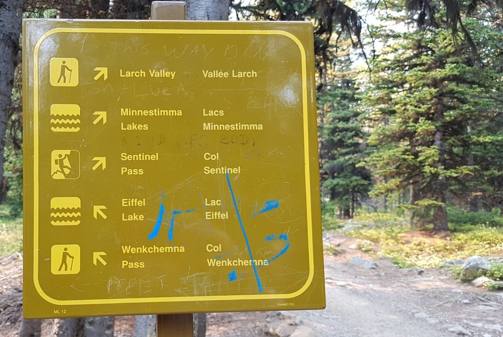
From the Moraine Lake parking lot (where the shuttle dropped you off :-), head right (south west) along the shore, past Moraine Lake Lodge and the little cabins. After walking for about 200 m, we found the trail sign. Take the Right trail heading uphill to Sentinel Pass.

Main Trail
From the trail sign, there is about 2.5 km of low angle switchbacks. This entire section is in the trees, with nary a view of the impressive surrounding mountains. We did find a few gorgeous creeks to admire.

This is one of the best trails in existence. I swear it was created by one of those old Swiss guides who said that if you could smoke your pipe while hiking, you were going slow enough for the guests to keep up. We gained about 330 m (just over 1,000′) without breaking a sweat, but saw enough people huffing and puffing on the way up to realize that everything is relative.
At about 2.6 km, we came to The Bench. This is where we found the second trail sign. Take the Right fork to continue to Sentinel Pass.
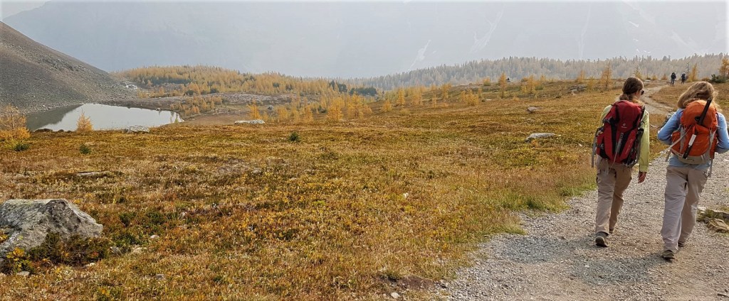
This is where the payoff begins. First off, the elevation backs way off as you are now in Larch Valley between Eiffel Peak (left) and Mount Temple (right). It is a gorgeous walk through the trees, with glimpses of the mountains above.

As the spruce and pine trees begin to thin out, the larch trees take over. People flock to the Lake Louise and Moraine Lake areas to catch these trees as they change colour in the fall.

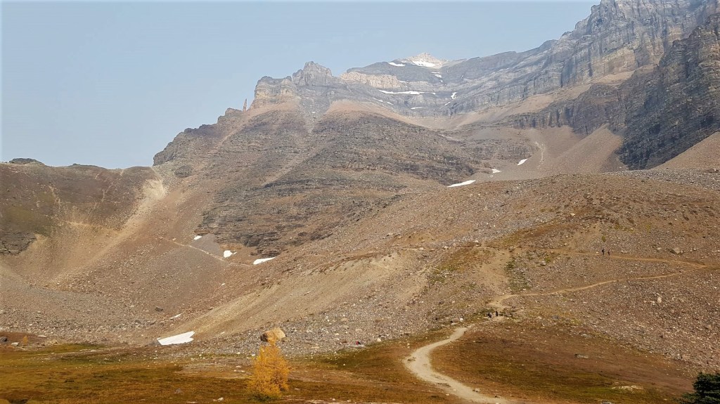
As you get close, the wall of Sentinel Pass comes into view. It looks daunting from here, but as you’ll see, there is a very easy way up.

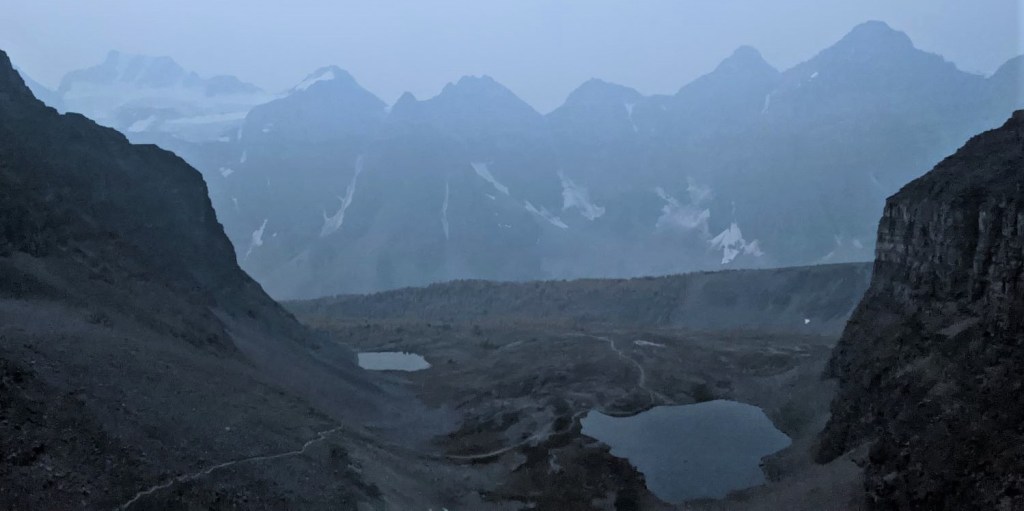
At 4.7 km, we reached a small tarn called Minnestimma Lake. This is where many people will decide to call it a day. I have no idea how many hundreds of people tramp through here daily, but lets just say I’m surprised there is any grass left. People are sprawled everywhere. I wish Ottawa would increase funding to the Alberta National Parks, because we could really use dozens of wardens to help educate people. But I digress, again.

The ascent to Sentinel Pass looks daunting. It is a near vertical wall that gets steeper as you ascend. I can see why it intimidates the casual hiker. It is 220 m (720′) of elevation gain over a very short distance. Fortunately, the trail was made by the same pipe smoking guide. The ascent first curves around the base of Mount Temple, and then starts a series of long, sweeping switchbacks that gently guides you to the top of Sentinel Pass.


Distance to Sentinel Pass is 6 km, with an elevation gain of 750m (2,475′). We hiked it in 2 hours, but we were on a mission that day to climb Mount Temple. I suggest a more leisurely pace to enjoy the scenery.
At Sentinel Pass, you will be joined by hundreds of others celebrating their success in a variety of ways. Some will be drinking beer. Some will decide that blasting music is appropriate. Others will be in various stages of undress as they pose for that perfect IG shot.
You’ll have to forgive my cynicism. As a 25 year mountain veteran, I realize that hiking is a ‘thing’ right now. I’ve watched as the people in the mountains have changed from being well-educated and respectful, to being – well, the opposite. I write these trip reports because I truly want to encourage people to enjoy the mountains, and to improve their health, both mental and physical. I also hope to educate people new to the mountains.
Sentinel Pass was not my sole destination this day. I was off to climb Mount Temple! Click HERE to read this trip report.
Sentinel Pass Return
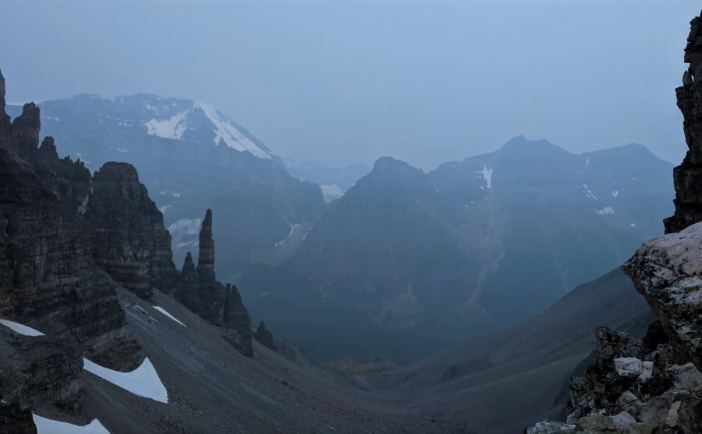
Return the way you came from Sentinel Pass. You may see some people coming up or going down the other side of Sentinel Pass into Paradise Valley. This is a completely different valley, and unless you planned this in advance, return the way you came.
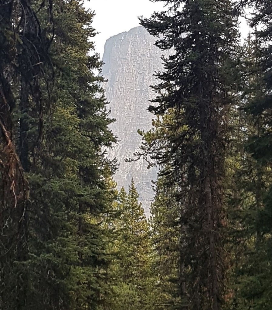
The way back affords you views not seen on the way up, like this peak at the Tower of Babel.
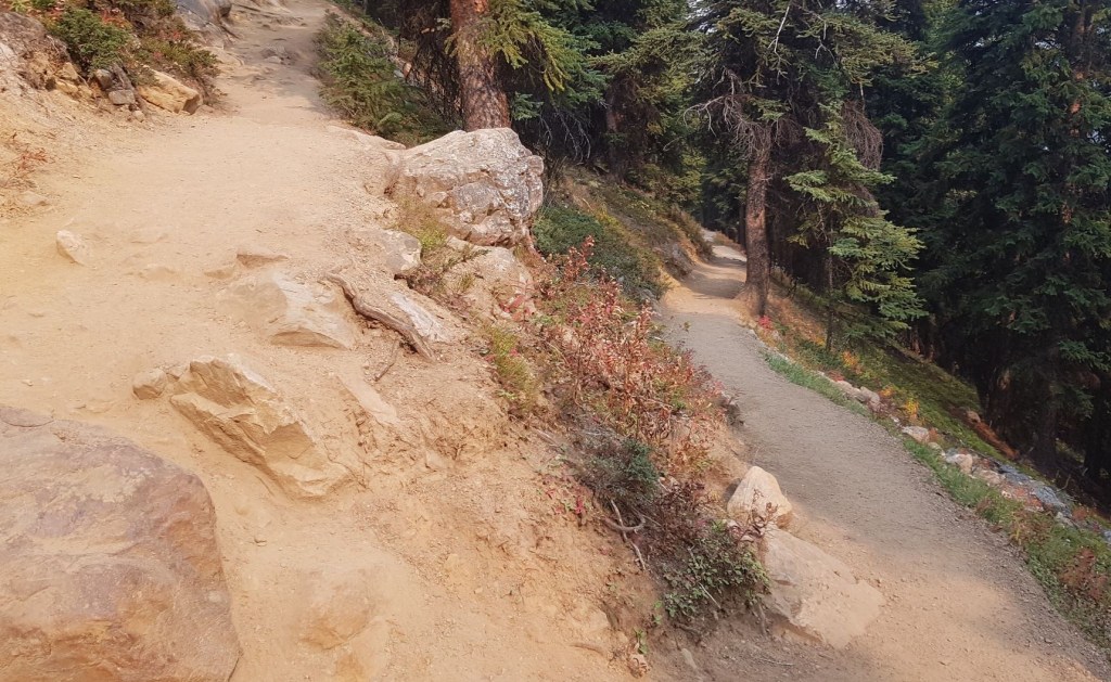
For the switchbacks on the lower slope above Moraine Lake, please do not take the “short cuts” between the trails. This ruins the trail, erodes the hillside, and makes a mess, especially in wet weather. There are plenty of signs asking you not to do this, but like I said, people behaving poorly…
Back at Moraine Lake, we took advantage of the cold lake waters to take off our boots and wade in. The water was just the right temperature, and our swollen feet felt better almost instantly. This made the ride back to Calgary that much more enjoyable.
If you found this post useful, please do me a huge favour and click the Star button to “Like” it. You can also follow my blog, follow me on Instagram, or join my FaceBook page Al’s Adventurers.
Alisen
Totals – Tracked on Strava
Date: September 18, 2020
Group: Four (Alisen, Mike, Kayla & Mackenzie)
Distance: 12 km
Elevation: 750m (2,475′)
Time: ~4 hours


I love all things mountains! I live next door to the Canadian Rocky Mountains, however I travel the world to enjoy the many different mountain environments and cultures that I can. I hope you enjoy these trip reports, and that it inspires you to accomplish your own adventure goals.

Another great post. I feel saddened by the change in behaviour re those who cannot respect the landscape they are in. Taking care is a simple enough thing to do.
Thank you for your kind words and I’m glad you enjoyed the post. I normally don’t like to get all preachy. I think respect and empathy need to be practiced everywhere. When that happens, then perhaps nature will be respected.
I don’t think you were preachy at all. I grew up in the Australian bush and desert country in the north west. We would go out into this landscape for 2 – 5 days at a time, hiking and camping here and there, respecting the environment long before it became a conscious thought in today’s world. It was just commonsense. Your posts remind me of the great times we had well away from the main stream popular hot spots, enjoying pristine pools of water and waterfalls, kangaroos and dingoes, aboriginal rock art (when you find such works in the middle of nowhere it really makes you think), colourful landscapes and just chilling out with nature 😊
Oh, what an amazing experience and memories. Do you still go out sometimes? I have never been to Australia, but if I ever go, I would love to spend some time in the desert and bush. It would be 100% opposite to what I am used to in the mountains, but that’s what an adventure is all about!
I do go back to the area two or three times a year for the work I do, but not actually out and about. It’s amazing country in, perhaps, the oldest part of the world. I have shared a link for you to look at if you have the time one day:
https://www.australiasnorthwest.com/explore/pilbara/karijini-national-park
Thank you SO much. Wow. What beautiful country. Those gorges look fantastic, especially against the red rock. Okay – even more motivated to get there. I can see why you spent so much time there.
Awesome, a great post again, 🙂👍thnx for share.
This is such a good read..!😊🙌🏻
Lovellyyyyy ❤
You’re very kind. Thank you.
Your most welcome 🤗🤗
It was my great pleasure ❤❤
Thank you very much for sharing this informative article.
You’re very welcome. I wish you many adventures of your own!
Great post 🙌👏
Lovely, thank you for sharing
Stay wealthy healthy safe and happy
Thank you – you too!
Great post. Like you, I wish that everyone respected the land.
I agree. It is so easy to do. I am perplexed as to why people do not stop to think for a moment.
I hear you. I think it’s because they’re either too lazy or they don’t care. People are horrid sometimes.
I wish I could travel to all these beautiful places!
I feel for you! I am sure you have many great places to adventure where you live.
Actually, Covid has made it possible for ME to travel to Lake Louise, even though I live nearby. The park was being overrun to the point where locals could not visit. I’m hoping we can get back to normal soon, but I’m also enjoying a bit of a breather too.
Kutluyorum güzel bir yazı