May 13, 2021
Updated April 27, 2025
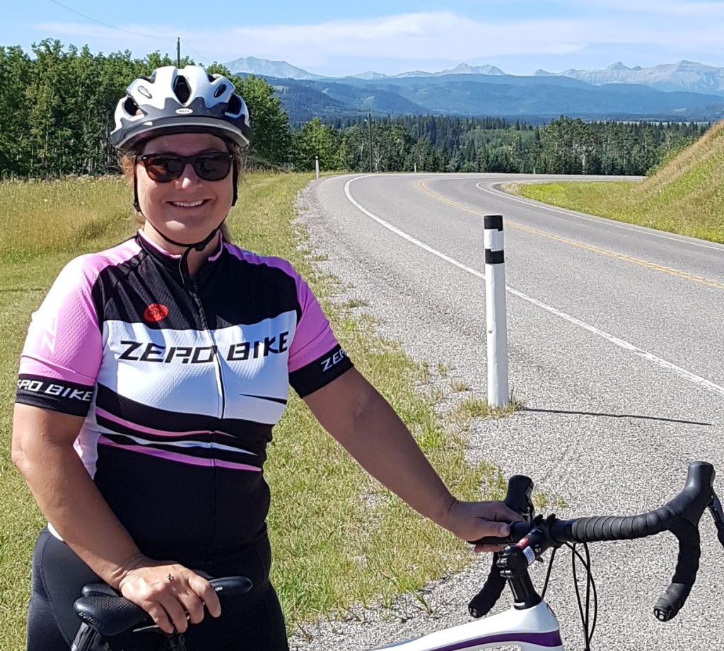
I have cycled this route for decades, but it has really grown in popularity over the last 2-4 years. Even in 2016, I cycled from Turner Valley and decided to count the number of cars on the road – it was less than 10 both ways! Yesterday was an absolute zoo. The photos below are from various trips over the years.
The Sheep River Road is closed from December 1st and reopens May 15th. The gates are at the Sandy McNabb campground. Please note that this is an equestrian area, and there is parking for horse trailers. Do not block these areas.
Access is via Diamond Valley (formerly known as Turner Valley), which is a small town and not used to the hoards descending upon them. Please drive SLOWLY through town. There is an RCMP detachment, and the Peace Officers swing through occasionally. Don’t make your eagerness to get to the park a reason to speed through someone else’s town.
Gear
Depending on where you start, your bike will change. Road cyclists can start at Turner Valley to get in the full 80 km. Mountain bikers might start at the Kananaskis sign to catch that extra hill. The heavier hybrid or single gear bikes with baskets on the front will enjoy parking at the gates. Ebikes are now a thing, but I usually see them parked at the gates as well. My advice? Do not drain your battery getting to the far end of Bluerock. Save 50% for the return trek, because there are just a many hills on the return.
Overview
Park at your chosen distance spot. Bike until you can’t stand one more hill, or the wind grinds you to a stand-still, then return the way you came.
Parking
Turner Valley
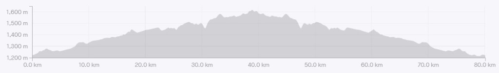
Distance – 77.44 km. Elevation Gain – 830 m. Time – 3 hours, 45 min. Includes breaks.
If you opt for the full meal deal, then drive to the Sheep River Library, and park at the end, next to the Flare ‘n Derrick hall. Please do not park in the Dr. Lander Pool parking lot. They have swimming lessons, and kids coming and going constantly. If that lot is full, then you will have to find street parking. Please do not be tempted to park in the library spots.
Totals – Downloadable Tracks on Strava
Date: May 13, 2021 (photo are from various trips over the years)
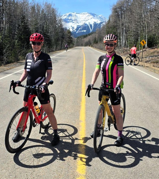
Group: Two (Alisen and Mike)
Distance: 77.6 km
Elevation: 830 m (2,739′)
Time: 3 hours 45 minutes (includes lunch & breaks)
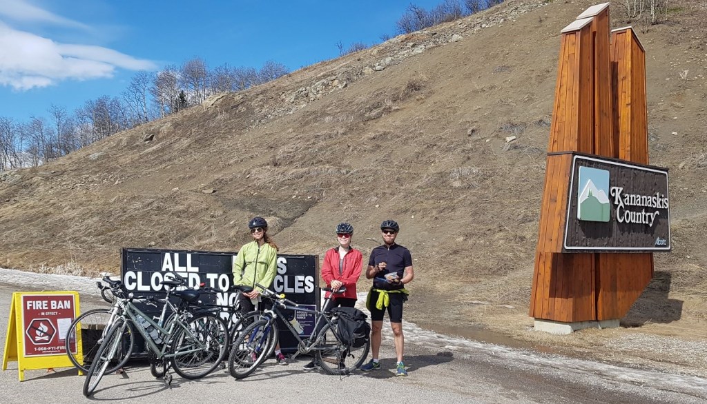
Kananaskis Sign
Distance – 47.2 km. Elevation Gain – 745 m
There is a pull out on the north side of highway 546. It’s mostly used by hikers, but is a great spot to park for some extra KMs.
Winter Gates
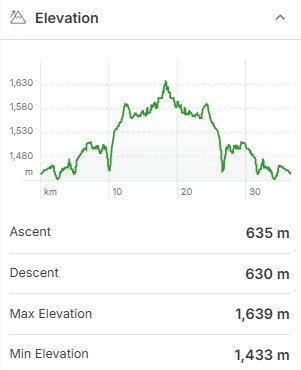
Distance – 36.6 km. Elevation Gain – 635 m.
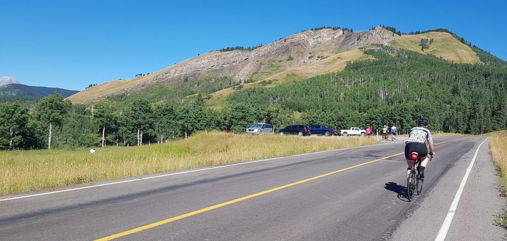
This is the most popular place to park. I should have taken a photo when I returned. The road was lined up on both sides, and people were parked in the lots on both sides. Again, this is an equestrian area. Parking along the entrance to the parking lots means these trucks and horse trailers cannot get into their lots, or turn around properly. Please do not ruin another user’s experience for the convenience of parking closer to the gate.

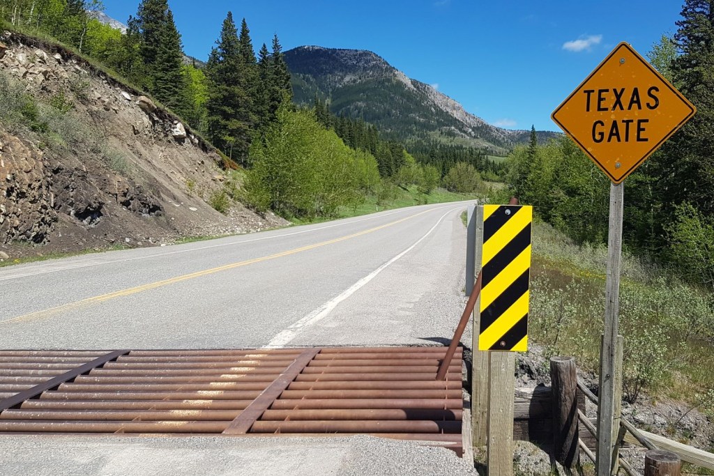
Texas Gates
This is cattle grazing country, and the main way to keep the cows from walking away is the use of cattle guards, known as Texas Gates here in Alberta (but oddly, not in Texas). These are a series of round metal bars inset in the road that prevent cattle from continuing down the road. They have thin strips of metal to cycle over.
To safely cycle over these, line up your front tire with the thin strip of metal. As soon as you hit the Texas Gate, stop looking down and focus on something straight ahead. Your bike will automatically stay straight, and you won’t fall off the thin strip.
You can also choose to simply bike over the rumble bars. It’s not pleasant, but if you keep up your speed, it’s over quickly.
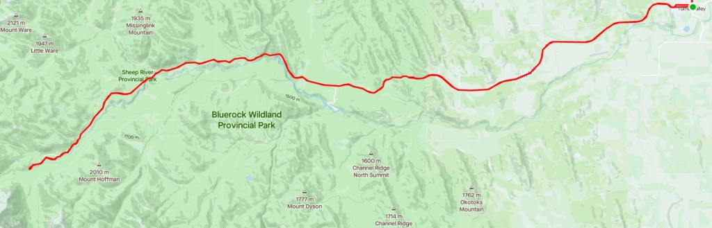
Cycle Route from Turner Valley to Junction Falls (Bluerock / end of the road)
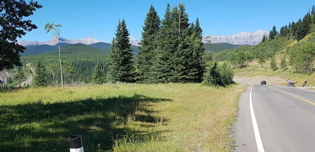
The cycle from Turner Valley to the Kananaskis sign is my favourite part of this trip. The rolling hills are beautiful. There is a nice wide shoulder. Other than cars with bikes on their racks racing to the park gate, there is very little traffic. It is a nice, steady climb up to the park gates with lovely views the whole way.

The Kananaskis Sign marks the start of the steep hills. Despite a good warm up to this point, this hill is still a bit of a kicker.
Once at the top of that hill, it’s a lovely and relatively flat cycle to the winter gates and beyond. From here, you start the constantly rolling hills, with the overall trend of gaining elevation.

Keep an eye on the wind. Ideally, you want a good west wind, that will then blow you back to your starting point. If you suspect an east wind, then be careful of going too far west and having one heck of a struggle back. That happened to me last August. It was a stiff east wind, and the group got away from me so I had to do it all myself. What doesn’t kill you…
The Gorge Creek Trail turn off is cause for concern for many cyclists. The road down is steep and long, but the road up the other side is super steep and unrelenting. According to Strava, the grade is 14.8% in some spots. When the road is closed, it’s possible to switchback up this steep section to lesson the angle. Walking your bike up is also an option, but remember that staying on your bike is always faster than walking, no matter how painful at the time.
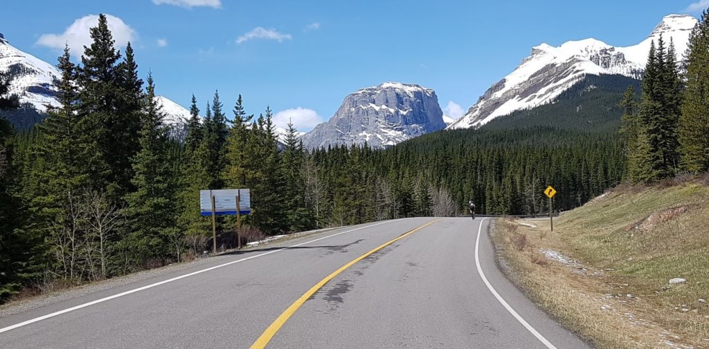
Beyond Gorge Creek is where the views get really pretty, and there are plenty of places to stop for viewpoints. There is Tiger Falls at the Indian Oils parking lot, and Sheep River Falls further down.

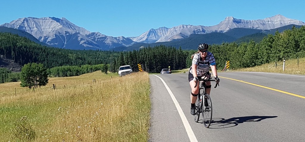
The mountain views are also incredible. While you can see Shunga-la-she on the left, and Mount Burns on the right, the impressive massif of Gibraltar Mountain is only visible from the far end of the Sheep River road.
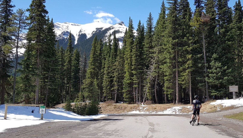
The end of the road is just past Bluerock Campground, at the Junction Falls turnout. There was still some snow at this relatively lower elevation, and was thankful the Conservation trucks had been through.

The best time to view the Bighorn Sheep is definitely early spring. The moms and babies are most readily viewed, with the rams coming and going. About 15 years ago, I biked this area in late March and saw a large circle of rams, heads down, horn to horn. It was quite the sight. There were no camera phones then, but I should have taken the time to dig out my real camera because I’ve never seen that again.

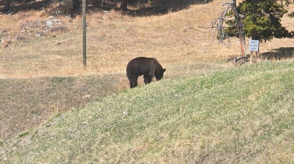
Bears are VERY common in the Sheep River park. A lot of people poo-poo the bear danger because the park is so close. True, there are very few grizzlies in the area, but there are a TONNE of black bears. A full-grown male black bear is predatory. Don’t take my word for it – listen to the experts. I often see black bears while hiking in this area. When cycling through, if you see a bear, just keep going. Do NOT stop, as this encourages everyone else to stop. A crowded bear who feels threatened might lash out, and really, who could blame them?
If you found this post useful, please do me a huge favour and click the Star button to “Like” it. You can also follow my blog, follow me on Instagram, or join my FaceBook page Al’s Adventurers.
Alisen
I love all things mountains! I live next door to the Canadian Rocky Mountains, however I travel the world to enjoy the many different mountain environments and cultures that I can. I hope you enjoy these trip reports, and that it inspires you to accomplish your own adventure goals.

What a beautiful place, and beautiful photographs.
Thank you. It’s a lovely day out.
🙂
Lovely vieww!! ❤️
Thanks. It’s a pretty way to see that area of the mountains.
Hello how are you doing? Hope you and your family are doing good. With all due respect can you 🙏 please send me friend request so we can be friends I just love everyone from the group
Hi. Please do join the facebook group. It’s a great group of people, and we help each other out. Take care, Al
It’s a pleasure meeting you here,would love to have a close chat with you get to know you better,can I have your Facebook username?
Great descriptions of the different options 🙂
Thanks Ann 🙂
Wow, that’s really nice location Alisen.
I also like the fact that you are multi disciplinary in terms of outdoor activities. From hiking and skiing up to biking.
Well done.
Awww, thank you! That puts a good spin on it 🙂 I am so NOT a specialist. That’s partly why I will never be a good climber like yourself. My other major passion sport is paddling. I LOVE a good canoe, but those trips take a lot of planning. Most of the good rivers and lakes are in the next province, and we are not allowed to travel there for Covid. Soon, hopefully.
Hi
I can see why this cycling route has become more popular over the past few years. It’s always a bonus when there is very little traffic on the roads. Looks like there are lots of great views of the landscape along the way, and potentially of Bighorn sheep too early in the spring. Hope all is well and you’re enjoying the spring. Take care.
Thank you! I’ve had to take a few weeks off for personal reasons, but I’m back now. I see you are still safe and enjoying your cabin in Ontario. Finding camping spots here is as bad as out there. My husband is a pilot, so we can’t book months in advance because we just don’t know his schedule. I highly doubt we will get in any camping as a result.
That’s unfortunate. It seems like everyone these days is into camping. We decided to postpone our big Northern Ontario road trip until September to avoid the crowds and stress of booking a decent campsite during the peak period. You might be able to snag a campsite last minute because there are usually people who don’t show up for their reservation. It can be a bit risky though as there is no guarantee.
Sadly because Covid I can’t Travel anymore for my blog that I just started. Feels really sad that I have to wait before planning a new travel journey 😦
Such an awesome trip!! It is my dream to cycle through those high mountains.
Yes, it is a beautiful trip. Well worth the effort.